Item B-05 (C14-2019-0165 - 6207 Ross Road; District 2).pdf — original pdf
Backup
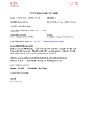
C14-2019-0165 1 ZONING CHANGE REVIEW SHEET CASE: C14-2019-0165 – 6207 Ross Road DISTRICT: 2 ZONING FROM: SF-4A TO: MF-4 (Tract 1) and LR-MU (Tract 2) ADDRESS: 6207 Ross Road SITE AREA: Tract 1 (9.19 acres), Tract 2 (1.5 acres) PROPERTY OWNER: Wehbe Properties (Najib Webhe) AGENT: South Llano Strategies (Glen Coleman) CASE MANAGER: Kate Clark (512-974-1237, kate.clark@austintexas.gov) STAFF RECOMMENDATION: Staff recommends Multifamily – Medium Density (MF-3) district zoning for Tract 1, and Neighborhood Commercial – Mixed Use (LR-MU) combining district zoning for Tract 2. For a summary of the basis of staff’s recommendation, see page 2. ZONING AND PLATTING COMMISSION ACTION / RECOMMENDATION: February 4, 2020 Scheduled for Zoning and Platting Commission CITY COUNCIL ACTION: February 20, 2020 Scheduled for City Council ORDINANCE NUMBER: ISSUES None at this time. B-051 of 12 C14-2019-0165 2 CASE MANAGER COMMENTS: This property is currently undeveloped and approximately 10.69 acres in size. It is located on the east side of Ross Road. Property across Ross Road to the west and adjacent to the east are within the City’s extraterritorial jurisdiction (ETJ) and not zoned. Properties adjacent to the north and south are zoned single family – small lot (SF-4A), see Exhibit A: Zoning Map and Exhibit B: Aerial Map. This property is part of a larger development. Only the portion of this development within the City limits is being rezoned. The applicant is requesting the rezoning in order to construct a multifamily project and to provide some associated neighborhood commercial services. The portion of the development east of the subject property is within the City’s ETJ. The applicant is proposing to build a mobile home community in this ETJ area. Once the subject property is rezoned, it is the applicant’s intent to develop a site plan that can accommodate the circulation needs of the future adjacent mobile home community through this site. BASIS OF RECOMMENDATION: Staff recommends Multifamily – Medium Density (MF-3) district zoning for Tract 1, and Neighborhood Commercial – Mixed Use (LR-MU) combining district zoning for Tract 2. 1. The proposed zoning should be consistent with the purpose statement of the district sought. The LR zoning district is intended for neighborhood shopping facilities which provide limited business service and office facilities predominately for the convenience of residents of the neighborhood. Ross Road is classified by the Austin Strategic Mobility Plan (ASMP) as a Level 3 road but has limited exiting commercial zoning along it. Rezoning a small tract adjacent to Ross Road to a LR base zoning district would allow for some neighborhood commercial uses while still maintaining a level of compatibility with the existing SF-4A zoning. 2. Zoning changes should promote compatibility with adjacent and nearby uses. Intensive multi-family zoning should be located on major arterials and highways. The MF-4 zoning district is appropriate for moderate-high density housing in centrally located areas near supporting transportation and commercial facilities, in areas adjoining downtown Austin and major institutional or employment centers, and in other selected areas where moderate-high density multifamily use is desirable. Staff recommends MF-3 for the remainder of the property because it can only be accessed by Ross Road, it is not located at a major intersection, or near a major institutional/employment center. While Ross Road is classified by the ASMP as a Level 3 road, all of the closest intersecting roads are a Level 1 classification. Additionally, within a MF-4 zoning district, buildings may be constructed up to 60 feet in height. Whereas, within both the MF-3 and LR zoning districts, buildings can only be built to a maximum height of 40 feet. This property is adjacent to existing SF-4A zoning which has a maximum building height of 35 feet. Rezoning the property to MF-3 and LR-MU would be more consistent with the surrounding existing land uses and site development regulations. B-052 of 12 C14-2019-0165 3 EXISTING ZONING AND LAND USES: Zoning Land Uses Site SF-4A North SF-4A South SF-4A Undeveloped Water Quality, Single Family Residential Water Quality, Single Family Residential East City ETJ (not zoned) Undeveloped West City ETJ (not zoned) Single Family Residential, Commercial and Undeveloped NEIGHBORHOOD PLANNING AREA: not applicable TIA: is deferred until site plan submittal WATERSHED: Dry Creek East OVERLAYS: Airport Overlay (Controlled Compatible Land Use Area) SCHOOLS: Popham Elementary, Del Valle Middle and Del Valle High Schools. Friends of Austin Neighborhoods Neighborhood Empowerment Foundation Onion Creek Homeowners Assoc. Seltexas Sierra Club, Austin Regional Group NEIGHBORHOOD ORGANIZATIONS Bike Austin Del Valle Community Coalition Del Valle Independent School District Elroy Neighborhood Association Far Southeast Improvement Association AREA CASE HISTORIES: C14-02-0074 DR to SF-4A 12501 Pearce Lane and 5821 Ross Road RELATED CASES: Number Request Commission City Council Granted SF-4A as staff recommended Approved AF-4A as Commission recommended C14-2016-0057: this property was rezoned from development reserve (DR) to single family – small lot (SF-4A), ordinance number 20161013-016. B-053 of 12 C14-2019-0165 4 EXISTING STREET CHARACTERISTICS: Street ROW Pavement Classification Sidewalks Bike Route Capital Metro (within ¼ mile) Ross Road 64’ 25’ Level 3 None None No OTHER STAFF COMMENTS: Comprehensive Planning This rezoning case is located on an undeveloped 10.69-acre parcel, which is located on the east side of Ross Road. The property is located outside the boundaries of a community with an adopted neighborhood plan and is not situated along or near an Activity Corridor or Center. Surrounding land uses includes vacant land and a single-family subdivision to the north; to the south is vacant land and a single-family subdivision; to the east is undeveloped land and a ranch house; and to the west is an autobody shop and ranch houses on large lots. The proposed use is multifamily housing on 9.19 acres and 1.5 acres of mixed use. Connectivity Ross Road is a two-lane road and this portion of the road has no public sidewalks, curb or gutters, bike lanes or public transit. The closest public transit stop is 2,600 linear feet walking distance from the subject property. Two public schools and two public parks are located over a mile away. The mobility and connectivity options in this area are below average. Imagine Austin The following Imagine Austin policies are applicable to this case: • LUT P3. Promote development in compact centers, communities, or along corridors that are connected by roads and transit that are designed to encourage walking and bicycling, and reduce health care, housing and transportation costs. • LUT P7. Encourage infill and redevelopment opportunities that place residential, work, and retail land uses in proximity to each other to maximize walking, bicycling, and transit opportunities. • HN P10. Create complete neighborhoods across Austin that have a mix of housing types and land uses, affordable housing and transportation options, and access to healthy food, schools, retail, employment, community services, and parks and recreation options. Analysis and Conclusion: Analyzing the land uses located within a half of a mile radius of this subject property, there appears to be a lack mobility options (no public transit, public sidewalks or bike lanes), and a B-054 of 12 C14-2019-0165 5 lack of local goods and services, civic uses or major employers. However, there are several single-family subdivisions located within a half of a mile radius of this location. If this property is thoughtfully developed, it has the potential to provide much needed local goods and services in the mixed-use portion of the project area and residential uses beyond single family housing and mobile home parks in this area. Based on the Imagine Austin text and polices above that supports a variety of housing types and neighborhood serving uses, but a lack of mobility and connectivity in the area, this project appears to only partially support the Imagine Austin Comprehensive Plan. Environmental The site is not located over the Edwards Aquifer Recharge Zone. The site is in the Dry Creek East Watershed of the Colorado River Basin, which is classified as a Suburban Watershed by Chapter 25-8 of the City's Land Development Code. Under current watershed regulations, development or redevelopment on this site will be subject to the following impervious cover limits: % of Gross Site Area % of Gross Site Area with Transfers 50% 60% Development Classification Single-Family (minimum lot size 5750 sq. ft.) Other Single-Family or Duplex 55% 60% Multifamily Commercial 80% 60% 70% 90% According to floodplain maps there is a floodplain within or adjacent to the project location. Based upon the location of the floodplain, offsite drainage should be calculated to determine whether a Critical Water Quality Zone exists within the project location. Standard landscaping and tree protection will be required in accordance with LDC 25-2 and 25-8 for all development and/or redevelopment. At this time, site specific information is unavailable regarding vegetation, areas of steep slope, or other environmental features such as bluffs, springs, canyon rimrock, caves, sinkholes, and wetlands. Under current watershed regulations, development or redevelopment requires water quality control with increased capture volume and control of the 2-year storm on site. At this time, no information has been provided as to whether this property has any preexisting approvals that preempt current water quality or Code requirements. Site Plan Site plans will be required for any new development other than single-family or duplex residential. Any development which occurs in an SF-6 or less restrictive zoning district which is B-055 of 12 C14-2019-0165 6 located 540 feet or less from property in an SF-5 or more restrictive zoning district will be subject to compatibility development regulations. Any new development is subject to Subchapter E. Design Standards and Mixed Use. Additional comments will be made when the site plan is submitted. Compatibility Standards The site is subject to compatibility standards. Along the north and south property lines, the following standards apply: • No structure may be built within 25 feet of the property line. • No structure in excess of two stories or 30 feet in height may be constructed within 50 feet of the property line. feet of the property line. • No structure in excess of three stories or 40 feet in height may be constructed within 100 • No parking or driveways are allowed within 25 feet of the property line. • A landscape area at least 25 feet wide is required along the property line. In addition, a fence, berm, or dense vegetation must be provided to screen adjoining properties from views of parking, mechanical equipment, storage, and refuse collection. • For a structure more than 100 feet but not more than 300 feet from property zoned SF-5 or more restrictive, height limitation is 40 feet plus one foot for each 10 feet of distance in excess of 100 feet from the property line. • An intensive recreational use, including a swimming pool, tennis court, ball court, or playground, may not be constructed 50 feet or less from adjoining SF-3 property. • A landscape area at least 25 feet in width is required along the property line if the tract is zoned LR, GO, GR, L, CS, CS-1, or CH. Additional design regulations will be enforced at the time a site plan is submitted. Airport Overlay This site is located within the Austin-Bergstrom Airport Controlled Compatible Land Use Area Overlay. No use will be allowed that can create electrical interference with navigational signals or radio communications between airport and aircraft, make it difficult for pilots to distinguish between the airport lights and others, result in glare in the eyes of pilots using the airport, impair visibility in the vicinity of the airport, create bird strike hazards or otherwise in any way endanger or interfere with the landing, taking off, or maneuvering of aircraft intending to use the Austin-Bergstrom Airport. Height limitations and incompatible uses with each Airport Overlay zone are established in the Airport Overlay Ordinance. Airport Hazard Zoning Committee review may be required prior to Planning Commission Hearing. Additional comments may be generated during the site plan review process. B-056 of 12 C14-2019-0165 7 Aviation Department The Aviation Department conducted a review for this property to determine whether height would be restricted due to the property being located within the Controlled Compatible Land Use Area (CCLUA). The applicant is requesting a MF-4 zoning district. Current site development regulations allow buildings within this zoning district to be a maximum of 60 feet in height. The Aviation Department’s review concluded the maximum height within this zoning district would be permitted. Other potential hazards with airport operations would be discussed or determined at the submittal of a site plan. Please see Exhibit C: CCLUA Analysis for a full copy of Aviation Department’s review. Transportation The Austin Strategic Mobility Plan (ASMP) adopted 04/11/2019, calls for 120 feet of right-of- way for Ross Road. It is recommended that 60 feet of right-of-way from the existing centerline should be dedicated for Ross Rd according to the Transportation Plan prior to 3rd reading of City Council. [LDC 25-6-51 and 25-6-55]. At the time of submittal of any site plan on the Property, a traffic impact analysis (“TIA”) is required if the proposed development or uses on the Property, considered cumulatively with all existing or previously authorized development and uses, generates traffic that exceeds 2,000 trips per day. Austin Water Utility The landowner intends to serve the site with City of Austin water and wastewater utilities. The landowner, at own expense, will be responsible for providing any water and wastewater utility improvements, offsite main extensions, utility relocations and or abandonments required by the land use. The water and wastewater utility plan must be reviewed and approved by Austin Water for compliance with City criteria and suitability for operation and maintenance. Depending on the development plans submitted, water and or wastewater service extension requests may be required. All water and wastewater construction must be inspected by the City of Austin. The landowner must pay the City inspection fee with the utility construction. The landowner must pay the tap and impact fee once the landowner makes an application for a City of Austin water and wastewater utility tap permit. INDEX OF EXHIBITS TO FOLLOW Exhibit A: Zoning Map Exhibit B: Aerial Map Exhibit C: CCLUA Analysis B-057 of 12 11-B 11-A 12-A 12-B 4 5 1 2 9 8 13 14 F O LE Y D R P14 7 6 10 15 16 TRACK 1 17-A 17-B TRACK 2 C14-2019-0165 SF-4-A D S R S O R 3 4 5 D S S R O R MH E LN A R C P E 10 9 8 7 6 12 11 13 14 16 19 20 21 22 23 24 L E G R N D A 25 26 15 17 18 LA 1 R G U 3 2 A 4 SF-4A 17 5 4 3 DIA LN 6 7 10 8 9 20 19 18 CIELO G 16 6 7 5 8 SF-4A 17 2 1 I-SF-4A R A 10 12 11 E ST DR 32 16 13 18 19 C A M 20 PA N 1 2 31 30 29 9 10 11 12 23 35 3 4 5 1 33 2 3 4 5 6 SF-4A 7 29 PALO M 7 9 8 8 27 28 26 25 A BLA 10 N 12 6 I-SF-4A 27 24 23 25 26 13 15 16 17 14 20 19 21 22 A W C A Y 18 16 17 18 19 S A L S A L A 33 L R T 20 22 21 23 24 I-SF-4A 13 14 15 49 SF-4A N D 11 12 15 14 5 6 7 8 9 10 22 1 56 A D R 12 2 3 4 I-SF-4A 6 54 52 51 53 4 5 6 2 3 31 30 I-SF-4A 29 9 28 25 24 23 27 26 29 30 31 28 25 26 32 33 34 48 47 45 LA PAZ LN 44 50 53 51 52 54 55 56 57 19 20 10 12 14 13 15 16 SF-4-A 18 13 P13 8 9 11 7 6 5 4 2 K LIC ETYS PLITW 22 AY 24 21 26 25 H AY 13 12 28 27 20 19 18 17 16 15 14 34 35 29 30 31 R H D EIG 32 11 37 38 39 L Y S N A B L A 3 2 1 6 5 4 21 19 18 16 17 23 22 20 15 14 E E S 8 7 9 D CT 13 12 11 10 24 1 2 3 4 23 7 5 6 8 9 11 T G S RIN P N S O G A W 8 6 5 4 11 9 32 7 3 2 1 34 35 36 13 12 10 28 30 31 33 G RIA R A C 3 2 1 E PIN 5 4 10 R N Y 18 19 W E M 17 SF-4-A 14 24 25 26 STE AIL W 22 17 SF-4-A 23 15 R S D E 23 24 13 12 Y A 14 20 A 26 N W O G A 10 9 8 7 11 10 9 8 30 7 6 28 31 33 A W G O T S E N O C 35 36 41 42 43 6 4 5 3 2 44 45 1 3 4 5 6 7 8 9 10 11 19 20 21 17 18 EIN M R E D 23 SF-4-A 8 7 6 14 15 16 R D H S R FA S O R 3 SF-4A 4 SUBJECT TRACT ZONING BOUNDARY ! ! ! ! ! ! PENDING CASE CREEK BUFFER ± 1'' = 500' 6027 ROSS ROAD ZONING CASE#: LOCATION: SUBJECT AREA: GRID: MANAGER: C14-2019-0165 6021 ROSS ROAD 10.69 Acres P13 KATE CLARK This map has been produced by the Communications Technology Management Dept. on behalf of the Planning Development Review Dept. for the sole purpose of geographic reference. No warranty is made by the City of Austin regarding specific accuracy or completeness. B-058 of 12 11-B 11-A 12-A 12-B 4 5 1 2 9 8 13 14 F O LE Y D R P14 7 6 10 15 16 TRACK 1 17-A 17-B TRACK 2 C14-2019-0165 SF-4-A D S R S O R 3 4 5 D S S R O R MH E LN A R C P E 10 9 8 7 6 12 11 13 14 16 19 20 21 22 23 24 L E G R N D A 25 26 15 17 18 LA 1 G U 3 2 A R 4 SF-4A 17 5 4 3 DIA LN 6 7 10 8 9 20 19 18 CIELO G 16 6 7 5 8 SF-4A 17 2 1 I-SF-4A R A 10 12 11 E ST DR 32 16 13 18 19 C A M 20 PA N 35 3 4 5 31 30 29 1 2 33 3 4 5 6 SF-4A 7 6 29 PALO M 7 9 8 10 9 10 11 12 23 8 27 28 26 25 A BLA N C 21 22 A W I-SF-4A 27 24 23 25 26 13 15 16 17 14 20 19 1 2 S A L S A L A 33 L R T 12 13 14 15 16 17 18 19 A Y 18 20 22 21 23 24 I-SF-4A 49 SF-4A N D 11 12 15 14 5 6 7 8 9 10 22 1 56 A D R 12 2 3 4 I-SF-4A 6 54 52 51 53 4 5 6 2 3 31 30 I-SF-4A 29 9 28 25 24 23 27 26 29 30 31 28 25 26 32 33 34 48 47 45 LA PAZ LN 44 50 53 51 52 54 55 56 57 19 20 10 12 14 13 15 16 SF-4-A 18 13 P13 8 9 11 7 6 5 4 2 K LIC ETYS PLITW 22 AY 24 21 26 25 H AY 13 12 28 27 20 19 18 17 16 15 14 34 35 29 30 31 R H D EIG 32 11 37 38 39 L Y S N A LB A 3 2 1 6 5 4 21 19 18 16 17 23 22 20 15 14 E E S 8 7 9 D CT 13 12 11 10 24 1 2 3 4 23 7 5 6 8 9 11 T G S RIN P N S O G A W 8 6 5 4 11 9 32 7 3 2 1 34 35 36 13 12 10 28 30 31 33 G RIA R A C 3 2 1 E PIN 5 4 10 R N Y 18 19 W E M 17 SF-4-A 14 24 25 26 STE AIL W 22 17 SF-4-A 23 15 R S D E 23 24 13 12 Y A 14 20 A 26 N W O G A 10 9 8 7 11 10 9 8 30 7 6 28 31 33 A W G O T S E N O C 35 36 41 42 43 6 4 5 3 2 44 45 1 3 4 5 6 7 8 9 10 11 19 20 21 17 18 EIN M R E D 23 SF-4-A 8 7 6 14 15 16 R D H S R FA S O R 3 SF-4A 4 SUBJECT TRACT ZONING BOUNDARY ! ! ! ! ! ! PENDING CASE CREEK BUFFER ± 1'' = 500' Copyright nearmap 2015 6027 ROSS ROAD ZONING CASE#: LOCATION: SUBJECT AREA: GRID: MANAGER: C14-2019-0165 6021 ROSS ROAD 10.69 Acres P13 KATE CLARK This map has been produced by the Communications Technology Management Dept. on behalf of the Planning Development Review Dept. for the sole purpose of geographic reference. No warranty is made by the City of Austin regarding specific accuracy or completeness. B-059 of 12 City of Austin Aviation Department Austin-Bergstrom International Airport 3600 Presidential Blvd., Ste. 411, Austin, Texas 78719 512/530-5543 Fax: 512/530-6630 January 28, 2020 6021 Ross Rd. Del Valle, TX 78617 Case No. C14-2019-0165 Jennifer Williams, P.E. Airport Planning and Development Supervisor City of Austin - Aviation Department FROM: DATE: SUBJECT: The Department of Aviation staff has completed a review for the address 6021 Ross Rd. Del Valle, TX 78617 and can be found under site plan number C14-2019-0165. The purpose of this analysis is to determine the restrictions on this property as it applies to operations at Austin- Bergstrom International Airport. The project site is not within the Airport Overlay, but it is within the boundaries of the Controlled Compatible Land Use Area (CCLUA). All locations within the CCLUA and the Airport Overlay are subject to conforming to the City of Austin’s Land Development Code, Chapter 25-13 Airport Hazard and Compatible Land Use Regulations. The proposed project site is at an elevation of approximately 507 feet Mean Sea Level (MSL) at its highest point and is located under the Federal Aviation Administration’s (FAA) Part 77 imaginary Horizontal Surface for runway 35L. As such, the maximum height of a structure (including any structures on top of a roof such as radio frequency antennas, HVAC systems) that could be built within this area is approximately 184 feet above ground level (691’ MSL). Any construction or alteration exceeding 184 ft. above ground level would require the submittal of the FAA 7460 form for FAA review. Hazards to airport operations include any land use, structure, or object of natural growth located within the CCLUA that exceeds height limitations, creates electronic interference with aircraft navigation or radio communications, inhibits a pilot’s ability to distinguish airport lighting from other lighting, results in glare in the eyes of a pilot, impairs visibility in the vicinity of the airport, creates a wildlife hazard (i.e., bird attractants), or otherwise endangers or interferes with the landing, taking off, or maneuvering of aircraft is prohibited. Should you have any questions or require additional information, feel free to contact me. Sincerely, Joseph Mercer Engineering Technician PH: 512-530-6622 Austin-Bergstrom International Airport 2716 Spirit of Texas Dr. Austin, Texas 78719-2353 B-0510 of 12 B-0511 of 12 B-0512 of 12