Item B-03 (C14-2019-0169 - 4001 Parmer; District 7).pdf — original pdf
Backup
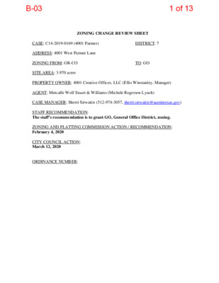
ZONING CHANGE REVIEW SHEET CASE: C14-2019-0169 (4001 Parmer) DISTRICT: 7 ADDRESS: 4001 West Parmer Lane ZONING FROM: GR-CO TO: GO SITE AREA: 3.970 acres PROPERTY OWNER: 4001 Creative Offices, LLC (Ellis Winstanley, Manager) AGENT: Metcalfe Wolf Stuart & Williams (Michele Rogerson Lynch) CASE MANAGER: Sherri Sirwaitis (512-974-3057, sherri.sirwaitis@austintexas.gov) STAFF RECOMMENDATION: The staff’s recommendation is to grant GO, General Office District, zoning. ZONING AND PLATTING COMMISSION ACTION / RECOMMENDATION: February 4, 2020 CITY COUNCIL ACTION: March 12, 2020 ORDINANCE NUMBER: 1 of 13B-03 ISSUES: N/A CASE MANAGER COMMENTS: The property in question is an undeveloped area within an existing retail center located at the southwest corner of W. Parmer Lane and Amherst Drive. To the east, there is a former restaurant (Abel’s North Grill and Tap House) that has been converted to office uses. Within the commercial development to the west there are restaurant, personal services and personal improvement services uses. To the north, there are financial services and office uses. To the south, there is an undeveloped area (floodplain) and a library (Austin Public Library- Milwood Branch). The applicant is requesting GO-CO zoning to develop a congregate living use (Please see Exhibit A – Applicant’s Request Letter). The staff recommends the applicant’s request of General Office District zoning as the property meets the intent of the GO district. The site is part of a commercial retail center that fronts onto West Parmer Lane, an arterial roadway/state-maintained highway. The property is surrounded by commercial and office zoning that provides services to the surrounding areas. The subject tract is located along the West Parmer Lane Activity Corridor and just under a mile from the North Burnet/Gateway Regional Center to the south. The applicant agrees with the staff ’s recommendation. BASIS OF RECOMMENDATION: 1. The proposed zoning should be consistent with the purpose statement of the district sought. General Office district is intended for offices and selected commercial uses predominately serving community and city-wide needs. 2. Zoning changes should promote an orderly and compatible relationship among land uses. This 4 acre site is part of an existing retail center that fronts onto West Parmer Lane, an arterial roadway/state-maintained highway and a designated Activity Corridor. The property is surrounded by commercial and office zoning. The applicant is proposing to develop the site with a congregate living facility. There will be adequate services to support this use from the commercial and office services to the north, east and west to the public library use located to the south on Amherst Drive. 2 of 13B-03 EXISTING ZONING AND LAND USES: ZONING GR-CO Site North GR-CO South GR East West LR-CO, LO GR-CO, LO LAND USES Undeveloped Area Financial Services (Bancorp South), Office (Aspire Dental, Structural Health Chiropractic), General Retail Sales Convenience (Walgreens Undeveloped Area, Library (Austin Public Library- Millwood Branch) Office (former Abel’s North Grill and Tap House) Retail Center (It’s a Grind Coffee House, Top Hair and Nails Spa, Rick’s Cleaners, Silver Grill Café, Kolache Factory, Hair Nook, Pitalicious, Greencare Massage, Thai Cuisine), North Austin Sleep Center NEIGHBORHOOD ORGANIZATIONS: Austin Independent School District Bike Austin Friends of Austin Neighborhoods Homeless Neighborhood Association Milwood Neighborhood Association Neighborhood Empowerment Foundation North Growth Corridor Alliance Northwood Neighborhood Association Preston Oaks Owners Association SELTEXAS Sierra Club, Austin Regional Group Walnut Crossing Neighborhood Association AREA STUDY: North Lamar Area Study TIA: Not Required WATERSHED: Walnut Creek NEIGHBORHOOD ORGANIZATIONS: Austin Independent School District Bike Austin Friends of Austin Neighborhoods Homeless Neighborhood Association Milwood Neighborhood Association Neighborhood Empowerment Foundation North Growth Corridor Alliance Northwood Neighborhood Association Preston Oaks Owners Association 3 of 13B-03 SELTEXAS Sierra Club, Austin Regional Group Walnut Crossing Neighborhood Association AREA CASE HISTORIES: NUMBER REQUEST COMMISSION CITY COUNCIL N/A C14-2018-0046 (4001 W. Parmer Lane) GR-CO to GR-MU 10/16/18: Granted indefinite postponement request by the staff due to TIA by consent (7-0, A. Tatkow-abstain, D. Breithaupt, S. Lavani and N. Barrera-Ramirez-absent); D. King-1st, B. Evans-2nd. 4/17/19: Case withdrawn by the applicant 3/06/18: Motion to deny the rezoning request (8-1, A. Tatkow-No, J. Kiolbassa and D. Breithaupt- absent); B. Greenberg-1st, B. King-2nd. 8/16/11: Approved staff’s recommendation of CS zoning by consent (6-0, G. Rojas- absent); D. Tiemann-1st, G. Bourgeios-2nd. 12/07/10: Approved CS-1-CO zoning, with condition to prohibit Adult Oriented Businesses (5-0, Seeger, Tiemann-absent); Baldridge-1st, Bourgeios-2nd. 12/07/10: Approved CS-1-CO zoning, with condition to prohibit Adult Oriented Businesses (5-0, Seeger, Tiemann-absent); Baldridge-1st, Bourgeios-2nd. 12/16/03: Approved SF-2-CO zoning, with condition limiting the site to 38 residential units (7-1, J. Martinez-Nay, C. Hammond-absent); J. Cortez-1st, M. Whaley-2nd. 8/15/00: Approved staff rec. of IP-CO (8-0), with conditions that terms 12/20/99 of The agent submitted an e-mail on March 29, 2018 requesting to withdrawn the rezoning request. Therefore, no action is required. 9/22/11: Approved CS zoning on consent on all 3 readings (7-0); B. Spelman-1st, L. Morrison-2nd. 11/13/11: Approved CS-1-CO (7-0); all 3 readings 11/13/11: Approved CS-1-CO zoning on consent on all 3 readings (7-0); Spelman-1st, Morrison-2nd. 1/15/04: Approved ZAP rec. of SF- 2-CO by consent (6-0, McCracken- off dais); all 3 readings 9/28/00: Approved IP-CO (7-0); 1st reading C14-2017-0051 (Waters Park Commercial) C14-2011-0076 (Mopac Mini Storage: 2707 O’Neal Lane) C14-2010-0168 (Weirdo’s 2: 2900 O’Neal Lane) C14-2010-0167 (Weirdo’s 1: 12408 North Mopac Expressway Service Road South Bound) C14-03-0160: 3100 West Parmer Lane RR, LO and GO to Tract 1: CS-1-CO and Tract 2: GR- CO RR to CS GR to CS-1 GR to CS-1 DR, RR to SF-2 C14-00-2145 (Hydrolab: 3400 IP to IP-CO 4 of 13B-03 Oak Creek Drive) to CS C14-97-0058 (Safe-T Stor: North Mopac Expressway NB) C14-85-149: The North Lamar Area Study Rezoning and between MTG/Agreement applicant neighborhood association be part of the zoning (8-0, SA-Off dais) 8/05/97: Approved CS-CO w/ 2,000 vehicle trip per day limit (9-0) 9/04/97: Approved CS-CO, w/conditions (7-0); all 3 readings 12/15/98: Approved staff’s rec. of restrictive covenant amendment (7-0) 1/14/99: Approved PC rec. of amending restrictive covenant w/conditions (7-0) RELATED CASES: C14-85-149 – North Lamar Area Study C8-2019-0063.0A - Subdivision Case SP-2019-0170C – Site Plan Case EXISTING STREET CHARACTERISTICS: Capital Metro (within ¼ mile) Yes Name ROW Pavement Classification Bicycle Route Sidewalks Amherst Drive 90 feet Parmer Lane 208 ft. 67 feet (includes median) 140 feet (includes median) Collector Yes Yes, buffered bike lane Arterial No Yes, bike lane Yes OTHER STAFF COMMENTS: Comprehensive Planning The subject tract for this zoning case is located along the West Parmer Lane Activity Corridor and just under a mile from the North Burnet/Gateway Regional Center to the south. This zoning case is located on the southwest corner of W. Parmer Lane (Hwy 734) and Amherst Drive, on a 4-acre parcel, within an existing retail center. The property is not located within the boundaries of a neighborhood planning area. Surrounding land uses includes a drugstore, medical offices and single family housing to the north; to the south is a public library, two private schools, a church, and a nursing home; to the west are single family houses and office buildings; and to the east are retail and office uses. The proposed use is a congregate living facility. 5 of 13B-03 Connectivity There are public sidewalks and bike lanes located along Amherst Drive. West Parmer Lane has unmarked bike lanes but or no public sidewalks abutting this property. However, the public sidewalk system resumes going eastbound on Parmer Lane of Amherst Drive. A Cap Metro transit stop is located across the street on Amherst Drive. The mobility and connectivity options in this area are average. Imagine Austin The Imagine Austin Growth Concept Map identifies this project as being located along an existing Activity Corridor (W. Parmer Lane). Activity Corridors are designated for additional people and jobs and are intended to allow people to reside, work, shop, access services without traveling far distances. Corridors are characterized by a variety of activities and types of buildings located along the roadway — shopping, restaurants and cafés, parks, schools, single-family houses, apartments, public buildings, houses of worship, mixed-use buildings, and offices. The following Imagine Austin policies are applicable to this case: • LUT P3. Promote development in compact centers, communities, or along corridors that are connected by roads and transit that are designed to encourage walking and bicycling, and reduce health care, housing and transportation costs. • LUT P4. Protect neighborhood character by directing growth to areas of change that includes designated redevelopment areas, corridors and infill sites. Recognize that different neighborhoods have different characteristics and new and infill development should be sensitive to the predominant character of these communities. • LUT P5. Create healthy and family-friendly communities through development that includes a mix of land uses and housing types and affords realistic opportunities for transit, bicycle, and pedestrian travel and provides both community gathering spaces, parks and safe outdoor play areas for children. Based upon this property being situated along an Activity Corridor, which supports residential uses; and the Imagine Austin policies referenced above that supports a variety of development, including residential uses, this proposal supports the Imagine Austin Comprehensive Plan. Environmental The site is located over the North Edwards Aquifer Recharge Zone. The site is in the Walnut Creek Watershed, which is classified as a Suburban Watershed by Chapter 25-8 of the City's Land Development Code. It is in the Desired Development Zone. Under current watershed regulations, development or redevelopment on this site will be subject to the following impervious cover limits: 6 of 13B-03 % of Gross Site Area % of Gross Site Area with Transfers 45% 50% Development Classification Single-Family Residential (min. lot size 5750 sq. ft.) One or Two Family Residential (lot size < 5750 sq. ft.) Multifamily Residential Commercial 55% 60% 65% 60% 65% 70% According to floodplain maps there is a floodplain within or adjacent to the project location. Based upon the location of the floodplain, offsite drainage should be calculated to determine whether a Critical Water Quality Zone exists within the project location. Standard landscaping and tree protection will be required in accordance with LDC 25-2 and 25-8 for all development and/or redevelopment. Site Plan Site plans will be required for any new development other than single-family or duplex residential. Any development which occurs in an SF-6 or less restrictive zoning district which is located 540 feet or less from property in an SF-5 or more restrictive zoning district will be subject to compatibility development regulations. Any new development is subject to Subchapter E. Design Standards and Mixed Use. Additional comments will be made when the site plan is submitted. Compatibility Standards The site is subject to compatibility standards. Along the west property line, the following standards apply: • No structure may be built within 25 feet of the property line. • No structure in excess of two stories or 30 feet in height may be constructed • No structure in excess of three stories or 40 feet in height may be constructed within 50 feet of the property line. within 100 feet of the property line. • No parking or driveways are allowed within 25 feet of the property line. • A landscape area at least 25 feet wide is required along the property line. In addition, a fence, berm, or dense vegetation must be provided to screen adjoining properties from views of parking, mechanical equipment, storage, and refuse collection. • For a structure more than 100 feet but not more than 300 feet from property zoned SF-5 or more restrictive, height limitation is 40 feet plus one foot for each 10 feet of distance in excess of 100 feet from the property line. • An intensive recreational use, including a swimming pool, tennis court, ball court, or playground, may not be constructed 50 feet or less from adjoining SF- 3 property. 7 of 13B-03 • A landscape area at least 25 feet in width is required along the property line if the tract is zoned LR, GO, GR, L, CS, CS-1, or CH. Transportation A traffic impact analysis was not required for this case because the traffic generated by the proposed zoning does not exceed the threshold of 2,000 vehicle trips per day. [LDC 25-6- 113]. Additional right-of-way maybe required at the time of subdivision and/or site plan. The adjacent street characteristics table is provided below: Name ROW Pavement Classification Sidewalks Bicycle Route Capital Metro (within ¼ mile) Parmer lane 200’ Multiple Lanes with median ASMP Level 4 (TXDOT) No Yes No Austin Water Utility The landowner intends to serve the site with City of Austin water and wastewater utilities. The landowner, at own expense, will be responsible for providing any water and wastewater utility improvements, offsite main extensions, utility relocations and or abandonments required by the land use. The water and wastewater utility plan must be reviewed and approved by Austin Water for compliance with City criteria and suitability for operation and maintenance. Depending on the development plans submitted, water and or wastewater service extension requests may be required. All water and wastewater construction must be inspected by the City of Austin. The landowner must pay the City inspection fee with the utility construction. The landowner must pay the tap and impact fee once the landowner makes an application for a City of Austin water and wastewater utility tap permit. INDEX OF EXHIBITS TO FOLLOW A: Zoning Map B. Aerial Map C. Applicant’s request letter 8 of 13B-03 PUD C814-04-0066 ANNEXED 940224-B 94-0015 SF-2 W PA R M E R LN SF-2 C O U N SF-2 CIL BLUFF D R SF-2 W ALLIN SF-2 SF-2 G F O R G E D R C O L U M SF-2 BIN E D R H T A R P A W SF-2 R N D O S O U Q O P SF-2 SF-2 R E D D E M Y N A G U N D E V 95-0083 SP-99-0056C UNDEV LO 85-244 SP-99-0056C SP95-0344C SP-05-1262C ! SP-04-0161C ! ! ! ! ! ! ! ! ! ! ! ! ! ! ! ! ! 95-0083 ! ! ! ! ! C14-95-0083 ! ! ! ! ! ! ! ! ! ! ! ! ! ! ! ! ! ! ! ! ! 83-238 ! UNDEV ! ! ! ! ! ! ! 85-244 A D E L P H I L N GR 80-138 UNDEV GR UNDEV R E SF-2 DAY CARE UNDEV SP-95-0088C TAIL C E N T E R SP95-0141C CS-1 83-326 LO UNDEV 94-0086 GO-CO SP95-0369C CASSADY DR ( ( ( ( ( ( ( ( ( ( ( ( ( ( ON LN BRIGAD O P SCHOOL ( ( SF-2 ( ( ( ( SF-2 ( ( ( ( ( ( ( ZONING ZONING CASE#: C14-2019-0169 SF-2 R L D A E R E SID ( ( SF-2 N A L V O A N R R E T ( ( ( ( ( ( ( ( ( ( ( ( ( ( ( ( ( ( ( ( ( ( ( ( ( ( ( ( SF-2 ( ( ( ( ( ( ( ( ( ( SF-3 ( D U P L E X E S ( ( ( ( ( ( SF-2 ( SF-3 N E T S T O R O C SP-95-0025C SP85-149 SP-95-0025C 92-21 81-095 ( ( ( ( ( 85-244 ( ( ( ( ( ( ( V C I H P L E D A ( ( ( SF-2 ( ( ( W ( BL O S S O M ( ( ( ( ( O O D D R ( ( ( ( ( ( ( ( ( ( ( ( SF-2 ( ( ( ( ( ( ( D A U P ( H I N ( E D SF-2 ( R ( SF-2 ( ( ( ( ( C A B A N A L N ( ( ( ( ( 79-084 ( SF-6 TOWN HOUSES 80-138 ( ( ± SUBJECT TRACT ! ! ! ! ! ! PENDING CASE ZONING BOUNDARY SF-2 EXHIBIT A 85-244 SF-2 T A M A R A C K T R L B U R SF-2 R O A K L N SF-2 P A L O M A R L N R K D E E R R C E SILV B E A C O N S D A L SF-2 E D R D A L E CIR ( S N O ( ( ( ( ( ( C B E A ( SF-2 ( ( ( ( ( ( ( ( ( ( ( ( ( ( ( ( ( L R K T C A R A M A T ( ( ( SF-2 ( SP92-0039C LO-CO GR 96-0123 UNDEV SP-97-0496C ! ! ! ! R T D S R E H M A LO SP97-0034C LR-CO 83-205 UNDEV 84-191 APARTMENTS SF-6 93-0046 SP92-0390C P O O L S ALE S ( ( SP-93-0535C RR RR ( ( A M ( ( ALFI C V ( SF-2 ( ( ( GABLE DR ( ( ( ( ( ( ( ( ( ( ( ( ( ( ( ( ( ( ( ( R E D L B A ( G SF-2 ( ( ( ! UNDEV ! GR-CO ! ! SP-01-0205C ! ! ! ! ! SP-99-0021C ! ! ! GAS MINI MART ! ! ! ! CAR LR-CO SP-93--408C LO SP-05-0390CS This product is for informational purposes and may not have been prepared for or be suitable for legal, engineering, or surveying purposes. It does not represent an on-the-ground survey and represents only the approximate relative location of property boundaries. 1 " = 400 ' This product has been produced by CTM for the sole purpose of geographic reference. No warranty is made by the City of Austin regarding specific accuracy or completeness. Created: 12/31/2019 9 of 13B-03 SF-2 SF-2 C O LU M SF-2 BIN E D R W F O R ALLIN E D G G R R H A AT W P K36 SF-2 SF-2 R N D O S O U Q O P SF-2 W P A R M E R L N B U R SF-2 R O A K L N P A L O SF-2 M A R L N B E A C O N S SF-2 A L E D A L E D R D S CIR N O C B E A SF-2 R SILVER REEK D C S K RIC V R C A B N A L V O A N R R E T SF-2 R E D D E M Y N A G LO SF-3 SF-2 C14-2019-0169 GR-CO K35 SF-2 SF-2 N E T S T SF-3 O R O C SF-2 GR A D E L P H I L N GR W PARMER LN LO LR-CO LR-CO GR R T D S R E H M A LO SF-6 SF-2 C A S S A D SF-2 Y D R LO CS-1 GO-CO SF-2 ± 1'' = 300' SUBJECT TRACT ZONING BOUNDARY ! ! ! ! ! ! PENDING CASE CREEK BUFFER 4001 W PARMER LANE ZONING CASE#: LOCATION: SUBJECT AREA: GRID: MANAGER: C14-2019-0169 4001 W PARMER LANE 4.0 ACRES K35 Sherri Sirwaitis This map has been produced by the Communications Technology Management Dept. on behalf of the Planning Development Review Dept. for the sole purpose of geographic reference. No warranty is made by the City of Austin regarding specific accuracy or completeness. 10 of 13B-03 SF-2 SF-2 C O LU M SF-2 BIN E D R W F O R ALLIN E D G G R R H A AT W P K36 SF-2 SF-2 R N D O S O U Q O P SF-2 EXHIBIT B B U R SF-2 R O A K L N P A L O SF-2 M A R L N B E A C O N S SF-2 A L E D A L E D R D S CIR N O C B E A SF-2 R SILVER REEK D C S K RIC V R C A B W P A R M E R L N N A L V O A N R R E T SF-2 R E D D E M Y N A G SF-2 SF-2 N E T S T SF-3 O R O C SF-2 LO SF-3 SF-2 C14-2019-0169 GR-CO K35 GR A D E L P H I L N GR W PARMER LN LO LR-CO LR-CO GR R T D S R E H M A LO SF-6 SF-2 C A S S A D SF-2 Y D R LO CS-1 GO-CO ± 1'' = 300' SUBJECT TRACT ZONING BOUNDARY ! ! ! ! ! ! PENDING CASE CREEK BUFFER 4001 W PARMER LANE ZONING CASE#: LOCATION: SUBJECT AREA: GRID: MANAGER: C14-2019-0169 4001 W PARMER LANE 4.0 ACRES K35 Sherri Sirwaitis This map has been produced by the Communications Technology Management Dept. on behalf of the Planning Development Review Dept. for the sole purpose of geographic reference. No warranty is made by the City of Austin regarding specific accuracy or completeness. SF-2 Copyright nearmap 2015 11 of 13B-03 EXHIBIT C January 20, 2020 Via Hand Delivery Mr. Jerry Rusthoven Planning and Zoning Department 505 Barton Springs Road, 5th Floor Austin, Texas 78704 Dear Mr. Rusthoven: Re: Application for Rezoning; 4 acres located at 4001 W Parmer Ln (the “Property”) As representatives of the owner of the above stated Property we respectfully submit the attached application for rezoning (“Application”). The Property is located at 4001 W Parmer Ln (see Location Map attached), and is currently zoned GR-CO (Community Commercial- Conditional Overlay) and the proposed zoning is GO (General Office). The proposed use of the Property is Congregate Living and a site plan is currently in review (SP-2019-0170C). The purpose of the rezoning is to downzone the property from GR-CO to GO to provide more flexibility in the future, should the Congregate Living use transition to a more assisted living type of use such as Convalescent Services, which is not allowed in GR. Congregate living and Convalescent Services are both allowed in the proposed base zoning of GO. The current CO, which we are proposing to remove, establishes Indoor Sports and Recreation as a Conditional Use (Ordinance No. 950817-Q). This use is not permitted in GO, and is therefore not applicable with the proposed base district. The Property is not within a neighborhood plan, therefore a neighborhood plan amendment is not required. Surrounding zoning is, GR- CO to the east, GR to the south, LO (Limited Office) to the west, and W Parmer Ln to the north. Surrounding land uses include commercial to the north, east and west, and a public library to the south. The proposed development does not generate more than 2,000 trips per day, therefore a Traffic Impact Analysis (TIA) is not required at this time. If you have any questions about this Application for rezoning or need additional information, please do not hesitate to contact me at your convenience. Thank you for your time and attention to this project. Very truly yours, cc: Dustin Slack, Opus Development Company, LLC Michele Rogerson Lynch 12 of 13B-03 Location Map 13 of 13B-03