Item 09 - Interlocal Agreement with CapMetro for Service Extension Request for Oversized Water Main — original pdf
Backup
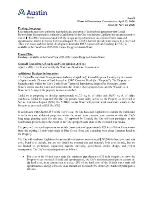
Item 9 Water & Wastewater Commission: April 15, 2026 Council: April 23, 2026 Posting Language ..Title Recommend approval to authorize negotiation and execution of an interlocal agreement with Capital Metropolitan Transportation Authority (CapMetro) for the City to reimburse CapMetro for an amount not to exceed $747,500 for costs associated with the design and construction of an oversized water main and appurtenances related to Service Extension Request No. 5781R2 that will provide water service to a proposed office warehouse and fleet facility development located at 10805 Cameron Road. Funding: $747,500 is available in the Fiscal Year 2025-2026 Capital Budget of Austin Water. ..De Fiscal Note Funding is available in the Fiscal Year 2025-2026 Capital Budget of Austin Water. Council Committee, Boards and Commission Action: April 15, 2026 – To be reviewed by the Water and Wastewater Commission. Additional Backup Information: The Capital Metropolitan Transportation Authority (CapMetro) Demand Response Facility project consists of approximately 25 acres of land located at 10805 Cameron Road (the “Property”). The Property is located entirely within the City’s 2-mile Extra-Territorial Jurisdiction, Impact Fee Boundary, Austin Water’s service area for water and wastewater, the Desired Development Zone, and the Walnut Creek Watershed. A map of the property location is attached. CapMetro is proposing to develop approximately 60,703 sq. ft. of office and 45,093 sq. ft. of office warehouse. CapMetro requested that the City provide water utility service to the Property as proposed in Service Extension Request (SER) No. 5781R2. Austin Water will provide retail wastewater service to the Property as proposed in SER No. 5782. In accordance with Chapter 25-9 of the City’s Code, the City has asked CapMetro to oversize the water main in order to serve additional properties within the north water pressure zone consistent with the City’s long range planning goals for this area. If approved by Council, the City will cost participate in this construction project only to the extent of the City’s proportionate share of the oversized water main. The proposed oversized improvements include construction of approximately 825 feet of 16-inch water main from the existing 16-inch water main in Blue Goose Road and extending west along Cameron Road to the Property. The City will reimburse CapMetro for an overall total amount not to exceed $747,500 for hard costs and soft costs. Hard costs include, but are not limited to, construction and materials. Soft costs include, but are not limited to, preliminary engineering reports, surveying, geotechnical studies, design, and project management. The City’s cost participation is as follows: For costs of the 16-inch water main (the minimum pipe diameter of 12-inches required to serve the Property to an oversized 16-inch) and appurtenances, the City’s maximum participation consists of: (1) hard costs, in an amount not to exceed 25% of the hard costs of the 16-inch water main and appurtenances, and (2) soft costs, in an amount not to exceed 15% of the City’s hard cost participation amount. Item 9 Water & Wastewater Commission: April 15, 2026 Council: April 23, 2026 Other terms of the agreement will require that CapMetro: Pay all costs for financing, interest, fiscal security, accounting, insurance, inspections, permitting, easement acquisition, legal services, and other non-reimbursable soft costs associated with the project; Conform to the City’s design criteria and construction standards; and Construct all improvements at their cost and, after the City’s final approval of the construction, dedicate the facilities to the City for ownership, operation, and maintenance. Use the project plans and specifications approved by the City to publicly solicit and publish invitations for bids for the construction of the improvements; and Follow CapMetro’s bidding practices and procedures, including establishing goals for Disadvantaged Business Enterprise (DBE) participation in the solicitation for bids. The proposed project will be managed through Austin Water staff and is located in zip code 78754, near City Council District 1. City of Austin Council Meeting Backup: April 23, 2026 File ID: 26-1535 LOCATION MAP P32 Demand Response Facility (Revision 2) Water SER-5781R2 R CIR A V O N IN E YAGER LN E PARMER LN R CIR A V O N IN P31 D V L G B N U S M A S R LN E G A E Y Q32 ESTORIA LN D Y R E LS U H RYDEN ST BALES ST T Y S A F BOBWAR ST Q31 N32 N31 MUSKET VALLEY TRL LONG WINTER DR FRIENDSHIP DR NESTLEWOOD DR R S D T H EIG R H E B TIM L S P E W A D L R U T A E N U R B N30 S P R I N K L E C U T O F F R D B L A Z E B Y D R D E F E N D E R T R L S E G W A L N U T C R E E K T UIN S ALAMO HEIGHTS AVE SPRINKLE RD E BRAKER LN RANCHERO RD BELL FARM RD R D M U R T N E C TAEBAEK DR P30 L O N G D A Y D R NIGHT CAMP DR UKAOMA WAY N29 N L R R A B P29 I S P R N G D A L E R D N28 GRID Subject Tract County Boundary Full-Purpose City Limit Unincorporated Travis County 2-Mile ETJ 5-Mile ETJ Limited-Purpose City Limit PARNELL DR / 0 CAMERON RD DRY RUSH WAY TRAVIS COUNTY Q30 CAMERON RD REALITOS BND NATIVE PEARL LN BRIDWELL LN E B R A K E R L N Y A S W AIN L H P NIS A P S R AIR D MINCH RD D A R LIC D R N D O R R U M E A G R O D R R D DIT R O E E D T Y C A A S C Y F R O E H P N M A O O P R R R D O L A E V U R T T A L L S A L T D R Q29 MINNOCH LN GARDEN ROSE PATH BLUE GOOSE RD P28 Q28 750 1,500 3,000 Feet 4,500 This product is for informational purposes and may not have been prepared for or be suitable for legal, engineering, or surveying purposes. It does not represent an on-the-ground survey and represents only the approximate relative location of property boundaries. This product has been produced by the City of Austin for the sole purpose of geographic reference. No warranty is made by the City of Austin regarding specific accuracy or completeness. 3/17/2026 City of Austin Council Meeting Backup: April 23, 2026 File ID: 26-1535 !!!!!!!!!!!!!!!!!!!!!!!!!!!!!!!!!!!!!!!!!!!!!!!!!!!!!!!!!!!!!!!!!!!!!!!!!!!!!!!!!!!!!!!!!!!!!!!!!!!!!!!!!!!!!!!!!!!!!!!!!!!!!!!!!!!!!!!!!!!!!!!!!!!!!!!!!!!!!!!!!!!!!!!!!!!!!!!!!!!!!!!!!!!!!!!!!!!!!!!!!!!!!!!!!!!!!!!!!!!!!!!!!!!!!!!!!!!!!!!!!!!!!!!!!!!!!!!!!!!!!!!!!!!!!!!!!!!!!!!!!!!!!!!!!!!!!!!!!!!!!!!!!!!!!!!!!!!!!!!!¬¬¬¬¬¬¬¬¬¬¬¬¬¬¬¬¬¬¬¬¬¬¬¬¬¬¬¬¬¬¬¬¬¬¬¬¸*¬¬¬¬¬¬¬È(È(È(È(È(È(È(È(È(È(È(È(È(È(È(È(È(È(È(È(È(È(È(È(È(È(È(È(È(È(È(È(È(È(È(È(È(È(È(È(È(È(È(CAMERONRDBARRLNNIGHT CAMP DRRELIANCECREEKDRBLUEGOOSERDMULETRAINDRBRIDWELLLNUKAOMA WAYPACK WAGON TRLNATIVEPEARLLNLONGSUMMERDRMYSTICTIMBERDRFURROWHILLDRMENOMINEE FALLS LNSPEEDWAGON RUN610600620590580630570640560610640570570570580620590580600570630630610640P29P308"12"16"8"8"12"8"8"8"8"8"8"8"8"8"8"8"12"8"8"8"8"8"16"8"8"8"8"8"8"8"8"8"8"8"16"8"8"16"8"8"8"8"8"8"8"8"8"8"W. S.E.R. Name: Demand Response Facility (Revision 2)W. S.E.R. Number: 5781R2Oversized Improvements Map.Utility Development Services Plotted 3/16/202604008001,200200FeetSubject Tract100-Year FEMA FloodplainCritical Water Quality ZoneFull-Purpose City Limit2-Mile ETJUnincorporated Travis CountyThis product is for informational purposes and may not have been prepared for or be suitable for legal, engineering, or surveying purposes. It does not represent an on-the-ground survey and represents only the approximate relativelocation of the property boundaries. This product has been produced by the City of Austin for the sole purpose of geographic reference. No warranty is made by the City of Austin regarding specific accuracy or completeness.STAFF PROPOSEDAPPROXIMATELY825FEETOFOVERSIZED16-INCHWATERMAIN