Item 12 - Service Extension Request Number 5003 for Wastewater Service — original pdf
Backup
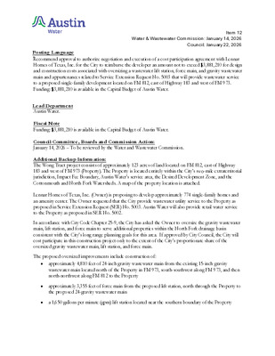
Item 12 Water & Wastewater Commission: January 14, 2026 Council: January 22, 2026 ..Title Posting Language Recommend approval to authorize negotiation and execution of a cost participation agreement with Lennar Homes of Texas, Inc. for the City to reimburse the developer an amount not to exceed $3,881,210 for design and construction costs associated with oversizing a wastewater lift station, force main, and gravity wastewater main and appurtenances related to Service Extension Request No. 5003 that will provide wastewater service to a proposed single-family development located on FM 812, east of Highway 183 and west of FM 973. Funding: $3,881,210 is available in the Capital Budget of Austin Water. ..De Lead Department Austin Water. Fiscal Note Funding: $3,881,210 is available in the Capital Budget of Austin Water. Council Committee, Boards and Commission Action: January 14, 2026 – To be reviewed by the Water and Wastewater Commission. Additional Backup Information: The Wong Tract project consists of approximately 123 acres of land located on FM 812, east of Highway 183 and west of FM 973 (Property). The Property is located entirely within the City’s two-mile extraterritorial jurisdiction, Impact Fee Boundary, Austin Water’s service area, the Desired Development Zone, and the Cottonmouth and North Fork Watersheds. A map of the property location is attached. Lennar Homes of Texas, Inc. (Owner) is proposing to develop approximately 774 single-family homes and an amenity center. The Owner requested that the City provide wastewater utility service to the Property as proposed in Service Extension Request (SER) No. 5003. Austin Water will also provide retail water service to the Property as proposed in SER No. 5002. In accordance with City Code Chapter 25-9, the City has asked the Owner to oversize the gravity wastewater main, lift station, and force main to serve additional properties within the North Fork drainage basin consistent with the City’s long range planning goals for this area. If approved by City Council, the City will cost participate in this construction project only to the extent of the City’s proportionate share of the oversized gravity wastewater main, lift station, and force main. The proposed oversized improvements include construction of: • • • approximately 4,810 feet of 24-inch gravity wastewater main from the existing 15-inch gravity wastewater main located north of the Property in FM 973, south-southwest along FM 973, and then north-northwest along FM 812 to the Property approximately 3,355 feet of force main from the proposed lift station, north through the Property to the proposed 24-gravity wastewater main a 1,650 gallons per minute (gpm) lift station located near the southern boundary of the Property Item 12 Water & Wastewater Commission: January 14, 2026 Council: January 22, 2026 The City will reimburse the Owner for an overall total amount not to exceed $3,881,210 for hard costs and soft costs. Hard costs include, but are not limited to, construction and materials. Soft costs include, but are not limited to, preliminary engineering reports, surveying, geotechnical studies, design, and project management. The City’s cost participation by project component is as follows: • • For costs of the 24-inch gravity wastewater main (the minimum pipe diameter of 12-inches required to serve the Property increased to an oversized 24-inch) and appurtenances, the City’s maximum participation consists of: (1) hard costs, in an amount not to exceed 50 percent of the hard costs of the 24-inch gravity wastewater main and appurtenances, and (2) soft costs, in an amount not to exceed 15%of the City’s hard cost participation amount For costs of the 1,650 gpm lift station and force main (the minimum pumping capacity of 525 gpm required to serve the Property increased to an oversized pumping capacity of 1,650 gpm) and appurtenances, the City’s maximum participation consists of: (1) hard costs, in an amount not to exceed 68.18 percent of the hard costs of the lift station, force main, and appurtenances, and (2) soft costs, in an amount not to exceed 15 percent of the City’s hard cost participation amount Other terms of the agreement require that the Owner complete the following: • Pay all costs for financing, interest, fiscal security, accounting, insurance, inspections, permitting, easement acquisition, legal services, and other non-reimbursable soft costs associated with the project; • Conform to the City’s design criteria and construction standards; • Construct all improvements at their cost and, after the City’s final approval of the construction, dedicate the facilities to the City for ownership, operation, and maintenance; • Allow the City to use the project plans and specifications approved by the City to solicit and publish invitations for bids for the construction of the improvements; and • Follow the City’s standard bidding practices and procedures, including the minority-owned business enterprise procurement program found in Title 2 of the City Code, and Texas Local Government Code Chapters 212 and 252. The proposed project will be managed through Austin Water staff and is located in zip code 78719, near City Council District 2. Water and Wastewater Commission: January 14, 2026 Item 12 LOCATION MAP Wong Tract Wastewater SER-5003 RESERVIST RD E V G A NIN W O R A B M M E M15 M14 SHAW LN L15 DIGNITY CIR BURLESON RD INDUSTRY WAY B N Y W H 3 8 1 S U S ONION CREEK D N E B L VIL E N N O B R D A R A K D E E G A B RIEL C LLIN S R D COTTAGE ROSE DR O L14 B S Y W H 3 8 1 S U S R D G N D O O G I HILLMOORE DR N15 N14 L P W O R E G D E H D R R E H C N F I P15 PEARCE LN P14 S SH 130 NB ELROY RD D LV G B SIN S O R S C E R O O M P13 G N A XI IN P M A C GEMMER ST APPERSON ST L G P WIN D R R VIE O O M D E E R C K13 L13 LAVA HILL RD E WILLIAM CANNON DR ALPHABET DR FINIAL DR FLATBUSH DR BOATHOUSE DR AUSBLICK AVE DINGO DR K11 D 5 R 2 6 M 1 F M12 L12 M13 FM 812 RD N13 D 3 R 7 M 9 S F LINDA VISTA DR 3 B 0 S H 1 S S N Y L R E W O T D AIN R B N12 B B D N D S R R V V 0 S 0 S 3 3 H 1 H 1 S S S S SAN JOSE AVE LONESOME LN T H S T E S D FAIT L L E O O G DRY CREEK EAST N11 MC KENZIE RD M11 D 3 R 7 M 9 S F CITATION AVE L11 E SLAUGHTER LN D 3 R 7 M 9 S F K10 L10 S U S 1 8 3 H W Y N N L O S P SIM K9 SHIVELY LN RODRIGUEZ RD L9 A CIR H A M M10 N10 MOORE RD N R L E K C O L B LAMBERT LN M9 N9 N8 P12 R O S S R D D S R U G N C A M P11 PILAND TRIANGLE P10 D S R M R D FA Grid N U L K R Subject Tract U B 2-Mile ETJ 5-Mile ETJ Full-Purpose City Limit P9 Limited-Purpose City Limit Unincorporated County Village of Mustang Ridge Full Purpose Village of Mustang Ridge ETJ P8 / 0 1,500 3,000 6,000 M8 Feet 9,000 This product is for informational purposes and may not have been prepared for or be suitable for legal, engineering, or surveying purposes. It does not represent an on-the-ground survey and represents only the approximate relative location of property boundaries. This product has been produced by the City of Austin for the sole purpose of geographic reference. No warranty is made by the City of Austin regarding specific accuracy or completeness. 11/25/2025 Water and Wastewater Commission: January 14, 2026 Item 12 0 0 5 5 1 0 0 2 5 0 0 5 0 1 5 5 0 0 0 54 0 55 0 2 5 530 560 0 7 5 510 520 5 2 0 0 5 5 0 6 5 0 3 5 0 5 5 0 4 5 530 % !P % MOORES BRIDGE RD 470 % !P %% !P 8" PVC !P 0 9 4 0 4 5 0 1 5 480 520 ?OSSF LINDA VISTA DR N13 % !P R D D O %% % % !P!P !P O !P W 15" PVC O R 500 STAFF PROPOSED APPROXIMATELY 4,810 FEET OF OVERSIZED 24-INCH WASTEWATER INTERCEPTOR (MIN. SLOPE OF 0.13%) 0 7 5 0 4 5 0 5 5 550 0 5 5 550 0 5 5 0 5 5 0 6 5 M13 550 WILLIAMS PIPE LINE COMPANY FM 812 RD ?OSSF 0 4 5 KINDER-MORGAN INC 570 570 D 3 R 7 0 6 5 M 9 S F 530 C I T G O P R O D U C T S P I P E L I N E C O M P A N Y 520 510 510 530 0 5 5 530 M11 MC KENZIE RD 540 530 "/ 0 2 5 530 PHILLIPS PIPELINE CO 550 5 5 0 530 MC ANGUS RD 0 4 5 0 6 5 560 D AIN R B N12 !P !P % !% ! STAFF PROPOSED APPROXIMATELY !P!P !% !% !P !P %!% !P !% !P !%! 3,355 FEET OF OVERSIZED FORCE MAIN ! ! ! ! ! SAN JOSE AVE 520 LONESOME LN STAFF PROPOSED OVERSIZED 1,650 GPM LIFT STATION 510 D 73 R M 9 S F 500 P M A B D S B TO FM 812 R R V 0 S P 3 0 M H 1 2 A 5 B R S S 0 H 130 S 51 0 N 3 0 H 1 B B 0 S S D N 5 0 S O S S B R 3 H 1 0 N V 0 S 2 T S S 3 H 1 3 1 H 1 M 8 S S S S 0 F 51 0 52 0 49 490 480 T E S L L E T H S GUDRUN ST AIT ISSA ST T E S ZILLY ST D F HELGA ST S 520 O A O H 510 G R C GUNNAR ST O IG 510 N11 S SH 130 SB AT FM 812 TRN S SH 130 NB AT FM 812 TRN 0 1 5 0 1 5 5 0 0 510 560 0 6 5 5 8 0 L13 0 7 5 590 560 540 5 4 0 M12 54 0 L12 530 530 550 L11 570 0 8 5 570 560 . 0 600 1,200 2,400 3,600 Feet W.W. S.E.R. Name: Wong Tract W.W. S.E.R. Number: 5003 Utility Development Services Plotted 3/25/2025 Subject Tract Full-Purpose City Limit 2-Mile ETJ Limited-Purpose City Limit Unincorporated County This product is for informational purposes and may not have been prepared for or be suitable for legal, engineering, or surveying purposes. It does not represent an on-the-ground survey and represents only the approximate relative location of the property boundaries. This product has been produced by the City of Austin for the sole purpose of geographic reference. No warranty is made by the City of Austin regarding specific accuracy or completeness.