Item 4 — original pdf
Backup
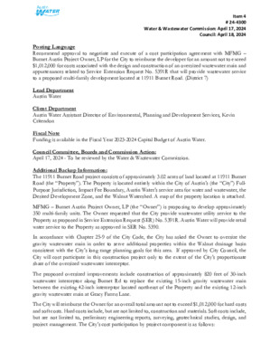
Item 4 # 24-4300 Water & Wastewater Commission: April 17, 2024 Council: April 18, 2024 Posting Language Recommend approval to negotiate and execute of a cost participation agreement with MFMG – Burnet Austin Project Owner, LP for the City to reimburse the developer for an amount not to exceed $1,012,000 for costs associated with the design and construction of an oversized wastewater main and appurtenances related to Service Extension Request No. 5391R that will provide wastewater service to a proposed multi-family development located at 11911 Burnet Road. (District 7) Lead Department Austin Water Client Department Austin Water Assistant Director of Environmental, Planning and Development Services, Kevin Critendon Fiscal Note Funding is available in the Fiscal Year 2023-2024 Capital Budget of Austin Water. Council Committee, Boards and Commission Action: April 17, 2024 - To be reviewed by the Water & Wastewater Commission. Additional Backup Information: The 11911 Burnet Road project consists of approximately 3.02 acres of land located at 11911 Burnet Road (the “Property”). The Property is located entirely within the City of Austin’s (the “City”) Full- Purpose Jurisdiction, Impact Fee Boundary, Austin Water’s service area for water and wastewater, the Desired Development Zone, and the Walnut Watershed. A map of the property location is attached. MFMG – Burnet Austin Project Owner, LP (the “Owner”) is proposing to develop approximately 350 multi-family units. The Owner requested that the City provide wastewater utility service to the Property as proposed in Service Extension Request (SER) No. 5391R. Austin Water will provide retail water service to the Property as approved in SER No. 5390. In accordance with Chapter 25-9 of the City Code, the City has asked the Owner to oversize the gravity wastewater main in order to serve additional properties within the Walnut drainage basin consistent with the City’s long range planning goals for this area. If approved by City Council, the City will cost participate in this construction project only to the extent of the City’s proportionate share of the oversized wastewater interceptor. The proposed oversized improvements include construction of approximately 820 feet of 30-inch wastewater interceptor along Burnet Rd to replace the existing 15-inch gravity wastewater main between the existing 42-inch interceptor located northeast of the Property and the existing 12-inch gravity wastewater main at Gracy Farms Lane. The City will reimburse the Owner for an overall total amount not to exceed $1,012,000 for hard costs and soft costs. Hard costs include, but are not limited to, construction and materials. Soft costs include, but are not limited to, preliminary engineering reports, surveying, geotechnical studies, design, and project management. The City’s cost participation by project component is as follows: Item 4 # 24-4300 Water & Wastewater Commission: April 17, 2024 Council: April 18, 2024 • For costs of the 30-inch wastewater interceptor (the minimum pipe diameter of 18-inches required to serve the Property to an oversized 30-inch) and appurtenances, the City’s maximum participation consists of: (1) hard costs, in an amount not to exceed 40% of the hard costs of the 30-inch wastewater interceptor and appurtenances, and (2) soft costs, in an amount not to exceed 15% of the City’s hard cost participation amount. Other terms of the agreement will require that the Owner: • Pay all costs for financing, interest, fiscal security, accounting, insurance, inspections, permitting, easement acquisition, legal services, and other non-reimbursable soft costs associated with the project; • Conform to the City’s design criteria and construction standards; • Construct all improvements at their cost and, after the City’s final approval of the construction, dedicate the facilities to the City for ownership, operation, and maintenance; • Allow the City to use the project plans and specifications approved by the City to solicit and publish invitations for bids for the construction of the improvements; and • Follow the City’s standard bidding practices and procedures, including the minority-owned business enterprise procurement program found in Title 2 of the City Code, and Texas Local Government Code Chapters 212 and 252. The proposed project will be managed through Austin Water staff and is located in zip code 78758, in City Council District 7. J36 K36 B LOCATION MAP H T 11911 Burnet Road A R P Wastewater SER-5391 A W R N D O S O U Q O P L K U N R A R O L36 W P A R M E R L N B S D R V S Y P X E C A P O M N L35 K35 J35 Z U N I D R J34 B D S R PY SV C EX PA O N M J33 B N D R V S Y P X E C A P O M N GRID W B R A K E R L N L R Y T TIVIT Subject Tract L R O T Surfacewater Feature (Lakes) V E B Full-Purpose City Limit A E R 2-Mile ETJ C 5-Mile ETJ Limited-Purpose City Limit J32 Other City Limit Other ETJ / 0 K E E R C H C N A R B R A T L34 D V L B RIC T E M W A L N U T C R E E K G R A C Y F A R M S L N L33 L32 K34 D U V A L R D G A U LT L N D O M A I N B L V D R AIN D M O D E V A E S O R K C O R PALM WAY Y W K A P R R E T L A K E E R C R E M A R K K33 D R T E N R U B K32 K R A M E R L N 800 1,600 3,200 Feet 4,800 This product is for informational purposes and may not have been prepared for or be suitable for legal, engineering, or surveying purposes. It does not represent an on-the-ground survey and represents only the approximate relative location of property boundaries. This product has been produced by the City of Austin for the sole purpose of geographic reference. No warranty is made by the City of Austin regarding specific accuracy or completeness. 8/10/2023 % % % 7 3 0 7 4 0 % % % NORTHERN WALNUT CREEK GREENBELT % % % 6" P V C % % !P % !P % !P % % 7 2 0 % % !P % !P % % C V % " P 8 % % !P % % BALCONES DISTRICT PARK Y S P X C E A P O N M 7 2 0 C V % !P % 8" P 8 " P V C 8" PVC %% !P!P %% % !P !P !P STAFF PROPOSED APPROXIMATELY 820 FEET OF OVERSIZED 30-INCH WASTEWATER INTERCEPTOR M O P A C S V R D N B A T N P A L M W A Y T O M O P A C N B R A M P 72 0 730 D U V A L N M O P A C E X P Y S V R D N B % !P % % !P 8 " P V C % 8 " P V C % !P !P % T R N D U V A L !P % 8 " R D P V C K34 7 2 0 % 8" PVC % % !P D " 8 I % !P % !P % % !P % !P !P % 710 % C V 15" P 0 72 0 3 7 % % !P !P % % !P %% !P!P % !( 12" PVC !P 8" P % !P !P % !P !P % !P C V % " P 2 1 !P 8" P 0 4 7 !P V ! % ! ! !P V % C 730 % 0 3 7 G A U LT L N % 7 4 0 % %% % !P!P % !P % !P % A L T E R R A P K W Y !P % C V P " 2 1 !P % 0 2 7 !P % !P C % V " P D T R 2 1 E N R U B JO H N S C H ASE TRL % !P V " P !P % ABND PRIVATE LIFT STATION !P!P [7L !P 5 !% ! 1 !% ! $. % %% !P !P!P AB 1 C ! 5 7 4 0 !P %% 12" PVC % % !P % % % % 6 9 0 P A R K B E N 0 0 7 D D R 670 V B R D S N R T D N E B K R A P T A Y N B N D R V S C A P O M N P B M X P 4 2 % " 7 0 0 R C P A C E B R A O P C N N M P O 9 6 A 0 O M A M P B R Y S B P WALNUT CREEK C S N M O P A C S B T O D U V A L R A M P O M O X N M O P A C E R M E R T A P A P % S T B M D N R R Y F A C V A Y S P % !P !P 6 NORTHERN WALNUT CREEK GREENBELT % !P %% !P!P % 86479 8 0 R 4 2 " 7 1 0 0 7 G C E 0 R X % A O P 15" PVC N M % !P % !P !P !P % 15" PVC 241389 ! ! ! % !P!P % !P !% !P !P %%% % !P % !P!P % !P " 15" PVC P ! 0 8 ! % % ! 0 7 C % V !P ! ! % % !P ! ! ! C P % !P % 7 0 0 % 4 2 % " R C P % !P 42" R C P % 0 7 6 !P % !P % C V P % " 2 1 !P % % ! !P ! % % % ! ! % ! !P STAFF PROPOSED APPROPRIATELY SIZED WASTEWATER CONNECTION % % % ! ! ! 6 6 0 !P % ! ! % % 8 " ! P V ! C % % !P !%! !P E C T % ! ! ! ! % 8" P !P % 0 1 7 K R A M E R C R EEK % !P % 12" PV C G R A C Y F !P % A R M S L N % 8" P V C V % C !P % 8 !P!P % % C V " P % !P % C V P " 2 1 !P C V % 8 6 0 % % !P 12" P !P !P % C V % !P 8" P % % !P % % !P 8" PVC % % !P 1 2 % " P 720 V % C Y A B W A W H C S ! ! ! ! ! ! Y H O R S % H O B B V C " P 5 7 ! ! ! ! ! ! 2 0 C !P % ! ! ! V ! ! 1 ! ! !P 8" P !P !% ! ! % ! !! C ! ! !! V C !! !! % ! ! !% !P !% ! !P 1 5 " P % !P !P!P !P !% ! C % G !% L XIN V 15" P !P % AZU !P % % " P V C ! ! ! ! ! ! ! K33 E V E A RIS Y K S PALM WAY 0 76 750 0 5 7 . 0 200 400 800 1,200 Feet W.W. S.E.R. Name: 11911 Burnet Road (Revised) W.W. S.E.R. Number: 5391R Oversized Improvements Map Utility Development Services Plotted 3/5/2024 % !P % 8" P 0 3 7 V C % % !P % % Subject Tract 100-yr FEMA Floodplain Critical Water Quality Zone This product is for informational purposes and may not have been prepared for or be suitable for legal, engineering, or surveying purposes. It does not represent an on-the-ground survey and represents only the approximate relative location of the property boundaries. This product has been produced by the City of Austin for the sole purpose of geographic reference. No warranty is made by the City of Austin regarding specific accuracy or completeness. % % %