Item 4 — original pdf
Backup
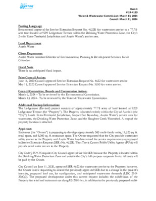
Item 4 # 24-4119 Water & Wastewater Commission: March 13, 2024 Council: March 21, 2024 Posting Language Recommend approval for Service Extension Request No. 4622R for wastewater service to a 77.78- acre tract located at 9209 Ledgestone Terrace within the Drinking Water Protection Zone, the City’s 2-mile Extra-Territorial Jurisdiction and Austin Water’s service area. Lead Department Austin Water Client Department Austin Water Assistant Director of Environmental, Planning & Development Services, Kevin Critendon Fiscal Note There is no anticipated fiscal impact. Prior Council Action: June 11, 2020 Council approved Service Extension Request No. 4622 for wastewater service May 18, 2023 Council approved Service Extension Request No. 5650 for water service. Council Committee, Boards and Commission Action: March 6, 2024 – To be reviewed by the Environmental Commission. March 13, 2024 - To be reviewed by the Water & Wastewater Commission. Additional Backup Information: The Ledgestone (Revised) project consists of approximately 77.78 acres of land located at 9209 Ledgestone Terrace (the “Property”). The Property is located entirely within the City of Austin’s (the “City”) 2-mile Extra-Territorial Jurisdiction, Impact Fee Boundary, Austin Water’s service area for wastewater, the Drinking Water Protection Zone, and the Slaughter Creek Watershed. A map of the property location is attached. Applicant: Endeavor (the “Owner”) is proposing to develop approximately 500 multi-family units, 11,620 sq. ft. retail space, and 8,000 sq. ft. restaurant space. The Owner requested that the City provide wastewater utility service to the Property and Austin Water has determined the service requirements as proposed in Service Extension Request (SER) No. 4622R. West Travis County Public Utility Agency (PUA) will provide retail water service to the Property. City Code § 25-9-35 requires City Council approval for this SER because the Property is located within the Drinking Water Protection Zone and outside the City’s full-purpose corporate limits. All costs will be paid by the Owner. City Council on June 11, 2020, approved SER-4622 for wastewater service to the Property; however, the Owner is now requesting to amend the previously approved SER due to a change in the project’s intensity, proposed land use, lot configuration, and anticipated wastewater demands (LDC 25-9- 39(C)3). The proposed development under this current request includes the subdivision of the Property for retail and restaurant use along US 290 Hwy, in addition to the previously proposed multi- Item 4 # 24-4119 Water & Wastewater Commission: March 13, 2024 Council: March 21, 2024 family use on the Property. Infrastructure Improvements: To serve the Property, the Owner will be required to construct: • Approximately 1,800 feet of 15-inch gravity wastewater main from the existing 15-inch gravity wastewater main near W SH 71 and extend west along Williamson Creek to Covered Bridge Drive, • Approximately 2,250 feet of 12-inch gravity wastewater main from the existing 8-inch gravity wastewater main located north of Towana Trail and extend west along Towana Trail and south along Mowinkle Drive, • An appropriately sized lift station, • Approximately 4,775 feet of appropriately sized force from the lift station and extend east along W US 290 Highway to the existing 8-inch gravity wastewater main located in Circle Dr. • Approximately 2,150 feet of 8-inch gravity wastewater main from the proposed lift station to the western boundary of the Property. The proposed wastewater improvements are sized to serve the needs of the Property and will conform to all City Code requirements. These improvements will be designed in accordance with City’s Environmental Criteria Manual and Utilities Criteria Manual, and will be inspected by the City’s Development Services Department. The Owner will construct all required improvements at their cost and dedicate the facilities to the City for ownership, operation and maintenance. All City fees are applicable to the provision of wastewater service including capital recovery fees. City Staff Recommendation: Austin Water has evaluated the Owner’s request for City wastewater service and can provide centralized wastewater service as proposed in SER-4622R. Attached is a report from Austin Water staff outlining additional technical information related to providing service to this tract. Additionally, a report provided by Watershed Protection Department staff that finds no significant environmental concerns with providing centralized wastewater service as proposed in SER-4622R is attached. Contingent upon approval of SER-4622R for wastewater service to the Property, approval of any related development applications for the Property is subject to current City Code, including the Save Our Springs Ordinance. The proposed project is located in zip code 78737 and is near City Council District 8. WZ22 T H O M A S S P R I N G B R A N C H WZ21 LOCATION MAP Ledgestone (Revised) A22 Wastewater SER-4622R R W D T VIE N A T DIS B L U E HILL D R W S H 7 1 A21 M AS SPRIN GS RD TH O B22 B21 WZ20 A20 TRAVIS COUNTY DEVILS PEN CREEK CIR C L E D R W U S 2 9 0 H W Y WZ19 R E E T N O T S E G D E L WY19 WY18 WZ18 GRID Subject Tract County Boundary Full-Purpose City Limit 2-Mile ETJ 5-Mile ETJ Limited-Purpose City Limit Other City Limit Other ETJ WZ17 / 0 SLAUGHTER CREEK 1,000 2,000 4,000 D E V I L S P E N C R E E K A17 Feet 6,000 R E D G RID D B E R E V O C WILLIA M SO N C REEK B20 SCENIC BROOK TRIBUTARY R R O O K D N I C B E C S B19 WH EE LE R BR A N C H KIN C H E O N B R A N C H B18 B17 A19 A18 This product is for informational purposes and may not have been prepared for or be suitable for legal, engineering, or surveying purposes. It does not represent an on-the-ground survey and represents only the approximate relative location of property boundaries. This product has been produced by the City of Austin for the sole purpose of geographic reference. No warranty is made by the City of Austin regarding specific accuracy or completeness. 2/6/2024 0 1 0 1 1 0 3 0 9 8 0 9 6 0 9 9 0 1 0 5 0 1 1 2 0 1110 1100 WZ21 1100 1 1 1 0 1 0 6 0 1 0 0 0 1 0 4 0 0 2 0 1 1 0 7 0 1 1 0 0 1 0 9 0 1100 0 7 0 1 TH O 0 6 0 1 STAFF PROPOSED APPROXIMATLEY 2,250 FEET OF 1 0 9 0 12-INCH GRAVITY WASTEWATER MAIN (MINIMUM 1.0% SLOPE) STREA 0 1 0 1 M L U A 1 0 8 0 0 1 1 1 A22 0 8 9 970 1 0 1 0 1020 1 0 5 0 1 0 0 0 A21 GS RD 1 0 8 0 1 0 5 0 M AS SPRIN 960 950 9 3 0 9 9 0 W S H 7 1 % % A N C H U 1050 0 2 0 1 B21 % % 990 % % % LANDMARK CONSERVANCY LS 0 2 0 1 % % % % % % % % \ \ \ % L T % S % R A % % STAFF PROPOSED APPROXIMATELY [7L % %\ 1,800 FEET OF 15-INCH GRAVITY SUMMER SKY DR WASTEWATER MAIN (MINIMUM 0.5% SLOPE) % % \ %\ % LE R NIG % \ % A \ \ \ \ \ \ % \ \ \ \ \ \ \ \ \ \ C % % % % % % % % % % % % % % % % % % % % % % % % % % % % % % 9 % !% % %% % \ %\ % % %% % % SIDE D H T D R 1 0 O A R D C C R 0 8 E L L I A K T STAFF PROPOSED APPROXIMATELY E N D N 2,150 FEET OF T L A R P 8-INCH GRAVITY E T 1090 PIT WASTEWATER MAIN 0 1 1 %\\ 1 \ 1070 % \ 4" P \ \ [7L \\ \ \\ % \ \ 1 0 0 0 \ 2 0 0 1 % % ! % ! D N R % E L % W % % % O N A R % % L T S % R H L E R A A R L O L C R A R % % L % % ! % % % % % % % % ! % % % % XT % % % % % A T ! % N D N D 0 7 9 0 3 9 0 4 0 1 A20 % % % % % % % 124875 % % % % % % % MURMURING CREEK DR % %% % % % % % % 124869 % !%% % % !% % % !% % % % % % % % % R %%%% % GE D MOCCASIN NEIGHBORHOOD PARK % % % % % % % % % % % RID % % % % % % %% 8" PVC % D B % % % R % % % 950 0 % % E D % % % 7 %% E 9 % ER %% L % % % % % K C OV % % 8" PVC WIN % % V % % 8" C % C % %% % % % 8" P % % % O % % %% % % 200276 % % % % M % % % % % % % % % % % % % %% % % % % % % % %% C % C % % % % % % V C V C 8" P % V 8" P 8" PVC % V % %% 8" P % % % % % % 8" P 8" P % %% % 8" PVC % % %% % % % %% % 8" PVC % % % THU % % % NDERBIRD RD % % % %% % 240187 % \\ % % % 8" PVC % % PRIVATE LIFT STATION % %(%\\\ %( %( %( D ( 8" PVC ( % 1 0 8 0 % 1080 %( ( \ " 6 \ W US 290 HWY %% % %% %\\\\ \\\\\\ % % % % % % %% % %% % % % % %% % % % % % % % % % % % % % % % % % \\ % [7L % % % % % % % \ % % % % % \ % % % % RIDGEVIEW LS % % % % % % 920 % % % C V 8" P % 1010 WH EE LE R BR A N C H %\\ %\\ %\ \ %\ %\ %\ % %(%(%( % %( %( % % % % % % % % % % % % % % % % % % % % % % A19 % % % % 1060 240017 0 7 0 1 1040 % % 1060 % % O N % 1 0 7 0 % C 930 990 M C % R D % % % % % % % % % % % % % % % % % % % % % % % % % % % % C V C % % % V % \ !% % I % T E % A A R R % % % % \ \ % 0 0 1 0 0 9 6 0 "J 6 0 1 9 9 0 %\ %\ [7L \ \ %\ \ %\ \ %\ \ \ % % % % 9 4 0 1 0 1 4 0 0 2 0 0 0 1 1 % % % 9 0 9 8 % % 0 6 9 % % 1030 %% %% C % % % % V % C % % % " P C % V % V % " P % " P 8 % % % % % % % % %%% 8 %% % % % 8 % % % % % % % % % % % %% % % !% % % % 9 2 0 9 6 0 970 % % % % 0 6 0 3 1 9 0 % % % % % % 890 % % !% % ! % % % % % % !% ! !% !% % !% 880 % % % !% % % % % !% 8 % % % 7 0 % % % !% % % % 9 0 0 % !% !% % !% !% % % % % % !% % !% % % % % !% !% % 0 % % % % 0 94 9 0 % % % % % % % % % % % % % % % % % % % % % % % % % % % % % % % % % % % % % % % % % 920 % % % % 9 % % % % % % % %\ %\ %\ %\ %\\\ %\ B19 % \ \ C \ V \ 4" P \ \ 9 7 0 %\\ % %\ % %\ %\ 8 0 % % \ 9 3 0 950 9 3 0 % % % !% % % % % % % % ABND PRIVATE LIFT STATION [7L % % % % % % AB % % % B20 % % % % % % 0 7 9 % % % % % STAFF PROPOSED APPROXIMATELY 4,775 FEET OF APPROPRIATELY SIZED FORCE MAIN STAFF PROPOSED APPROPRIATELY SIZED LIFT STATION Y O A18 2 9 9 0 0 3 0 1 9 U N G L N 0 1,000 2,000 4,000 6,000 Feet 1 0 1 0 0 4 9 980 B E L L A17 0 5 9 A VIS T A T R L 0 3 0 1 990 % % % % % % % % % % % %\ % % % % \ % 6 \ % 0 \ 9 4 0 %\ %\ % % % % 9 % % % % % % % % B18 % % 12" PVC % % % % % . \ \ \ \ " 1 5 P 9 3 0 0 1 9 % % \ \ V C % 0 8 8 %\ %\ % % % % % % % % % %% % % % \ % % \ %\ 920 % % % % PRIVATE LIFT STATION % % % % % 0 7 % % 9 % % \ % % % % % % % % % %% % % % % % % % % % N D % % % Subject Tract % % % % % VIA RICCODR % % % % % % % % % N % R N L % % Y D % O % % % %% % % % % S % T % % D T % A R % A E % %% % % % % B W % % D % E [7L %\\ 960 9 8 0 % % % % % BIO % % % % % % % % % G R A % % % T T E Y R A D B % 100-yr FEMA Floodplain Full-Purpose City Limit 2-Mile ETJ Limited-Purpose City Limit W.W. S.E.R. Name: Ledgestone (Revised) W.W. S.E.R. Number: 4622R Utility Development Services Plotted 11/3/2023 This product is for informational purposes and may not have been prepared for or be suitable for legal, engineering, or surveying purposes. It does not represent an on-the-ground survey and represents only the approximate relative location of the property boundaries. This product has been produced by the City of Austin for the sole purpose of geographic reference. No warranty is made by the City of Austin regarding specific accuracy or completeness. WZ20 1 0 3 0 WZ19 9 9 0 1 0 1 0 4 0 7 0 0 5 0 1 1 0 6 0 1060 R E E T N O T S E G D E L 0 2 0 1 WZ18 1 0 4 0 0 4 0 1 SANDSTONE ST 1030 980 970 . DRAFT City of Austin | Austin Water P.O. Box 1088 Austin, TX 78767 AustinWater.org MEMORANDUM To: From: Date: Subject: Ledgestone (Revised) (Wastewater SER-4622R) Water and Wastewater Commissioners Brett Ueno, Utility Development Services March 13, 2024 Enclosed is additional technical information related to Wastewater SER-4622R and the associated Request for Council Action. Other SERs: • There are 8 water SERs located within one-half of a mile of the subject tract. Of these SERs, 3 were administratively approved, 2 were approved by City Council, and 3 were withdrawn prior to City Council consideration. • There are 8 wastewater SERs located within one-half of a mile of the subject tract. Of these SERs, 5 were approved by City Council, 2 were administratively approved, and 1 was withdrawn prior to City Council consideration. Water Utility Service: Wastewater Utility Service: • Water Service will be provided by the West Travis County Public Utility Agency (PUA). • On May 18, 2023, City Council approved water SER-5650 for water service to the subject tract; however, the Applicant has subsequently decided to obtain water service from the West Travis County PUA. The City’s existing wastewater collection system is located approximately 4,200 feet from the subject tract. City Council on June 11, 2020, approved SER-4622 for extension of centralized wastewater service to the subject tract for a proposed multi-family project; however, the Applicant is now requesting to amend the previously approved SER for the addition of retail and restaurant use. SER Improvements: • The SER improvements will cross a known environmental feature, Devil’s Pen Creek. The improvements will be located along the US 290 Hwy right-of-way at this creek crossing. • The SER improvements will conform to all City Code requirements, be designed in accordance with City’s Environmental Criteria Manual and Utilities Criteria Manual, and be inspected by the City’s Development Services Department. If you need additional information, please let me know. Thank you. The City of Austin is committed to compliance with the Americans with Disabilities Act (ADA). Reasonable modifications and equal access to communications will be provided upon request. cc: Colleen Kirk, P.E., SER Program Supervising Engineer Martin Tower, P.E. Utility Development Services Interim Division Manager Kevin Critendon, P.E., Assistant Director Shay Ralls Roalson, P.E., Director ITEM FOR ENVIRONMENTAL COMMISSION AGENDA COMMISSION MEETING DATE: March 6, 2024 NAME & NUMBER OF PROJECT: Ledgestone Revised Wastewater Service Extension Request #4622R NAME OF APPLICANT OR ORGANIZATION: Danny Miller, P.E. LJA Engineering, Inc. LOCATION: 9209 Ledgestone Terrace, Austin, Texas 78737 COUNCIL DISTRICT: Austin 2-Mile Extraterritorial Jurisdiction PROJECT FILING DATE: November 3, 2023 WPD/ENVIRONMENTAL STAFF: Kaela Champlin, Environmental Program Coordinator (512) 974-3443, Kaela.Champlin@austintexas.gov WATERSHED: REQUEST: STAFF DETERMINATION: Recommended Slaughter Creek Watershed, Barton Springs Zone, Edwards Aquifer Contributing Zone, Drinking Water Protection Zone Wastewater Service Extension Revision 1 MEMORANDUM TO: Kevin Ramberg, Chair, and Members of the Environmental Commission FROM: Kaela Champlin, Environmental Program Coordinator Watershed Protection Department DATE: February 13, 2024 SUBJECT: Ledgestone Revised Wastewater SER #4622R Service Extension Requests (SER) located in the Drinking Water Protection Zone and outside of the City of Austin’s full purpose jurisdiction require Council approval and review by the Environmental Commission. Watershed Protection Department staff have completed the review for Ledgestone Wastewater Revised SER #4622R and recommend approval of the request. Site Overview The site consists of one tract of approximately 77.78 acres, located at 9209 Ledgestone Terrace. The site is in the City of Austin’s Two-Mile Extraterritorial Jurisdiction (ETJ), the Slaughter Creek Watershed, the Barton Springs Zone, and the Drinking Water Protection Zone. It is also within the Edwards Aquifer Contributing Zone and is subject to the Save Our Springs (SOS) Ordinance. Previously approved SERs The applicant previously received an approval for a wastewater SER (SER #4622) and a water SER (SER #5650) for this site. At the time, the applicant’s proposal was for a 550-unit multi- family development with 275 Living Unit Equivalents (LUEs). The wastewater SER was recommended by the Environmental Commission, Water and Wastewater Commission, and subsequently approved by Council in June of 2020. The water SER was requested and approved in May of 2023. The staff memo and recommendations from the Environmental Commission are attached as Exhibit A. Request Summary In the revised wastewater SER, the applicant is proposing to add 50 LUEs, an increase from 275 LUEs to 325 total LUEs to accommodate the addition of retail and restaurant space on the site. The proposed development includes: 2 Proposed Development Use Units Multifamily Condo Units Retail Restaurant 140 360 11,620 sq. ft. 8,000 sq. ft Total LUEs LUEs 98 180 7 40 325 The applicant resubmitted a site plan application that is currently in review (Case Number: SP- 2023-0177D). The applicant is subject to land use and development regulations established in the current Land Development Code standards. Impacts from SER improvements Wastewater: The applicant is proposing to replace approximately 1,800 feet of existing 12-inch gravity wastewater main with 15-inch gravity wastewater main (minimum 0.5% slope) along Williamson Creek. Portions of the proposed 15-inch gravity wastewater main are also proposed to be constructed by others. If the applicant’s project timeline needs these wastewater improvements prior to the completion of them by others, then the design and construction of these improvements are the responsibility of the applicant. Applicant will replace approximately 2,250 feet of existing 8-inch gravity wastewater main with a 12-inch gravity wastewater main along Towana Trail and Mowinkle Drive. The proposed 12- inch gravity wastewater main is also proposed to be constructed by others. If the applicant’s project timeline needs these wastewater improvements prior to the completion of them by others, then the design and construction of these improvements are the responsibility of the applicant. The applicant will construct an appropriately sized lift station at the approximate location shown on the attached map. Approximately 4,775 feet of appropriately sized force main from the proposed lift station and extend north to W. US 290 Hwy, then northeast along West US 290 Highway and then north along South Bend Drive to the existing 8-inch gravity wastewater main located in Circle Drive. The lift station and force main improvements are also proposed by the applicant for SER #4796. If the others construct the lift station and force main first, then the applicant will construct appropriately sized lift station and force main upgrades as needed to serve this development. Applicant will also construct approximately 2,150 feet of 8-inch gravity wastewater main from the proposed lift station described above and extend north to W. US 290 Hwy and then along W. US 290 Hwy to the subject tract. A map showing the approximate locations of these improvements can be found on the attached map, Exhibit B. Alternative Wastewater Service: Watershed Protection Department staff determined that if the estimated 325 LUEs are permitted, approximately 79,625 gallons per day of wastewater would be produced. If service is not extended to the site and wastewater disposal is required, there are two options for this amount of effluent treatment: an Onsite Sewage Facility (OSSF) or land application (surface irrigation or subsurface land application). Land application would require a Texas Land Application Permit 3 (TLAP) or a Subsurface Area Drip Dispersal System (SADDS) issued by the Texas Commission on Environmental Quality (TCEQ). Most of the site is located on Brackett-Rock outcrop soils with some areas of Volente silty clay loam along the northeastern boundary. Brackett-Rock outcrop soils are not ideal for OSSFs or land application because the soil type is thin and rocky and there are severe limitations for septic tank absorption fields and pond construction noted in the soil survey due to the shallow depth of bedrock. Soil could be imported at a considerable expense, but the land application system maintenance requirements would increase due to the underlying Brackett soils. Soil piping and preferential flow paths would likely form, allowing wastewater migration below the root zone. OSSFs could be developed with single family residences, but Travis County requires a lot size of at least one acre for OSSFs. Under these rules, a multifamily development with a similar density as currently proposed would not be possible. If a SADDS were built onsite, it would require roughly 19 acres of the site area for an application area, storage pond, and a wastewater treatment plant footprint to reach secondary treatment levels. This would consist of roughly 25% of the tract coverage that would need to be deducted from the net site area calculations associated with the impervious cover limits. If spray irrigation were used, it would require roughly 25 acres of the site area for the spray irrigation area, surface spray pond, and the wastewater treatment footprint. This would consist of roughly 32 percent of the tract coverage that would need to be deducted from the net site area calculations associated with the impervious cover limits. Based on the information provided by the applicant, the site contains 76.49 acres of net site area and 19.39 acres of allowable impervious cover. If service is not extended to the site and wastewater disposal is required under a TLAP, the allowable impervious cover would likely reduce to about 13.17 to 14.59 acres depending on the type of land application permit. The total proposed impervious cover on the site is 16.87 acres. Based on the information provided, the applicant would not be able to develop with the same intensity with a TLAP. Furthermore, due to the unsuitability of the soils in this area, a centralized wastewater system would be preferable to a TLAP. Water: The applicant previously received an approved water SER (#5650). However, the applicant notified staff that they now plan to utilize service from West Travis County Public Utility Agency (PUA). Therefore, no revised water SER has been submitted at this time. Environmental impacts The property is in the Slaughter Creek Watershed and classified as the Barton Springs Zone. The site is in the Drinking Water Protection Zone, the Edwards Aquifer Contributing Zone, and is subject to the Save Our Springs (SOS) Ordinance. A wetland critical environmental feature (CEF) and its associated buffer were identified by staff during the review process along a natural channel of Slaughter Creek on the northern portion of the property. The southwestern and eastern 4 corners of the site are within the Slaughter Creek critical water quality zone and water quality transition zone. The site does not drain to occupied salamander habitat. Recommendation The Watershed Protection Department recommends approval of the revised wastewater SER #4622R for the following reasons: • A wastewater SER was previously approved in 2020 with a similar intensity. This revised SER will add 50 LUEs so the applicant may add retail and restaurant uses to their development. • Alternative wastewater systems such as OSSF or land application are not preferred due to the thin and rocky soils on this site. This can lead to soil piping and preferential flow paths that are likely to form, allowing wastewater migration below the root zone. The attached exhibits provide further detail on the applicant’s request. Please feel free to contact Kaela Champlin at (512) 974-3443 or kaela.champlin@austintexas.gov if you have any questions or comments about the proposed revision. cc: Brett Ueno, Graduate Engineer, Austin Water Colleen Kirk, P.E., Austin Water Liz Johnston, Deputy Environmental Officer, Watershed Protection Department Katie Coyne, Environmental Officer, Watershed Protection Department 5 EXHIBIT A ITEM FOR ENVIRONMENTAL COMMISSION AGENDA COMMISSION MEETING DATE: June 3, 2020 NAME & NUMBER OF PROJECT: Ledgestone Wastewater Service Extension Request #4622 NAME OF APPLICANT OR ORGANIZATION: Daniel Ryan, P.E. LJA Engineering, Inc. LOCATION: 9021 W US 290 Hwy, Austin, TX 78737 COUNCIL DISTRICT: Austin 2-Mile Extraterritorial Jurisdiction PROJECT FILING DATE: October 17, 2019 WPD/ENVIRONMENTAL STAFF: Kaela Champlin, Environmental Officer’s Office (512) 974-3443, kaela.champlin@austintexas.gov Slaughter Creek Watershed, Barton Springs Zone, Edwards Aquifer Contributing Zone, Drinking Water Protection Zone WATERSHED: REQUEST: STAFF DETERMINATION: Wastewater Service Extension Recommended 1 MEMORANDUM May 21, 2020 Linda Guerrero, Chair, and Members of the Environmental Commission Kaela Champlin, Environmental Officer’s Office Watershed Protection Department TO: FROM: DATE: SUBJECT: Ledgestone Wastewater SER #4622 Service Extension Requests (SER) located in the Drinking Water Protection Zone and outside of the City of Austin’s full purpose jurisdiction require Council approval and review by the Environmental Commission. Watershed Protection Department staff have completed the review for Ledgestone Wastewater SER #4622 and recommend approval of the request. Site Overview The site consists of one tract of approximately 77.78 acres, located at 9021 W US 290 Hwy. The site is in the City of Austin’s Limited Purpose Jurisdiction, the Slaughter Creek Watershed, the Barton Springs Zone, and the Drinking Water Protection Zone. The site is also within the Edwards Aquifer Contributing Zone and is subject to the Save Our Springs (SOS) Ordinance. An Environmental Resource Inventory submitted by the applicant identified no critical environmental features within the property. The applicant is proposing to develop a 550-unit multi-family development. A site plan has not yet been submitted to the City of Austin. Development Impacts Water: The site is located in the water service area of the West Travis County Public Utility Agency (PUA). Wastewater: The applicant shall construct approximately 1,000 feet of 8-inch gravity wastewater main in Circle Dr and extend south along Circle Dr and then west along US 290 to the highest point that can be served by the proposed gravity wastewater main, as approximately shown on the attached map. Applicant shall also construct an appropriately sized public lift station at the approximate location shown on the attached map. Applicant shall construct approximately 6,150 feet of 2 appropriately sized force main from the proposed lift station and extend north through the subject tract and northeast along US 290 Hwy to the proposed 8-inch gravity wastewater main in US 290 Hwy. Applicant shall dedicate appropriately sized wastewater easements from the proposed lift station west to Ledgestone Terrace and north to W US 290 Hwy. Applicant shall construct approximately 1,800 feet of 15-inch gravity wastewater main (minimum 0.4% slope) from the existing 15-inch gravity wastewater main along Williamson Creek, and extend west to the existing 12-inch gravity wastewater main located west of Covered Bridge Dr, as approximately shown on the attached map. The proposed 15-inch gravity wastewater main shall replace the existing 12-inch gravity wastewater main in its path. Applicant shall reconnect all existing wastewater services from the existing 12-inch gravity wastewater main to the proposed 15-inch gravity wastewater main. Applicant shall construct approximately 2,250 feet of 12-inch gravity wastewater main (minimum 1.0% slope) from the existing 8-inch gravity wastewater main located north of Towana Trl, and extend south towards Towana Trl, west along Towana Trl, and then south along Mowinkle Dr to the existing 8-inch gravity wastewater main in Mowinkle Dr, as approximately shown on the attached map. The proposed 12-inch gravity wastewater main shall replace the existing 8-inch gravity wastewater main along its path. Applicant shall reconnect all existing wastewater services from the existing 8-inch gravity wastewater main to the proposed 12-inch gravity wastewater main. Alternative Wastewater Service: The applicant has stated that the site could develop with a similar density with decentralized service approved by a Texas Land Application Permit (TLAP) issued by the Texas Commission on Environmental Quality. Environmental Impacts The property is in the Slaughter Creek Watershed and classified as the Barton Springs Zone. The site is in the Drinking Water Protection Zone, the Edwards Aquifer Contributing Zone, and is subject to the Save Our Springs (SOS) Ordinance. The southwestern and eastern corners of the site are within the Devils Pen Creek critical water quality zone and water quality transition zone. An Environmental Resource Inventory was conducted by the applicant, and no known recharge environmental features or critical environmental features were found onsite. The site does not drain to occupied salamander habitat. Based on the information provided by the applicant, the site contains 74.88 of net site area. Therefore, the site contains 18.72 acres of allowable impervious cover. If service is not extended to the site and wastewater disposal is required under a Texas Land Application Permit with the Texas Commission on Environmental Quality, the allowable impervious cover would likely reduce to 15.1 acres based on staff’s estimation of the irrigation area. By staff’s estimation, the site could develop without any required Land Use Commission variances to the City of Austin Land Development Code. Recommendation Staff review determined that there are no significant environmental risks to extend service to the site and therefore recommends approval of Service Extension Request #4622. 3 The attached information provides further detail on the applicant’s request. Please feel free to contact Kaela Champlin at (512) 974-3443 or kaela.champlin@austintexas.gov if you have any questions or comments about the proposed SER. cc: Kevin Critendon, P.E., Austin Water Colleen Kirk, P.E., Austin Water Christopher Herrington, P.E., Watershed Protection Department 4 ENVIRONMENTAL COMMISSION MOTION 20200603-006c Date: June 3, 2020 Subject: Ledgestone Wastewater Service Extension Request #4622 Motion by: Kevin Ramberg Seconded by: Wendy Gordon RATIONALE: WHEREAS, the Environmental Commission recognizes the applicant wishes to conduct a public hearing and seeks approval of a wastewater service extension request on property locally known as 9021 W US 290 Hwy. WHEREAS, the Environmental Commission recognizes that staff review determined that there are no significant environmental risks to extend service to the site and therefore recommends approval of Service Extension Request #4622. THEREFORE, the Environmental Commission recommends approval of Service Extension Request #4622. VOTE 8-0 For: Smith, Thompson, Neely, Coyne, Maceo, Ramberg, Guerrero, and Bedford Against: None Abstain: None Recuse: None Absent: Creel, Nill, Gordon Approved By: Linda Guerrero, Environmental Commission Chair 1 ITEM FOR ENVIRONMENTAL COMMISSION AGENDA COMMISSION MEETING DATE: May 3, 2023 NAME & NUMBER OF PROJECT: Ledgestone Water Service Extension Request #5650 NAME OF APPLICANT OR ORGANIZATION: Vito Trupiano, P.E., Endeavor Real Estate Group LOCATION: 9209 Ledgestone Terrace, Austin, TX 78737 COUNCIL DISTRICT: Austin 2-Mile Extraterritorial Jurisdiction PROJECT FILING DATE: March 8, 2023 WPD/ENVIRONMENTAL STAFF: Kaela Champlin, Environmental Program Coordinator, Watershed Protection Department (512) 974-3443, kaela.champlin@austintexas.gov WATERSHED: REQUEST: STAFF DETERMINATION: Slaughter Creek Watershed, Barton Springs Zone, Edwards Aquifer Contributing Zone, Drinking Water Protection Zone Water Service Extension Staff recommends approval of the water service extension 1 MEMORANDUM TO: FROM: Kevin Ramberg, Chair, and Members of the Environmental Commission Kaela Champlin, Environmental Program Coordinator, Watershed Protection Department May 3, 2023 DATE: SUBJECT: Ledgestone Terrace Water SER #5650 Service Extension Requests (SER) located in the Drinking Water Protection Zone and outside of the City of Austin’s full purpose jurisdiction require Council approval and review by the Environmental Commission. Watershed Protection Department staff have completed the review for Ledgestone Water SER #5650 and recommend approval of the request. Site Overview The site consists of one tract of approximately 77.78 acres, located at 9209 Ledgestone Terrace. The site is in the City of Austin’s 2-mile Extraterritorial Jurisdiction, the Slaughter Creek Watershed, the Barton Springs Zone, and the Drinking Water Protection Zone. The site is also within the Edwards Aquifer Contributing Zone and is subject to the Save Our Springs (SOS) Ordinance. The applicant is proposing to develop a 550-unit multi-family development with 275 LUEs. The applicant applied for a site plan on December 22, 2021 (Permit/Case: 2021-205506 SP; Reference File Name: SP-2021-0473D) However, the application is currently expired and the last review updates were in March 2022. According to the application, the project was being reviewed with current code standards. Development Impacts Water: Two water service options are proposed. Applicant intends to pursue Option 1; however, AW has also provided Option 2 to provide flexibility if adequate space is not available east of South Bend along US 290 in consideration of the ongoing highway expansion project, other utility conflicts, and/or inability to acquire easement along this path. The two water service options are described in the following paragraph. 2 Water Service Option 1: • The applicant is proposing to construct 5,000 feet of 16-in water main from the existing 30-inch water transmission main located in South View Road and extend west along West US Highway 290 to the subject tract, as approximately shown on Attachment A. The proposed 16-inch water main will replace the existing 8-inch mains along this path and all existing services will be reconnected to the proposed 16-inch water main. • The applicant is also proposing to construct 4,450 feet of “looped” 8-inch water main from the proposed 16-inch water main described above, and extend south and then east to the existing 6-inch water main located in West View Road, as shown on Attachment A. Water Service Option 2: • The applicant is proposing to construct 4,500 feet of 16-inch water main from the existing 12-inch water main located in Circle Drive and extend southwest along South Bend Avenue and then west along US Highway 290 West to the subject tract, as shown on Attachment 2. • The applicant is also proposing to construct 4,450 feet of “looped” 8-inch water main from the proposed 16-inch water main described above, and extend south and then east to the existing 6-inch water main located in West View Road, as shown on Attachment B. The improvements will be shared with the adjacent property at 8921 W US Highway 290, Water SER #5672. If this project needs these water improvements prior to the completion of them by others, the design and construction of those improvements are the responsibility of the applicant. Wastewater: A wastewater service extension request was recommended by the Environmental Commission on June 3, 2020 and was subsequently approved by Council on June 11, 2020. Alternative Water Service: The site is in the water service area of the West Travis County Public Utility Agency (PUA). If the applicant is denied a water SER from the City of Austin, they would be required to apply for water service from West Travis County PUA. Environmental Impacts The property is in the Slaughter Creek Watershed and classified as the Barton Springs Zone. The site is in the Drinking Water Protection Zone, the Edwards Aquifer Contributing Zone, and is subject to the Save Our Springs (SOS) Ordinance. The southwestern and southeastern corners of the site contain a natural channel of Slaughter Creek and its critical water quality transition zone and water quality transition zone. The northeastern corner of the property also contains water quality transition zone for Devils Pen Creek. An Environmental Resource Inventory was conducted by the applicant, and no known recharge environmental features or critical environmental features (CEFs) were found onsite. Two wetland CEFs were later identified by COA staff along a natural channel of Slaughter Creek on the norther portion of the site. The applicant will be required to comply with the CEF setback requirements on the site. The site does not drain to occupied salamander habitat. 3 Recommendation While sensitive environmental features do exist within the parcel, WPD staff recommend approval of Service Extension Request #5650 for the following reasons: • The approved wastewater SER on the site and adjacent to the site will eventually allow for the construction of new public wastewater infrastructure and the proposed infrastructure is similar to that which has been approved previously. • Based on the information provided, the water line is code compliant. The proposed water line is a perpendicular crossing of Devils Pen Creek and can be administratively approved during the site plan process. The attached information provides further detail on the applicant’s request. Please feel free to contact Kaela Champlin at (512) 974-3443 or kaela.champlin@austintexas.gov if you have any questions or comments about the proposed SER. cc: Brett Ueno, Graduate Engineer, Austin Water Colleen Kirk, P.E., Austin Water Liz Johnston, Deputy Environmental Officer, Watershed Protection Department 4 ATTACHMENT A !!!!!!!!!!!!!!!!!!!!!!!!!!!!!!!!!!!!!!!!!!!!!!!!!!!!!!!!!!!!!!!!!!!!!!!!!!!D·(·(È(È(È(È(È(È(È(È(È(·(È(È(È(È(È(È(È(·(È(È(·(È(È(È(È(È(È(·(È(È(·(È(È(È(È(È(È(·(È(·(È(È(È(È(È(È(·(È(È(È(È(·(È(·(È(È(È(È(È(È(È(È(È(È(È(È(È(È(È(È(È(È(·(·(È(È(È(·(È(È(È(È(È(È(È(È(È(È(È(È(·(È(È(È(È(È(È(È(·(·(·(È(È(È(È(STAFF PROPOSEDAPPROXIMATELY4,450 FEET OF8-INCH WATER MAINSTAFF PROPOSEDAPPROXIMATELY5,000 FEET OF16-INCH WATER MAINCIRCLE DRW US 290 HWYTARA LNMOWINKLE DRTOWANA TRLDORELLA LNSOUTH VIEW RDHONEYCOMB DRFLINTROCK CIRVIKKI TERPITTER PAT LNLEDGESTONE TEREL REY BLVDSAM CARTER DRSAN DIEGO RDWEST VIEW RDRIMSTONE TRLKAY LNWEIR LOOP CIRCREST VIEW RDWHISPERING TRLWILLIAMSON CREEK DROAK VALLEY RDMICHAEL DALEDEER HAVEN RDPUTT RDTHUNDERBIRD RDFEATHER HILL RDVANTAGE POINT DRVERA CRUZ RDSAN LUCAS DRLA FAUNA PATHEITEL LNROCKWOOD CIRTURNING TRLLAURALAN DRKATHLEEN DRRAE WAYSOUTH BEND AVEROCKY BLUFF DRBUTLER CIRHIGH SUMMIT LNEVELINA TRLRAMBLE THREE STSCARLET CIRTOWANA CIRMOWINKLE CVTHUNDERBIRD CVOLD CORRAL CVLA FAUNA VWPEAKRIDGE DRCLAXTON DRLEDGESTONE TERWEIR LOOP CIR10201010103099098010009701060105096010401070950108010909401100111098010509501070103010609601070106099010501040108096010101060940990101010701040990101095010109701020990107098096010501020108099099099010301050970105010901000104010301000108098010401060970106010309909601030A19WZ19A18A20WZ18WZ2024"30"4"8"6"16"12"6"6"6"6"6"6"8"6"6"6"4"6"8"8"8"6"6"6"6"16"4"6"8"8"8"6"8"24"6"8"24"6"6"8"6"6"24"8"6"8"6"6"8"6"8"8"6"8"6"6"6"8"6"6"8"6"6"30"12"8"W. S.E.R. Name: Ledgestone TerracesW. S.E.R. Number: 5650Water Service Option 1.Utility Development Services Plotted 4/13/202301,0002,0003,000500FeetSubject Tract100-Year FEMA FloodplainFull-Purpose City LimitLimited-Purpose City Limit2-Mile ETJCritical Water Quality ZoneWater Quality Transition ZoneThis product is for informational purposes and may not have been prepared for or be suitable for legal, engineering, or surveying purposes. It does not represent an on-the-ground survey and represents only the approximate relativelocation of the property boundaries. This product has been produced by the City of Austin for the sole purpose of geographic reference. No warranty is made by the City of Austin regarding specific accuracy or completeness.DRAFT ATTACHMENT B !!!!!!!!!!!!!!!!!!!!!!!!!!!!!!!!!!!!!!!!!!!!!!!!!!!!!!!!!!!!!!!!!!!!!!!!!!!D·(·(È(È(È(È(È(È(È(È(È(·(È(È(È(È(È(È(·(È(È(·(È(È(È(È(È(È(·(È(È(·(È(È(È(È(È(È(·(È(·(È(È(È(È(È(È(·(È(È(È(È(·(È(·(È(È(È(È(È(È(È(È(È(È(È(È(È(È(È(È(È(È(·(·(È(È(È(·(È(È(È(È(È(È(È(È(È(È(È(È(·(È(È(È(È(È(È(È(·(·(·(È(È(È(È(STAFF PROPOSEDAPPROXIMATELY4,450 FEET OF8-INCH WATER MAINSTAFF PROPOSEDAPPROXIMATELY5,000 FEET OF16-INCH WATER MAINCIRCLE DRW US 290 HWYTARA LNMOWINKLE DRTOWANA TRLDORELLA LNSOUTH VIEW RDHONEYCOMB DRFLINTROCK CIRVIKKI TERPITTER PAT LNLEDGESTONE TEREL REY BLVDSAM CARTER DRSAN DIEGO RDWEST VIEW RDRIMSTONE TRLKAY LNWEIR LOOP CIRCREST VIEW RDWHISPERING TRLWILLIAMSON CREEK DROAK VALLEY RDMICHAEL DALEDEER HAVEN RDPUTT RDTHUNDERBIRD RDFEATHER HILL RDVANTAGE POINT DRVERA CRUZ RDSAN LUCAS DRLA FAUNA PATHEITEL LNROCKWOOD CIRTURNING TRLLAURALAN DRKATHLEEN DRRAE WAYSOUTH BEND AVEROCKY BLUFF DRBUTLER CIRHIGH SUMMIT LNEVELINA TRLRAMBLE THREE STSCARLET CIRTOWANA CIRMOWINKLE CVTHUNDERBIRD CVOLD CORRAL CVLA FAUNA VWPEAKRIDGE DRCLAXTON DRLEDGESTONE TERWEIR LOOP CIR10201010103099098010009701060105096010401070950108010909401100111010501010107098010501070101099010201060107096010101060940104010709909909909901010950103096010309509809601050990102010609601080104010509901050970100010401030100010801080980970104010609701030105099010601030A19WZ19A18A20WZ18WZ2024"30"4"8"6"16"12"6"6"24"6"6"6"6"6"6"6"6"6"8"6"8"8"8"30"16"8"6"6"6"8"24"6"6"6"30"8"8"8"8"6"6"6"4"8"8"6"6"8"8"6"8"8"8"6"6"6"24"6"6"6"6"8"6"6"12"W. S.E.R. Name: Ledgestone TerracesW. S.E.R. Number: 5650Water Service Option 2.Utility Development Services Plotted 4/13/202301,0002,0003,000500FeetSubject Tract100-Year FEMA FloodplainFull-Purpose City LimitLimited-Purpose City Limit2-Mile ETJCritical Water Quality ZoneWater Quality Transition ZoneThis product is for informational purposes and may not have been prepared for or be suitable for legal, engineering, or surveying purposes. It does not represent an on-the-ground survey and represents only the approximate relativelocation of the property boundaries. This product has been produced by the City of Austin for the sole purpose of geographic reference. No warranty is made by the City of Austin regarding specific accuracy or completeness.DRAFT ENVIRONMENTAL COMMISSION MOTION 20230503-004 Date: May 3, 2023 RATIONAL: Subject: Ledgestone Water Service Extension Request #5650 Motion by: Jennifer Lee Bristol Seconded by: Kevin Ramberg WHEREAS, the Environmental Commission recognizes the applicant is requesting a Water Service Extension within the Austin 2-Mile Extraterritorial Jurisdiction; and WHEREAS, the Environmental Commission recognizes the site is located in the Slaughter Creek Watershed, Barton Springs Zone, Edwards Aquifer Contributing Zone, and the Drinking Water Protection Zone; and WHEREAS, the Environmental Commission recognizes that staff recommends the water service extension. THEREFORE, the Environmental Commission recommends the WSE request. VOTE: 6-2 For: Krueger, Schiera, Ramberg, Bristol, Coffer, and Nickells Against: Brimer and Sullivan Abstain: Qureshi and Scott Recuse: none Absent: none Approved By: Kevin Ramberg, Environmental Commission Chair 1 EXHIBIT B 0 1 0 1 1 0 3 0 9 8 0 9 6 0 9 9 0 1 0 5 0 1 1 2 0 1110 1100 WZ21 1100 1 1 1 0 1 0 6 0 1 0 0 0 1 0 4 0 0 2 0 1 1 0 7 0 1 1 0 0 1 0 9 0 1100 0 7 0 1 TH O 0 6 0 1 STAFF PROPOSED APPROXIMATLEY 2,250 FEET OF 1 0 9 0 12-INCH GRAVITY WASTEWATER MAIN (MINIMUM 1.0% SLOPE) STREA 0 1 0 1 M L U A 1 0 8 0 1 1 0 1 A22 0 8 9 970 1 0 1 0 1020 1 0 5 0 1 0 0 0 A21 GS RD 1 0 8 0 1 0 5 0 M AS SPRIN 960 950 9 3 0 9 9 0 W S H 7 1 % % A N C H U 1050 0 2 0 1 B21 % % 990 % % % LANDMARK CONSERVANCY LS 0 2 0 1 % % % % % % % % \ \ \ % L T % S % R A % % STAFF PROPOSED APPROXIMATELY [7L % %\ 1,800 FEET OF 15-INCH GRAVITY SUMMER SKY DR WASTEWATER MAIN (MINIMUM 0.5% SLOPE) % % \ %\ % LE R NIG % \ % A \ \ \ \ \ \ % \ \ \ \ \ \ \ \ \ \ C % % % % % % % % % % % % % % % % % % % % % % % % % % % % % % 9 % !% % %% % \ %\ % % %% % % SIDE D H T D R 1 0 O A R D C C R 0 8 E L L I O R A K T L STAFF PROPOSED APPROXIMATELY E N D N 2,150 FEET OF T L A R P 8-INCH GRAVITY E T 1090 PIT WASTEWATER MAIN 0 1 1 %\\ 1 \ 1070 % \ 4" P \ \ [7L \\ \ \\ % M C R D C \ T E A R \ 1 0 0 0 \ 1 2 0 0 % % ! % ! D N R % E L % W % % % N A % % L T S % R H L E R A A R L O L C R A R % % % % ! % % % % % % % % ! % % % % XT % % % % % A T ! % N D N D 0 7 9 0 3 9 0 4 0 1 A20 % % % % % % % 124875 % % % % % % % MURMURING CREEK DR % %% % % % % % % 124869 % !%% % % !% % % !% % % % % % % % % R %%%% % GE D MOCCASIN NEIGHBORHOOD PARK % % % % % % % % % % % RID % % % % % % %% 8" PVC % D B % % % R % % % 950 0 % % E D % % % 7 %% E 9 % ER %% L % % % % % K C OV % % 8" PVC WIN % % V % % 8" C % C % %% % % % 8" P % % % O % % %% % % 200276 % % % % M % % % % % % % % % % % % % %% % % % % % % % %% C % C % % % % % % V C V C 8" P % V 8" P 8" PVC % V % %% 8" P % % % % % % 8" P 8" P % %% % 8" PVC % % %% % % % %% % 8" PVC % % % THU % % % NDERBIRD RD % % % %% % 240187 % \\ % % % 8" PVC % % PRIVATE LIFT STATION % %(%\\\ %( %( %( D ( 8" PVC ( % 1 0 8 0 % 1080 %( ( \ " 6 \ W US 290 HWY %% % %% %\\\\ \\\\\\ % % % % % % %% % %% % % % % %% % % % % % % % % % % % % % % % % % \\ % [7L % % % % % % % \ % % % % % \ % % % % RIDGEVIEW LS % % % % % % 920 % % % C V 8" P % 1010 WH EE LE R BR A N C H %\\ %\\ %\ \ %\ %\ %\ % %(%(%( % %( %( % % % % % % % % % % % % % % % % % % % % % % A19 % % % % 1060 240017 0 7 0 1 1040 % % 1060 % % O N % 1 0 7 0 % C 930 990 % % % % % % % % % % % % % % % % % % % % % % % % % % % % % V C % % % V % \ !% % I % % A R % % % % \ \ % 0 0 1 0 0 9 6 0 "J 6 0 1 9 9 0 %\ %\ [7L \ \ %\ \ %\ \ %\ \ \ % % % % 9 4 0 1 0 1 4 0 0 2 0 0 0 1 1 % % % 9 0 9 8 % % 0 6 9 % % 1030 %% %% C % % % % V % C % % % " P C % V % V % " P % " P 8 % % % % % % % % %%% 8 %% % % % 8 % % % % % % % % % % % %% % % !% % % % 9 2 0 9 6 0 970 % % % % 0 6 3 0 1 9 0 % % % % % % 890 % % !% % ! % % % % % % !% ! !% !% % !% 880 % % % !% % % % % !% 8 % % % 7 0 % % % !% % % % 9 0 0 % !% !% % !% !% % % % % % !% % !% % % % % !% !% % 0 % % % % 0 94 9 0 % % % % % % % % % % % % % % % % % % % % % % % % % % % % % % % % % % % % % % % % % 920 % % % % 9 % % % % % % % %\ %\ %\ %\ %\\\ %\ B19 % \ \ C \ V \ 4" P \ \ 9 7 0 %\\ % %\ % %\ %\ 8 0 % % \ 9 3 0 950 9 3 0 % % % !% % % % % % % % ABND PRIVATE LIFT STATION [7L % % % % % % AB % % % B20 % % % % % % 0 7 9 % % % % % STAFF PROPOSED APPROXIMATELY 4,775 FEET OF APPROPRIATELY SIZED FORCE MAIN STAFF PROPOSED APPROPRIATELY SIZED LIFT STATION Y O A18 2 9 9 0 0 3 0 1 9 U N G L N 0 1,000 2,000 4,000 6,000 Feet 1 0 1 0 0 4 9 980 B E L L A17 0 5 9 A VIS T A T R L 0 3 0 1 990 % % % % % % % % % % % %\ % % % % \ % 6 \ % 0 \ 9 4 0 %\ %\ % % % % 9 % % % % % % % % B18 % % 12" PVC % % % % % . \ \ \ \ " 1 5 P 9 3 0 0 1 9 % % \ \ V C % 0 8 8 %\ %\ % % % % % % % % % %% % % % \ % % \ %\ 920 % % % % PRIVATE LIFT STATION % % % % % 0 7 % % 9 % % \ % % % % % % % % % %% % % % % % % % % % N D % % % Subject Tract % % % % % VIA RICCODR % % % % % % % % % N % R N L % % Y D % O % % % %% % % % % S % T % % D T % A R % A E % %% % % % % B W % % D % E [7L %\\ 960 9 8 0 % % % % % BIO % % % % % % % % % G R A % % % T T E Y R B A D % 100-yr FEMA Floodplain Full-Purpose City Limit 2-Mile ETJ Limited-Purpose City Limit W.W. S.E.R. Name: Ledgestone (Revised) W.W. S.E.R. Number: 4622R Utility Development Services Plotted 11/3/2023 This product is for informational purposes and may not have been prepared for or be suitable for legal, engineering, or surveying purposes. It does not represent an on-the-ground survey and represents only the approximate relative location of the property boundaries. This product has been produced by the City of Austin for the sole purpose of geographic reference. No warranty is made by the City of Austin regarding specific accuracy or completeness. WZ20 1 0 3 0 WZ19 9 9 0 1 0 1 0 4 0 7 0 0 5 0 1 1 0 6 0 1060 R E E T N O T S E G D E L 0 2 0 1 WZ18 1 0 4 0 0 4 0 1 SANDSTONE ST 1030 980 970 . DRAFT