B10 — original pdf
Backup
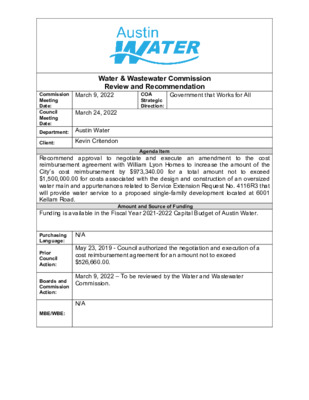
Water & Wastewater Commission Review and Recommendation Government that Works for All COA Strategic Direction: March 9, 2022 Commission Meeting Date: Council Meeting Date: Department: Austin Water March 24, 2022 Client: Kevin Critendon Agenda Item Recommend approval to negotiate and execute an amendment to the cost reimbursement agreement with William Lyon Homes to increase the amount of the City’s cost reimbursement by $973,340.00 for a total amount not to exceed $1,500,000.00 for costs associated with the design and construction of an oversized water main and appurtenances related to Service Extension Request No. 4116R3 that will provide water service to a proposed single-family development located at 6001 Kellam Road. Funding is available in the Fiscal Year 2021-2022 Capital Budget of Austin Water. Amount and Source of Funding May 23, 2019 - Council authorized the negotiation and execution of a cost reimbursement agreement for an amount not to exceed $526,660.00. March 9, 2022 – To be reviewed by the Water and Wastewater Commission. Purchasing Language: N/A Prior Council Action: Boards and Commission Action: MBE/WBE: N/A The “71 East – 428 Acre Tract” project is located at 6001 Kellam Road (the “Property”). The Property is located entirely within the City of Austin’s (the “City”) 2-mile Extra- Territorial Jurisdiction, Impact Fee Boundary, Austin Water’s service area for water and wastewater, the Desired Development Zone, and the Dry South Watershed. A map showing the property location is attached. William Lyon Homes (the “Applicant”) is proposing to develop approximately 1,550 single-family homes. Service Extension Request No. 4116R2 (SER-4116R2) was submitted and approved to extend City water utility service to the Property. As authorized by City Council on May 23, 2019, the City and the Applicant executed a Cost Reimbursement Agreement (the “Agreement”) on March 26, 2021 for $526,660.00 of total project costs for the construction of an oversized 24-inch water main and appurtenances as proposed in SER-4116R2. Under the agreement, the Applicant will construct approximately 5,615 feet of 24-inch water main and convey the water improvements to the City for the City’s ownership, operation, and maintenance. The Applicant will construct the project in two phases, with Phase 1 including approximately 4,350 feet of 24-inch water main. These water improvements were oversized and required by the City in order to serve additional properties within the Central South water pressure zone consistent with the City’s long range planning goals for this area. The City agreed to reimburse a percentage of the actual project costs associated with the construction of the water main. The certified low bid for construction of Phase 1 of the oversized water improvements was received by the City on October 21, 2021, and the City’s proportionate share is in excess of the Council approved reimbursement amount. The bids received exceeded the original cost estimate primarily due to an increase in material and construction costs as a result of the COVID-19 pandemic. The original cost estimate was prepared at a preliminary phase of the Project prior to the onset of the COVID-19 pandemic and was based on material and construction costs at that time. Under the proposed amendment to the Agreement, the City will reimburse an overall total amount not to exceed $1,500,000.00 for the actual project costs associated with the construction of Phase 1 and future Phase 2 of the oversized water main. This amount is a $973,340.00 increase from the City Council’s previously approved reimbursement amount. The proposed project will be managed through Austin Water staff and is located in zip code 78617, adjacent to City Council District 2. PL A TT L N TE SL A R N19 P19 D B LOCATION MAP B D N D S 71 East - 428 Acre Tract R R V V 0 S 0 S Q19 Water SER-4116R3 & 3 3 H 1 H 1 Wastewater SER-4117R3 S S S S R19 R N B D N L O E L M A TIL C S19 D P R A L N U S D G A R G A R D E D E N G ATE D R N G R O V E D R N18 P18 Y A S W LIVIO S O O L E C A J Y A Y W R A D R A L E P17 L L N L L W E F A L M E L ELLO D R U E S N R D H 71 S M R D V R D W E V B A S T DIONDA LN E S H 71 E B E S H 71 S P16 S PIRIT D R V R D E B B D S B D N R V R 0 S V 0 S H 1 H 1 S S S S 3 3 Q18 Q17 Q16 Q15 N15 S F M 9 7 3 R D D R R E H C N F I Y A P15 N W O S N E B R O D LIC PIM P14 S S H 130 N B P13 N13 Map Legend Basemap Polygon GRID Subject Tract D M R R A E F EIN H Full-Purpose City Limit 2-Mile ETJ Limited Purpose Jurisdictions P12 Y R EL R O D / 0 S S H 130 S B M A RIO D R IR VIN E L N R E V A R D D S R S O R SPIE R D N A H A B Q14 GIL W S E A BIS C O O M E ELL D R C UIT D S D R R F O L E Y D R S K Y H P E A R C E L N R S W A Y A R LA P B O R D AZ LN R D S R S O R D M R A L L E K Q13 Q12 Feet 9,000 R18 S18 R17 S17 R H D C R U B R16 R T D T O C R S O T C O D R15 E S H 7 1 W B S S A K P E E R O C R R A V A N R14 D K R E E R O C R R A V A N R13 R12 S16 N D L O O W R O N S15 S14 S13 S12 1,500 3,000 6,000 This product is for informational purposes and may not have been prepared for or be suitable for legal, engineering, or surveying purposes. It does not represent an on-the-ground survey and represents only the approximate relative location of property boundaries. This product has been produced by the City of Austin for the sole purpose of geographic reference. No warranty is made by the City of Austin regarding specific accuracy or completeness. 2/9/2022 0 3 4 4 8 0 5 1 0 520 0 0 5 5 1 0 490 490 490 E S H 7 1 W B 2 4 " OVERSIZED WATER MAP R 71 East - 428 Acre Tract H D Water SER-4116R3 C R U B 500 24" 24 " E S H 7 1 E B 0 8 4 4 8 0 480 0 7 4 49 0 490 500 5 0 0 0 9 4 49 0 490 6 " 1 510 Q15 5 1 0 12" 16" 12" 0 0 5 6" 1 490 1 2" 12" 8 " 6 " 0 9 4 8" 8" 8" 6" 12" 8" 8" 8" 8" 12" 8" 8" 6 " 8" 12" 8" 8" 4 9 0 12" 8" 8" 8" 8" 8" 8" 8" 8 " 8" 8" 8" 8" 47 0 " 8 8" " 6 1 " 8 " 8 12" " 8 " 8 " 8 " 8 Q14 8" 8" 6" 460 " 8 " 8 8" 8 " 8" 8" 4 5 0 0 5 4 45 0 4 5 0 Q13 Central South 16" D M R A L L E K 8" 460 4 8 0 0 7 4 0 0 5 4 9 0 0 1 5 / 0 R15 4 9 0 4 8 0 4 9 0 4 8 0 0 7 4 R14 Staff Proposed Approximately 5,615 Feet of Oversized 24-Inch Water Main 450 4 4 0 440 0 4 4 4 6 0 R13 440 4 5 0 4 5 0 0 7 4 4 4 0 440 480 0 0 5 4 9 0 4 6 0 4 5 0 4 5 0 4 8 0 S S A K P E E R O C R R A V A N D K R E E R O C R R A V A N Map Legend Basemap Polygon GRID Subject Tract Contour - 10' 100-yr FEMA Floodplain Water Lines In Service ! ! ! ! Proposed In Service Private ! ! ! ! Proposed Private Jurisdictions 450 Full-Purpose City Limit 2-Mile ETJ Limited Purpose 6 4 0 0 7 4 600 1,200 2,400 Feet 3,600 This product is for informational purposes and may not have been prepared for or be suitable for legal, engineering, or surveying purposes. It does not represent an on-the-ground survey and represents only the approximate relative location of property boundaries. This product has been produced by the City of Austin for the sole purpose of geographic reference. No warranty is made by the City of Austin regarding specific accuracy or completeness. 2/9/2022