B5 — original pdf
Backup
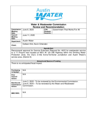
Water & Wastewater Commission Review and Recommendation Government That Works For All COA Strategic Decision: June 8, 2020 Commission Meeting Date: Council Meeting Date: Department: Austin Water June 11, 2020 Client: Colleen Kirk, Kevin Critendon Agenda Item Recommend approval for Service Extension Request No. 4622 for wastewater service to a 77.78-acre tract located at 9021 W. US 290 Highway within the Drinking Water Protection Zone, the City’s 2-mile Extra-Territorial Jurisdiction and Austin Water’s service area. (District 8) Amount and Source of Funding There is no anticipated fiscal impact. N/A N/A Purchasing Language: Prior Council Action: Boards and Commission Action: MBE/WBE: June 3, 2020 - To be reviewed by the Environmental Commission. June 8, 2020 – To be reviewed by the Water and Wastewater Commission. N/A The Ledgestone project consists of approximately 77.78 acres of land located at 9021 W. US 290 Highway (the “Property”). The Property is located entirely within the City of Austin’s (the “City”) 2-mile Extra-Territorial Jurisdiction, Impact Fee Boundary, Austin Water’s service area for wastewater, the Drinking Water Protection Zone, and the Slaughter Watershed. A map of the property location is attached. Applicant: Michael Wong 1991 Trust (the “Owner”) is proposing to develop approximately 550 multi-family units. The Owner requested that the City provide wastewater utility service to the Property as proposed in Service Extension Request (SER) No. 4622. West Travis County Public Utility Agency will provide retail water service to the Property. City Code § 25-9-35 requires City Council approval for this SER because the Property is located within the Drinking Water Protection Zone and outside the City’s full-purpose corporate limits. The City will not cost participate on this project. Infrastructure Improvements: To serve the Property, the Owner will be required to construct: • Approximately 1,800 feet of 15-inch gravity wastewater main from the existing 15-inch gravity wastewater main near W SH 71 and extend west along Williamson Creek to Covered Bridge Drive, • Approximately 2,250 feet of 12-inch gravity wastewater main from the existing 8- inch gravity wastewater main located north of Towana Trail and extend west along Towana Trail and south along Mowinkle Drive, • Approximately 1,000 feet of 8-inch gravity wastewater main from the existing 8- inch gravity wastewater main in Circle Drive and extend west along W US 290 Highway, • An appropriately sized lift station within the subject tract, and • Approximately 6,150 feet of appropriately sized force main from the lift station and extend east along W US 290 Highway to the proposed 8-inch gravity wastewater main described above. The proposed wastewater improvements are sized to serve the needs of the Property and will conform to all City Code requirements. These improvements will be designed in accordance with City’s Environmental Criteria Manual and Utilities Criteria Manual and will be inspected by the City’s Development Services Department. The Owner will construct all required improvements at their cost and dedicate the facilities to the City for ownership, operation and maintenance. All City fees are applicable to the provision of wastewater service including capital recovery fees. City Staff Recommendation: Austin Water has evaluated the Owner’s request for City wastewater service and can provide centralized wastewater service as proposed in SER-4622. Attached is a report from Austin Water staff outlining additional technical information related to providing service to this tract. Additionally, a report provided by Watershed Protection Department staff that finds no significant environmental concerns with providing centralized wastewater service as proposed in SER-4622 is also attached. Contingent upon approval of SER-4622 for wastewater service to the Property, approval of any related development applications for the Property is subject to current City Code, including the Save Our Springs Ordinance. The proposed project is located in zip code 78737 and is near City Council District 8. City of Austin | Austin Water P.O. Box 1088 Austin, TX 78767 AustinWater.org MEMORANDUM To: From: Date: Subject: Ledgestone (Wastewater SER-4622) Water and Wastewater Commissioners Colleen Kirk, P.E., Utility Development Services May 2, 2020 Enclosed is additional technical information related to Wastewater SER-4622 and the associated Request for Council Action. Other SERs: There are 3 wastewater SER applications located within one-half of a mile of the subject tract. Of these SERs, one was approved by City Council and two were administratively approved by Austin Water. None of these SERs were denied by City Council. There are 5 water SER applications located within one-half of a mile of the subject tract. Of these SERs, three were administratively approved by Austin Water and two were withdrawn. None of these SERs were denied by City Council. Water Utility Service: Wastewater Utility Service: Water service will be provided by West Travis County Public Utility Agency. The City’s existing wastewater collection system is located approximately 4,200 feet from the subject tract in Circle Dr. An on-site sewage facility (OSSF) is not currently located on the subject tract. The site could develop with a similar density utilizing a private decentralized wastewater system under a Texas Land Application Permit (TLAP). SER Improvements: The SER improvements will cross a known environmental feature, Devil’s Pen Creek. The improvements will be located along the US 290 Hwy right-of-way at this creek crossing. The SER improvements will conform to all City Code requirements, be designed in accordance with City’s Environmental Criteria Manual and Utilities Criteria Manual, and be inspected by the City’s Development Services Department. If you need additional information, please let me know. Thank you. cc: Kevin Critendon, P.E., Assistant Director Greg Meszaros, Director The City of Austin is committed to compliance with the Americans with Disabilities Act (ADA). Reasonable modifications and equal access to communications will be provided upon request. MEMORANDUM May 21, 2020 Linda Guerrero, Chair, and Members of the Environmental Commission Kaela Champlin, Environmental Officer’s Office Watershed Protection Department TO: FROM: DATE: SUBJECT: Ledgestone Wastewater SER #4622 Service Extension Requests (SER) located in the Drinking Water Protection Zone and outside of the City of Austin’s full purpose jurisdiction require Council approval and review by the Environmental Commission. Watershed Protection Department staff have completed the review for Ledgestone Wastewater SER #4622 and recommend approval of the request. Site Overview The site consists of one tract of approximately 77.78 acres, located at 9021 W US 290 Hwy. The site is in the City of Austin’s Limited Purpose Jurisdiction, the Slaughter Creek Watershed, the Barton Springs Zone, and the Drinking Water Protection Zone. The site is also within the Edwards Aquifer Contributing Zone and is subject to the Save Our Springs (SOS) Ordinance. An Environmental Resource Inventory submitted by the applicant identified no critical environmental features within the property. The applicant is proposing to develop a 550-unit multi-family development. A site plan has not yet been submitted to the City of Austin. Development Impacts Water: The site is located in the water service area of the West Travis County Public Utility Agency (PUA). Wastewater: The applicant shall construct approximately 1,000 feet of 8-inch gravity wastewater main in Circle Dr and extend south along Circle Dr and then west along US 290 to the highest point that can be served by the proposed gravity wastewater main, as approximately shown on the attached map. Applicant shall also construct an appropriately sized public lift station at the approximate location shown on the attached map. Applicant shall construct approximately 6,150 feet of 2 appropriately sized force main from the proposed lift station and extend north through the subject tract and northeast along US 290 Hwy to the proposed 8-inch gravity wastewater main in US 290 Hwy. Applicant shall dedicate appropriately sized wastewater easements from the proposed lift station west to Ledgestone Terrace and north to W US 290 Hwy. Applicant shall construct approximately 1,800 feet of 15-inch gravity wastewater main (minimum 0.4% slope) from the existing 15-inch gravity wastewater main along Williamson Creek, and extend west to the existing 12-inch gravity wastewater main located west of Covered Bridge Dr, as approximately shown on the attached map. The proposed 15-inch gravity wastewater main shall replace the existing 12-inch gravity wastewater main in its path. Applicant shall reconnect all existing wastewater services from the existing 12-inch gravity wastewater main to the proposed 15-inch gravity wastewater main. Applicant shall construct approximately 2,250 feet of 12-inch gravity wastewater main (minimum 1.0% slope) from the existing 8-inch gravity wastewater main located north of Towana Trl, and extend south towards Towana Trl, west along Towana Trl, and then south along Mowinkle Dr to the existing 8-inch gravity wastewater main in Mowinkle Dr, as approximately shown on the attached map. The proposed 12-inch gravity wastewater main shall replace the existing 8-inch gravity wastewater main along its path. Applicant shall reconnect all existing wastewater services from the existing 8-inch gravity wastewater main to the proposed 12-inch gravity wastewater main. Alternative Wastewater Service: The applicant has stated that the site could develop with a similar density with decentralized service approved by a Texas Land Application Permit (TLAP) issued by the Texas Commission on Environmental Quality. Environmental Impacts The property is in the Slaughter Creek Watershed, and classified as the Barton Springs Zone. The site is in the Drinking Water Protection Zone, the Edwards Aquifer Contributing Zone, and is subject to the Save Our Springs (SOS) Ordinance. The southwestern and eastern corners of the site are within the Devils Pen Creek critical water quality zone and water quality transition zone. An Environmental Resource Inventory was conducted by the applicant, and no known recharge environmental features or critical environmental features were found onsite. The site does not drain to occupied salamander habitat. Based on the information provided by the applicant, the site contains 18.4 of net site area. Therefore, the site contains 4.5 acres of buildable area. By staff’s estimation, the site could develop without any required Land Use Commission variances to the City of Austin Land Development Code. Recommendation Staff review determined that there are no significant environmental risks to extend service to the site and therefore recommends approval of Service Extension Request #4622. 3 The attached information provides further detail on the applicant’s request. Please feel free to contact Kaela Champlin at (512) 974-3443 or kaela.champlin@austintexas.gov if you have any questions or comments about the proposed SER. cc: Kevin Critendon, P.E., Austin Water Colleen Kirk, P.E., Austin Water Christopher Herrington, P.E., Watershed Protection Department 4 WZ22 WY22 T H O M A S S P R I N G B R A N C H WY21 WZ21 A22 W S H 7 1 LOCATION MAP R W D Ledgestone T VIE Wastewater SER-4622 B L U N A T DIS E HILL D R A21 GS RD M AS SPRIN TH O R E D L C C I R WY20 WZ20 A20 B20 W ILLIA M S O N C R E E K R E D G RID D B E R E V O C TRAVIS COUNTY DEVILS PEN CREEK W U S 2 9 0 H W Y WY19 WZ19 A19 A18 D E V I L S P E N C R E E K A17 WZ18 WY18 Subject Tract Railroad GRID County Boundary Jurisdictions Full-Purpose City Limit 2-Mile ETJ 5-Mile ETJ / 0 S L A U G H T E R C R E E K Limited-Purpose City Limit WY17 Cedar Park ETJ Cedar Park City Limit WZ17 1,000 2,000 4,000 Feet 6,000 This product is for informational purposes and may not have been prepared for or be suitable for legal, engineering, or surveying purposes. It does not represent an on-the-ground survey and represents only the approximate relative location of property boundaries. This product has been produced by the City of Austin for the sole purpose of geographic reference. No warranty is made by the City of Austin regarding specific accuracy or completeness. 4/30/2020 B22 B21 B19 K I N C H E O N B R A N C H B18 B17 1 0 5 0 1 1 2 0 0 1 0 1 1 0 3 0 9 8 0 9 6 0 9 9 0 1 0 6 0 1110 1100 WZ21 1100 1 1 1 0 A22 0 8 9 970 1 0 1 0 1020 1 0 5 0 1 0 0 0 A21 1 0 5 0 1 0 8 0 M AS SPRIN GS RD 1 0 0 0 1 0 4 0 0 2 0 1 1 0 7 0 1 1 0 0 1 0 9 0 1100 1 0 1 0 7 TH O 0 6 0 1 STAFF PROPOSED APPROXIMATLEY 2,250 FEET OF 12-INCH GRAVITY WASTEWATER MAIN (MINIMUM 1.0% SLOPE) STREA 1 0 9 0 0 1 0 1 M L U A 0 8 0 0 1 1 1 C SIDE D MURMURING CREEK DR WZ20 1 0 8 0 C I R C L E D R 1 0 3 0 9 9 0 W S H 7 1 % % A N C H U 1050 0 2 0 1 960 950 9 3 0 9 4 0 1 0 1 4 0 0 2 0 0 0 1 1 % % 8 9 0 2 0 1 % % % 990 % 1030 % %% % C % % % % %%% V LANDMARK CONSERVANCY LS % % C % % % " P C % %% %% % V V % % " P % " P 8 % % %%% % % % % % 8 %% % % %%% 8 %% % %% % %% % % % % % % B21 % %% % % % 9 6 0 0 6 9 970 % % % % % 9 % % % % % % 0 0 6 9 \ 0 3 \ % \ \ \ \ \ \ \ \ %\ %\ [7L \ %\ \ %\ \ %\ \ \ \ \ \ \ \ \ \ % % % % % L T \ % S % R A \ \ % \ R H A R % % % % % % % LE % % % % % % \ %\ % % % % T D % % 0 7 9 \ %\ % % % % 0 4 0 1 R NIG [7L % %\% SUMMER SKY DR STAFF PROPOSED APPROXIMATELY 1,800 FEET OF 15-INCH GRAVITY WASTEWATER MAIN (MINIMUM 0.4% SLOPE) %%%% %% % %% % 124869 % %% %% % %%%% % %% %%%%%%%%%%%%%%% R % % % E D % %% G %% %%%% %% % % % RID % % % 8" PVC % D B %%% % % % 950 % 0 % %%%%%% %% %%% % 7 E 9 ER % %% % C OV % % 8" PVC %%% V % %%% %%%%% 8" P % % %%%% % % % % %% % % %% %% % % %%% % %% % %% C % % % % % C V % % V 8" P % % % % 8" P %% % % %% % % % %%% % % % DERBIRD R %% % 8" C % % % % % % % % % % % % % 8" PVC % % % % R E D L K WIN O 200276 M C V 8" P % C V 8" P % % % % % 8" PVC % % % % % % % % C %% % % 124875 % % % % % % % % %%% 8" P 8" P THUN 240017 % % 0 3 9 930 % N D % % % % % % % % % % % % % % % % % % % % % % % % % % % % % % N C O V % V C % % D X A R T O R % % % C % % % % % % % %% % % 8" PVC % % % % %% % % % % % % % % % % % % 9 1 0 % 9 2 0 % % % 6" P % % C V % 890 % % % !% % %%% 880 !% % % % 9 % % % 8 7 % % % 0 !% % % 0 0 % % % % % % %!% %!%% % % % % % % % % % % % B20 % % % % ABND PRIVATE LIFT STATION [7L % % % AB % % % % % % % % % 920 % % 0 7 9 % % % % % % % % % % % % % % 0 94 % % % % % % % % % % % % % % % % % % % % % % % % WZ19 9 9 0 1 0 1 0 1 0 1 0 2 0 0 0 1 0 9 9 PRIVATE LIFT STATION C L R A L A N D W A N A T R L A20 T O L L A R L N A M C K A T H D O LE R E S E N D N T L A R P E T PIT 1090 %\\ \ % 1070 \ \ \ [7L \\ \ \\ % 0 1 1 1 0 8 0 1 \ \ \ \\ A19 A R T E R D R 240187 % % %%% \\\% % % \ \ 1080 \ %%%%% %% %%% \\\\ \\\\\\ %%%%% % %%% % %%%% % %% 1 0 0 0 % %%%% % 0 7 0 1 1 0 6 0 9 9 0 A18 D E V I L S 9 6 0 P E N 0 6 9 C R E E K \ % % \ % 1 0 7 0 W US 290 HWY %%%%% %% %%%% %%%% \\ [7L %% % % % \ % RIDGEVIEW LS %%%%%% %%%%%%%%% \ \ 1040 0 6 0 1 9 9 0 STAFF PROPOSED APPROXIMATELY 6,150 FEET OF APPROPRIATELY SIZED FORCE MAIN % 8" P % V % C % % % B19 9 2 %%%%%%%%%%%%%% %% % 970 0 9 0 8 % \ \ \ \ \ \ % 9 %\ % % % % % % % % STAFF PROPOSED % % % % % %\%\%\%\%\\ %\\ %\\\ %\\%\%\%\%\ \%\ %\%\ APPROXIMATELY %\%\%\ 1,000 FEET OF 8-INCH GRAVITY WASTEWATER MAIN % % % \%%%\ % %%%%% %% % \ 6 12" PVC % 0 \ %\ 9 4 0 %\ %%%% % %%% % %% 920 % % % % PRIVATE LIFT STATION [7L % % % % % %% % VIA RICCODR % % % % % % 0 7 %% 960 % % 9 % %% % N % 9 8 0 % N L R %%% %% % % % Y D %% %% %% %%% % % O %% %% %% S T %%% % D T % A R E A % % % % %%% B W % % % % D E % % % !% !% % % % % % % Subject Tract B18 % %% % B17 % % % % % % % % % \ \ %\ 930 0 1 9 BIO N D % A T % % % % % % % % % % % % % % % % % % % %\ G A R % L T R % % . 8 8 0 %\ \ \ 1 0 1 0 \ \ 9 5 0 5 0 9 C " T T % 9 3 0 E Y ! P V ! B A D R % 5 1 ! ! ! ! ! % 980 100-yr FEMA Floodplain Full-Purpose City Limit 2-Mile ETJ Limited-Purpose City Limit STAFF PROPOSED APPROPRIATELY SIZED LIFT STATION Y O U N G L N A17 0 3 9 0 2 9 0 1 9 0 4 9 B E L L A VIS 0 1,000 2,000 4,000 6,000 Feet 0 7 0 0 5 0 1 1 0 6 0 1060 R E E T N O T S E G D E L 1 0 4 0 0 2 0 1 "J WZ18 1 0 4 0 0 4 0 1 SANDSTONE ST 1030 980 970 . W.W. S.E.R. Name: Ledgestone W.W. S.E.R. Number: 4622 Utility Development Services Plotted 11/27/2019 This product is for informational purposes and may not have been prepared for or be suitable for legal, engineering, or surveying purposes. It does not represent an on-the-ground survey and represents only the approximate relative location of the property boundaries. This product has been produced by the City of Austin for the sole purpose of geographic reference. No warranty is made by the City of Austin regarding specific accuracy or completeness. DRAFT