B5 — original pdf
Backup
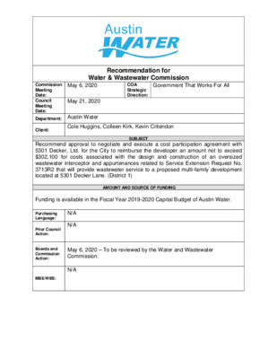
Recommendation for Water & Wastewater Commission Government That Works For All COA Strategic Direction: May 6, 2020 Commission Meeting Date: Council Meeting Date: Department: Austin Water May 21, 2020 Client: Cole Huggins, Colleen Kirk, Kevin Critendon SUBJECT Recommend approval to negotiate and execute a cost participation agreement with 5301 Decker, Ltd. for the City to reimburse the developer an amount not to exceed $302,100 for costs associated with the design and construction of an oversized wastewater interceptor and appurtenances related to Service Extension Request No. 3713R2 that will provide wastewater service to a proposed multi-family development located at 5301 Decker Lane. (District 1) Funding is available in the Fiscal Year 2019-2020 Capital Budget of Austin Water. AMOUNT AND SOURCE OF FUNDING N/A N/A Purchasing Language: Prior Council Action: Boards and Commission Action: MBE/WBE: May 6, 2020 – To be reviewed by the Water and Wastewater Commission. N/A The 969 Express Mart (Revision 2) project consists of approximately 19.65 acres of land located at 5301 Decker Lane (the “Property”). The Property is located entirely within the City of Austin’s (the “City”) Full-Purpose, Impact Fee Boundary, Austin Water’s service area for wastewater, the Desired Development Zone, and the Walnut Creek Watershed. A map of the property location is attached. 5301 Decker, Ltd. (the “Owner”) is proposing to develop a mixed-use development that includes approximately 3,600 sq. ft. of retail, 1,450 sq. ft. of restaurant, and 324 multi- family units. The Owner requested that the City provide wastewater utility service to the Property as proposed in Service Extension Request (SER) No. 3713R2. Austin Water will provide retail water service to the Property. In accordance with Chapter 25-9 of the City Code, the City has asked the Owner to oversize the gravity wastewater interceptor in order to serve additional properties within the Walnut Creek drainage basin consistent with the City’s long-range planning goals for this area. If approved by City Council, the City will cost participate in this construction project only to the extent of the City’s proportionate share of the oversized interceptor. The proposed oversized improvements include construction of approximately 425 feet of 30-inch gravity wastewater interceptor from existing manhole number 80461 to existing manhole number 194294 along FM 969. The City will reimburse the Owner for an overall total amount not to exceed $302,100 for hard costs and soft costs. Hard costs include, but are not limited to, construction and materials. Soft costs include, but are not limited to, preliminary engineering reports, surveying, geotechnical studies, design, and project management. The City’s cost participation by project component is as follows: • For costs of the 30-inch gravity wastewater interceptor (the minimum pipe diameter of 15-inches required to serve the Property to an oversized 30-inch) and appurtenances, the City’s maximum participation consists of: (1) hard costs, in an amount not to exceed 50% of the hard costs of the 30-inch gravity wastewater interceptor and appurtenances, and (2) soft costs, in an amount not to exceed 15% of the City’s hard cost participation amount. To serve the Property, the Owner will additionally be required to construct, at their own cost: • approximately 150 feet of 8-inch gravity wastewater main from Lot 1 (existing manhole number 289299) to Lot 4 within the subject tract Other terms of the agreement will require that the Owner: • Pay all costs for financing, interest, fiscal security, accounting, insurance, inspections, permitting, easement acquisition, legal services, and other non- reimbursable soft costs associated with the project; • Conform to the City’s design criteria and construction standards; • Construct all improvements at their cost and, after the City’s final approval of the construction, dedicate the facilities to the City for ownership, operation, and maintenance; • Allow the City to use the project plans and specifications approved by the City to solicit and publish invitations for bids for the construction of the improvements; and • Follow the City’s standard bidding practices and procedures, including the minority-owned business enterprise procurement program found in Title 2 of the City Code, and Texas Local Government Code Chapters 212 and 252. The proposed project will be managed through Austin Water staff and is located in zip code 78724, in City Council District 1. LOCATION MAP 969 Express Mart P25 Wastewater SER-3713R2 V I E W R I D G E D R M A Y VIE W D R Q25 R N D O T G M I N W I L E K C I R G A R C R E Q24 CARINO RD HIDDEN WEST BLVD B A G B Y D R N R L E K C E D D E C K E R L A K E R D N25 D RIS R R O Y M N N H O J N24 A RIE S L N R F D O N H O L S D G N A VIR S L O Y O L A L N M A R R CV R LITA D R E D L VIL E S N E R O L F N CIA L E V A A N A C S O T T R S E PIZ P24 R E P S I G N A L P T T A D R L R R T E R TIN D D O O W L E M R Y D O TIC A S P I N O N V I S A C I R H T A G A C A T A P T O P A T O N G N O P O L N A L N A L N N O G A A V E AVA LN W R O G E R S L N H O G E D I G O S Y E R D C I I N N C H L N S S A HIO P O K Y D R C HIN S O U T H A R O S E D R WIC K D R Q23 C O L F A X D R N Y L A W O L L O J M H P23 N S L R E G O R N23 N N L O NIX N22 W A L N U T C R E E K C O L O R A D O R I V E R Basemap Polygon Street Names Railroad GRID Austin Impact Fee Boundary N21 Subject Tract Jurisdictions Full-Purpose City Limit 2-Mile ETJ 5-Mile ETJ LIMITED PURPOSE / 0 F M 9 6 9 R D P22 M O W A Y N A R C SID E B H L N LV D R L D RIA E P N IM C A T H E RIN E D R Q22 D F R F U L E B U L B R L D RIA E P IM H E R M E S D R R R D R T D E W D L E V O L P21 Q21 E L M C R E E K D 3 R 7 M 9 N F 900 1,800 3,600 Feet 5,400 This product is for informational purposes and may not have been prepared for or be suitable for legal, engineering, or surveying purposes. It does not represent an on-the-ground survey and represents only the approximate relative location of property boundaries. This product has been produced by the City of Austin for the sole purpose of geographic reference. No warranty is made by the City of Austin regarding specific accuracy or completeness. 4/4/2020 R D Y HIDDEN VIEW CIR O TIC A S 5 6 0 T O P A N G A L N TA N P R N D O L R E H T A R T S 5 4 0 540 TO N O % !P W R STAFF PROPOSED APPROXIMATELY 425 FEET OF OVERSIZED 30-INCH WASTEWATER INTERCEPTOR %% !P % % G E A LN S L !P P R N O 0 5 5 %% !P 2 5 0 8" DI % % !P 530 5 1 0 490 0 9 4 8" DI %% N !P S L 8" DI P O R O E % !P L G 12" PVC 8" DI !P O S R R !P !P E !P !P !P G %% 12" PVC O !P !P R % !P !P % !P % % % % 0 4 5 % 12" PVC !P % % !P % !P !P % % 540 !P % % % % \ %\ \ \ \ \ % \ \ \ \ \ !P %% 12" PVC !P !P % \ !P % \ C \ V \ % 6" P \ \ \ \ \ \ \ % \ \ \ % \ \ P V 8 " \ C \ \ \ \ \ % \ STAFF PROPOSED APPROXIMATELY 150 FEET OF 8-INCH GRAVITY WASTEWATER MAIN \ % \ \ % \ \ \ \ \ \ % !P %% C V 8" P !P % !P % % % !P A N N E T T E C V !P % !P % 8 " P V C % !P !P !P %%%%% !P !P !P % AVA LN !P % 0 4 !P % 5 !P I % % !P R C A H T A G A 8 " P V C 4 6 0 !P % %% !P % 8 " P 8 " P V C % !P % 8 " P V C V C % !P % Y W C V K P " P S L 8 %% L !P I H C O V R P E D " %% !P N 8 450 E % !P S !P 470 !P !P !P 12" PVC !P % 80461 % 12" PVC !P !P !P % !P % !P !P !P % 194294 540 % % % % 4 5 0 % !P % !P !P !P %%% 4 5 0 N23 4 4 0 440 P23 % !P \ % !P \ C \ % V \ 8" DI 8" P \ N \ % N L \ !P %%%% \ !P O \ NIX !P \ % !P \ 8" DI \ \ \ \ % \ 58 NIXON LANE LS [7L !P \ % % % \ 2" DI 0 4 4 % 1 % !P 12" DI % % !P % % 0 4 4 0 44 8 " \ \ \ \ \ \ % \ [7L 5 2 0 0 4 4 P V PRIVATE LIFT STATION C \ \ \ PRIVATE LIFT STATION N22 P22 4 3 0 4 3 0 4 3 0 \ \ \ \ \ % \\\ \ \\ [7L \ % \ PRIVATE LIFT STATION 5 3 0 % % !P 1 5 \ %%% !P !P !P !P \ \ \ % \ \ \ % \ \ \ \ 0 \ \ \ \ \ \ \ % \ \ \ % \ \ $. \ \ \ \ \ \ \ \ \ \ % \ \ % \ \ \ \ \ 5 3 0 " 6 \ \ % \ \ \ \ \ \ \ C % \ \ \ P V \ \ \ [7L % \ 0 50 48 0 0 2 5 0 2 5 C A N O G 0 FL 4 5 O A A V E RID A P S S S S A A O P H A S ID S S A HIO P O A S S N R L E K C E D 540 MIC HIG N E B R A S ALA S K A N P GIA P A S K R O A P E G A P A A S S SS 0 53 !P % % !P 8" PVC 8" PVC !P 8" P % !P % V C 0 4 5 530 5 4 0 !P % 530 0 4 5 \ \ 5 3 \ % \ 0 \ \ \ 5 4 0 0 4 5 5 4 0 5 4 0 5 0 4 \\ \ \ % \ \ \ \ \ \ % %% !P \ 3 % \ !P %% !P \% !P !P 1 2 \ \ \ 8" DI \ % \ \ % \\\\\\\\\\\ % !P !P % % \ \ \ \ \ 4 0 3 5 5 4 0 F M 9 6 9 R D !P % %% !P !P T % A S L L P A R K A T W " 8 5 3 0 S K N A E L D R % !P !P !P O D L A N D S D R PIC !P % % !P %% D CIR !P 8" P V C O E N G LIS H G LA D E % !P D %%%% !P N B !P S D O O % !P C T % Y E V P R C % M W O T N A B 5 3 0 4 9 0 Subject Tract Full-Purpose City Limit 2-Mile ETJ 0 4 4 4 4 0 440 440 0 4 4 . 0 350 700 1,400 2,100 Feet W.W. S.E.R. Name: 969 Express Mart (Revision 2) W.W. S.E.R. Number: 3713R2 Utility Development Services Plotted: 4/7/2020 This product is for informational purposes and may not have been prepared for or be suitable for legal, engineering, or surveying purposes. It does not represent an on-the-ground survey and represents only the approximate relative location of the property boundaries. This product has been produced by the City of Austin for the sole purpose of geographic reference. No warranty is made by the City of Austin regarding specific accuracy or completeness. 0 2 4 0 JOHN TREVINO JR. METRO PARK AT MORRISON RANCH 7 4 0 3 5 0 6 4 4 8 0 DRAFT