SIF Information Backup — original pdf
Backup
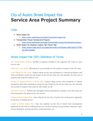
Links City of Austin Street Impact Fee Service Area Project Summary 1. Street Impact Fee ○ https://www.austintexas.gov/department/street-impact-fee 2. Transportation Project Development Program ○ https://www.austintexas.gov/page/transportation-project-development-program 3. Street Impact Fee Roadway Capacity Plan Project Map ○ https://austin.maps.arcgis.com/apps/View/index.html?appid=af6815a6521747f3a 5dc1dfd11a8da6e Street Impact Fee (SIF) Definition of Terms SIF Transportation Projects: Number of projects included in the approved SIF study for each service area Total Cost in SIF Study: Planning-level cost estimates for the projects included in the SIF study Costs Eligible for SIF Funds: Projects along service area boundaries or sharing boundaries with other jurisdictions cannot be fully funded by the SIF per state law; this indicates the total cost of projects that could be funded by SIF Number of Projects Entirely in Service Area: Projects along service area boundaries or sharing boundaries with other jurisdictions cannot be fully funded by the SIF per state law; this indicates the number of projects that could be fully funded by SIF Forecasted Revenue: Reflects the anticipated future development included in the SIF study and the development fee approved by City Council Collected Street Impact Fees: Fees collected by the City of Austin from development applicants at the time of building permit Credits to Street Impact Fees: Fees not collected by the City of Austin from development applicants at the time of building permit as a result of reduced trip generation measures, right- of-way dedication, parking reduction, transit proximity, etc. 1 Street Impact Fee (SIF) Definition of Terms (Cont.) Fees Spent on Transportation Projects: The total amount of money spent to date on eligible projects within the SIF service area Projects Built by Street Impact Fees: Projects that have been completed utilizing SIF funding (partially or wholly) Summary Tables Table 1 - Summary by Council District Council District Service Areas Total Number of Projects Number of Projects Planned Number of Projects Constructed to Date Total Cost of All Projects Number of Projects to Plan in FY22 and FY23 223 157 97 63 88 114 140 85 116 65 1 2 3 4 5 6 7 8 9 D, DT, G, I, J N, O, P G, J, L, N, P C, D, F, I, J L, N, O A, B, E, H B, C, D, F, I K, L, M, N DT, I, J, L 10 E, F, H, I, K 37 39 17 20 39 34 24 23 19 15 4 4 1 0 1 7 1 0 1 4 $523,055,553 $462,630,200 $166,770,205 $141,045,000 $178,105,255 $440,946,000 $370,242,000 $256,482,000 $106,483,000 $310,360,000 Total - 1,148 267 23 $2,956,119,213 122 28 16 14 5 5 10 14 6 13 11 2 Summary Tables (Cont.) Table 2 - Summary by Service Area Service Area Council Districts Total Number of Projects Number of Projects Planned Number of Projects Constructed to Date Total Cost of All Projects Maximum Forecasted Collected SIF Number of Projects to Plan in FY22 and FY23 DT A B C D E F G H I J K L M N O P 6 6, 7 4, 7 1, 4 1, 9 6, 10 4, 7 1, 3 6, 10 1, 4, 7, 9, 10 1, 3, 4, 9 8, 10 3, 5, 8, 9 2, 3, 5, 8 1, 7 2, 5 2, 3 - 105 31 76 87 47 47 64 75 12 78 102 17 103 66 94 94 50 Priority Projects 10 3 21 14 8 22 15 11 7 16 22 3 21 18 50 23 3 $231,816,553 $10,677,850 22 1 1 0 0 5 6 0 0 3 1 1 0 0 0 1 3 1 $65,039,000 $33,735,885 $374,337,000 $56,345,880 $221,290,000 $39,842,410 $296,253,000 $99,138,210 $42,932,000 $29,623,250 $149,266,000 $29,389,250 $124,213,000 $73,389,060 $61,892,000 $32,247,355 $162,466,000 $36,012,210 $170,047,000 $8,043,525 $103,221,000 $41,314,010 $137,933,000 $50,358,225 $173,216,000 $65,564,810 $169,680,460 $71,631,245 $298,482,200 $52,996,520 $174,035,000 $52,503,900 Total 1,148 267 23 $2,956,119,213 $782,813,595 122 *Projects noted in the following sections ranked highly within the Service Area based on the community values prioritized within the ASMP and the metrics chosen to reflect those values. The projects have not yet had necessary review and/or planning to determine their feasibility. These are not necessarily the projects that will be selected for first construction funding through SIF. Some projects may become ineligible for use of SIF funding through the project development process. We anticipate that some locations will not have sufficient right-of-way to include all planned elements. Based on technical analysis and available/potential right-of-way, we will develop feasible options and present to the local community for input and comment before any spending decisions are made. 2 4 4 9 - 9 8 2 7 11 4 15 3 4 10 8 3 Service Area A Summary Number of SIF RCP Projects: 31 Total Cost of SIF Projects: $65,039,000 Lakeline Road Roadway Widening / Neenah Avenue Access Management (District 6) ● Project A-6 would widen Lakeline Boulevard with two new lanes and associated all ages and abilities bicycle and pedestrian improvements from Staked Plains Drive to just west of Parmer Lane (1.0 miles) ● Project A-7 would improve access management via new turn lanes and medians and include all ages and abilities bicycle and pedestrian improvements along Neenah Avenue from Olive Hill Drive to St. Dominic Savio Catholic High School (0.6 miles) ● The planning level cost estimate in the SIF study for this set of improvements is $12,242,000 4 Service Area B Summary Number of SIF RCP Projects: 76 Total Cost of SIF Projects: $374,337,000 McNeil Drive / Spicewood Springs Road Access Management (District 6) ● Projects B-13 and E-16 would improve access management via new turn lanes and medians and include all ages and abilities bicycle and pedestrian improvements along McNeil Drive from Avery Island Avenue to US-183 (1.1 miles) and along Spicewood Springs Road from US-183 to Chancellory Drive (0.6 miles) ○ This section includes a signal installation at Avery Island Avenue (BI-19) ● The planning level cost estimate in the SIF study for this set of improvements is $2,429,000 Anderson Mill Road Access Management (District 6) ● Project B-1 would improve access management via new turn lanes and medians include all ages and abilities bicycle and pedestrian improvements along Anderson Mill Road from Broadmeade Avenue / Turtle Rock Road to US-183 (0.9 miles) ○ This section includes intersection improvements at Broadmeade Avenue / Turtle ● The planning level cost estimate in the SIF study for this set of improvements is Rock Road (BI-5) $1,278,000 5 Service Area C Summary Priority Projects* Number of SIF RCP Projects: 87 Total Cost of SIF Projects: $221,290,000 Metric Boulevard / Parmer Lane Intersection Improvements (District 7) ● Project CI-6 would install intersection improvements at the intersection, which could include new turn lanes, additional median protection, and associated signal upgrades ● The planning level cost estimate included in the SIF study for this set of improvements is $401,000 Braker Lane Access Management (District 1, District 4, District 7) ● Projects C-50 and D-61 would improve access management via new turn lanes and medians and include all ages and abilities bicycle and pedestrian improvements along Braker Lane from Lamar Boulevard to Bluff Bend Drive / Wedgewood Drive (0.9 miles) ○ This section includes intersection improvements at Lamar Boulevard (CI-19) and I-35 (CI-20/DI-20) ● The planning level cost estimate in the SIF study for this set of improvements is $13,374,000, though $10,000,000 of that is for the I-35 intersection improvements (CI- 20/DI-20). 6 Service Area D Summary Number of SIF RCP Projects: 105 Total Cost of SIF Projects: $296,253,000 Yager Lane Road Widening / Access Management (District 1, District 7) ● Projects D-18 and D-69 would widen East Yager Lane Boulevard with curb and gutter, medians, and associated all ages and abilities bicycle and pedestrian improvements from Parmer Lane to Tech Ridge Boulevard (1.4 miles) ○ This section includes an intersection signalization and new turn lanes at Parmer ● The planning level cost estimate in the SIF study for this set of improvements is Lane (DI-16) $10,455,000 Center Ridge Drive Road Widening / Access Management (District 7) ● Projects D-56 and D-57 would widen Center Ridge Drive with medians, turn lanes, and associated all ages and abilities bicycle and pedestrian improvements from I-35 to McCallen Pass (0.6 miles) ○ This section includes an intersection signalization at McCallen Pass (DI-10). The planning level cost estimate in the SIF study for this set of improvements is $2,910,000 ● This section will also be affected by the Orange Line northern terminus design ● Transportation designers have begun reviewing this area for design options 7 Service Area DT Summary Number of SIF RCP Projects: 47 Total Cost of SIF Projects: $42,932,000 Downtown Transportation Improvements ● SIF funding for the downtown service area will be used to build out the traffic signal network and convert one-way streets to two-way where appropriate ● Decisions to complete eligible projects will be based on collision information and development activity, as well as changes proposed from the planning and design of I-35 and Project Connect 8 Service Area E Summary Number of SIF RCP Projects: 47 Total Cost of SIF Projects: $149,266,000 Jollyville Road Access Management (District 10) ● Project E-17 would improve access management via new turn lanes and medians and include all ages and abilities bicycle and pedestrian improvements along Jollyville Road from Barrington Way to Great Hills Drive (3.2 miles) ○ This section includes intersection improvements at Oak Knoll Drive (EI-18), Duval Road (EI-19), and Great Hills Trail (EI-25), as well as a signal installation at Taylor ● The planning level cost estimate in the SIF study for this set of improvements is Draper Lane (EI-28) $4,974,000 Anderson Mill Road Access Management (District 6) ● Project E-6 would improve access management via new turn lanes and medians and include all ages and abilities bicycle and pedestrian improvements along Anderson Mill Road from Centennial Trail to Crosstimber Drive (0.2 miles) ○ This section includes signal installations at Taterwood Drive (EI-9) and Pecan Creek Road (EI-27) ● The planning level cost estimate in the SIF study for this set of improvements is $974,000 9 Service Area F Summary Number of SIF RCP Projects: 64 Total Cost of SIF Projects: $124,213,500 Ohlen Road Intersection Improvements (District 7) ● Projects FI-8 and FI-9 would install new traffic signals along Ohlen Road and Putnam Drive ● The planning level cost estimate included in the SIF study for this set of improvements is and Contour Drive $600,000 West Anderson Lane Access Management (District 7) ● Project F-7 would improve access management via new turn lanes and medians and include all ages and abilities bicycle and pedestrian improvements along West Anderson Lane from Burnet Road to Lamar Boulevard (1.2 miles) ○ This section includes signal installations at Anderson Square (FI-17) and Watson ● The planning level cost estimate in the SIF study for this set of improvements is Street (FI-18) $1,921,000 Shoal Creek Boulevard Access Management / Steck Avenue Access Management (District 7) ● Projects F-27 and F-28 would improve access management via new turn lanes and medians and include all ages and abilities bicycle and pedestrian improvements along Steck Avenue from the railroad underpass to Shoal Creek Boulevard (0.2 miles) and Shoal Creek Boulevard from Steck Avenue to Foster Lane (0.6 miles) ○ This section includes a signal installation at Shoal Creek Boulevard / Foster Lane (FI-15) ● The planning level cost estimate in the SIF study for this set of improvements is $1,316,000 10 Service Area G Summary Number of SIF RCP Projects: 75 Total Cost of SIF Projects: $231,816,553 Decker Lane Access Management (District 1) ● Projects G-15, G-16, G-17, G-18, and G-52 would widen Decker Lane with curb and gutter, medians, and associated pedestrian and bicycle improvements from Lindell Lane to 700 feet south of Decker Lake Road / Loyola Lane (3.0 miles) ○ The section includes intersection improvements at Loyola Lane (GI-14), as well as signal installations at Lindell Lane (GI-1) and Colony Loop Lane (GI-13) ● The planning level cost estimate in the SIF study for this set of improvements is $5,194,000; the SIF would fund $3,206,500 of those improvements based on eligibility from the SIF technical study Springdale Road / Manor Road Access Management (District 1) ● Projects D-67, G-46, G-47, J-1, and J-37 would improve access management via new turn lanes and medians and include all ages and abilities bicycle and pedestrian improvements along Springdale Road / Manor Road from Sansom Road to Turner Lane (1.5 miles) ● The planning level cost estimate in the SIF study for this set of improvements is $4,538,000; the SIF would fund $3,715,500 of those improvements based on eligibility from the SIF technical study Blue Bluff Road / Lindell Lane / Bloor Road Road Widening (District 1) ● Projects G-19 and G-20 would widen Lindell Lane from Decker Lane to Blue Bluff Road (1.3 miles); projects G-21, G-22, G-24, and G-25 would widen Blue Bluff Road from Wildhorse Ranch Trail to Bloor Road (1.5 miles); projects G-26, G-27, and G-29 would widen Bloor Road from Blue Bluff Road to the TX-130 Southbound Frontage Road (1.4 miles) ○ Each would be improved with curb and gutter, medians, and associated pedestrian and bicycle improvements ○ The section includes signal installations at Blue Bluff Road / Braker Lane Extension (GI-2), Blue Bluff Road / SH-130 Frontage Road interchange (GI-3), and Blue Bluff Road / Parmer Lane / Wildhorse Ranch Trail (GI-4) ● The planning level cost estimate in the SIF study for this set of improvements is $29,374,000; the SIF would fund $23,639,500 of those improvements based on eligibility from the SIF technical study 11 Service Area H Summary Priority Projects* City Park Road Widening (District 10) Number of SIF RCP Projects: 12 Total Cost of SIF Projects: $61,892,000 ● Projects H-4 and H-5 would widen City Park Road with medians, turn lanes, and associated pedestrian and bicycle improvements from RM 2222 to 900 feet west of Bridge Point Parkway (1.2 miles) ● The planning level cost estimate in the SIF study for this set of improvements is $6,070,000; the SIF would fund $4,170,500 of those improvements based on eligibility from the SIF technical study 12 Service Area I Summary Priority Projects* Number of SIF RCP Projects: 78 Total Cost of SIF Projects: $162,466,000 West 38th Street Access Management (District 9, District 10) ● Projects I-11, I-14, I-15, I-16, and I-17 would improve access management via new turn lanes and medians on West 38th Street, as well as provide associated pedestrian and bicycle improvements, from Jefferson Street to Speedway (1.3 miles) ○ The section includes intersection improvements at Medical Parkway (II-20) and at ● The planning level cost estimate in the SIF study for this set of improvements is Speedway (II-21) $4,994,000 13 Service Area J Summary Priority Projects* Number of SIF RCP Projects: 102 Total Cost of SIF Projects: $170,047,500 East 7th Street Road Widening / Access Management (District 3) ● Projects J-29 and J-44 would improve access management via medians and turn lanes and include all ages and abilities bicycle and pedestrian improvements on East 7th Street from the I-35 Northbound Frontage Road to Pleasant Valley Road (1.6 miles); project J- 34 would make similar improvements from Allen Street to Levander Loop (0.6 miles) ○ This section includes intersection improvements at Attayac Street (JI-33) and Pleasant Valley Road (JI-38), as well as a signal installation at Waller Street (JI- ● The planning level cost estimate in the SIF study for this set of improvements is 32) $15,573,000 East 51st Street Access Management (District 4) ● Projects J-4 and J-5 would improve access management via medians and turn lanes and include all ages and abilities bicycle and pedestrian improvements on East 51st Street from Cameron Road to Berkman Drive (0.7 miles) ● The planning level cost estimate in the SIF study for this set of improvements is $1,819,000 ● This will also build off previous work completed by the Public Works Department 14 Service Area K Summary Number of SIF RCP Projects: 17 Total Cost of SIF Projects: $103,221,000 Priority Projects* Westlake Drive Road Widening (District 10) ● Projects K-1 and K-7 would widen Westlake Drive with medians, turn lanes, and associated pedestrian and bicycle improvements and include all ages and abilities bicycle and pedestrian improvements from Lakeplace Lane to Bee Creek (2.9 miles) and from Long Champ Drive to Ravine Ridge Trail (0.7 miles) ● The planning level cost estimate in the SIF study for this set of improvements is $20,821,000 Stratford Drive Road Widening (District 8) ● Projects K-3 and L-1 would widen Stratford Drive with curb and gutter, medians, turn lanes, and associated pedestrian and bicycle improvements from Elgin Avenue to Lou Neff ● The planning level cost estimates in the SIF study for this set of improvements is Road (0.8 miles) $3,217,000 Walsh Tarlton Lane / Tamarron Boulevard Intersection Improvements (District 8) ● Project KI-9 would install a new traffic signal at Walsh Tarlton Lane and Tamarron ● The planning level cost estimate included in the SIF study for this set of improvements is Boulevard $359,000 15 Service Area L Summary Priority Projects* Number of SIF RCP Projects: 103 Total Cost of SIF Projects: $137,933,000 Pleasant Valley Road Access Management (District 3) ● Projects J-49 and L-29 improve access management via medians and turn lanes and include all ages and abilities bicycle and pedestrian improvements on Pleasant Valley Road from Canterbury Street to East Riverside Drive (1.2 miles) ● The planning level cost estimate in the SIF study for this set of improvements is $3,856,000 South 1st Street Access Management (District 3) ● Project L-58 would improve access management via medians and turn lanes on South 1st Street from Fort McGruder Lane to the SH-71 Westbound Frontage Road (0.1 miles) ● The planning level cost estimate in the SIF study for this set of improvements is $163,000 Oltorf Street Access Management/Street Widening (District 3, District 9) ● Project L-33 would improve access management via medians and turn lanes and include all ages and abilities bicycle and pedestrian improvements on Oltorf Street from the I-35 Northbound Frontage Road to Montopolis Drive (2.3 miles) ○ This section includes intersection improvements at Parker Lane (LI-22) and Montopolis Drive (LI-33), as well as a signal installation at the future Faro Drive ○ The planning level cost estimate in the SIF study for this set of improvements is Extension (LI-28) $3,141,000 ● Projects L-51, L-52, L-53, and L-54 would improve access management via medians and turn lanes and include all ages and abilities bicycle and pedestrian improvements on Oltorf Street from the South 2nd Street to Rebel Road (0.5 miles) ○ This section includes intersection improvements at South 1st Street (LI-17), South Congress Avenue (LI-19), and East Side Drive (LI-20), as well as a signal installation at Wilson Street (LI-18) ○ The planning level cost estimate in the SIF study for this set of improvements is $6,220,000 16 Service Area M Summary Number of SIF RCP Projects: 66 Total Cost of SIF Projects: $173,216,000 Convict Hill Road Widening (District 8) ● Project M-21 would widen Convict Hill Road with curb and gutter, medians, turn lanes, and associated pedestrian and bicycle improvements from Woodcreek Road to Brush Country Road (0.6 miles); project M-24 would widen Convict Hill Road with similar improvements from Brush Country Road to Kandy Drive (0.8 miles) ● The planning level cost estimate in the SIF study for this set of improvements is $7,523,000 Travis Cook Road Widening (District 8) ● Project M-2 would widen Travis Cook Road with curb and gutter, medians, turn lanes, and associated pedestrian and bicycle improvements from Southwest Parkway to Old Bee ● The planning level cost estimate in the SIF study for this set of improvements is Caves Road (0.5 miles) $2,576,000 17 Service Area N Summary Number of SIF RCP Projects: 94 Total Cost of SIF Projects: $169,680,460 West Gate Boulevard Access Management (District 5) ● Project N-1 improves access management via medians and turn lanes and include all ages and abilities bicycle and pedestrian improvements on West Gate Boulevard from Western Trails Boulevard to the SH-71 Eastbound Frontage Road (0.1 miles) ● The planning level cost estimate in the SIF study for this set of improvements is $635,000 Matthews Lane Widening (District 2, District 5) ● Project N-8 would widen Matthews Lane with curb and gutter, medians, turn lanes, and associated pedestrian and bicycle improvements from Mount Carrell Drive to Cooper Lane ○ Project N-37 also widens with similar improvements Matthews Lane from Cherry Meadow Drive to Meadow Run (0.4 miles) ● The planning level cost estimate in the SIF study for this set of improvements is Forest Wood Road Widening (District 5) ● Project N-42 would widen Forest Wood Road with curb and gutter, medians, turn lanes, and associated pedestrian and bicycle improvements from Matthews Lane to Dittmar Road ● The planning level cost estimate in the SIF study for this set of improvements is (0.2) $2,537,000 (0.8 miles) $3,555,000 18 Service Area O Summary Priority Projects* Bluff Springs Road Widening (District 2) Number of SIF RCP Projects: 94 Total Cost of SIF Projects: $298,482,200 ● Project O-45 would widen Bluff Springs Road with medians, turn lanes, and associated pedestrian and bicycle improvements from William Cannon Drive to Boggy Creek (1.3 miles) ○ This section includes intersection improvements at William Cannon Drive (OI-14), as well as a signal installation at Quicksilver Boulevard (OI-18) ● The planning level cost estimate in the SIF study for this set of improvements is $16,376,000; the SIF would fund $16,226,000 of those improvements based on eligibility from the SIF technical study Brandt Road Road Widening (District 2, District 5) ● Project O-29 and O-30 would widen Brandt Road with medians, turn lanes, and associated pedestrian and bicycle improvements from Brockman Lane to I-35 Northbound Frontage Road (1.0 miles) ● The planning level cost estimate in the SIF study for this set of improvements is $6,333,000; the SIF would fund $4,515,000 of those improvements based on eligibility from the SIF technical study Burleson Road Access Management (District 2) ● Project O-5 would improve access management along Burleson Road with medians, turn lanes, and associated pedestrian and bicycle improvements from the SH-71 Eastbound Frontage Road to US-183 (3.5 miles) ○ This section includes intersection improvements at McKinney Falls Parkway (OI-5) and at US-183 (OI-6/PI-1), as well as signal installations at Metropolis Drive (OI- 3) and Breckenridge Drive (OI-4) ● The planning level cost estimate in the SIF study for this set of improvements is $6,344,000; the SIF would fund $5,965,750 of those improvements based on eligibility from the SIF technical study 19 Service Area P Summary Priority Projects* Pearce Lane Road Widening (District 2) Number of SIF RCP Projects: 50 Total Cost of SIF Projects: $174,035,000 ● Projects P-14, P-16, and P-17 would widen Pearce Lane with curb and gutter, medians, turn lanes, and associated pedestrian and bicycle improvements from Pimlico Drive to Kellam Road (1.9 miles) ○ This section includes intersection improvements at TX-130 (PI-7) and Kellam Road (PI-10), as well as a signal installation at Ross Road (west) (PI-8) ● The planning level cost estimate in the SIF study for this set of improvements is $20,356,000; the SIF would fund $14,999,000 of those improvements based on eligibility from the SIF technical study Hergotz Lane Road Widening (District 3) ● Project P-1 would widen Hergotz Lane with curb and gutter, medians, turn lanes, and associated pedestrian and bicycle improvements from the edge of existing development in the west to Thompson Lane ● The planning level cost estimate in the SIF study for this set of improvements is $1,124,000 20 Inactive Projects Project Descriptions (Project D-5) infeasible Connection of Cadence Drive and Fort Dessau Drive between Stripling Lane and Harrisglenn Drive ● Between the preparation of the ASMP Roadway Network Map and approval of the ASMP, a single-family development was approved in this location that makes the connection Extension of Red River Street between Davis Street and River Street (Project DT-1) ● A recommendation passed by the MACC Board in August 2021 outlined the position of the community advocates and Board members opposing the project; as a result, the Austin Transportation Department is no longer pursuing this project Connection of RM 2222 Connector to River Place Boulevard / Four Points Drive (Project E-10) ● This connection would require a five-approach intersection with Four Points Drive and River Place Boulevard, as well as a significant adjustment to the recently-constructed RM 2222 Connector ● A re-development plan for the 3M site is being prepared and will allow the opportunity for the Austin Transportation Department to evaluate circulation in the area and identify specific needs for mobility improvement in the area connecting to both RM 2222 and RM 620 21 Inactive Projects (Cont.) Project Descriptions (Cont.) Connection of Grove Boulevard to Montopolis Drive (Project L-44) ● This connection would mostly use ROW previously acquired by the City to connect Grove Boulevard and Montopolis Drive in order to decrease traffic volumes on Montopolis Drive Implementation of this roadway would be immediately adjacent to the Historic Montopolis ● Negro School site, which is currently under evaluation for an improvement by the Parks and Recreation Department It would also travel through an ecology preserve to the west, on which much work has ● occurred to restore the site to an important habitat in the Colorado River Watershed ● Austin Transportation Department has proposed removing this roadway from the ASMP ecosystem and will not pursue it any further Connection of Summerset Trail to Monterey Oaks Boulevard via Brush Country Road Extension (Project M-27 and Project M-29) ● This connection was intended to provide better connectivity between the existing neighborhood and the schools along Monterey Oaks Boulevard ● The Westcreek Neighborhood Association helped fund construction of a pedestrian and bicycle path that connects Summerset Trail and Cana Cove to Small Middle School and Brush Country Road/Monterey Oaks Boulevard ○ The neighborhood has expressed a strong desire to keep the connection a greenway and not to have any vehicular capacity included along this connection. ● The connection would travel through an environmentally sensitive area ● Austin Transportation Department has proposed removing these roadways from the ASMP and will not pursue them any further 22