4.1 - C14H-2023-0136 - 1201 E 7th St - Green & White - supplemental — original pdf
Backup
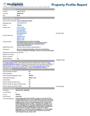
Permitting and Development Center | 6310 Wilhelmina Delco Drive, Austin, TX 78752 | (512) 978-4000 Property Profile Report General Information Location: Parcel ID: Grid: 1201 E 7TH ST 0205070101 MJ22 Planning & Zoning *Right click hyperlinks to open in a new window. Future Land Use (FLUM): Specific Regulating District Regulating Plan: Plaza Saltillo TOD Zoning: TOD-NP Zoning Cases: C14-01-0148 C14-01-0148.004 C14-2008-0029 NPA-2007-0009.01 NPA-2008-0009.01 011213-42 19990225-070b 20081211-082 20081211-084 Zoning Ordinances: Zoning Overlays: Neighborhood Plan: Infill Options: Neighborhood Restricted Parking Areas: -- Mobile Food Vendors: Historic Landmark: -- -- Urban Roadways: Yes No No No No No No Environmental Fully Developed Floodplain: FEMA Floodplain: Austin Watershed Regulation Areas: URBAN Watershed Boundaries: Waller Creek Creek Buffers: Edwards Aquifer Recharge Zone: Edwards Aquifer Recharge Verification Zone: Erosion Hazard Zone Review Buffer: Political Boundaries Jurisdiction: AUSTIN FULL PURPOSE Council District: 3 County: TRAVIS School District: Austin ISD Community Registry: ADU Approximate Area Reduced Parking Residential Design Standards: LDC/25-2-Subchapter F Transit Oriented Development: PLAZA SALTILLO Selected Sign Ordinances CENTRAL EAST AUSTIN: SUB-DISTRICT 1 Mixed Use Building Infill Option, Urban Home Infill Option, Secondary Apartment Infill Option, Small Lot Amnesty Infill Option Zoning Guide The Guide to Zoning provides a quick explanation of the above Zoning codes, however, the Land Development Information Services provides general zoning assistance and can advise you on the type of development allowed on a property. Visit Zoning for the description of each Base Zoning District. For official verification of the zoning of a property, please order a Zoning Verification Letter. General information on the Neighborhood Planning Areas is available from Neighborhood Planning. Imagery Map Zoning Map Vicinity Map Austin Independent School District, Austin Lost and Found Pets, Austin Neighborhoods Council, Capital Metro, Del Valle Community Coalition, East Austin Conservancy, El Concilio Mexican-American Neighborhoods, Friends of Austin Neighborhoods, Greater East Austin Neighborhood Association , Guadalupe Association for an Improved Neighborhood, Guadalupe Neighborhood Development Corporation, Homeless Neighborhood Association, Neighborhood Empowerment Foundation, Neighbors United for Progress, Organization of Central East Austin Neighborhoods , Plaza Saltillo TOD Staff Liaison, Preservation Austin, SELTexas, Sierra Club, Austin Regional Group, Tejano Town The Information on this report has been produced by the City of Austin as a working document and is not warranted for any other use. No warranty is made by the City regarding its accuracy or completeness. Date created: 11/2/2023 Amber Allen Historic Preservation Office City of Austin October 17, 2023 RE: Green and White Grocery (1201 E. 7th St.), request to consider initiation of historic zoning Dear Ms. Allen, I would like to include the historic Green and White Grocery, located at 1201 E. 7th St., on the Historic Landmark Commission’s November agenda for consideration of initiation of historic zoning. The owner, John Cazares, has expressed support for this proposed agenda item. Since 1940, the Green and White Grocery building has served as a long-established commercial landmark in East Austin. Honored by Preservation Austin as a 2023 Legacy Business, Green and White Grocery is one of a handful of original East Austin businesses still owned by family descendants. John Cazares has owned the botanica since 1993 and inherited the business from his father John Cazares Sr., and maternal grandfather Norberto Lopez (co- founder). Mr. Cazares has worked tirelessly to keep up with a changing community and has embraced tourists and visitors from nearby hotels and Airbnbs. Historic zoning for the Green and White Grocery building would help Mr. Cazares continue serve the neighborhood he calls home. The Green and White Grocery building was determined eligible for local landmark designation for its architecture, community value, historical association with business development in East Austin, as well as the role of small Mexican American groceries in the commercial and cultural development of East Austin. Thank you for your consideration and feel free to reach out regarding any questions or concerns. Thank you, JuanRaymon Rubio, Associate AIA Historic Landmark Commissioner, District 2 708.743.8148 BC-JuanRaymon.Rubio@AustinTexas.gov City of Austin, Historic Preservation Office Amber Allen PO Box 1088 Austin, TX 78776 October 24, 2023 Dear Ms. Allen, RE: Green & White Grocery (1201 East 7th St) request to initiate historic zoning I am writing to petition that Green & White Grocery, located at 1201 East 7th St, be added to the commission’s November agenda for historic zoning consideration. Since its inception in 1936, Green & White Grocery served as fixture for the East Austin Mexican American community, providing it with staples and goods imported from Mexico. Its use evolved in the 1990’s, to a botanica, supplying candles, charms, and other spiritual goods, with its local significance remaining. The building itself maintains a high degree of architectural integrity. Throughout its life the owner has made few exterior changes and is committed to its preservation. I believe the site will also be favorably reviewed for its longstanding community value and demonstrated historical association. I look forward to further discussions about the property. Jaime Alvarez, AIA Historic Landmark Commissioner, District 7 BC-jaime.alvarez@austintexas.gov. October 30, 2023 RE: Green & White Grocery Historic Landmark Designation Dear Chair Heimsath, Vice Chair Featherston, and Members of the Historic Landmark Commission, Preservation Austin exists to empower Austinites to shape a more inclusive, resilient, and meaningful community culture through preservation. We write to you today in support of historic zoning for Green & White Grocery, a landmark of East Austin’s Mexican American heritage, for its Architecture, Historic Associations, and Community Value. Founded in 1930s by Norverto and Susie Lopez, Green & White Grocery has been a family-owned business for three generations and an East Austin institution for nearly a century. Originally a general store with food and goods imported from Mexico, the shop became well-known for its tamales in the 1960s. The famous delicacy attracted hundreds of customers, especially around Christmastime, until they stopped producing tamales in the 1990s. John Cazares Sr., Lopez's son-in-law, took over the store when Lopez died. Cazares Sr. was a supportive and active member of the community, giving credit to customers who could not always afford to pay and arranging grocery deliveries for his elderly customers. In 1993, Cazares Sr. retired and passed the store to his son, John Cazares, Jr., who transformed the grocery into a botanica in 1996. The building is a great example of a Craftsman-style commercial building and features the Lopez’s original grocery store signage. Now specializing in items that promote a healthy lifestyle including spiritual goods, votive candles, perfumes, and herbal supplements, Green & White Grocery continues to be a staple in the East Austin community. In recent years, our organization has had the privilege of working with Mr. Cazares on two initiatives. In 2022, Green & White Grocery was featured in our East Austin Barrio Landmarks Project, which honors the historic and cultural significance of East Austin's Mexican American community. In addition to documenting 25 sites associated with this heritage, our initiative also resulted in a successful State of Texas subject marker for Green & White. In 2023, Green & White was featured as a participating business in our first-ever Legacy Business Month passport, which guided Austinites through our city’s iconic local businesses, encouraging them to celebrate and support the institutions that define so much of Austin’s culture. We are proud to partner with Mr. Cazares in this work and look forward to continuing our fruitful partnership in the many years to come. Preservation Austin wholeheartedly supports the designation of Green & White Grocery as a City of Austin Landmark and look forward to celebrating this significant preservation milestone for our city. Thank you for your consideration and your service to the City of Austin. Sincerely, Melissa Barry, President 2.6.4. COMMUNITY LIFE 2.6.4.1. Businesses CITY OF AUSTIN HISTORIC RESOURCES SURVEY – VOLUME I stated that East Avenue was, “destined to be the backbone for all traffic in the eastern portion of the City.” The Sanborn map indicates the incorporation of medians had occurred by 1935. With the divisions that existed between the East Austin community and the rest of the city as well as the shortage of jobs during the Depression Era, many residents in the area resorted to opening their own businesses during the 1930s and 1940s. This trend reflects the self‐reliance, industriousness, and ambition that members of the East Austin community developed and drew upon amidst the segregated environment. Within two decades after the adoption of Koch and Fowler’s 1928 plan, over 100 businesses operated throughout East Austin, many of which lined East 1st (Cesar Chavez), East 6th, East 11th, and East 12th Streets, and Manor Road (figure I‐52, to follow). They included restaurants, bakeries, a beauty school, grocery stores, and offices for professionals such as doctors and attorneys.46 Beginning in the 1930s, the locations of businesses were determined not only by the locations of streetcar lines and paved roads, but also by the locations of bus routes as seen in figure I‐39. As shown in this 1933 map, the bus routes supplemented the earlier streetcar lines along East 1st (Cesar Chavez) and East 7th Street bus line (figure I‐53). (For additional information regarding the bus system citywide, refer to Section 1.3.7.1 of the Citywide Historic Context.) Figure I‐48. Territorial Growth of the City of Austin 1840‐ 1970. This map, produced by the City of Austin, shows that most of the growth that occurred in East Austin during the Depression Era took place east of Chestnut Street. Map courtesy of Austin History Center, Austin Public Library. I.2. East Austin Historic Context – Section 6 I-83 Figure I-49. Detail of Cities and Towns, Travis County, Texas, Texas State Highway Department Map, produced in 1936 and revised 1940. This map of Austin illustrates the road network in the city at the time. It is apparent that East Avenue, East 1st Street, East 19th Street, Manor Road, and part of East 7th Street (from East Avenue to Comal Street), constituted the only paved roads by 1940 in the East Austin project area. Map source: Texas State Library and Archives, from the University of Texas Libraries, Perry Castañeda Map Collection, accessed June 27, 2016, https://www.tsl.tex as.gov/arc/maps/im ages/map5009.jpg. CITY OF AUSTIN HISTORIC RESOURCES SURVEY – VOLUME I I.2. East Austin Historic Context – Section 6 I-84 CITY OF AUSTIN HISTORIC RESOURCES SURVEY – VOLUME I Figure I-50. Side-by-side comparison of photographs taken of East 19th Street looking east, before paving (left) and after paving (right). Source (photo on left): Jordan-Ellison, Unpaved Nineteenth Street, July 19, 1930, photograph, accessed June 30, 2016, https://texashistory.unt.edu/ark:/67531/metapth125183/, University of North Texas Libraries, The Portal to Texas History. Photo on right: Jordan-Ellison. Nineteenth Street looking east, October 31, 1930, photograph, accessed June 30, 2016, https://texashistory.unt.edu/ark:/67531/metapth125182/, University of North Texas Libraries, The Portal to Texas History. Figure I-51. Side-by-side comparison of photographs taken of East Avenue looking south from 8th Street, during paving (left) and after paving (right). Source (photo on left): Jordan-Ellison, East Avenue looking south at 8th St. during paving project, September 3, 1930, photograph, accessed June 30, 2016, https://texashistory.unt.edu/ark:/67531/metapth 125221/, University of North Texas Libraries, The Portal to Texas History. Photo on right: Jordan-Ellison, East Avenue looking south at 8th St. after paving project, November 1, 1930, photograph, accessed June 30, 2016, https://texashistory.unt.edu/ark:/67531/metapth125222/, University of North Texas Libraries, The Portal to Texas History. I.2. East Austin Historic Context – Section 6 I-85 CITY OF AUSTIN HISTORIC RESOURCES SURVEY – VOLUME I Figure I-52. Map depicting the spatial distribution of extant commercial and industrial resources in East Austin constructed from 1929 to 1945, shown in green. The multicolored patchwork represents subdivisions. Source: Map by HHM, using Google base map, 2016. 6th Streets by extending further east along East 6th Street, and by incorporating East 7th Street, East 19th Street (MLK, Jr. Boulevard), and Manor Road. By 1940, the streetcar lines fell out of service, and bus lines provided the only form of public transportation in East Austin. The routes primarily functioned to transport the residents of East Austin to jobs downtown and in West Austin, but the additional traffic that they generated also encouraged the development of new businesses like the Green and White Grocery, which opened around 1940 at 1201 East 7th Street – right at the terminus of the new I.2. East Austin Historic Context – Section 6 I-86 CITY OF AUSTIN HISTORIC RESOURCES SURVEY – VOLUME I Figure I-53. Photograph of the Green and White Grocery at 1201 East 7th Street, established ca. 1940 by Noberto Lopez and his wife Susie, who both lived and worked in the building.1 The grocery is sited along the bus route on East 7th Street, which started service around 1933. The building meets the criteria for local landmark and individual NRHP listing for its association with the significant trends of business development in East Austin along bus routes in the 1940s, as well as the role of small Mexican American groceries in the commercial and cultural development of East Austin. Source: Photo by HHM, 2016. On East 6th Street, the Italian immigrant presence begun in the early 1900s persisted. The Franzetti family also took over the former Cherico grocery at 1401 E. 6th Street from about 1929 through at least 1935 (still extant, see figure I‐27 in Section 2.4.2.3), as well as the Franzetti Food Store at 1200 East 12th Street by 1940 (no longer extant). The family members continued to live near their businesses in East Austin, and by 1929, occupied residences at 2001 Chicon Street by, 904 Lydia, and the former Cherico residence at 1403 East 6th Street (all still standing).47 After the adoption of the 1928 plan, the Cherico family abandoned East Austin around 1930, and moved to Travis Heights in South Austin, but the Franzetti family remained committed to living and working in East Austin until the 1940s.48 By 1940, John J. Franzetti moved his family from 1403 East 6th Street to 309 Park Lane in Fairview Park, and Joseph P. Franzetti moved to 200 East Live Oak Street near Travis Heights.49 In an illustration of the changing demographics of the area, by 1944, ownership of the grocery and house at 1401 and 1403 East 6th Street transferred to Ysabel Arriaga and his wife Louisa.50 The Arriagas moved to Austin in 1942,51 possibly immigrating from Mexico, considering that neither Ysabel nor Louisa were enumerated in the 1940 U.S. Census. This and other groceries operated by Mexican Americans in this era became an important part of East Austin’s identity, helping to build a culture of entrepreneurship, as well as to keep cultural food traditions intact. In its American Latino Theme Study, the National Park Service recognizes both commerce and food as significant themes within the history of Latinos in the United States.52 Furthermore, by 1946, Arriaga Grocery paid for an advertisement in the LULAC News53—published by the League of United Latin American Citizens— foreshadowing the significant role that East Austin’s Mexican American I.2. East Austin Historic Context – Section 6 I-87 CITY OF AUSTIN HISTORIC RESOURCES SURVEY – VOLUME I business owners would play in the Civil Rights Movement in the decades to come (further discussed in Section 2.7). With the increasingly African American demographic resulting from the 1928 plan, businesses increasingly catered to an African American clientele. The many businesses in East Austin during the Depression Era provided not only services that community members could not attain elsewhere in the city, but also a sense of unity and pride. Given the density of buildings in East Austin, commercial establishments abounded, and most were in close proximity to residents, whose primary mode of getting around town was by walking. The most sizeable African American commercial node was along East 11th Street, which was one of the few roads to be paved by the 1920s (as shown previously in figure I‐19 in Section 2.4.1.2.3). In 1936, African American‐owned and ‐run businesses in Austin included five tire shops, nine tailors, a creamery, two furniture repair shops, two boarding houses, two meat markets, a beauty college, six service stations, a lumberyard, two blacksmiths, 16 cafes, 17 grocery stores, a fish market, a theater, three drug stores, a print shop, three funeral homes, three shoe shops, seven garages, eight wood yards, three vegetable stands, 10 beauty shops, a loan agency, and a hotel.54 Another African American‐owned business in East Austin was Hillside Drugs, originally located at 607 San Jacinto Street. Dr. Ulysses Young, who earned his bachelor’s degree at Paul Quinn College in Waco and pharmaceutical degree at Meharry Medical College in Nashville, prepared prescriptions specifically for the African American community’s needs. The business later moved to East 11th Street (see figure I‐54). Because the city did not enforce zoning ordinances in East Austin, many business owners were creative and opportunistic in their ventures.55 Numerous residents operated businesses such as beauty parlors out of their homes, which had separate back entrances for the business. For example, in the 1940s, Simpson Beauty Salon, and later OK Beauty Shop (still extant), I.2. East Austin Historic Context – Section 6 Figure I-54. 2016 Photograph of building located at 1209 East 11th Street. The building, which now houses a restaurant, is the former location of Hillside Drugs, a pharmacy owned and operated by Dr. Ulysses Young. The original location of the pharmacy was at 607 San Jacinto Street. Dr. Young moved the location of his business to the East 11th building after it was completed in 1950. Photo by HHM. I-88 CITY OF AUSTIN HISTORIC RESOURCES SURVEY – VOLUME I operated out of the bungalow at 2121 East 1st Street. Mabelle Harper, at 1199 Coleto Street, also operated a beauty salon and shop, called Mabelle’s Studio and Gift Shop, out of her house in the late 1940s (also extant, see figure I‐55). Other business owners ran beauty parlors outside of their homes. For example, Jewel Warren, a graduate of Tillotson College and Crescent Institute, had a full‐service beauty salon, Parisienne Beauty Shop, located at 1014 East 11th Street. The salon catered to the local African American community. Crescent Institute, located at 1205 East 11th Street, was founded in 1931 by Urissa Christian. The Institute provided technological training to young people wishing to join the workforce. The school also had beauty, business administration, and mechanics departments, offering evening classes and job placement services.56 Figure I-55. House at 1199 Coleto Street that once served as a Mabelle’s Studio and Gift shop in the 1940s, run by African American and East Austin resident Mabelle Harper. Among the many African American‐owned businesses that fronted East 11th Street was Arnold’s Bakery, which later became Rueter’s Bakery. Situated catty corner from the Haehnel Store building (a historic commercial building constructed about 1880), two generations of the Rueter family worked at the bakery and lived behind the building.57 Next door to the bakery sat Franklin’s Barber Shop, opened in 1932. Starting in the 1930s, William Handy Fuller and his wife Maud A. B. Fuller took over Rhambo Funeral Parlor, founded by African American Nathan W. Rhambo, and renamed it Fuller Funeral Home. The Fullers moved their business into a large frame house on Angelina Street which featured a number of bedrooms, separate repose rooms, a chapel, and an inviting landscaped yard (see figure I‐56, to follow). Considered pillars of the community, Mr. and Mrs. Fuller each organized various charitable organizations, were active in Baptist missionary endeavors, and enjoyed providing employment opportunities to members of their community. After Mr. Fuller’s death in 1941, Mrs. Fuller partnered with C. E. M. Mercer and renamed the business Fuller‐Mercer Funeral Home. They moved their business to East 19th Street in 1984.58 I.2. East Austin Historic Context – Section 6 I-89 HHM ID 11630 1201 E 7 ST Feb 2016 Image ID 11841 Feb 2016 Image ID 11638 IDENTIFICATION Street number 1201 Street direction E Street name 7 Street type ST Zip code 78702 Addition / subdivision DIVISION A Neighborhood CENTRAL EAST AUSTIN GENERAL EXTERIOR Type Building - Commercial - Hybrid House/Store Stylistic influences Craftsman Exterior wall materials Asbestos Siding Structural materials Wood ROOF Legal description LOT 1 BLK 1 OLT 3 DIVISION A Zoning code TOD-NP Owner name 1 CAZARES JOHN LOPEZ Owner city AUSTIN Owner state TX Owner zip code 78702 Parcel ID 192881 Zoning ID 223355 Bays 1 Stories 1 Foundation type Unknown Description notes None Roof shape Hipped Roof materials Asphalt composition shingles Number of chimneys None visible Chimney locations N/A Chimney materials N/A Chimney features N/A DOORS AND WINDOWS Door types Double door primary entrance Door features Transom light PORCH LANDSCAPE Porch type Awning Porch roof type Shed Landscape features None No. of garages None visible Window types Fixed Window materials Aluminum Window features None Porch support type None Other porch features None No. of sheds None visible Other outbuildings None visible Other associated places None visible Volume IV - Appendix C - Page 75 HHM ID 11630 1201 E 7 ST HISTORY Current name Green and White Grocery Historic use Commercial Current use Commercial Year built ca. 1940 Source for historic use Field estimate Architect None known Source for year built Estimate based on Sanborn maps and Source for architect N/A City Directories; TCAD lists 1920 but address not listed in City Directories until ca. 1940 Builder None known Source for builder N/A Historic name Green and White Grocery History notes Shown as store at front and dwelling Source for historic name None at rear on 1962 Sanborn map; not shown on 1935 Sanborn map. Historic photo at https://texashistory.unt.edu/ark:/67531/metapth531415/? q=%20date%3A1946-1962 Occupant history 1940: Green and White Gro. No. 2, Noberto Lopez (o, grocer), Susie Lopez; 1945: Noberto Lopez, Green and White Grocery; 1952: Green and White Grocery; 1957: Green and White Grocery; 1962: Green and White Grocery; 1967: Green and White Grocery; 1972: Green and White Grocery City Directories Source for occupant history INTEGRITY Additions Rear addition PRIOR DESIGNATIONS Prior local designations None Prior NRHP designations None Alterations Doors replaced, Windows replaced, Exterior wall materials replaced Integrity notes None Prior NRHP determinations None Other designations None known Designation notes None PREVIOUS AND RECOMMENDED DESIGNATIONS Previous and recommended local designations Recommended local designations Justification for local recommendation No previous local designations; Recommended eligible as a local landmark Recommended eligible as a local landmark N/A Previous and recommended NRHP designations Recommended NRHP designations Justification for NRHP recommendation No previous NRHP designations; Recommended individually eligible for the NRHP Recommended individually eligible for the NRHP N/A Local criteria Architecture, Historical Associations, Local areas of significance Potential local historic district Community Value Long-established commercial enterprise in East Austin (Green and White Grocery), 2.6.4.1 Businesses N/A NRHP criteria A, C NRHP areas of significance NRHP level of significance Potential NRHP historic district N/A Community Planning and Development, Architecture Local Volume IV - Appendix C - Page 76 Stylistic influences Craftsman Year built 1920 History notes None Alterations Roof shape altered Additions None visible Integrity notes None Stylistic influences No style Year built 1919 History notes None Alterations Doors replaced Additions None visible Integrity notes None Stylistic influences No style Year built 1919 History notes None Alterations Doors replaced, Windows replaced Additions Front addition Integrity notes None Stylistic influences No style Year built 1972 History notes None Additions None visible Integrity notes None Alterations Exterior wall materials replaced, Fenestration altered Stylistic influences Folk Victorian Year built 1905 History notes None Alterations Porch altered Additions Rear addition Integrity notes None 1121 E 7 ST Type Commercial - Office building Stylistic influences Spanish Colonial Revival Year built 1992 History notes None Alterations None visible Additions None visible Integrity notes None Stylistic influences No style Year built 1920 History notes None Alterations None visible Additions None visible Integrity notes None Previous and recommended local designations No previous local designations; Recommended not eligible for a local designation Previous and recommended NRHP designations No previous NRHP designations; Recommended not eligible for a NRHP designation HHMID 11660 Previous and recommended local designations No previous local designations; Recommended contributing to a local historic district Previous and recommended NRHP designations No previous NRHP designations; Recommended contributing to a NRHP district HHMID 11782 Previous and recommended local designations No previous local designations; Recommended non-contributing to a local historic district Previous and recommended NRHP designations No previous NRHP designations; Recommended non-contributing to a NRHP district HHMID 11781 Previous and recommended local designations No previous local designations; Recommended not eligible for a local designation Previous and recommended NRHP designations No previous NRHP designations; Recommended not eligible for a NRHP designation HHMID 11652 Previous and recommended local designations Previously listed as a local landmark; Recommended contributing to a local historic district HHMID 11795 Previous and recommended NRHP designations Previously listed individually on the NRHP; Recommended contributing to a NRHP district HHMID 11645 Previous and recommended local designations No previous local designations; Recommended not eligible for a local designation Previous and recommended NRHP designations No previous NRHP designations; Recommended not eligible for a NRHP designation Previous and recommended local designations No previous local designations; Recommended not eligible for a local designation Previous and recommended NRHP designations No previous NRHP designations; Recommended not eligible for a NRHP designation HHMID 11636 HHMID 11630 Stylistic influences Craftsman Year built ca. 1940 Additions Rear addition Alterations Doors replaced, Windows replaced, Exterior wall materials replaced History notes Shown as store at front and dwelling at rear on 1962 Sanborn map; not shown on 1935 Sanborn map. Historic photo at https://texashistory.unt.edu/ark:/67531/metapth531415/? q=%20date%3A1946- 1962 Integrity notes None Previous and recommended local designations No previous local designations; Recommended eligible as a local landmark Previous and recommended NRHP designations No previous NRHP designations; Recommended individually eligible for the NRHP Stylistic influences No style Year built ca. 1950 History notes None Additions None visible Integrity notes None Alterations Doors replaced, Windows replaced, Exterior wall materials replaced Previous and recommended local designations No previous local designations; Recommended non-contributing to a local historic district Previous and recommended NRHP designations No previous NRHP designations; Recommended non-contributing to a NRHP district HHMID 11825 1007 E 7 ST Type Residential - Single- Family House - Bungalow 1010 E 7 ST Type Residential - Outbuilding - Back House 1010 E 7 ST Type Residential - Single- Family House - Hipped-Roof Square-Plan 1021 E 7 ST Type Commercial - Warehouse 1022 E 7 ST Type Residential - Single- Family House - Modified L-Plan 1201 E 7 ST Type Residential - Outbuilding - Garage Apartment 1201 E 7 ST Type Commercial - Hybrid House/Store 1202 E 7 ST Type Residential - Outbuilding - Back House Volume III - Appendix B - Page 759