5.8 - 6301 Bluff Springs Rd - Sebron Sneed - Zoning ordinance 20080807-064 — original pdf
Backup
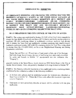
ORDINANCE NO. 20080807-064 AN ORDINANCE REZONING AND CHANGING THE ZONING MAP FOR THE PROPERTY GENERALLY KNOWN AS THE SNEED HOUSE LOCATED AT 1801 NELMS DRIVE FROM FAMILY RESIDENCE (SF-3) DISTRICT AND (SF-3-H) COMBINING FAMILY RESIDENCE-HISTORIC LANDMARK DISTRICT TO MULTIFAMILY RESIDENCE MODERATE HIGH DENSITY (MF- 4) DISTRICT FOR TRACT ONE AND MULTIFAMILY RESIDENCE LANDMARK-CONDITIONAL MODERATE HIGH DENSITY-HISTORIC OVERLAY (MF-4-H-CO) COMBINING DISTRICT FOR TRACT TWO. BE IT ORDAINED BY THE CITY COUNCIL OF THE CITY OF AUSTIN: PART 1. The zoning map established by Section 25-2-191 of the City Code is amended to change the base district from family residence (SF-3) district and family residence-historic landmark (SF-3-H) combining district to multifamily residence moderate high density (MF-4) district for Tract One and multifamily residence moderate high density-historic landmark-conditional overlay (MF-4-H-CO) combining district for Tract Two as described in Zoning Case No. C14-2007-0042, on file at the Neighborhood Planning and Zoning Department, as follows: Tracts One and Two: A 1.78 acre tract of land, more or less, out of the Santiago Del Valle Grant, Travis County, the tract of land being more particularly described by metes and bounds in Exhibit "A" incorporated into this ordinance (the "Property"), generally known as the Sneed House, locally known as 1801 Nelms Road, in the City of Austin, Travis County, Texas, and generally identified in the map attached as Exhibit "B". PART 2. The Property within the boundaries of the conditional overlay combining district established by this ordinance is subject to the following conditions: A. A 25-foot wide setback shall be established around the footprint area identified as Tract Two on Exhibit "A". Within the 25-foot wide setback the maximum impervious cover is 50 percent. B. Field notes to more particularly describe all tracts will be submitted with site plan application. Page 1 of 2 Except as specifically restricted under this ordinance, the Property may be developed and used in accordance with the regulations established for the multifamily residence moderate high density (MF-4) base district, and other applicable requirements of the City Code. PART 3. This ordinance takes effect on August 18, 2008. PASSED AND APPROVED August 7 ., 2008 Will Wy Mayor APPROVED ATTEST: David Allan Smith City Attorney Shirley A. Gentry City Clerk Page 2 of 2 'Office 512-487-9602 Fax 512-330-1621 Thomas P. Dixon R.P.L.S. 4324 J11502 Waterloo Surveyors Inc, EXHIBIT "A" March 21,2007 FIELD NOTES FIELD NOTES FOR 1.78 ACRES OF LAND, MORE OR LESS, OUT OF THE SANTIAGO DEL VALLE GRANT IN TRAVIS COUNTY, TEXAS, SAME BEING THE SAME TRACT OF LAND MORE PARTICULARLY DESCRIBED IN VOLUME 8957, PAGE 138, REAL PROPERTY RECORDS, TRAVIS COUNTY, TEXAS, BEING THE SAME PROPERTY CONVEYED IN TAX RESALE DEED RECORDED IN DOCUMENT NUMBER 2006227540, OFFICIAL PUBLIC RECORDS OF TRAVIS COUNTY, TEXAS; FOR WHICH A MORE PARTICULAR DESCRIPTION BY METES AND BOUNDS IS AS FOLLOWS: BEGINNING at an iron rod found on the south R.O.W. of Nelms Drive at the most northerly, N.W. corner of Lot 4, Block C, COMAL BLUFF SECTION ONE, a subdivision in Travis County, Texas, according to the map or plat thereof recorded in Volume 84, Page 16B, Plat Records of Travis County, Texas, for the N.E. comer hereof, THENCE the following two (2) courses and distances along the common west and north line of Lot 4: 1. S03°33M7"W for a distance of 389 95 feet to an iron rod found; 2. N59°22'40"W for a distance of 305.25 feet to an iron rod found on the curving east R.O W. of Bluff Springs Road for the S.W. corner hereof; THENCE the following two (2) courses and distances along the east R.O.W. of Bluff Springs Road: 1.183.37 feet along the arc of a curve curving to the left with a radius of 975.00 feet and having a chord which bears N17°41'47"E for a distance of 183.10 feet to an iron rod found at the point of tangency of said curve; 2. N12°50'34"E for a distance of 46.75 feet to an iron rod found at the point of curvature of a curve having a radius of 15.00 feet; THENCE the following two (2) courses and distances along the south R.O.W. of Nelms Drive: 1. 22.17 feet along the arc of a curve curving to the right with a chord which bears N54°34*32"E for a distance of 20.20 feet to an iron rod found at the point of a reverse curve curving to the left with a radius of 777.00 feet; 2. 204.95 feet along the arc of said curve with a chord which bears N89°28'18"E for a distance of 204.35 feet to the POINT OF BEGINNING, containing 1.78 acres of land. I, the undersigned do hereby certify that the field notes hereon were prepared from an actual on-the-ground survey under my direct supervision and that they are true and correct to the best of my knowledge. Thomas P. Dixon R.P.L.S. 4324 OWNER: CHI EN-CHUN-LU ADDRESS: 1801 NELMS DRIVE Waterloo Surveyors Inc. "THIS SURVEY WAS PERFORMED FOR AND CERTIFIED TO SURVEY PLAT jnso2 THE UEN HOLDERS AND/OR THE OWNERS OF THE PREMISES SURVEYED AND TO FIDELITY NATIONAL TITLE INSURANCE COMPANY AS PER GF NO 07-801243" THE PROPERTY SURVEYED HEREON IS SUBJECT TO: [1] RESTRICTIVE COVENANTS RECORDED IN DOCUMENT NO 2006227540, OFFICIAL PUBLIC RECORDS, TRAVIS COUNTY. TEXAS THE PROPERTY SURVEYED HEREON IS NOT SUBJECT TO: Ml PIPELINE EASEMENTS RECORDED IN 417/93, 852/332, DEED RECORDS, [2] ELECTRIC EASEMENTS RECORDED IN 548/330, 551/573, 2058/135, 2128/348, 2282/451, 2376/466, DEED RECORDS, [3] TELEPHONE EASEMENT RIGHTS RECORDED IN 4041/640 AND 5696/1410, DEED RECORDS. [4] WATER EASEMENT RIGHTS RECORDED IN 5030/911, DEED RECORDS; [5] SANITARY SEV/ER EASEMENT RIGHTS RECORDED IN 2406/310. 3805/1036 AND 4717/1327, DEED RECORDS, -g ALL TRAVIS COUNTY, TEXAS. Found Iron Rod POINT OF BEGINNING ( LEGEND RECORD CALL ) OVERHEAD ELECTRIC -e- CHAIN LINK FENCE — WOOD FENCE WROUGHT IRON FENCE WATER METER ELECTRIC MANHOLE® UTILITY POLE -X (N 54-36'06M E) N 54'34'32" E chord = 20.20' arc = 22 17\2J2.;6'} radius : LOT 4 BLOCK C BLUFF SECTION 84/1 6B ONE abandoned house (falling apart) 8957/138 Doc# 2OO21173O7 77,698 sq, ft, 1,78 acres 84/16B 15' Drainage & PUE (N 59'29'08" W 305.00') N 59'22'40" W 305 25' COMAL BLUFF SECTION LOT 4 BLOCK C 84/1 6B LEGAL DESCRIPTION: 1 78 ACRES OF LAND, MORE OR LESS, OUT OF THE SANTIAGO DEL VALLE GRANT. IN TRAVIS COUNTY, TEXAS. AND BEING THE SAME TRACT OF LAND MORE PARTICULARLY DESCRIBED IN BY METES AND BOUNDS IN THE DEED RECORDED IN VOLUME S957, PAGE 138, REAL PROPERTY RECORDS OF TRVIS COUNTY, TEXAS, BEING THE SAME PROPERTY CONVEYED IN TAX RESALE DEED REDCORDED IN DOCUMENT NUMBER 2006227540, OFFICIAL PUBLIC RECORDS OF TRAVIS COUNTY, TEXAS Stata of Texas. County of Travis The undersigned does hereby certify that this survey was this day made on the property legally described hereon and is correct, and this survey substantially complies with the current Texas Society of Professional Surveyors Standards and Specifications for a Category Condition B Survey 1A 2 Dated this the. da? of. 21ST MARCH IS NOT ^_^_ -,200 >__. And I certify that tbo proporty shown heraon hazard area as Identified by the federal Insurance Adm. Popart me nt of HUD Flood hazard boundary map revised as per Map Number Zone _Ji 48453C0210 F 06/05/97 ..within a special flood @ Copyright 2007 P.O. Box 160176. Austin. Texas 78716-0176 Phone: 481-9602 Thomas P. Dixon RP LS ^324 GR-Cj TRACT 2 88-0058 82-204 SP-85-112 SP-93-0538C APARTMENTS MF-3 84-312 GR-CO TRACT 1- ENTIRE AREA SURROUNDING TRACT 2 90-036 RETAILlgALES SP85-112 83-138 RZ86-013 MF-3 APTS 83-138 RZ86-013 APTS ZONING CASE PENDING_CASE ZONING ZONING GxsrLBtt 1?> ZONING CASE NUMBER: C14-2007-0042 ADDRESS: 1801 NELMS DR. AREA: 1.78 AC. GRID:H15,16 CASE MGR: W.RHOADES 1" = 200' Ths maphasbeon produced by G I S Services for tha sote purpose of fleographic reference No warranty Is made by tha City of Austin regarding specific accuracy or completeness