5.0 - 6301 Bluff Springs Rd - Sebron Sneed — original pdf
Backup
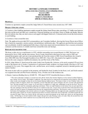
HISTORIC LANDMARK COMMISSION APPLICATION FOR A CERTIFICATE OF APPROPRIATENESS AUGUST 3, 2022 HR-2022-084104 SEBRON G. SNEED HOUSE 6301 BLUFF SPRINGS ROAD 5.0 – 1 PROPOSAL PROJECT SPECIFICATIONS Construct an apartment complex around the Judge Sebron G. Sneed House ruins erected circa 1857-1860. 1) Construct a three-building apartment complex around the Sebron Sneed House ruins, providing a 25’ buffer zone between the ruins and the pool and other new construction. Proposed buildings are each three stories in height and display Mission Revival stylistic cues; they are clad in stucco and capped with hipped, tiled roofs. Columned arches accent the main entrance to each building. 2) Construct a fence around the ruins. Note: The applicant has provided 2015 correspondence, per Committee feedback, showing that former Preservation Officer Steve Sadowsky requested a mortar analysis and preliminary stabilization plan. The applicant specified that tuck-pointing and consolidation would be implemented following an observation report and recommendation from a masonry restoration contractor and the erection of a double steel fence around the ruins (see backup). RESEARCH & ARCHITECTURE The home on this site was zoned historic in 1979, with the surrounding area rezoned historic in 1980. The house was destroyed by fire in 1989, and the ruins remain. Travis County foreclosed on the home for taxes owed in 2002 and retained the property until a private owner purchased the site from the county in 2006. Invest SmartHomes Inc owned it from 2006-2009, then The Foresight Foundation from 2009-2011. Since 2011, the property has toggled ownership between the same companies: IndoPak Investments, Inc and The Circle at The Nelms. In 1854, Judge Sebron G. Sneed moved his entire family from Fayetteville, Arkansas, to his newly acquired 470-acre farm south of the present city of Austin. Construction of a permanent family residence was begun shortly after that in 1857 and continued for five years. War stopped the work, and the house, never entirely completed, lacked its intended porches and interior finishes.1 The stone for the walls was quarried on the property and finished by hand. Lumber for the floors, roof, and finish material was acquired from the Lost Pine Forest at Bastrop, Texas, 30 miles east of the residence site. A Historic American Building Survey (HABS TX - 399) dated 2/3/1937 described the house as follows: “ This native limestone residence is located one mile off the Austin-San Antonio Highway on the Austin-Lockhart Highway, near Austin, Travis County. The builder is unknown. The stone used in its construction was quarried on the property; pine and other woods were brought in from the not far distant Bastrop timbered areas. The house is more or less Colonial: style, roof pitched at about 45 degrees which were originally covered with hand split cypress shingles, but now covered with galvanized iron. The plan includes twelve rooms, six on each floor, in addition to a large attic, unfinished except for the floor. The attic v/as to have been used for community gatherings and dances. There are eight fireplaces in the house, four on each main floor. The only openings in the East and West walls are two windows in the attic, except a door on the first floor of the East Elevation, which was used as means of communication between the original kitchen and house. The Exterior cornice is of cut stone, and the frames of all openings in the exterior walls are of cypress. Framing timbers are of rough sawn pine, assembled with mortice and tenon joints. Lintels are of pine with flat keyed arches in exterior stonework; sills of limestone. All finish woodwork was executed by hand. Water was carried off the roof using two metal downspouts on the South end, which are still functioning today. All floorings in of inch random width, tongue and grooved, pine flooring. Lath is of cedar. Only the second floor was completely plastered, which condition was on account of the advent of the Civil War.” 1 HABS TX – 399 Supplemental https://tile.loc.gov/storage-services/master/pnp/habshaer/tx/tx0200/tx0291/supp/tx0291supp.pdf 5.0 – 2 DESIGN STANDARDS The City of Austin’s Historic Design Standards (March 2021) are based on the Secretary of the Interior’s Standards for Rehabilitation and are used to evaluate projects at historic landmarks. The following standards apply to the proposed project: Residential new construction 1. Location, 2. Orientation, 4. Proportions While individual design standards cater to neighborhood residences’ setbacks and streetscapes, the proposed project does not comply with the Secretary of the Interior’s guidance for siting new buildings near historic properties. The proposed apartment complex will visually overpower the existing ruins. 3. Scale, massing, and height The proposed project does not appear to conform to the relevant standards, though each building does seem to be segmented into two modules. 5. Design and style, 6. Roofs, 7. Exterior walls, 8. Windows and doors The proposed building’s Mission Revival design elements and modern fenestration do not reflect the Sneed House during its period of significance, nor do they relate to its current state by incorporating similar materials, scale, etc. 10. Chimneys The proposed buildings do not include boxed chimneys. Sites and streetscapes 1. Vegetation, topography, and landscaping The proposed project maintains only a 25’ buffer between the historic ruins and the apartments’ active circulation elements and amenities. Since no bracing is planned for the ruins, there may be safety concerns as well as concerns regarding accelerated deterioration from the vibration of motor vehicle activity from adjacent parking. The 25’ buffer immediately abuts the complex’s swimming pool, laundry, pedestrian routes, and residential Building #.1 2. Walls and fences The proposed fence appears to comply with the design standards’ requirement for transparency; however, its placement appears inappropriately close to the ruins, and its spiked design may not be allowed per recent Code changes. As the citywide design standards do not adequately address the sensitive archaeological context of this site, the Secretary of the Interior’s Standards for Rehabilitation must be consulted when evaluating the project’s potential for endangering subsurface materials associated with the Sebron Sneed House, including but not limited to historic resources related to the lives and activities and people who lived, worked and established Community on the Sneed property during the nineteenth century. Standards for Rehabilitation 8. Archeological resources will be protected and preserved in place. If such resources must be disturbed, mitigation measures will be undertaken. The proposed project does not provide a plan for exploratory testing, monitoring, or mitigation should resources be unearthed during construction. Summary The project does not meet the applicable standards. STAFF COMMENTS 2007: The Historic Landmark Commission reviewed a zoning change from SF-3-H to MF-4 and MF-4-H for the property in 2007. The Historic Landmark Commission’s July 23, 2007, recommendation was as follows: Recommend a zoning change to family residence-historic (SF-3-H) district zoning for the ruins and a 40- foot setback around the ruins, and within the setback, there is a maximum impervious cover (IPC) of 50%, and multi-family residence (medium density) historic (MF-3-H) district zoning for the remainder of the tract.2 2 “C14-2007-0042—1801 Nelms Drive.” Zoning Change Review Sheet, 2007. https://www.austintexas.gov/edims/document.cfm?id=115594 In January and February of 2007, the owner presented plans to the Historic Landmark Commission (HLC) for a Certificate of Appropriateness on the treatment of the ruins. The HLC granted a Certificate of Appropriateness in April 2007 for stabilization of the ruins and indicating that the applicant’s proposal constituted the minimum of the preservation work approved for the site. The applicant also proposed a two-story tall multi-family residential project surrounding the proposed plaza incorporating the ruins. The proposed stabilization of the ruins was never completed. 5.0 – 3 2008: 2011: 2015: After the zoning change request proceeded to City Council in 2008, the 40-foot compatibility setback was decreased to 25 feet with a maximum (IPC) of 50% (within the setback). The Multi-Family zoning ZAP recommended as a conditional use (explicitly that any use/density higher than SF-3 required Site Plan approval by ZAP, thus giving the ability for ZAP to send the Site Plan back to HLC for review) did not pass at Council.3 The final rezoning ordinance (20080807-064) resulted in MF-4-H-CO for the ruins plus a 25-foot setback around it (Track 2) and MF- 4 for the remaining area surrounding it (Track 1)4. In 2011, HLC reviewed conceptual development plans for the site. The applicant requested that the Certificate of Appropriateness Review Committee review a strategy for developing the area inside the ruins and sought a review of the placement of sidewalks and other public access routes to the ruins. Staff recommendation was that it was a conceptual review of development plans for the site, which were primarily proposed to be placed outside the limits of the historic zoning. Staff recommended as great of public accessibility and ability to see the ruins from the public right-of-way as possible and a prohibition against any development within the walls of the ruins. Staff further recommended “the installation of an interpretive display detailing the history of the house before the fire which reduced it to ruins.”5 In 2015, HLC reviewed a proposal to tuck point the remaining limestone walls of the ruined house and clean the site of debris. After the restoration work was completed, two steel fencing rings were erected to prevent intrusions into the ruins. A protective epoxy sealant was proposed to be applied to the top of the walls to prevent further deterioration from water penetration. The Historic Landmark Commission’s recommendation was as follows: Approve the application for repointing and sealing the tops of the limestone walls for stability and the prevention of further deterioration but reserve the right to determine any further stabilization measures necessary for the long- term preservation of the walls, especially in light of the proposed housing development that will surround the ruins in the future. Staff further recommends that any fallen rock found on the site be retained on the site and re-used to the greatest extent possible, but that the remaining vegetation and debris on the site be cleared. In addition, the staff recommends that the applicant follow the directives from a preservation professional regarding the repairs and stabilization of the walls.6 The 2015 proposal was not completed. The applicant has provided 2015 correspondence, per Committee feedback, showing that former Preservation Officer Steve Sadowsky requested a mortar analysis and preliminary stabilization plan. The applicant specified that tuck-pointing and consolidation would be implemented following an observation report and recommendation from a masonry restoration contractor and the erection of a double steel fence around the ruins (see backup). 3 “C14-2007-0042—1801 Nelms Drive.” Second-Third Readings Summary Sheet, 2008. https://www.austintexas.gov/edims/document.cfm?id=119633; Ord. 20080807-064, 2008, https://www.austintexas.gov/edims/document.cfm?id=120169 4 20080807-064, Ordinance (austintexas.gov) 5 https://www.austintexas.gov/edims/document.cfm?id=156975 6 https://www.austintexas.gov/edims/document.cfm?id=241478 5.0 – 4 The November 2016 HLC Agenda (E.1) noted Staff was in contact with the architect on site (DBN-2015-001). In March of 2017, the HLC agenda (E.1) noted: “Staff is initiating the demolition by neglect case” (DBN-2015-001). In August of 2017, Steve Sadowsky, Historic Preservation Officer (2000-2022), sent a letter to the owners to discuss Demolition by Neglect and stabilization of the ruins (see backup). In May of 2018, the HLC agenda (E.1) noted “a staff report on the progress of contacts with the owner of the property to resolve issues stemming from neglect.” In July 2018, the HLC Agenda (E.1) noted, “Staff referred the item to the law department.” In January 2019, DBN 2015-001 was offered to the Commission for Consent Approval to “Maintain the Case on the HLC Agenda.” In February 2019, it was referred back to the law department. In April 2019, the HLC item noted, “Staff has filed a code complaint.” In August of 2019, it was again offered for consent to “maintain on the HLC agenda with no new updates.” In January 2020, the DBN case number was changed from 2015-001 to HDP-2019-0394 but remained on the HLC agenda under item E.1 as a Demolition by Neglect item. It remained on the HLC agenda under item E.1 until May 2021. COMMITTEE FEEDBACK ARC June 2022: ARC July 2022: STAFF RECOMMENDATION Provide documentation of previous discussions with former Preservation Officer Steve Sadowsky. Implement a 40’ buffer for safety and separation from new construction. Avoid adding spike-topped fencing around the ruins. Consider relocating the swimming pool. Provide stabilization for ruins and explore archaeological monitoring. Recommend stabilizing the ruins, an engineering stabilization plan, and ongoing archaeological monitoring of any excavation within the historic footprint. In addition, they continued the request that development does not obscure the view of the ruins. Staff recommends postponing to the next HLC meeting on September 7, 2022 until the applicant brings the Commission a Preservation Plan containing the following elements: a professional engineering report with stabilization recommendations and implementation program, a professional archaeological assessment/report, including an acceptable plan for monitoring of the ruins, a field study of the Site with the likelihood of adverse effects on known or possible unknown resources on the site, including any need for exploratory testing, monitoring, or mitigation if historic resources or remains may be unearthed during construction. 2016: 2017: 2018: 2019: 2020: 2021: LOCATION MAP 5.0 – 5 5.0 – 6 Historic American Buildings Survey, Arthur W. Stewart, Photographer November 27, 1936 SOUTHEAST ELEVATION. - Judge Sebron G. Sneed House, Route I-35 & Bluff Springs Road, Austin, Travis County, TX https://www.loc.gov/pictures/item/tx0291.photos.156361p/ Historic American Buildings Survey, Arthur W. Stewart, Photographer November 27, 1936 SOUTHWEST ELEVATION (SOUTH FRONT AND WEST SIDE). - Judge Sebron G. Sneed House, Route I-35 & Bluff Springs Road, Austin, Travis County, TX https://www.loc.gov/pictures/item/tx0291.photos.156359p/resource/ 5.0 – 7 https://www.loc.gov/pictures/item/tx0291.photos.156360p/resource/ Historic American Buildings Survey, Arthur W. Stewart, Photographer November 27, 1936 SOUTH ELEVATION (FRONT). - Judge Sebron G. Sneed House, Route I-35 & Bluff Springs Road, Austin, Travis County, TX 5.0 – 8 HABS TEX,227-AUSTIN.V,1- (sheet 2 & 3 of 8) - Judge Sebron G. Sneed House, Route I-35 & Bluff Springs Road, Austin, Travis County, TX https://www.loc.gov/pictures/item/tx0291.sheet.00002a/resource/ Sebron G. Sneed House Ruins: “photos” (Historic Review Application, 2022) 5.0 – 9