1 - Guadalupe Storm Drain Improvement - THC coordination letter — original pdf
Backup
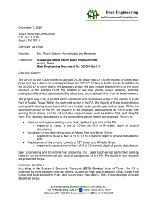
December 7, 2020 Texas Historical Commission P.O. Box 11276 Austin, TX 78711 Delivered via eTrac Attention: Reference: Guadalupe Street Storm Drain Improvements Ms. Tiffany Osburn, Archeologist and Reviewer Austin, Texas Baer Engineering Document No. 202001-8b.011 Dear Ms. Osburn: The City of Austin (CoA) intends to upgrade 20,000 linear feet (LF) (6,096 meters) of storm drain pipes and box culverts on Guadalupe Street and 35th-37th streets in Austin, Texas. In addition to the 20,000 LF of storm drains, the proposed project will also include improvements to the outlet structure of the Triangle Pond, the addition of two new ponds, culvert upsizing, potential underground detention, associated utility relocations, and roadway/minor channel improvements. The project area (PA) is located within residential and commercial areas in the vicinity of Hyde Park in Austin, Texas. Within the northwest portion of the PA, the majority of these improvements overlap with existing storm drains which are located under paved roads and surfaces. Within the southwest portion of the PA, the majority of the proposed improvements do not overlap with existing storm drains, and the PA includes unpaved areas such as Adams Park and Hemphill Park. The following disturbances to the surrounding ground matrix are expected (FIGURE 1): • Remove and replace existing storm drain pipeline in portions of the PA: o expected to cause a one to 30-foot (ft) (0.3 to 9-meters) depth of ground disturbance; and • Installation of two detention ponds at Adams Park and Baker Center: o expected to cause a five to 10-ft (1.5 to 3-meters) depth of ground disturbance; • Replacement of the existing culverts at 32nd Street and Wheeler Street: o expected to cause a one to five-ft (0.3 to 1.5-meters) depth of ground disturbance. Baer Engineering and Environmental Consulting, Inc. (Baer Engineering) performed desktop research on the environmental and cultural backgrounds of the PA. The results of our research are presented below. GEOLOGY AND SOILS According to the Bureau of Economic Geology’s (BEG) Geologic Atlas of Texas, the PA is underlain by three geologic units as follows: Quaternary high gravel deposits (Qhg), Eagle Ford Group and Buda Limestone (Keb), and Austin chalk (Kau) (BEG 1995). These geologic units are described below: Freese and Nichols: 202001-8b.011 Guadalupe Street Storm Drain Improvements QUATERNARY HIGH GRAVEL DEPOSITS (QHG): EAGLE FORD GROUP AND BUDA LIMESTONE (KEB) High gravel deposits comprise an upper unit of silty clay with gravel commonly exposed on the surface, and a lower coarse unit yielding some water. December 7, 2020 Page 2 Eagle Ford group comprises shale and limestone. In the upper part of the Eagle Ford Group shale is compact, silty, contains fossil fish teeth and bones, and is 10 feet thick or more. The middle part is silty limestone grading to calcareous siltstone, flaggy, medium gray, weathers pale yellowish brown, and is five feet thick. The lower part is shale, calcareous, dark gray, seven to fifty feet thick. The thickness of Eagle Ford Group is between 25 to 65 feet. Buda Limestone is fine grained, bioclastic, commonly glauconitic, pyritiferous, hard, massive, poorly bedded to nodular, and thinner bedded and argillaceous near upper contact. It is light gray to pale orange, and weathers dark gray to brown. Burrows are filled with chalky marl, with abundant pelecypods. Thickness is up to 45 feet. AUSTIN CHALK (KAU). Austin Chalk is described as massive, with some interbeds and partings of calcareous clay. It is mostly thin-bedded marl with interbeds of massive chalk, hard lime mudstone to soft chalk which is light grey that weathers to white. Marine megafossils are scarce, and the chalk is mostly microgranular calcite with minor foraminifer tests and Inoceramus prisms. According to the U.S. Department of Agriculture–Natural Resources Conservation Service (USDA-NRCS 2020), there are six soil units underlying the PA (FIGURE 3): HOUSTON BLACK CLAY AND URBAN LAND 0 TO 8 PERCENT SLOPES (HSD): Houston Black soils are very deep, moderately well drained, very slowly permeable soils that formed in clayey residuum derived from Cretaceous calcareous mudstone. These nearly level to moderately sloping soils occur on interfluves and side slopes on upland ridges and plains on dissected plains. Slopes are mainly one to three percent but range from zero to eight percent. Werchan et al. (1974:58) describe Urban land as areas covered (75 percent or more) with works and structures such as buildings, streets and parking lots. In these areas, the “installation of works and structures has so altered and obscured soil features that they do not resemble soils described in the various [USDA-NRCS soil] series.” LEWISVILLE SOILS AND URBAN LAND 0 TO 2 PERCENT SLOPES (LEB): Lewisville soils are very deep, well drained, moderately permeable soils that formed in ancient loamy and clayey calcareous sediments. These upland soils have slopes of zero to 10 percent. For a description of urban land, please see the above description for HsD. TRAVIS SOILS AND URBAN LAND 1 TO 8 PERCENT SLOPES (TUD): Travis soils are very deep, well drained, slowly permeable soils that formed in clayey and loamy sediments of ancient terraces. These soils are on nearly level to sloping uplands. Travis soils occur in central and east-central Texas in small bodies along major streams. Baer Engineering and Environmental Consulting, Inc. Freese and Nichols: 202001-8b.011 Guadalupe Street Storm Drain Improvements December 7, 2020 Page 3 For a description of urban land, see the above entry on HsD soils. URBAN LAND 0 TO 6 PERCENT SLOPES (UR): For a description of urban land, please see the above description for HsD. URBAN LAND AND AUSTIN SOILS 0 TO 5 PERCENT SLOPES (USC): For a description of urban land, please see the above description for HsD. Austin soils are moderately deep, well drained, moderately slowly permeable soils that formed in residuum weathered from chalk. These soils are on nearly level to sloping erosional uplands. Slopes range from zero to eight percent. URBAN LAND, AUSTIN, AND WHITEWRIGHT SOILS 1 TO 8 PERCENT SLOPES (UTD): For a description of urban land, please see the above description for HsD. For a description of Austin soils, please see the above description for UsC. Whitewright soils comprise shallow to paralithic contact. These well drained soils formed in residuum derived from weakly cemented chalk and marl of Upper Cretaceous Age. These gently sloping to moderately steep soils are on convex ridges on dissected plains. Slopes are dominantly four to 10 percent, but range from one to 15 percent. POTENTIAL ARCHEOLOGY LIABILITY MAPS (PALMS) According to the Texas Department of Transportation (TxDOT) PALM for the area the PA has low potential for shallowly buried archeological deposits and portions of the northwest and southwest PA have moderate potential for deeply-buried deposits (FIGURE 4). PREVIOUSLY-RECORDED ARCHEOLOGICAL SITES According to the Texas Historical Commission’s (THC) Archeological Sites Atlas (Atlas), there are three recorded archeological sites within the PA: 41TV474, 41TV7, 41TV2562. Descriptions of the sites located within the PA are bolded in the table below. Baer Engineering used an arbitrary one-kilometer buffer around the PA to collect a representative sample of local archeology within the same geologic units as the PA (FIGURE 5). These sites are listed in the table below: TRINOMIAL SITE TYPE SITE DESCRIPTION 41TV474 N/A N/A N/A AREA AND DEPTH NRHP* AND SAL** STATUS Not available (N/A) Historical 41TV548 N/A Eligible REFERENCE Anon., n.d. A Briggs 1981; Fuszek 1991; Gillentine and Miller 2009 Two, possibly three limestone buildings associated with the studio and residence of sculptor Elisabet Ney. Now a historical museum. Architectural materials, and domestic and culinary refuse were collected during survey. Baer Engineering and Environmental Consulting, Inc. Freese and Nichols: 202001-8b.011 Guadalupe Street Storm Drain Improvements TRINOMIAL SITE TYPE SITE DESCRIPTION 41TV7 N/A 41TV2562 Historical December 7, 2020 Page 4 NRHP* AND SAL** STATUS AREA AND DEPTH N/A N/A REFERENCE Anon. n.d. B 136 acres Building Prociuk et al. 2019 501 NRHP Listed Site investigated by Glen Shipe and the associated collection was donated in 1929. Austin State Hospital. Above-ground resources include over 20 structures and associated landscape currently in use as a mental healthcare facility. Main administrative building 501 listed on the National Register and was constructed in 1861. Below-ground resources include the foundations and other debris of structures demolished over the course of the history of the facility. Historical-period artifacts collected and observed during survey (ongoing). Prehistoric midden and historical dump site with glass, concrete, clay pipe fragments, bone, pottery, and fractured chert flakes and possible cores recovered. Historical house site and prehistoric lithic procurement site. Abundant Pleistocene chert and quartzite cobbles, chert cores, debitage, thick and thin bifaces, unifaces, and utilized flakes collected and observed on surface. Historical Lamar Street Dump Site with European and American ceramics and glass fragments from the late 19th and early 20th century observed. Historical trash dump with various colored bottle glass fragments, one button, dinnerware, crockery, whiteware sherds, earthenware, and seamed tin cans observed. 41TV876 Prehistoric, Historical N/A N/A Christie and Davis 1972 41TV2454 Modern Historical, Prehistoric 45x30 meters N/A Anthony and Malof 2014 41TV137 Historical N/A N/A Anon., n.d. C; Feit et al. 2013. 41TV2060 Historical Site size: 250x150 meters; Depth: 30cm NRHP Ineligible Goodwin and Weaver 2003; Jones 2007 Baer Engineering and Environmental Consulting, Inc. Freese and Nichols: 202001-8b.011 Guadalupe Street Storm Drain Improvements TRINOMIAL SITE TYPE SITE DESCRIPTION 41TV1293 41TV1285 N/A Historical December 7, 2020 Page 5 AREA AND DEPTH N/A 75x66 meters NRHP* AND SAL** STATUS N/A NRHP Ineligible REFERENCE N/A McCollum 1986 N/A Historical (early 1900s) clubhouse, stable, or workshop associated with the original Austin Country Clubhouse. Various colored glass fragments, ceramic sherds, Ginger beer bottlenecks, square nails, horseshoes and metal objects were collected during survey. Late 19th to early 20th century trash scatter with two features from early construction of Pease Park, a square nail, brick, glass, whiteware, enamel ware, coal clinker, and bone observed during survey. 41TV2412 Historical 6475 m2 Butler 2012 NRHP Ineligible *National Register of Historic Places **State Antiquities Landmarks PREVIOUS ARCHEOLOGICAL SURVEYS According to the Atlas there is one previously-recorded archeological survey within the PA (FIGURE 6). A survey (TAC Permit 8985) was conducted by SWCA Environmental Consultants on behalf of the CoA in 2019. No archeological sites were identified that meet the criteria for designation as a SAL or NRHP 9 during the survey (Morton 2019) (FIGURE 6). PREVIOUSLY-IDENTIFIED HISTORICAL RESOURCES According to the Atlas, there are 14 NRHP-listed properties or districts and Registered Texas Historical Landmarks (RTHLs) within the project area. Descriptions of the historical resources located within the PA are bolded in the table below. According to the Atlas, there are 61 NRHP- listed properties or districts and RTHLs within the one-kilometer buffer of the PA (FIGURE 7). These resources are listed in the table below: MAP LABEL NAME RESOURCE TYPE RESOURCE DESCRIPTION REFERENCE/ MARKER NUMBER Smith- Marcuse- Lowry House Building 1 2 Queen Anne architectural style dated between 1875- 1899. Architect John Greggie (n.d. D). Queen Anne (1875-1899) and other (1900-1924, styles. Architect E.A. Ellingson (n.d. E). Oliphant- Walker House Building 1925-1949) architectural 90001177 90001180 NRHP, SAL, RTHL STATUS NRHP Listed NRHP Listed Baer Engineering and Environmental Consulting, Inc. Freese and Nichols: 202001-8b.011 Guadalupe Street Storm Drain Improvements December 7, 2020 Page 6 MAP LABEL NAME RESOURCE TYPE RESOURCE DESCRIPTION REFERENCE/ MARKER NUMBER NRHP, SAL, RTHL STATUS 3 4 5 6 7 8 9 10 11 Rev. Henry M. and Jennie Sears House Hyde Park Presbyterian Church Moonlight Towers Commercial Building at 4113 Guadalupe Street Alice H. Robbins House Building Queen Anne and other architectural styles dated between 1900-1924 (n.d. NRHP Listed 90001174 “Other” architectural Building style dated between 1900- 1924 and 1875-1899 (n.d. NRHP Listed 90001175 Building 1899. Architect Fort 76002071 “Other” architectural style dated between 1875- Wayne Electric Co (n.d. NRHP Listed F). D). G). Building “Other” architectural style dated between 1900-1924. Architect L. Shaffer (n.d. H). NRHP Listed 90001187 Building Bungalow/Craftsman, other architectural style dated between 1925-1949. Architect R.W. Herndon (n.d. I). NRHP Listed 90001235 Bluebonnet Tourist Camp Building “Other” architectural style dated between 1925-1949. Architect Brydson Lumber NRHP Listed Robert H. and Edith Ethel McCauley House F.T. and Belle Ramsey House Building Building Hyde Park Historic District District Co (n.d. J). Tudor Revival dated between 1925-1949. Architect Kenneth N. Sanders (n.d. K). Queen Anne and other architectural styles dated between 1900-1924, 1875- 1899, 1925-1949 (n.d. L). Tudor Revival (1900- 1924), Bungalow/Craftsman (1925-1949), Queen Anne (1875-1899) architectural styles (n.d. M). NRHP Listed NRHP Listed NRHP Listed 90001188 90001236 90001176 90001191 Baer Engineering and Environmental Consulting, Inc. Freese and Nichols: 202001-8b.011 Guadalupe Street Storm Drain Improvements December 7, 2020 Page 7 MAP LABEL NAME RESOURCE TYPE RESOURCE DESCRIPTION REFERENCE/ MARKER NUMBER NRHP, SAL, RTHL STATUS 12 Williams- Weigl House Building with F. Lee Weigl, a RTHL 12887 Bungalow architectural style built in 1911 by Harvey Murdock Williams and his wife Euphemia (Sinclair). Also associated craftsman who moved to the home in 1947 and contributed elaborate ironwork to the home’s detailing (n.d. N). Classical Revival dated between 1900-1924 and 1875-1899. Architect Elisabet Ney (n.d. O). Elisabet Ney was a world- renowned sculptor who built this studio in 1892 to execute statues of Stephen F. Austin and Sam Houston for the Texas exhibit at the 1893 World Fair (n.d. P). Historical medallion only (n.d. Q). Built around 1850 by famed pioneer architect Abner Cook, for Waymen Wells (n.d. D). House built in 1896 by Kopperl (n.d. R). Craftsman architectural style home designed by prominent Austin architect Charles H. Page, Sr., built in 1909 (n.d. S). Austin’s first planned suburb. Promoted by Monroe M. Ships in the mid-1800s (n.d. T). House built in 1904 by Elvira T. Manor Davis (n.d. U). 13 Elisabet Ney Studio and Museum District and Women’s history 14 Elisabet Ney Women’s history 15 16 Elisabet Ney Home Wells-LaRue House Building Building NRHP Listed 72001374 RTHL 13828 RTHL 13829 RTHL 14592 17 Kopperl House Building sportswoman Loula Dale RTHL 13941 18 Hodnette House Building RTHL 12242 19 Hyde Park Neighborhood RTHL 14424 20 Manor Davis Building RTHL 15042 Elvira T. House Baer Engineering and Environmental Consulting, Inc. Freese and Nichols: 202001-8b.011 Guadalupe Street Storm Drain Improvements December 7, 2020 Page 8 MAP LABEL NAME RESOURCE TYPE RESOURCE DESCRIPTION REFERENCE/ MARKER NUMBER NRHP, SAL, RTHL STATUS 21 Building 1934 from materials RTHL 17925 Hancock Recreation Center 22 Hancock Golf Course District NRHP Listed 17925 23 Edgar H. Perry Jr. House District N/A (n.d. X) RTHL 14000404 The Austin Country Club and Clubhouse, later named Hancock Recreation Center, was constructed in salvaged from University of Texas Old Main Building, influenced by the Colonial Revival style (n.d. V). Golf course constructed in 1899, participated in Texas’s first pay-for-play golf tournament established Austin as a premier golf city (n.d. W). Renaissance, Gothic Revival district dated between 1900-1924, 1925- 1949, 1950-1974. Architect Henry Bowers Thompson (n.d. Y). N/A (n.d. Z) Built in 1935 for Mary Susie Sheedy, the house became known as the “Red Rock House on the Corner” due to its eclectic structure and mixed stone and brick walls (n.d. AA). Bungalow/Craftsman (1925- 1949) and Tudor Revival (1900-1924) architectural styles (n.d. BB). Monroe Martin Shipe had this residence built in 1892 in Hyde Park, a suburb which he developed on the site of the old state fairgrounds (n.d. CC). Historical home constructed in 1933-34 by William Kutalek and Peter Mansbendel for William T. Williams, Jr. and Clotilde Valerie (Mansbendel) Williams (n.d. DD). NRHP Listed NRHP Listed 1000874 100005460 NRHP Listed 90001192 RTHL 14361 24 25 27 28 Perry Estate- St. Mary’s Academy District McFarland House District Shadow Lawn Historic District District The Shipe House Building William T. and Valerie Williams House 29 Mansbendel Building RTHL 17589 Baer Engineering and Environmental Consulting, Inc. 26 Addcox House Building RTHL 12238 Freese and Nichols: 202001-8b.011 Guadalupe Street Storm Drain Improvements December 7, 2020 Page 9 MAP LABEL NAME RESOURCE TYPE RESOURCE DESCRIPTION REFERENCE/ MARKER NUMBER NRHP, SAL, RTHL STATUS 30 Building RTHL 17561 Texas Confederate Woman’s Home Buddington- Benedict- Sheffield Compound 32 33 Penn and Nellie Wooldridge House Arthur N. and Jane Y. McCallum House Jane Yelvington McCallum Opened in 1908, the Texas Confederate Woman’s Home provided a home for over three thousand wives and widows of Confederate Veterans (n.d. EE). Albert and Rebecca Buddington built the first part of this compound as their home in 1860. Delia Edwards later commissioned Arthur Fehr to alter original house and design adjacent rustic-style cottage with fireplace mantel carved by Peter Mansbendel. In the 1940s Wilhelmine Sheffield added another house and enclosing wall, as well as ironwork by Fortunat Weigl (n.d. FF). Georgian Revival house designed by architect Hugo Nellie Wylie Holden in 1913 (n.d. GG). Queen Anne architectural style dated between 1900- 1924 and 1925-1949. Architect John C. Adrian (n.d. HH). One of the most prominent leaders of the Texas woman suffrage movement of the early 20th century, Jane Y. McCallum lived in the home with her husband, and their five children. She was appointed Secretary of State in 1927 and reappointed in 1931 (n.d. II). Queen Anne architectural style dated between 1875- 1899. Architects Christopher H. Page and William John Sutor (n.d. JJ). 31 Building RTHL 13232 Building F. Kuehne and built by RTHL 14313 Building NRHP Listed 96000963 34 State official RTHL 15417 35 Page-Gilbert House Building NRHP Listed 90001186 Baer Engineering and Environmental Consulting, Inc. Freese and Nichols: 202001-8b.011 Guadalupe Street Storm Drain Improvements December 7, 2020 Page 10 MAP LABEL NAME RESOURCE TYPE RESOURCE DESCRIPTION REFERENCE/ MARKER NUMBER 90001184 83003167 90001183 90001182 Building Building Building Building Hildreth- Flanagan- Heierman House Col. Monroe M. Shipe House Peter and Clotilde Shipe Mansbendel House W.T. and Clotilde V. Williams House Stanley and Emily Finch House James F. and Parker House Missouri, Kansas and Texas Land Co. House Tudor Revival (1925-1949) architectural style. Architect William Kutalek (n.d. NN). NRHP Listed NRHP, SAL, RTHL STATUS NRHP Listed NRHP Listed NRHP Listed NRHP Listed NRHP Listed NRHP Listed NRHP Listed Colonial Revival (1900- 1924) architectural style. Architect William Voss Sr (n.d. KK). Stick/Eastlake (1900-1924), and other (1875-1899) architectural style (n.d. LL). Tudor Revival (1925-1949) architectural style. Architect Peter Mansbendel (n.d. MM). Colonial Revival constructed in 1927-28. The architect Raymond Everett (n.d. OO). Built and added on to between 1859-1864, this house was originally built for Jacob Leser’s soap and candle factory (n.d. PP). Bungalow/Craftsman (1925- 1949) architectural style. Sternenberg Lumber Co (n.d. QQ). “Other” architectural style dated between 1900-1924. Architect Missouri, Kansas & Texas Land Co (n.d. RR). Classical Revival, Italianate style, with additions dated between 1850-1874; 1875- 1899; 1900-1924; and 1925-1949. Architects Charles Payne and A.O. Watson (n.d. SS). Colonial Revival style architecture dated between 1900-1924 and 1925-1949. Architect Herbert M. Greene (n.d. TT). Late 19th and early 20th church (n.d. UU) Building house was designed by RTHL 12239 Jacob Leser House Building RTHL 14254 42 Susie R. Building Architect Kuntz- 90001181 43 Building 90001179 44 State Lunatic Asylum Building NRHP Listed 87002115 Scottish Rite Dormitory Building 98000404 All Saints Chapel Building century Late Gothic Revival 15000543 36 37 38 39 40 41 45 46 Baer Engineering and Environmental Consulting, Inc. Freese and Nichols: 202001-8b.011 Guadalupe Street Storm Drain Improvements December 7, 2020 Page 11 NAME RESOURCE TYPE RESOURCE DESCRIPTION REFERENCE/ MARKER NUMBER NRHP, SAL, RTHL STATUS Graveyard N/A (n.d. VV) RTHL 18634 MAP LABEL 47 George H. Kinsolving Crypt Rebecca 48 Kilgore Stuart Red Women’s History and Education RTHL 15556 Austin Presbyterian Theological Seminary Campus Austin Presbyterian Theological Seminary Brueggemann- Sandbo House Church facilitate educational RTHL 12757 Churches and Education RTHL 12743 Building Brueggemann and his two RTHL 15080 52 Buen Retiro Building RTHL 15258 Zeta Tau Alpha House Women’s History and Building DeWitt Clinton Baker Home Educational, Writers and Poets Site Beriah Graham House Edmund and Emily Miller House RTHL 16954 N/A (n.d. CCC) RTHL 14392 Building N/A (n.d. DDD) RTHL 13926 Building RTHL 12592 Worrell- Ettlinger House Building NRHP Listed 4001152 Baer Engineering and Environmental Consulting, Inc. Rebecca Kilgore Stuart became the principal of Live Oak Female Seminary in 1853, where she continued to teach until 1886 (n.d. WW). Constructed in 1907 with later additions, the campus was built in this location to opportunities between the seminary and the University of Texas (n.d. XX). Started in 1884 by Rev. Dr. Richmond Kelly Smoot and the Rev. Dr. Robert Lewis Dabney (n.d. YY). House built by Julius sons in 1907 (n.d. ZZ). Colonial Revival mansion built in 1902 by Louis Nicholas Goldbeck (n.d. AAA). Neoclassical architectural style-building designed by the architectural firm Page Southerland and built in 1939 (n.d. BBB). Mediterranean style home built in 1923, the house was designed by Emily Miller, her nephew Edward Sammons Maverick, and architecture professor Raymond Everett (n.d. EEE). Bungalow/Craftsman style architecture dated between 1900-1924 and 1925-1949. Architects A.W. Johns and Samuel Gideon (n.d. FFF). 49 50 51 53 54 55 56 57 Freese and Nichols: 202001-8b.011 Guadalupe Street Storm Drain Improvements December 7, 2020 Page 12 MAP LABEL NAME RESOURCE TYPE RESOURCE DESCRIPTION REFERENCE/ MARKER NUMBER 58 Cox-Craddock House Building 1000612 NRHP, SAL, RTHL STATUS NRHP Listed 59 Rather House Building NRHP Listed 79003013 Colonial Revival style architecture dated between 1925-1949. Architect Hugo Franz Kuehne (n.d. GGG). Mission/Spanish Revival style architecture dated between 1900-1924. Architects Brigham, Coveney & Bisbee (n.d. HHH). John E. Hines was the presiding Bishop of the Episcopal Church between institutions and called for widespread change in church priorities (n.d. III). House built in 1925 and occupied by J. Frank Dobie 1926 until their deaths (n.d. JJJ). House built in 1925 and occupied by J. Frank Dobie 1926 until their deaths (n.d. KKK). Late 19th and early 20th century Revivals and other 60 John Elbridge Educational 1969-1974. He founded Hines Topic many educational RTHL 15862 61 J. Frank Dobie House Building and his wife Bertha from RTHL 14242 62 J. Frank Dobie House Building and his wife Bertha from N/A NRHP Listed 63 Battle Hall Building 70000763 architectural style dated between 1900-1924. NRHP Listed Architect Cass Gilbert (n.d. LLL). Sven Axel Philquist hired Swedish builder F. Oscar family home in 1912 (n.d. MMM). Queen Anne architectural style home dated between 1875-1899 (n.d. NNN). NRHP Listed Building Blomquist to build this RTHL 15196 Building 90001185 64 65 Philquist- Wood House Frank M. and Annie G. Covert House Baer Engineering and Environmental Consulting, Inc. Freese and Nichols: 202001-8b.011 Guadalupe Street Storm Drain Improvements December 7, 2020 Page 13 MAP LABEL NAME RESOURCE TYPE RESOURCE DESCRIPTION REFERENCE/ MARKER NUMBER NRHP, SAL, RTHL STATUS 66 Austin Historic District Old West District NRHP Listed 3000937 67 Educational RTHL 14343 Site of Texas Wesleyan College 68 University Baptist Church Building NRHP Listed 98000955 Littlefield House Building NRHP Listed 70000767 Cemetery RTHL 13278 Building 1900-1924. Architect 90001178 Late 19th and early 20th century Revivals, Late 19th and early 20th century American movements dated between 1850-1874, 1875- 1899, 1900-1924, 1925- 1949, 1950-1974. Architects include Anderson, Adams, Dixon, Ayers, Cook, Everett, Jensen, and Thomas (n.d. OOO). Founded by Swedish Methodists, Wesleyan College opened in 1912 (n.d. PPP). Mission/Spanish Revival architectural style dated between 1900-1924 and 1925-1949. Architects Albert Kelsey and Roy L. Thomas (n.d. D). Second Empire architectural style dated between 1875-1899. Architect James Wahrenberger (n.d. QQQ). Historical Texas cemetery established in 1882 (n.d. RRR). Bungalow/Craftsman style architecture dated between Charles P. Ledbetter (n.d. SSS). Albert Buddington, a local settler, built the first home that would become Aldridge Place in 1860. degree of architectural integrity with styles dated to 1860 and 1912-1965 (COA 2020). Historical bridge located at West 32nd Street, built in 1930. Historical bridge located at West 30th Street at Hemphill Branch, built in 1931. NRHP Listed NRHP Listed NRHP Listed NRHP Listed 69 70 71 72 73 Austin State Hospital Cemetery Charles P. Ledbetter House Aldridge Place Local Historic District (APLHD) APLHD Wheeler Street Bridge- Culvert West 30th Culvert Bridge 142270B00088001 74 Street Bridge- Bridge 142270B00082001 Baer Engineering and Environmental Consulting, Inc. District The district retains a high N/A Freese and Nichols: 202001-8b.011 Guadalupe Street Storm Drain Improvements December 7, 2020 Page 14 NRHP, SAL, RTHL STATUS NRHP Listed MAP LABEL NAME RESOURCE TYPE RESOURCE DESCRIPTION REFERENCE/ MARKER NUMBER 75 The Baker School Building Historical Baker Elementary School located within the Hyde Park Historical District. N/A CEMETERIES According to the Atlas, there are no cemeteries listed within the PA (FIGURE 7). However, according to the Atlas, there are two cemeteries located within the one-kilometer buffer. The George Herbert Kinsolving Crypt (TV-C199) is located on the northernmost edge of the University of Texas campus (n.d. WWW). Kinsolving was the second bishop of the Episcopal Diocese of Texas, serving from 1893-1928 (Battle 2020). Kinsolving was buried beneath the altar of the All Saints Chapel in Austin, Texas. The Austin State Hospital Cemetery (TV-C023) is located on 51st Street and covers 11 acres (0.04 square kilometers). There are 2,700 recorded burials dating from the mid-19th century to present. HISTORICAL MAPS AND AERIAL PHOTOGRAPHS Baer Engineering reviewed historical topographic maps and aerial photographs for additional information about the historical development of the PA. Historical topographic maps were available for 1896, 1897, 1910, and 1954. The 1896 Austin 30-minute map shows the PA crossing several unnamed roads in the Sieder Springs neighborhood between Watter [sic] Creek and Shoal Creek (FIGURE 8). The map depicts several structures within the area. The 1897 Austin 30- minute map shows the same information as the 1896 map. The 1910 Austin 30-minute map shows the same information as the 1896 and 1897 maps. The 1954 Austin East 7.5-minute map depicts the same information as the previous maps; however, the map shows that the PA is located between Guadalupe Street and Duval Street and historical resources such as the Baker School, Shipe Playground Swimming Pool, the Light Tower, and several churches (FIGURE 9). The 1954 map also shows the southwest portion of the PA crossing over seminary property. Baer Engineering reviewed aerial photographs from 1940, 1951, and 1966. All of the aerial photographs depict the PA as crossing through a developed, mostly residential neighborhood, southeast of the Austin State Hospital (FIGURE 10). The Baker School is visible in the middle portion of the PA, as well as the Aldridge Place Local Historic District The layout of the roads depicted appear to be consistent throughout each photograph. SUMMARY The records reviewed by Baer Engineering provide evidence indicating the PA may have potential to contain sites of prehistoric and historical interest. The TxDOT PALM data identifies the PA as having low potential for shallowly buried archeological deposits and moderate potential for deeply- buried deposits. According to these records, there are 13 NRHP-listed or RTHL properties or districts, four previously-recorded archeological sites, and one previously-recorded archeological survey within the PA. Our records also show numerous archeological sites and historical resources have been recorded within the one-kilometer buffer of the PA. Areas that are beneath paved surfaces or previously disturbed soils, particularly in the northwest PA, may not warrant a survey at this time. However, a survey may be warranted in the southwest portion of the PA, near Adams and Hemphill parks and/or in unpaved portions of the PA. Baer Engineering and Environmental Consulting, Inc. Freese and Nichols: 202001-8b.011 Guadalupe Street Storm Drain Improvements If you have questions about this letter, please call me at (512) 453-3733 or contact me by email at emarigny@baereng.com. Respectfully submitted, BAER ENGINEERING AND ENVIRONMENTAL CONSULTING, INC. December 7, 2020 Page 15 Elizabeth de Marigny, PhD Project Archeologist Attachments: Figure 1 – Project Area Figure 2 – Site Specific Geology Figure 3 – Site Specific Soils Figure 4 – PALM Figure 5 – Previously-Recorded Archeological Sites Figure 6 – Previously-Recorded Archeological Surveys Figure 7 – Historical Resources and Cemeteries Figure 8 – 1896 Topographic Map Figure 9 – 1954 Topographic Map Figure 10 – 1940 Aerial Photograph REFERENCES CITED Anon. n.d. A Form for Site 41TV474. Available at the THC. https://atlas.thc.state.tx.us/Map accessed n.d. B Form for Site 41TV7. Available at the THC. https://atlas.thc.state.tx.us/Map accessed on October 29, 2020. on November 17, 2020. n.d. C Form for Site 41TV137. Available at the THC. https://atlas.thc.state.tx.us/Map accessed on October 29, 2020. n.d. D Form https://atlas.thc.state.tx.us/Map accessed on October 29, 2020. for Historical Marker 90001180. Available at the THC. n.d.E Form for Historical Marker 90001177. Available at the THC. https://atlas.thc.state.tx.us/Map n.d. F Form for Historical Marker 90001174. Available at the THC. https://atlas.thc.state.tx.us/Map accessed on October 29, 2020. accessed on October 29, 2020. Baer Engineering and Environmental Consulting, Inc. Freese and Nichols: 202001-8b.011 Guadalupe Street Storm Drain Improvements n.d.G Form for Historical Marker 90001175. Available at the THC. https://atlas.thc.state.tx.us/Map December 7, 2020 Page 16 n.d.H Form for Historical Marker 76002071. Available at the THC. https://atlas.thc.state.tx.us/Map n.d. I Form for Historical Marker 90001187. Available at the THC. https://atlas.thc.state.tx.us/Map n.d. J Form for Historical Marker 90001235. Available at the THC. https://atlas.thc.state.tx.us/Map n.d. K Form for Historical Marker 90001188. Available at the THC. https://atlas.thc.state.tx.us/Map n.d. L Form for Historical Marker 90001236. Available at the THC. https://atlas.thc.state.tx.us/Map n.d. M Form for Historical Marker 90001176. Available at the THC. https://atlas.thc.state.tx.us/Map n.d. N Form for Historical Marker 90001191. Available at the THC. https://atlas.thc.state.tx.us/Map n.d. O Form for Historical Marker 12887. Available at the THC. https://atlas.thc.state.tx.us/Map n.d. P Form for Historical Marker 72001374. Available at the THC. https://atlas.thc.state.tx.us/Map n.d. Q Form for Historical Marker 13828. Available at the THC. https://atlas.thc.state.tx.us/Map n.d. R Form for Historical Marker 13829. Available at the THC. https://atlas.thc.state.tx.us/Map n.d. S Form for Historical Marker 14592. Available at the THC. https://atlas.thc.state.tx.us/Map n.d. T Form for Historical Marker 13941. Available at the THC. https://atlas.thc.state.tx.us/Map n.d. U Form for Historical Marker 12242. Available at the THC. https://atlas.thc.state.tx.us/Map n.d. V Form for Historical Marker 14424. Available at the THC. https://atlas.thc.state.tx.us/Map n.d. W Form for Historical Marker 15042. Available at the THC. https://atlas.thc.state.tx.us/Map accessed on October 29, 2020. accessed on October 29, 2020. accessed on October 29, 2020. accessed on October 29, 2020. accessed on October 29, 2020. accessed on October 29, 2020. accessed on October 29, 2020. accessed on October 29, 2020. accessed on October 29, 2020. accessed on October 29, 2020. accessed on October 29, 2020. accessed on October 29, 2020. accessed on October 29, 2020. accessed on October 29, 2020. accessed on October 29, 2020. accessed on October 29, 2020. accessed on October 29, 2020. Baer Engineering and Environmental Consulting, Inc. Freese and Nichols: 202001-8b.011 Guadalupe Street Storm Drain Improvements n.d. X Form for Historical Marker 17925. Available at the THC. https://atlas.thc.state.tx.us/Map December 7, 2020 Page 17 accessed on October 29, 2020. accessed on October 29, 2020. accessed on October 29, 2020. accessed on October 29, 2020. n.d. Y Form for Historical Marker 17925. Available at the THC. https://atlas.thc.state.tx.us/Map n.d. Z Form for Historical Marker 14000404. Available at the THC. https://atlas.thc.state.tx.us/Map n.d. AA Form for Historical Marker 1000874. Available at the THC. https://atlas.thc.state.tx.us/Map n.d. BB Form https://atlas.thc.state.tx.us/Map accessed on October 29, 2020. for Historical Marker 100005460. Available at the THC. n.d. CC Form for Historical Marker 12238. Available at the THC. https://atlas.thc.state.tx.us/Map n.d. DD Form for Historical Marker 90001192. Available at the THC. https://atlas.thc.state.tx.us/Map n.d. EE Form for Historical Marker 14361. Available at the THC. https://atlas.thc.state.tx.us/Map n.d. FF Form for Historical Marker 17589. Available at the THC. https://atlas.thc.state.tx.us/Map n.d.GG Form for Historical Marker 17561. Available at the THC. https://atlas.thc.state.tx.us/Map n.d. HH Form for Historical Marker 13232. Available at the THC. https://atlas.thc.state.tx.us/Map n.d. II Form for Historical Marker 14313. Available at the THC. https://atlas.thc.state.tx.us/Map accessed n.d. JJ Form for Historical Marker 96000963. Available at the THC. https://atlas.thc.state.tx.us/Map n.d. KK Form for Historical Marker 15417. Available at the THC. https://atlas.thc.state.tx.us/Map n.d. LL Form for Historical Marker 90001186. Available at the THC. https://atlas.thc.state.tx.us/Map n.d. MM Form for Historical Marker 90001184. Available at the THC. https://atlas.thc.state.tx.us/Map n.d. NN Form for Historical Marker 83003167. Available at the THC. https://atlas.thc.state.tx.us/Map accessed on October 29, 2020. accessed on October 29, 2020. accessed on October 29, 2020. accessed on October 29, 2020. accessed on October 29, 2020. accessed on October 29, 2020. on October 29, 2020. accessed on October 29, 2020. accessed on October 29, 2020. accessed on October 29, 2020. accessed on October 29, 2020. accessed on October 29, 2020. Baer Engineering and Environmental Consulting, Inc. Freese and Nichols: 202001-8b.011 Guadalupe Street Storm Drain Improvements n.d. OO Form for Historical Marker 90001183. Available at the THC. https://atlas.thc.state.tx.us/Map December 7, 2020 Page 18 n.d. PP Form for Historical Marker 90001182. Available at the THC. https://atlas.thc.state.tx.us/Map n.d. QQ Form for Historical Marker 12239. Available at the THC. https://atlas.thc.state.tx.us/Map n.d. RR Form for Historical Marker 14254. Available at the THC. https://atlas.thc.state.tx.us/Map n.d. SS Form for Historical Marker 90001181. Available at the THC. https://atlas.thc.state.tx.us/Map n.d. TT Form for Historical Marker 90001179. Available at the THC. https://atlas.thc.state.tx.us/Map n.d. UU Form for Historical Marker 87002115. Available at the THC. https://atlas.thc.state.tx.us/Map n.d. VV Form for Historical Marker 98000404. Available at the THC. https://atlas.thc.state.tx.us/Map n.d. WW Form for Historical Marker 15000543. Available at the THC. https://atlas.thc.state.tx.us/Map n.d. XX Form for Historical Marker 18634. Available at the THC. https://atlas.thc.state.tx.us/Map n.d. YY Form for Historical Marker 15556. Available at the THC. https://atlas.thc.state.tx.us/Map n.d. ZZ Form for Historical Marker 12757. Available at the THC. https://atlas.thc.state.tx.us/Map n.d. AAA Form for Historical Marker 12743. Available at the THC. https://atlas.thc.state.tx.us/Map n.d. BBB Form for Historical Marker 15080. Available at the THC. https://atlas.thc.state.tx.us/Map n.d. CCC Form for Historical Marker 15258. Available at the THC. https://atlas.thc.state.tx.us/Map n.d. DDD Form for Historical Marker 16954. Available at the THC. https://atlas.thc.state.tx.us/Map n.d. EEE Form for Historical Marker 14392. Available at the THC. https://atlas.thc.state.tx.us/Map accessed on October 29, 2020. accessed on October 29, 2020. accessed on October 29, 2020. accessed on October 29, 2020. accessed on October 29, 2020. accessed on October 29, 2020. accessed on October 29, 2020. accessed on October 29, 2020. accessed on October 29, 2020. accessed on October 29, 2020. accessed on October 29, 2020. accessed on October 29, 2020. accessed on October 29, 2020. accessed on October 29, 2020. accessed on October 29, 2020. accessed on October 29, 2020. accessed on October 29, 2020. Baer Engineering and Environmental Consulting, Inc. Freese and Nichols: 202001-8b.011 Guadalupe Street Storm Drain Improvements n.d. FFF Form for Historical Marker 13926. Available at the THC. https://atlas.thc.state.tx.us/Map December 7, 2020 Page 19 n.d. GGG Form for Historical Marker 12592. Available at the THC. https://atlas.thc.state.tx.us/Map n.d. HHH Form for Historical Marker 4001152. Available at the THC. https://atlas.thc.state.tx.us/Map n.d. III Form for Historical Marker 1000612. Available at the THC. https://atlas.thc.state.tx.us/Map n.d. JJJ Form for Historical Marker 79003013. Available at the THC. https://atlas.thc.state.tx.us/Map n.d. KKK Form for Historical Marker 15862. Available at the THC. https://atlas.thc.state.tx.us/Map n.d. LLL Form for Historical Marker 14242. Available at the THC. https://atlas.thc.state.tx.us/Map n.d. MMM Form for Historical Marker N/A. Available at the THC. https://atlas.thc.state.tx.us/Map n.d. NNN Form for Historical Marker 70000763. Available at the THC. https://atlas.thc.state.tx.us/Map n.d. OOO Form for Historical Marker 15196. Available at the THC. https://atlas.thc.state.tx.us/Map n.d. PPP Form for Historical Marker 90001185. Available at the THC. https://atlas.thc.state.tx.us/Map n.d. QQQ Form for Historical Marker 3000937. Available at the THC. https://atlas.thc.state.tx.us/Map n.d. RRR Form for Historical Marker 14343. Available at the THC. https://atlas.thc.state.tx.us/Map n.d. SSS Form for Historical Marker 98000955. Available at the THC. https://atlas.thc.state.tx.us/Map n.d. TTT Form for Historical Marker 70000767. Available at the THC. https://atlas.thc.state.tx.us/Map n.d. UUU Form for Historical Marker 13278. Available at the THC. https://atlas.thc.state.tx.us/Map n.d. VVV Form for Historical Marker 90001178. Available at the THC. https://atlas.thc.state.tx.us/Map accessed on October 29, 2020. accessed on October 29, 2020. accessed on October 29, 2020. accessed on October 29, 2020. accessed on October 29, 2020. accessed on October 29, 2020. accessed on October 29, 2020. accessed on October 29, 2020. accessed on October 29, 2020. accessed on October 29, 2020. accessed on October 29, 2020. accessed on October 29, 2020. accessed on October 29, 2020. accessed on October 29, 2020. accessed on October 29, 2020. accessed on October 29, 2020. accessed on October 29, 2020. Baer Engineering and Environmental Consulting, Inc. Freese and Nichols: 202001-8b.011 Guadalupe Street Storm Drain Improvements n.d. WWW Form for cemetery TV-C199. Available at the THC. . https://atlas.thc.state.tx.us/Map December 7, 2020 Page 20 accessed on October 29, 2020. Anthony, Dana and Andy Malof 2014 Form for Site 41TV2454. Available at the THC. https://atlas.thc.state.tx.us/Map accessed on October 29, 2020. Battle, William James 2020 “Kinsolving, George Herbert (1849-1928)”. Handbook of Texas Online. https://www.tshaonline.org/handbook/entries/kinsolving-george-herbert. Accessed on November 17, 2020. Briggs, Alton K 1981 Form for Site 41TV548. Available at the THC. https://atlas.thc.state.tx.us/Map accessed on October 29, 2020. Butler, Joel 2012 Form for Site 41TV2412. Available at the THC. https://atlas.thc.state.tx.us/Map accessed on October 29, 2020. Bureau of Economic Geology (BEG) 1995 Geologic Atlas of Texas: Austin Sheet. Bureau of Economic Geology, The University of Texas at Austin. Christie, V. and G. Davis 1972 Form for Site 41TV876. Available at the THC. https://atlas.thc.state.tx.us/Map accessed on October 29, 2020. (COA) City of Austin 2020 Electronic resource for APLHD historical resource. http://www.austintexas.gov/department/historic-districts#Aldridge%20Place. Accessed on November 23, 2020. Feit, Rachel, Joel Butler and Kurt Korfmacher 2013 Form for Site 41TV137. Available at the THC. Available at the THC. https://atlas.thc.state.tx.us/Map accessed October 29, 2020. Fuszek, Rick 1991 Form for Site 41TV548. Available at the THC. Available at the THC. https://atlas.thc.state.tx.us/Map accessed October 29, 2020. Gillentine, James and Theresa Miller 2009 Form for Site 41TV548. Available at the THC. Available at the THC. https://atlas.thc.state.tx.us/Map accessed October 29, 2020. Goodwin, Molly and William J. Weaver 2003 Form for Site 41TV2060.Available at the THC. https://atlas.thc.state.tx.us/Map accessed on October 29, 2020. Jones, Bradford Baer Engineering and Environmental Consulting, Inc. Freese and Nichols: 202001-8b.011 Guadalupe Street Storm Drain Improvements December 7, 2020 Page 21 2007 “ The Archeological Survey of the Proposed Reimers-Peacock Road Highway Improvement, Travis County, Texas”. Available at the THC. https://atlas.thc.state.tx.us/Map accessed on November 17, 2020. McCollum, Melanie 1986 Form for Site 41TV1285. Available at the THC. https://atlas.thc.state.tx.us/Map accessed October 29, 2020. Morton, Benjamin 2019 Form for TAC Permit 8985 Survey. Available at the THC. Available at the THC. https://atlas.thc.state.tx.us/Map accessed October 29, 2020. Prociuk, Nadya, and Eric Schroeder, Danielle Blut, Steven Schooler, Will Crisp, Elizabeth de Marigny, Jordan Bowers, and Austin Schroeder 2019 Form for Site 41TV2562. Available at the THC. https://atlas.thc.state.tx.us/Map accessed on October 29, 2020. Conservation Service, Washington DC. United States Department of Agriculture–Natural Resources Conservation Service (USDA- NRCS) 2020 Soil Survey of Travis County, Texas. United States Department of Agriculture, Soil Werchan, L.E., A.C. Lowther, and R.N. Ramsey 1974 Soil Survey of Travis County, Texas. United States Department of Agriculture, Soil Conservation Service. Washington, D. C. Baer Engineering and Environmental Consulting, Inc. £¤290 W 43R d St Project e v Location dale A ST1 e os R d urnet R n Lewis L B Austin £¤183 ST71 W 40T ¨§¦35 h St y w k P ST130 l a c i d e M d mar Blv N La W 39Th St ue A n e Av e C u n e Av y a w eed p S W 44Th St E 45T h St ue G n e Av W 41St St E 42N d St E 43R d St E 44T h St W 38Th St e v st A We e St p dalu ua G W 40T h St W 39Th St Maiden Ln W 34Th St Fruth St ar St d e C n L e m o H W 32N d St e v st A We W 30Th St W 31St St W 29Th St W e s t D r r stD E a W 31StSt k r a P l l i h p m e H e v A s i t i h W t S l r a e P t S e d n a r G o i R t S o d a l a S Project Area W 32Nd St Ave ersity niv U E 35Th St E 34Th St E 33R d St E 32N d St E 3 1 S t S t E 3 0 T h S t Dr a elv n e B µ Feet 400 0 800 Baer Project No. 202001.01 Date: December 7, 2020 TBPE Firm No. F-3181 TBPG Firm No. 50030 Base Map: World Imagery e Av w arro B al St v u D e k Av c Pe ue H n e Av e St s ntro o M E 38Th St y a w n e e r G Harris Ave St River Red erty St Lib E 32N d St Figure 1 Project Area Guadalupe Street Storm Drain Improvements e v e os R dale A ¬«Keb d urnet R Lewis L B n W 40T h St y w k P l a c i d e M W 39Th St W 43R d St ¬«Kau d mar Blv N La ¬«Qhg ue A n e Av e C u n e Av W 44Th St E 45T h St y a w eed p S ¬«Kau ¬«Qhg ue G n e Av E 44T h St W 38Th St e v st A We W 41St St E 42N d St E 43R d St e St p dalu ua G ¬«Keb W 40T h St W 39Th St Maiden Ln W 34Th St Fruth St ar St d e C n L e m o H ¬«Kdg W 30Th St e v st A We W 32N d St W 31St St t S l r a e P W 29Th St W e s t D r r stD E a W 31StSt ¬«Keb t S e d n a r G o i R t S o d a l a S k r a P l l i h p m e H e v A s i t i h W Project Area Geologic Formations: Kau: Austin Chalk W 32Nd St Ave ersity niv U E 35Th St E 34Th St E 33R d St E 32N d St E 3 0 T h S t Dr a elv n e B E 3 1 S t S t ¬«Kau µ Feet 400 Kdg: Georgetown Formation Keb: Eagle Ford Group and Buda Limestone Qhg: Quaternary high gravel and terrace deposits 0 800 Baer Project No. 202001.01 Date: December 7, 2020 TBPE Firm No. F-3181 TBPG Firm No. 50030 Base Map: World Imagery e Av w arro B al St v u D e k Av c Pe ¬«Kau E 38Th St y a w n e e r G Harris Ave St River Red ue H n e Av ¬«Qhg e St s ntro o M erty St Lib E 32N d St Figure 2 Site-Specific Geology Guadalupe Street Storm Drain Improvements e v dale A e os R ¬«TeE y w k P l a c i d e M n d B urnet R Lewis L ¬«UtD W 39Th St W 43R d St ¬«UsC d mar Blv N La ¬«HsD ue A n e Av W 44Th St ¬«UtD y a w eed p S e C u n e Av ¬«HsD E 45T h St ¬«LeB ue G n e Av W 41St St E 42N d St E 43R d St E 44T h St ¬«TuD ¬«TuD e St p dalu ua G W 38Th St e v st A We ¬«UsC Maiden Ln W 34Th St Fruth St ¬«UtD ¬«HsD e v st A We W 32N d St W 31St St ¬«Ur W 29Th St W e s t D r r stD E a W 31StSt ¬«HsD ¬«TeE W 30Th St ¬«UtD t S l r a e P ¬«TeE ¬«TeF t S e d n a r G o i R t S o d a l a S ¬«UsC k r a P l l i h p m e H e v A s i t i h W W 40T h St W 39Th St ar St d e C n L e m o H ¬«LeB E 35Th St W 32Nd St E 34Th St ¬«UtD E 33R d St ¬«TuD ¬«UtD E 32N d St E 3 1 S t S t E 3 0 T h S t Dr a elv n e B Project Area µ Feet 400 0 800 Baer Project No. 202001.01 Date: December 7, 2020 TBPE Firm No. F-3181 TBPG Firm No. 50030 Base Map: World Imagery ¬«UsC ue H n e Av e Av w arro B ¬«TuD ¬«Fs ¬«UtD al St v u D e k Av c Pe ¬«UtD y a w n e e r G Soils within the Project Area e St ntro o M HsD: Houston Black soils and Urban land, 0 to 8% slopes s LeB: Lewisville soils and Urban land, 0 to 2% slopes ¬«TuD erty St Lib E 32N TuD: Travis soils and urban land, 1 to 8% slopes Ur: Urban land, 0 to 6% slopes UsC: Urban land and Austin soils, 0 to 5% slopes d St UtD: Urban land, Austin, and Whitewright soils, 1 to 8% slopes Red Harris Ave ¬«Ur St River Figure 3 Site-Specific Soils Guadalupe Street Storm Drain Improvements ue A n e Av e C u n e Av y a w eed p S W 44Th St E 45T h St ue G n e Av W 41St St E 42N d St E 43R d St E 44T h St dale A e os R Austin Hybrid Potential e v Archeological Liability Key d 0-negligible potential urnet R Lewis L B n y 1 - low potential w k P 2 - low shallow potential, moderate deep potential a c l i d e M 3 - low shallow potential, high deep potential 5 - moderate potential 6 - moderate shallow potential, high deep potential W 39Th St d mar Blv N La W 38Th St e v st A We W 32N d St e v st A We W 30Th St W 31St St e St p dalu ua G W 40T h St W 39Th St Maiden Ln W 34Th St Fruth St ar St d e C n L e m o H W 32Nd St E 35Th St E 34Th St E 33R d St E 32N d St t S l r a e P t S e d n a r G o i R t S o d a l a S W 29Th St W e s t D r r stD E a W 31StSt E 3 1 S t S t E 3 0 T h S t Dr a elv n e B erty St Lib E 32N d St k r a P l l i h p m e H e v A s i t i h W Project Area µ Feet 400 0 800 Baer Project No. 202001.01 Date: December 7, 2020 TBPE Firm No. F-3181 TBPG Firm No. 50030 Base Map: World Imagery e Av w arro B al St v u D e k Av c Pe ue H n e Av e St s ntro o M y a w n e e r G Harris Ave St River Red Figure 4 Potential Archeological Liability Map Guadalupe Street Storm Drain Improvements 45th St. 41TV2562 mar Blvd. N. La 41TV7 41TV876 #* 41TV2454 29th St. #* 41TV137 41TV1293 #* 41TV2060 41TV2412 #* #* 24th St. 51st St. uval St. D #* 41TV548 #* 38th St. 41TV474 #* 41TV1285 A i r p o r t B l v d . §¨¦35 R d . M a n o r #* Previously-Recorded Archeological Site Centroid Previously-Recorded Archeological Site Area Project Area Buffer (1-km) µ Feet 0 850 1,700 Baer Project No. 202001.01 Date: December 7, 2020 TBPE Firm No. F-3181 TBPG Firm No. 50030 Base Map: World Imagery Figure 5 Previously-Recorded Archeological Sites Guadalupe Street Storm Drain Improvements 45th St. mar Blvd. N. La 29th St. 51st St. 38th St. uval St. D A i r p o r t B l v d . §¨¦35 R d . M a n o r SWCA 2019 24th St. Previous Archeological Investigations Project Area Buffer (1-km) µ Feet 0 850 1,700 Baer Project No. 202001.01 Date: December 7, 2020 TBPE Firm No. F-3181 TBPG Firm No. 50030 Base Map: World Imagery Figure 6 Previous Archeological Investigations Guadalupe Street Storm Drain Improvements 45th St. Austin State Hospital Cemetery 51st St. ^_ #70 A i r p o r t B l v d . #9 ^_ ^_^_ ^_ #8 #7 #10 #75 ^_ ^_ #20 #16 ^_ uval St. #13 D #18 #19 ^_ ^_ ^_ #17 #5 ^_ #14-15 #6 ^_ #44 ^_ #4 #43 #2 ^_ ^_ #1 ^_ ^_ ^_ ^_ ^_ #38 ^_ #65 #42 ^_ ^_^_ ^_ ^_^_ ^_ ^_ ^_ #37 #39 #29 #71 #27 ^_ #64 #11 #12 #35 #36 #28 #3 ^_ #30 #23 #24 #22 #25 §¨¦35 ^_ #21 #26 ^_ #41 ^_ mar Blvd. N. La #33-34 ^_ ^_ #31 ^_ #32 #73 ^_ 29th St. #66 #53 ^_ #54 ^_ #56 ^_ ^_ #52 #55 #45 ^_ ^_ ^_ ^_ ^_ #46 #47 #59-60 ^_ ^_ #51 #48-50 #57 #58 ^_ ^_ ^_ #74 #72 #40 ^_ #72 ^_ ^_ #61-62 #69 µ Feet ^_ #67 24th St. ^_ #63 ^_ #68 R d . M a n o r Figure 7 Previously-Recorded Historical Resources and Cemeteries Guadalupe Street Storm Drain Improvements ^_ Historic Marker Cemetery Project Area Buffer (1-km) National Register Historic District 0 850 1,700 Baer Project No. 202001.01 Date: December 7, 2020 TBPE Firm No. F-3181 TBPG Firm No. 50030 Base Map: World Imagery Project Area µ Feet 500 0 1,000 Baer Project No. 202001.01 Date: December 7, 2020 TBPE Firm No. F-3181 TBPG Firm No. 50030 Figure 8 1896 Topographic Map Guadalupe Street Storm Drain Improvements Project Area µ Feet 500 0 1,000 Baer Project No. 202001.01 Date: December 7, 2020 TBPE Firm No. F-3181 TBPG Firm No. 50030 Figure 9 1954 Topographic Map Guadalupe Street Storm Drain Improvements Project Area µ Feet 500 0 1,000 Baer Project No. 202001.01 Date: December 7, 2020 TBPE Firm No. F-3181 TBPG Firm No. 50030 Figure 10 1940 Aerial Photographs Guadalupe Street Storm Drain Improvements