Play video — original link
Play video
Play video
1 ENVIRONMENTAL COMMISSION MOTION 20221005-003 Date: October 5, 2022 Subject: Park 290 Logistic, SP-2021-0095C Motion by: Jennifer Bristol RATIONALE: Seconded by: Kevin Ramberg WHEREAS, the Environmental Commission recognizes the applicant is requesting to vary from LDC 25-8-342 to allow fill over 4 feet up to 28 feet and requesting to vary from LDC 25-8-341 to allow cut over 4 feet up to 22 feet and; WHEREAS, the Environmental Commission recognizes the site is located in the Gilleland Creek Watershed, Suburban, Desired Development Zone; and WHEREAS, the Environmental Commission recognizes that Staff recommends this variance, with conditions having determined the required Findings of Fact have been met. THEREFORE, the Environmental Commission recommends the variance request with the following conditions: Staff Conditions: • Provide a tree-shaded outdoor seating area as to encourage employees to take breaks on-site, rather than driving to alternative locations. • Provide an on-site trail with drainage swales that naturally convey flows into existing on-site ponds. • Provide vegetative walls adjacent to the critical environmental feature located on the site. • Provide terraced landscaping area in the open space allocated on the site. and the following Environmental Commission Conditions: • • • • • • Recommend including solar technology where possible Recommend using A/C condensation catchment system to be used for landscaping Include at least one EV charging station for staff or visitors Encourage long-term tree care plan for the new and existing trees Utilize native plant standards for Blackland Prairie Utilize Dark Sky lighting in outdoor spaces The applicant will work with staff and landscape architect to increase the number of trees on site by 50 additional trees beyond what is on the plan set to the maximum extent practicable per site condition availability. Incorporate plants that support pollinators. The applicant will work with staff to review the reflective glass product they have proposed to ensure it is reducing bird strikes onsite. VOTE 9-0 For: Aguirre, Bedford, Brimer, Bristol, Ramberg, Schiera, Scott, Thompson, and Qureshi Against: None Abstain: None Recuse: None Absent: Barrett Bixler and Nickells Approved By: Kevin Ramberg, Environmental Commission Chair • • • 2
1 ENVIRONMENTAL COMMISSION MOTION 20221005-004 Date: October 5, 2022 Subject: Project Connect Motion by: Kevin Ramberg RATIONALE: WHEREAS, the Environmental Commission supports the implementation and operation of Project Connect. WHEREAS, the Environmental Commission understands this proposed ordinance will not change the code requirements that trigger Boards and Commissions review and approvals. Seconded by: Rick Brimer THEREFORE, the Environmental Commission recommends the proposed ordinance in response to Resolution 20211029-003 with the following Environmental Commission Conditions: 1. Project Connect commits to brief the Environmental Commission and seek our recommendations on the 2. Project Connect commits to implementing multilingual public outreach based on the languages spoken in project development annually at a minimum; the target populations; and 3. Project Connect commits to presenting to the Environmental Commission early in the Draft EIS NEPA public involvement period to seek Commission comments and recommendations related to sound mitigation and management and other environmental elements. VOTE 8-0 For: Aguirre, Bedford, Brimer, Ramberg, Schiera, Scott, Thompson, and Qureshi Against: None Abstain: None Recuse: None Absent: Barrett Bixler, Bristol, Nickells Approved By: Kevin Ramberg, Environmental Commission Chair
ENVIRONMENTAL COMMISSION MOTION 20221005-005 Date: October 5, 2022 Subject: Ordinance Amendment to Title 25 related to environmental protection, landscape requirements, and site plan requirements Motion by: Perry Bedford WHEREAS, the Environmental Commission has considered the ordinance amendments to Title 25 in a working group and is making additional recommendations related to environmental protection and landscape requirements and; WHEREAS, the Environmental Commission recognizes this ordinance responds to Council Resolution No. 20220609-061, which initiated Land Development Code amendments related to environmental protection, drainage, and landscape requirements. The resolution directed staff to present most of the initiated amendments to Council for consideration and; Seconded by: Rick Brimer WHEREAS, the Environmental Commission recognizes that neighborhoods and residents east of I-35 have not shared the same environmental protections as those within the Edwards Aquifer Recharge Zones or where endangered species exist in West Austin and; WHEREAS, the Environmental Commission recognizes Ordinance Amendment to Title 25 has not go through public review outside of Boards and Commissions; THEREFORE, the Environmental Commission recommends the amendments to Title 25 with the following additional recommendations; • § 25-2-1008 IRRIGATION REQUIREMENTS. o Recommend that xeriscaping and drought-tolerant plants be part of the landscaping requirements to reduce the dependency on irrigation and increase the survivability of the plants installed in parking areas. o (F) Remove the administrative authority to grant a variance and include the Environmental Commission as the authority to grant variances. • Functional Green o We recognize and support all functional green standards. Because this is a new area of the code the Environmental Commission requests presentations on the projects utilizing Functional Green so we can learn more about its real-world application and support the growth of its use. • § 25-8-42 ADMINISTRATIVE VARIANCES. o Remove all additions to this section. ▪ The additions go too far with administrative approvals and the removal of citizen oversite via public notices or review from boards and commissions. o Because the section removes all citizen oversite and public review it is not equitable. • § 25-2-1179 ENVIRONMENTAL PROTECTION. o The maintenance and repair of watercraft shall be performed in a manner that prevents discharge of fuel, oil, or other pollutants into the water. ▪ Add- in the event of a leak or spill during maintenance, owner or repair service will contain the leak or spill and dispose of the hazardous material properly. ▪ Require all fuels, oil, and hazardus materials be stored …
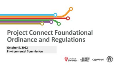
Project Connect Foundational Ordinance and Regulations October 5, 2022 Environmental Commission Project Connect Overview 2 Project Connect: Program Components 33 Integrated Program Delivery 4 Project Connect in Progress MetroRapid Expansion, Red Line Improvements, Pickup Service Expansion • Summer 2021: Three new Circulator Pickup Zones • • • • • December 2021: MetroRapid Expo Center Groundbreaking February 2022: MetroRapid Pleasant Valley Groundbreaking July 2022: Red Line McKalla Station Groundbreaking August 2022: MetroBike Program incorporated into CapMetro Summer 2023: Target for new MetroRapid in Service • All-electric, Zero emission buses, Solar where possible To help protect your privacy, PowerPoint has blocked automatic download of this picture. Recently completed North Operations Electric Bus Yard 5 Light Rail Project Development Process Project Development Engineering Construction Revenue Service Entry into Engineering Grant Agreement Note: Project Development includes Preliminary Engineering 6 Light Rail Project Cost Considerations COST BASIS ASSUMPTIONS Original cost estimates (2019-2020) were based on 5% design and peer transit system comparison data 2022: costs have increased significantly (up to 70%-80%), due to the following drivers: Right-of-way and real estate prices (Austin market) Inflation, labor shortage, and anticipated supply chain barriers Program scope changes as a result of community input and technical requirements (e.g. Tunnel length increase from 1.5 to 4 miles) NEXT STEPS • NEED TO ALIGN PROGRAM SCOPE AND SEQUENCING TO • Community input will be essential to defining project scope, AVAILABLE FUNDING phasing and next steps. Tax increment rate will not be increased to cover ongoing program costs Federal Environmental Review Process The National Environmental Policy Act (NEPA) process requires federal agencies to: • Assess the potential impacts of their actions on the human and natural environment • Avoid, minimize or mitigate adverse effects where reasonably feasible • Where impacts are identified, mitigation strategies are defined, and could include items such as maintaining property access, tree relocation, or noise monitoring during construction • Inform the public that environmental concerns were considered in their decision-making process 8 Cultural Environment Historic and Archeological Park and Recreation Visual and Aesthetic Physical and Natural Environment Air Quality Water Quality Noise and Vibration Trees Human Environment Environmental Justice Neighborhood & Community City of Austin Boards & Commissions – Project Connect Roles • Fulfill regulatory requirements: • Subject specific ordinances & code updates • Commission level variances or other approvals needed for permitting / project delivery • Subject specific briefings to subject-relevant commissions (e.g. NEPA to Environmental Commission) …
ENVIRONMENTAL COMMISSION REGULAR MEETING MINUTES 5, October, 2022 The Environmental Commission convened in a regular meeting on 5, October, 2022 at 6310 Wilhelmina Delco Drive in Austin, Texas. Commissioners in Attendance: Ana Aguirre, Perry Bedford, Jennifer Bristol, Rick Brimer, Melinda Schiera, Kevin Ramberg, and Haris Qureshi. Commissioners in Attendance Remotely: Pam Thompson and Rachel Scott. Commissioners absent: Audrey Barrett Bixler and Colin Nickells. CALL TO ORDER Chair Ramberg called the Environmental Commission Meeting to order at 6:02 P.M. PUBLIC COMMUNICATION: GENERAL None APPROVAL OF MINUTES AND ACTION 1. Approval the minutes of the Environmental Commission Regular Meeting on September 21, 2022 (5 minutes) The minutes of the September 21, 2022 Environmental Commission Regular Meeting were approved with a noted amendment on Vice Chair Bedford’s motion, Chair Ramberg’s second on a 8-0 vote. Commissioners Barrett Bixler and Nickells were absent. Commissioner Bristol was off the dais. DISCUSSION AND ACTION ITEMS 2. Review and approve the 2023 Environmental Commission meeting calendar (10 minutes) The 2023 Environmental Commission meeting calendar was approved on Commissioner Bedford’s motion, Chair Ramberg’s second on a 8-0 vote. Commissioners Barrett Bixler and Nickells were absent. Commissioner Bristol was off the dais. PUBLIC HEARINGS 3. Name: Park 290 Logistic, SP-2021-0095C Applicant: BSREP III Decker Lane Location: 11653 Decker Lane, Austin, TX 78724 Council District: District 1 Staff: Enrique A. Maiz-Torres, Environmental Review Specialist Senior, Development Services Department 1 4. 5. 7. 8. 9. 10. DISCUSSION AND POSSIBLE ACTION ITEMS Watershed: Gilleland Creek/Decker Creek Watershed, Suburban, Desired Development Zone Request: Variance requests are as follows: 1. Request to vary from LDC 25-8-342 to allow fill over 4 feet up to 28 feet. 2. Request to vary from LDC 25-8-341 to allow cut over 4 feet up to 22 feet. Staff Recommendation: Recommended with conditions (30 minutes) A motion to close the public hearing was approved on Chair Ramberg’s motion, Commissioner Bedford’s second on a 9-0 vote. Commissioners Barrett Bixler and Nickles were absent. A motion to recommend the requested variance with conditions was approved on Commissioner Bristol’s motion, Commissioner Ramberg’s second on a 9-0 vote. Commissioners Barrett Bixler and Nickells were absent. Briefing on a proposed ordinance in response to Resolution 20211029-003 which directs staff to review City Code, criteria manuals, and permitting procedures to identify impediments to the design, construction, implementation, and operation of Project Connect—Donna Galati, Project Connect Office (1 hour) A recommendation to support the proposed ordinance …
Regular Meeting of the Environmental Commission September 21, 2022 at 6:00 P.M. Permitting and Development Center, Events Center, Room 1405 6310 Wilhelmina Delco Drive Austin, Texas 78752 Some members of the Environmental Commission will be participating by videoconference. The meeting may be viewed online at: http://www.austintexas.gov/page/watch-atxn-live Public comment will be allowed in-person or remotely by telephone. Speakers may only register to speak on an item once either in-person or remotely and will be allowed up to three minutes to provide their comments. Registration no later than noon the day before the meeting is required for remote participation. To register to speak remotely, call or email Kaela Champlin, Watershed Protection Department, at (512) 974-3443, Kaela.Champlin@austintexas.gov, no later than noon, (the day before the meeting). The following information is required: speaker name, item number(s) they wish to speak on, whether they are for/against/neutral, email address and telephone number (must be the same number that will be used to call into the meeting). CURRENT COMMISSIONERS: Haris Qureshi Rachel Scott Pam Thompson Melinda Schiera Audrey Barrett Bixler Colin Nickells Jennifer Bristol, Secretary Kevin Ramberg, Chair Ana Aguirre Richard Brimer Perry Bedford, Vice-Chair AGENDA CALL TO ORDER PUBLIC COMMUNICATION: GENERAL The first 10 speakers who register to speak no later than noon the day before the meeting will be allowed a three-minute allotment to address their concerns regarding items not posted on the agenda. APPROVAL OF MINUTES AND ACTION 1. Approval the minutes of the Environmental Commission Regular Meeting on September 7, 2022 (5 minutes) 1 DISCUSSION AND ACTION ITEMS 2. Consider an ordinance regarding amendments to Title 25 related to environmental protection, landscape requirements, and site plan requirements. City Staff: Liz Johnston, Deputy Environmental Officer, Watershed Protection Department (1 hour) PUBLIC HEARINGS 3. Name: Manor ISD Elementary School #10 (SP-2022-0095CX) Applicant: Manor ISD Elementary School #10 (Monica Silva) Location: 10400 Wildhorse Ranch Trail, Austin, Texas 78724 Council District: District 1 Staff: Tunde Daramola, Environmental Review Specialist Senior, Development Services Department Watershed: Gilleland Creek Watershed, Suburban, Desired Development Zone Request: Request to vary from LDC 25-8-342 to allow fill over 4 feet up to 33 feet. Staff Recommendation: Recommended with conditions (30 minutes) DISCUSSION ITEMS 4. COMMITTEE REPORTS 5. Briefing and discussion on Trash in Creeks study—Andrew Clamann, Environmental Scientist, Watershed Protection Department (1 hour) Urban Forestry Committee – Richard Brimer (Committee Chair), Pam Thompson, Rachel Scott, and Colin Nickells Report on the Joint Sustainability …
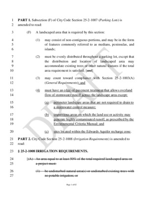
1 2 3 4 5 6 7 8 9 10 11 12 13 14 15 16 17 18 19 20 21 22 24 25 26 27 PART 1. Subsection (F) of City Code Section 25-2-1007 (Parking Lots) is amended to read: (F) A landscaped area that is required by this section: (1) may consist of non-contiguous portions, and may be in the form of features commonly referred to as medians, peninsulas, and islands; (2) must be evenly distributed throughout a parking lot, except that the distribution and landscaped area may location of accommodate existing trees or other natural features if the total area requirement is satisfied; [and] (3) may count toward compliance with Section 25-2-1003(A) (General Requirements); and (4) must have an edge-of-pavement treatment that allows overland flow of stormwater runoff across the landscape area except: (a) (b) perimeter landscape areas that are not required to drain to a stormwater control measure; impervious areas on which the land use or activity may generate highly contaminated runoff, as prescribed by the Environmental Criteria Manual; and (c) sites located within the Edwards Aquifer recharge zone. PART 2. City Code Section 25-2-1008 (Irrigation Requirements) is amended to read: 23 § 25-2-1008 IRRIGATION REQUIREMENTS. [(A) An area equal to at least 50% of the total required landscaped area on a project must: (1) be undisturbed natural area(s) or undisturbed existing trees with no potable irrigation; or Page 1 of 62 28 29 30 31 32 33 34 35 36 37 38 39 40 41 42 43 44 45 46 47 48 49 50 51 (2) be irrigated by stormwater runoff conveyed from impervious surfaces on the site using one or more of the following methods: (a) overland flow; (b) storm drains; (c) downspouts; (d) rainwater harvesting; (e) retention-irrigation; or (f) other methods of conveyance as prescribed by rule. (B) The drainage area used to irrigate under Subsection (A) must be calculated to provide sufficient water for the landscaped area, as prescribed by rule. (C) Unless the landscaped area under Subsection (A) is being designed as a water quality control under Section 25-8-211, the drainage area used to irrigate the landscaped area: (1) may not include impervious areas on which the land use or activities may generate highly contaminated runoff, as prescribed by rule; and (2) may not include impervious areas used for parking or driving of vehicles if located within the Edwards Aquifer Recharge …
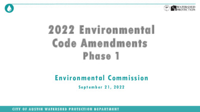
2022 Environmental Code Amendments Phase 1 Environmental Commission S e p t e m b e r 2 1 , 2 0 2 2 C I T Y O F A U S T I N W A T E R S H E D P R O T E C T I O N D E P A R T M E N T Objective • Respond to por tion of Resolution 20220609- 061 that requires staff to bring for th an ordinance amending Title 25 related to environmental protection. • Due September 15, 2022 • Key subject areas Stormwater Landscape • • • Water Resource Protection Colorado River Protections • Previously identified minor code amendments and other amendments that meet the • objectives of the resolution • Don’t Disincentivize Missing Middle C I T Y O F A U S T I N W A T E R S H E D P R O T E C T I O N D E P A R T M E N T 2 Progress So Far • I n t e r n a l W a t e r s h e d P r o t e c t i o n D e p t ( W P D ) t e c h n i c a l s t a f f • I n p u t f r o m o t h e r d e p a r t m e n t s i n c l u d i n g • Development Services Department • Austin Water • Austin Transportation • CoA Project Connect Office • Housing and Planning • Law • E n v i r o n m e n t a l C o m m i s s i o n W o r k g r o u p 7 / 2 5 / 2 0 2 2 • E n v i r o n m e n t a l C o m m i s s i o n U p d a t e 8 / 3 / 2 0 2 2 • C o d e s a n d O r d i n a n c e s J o i n t C o m m i t t e e 8 / …
9/9/22 C20-2022-005a ORDINANCE AMENDMENT REVIEW SHEET Amendment: C20-2022-005a, Land Development Code Amendments Description: Consider an ordinance regarding amendments to Title 25 related to environmental protection and landscape requirements. Proposed Language: Draft language is included as Attachment A. Summary of proposed code changes: A summary of the proposed code changes is included as Attachment B. Background: This ordinance responds to Council Resolution No. 20220609-061, which initiated Land Development Code amendments related to environmental, drainage, and landscape requirements. The resolution directed staff to present most of the initiated amendments to Council for consideration by September 15, 2022. The initiated code amendments and a summary of the staff proposal is provided below: 1. Establish criteria that prioritize when green stormwater methods should be required or incentivized over conventional stormwater controls; The proposed code amendments would require most sites to use green stormwater infrastructure, or GSI, to meet water quality treatment requirements. This amendment was previously proposed and reviewed as part of the Land Development Code (LDC) Revision. Under current code, many sites meet water quality treatment requirements by building a sedimentation/filtration pond. Sedimentation/filtration devices provide some water quality benefits by filtering polluted runoff and helping control stream-channel erosion, but they do not significantly address other important ancillary goals such as supporting on-site vegetation, increasing rainwater infiltration, and reducing potable water consumption. Requiring most sites to use GSI instead of conventional grey stormwater infrastructure will provide myriad benefits, including stormwater infiltration, soil health, wildlife habitat, urban heat island mitigation, water conservation, aesthetic value, and other ecosystem services.1 GSI also provides enhanced water quality benefits compared to sedimentation/filtration devices, including better removal of nutrients from stormwater and further reductions in erosive flows.2 The proposed code amendments would allow developments to choose from a variety of green stormwater controls, including biofiltration ponds, rain gardens, rainwater harvesting systems, porous pavement, and retention-irrigation systems (which can be built in conjunction with green roofs). All of these systems beneficially use rainwater to infiltrate and/or offset potable 1 Christman et al. 2022. Stormwater Control Measure Audit. City of Austin, Unpublished. 2 Richter, A. 2018. Structural Stormwater Control Measure Performance Update 2018. City of Austin, SR-18-08. 1 9/9/22 C20-2022-005a water. Staff also proposes to increase the beneficial use benefits of these controls over time through improvements to the design criteria in the Environmental Criteria Manual. The proposed code amendments provide some exceptions from the GSI requirement, allowing conventional controls to be …
RESOLUTION NO. 20220609-061 WHEREAS, protecting our environment is the foundation for sustaining our planet, community, and economy; and WHEREAS, the City ofAustin's "State of Our Environment: 2020 Annual Report," showed that creeks in the Desired Development Zone scored on average 10 points lower than those in the Drinking Water Protection Zone; and WHEREAS, the Drinking Water Protection Zone designation located on the west side of Austin has restricted development through regulations creating positive environmental outcomes, while the Desired Development Zone, located in Central and East Austin, has more permissive regulations that have resulted in some negative outcomes; and WHEREAS, properties located in the Desired Development Zone have more permissive development regulations with regard to the size of creek buffers, impervious cover limits, cut and fill, and construction on slopes; and WHEREAS, extensive empirical literature links exposure to nature with better health, and creeks provide city-wide opportunities to experience nature; and WHEREAS, current code allows for structures such as in-channel detention basins and concrete wastewater manholes to be placed in creeks, which can cause erosion and other severe, often long-lasting consequences that can be expensive to reverse; and WHEREAS, the City is faced with the existing and growing threat of industrial discharges that can negatively impact creeks and communities located primarily on the east side of the City of Austin; and Page 1 of 10 WHEREAS, there has been a steady increase in the amount of land area in Austin covered by impervious surfaces and a corresponding steady decrease in the amount of pervious land area capable of absorbing rainfall; and WHEREAS, one result of the historically high rates of development is a rise in the amount of runoff that flows off-site from developed properties and into older, undersized stormwater drain systems, creeks, rivers, and lakes, contributing to increases in flooding severity, damage to private property, loss of life, and water pollution; and WHEREAS, currently City Code allows redeveloped sites to use existing impervious cover as a baseline for drainage calculations, resulting in increased runoff and contributing to flooding and erosive flows downstream; and WHEREAS, increasing density reduces sprawl and thereby reduces traffic congestion, pollution, and development of open spaces and agricultural; and WHEREAS, a U.S. Geological Survey study found that using green stormwater infrastructure for water quality provided enhanced mitigation of peak flows and run-off volumes compared to large, detention-based stormwater control practices; and WHEREAS, the Watershed Protection Department "Master …
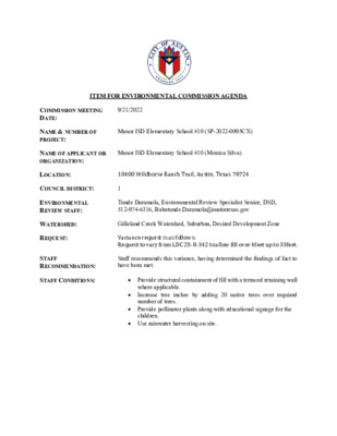
ITEM FOR ENVIRONMENTAL COMMISSION AGENDA COMMISSION MEETING DATE: 9/21/2022 NAME & NUMBER OF PROJECT: NAME OF APPLICANT OR ORGANIZATION: COUNCIL DISTRICT: 1 Manor ISD Elementary School #10 (SP-2022-0095CX) Manor ISD Elementary School #10 (Monica Silva) LOCATION: 10400 Wildhorse Ranch Trail, Austin, Texas 78724 ENVIRONMENTAL REVIEW STAFF: Tunde Daramola, Environmental Review Specialist Senior, DSD, 512-974-6316, Babatunde.Daramola@austintexas.gov WATERSHED: REQUEST: STAFF RECOMMENDATION: STAFF CONDITIONS: Gilleland Creek Watershed, Suburban, Desired Development Zone Variance request is as follows: Request to vary from LDC 25-8-342 to allow fill over 4feet up to 33feet. Staff recommends this variance, having determined the findings of fact to have been met. Provide structural containment of fill with a terraced retaining wall where applicable. Increase tree inches by adding 20 native trees over required number of trees. Provide pollinator plants along with educational signage for the children. Use rainwater harvesting on site. Development Services Department Staff Recommendations Concerning Required Findings Project Name: Ordinance Standard: Watershed Protection Ordinance Variance Request: Manor ISD Elementary School #10 To allow for fill exceeding 4 feet up to 33 feet for building construction Include an explanation with each applicable finding of fact. A. Land Use Commission variance determinations from Chapter 25-8-41 of the City Code: 1. The requirement will deprive the applicant of a privilege available to owners of similarly situated property with approximately contemporaneous development subject to similar code requirements. Yes. The variance will not be providing a special privilege to the applicant. The property slopes steeply down from Wildhorse Ranch Trail ROW at the west to the southeastern corner of the site over a 52-foot fall. The proposed buildings are constrained in design flexibility due to the requirements of the Texas Education Agency, City of Austin, and ADA. The size of the school is determined by what TEA allows based on student per square foot requirements which is not a design choice. In order to facilitate this type of development, substantial fill is required, and the layout has to follow the TEA, COA and ADA guidelines which has constricted design flexibility. Similarly situated property do not have to meet the aforementioned requirements the way a public elementary school is required. 2. The variance: a) Is not necessitated by the scale, layout, construction method, or other design decision made by the applicant, unless the design decision provides greater overall environmental protection than is achievable without the variance; Yes. The school must …
MANOR ISD ELEMENTARY SCHOOL #10 10400 WILDHORSE RANCH TRL SP-2022-0095CX Tunde Daramola Environmental Review Specialist Senior Development Services Department 1 Synopsis and Site requirements OUTLINE Property Data Existing Conditions Variance Request Grading Exhibit Variance Exhibits Variance Recommendation and Conditions 2 PROPERTY DATA Gilleland Creek Watershed Suburban Watershed Classification Desired Development Zone Not located over the Edwards aquifer recharge zone 3 SYNOPSIS 11.05-acre site within the Wildhorse Planned Unit Development, proposing the construction of a public elementary school with driveways, water wastewater and drainage improvements. Elevation ranges from 605’ in the west to 556’ in the southeast corner. The natural sloping nature has necessitated the amount of fill for this project. Limited design flexibility since project is subject to TEA, COA and ADA requirements 4 5 EXISTING CONDITIONS Ground vegetation is typical grasses, prairie, 6 VARIANCE REQUEST To allow fill in excess of 4 feet and up to 33 feet within the Desired Development Zone. (LDC 25-8-342) 7 Grading Exhibit Necessitated because of the sloping nature of the site, previous use as spoils area for subdivision development and other requirements (TEA, COA and ADA requirements) 8 VARIANCE RECOMMENDATION & CONDITIONS Staff recommends the variance, having determined that the required findings of fact have been met. Staff also recommends and supports the following conditions in accordance to approved variance exhibits: • Provide structural containment of fill with a terraced retaining wall where • applicable. Increase tree inches on site by adding 20 native trees over the required number of trees. • Provide pollinator plants along with educational signage for the kids. • Use rainwater harvesting on site. 9 V A R I A N C E E X H I B I T S 10 11 THANK YOU REFERENCES GOOGLE EARTH VARIANCE PACKET GIS PROPERTY PROFILE 13
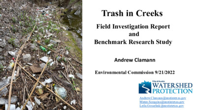
Trash in Creeks Field Investigation Report and Benchmark Research Study Andrew Clamann Environmental Commission 9/21/2022 Andrew.Clamann@austintexas.gov Mateo.Scoggins@austintexas.gov Leila.Gosselink@austintexas.gov Resolution No. 20200123-108 (CIUR 2234) field study benchmark report upstream concentration source downstream concentration Typical pollutant assessment: downstream – upstream = source contribution This assessment does not work for trash Variability in storm intensity Variability in stream character Data Collection • 20 Creeks • 110 miles • Observations every 30ft • 19,467 data points Scooters only 21 found Small number of occurrence due to: o reduced permitted fleets (since 2020) o improved process for reporting (311) o efficient process for removal (vendor) Trash intensity score + source presence • Overflowing dumpster • Outfall/tributary • Encampment • Dumping historic site • Dumping point source • Dumping unknown • Property management Sources by occurrence Takeaway # 1 Encampment was the most commonly-observed source, but is similar in intensity and range to most other sources Result: A georeferenced map of intensity* and sources example: upper shoal creek *can be used by internal or external partners for strategic cleaning https://arcg.is/0z48bj0 Takeaway # 2 Trash intensity is not proportional to its drainage area (source input locations are deceiving) Geospatial analysis using 300’ and 3000’ buffers Population Transportation Land Use Takeaway # 3 There were no statistically significant correlations between trash intensity and: landuse, census, transportation, • • • • parks, etc. Takeaway # 4 Virtually anything can be found in creeks, but single use plastics were the most common item clothing, tents, bedding recreation items, toys erosion matting, silt fences packaging, shipping office, household lawn tools, mulch bags, garden hoses, appliances medical, electronics, textiles, hardware traffic cones, barriers, safety construction materials, asphalt, lumber Telecommunication cables, displaced infrastructure 500+ shopping carts Takeaway # 5 76% of the trash is found in 10% of the area (opportunity for strategic site selection for cleanups by COA, partners, contractors, volunteers) Field report provides diverse assemblage of recommendations at different scales • • • • • • • site-specific cleanups, improved rules for dumpsters, structural controls, enforcement, education/outreach, coordination with partners, etc Benchmarking Research Report • EXTRACTION (physically removing trash from waterways) ex: structural controls, machines, manual labor • INTERCEPTION (keeping trash from entering waterways) ex: education, enforcement, landscape cleanups, structural controls • SOURCE REDUCTION (stemming the flow into our community) ex: limit single use plastics Extraction • creek and lake cleanups* • requirement/enforcement of vendors/individuals to clean up • targeted cleanups …
Zoning and Platting Commission Resolution Whereas, the Austin City Council passed Resolution 20220609-061 “relating to environmental protections and water quality”; and Whereas, the City Council directed the City Manager “to address the equitable protection of the environment throughout the City of Austin as part of the Watershed Protection Strategic Plan’; and Whereas, the proposed regulations include green stormwater infrastructure and functional green to lessen the heat island effect and provide other benefits; and Whereas, the proposed regulations lessen environmental reviews for some projects including water quality controls, critical environmental features, construction on slopes and watershed impervious cover limits; and Whereas, the City of Austin Zoning and Platting Commission welcomes improved environmental protections and water quality throughout the entire City. Now, therefore, be it resolved that the Zoning and Platting Commission encourages the Austin City Council to approve C20-2022-005a, Land Development Code Amendments with the following changes: • Implementation of Functional Green requirements will be deferred until such time as the Emergency Rules for the Environmental Criteria Manual is adopted to reflect the appropriate Criteria; • Allow boat dock access to remain within 50’ of the Lake as it relates to items 25-8-25 (B)(2), 25-8-27 (D)(2) • Under Section 25-8-64(E) for lots that cannot meet this criteria a mechanism to allow smaller units will be developed • Remove 25-8-213(A)(1) proposed changes • Clarify that the impervious cover limit in § 25-5-3 (B)(13)(b) is the impervious cover allowed by the zoning not to exceed 55%, Be it further resolved as Part of Phase 2 of Council initiated code updates that the following directions from the Council resolution be completed as soon as possible: • Require the environmental staff to work with Austin’s Equity Office to address inequities created by different rules for the Desired Development Zone and Critical Water Quality Zones such as Barton Springs; • Once the Affordability impact is determined any negative aspects will be counter balanced with incentives to ensure that there is no negative financial impact of these new requirements; • Recommend that all subdivisions and site plans in Urban Watersheds meet steep slope protections; and • Recommend new and redeveloped projects to use greenfield conditions as a baseline when calculating drainage requirements
Play video
ENVIRONMENTAL COMMISSION MOTION 20220921-002 Date: September 21, 2022 Subject: Ordinance Amendment to Title 25 related to environmental protection, landscape requirements, and site plan requirements Motion by: Jennifer L. Bristol WHEREAS, the Environmental Commission has considered the ordinance amendments to Title 25 related to environmental protection and landscape requirements, and WHEREAS, the Environmental Commission recognizes this ordinance responds to Council Resolution No. 20220609-061, which initiated Land Development Code amendments related to environmental, drainage, and landscape requirements. The resolution directed staff to present most of the initiated amendments to Council for consideration. Seconded by: Kevin Ramberg THEREFORE, the Environmental Commission recommends the amendments to Title 25 with the following Environmental Commission recommendations. 1. Require small-scale missing middle projects to send out zoning and building notifications to adjacent neighbors within 500 ft. Notices should be, at a minimum in English and Spanish. 2. Require landscaping and functional green infrastructure to have a long-term maintenance plan to ensure plant survival, reduce heat island effects, and increase tree canopy. 3. Bring affected neighborhood drainage up to code to improve capacity and reduce environmental impact 4. Remove “grandfathered” development projects before May 18, 1986, so everyone receives equitable 5. Consider slopes in urban and suburban watersheds as the same. 6. Consider the environmental and economic impact on adjacent landowners of small-scale missing middle due to leakage. review and protections. projects. 7. Review SF-3 and above for equitable application of the proposed code changes. 8. Review watersheds across the city to create similar or equitable water quality standards similar to the Barton Creek Watersheds to improve the downstream impact to the Colorado River. 9. Include increased traffic and its environmental impact in neighborhoods where small-scale missing middle projects will occur. 10. Require all new code or improved code to comply with Atlas-14 standards. 11. Require public notification and review of in-channel flood variances. 12. Incentivize electric car charging stations in small-scale missing middle projects and commercial development. 1 13. Incentivize use of solar capturing technology in small-scale missing middle projects and single-family homes. 14. Encourage public input to all code changes. a. Environmental Commission wishes to voice their concern that the public was not included in this code rewrite. maintenance. 15. Encourage water catchment systems in commercial development for landscaping and functional green 16. Reinstate that the public is notified of Section 25-8-25(b)(4) changes regarding neighborhood plans adopted by Council. 17. Require the environmental staff to work …
ENVIRONMENTAL COMMISSION MOTION 20220921-003 Seconded by: Kevin Ramberg Date: September 21, 2022 Subject: Manor ISD Elementary School #10 (SP-2022-0095CX) Motion by: Jennifer Bristol RATIONALE: WHEREAS, the Environmental Commission recognizes the applicant is requesting to vary from LDC 25-8- 342 to allow fill over 4 feet up to 33 feet, and WHEREAS, the Environmental Commission recognizes the site is located in the Gilleland Creek Watershed, Suburban, Desired Development Zone; and WHEREAS, the Environmental Commission recognizes that Staff recommends this variance, with conditions having determined the required Findings of Fact have been met. THEREFORE, the Environmental Commission recommends the variance request with the following: Staff Conditions: • Provide structural containment of fill with a terraced retaining wall where applicable • Increase tree inches by adding 20 native trees over the required number of trees • Provide pollinator plants along with educational signage for the children • Use rainwater harvesting on-site and the following Environmental Commission Conditions: • • • • • • Consider including solar technology Consider using A/C Condensation catchment system Consider including at least one charging station for staff or visitors Encourage a long-term tree care plan for the new and existing trees Consider natural classroom and natural play areas Consider composting and gardening educational areas. 1 VOTE 11-0 For: Aguirre, Barrett Bixler, Bedford, Bristol, Brimer, Nickells, Ramberg, Schiera, Scott, Thompson, and Qureshi Against: None Abstain: None Recuse: None Absent: None Approved By: Kevin Ramberg, Environmental Commission Chair 2
Regular Meeting of the Environmental Commission September 7, 2022 at 6:00 P.M. Permitting and Development Center, Events Center, Room 1405 6310 Wilhelmina Delco Drive Austin, Texas 78752 Some members of the Environmental Commission will be participating by videoconference. The meeting may be viewed online at: http://www.austintexas.gov/page/watch-atxn-live Public comment will be allowed in-person or remotely by telephone. Speakers may only register to speak on an item once either in-person or remotely and will be allowed up to three minutes to provide their comments. Registration no later than noon the day before the meeting is required for remote participation. To register to speak remotely, call or email Kaela Champlin, Watershed Protection Department, at (512) 974-3443, Kaela.Champlin@austintexas.gov, no later than noon, (the day before the meeting). The following information is required: speaker name, item number(s) they wish to speak on, whether they are for/against/neutral, email address and telephone number (must be the same number that will be used to call into the meeting). CURRENT COMMISSIONERS: Haris Qureshi Rachel Scott Pam Thompson Melinda Schiera Audrey Barrett Bixler Colin Nickells Jennifer Bristol, Secretary Kevin Ramberg, Chair Ana Aguirre Richard Brimer Perry Bedford, Vice-Chair AGENDA CALL TO ORDER PUBLIC COMMUNICATION: GENERAL The first 10 speakers who register to speak no later than noon the day before the meeting will be allowed a three-minute allotment to address their concerns regarding items not posted on the agenda. APPROVAL OF MINUTES AND ACTION 1. Approval the minutes of the Environmental Commission Regular Meeting on August 17, 2022, and the Environmental Commission Special Called Meeting on August 31, 2022 (5 minutes) 1 PUBLIC HEARINGS 2. Name: Shoal Cycle, SP-2021-0350C Applicant: CJI Properties Inc. Location: 812 West 11th Street, Austin, Texas, 78701 Council District: District 9 Staff: Naomi Rotramel, City Arborist Ordinance: Heritage Tree Ordinance (LDC 25-8-641) Request: The applicant is seeking the removal of a Heritage tree with a single stem over 30 inches in diameter Staff Recommendation: The request meets City Arborist approval criteria set forth in LDC 25- 8-624(A)(2). Thus, the variance is recommended. (30 minutes) Name: BKO Parmer, SP-2021-0034D Applicant: Steve Jamison Location: 4801 East Yager, Austin, Texas 78754 Council District: None (Extraterritorial Jurisdiction) Staff: Tunde Daramola, Development Services Department Watershed: Harris Branch Watershed, Suburban, Desired Development Zone Request: Request to vary from LDC 25-8-342 to allow fill over 4 feet up to 12 feet Staff Recommendation: Recommended with conditions (30 minutes) DISCUSSION AND ACTION ITEMS 4. …
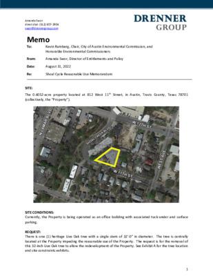
Amanda Swor direct dial: (512) 807-2904 swor@drennergroup.com Memo To: Re: SITE: Kevin Ramberg, Chair, City of Austin Environmental Commission, and Honorable Environmental Commissioners From: Amanda Swor, Director of Entitlements and Policy Date: August 31, 2022 Shoal Cycle Reasonable Use Memorandum The 0.4052-acre property located at 812 West 11th Street, in Austin, Travis County, Texas 78701 (collectively, the “Property”). SITE CONDITIONS: Currently, the Property is being operated as an office building with associated tuck-under and surface parking. REQUEST: There is one (1) heritage Live Oak tree with a single stem of 32’-0” in diameter. The tree is centrally located at the Property impeding the reasonable use of the Property. The request is for the removal of this 32-inch Live Oak tree to allow the redevelopment of the Property. See Exhibit A for the tree location and site constraints exhibits. 1 Amanda Swor direct dial: (512) 807-2904 swor@drennergroup.com The fair to poor condition of the 32” Live Oak tree (as determined by the consulting arborists and City of Austin Arborist), in addition to the central location of the 32’’ Live Oak tree combined with: (1) the diminished physical condition of the tree 2) the central location of the tree 3) size of the site; (2) geometry of the site; (3) setback constraints; (4) the unsuccessful and diligent attempt to relocate the due to the tree’s condition, lack of relocation destination, and utility issues; (5) EDI’s assessment stating the tree is a poor transplant candidate and (6) the advanced tree assessment prepared by Bartlett Tree Experts, we respectfully request the removal of the 32-inch Live Oak tree. EXHIBIT A: Site Constraints Exhibits 2 Amanda Swor direct dial: (512) 807-2904 swor@drennergroup.com CONSTRAINTS: The Property consists of approximately 0.4052 acres, or approximately 17,650.5 SF, is zoned DMU-CO (Downtown Mixed Use – Conditional Overlay) and is located in the Northwest Subdistrict of the Downtown Austin Plan. The Property is located in a portion of Downtown Austin that is ineligible for participation in the Downtown Density Bonus Program. The conditional overlay on the Property restricts the maximum height to 90 feet and requires administrative and business office land uses to be conditional above the ground floor of the Property to ensure a residential use is provided on the Property. Although unable to participate in the Downtown Density Bonus Program, upon the rezoning of the Property to DMU-CO per ordinance 20210826-091, a restrictive covenant was entered into between …