Item 3 Draft Recommendation for Subdistrict FAR — original pdf
Backup

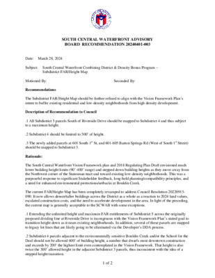
SOUTH CENTRAL WATERFRONT ADVISORY BOARD RECOMMENDATION 20240401-003 Subject: South Central Waterfront Combining District & Density Bonus Program – Subdistrict FAR/Height Map Seconded By: Date: March 28, 2024 Motioned By: Recommendations The Subdistrict FAR/Height Map should be further refined to align with the Vision Framework Plan’s intent to buffer existing residential and low-density neighborhoods from high density development. Description of Recommendation to Council .1 All Subdistrict 5 parcels South of Riverside Drive should be mapped to Subdistrict 4 and thus subject to a maximum height. .2 Subdistrict 4 should be limited to 500’ of height. .3 The newly added parcels at 601 South 1st St, and 601-605 Barton Springs Rd (West of South 1st Street) should be mapped to Subdistrict 3. Rationale: The South Central Waterfront Vision Framework plan and 2018 Regulating Plan Draft envisioned much lower building height limits (90’-400’ range) and stepped down building heights as they move away from the Northwest corner of the Statesman tract and toward existing low-density neighborhoods. This was a purposeful response to significant Stakeholder feedback, long-held planning/compatibility principles, and a need for enhanced environmental protections/setbacks at Bouldin Creek. The current FAR/Height Map has been completely revamped to address Council Resolution 20220915- 090. It now allows denser/taller buildings across the District as a whole as a reaction to 2024 land values, escalated construction costs, and the need to accelerate development in the area. In light of the preceding, the current map is generally acceptable to the SCWAB with some exceptions. .1 Extending the unlimited height and maximum FAR entitlements of Subdistrict 5 across the originally proposed dividing line at Riverside Drive is incongruous with the Vision Framework Plan’s stated goal to transition height down as it nears existing neighborhoods. In addition, several of these parcels are mapped to legacy lot lines that are likely going to be eliminated via the Developer’s DDA process. .2 Subdistrict 4 parcels adjacent to the environmentally sensitive Bouldin Creek and/or the School for the Deaf should not be allowed 600’ of building height, a number that dwarfs most downtown construction and exceeds by 200’ the highest limit even contemplated in the Vision Framework. That height is also twice the 300’ allowed height in the adjacent Subdistrict 3 parcels, thus inconsistent with the idea of a stepped height transition. 1 of 2 .3 The newly included parcels West of South 1st Street are in close proximity to one and two-story SF- zoned properties on Post Oak Street and S. 3rd Street that have historically been protected by Compatibility Limits. In other parts of the map, similar parcels have been listed as Subdistrict 3, which has reduced height and density limits to better serve as a buffer zone to the neighborhood. Vote For: Against: Abstain: Absent: Attest: [Staff or board member can sign] 2 of 2