Item 2.a._2: Staff Presentation_2020 Implementation — original pdf
Backup
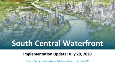
South Central Waterfront Implementation Update: July 20, 2020 South Central Waterfront Advisory Board| Austin, TX SCW DISTRICT TODAY ● 97 acres in properties (118 acres w/ ROW included) ● Patchwork of 34 private properties, and 1 City-owned property (OTC) ● Lack of connectivity - Could drop 33 downtown blocks in district of superblocks and surface parking ● Pedestrian-hostile - Limited walking grid, narrow sidewalks, few street trees, fewer streetscape amenities ● Scarcity of Greenery - ~20% of district is surface parking. Sparse tree canopy. Lack of open space. ● No Affordable Housing guaranteed. WHAT IS THE SCW VISION? Public/Private Partnership model to transform the district by: ● GREEN: Retrofitting 17 new acres of connected parks, trails, plazas and open spaces across a patchwork of properties ● CONNECTED: Insert .6 miles of new streets, add over 2 miles of refurbished and new sidewalks, and include transit options, to create a walkable and transit- friendly district ● AFFORDABLE: Incentive and support affordable housing to ultimately equal 20% of the district’s new residential units FRAMEWORK > Three Legged Stool $ Physical Framework Financial Framework City Leadership Green Streets, Pedestrian Connections & Open Space for a great public realm District-wide Value Capture, Strategic Capital Investments and Bonus Entitlements to fund public realm and affordable housing. Public-Private Partnerships and Leverage City Assets in order to achieve community goals PHYSICAL FRAMEWORK 1. 2020 (MODIFIED) PHYSICAL FRAMEWORK 2. 2020 TRANSPORTATION & OPEN SPACE PLAN 3. 2020 PHYSICAL FRAMEWORK PROJECT COST A PHYSICAL FRAMEWORK FOR RATIONAL DEVELOPMENT 1. Expanded Waterfront Open Space 1. Expanded Waterfront Open Space 1. Expanded Waterfront Open Space 1. Expanded Waterfront Open Space 1. Expanded Waterfront Open Space 2. Catalyst Open Space, Trails & Green Streets 2. Catalyst Open Space, Trails & Green Streets 2. Catalyst Open Space, Trails & Green Streets 2. Catalyst Open Space, Trails & Green Streets 3. Developer added Green Streets 3. Developer added Green Streets 3. Developer added Green Streets 4. Existing Roadway Improvements 4. Existing Roadway Improvements 5. Public Realm Framework for development Existing Waterfront Existing Waterfront Open Space Open Space New Waterfront Open Space STATESMAN & CROCKETT PROPERTIES - First among equals 35 properties = 97 acres These 2 properties = 30 acres (30% of the District’s properties area) In the SCW Vision, these two properties contribute: 65% of District’s Open Space 70% of District’s New Streets 62% of Projected District Buildout 2020 Modified SCW PLAN UPDATE WATERFRONT PARK INTERNAL STREETS BARTON SPRINGS EXTENSION CROCKETT SQUARE E Riverside 2016 SCW Plan ● Block Structure reflects idealized district vision ● Barton Springs Alignment: ○ ○ ○ ○ Requires City Leadership to facilitate cooperation between two major property owners - Cox & Crockett Requires City Initiative and Public Funding to complete the construction Park & Pedestrian Plazas - 9.6 acres; flexible layout Crockett Square - 1 acre plaza; flexible layout + Green Connector ● Open Space Requirements: ● Block Structure follows the flexible guidelines laid out in the 2016 Plan and reflects on- 2020 Modified SCW Plan the-ground realities ● Barton Springs Alignment: follows property boundary between Cox & Crockett Barton Springs on Cox property consistent w/ 2019 PUD proposal ■ This shift requires Cox to dedicate ~1.6 acres to Barton Springs Rd. that would otherwise have been on Crockett ● Open Space Requirements: Key Open Spaces change slightly to accommodate the altered grid structure Cox Property requirement ~ 9 acres Park & Pedestrian Plazas Crockett Property - 1.3 acre plaza; flexible layout + Green Connector ○ ○ ○ ○ ○ 2020 UPDATED PHYSICAL FRAMEWORK Updated Illustrative Plan and Master Map Updated Transportation Network Updated Open Spaces Updated Utilities Updated Street Classification Waterfront Park Water & Wastewater Updated Streetscape Improvements Green Connector Reclaimed Water Updated Street Sections Crockett Square Electricity Updated Transit Map Bouldin Creek Trail Telecommunications Nightwing Plaza Gas 2020 UPDATED PROJECT COSTS 2016 ILLUSTRATIVE PLAN (replace w/ 2020 illustrative plan) UPDATE UNDERWAY TO REFLECT SHIFTED GRID 2020 TRANSPORTATION NETWORK 2020 STREET CLASSIFICATION & OPEN SPACES PHYSICAL FRAMEWORK COSTS > Roadway & Drainage 30% $75,796,628 PHYSICAL FRAMEWORK COSTS > Streetscape + Green Infrastructure 20% $51,213,632 BAGBY STREET Houston, TX Design Workshop/ Asakura Robinson / Walter P Moore 2.85 miles of green streetscape (43% on new streets, 57% on upgrades to existing streets) 2020 OPEN SPACES > Waterfront Park & Plazas ~9 ACRES $52,745,725 2020 OPEN SPACES > Crockett Square 1.3 ACRES $17,268,720 2020 OPEN SPACES > Green Connector 0.6 ACRES $2,314,444 2020 OPEN SPACES > Bouldin Creek Trail 5.2 ACRES $8,931,331 2020 OPEN SPACES > Nightwing Plaza 0.3 ACRES $3,990,000 PHYSICAL FRAMEWORK COSTS > Utilities ✔Water ✔Wastewater ✔Reclaimed Water ✔Electric ✔Telecommunication ✔Gas 14% $34,682,329 MAKING DOLLARS AND SENSE OF THE PHYSICAL FRAMEWORK OPEN SPACE 34%, $85,250,220 RECLAIMED WATER 1%, $2,210,819 UTILITIES 13%, $32,471,510 $251,928,285 ROADWAY AND DRAINAGE 30%, $75,796,628 STREETSCAPE 20%, $51,213,632 GREEN INFRASTRUCTURE 2%, $4,985,476 2020 HYBRID 1. BUILDOUT FOR FINANCIAL ANALYSIS 2. GETTING TO 20% AFFORDABLE HOUSING A PHYSICAL FRAMEWORK TO SUPPORT DEVELOPMENT 8.7 Million SF 6.4 Million new development under SCW Plan 2.3 Million existing remaining 2018 Existing 2040 Projected Mixed-Use development w/ 20% AFFORDABLE HOUSING VISION 20% AFFORDABLE GOAL = 568 UNITS* 2,840 UNITS MARKET RATE = 2,272 UNITS* HOTEL 220,000 SF RETAIL 339,300 SF RESIDENTIAL 3,025,848 SF OFFICE 2,856,500 SF l t n e m p o e v e D w e N F S 8 4 6 , 1 4 4 , 6 *Unit Numbers based on Sample Scenario 1 ACHIEVING THE SCW 20% AFFORDABLE HOUSING VISION Partnerships with the Private Sector (subsidizing affordable housing in district through public funds) for *on-site affordable housing w/ development * Other scenarios modeled and possible, pending Council direction: - crediting development w/ off-site affordable housing for bigger bang for buck Leverage City Property at One Texas Center for affordable housing ONE TEXAS CENTER > Leveraging City Owned Property 142 units 60’ tower Other scenarios also studied OTC parking lot ~ 1 acre Program*: ● 60’ Tower w/ structured parking ● 100% affordable ● 142 ownership units * 9 program scenarios modeled and possible, pending Council direction: - - - rental vs ownership units low-rise, mid-rise, high-rise 100% affordable vs mixed-use Program shown based on Sample Scenario 1 FINANCIAL FRAMEWORK 1. THE FINANCIAL TOOLKIT 2. THE INTERACTIVE FINANCIAL CALCULATOR 3. TWO SAMPLE SCENARIOS TO IDENTIFY THE GAP 4. DECISIONS BEFORE THE COUNCIL A FINANCIAL TOOLKIT TO FUND THE VISION OPERATIONS & MAINTENANCE TRANSPORTATION & INFRASTRUCTURE OPEN SPACES (Parks, Trails, Plazas) AFFORDABLE HOUSING Bonus Development Requirement ✔ ✔ PRIVATELY FUNDED Baseline Development Requirement Public Improvement District Philanthropy (Conservancy) PUBLICLY FUNDED Tax Increment Finance (TIF) Capital Improvement Projects (CIP) Public Utilities Affordable Housing (AHTF, tax credits) ✔ ✔ ✔ ✔ ✔ ✔ ✔ ✔ ✔ ✔ ✔ FUNDING THE VISION > Balancing Costs with Revenue PROJECT COSTS PRIVATE & PUBLIC REVENUE STREAMS SCW Infrastructure & Public Realm $252 Million known quantity 20% Affordable Housing Gap Gap Varies, depending on policy choices Private: Developer Contribution: Baseline and Bonus Fees Baseline Fees: street impact fees water & wastewater impact fees parkland dedication fees Bonus Fees: $/SF fee for all development Private: Philanthropy Unknown: Potential Role for Conservancy or Development Corporation Public Funds - CIP Funds - Utilities - Affordable Housing funding tools & - TIF funds Financial model shows all public sources will be needed, including TIF, to close the gap INTERACTIVE FINANCIAL CALCULATOR > Exploring Options & Impacts 10 variables to test financial feasibility and gap funding requirements to inform policy choices INTERACTIVE FINANCIAL CALCULATOR > Sample Scenario 1 20% Affordable Housing Target Provided 100% Within District Affordability Requirement Affordable Housing Unit Shortfall One Texas Center Scenarios Market Assumptions Buildout Scenario District-wide at 20% Fulfilled Within District 2019 Interviews Based on 2016 Plan Site-by-site Fulfilled Outside District Robust Market 60’ Building: Rental vs Ownership 85’ Building: Rental vs Ownership 170’ Building: Rental vs Ownership Historical CAP Rates Based on Statesman PUD Based on Statesman PUD layout with 2016 heights District Fee Subsidy for Affordable Housing $ ___ / SF Per Unit Subsidy No Fee No Subsidy SAMPLE SCENARIO 1 > Estimated Gap 20% Affordable Housing Target provided 100% within the District Offsite Benefits: Infrastructure and Affordable Housing Onsite Benefits: Infrastructure, Affordable Housing, & Feasibility TOTAL GAP TOTAL AFFORDABLE UNITS IN DISTRICT $122 Million $432 Million $554 Million 568 Units INTERACTIVE FINANCIAL CALCULATOR > Sample Scenario 2 Some of 20% Affordable Housing Target Provided Outside District Affordability Requirement Affordable Housing Unit Shortfall One Texas Center Scenarios Market Assumptions Buildout Scenario District-wide at 10% Fulfilled Within District 2019 Interviews Based on 2016 Plan Site-by-site Fulfilled Outside District Robust Market 60’ Building: Rental vs Ownership 85’ Building: Rental vs Ownership 170’ Building: Rental vs Ownership Historical CAP Rates Based on Statesman PUD Based on Statesman PUD layout with 2016 heights District Fee Subsidy for Affordable Housing $ ___ / SF Per Unit Subsidy No Fee No Subsidy SAMPLE SCENARIO 2 > Estimated Gap Some of 20% Affordable Housing Target Provided Outside District Offsite Benefits: Infrastructure and Affordable Housing Onsite Benefits: Infrastructure, Affordable Housing, & Feasibility TOTAL GAP TOTAL AFFORDABLE UNITS IN DISTRICT TOTAL AFFORDABLE UNITS OUTSIDE DISTRICT $93 Million $400 Million $493 Million 280 Units 288 Units SAMPLE SCENARIO 1 vs SCENARIO 2 > Exploring Trade-offs In our sample, both scenarios used the same set of assumptions EXCEPT: ALL affordable housing is in the SCW district 1 $61 M added to district gap compared to Scenario 2 Most affordable housing is in the SCW district but some is outside of district 2 INTERACTIVE FINANCIAL CALCULATOR > Dozens of scenarios possible Depending on policy choices and assumptions selected in the Tool, most scenarios fall within a range: Offsite Benefits: Infrastructure and Affordable Housing ~ $100 M Onsite Benefits: Infrastructure, Affordable Housing, & Feasibility TOTAL GAP ~ $ 300 M - $500 M ~ $400 M to $600 M VALUE CAPTURE > The Last Bridge in the Funding Gap $6.7 Billion 8.7 Million SF 6.4 Million new development under SCW Plan 2.3 Million existing remaining 3.2 Million SF $958 Million 2018 Existing 2040 Projected 2016 2040 Buildout Taxable Value* *Per Capitol Market Research Report, ‘2018 SCW TIRZ Market Analysis’, which assumes 8.5 Million SF of new development project for the SCW District 2040 buildout. This work needs to be updated to reflect the SCW 2020 Modified Plan and to account for SB-2. DECISIONS BEFORE THE CITY COUNCIL PROJECT COSTS PRIVATE & PUBLIC REVENUE STREAMS SCW Infrastructure & Public Realm Confirm: 2020 SCW Modified Physical Framework projects for the TIF Project Plan Affordable Housing Gap Finance Determine: Depth of Affordability In-district vs out- district City commitment @ One Texas Center Private Developer Bonus Fees Choose: Developer Fee Structure, tied to Regulating Plan Private Philanthropy Determine: City relationship with economic entity and/or potential conservancy Public Funds - CIP Funds - Utilities - Affordable Housing $$ - TIF Determine: Share of public funds Portion of TIF set aside for SCW TIRZ Establish: SCW Tax Increment Refinance Zone Authorize: Creation of an Economic Development Entity Adopt: SCW Regulating Plan (DRAFT UNDERWAY) South Central Waterfront