Item 2.f_Update EDD+Consultant for Development Corporation Entity — original pdf
Backup
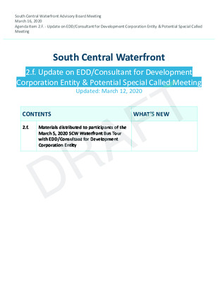
South Central Waterfront Advisory Board Meeting March 16, 2020 Agenda Item 2.F. - Update on EDD/Consultant for Development Corporation Entity & Potential Special Called Meeting South Central Waterfront 2.f. Update on EDD/Consultant for Development Corporation Entity & Potential Special Called Meeting Corporation Entity & Potential Special Called Meeting Corporation Entity & Potential Special Called Meeting Updated: March 12, 2020 T T T T T T T T T T T T T T T T F F F F F F F F F F F F F F F F CONTENTS WHAT’S NEW WHAT’S NEW WHAT’S NEW 2.f. 2.f. 2.f. Materials distributed to participants of the Materials distributed to participants of the Materials distributed to participants of the March 5, 2020 SCW Waterfront Bus Tour March 5, 2020 SCW Waterfront Bus Tour March 5, 2020 SCW Waterfront Bus Tour with EDD/Consultant for Development with EDD/Consultant for Development with EDD/Consultant for Development Corporation Entity Corporation Entity Corporation Entity A A A A A A A A A A A A A A A A R R R R R R R R R R R R R R R R D D D D D D D D D D D D D D D D MARCH 5, 2020: S CW BU S TOU R ECONOMIC DEVELO PM ENT D EPARTMENT/ECONOMI C D EVELOPMENT ENTI TY DI S C USS I O N * Provide overview of the 2016 South Central Waterfront D D D D * Provide overview of the 2016 South Central Waterfront * Provide overview of the 2016 South Central Waterfront * Highlight four key recomendations which exemplify the master plan & the SCW District PU RP OSE OF TOUR: range of potential p3 projects that create affordable housing, urban trail infrastructure, high-capacity transit, and park/ plaza/placemaking * Consider role of an economic development entity to facilitate p3 and project delivery A A A A F F F F 1 2 R R R R T T T T 4 3 1 MARCH 5, 2020: S CW BU S TOU R ECONOMIC DEVELO PM ENT D EPARTMENT/ECONOMI C D EVELOPMENT ENTI TY DI S C USS I O N F F F F F F F F F F F F F F F F F F F F F F F F F F F F F F F 3 A A A A A A A A A A A A A A A A A A A A A A A A A A A A A A A 4 D D D D D D D D D D D D D D D D D D D D D D D D D D D D D D D R R R R R R R R R R R R R R R R R R R R R R R R R R R R R R R 2 1 The South Central Waterfront Vision Framework Plan (SCW Plan) promotes a vision to guide redevelopment over the next 20 years. The SCW Plan is based on a district-wide, public/private partnerships model to transform the district by: • Retrofitting 17 new acres of connected parks, •• trails, plazas and open spaces across a patchwork of properties. • Adding over 2 miles of new green streetscapes, expand the street grid, and promote transportation options to create a lively, walkable district. Created by Assyifa Art from the Noun Project • Enhancing connections and open spaces to and Created by Made by Made from the Noun Project • along the waterfront. Incentivizing new affordable housing units to ultimately equal 20% of the district’s new to ultimately equal 20% of the district’s new to ultimately equal 20% of the district’s new to ultimately equal 20% of the district’s new Created by Creaticca Creative Agency from the Noun Project residential units. To secure the vision, the City must enact the key financial, regulatory, and governance programs that the Plan calls for. Developing an Economic Development Entity is one of the essential recommendations. Doing so will empower the City to be a full partner in providing a financially feasible, predictable, and sustainable transformation for the district. T T T T T T T T T T T T T T T T T T T T T T T T T T T T T T T 1. On e Texas Cent er 2. Trail @ Tex as Sch o ol for the Deaf 3. Green Co nnector 4. States man Site 2 PROP E RTY OWNERSHIP Auditorium Auditorium Shores et e st Str S 1 3 1 2 4 5 6 7 10 e u n e v8 v s A s A s A s s s e e e r r r g g 9 g n n n o o o C C 4 22 11111 13 11 W R iv e 12 r si d d e D r 21 20 15 16 17 18 19 23 14 222 E R i v e 24 3 33 3 Texas School for the Deaf N 0 Feet 200 400 DRAFT 03.12.20 SOUTH CENTRAL WATERFRONT: PARCEL OWNERSHIP 2020 This product is for informational purposes and may not have been prepared for or be suitable for legal, engineering, or surveying purposes. It does not represent an on-the-ground survey and represents only the approximate relative location of property boundaries. It has been produced the Planning and Zoning Department for the sole purpose of geographic reference. No warranty is made by the City of Austin regarding specific accuracy or completeness. Lady Bird Lake Waller Creek R R R R R R R R R R R R R R R R R R R R R R R R R R R R R R R R R R R R R R R R R R R R R R R R R R R R R R R R R R R R R R R R R R R R R R R R R R R R R R R R R R R R R R R R R R R R R R R R R R R R R R R R R R R R R R R R R R R R R R R R R R R R R R R R R R R R R R R R R R R R R R R R R R R R R R R R R R R R R R R R R R R R R R R R R R R R R R R R R R R R R R R R R R R R R R R R R R R R R R R R R R R R R R R R R R R R R R R R R R R R R R R R R R R R R R R R R R R R R R R R R R R R R R R R R R R R R R R R R R R R R R R R R R R R R R R R R R R R R R R R R R R R R R R R R R R R R R R R R R R R R R R R R R R R R R R R R R R R R R R R R R R R R R R R R R R R R 30 30 30 31 31 31 29 32 33 D D D r e e e 25 27 r si i i i i d d d d d D eD D D D D D D D D D D D D D D D D D D D D D D D D D D D D D D D D D D D D D D D D D D D D D D D D D D D D D D D D D D D D D D D D D D D D D D D D D D D D D D eD rD rD D D D D D D D D D D D D D D D D D D D D D D D D D D D D D D D D D D D D D D D D D D D D D D D D D D D D D D D D D D D D D D D D D D D D D D D D D D D D D D D D D D D D D D D D D D D D D D D D D D D D D D D D D D D D D D D D D D D D D D D D D D D D D D D D D D D D D D D D D D D D D D D D D D D D D D D D D D D D D D D D D D D D D D D D D 26D 26D D D D D D D D D D D D D D D D D D D D D D D D D D D D D D D D D D D D D D 27D 27D D D D D 25 D 25 D D D D D D D D D D D D D D D D D D D D D D D D 28D 28D D D D D D D D D D 26 28 F F F F F F F F F F F F F F F F F F F F F F F F F F F F F F F F F F F F F F F F F F F F F F F F F F F F F F F F F F F F F F F F F F F F F F F F F F F F F F F F F F F F F F F F F F F F F F F F F F F F F F F F F F F F F F F F F F F F F F F F F F F F F F F F F F F F F F F F F F F F F F F F F F F F F F F F F F F F F F F F F F F F F F F F F F F F F F F F F F F F F F F F F F F F F F F F F F F F F F F F F F F F F F F F F F F F F F F F F F F F F F F F F F F F F F F F F F F F F F F F F F F F F F F F F F F F F F F F F F F F F F F F F F F F F F F F F F F F F F F F F F F F F F F F F F F F F F F F F F F F F F F F F F F F F F F F F F F F F F F F F F F F F F F F F F F F F A A A A A A A A A A A A A A A A A A A A A A A A A A A A A A A A A A A A A A A A A A A A A A A A A A A A A A A A A A A A A A A A A A A A A A A A A A A A A A A A A A A A A A A A A A A A A A A A A A A A A A A A A A A A A A A A A A A A A A A A A A A A A A A A A A A A A A A A A A A A A A A A A A A A A A A A A A A A A A A A A A A A A A A A A A A A A A A A A A A A A A A A A A A A A A A A A A A A A A A A A A A A A A A A A A A A A A A A A A A A A A A A A A A A A A A A A A A A A A A A A A A A A A A A A A A A A A A A A A A A A A A A A A A A A A A A A A A A A A A A A A A A A A A A A A A A A A A A A A A A A A A A A A A A A A A A A A A A A A A A A A A A A A A A A A A A A East Branch of Bouldin Creek Bouldin Creek Bouldin Creek 34 Blunn Creek 35 SOUTH CENTRAL WATERFRONT PROPERTY OWNERSHIP PARCELS WITHIN SCW REGULATING PLAN OTHER PARCELS WITHIN SCW BOUNDARY / FUTURE REG PLAN T T T T T T T T T T T T T T T T T T T T T T T T T T T T T T T T T T T T T T T T T T T T T T T T T T T T T T T T T T T T T T T T T T T T T T T T T T T T T T T T T T T T T T T T T T T T T T T T T T T T T T T T T T T T T T T T T T T T T T T T T T T T T T T T T T T T T T T T T T T T T T T T T T T T T T T T T T T T T T T T T T T T T T T T T T T T T T T T T T T T T T T T T T T T T T T T T T T T T T T T T T T T T T T T T T T T T T T T T T T 6 T 6 T 7 T 8 T 9 T 10 T 11 T 12 T T T T T T T T T T T T T T T T T T T T T T T T T T T T T T T T T T T T T T T T T T T T T T T T T T T T T T T T T T T T T T T T T T T T T T T T T T T T T T T T T T T T T T T T T T T T T T T T T T T T T T T T T T T TANTALLON AUSTIN LLC OGLE CHERYL & THE CRYSTAL OGLE MANAGEMENT TRUST BROADSTONE AT THE LAKE LLC CATHERINE TOWER LLC ENDEAVOR ENDEAVOR ENDEAVOR ENDEAVOR ASSOCIATED GENERAL CONTRACTORS ASSOCIATED GENERAL CONTRACTORS ASSOCIATED GENERAL CONTRACTORS BATHAUS LTD BATHAUS LTD BATHAUS LTD CPG 220 SOCO LP CPG 220 SOCO LP CPG 220 SOCO LP MOLLY BELLE PROPERTIES MOLLY BELLE PROPERTIES MOLLY BELLE PROPERTIES BARTON SPRINGS CENTER LTD BARTON SPRINGS CENTER LTD BARTON SPRINGS CENTER LTD AUSTIN TRUST COMPANY AUSTIN TRUST COMPANY AUSTIN TRUST COMPANY CROCKETT PARTNERS LTD CITY OF AUSTIN FOR SALE 1 2 3 4 5 6 7 7 8 8 9 9 10 10 11 11 12 12 13 14 15 16 WORLD CLASS CAPITAL GROUP 17 18 19 20 21 WESLEY PEARSON JR & JERRY PEARSON 22 23 24 25 26 27 28 29 30 31 32 33 34 35 ANDREW COTTON & JOHN MEDDAUGH FIFTH & CHICON LTD RIVERSIDE PROPERTIES LTD GARWALD COMPANY INC CWS RIVERSIDE LP GORDON PLACETTE JR & RICHARD DALE GUTHRIE CONDOS - MULTIPLE OWNERS COUNTY LINE PROPERTIES INC RIVER CRAB LTD RICHARD T SUTTLE, TRUSTEE CROCKETT PARTNERS LTD DJ INTERESTS LTD AUSTIN CRESCENT APARTMENTS LLC POSSIBLE NEW OWNER SLACK BROTHERS INC ALICE G KASPAR, TRUSTEE OFLP 1 LTD CONGRESS DOT LLC 3 2 0 1 6 SCW PHYSICAL FRAMEWOR K MAP S S F F 1 1 et e st Str S 1 P P R R 5 5 + + 6 6 - - 1 1 W B 2 W B 2 S S F F 2 2 W W R R 1 1 P P P P P P P R R R R R R R 1 1 1 1 1 1 1 0 0 0 0 0 0 0 - - - - - - - 1 1 1 1 1 1 1 W B 1 W B 1 11P 1P P P P P P R R R R R R R 1 1 1 1 1 1 1 4 4 4 4 4 4 4 - - - - - - - 1 1 1 1 1 1 1 A A A A D D D D 1 1 1 1 T T T L L L 1 1 1 P P R R 1 1 3 3 - - 1 1 HA1 HA1 P P P P R R R R 1 1 1 1 2 2 2 2 - - - - 1 1 1 1 W R iv e r si W W R R d 2 2 e D r P P R R 1 1 6 6 - - 1 1 S S F F 3 3 TL2 TL2 22222 O O S S - - 5 5 AD2 AD2 AD2 P P R R 1 1 6 6 - - 2 2 C C A A 3 3 E R i v P P P P R R R R 2 2 2 2 4 4 4 4 - - - - 1 1 1 1 e r si d Texas School Texas School Texas School for the Deaf for the Deaf C C A A 1 1 e u n e v s A s e r g n o C 44 P P R R 2 2 2 2 A A A 1 1 1 - - 1 1 O O O O O S S S S S - - - - - 4 4 4 4 4 P P R R 2 2 2 2 - - 2 2 O O S S - - 1 1 E E E E E E E E E E E E E E E B B B B B B B B B B B B B B B 1 1 1 1 1 1 1 1 1 1 1 1 1 1 1 B1 B1 B1 A A A 2 2 2 C C A A 2 2 P P P P R R R R 2 2 2 2 1 1 1 1 - - - - 1 1 1 1 P P R R 2 2 3 3 - - 1 1 E E E E E E E E E E E E E E E B B B B B B B B B B B B B B B 2 2 2 2 2 2 2 2 2 2 2 2 2 2 2 C1 C1 C1 D D D 1 1 1 P P R R 2 2 3 3 - - 3 3 D D D 2 2 2 E1 E1E1 P P R R 2 2 2 2 - - 3 3 B2 B2 B2 O O S S - - 3 3 E E E E E E E E E E E E E E E B B B B B B B B B B B B B B B 3 3 3 3 3 3 3 3 3 3 3 3 3 3 3 C2 C2 C2 A A A 3 3 3 P P P R R R 2 2 2 2 2 2 - - - 4 4 4 B3 B3 B3 P P P R R R 2 2 2 2 2 2 - - - 5 5 5 E E E E E E E E E E E E E E E B B B B B B B B B B B B B B B 4 4 4 4 4 4 4 4 4 4 4 4 4 4 4 P P P P R R R R 2 2 2 2 3 3 3 3 - - - - 2 2 2 2 R R R R R R R R R R R R R R R R R R R R R R R R R R R R R R R R R R R R R R R R R R R R R R R R R R R R R R R R R R R R R R R R R R R R R R R R R R R R R R R R R R R R R R R R R R R R R R R R R R R R R R R R R R R R R R R R R R R R R R R R R R R R R R R E E R R 2 2 e D E E E r R R R O O O O O O O O O O O O O S S S S S S S S S S S S S - - - - - - - - - - - - - 2 2 2 2 2 2 2 2 2 2 2 2 2 D D D D D D D P P P P P P P P R R R R R R R R 1 3 3 3 3 3 3 3 4 4 4 4 3 3 3 3 3 3 3 3 2 2 2 2 2 2 2 2 - - - - - - - - ML2 ML2 3 33 ML13ML1 ML1 3ML13ML1D ML1D ML1D D 1D D D D D D D D D D D D D D D D D D D D D D D D D D D D D D D D D D D D D D D D D D D D D D D D D D D D D D D D D D D D D D D D D D D D D D D D D D D D D D D D D D D D D D D D D D ML2D D D D D 1D D D 4D 4D 4D 4D D D D D D D D D D D D D D D D D D D D D D N 0 Feet Feet 200 400 DRAFT DRAFT 03.12.20 SOUTH CENTRAL WATERFRONT: SOUTH CENTRAL WATERFRONT: PARCEL OWNERSHIP 2020 This product is for informational purposes and may not have been prepared for or be suitable for legal, engineering, or surveying purposes. It does not represent an on-the-ground survey and represents only the approximate relative location of property boundaries. It has been produced the Planning and Zoning Department for the sole purpose of geographic reference. No warranty is made by the City of Austin regarding specific accuracy or completeness. Lady Bird Lake Lady Bird Lake Waller Creek Waller Creek Waller Creek F F F F F F F F F F F F F F F F F F F F F F F F F F F F F F F F F F F F F F F F F F F F F F F F F F F F F F F F F F F F F F F F F F F F F F F F F F F F F F F F F F F F F F F F F F F F F F F F F F F F F F F F F F F F F F F F F F F F F F F F F F F F F F F A A A A A A A A A A A A A A A A A A A A A A A A A A A A A A A A A A A A A A A A A A A A A A A A A A A A A A A A A A A A A A A A A A A A A A A A A A A A A A A A A A A A A A A A A A A A A A A A A A A A A A A A A A A A A A A A A A A A A A A A A A A A A A A East Branch East Branch of Bouldin Creek of Bouldin Creek of Bouldin Creek Blunn Creek SOUTH CENTRAL WATERFRONT 2016 SCW Physical Framework Map PARCELS WITHIN SCW REGULATING PLAN OTHER PARCELS WITHIN SCW BOUNDARY / FUTURE REG PLAN T T T T T T T T T T T T T 6 T 6 T 7 T 8 T 9 T 10 T 11 T 12 T T T T T T T T T T T T T T T T T T T T T T T T T T T T T T T T T T T T T T T T T T T T T T T T T T T T T T T T T T T T T T T T T T T T T T T T T T T T T T T T T T T T T T T T T T T T T T T T T T T T T T T T T T T TANTALLON AUSTIN LLC OGLE CHERYL & THE CRYSTAL OGLE MANAGEMENT TRUST BROADSTONE AT THE LAKE LLC CATHERINE TOWER LLC ENDEAVOR ENDEAVOR ENDEAVOR ENDEAVOR ASSOCIATED GENERAL CONTRACTORS ASSOCIATED GENERAL CONTRACTORS ASSOCIATED GENERAL CONTRACTORS BATHAUS LTD BATHAUS LTD BATHAUS LTD CPG 220 SOCO LP CPG 220 SOCO LP CPG 220 SOCO LP MOLLY BELLE PROPERTIES MOLLY BELLE PROPERTIES MOLLY BELLE PROPERTIES BARTON SPRINGS CENTER LTD BARTON SPRINGS CENTER LTD BARTON SPRINGS CENTER LTD AUSTIN TRUST COMPANY AUSTIN TRUST COMPANY AUSTIN TRUST COMPANY CROCKETT PARTNERS LTD CITY OF AUSTIN FOR SALE 1 2 3 4 5 6 7 7 8 8 9 9 10 10 11 11 12 12 13 14 15 16 WORLD CLASS CAPITAL GROUP 17 18 19 20 21 WESLEY PEARSON JR & JERRY PEARSON 22 23 24 25 26 27 28 29 30 31 32 33 34 35 ANDREW COTTON & JOHN MEDDAUGH FIFTH & CHICON LTD RIVERSIDE PROPERTIES LTD GARWALD COMPANY INC CWS RIVERSIDE LP GORDON PLACETTE JR & RICHARD DALE GUTHRIE CONDOS - MULTIPLE OWNERS COUNTY LINE PROPERTIES INC RIVER CRAB LTD RICHARD T SUTTLE, TRUSTEE CROCKETT PARTNERS LTD DJ INTERESTS LTD AUSTIN CRESCENT APARTMENTS LLC POSSIBLE NEW OWNER SLACK BROTHERS INC ALICE G KASPAR, TRUSTEE OFLP 1 LTD CONGRESS DOT LLC 4 DR AF T FINANCIAL FRAMEWORK - MARCH 2 020 T T T T T T T T T T T F F F F F F F F F F F A A A A A A A A A A A R R R R R R R R R R R D D D D D D D D D D D 5 DR AF T FINANCIAL FRAMEWORK - MARCH 2 020 T T T T T T T T T T T F F F F F F F F F F F A A A A A A A A A A A R R R R R R R R R R R D D D D D D D D D D D 6 1. ONE TEXAS CEN TE R ( OTC) South Central Waterfront Vision • 60’ height (of entitled 180’) • 150 Affordable Housing Units • Family-friendly ownership units • 80% MFI South Central Waterfront Plan Created by Creaticca Creative Agency from the Noun Project Implementation Update Created by Assyifa Art from the Noun Project Potential Partners • Strategic Facilities Governance Team considering alternatives for One Texas Center 2/20/20 Council resolution to provide recommendations 2/20/20 Council resolution to provide recommendations 2/20/20 Council resolution to provide recommendations • 2/20/20 Council resolution to provide recommendations for the redevelopment of One Texas Center including a for the redevelopment of One Texas Center including a for the redevelopment of One Texas Center including a for the redevelopment of One Texas Center including a range of community benefits by June 2020 SCW Consultant currently modeling alternative affordable SCW Consultant currently modeling alternative affordable SCW Consultant currently modeling alternative affordable • SCW Consultant currently modeling alternative affordable housing options for OTC. (see below) housing options for OTC. (see below) housing options for OTC. (see below) housing options for OTC. (see below) • COA ( NHCD, Finance, Real Estate, etc.) • Non-profit and for profit housing developers • Other developing properties in the district _______________________________________________________ _______________________________________________________ _______________________________________________________ _______________________________________________________ _______________________________________________________ _______________________________________________________ _______________________________________________________ _______________________________________________________ _______________________________________________________ _______________________________________________________ T T T T T T T T T F F F F F F F F F A A A A A A A A A R R R R R R R R R D D D D D D D D D 7 2. TR A I L @ TEX AS SCHOOL FO R T HE DEAF South Central Waterfront Vision • .25 mile trail/bridge connector between South First Street and South Congress • Bridge connections to properties across creek to OTC and/or World Class Properties • Water quality and riparian restoration of creek • Bouldin Creek Neighborhood connections to South Congress, and TSD’s connections to the City Implementation Update Potential Partners Created by Made by Made from the Noun Project Created by Assyifa Art from the Noun Project • State of Texas facilities master plan for the TSD references and includes the SCW recommendations for the trail • Updated project costs in 2020 O n C e P s g e a x r i n a g e T e e t n r a G a k r k e u l d i n C r e o h o f B c n s t B r a a E South Central Waterfront Plan Texas Facilities Commission - 2016 Campus Master Plan F F F F F F F F F F F F F F Trail per SCW Plan Trail per SCW Plan Trail per SCW Plan A A A A A A A A A A A A A A R R R R R R R R R R R R R R D D D D D D D D D D D D D D • State of Texas (Texas Facilities Commission) • Other developing properties in the district • Other developing properties in the district • City of Austin ( Watershed, Public Works, etc.) • City of Austin ( Watershed, Public Works, etc.) • Texas School for the Deaf (board, staff, community) • Non-profit Conservancies and Philanthropy Non-profit Conservancies and Philanthropy • (eg. The Trail Foundation) (eg. The Trail Foundation) (eg. The Trail Foundation) T• T•• T•• City of Austin ( Watershed, Public Works, etc.) T City of Austin ( Watershed, Public Works, etc.) T•• Non-profit Conservancies and Philanthropy T Non-profit Conservancies and Philanthropy T (eg. The Trail Foundation) T•• Other developing properties in the district T Other developing properties in the district T_______________________________________________________ T T T T _______________________________________________________ _______________________________________________________ _______________________________________________________ _______________________________________________________ _______________________________________________________ _______________________________________________________ _______________________________________________________ _______________________________________________________ _______________________________________________________ _______________________________________________________ _______________________________________________________ _______________________________________________________ _______________________________________________________ 8 3. GREEN CONNECTOR + M OTO N L AN E South Central Waterfront Vision Implementation Update Potential Partners • Moton Lane = District serving street connector + lineal rain garden + dedicated bike lane + green streetscapes Crossing • Pending Capital Metro recommendation on Blue Line • Private property owner (Crockett family) Created by Made by Made from the Noun Project Created by Assyifa Art from the Noun Project • Green Connector = lineal park/trail from Riverside Drive • PAZ updating physical framework costs (March 2020) to the Statesman Park • the Green Connector can transform into a high capacity transit line for Capital Metro’s Blue Line • PAZ updating financial modeling (April 2020) • PAZ draft regulating plan (May 2020) F F F F F F F F F F F F F A A A A A A A A A A A A A Moton Lane R R R R R R R R R R R R R D D D D D D D D D D D D D • Cap Metro (Project Connect) • Cap Metro (Project Connect) • City of Austin (ATD, Public Works, etc.) • Non-profit Conservancies and Philanthropy Non-profit Conservancies and Philanthropy • (eg. The Trail Foundation) (eg. The Trail Foundation) (eg. The Trail Foundation) _______________________________________________________ _______________________________________________________ _______________________________________________________ T• T•• T T•• Cap Metro (Project Connect) T Cap Metro (Project Connect) T•• Non-profit Conservancies and Philanthropy T Non-profit Conservancies and Philanthropy T (eg. The Trail Foundation) T_______________________________________________________ T T T T _______________________________________________________ _______________________________________________________ _______________________________________________________ _______________________________________________________ _______________________________________________________ _______________________________________________________ _______________________________________________________ _______________________________________________________ _______________________________________________________ _______________________________________________________ _______________________________________________________ Moton Lane Green Connector 9 SCW Street Key Map Exhibits from 2020 ULI Presentation with Cap Metro Project Connect Exhibits from 2020 ULI Presentation with Cap Metro Project Connect Exhibits from 2020 ULI Presentation with Cap Metro Project Connect Image from SCW Interim Plan- Green Connector Image from SCW Interim Plan- Green Connector with Blue Line 4. STAT ESMAN SITE - 2 016 S CW PH YS ICAL FR AM EWOR K South Central Waterfront Vision Implementation Update • Largest property of 35 (19 acres, 20% of District area) • PAZ updating physical framework costs (March 2020) • Provides 56% of the District’s 17 acres of new open • PAZ updating financial modeling (April 2020) • PAZ draft regulating plan (May 2020) • Barton Springs extension - significant new public spaces serving street F F F F F F F F F F F F F F F F F A A A A A A A A A A A A A A A A A R R R R R R R R R R R R R R R R R D D D D D D D D D D D D D D D D D Created by Made by Made from the Noun Project Created by Creaticca Creative Agency from the Noun Project Created by Assyifa Art from the Noun Project Potential Partners • Private property owner (Cox family) • Downtown Austin Alliance • Downtown Austin Alliance • Cap Metro (Project Connect) • Cap Metro (Project Connect) • City of Austin (ATD, Utilities, PARD, EDD, REO, etc.) • Non-profit Conservancies and Philanthropy Non-profit Conservancies and Philanthropy • (eg. The Trail Foundation) (eg. The Trail Foundation) (eg. The Trail Foundation) T• T•• T•• Non-profit Conservancies and Philanthropy T Non-profit Conservancies and Philanthropy T (eg. The Trail Foundation) T•• Cap Metro (Project Connect) T Cap Metro (Project Connect) T•• Downtown Austin Alliance T Downtown Austin Alliance T _______________________________________________________ T T T T T T T _______________________________________________________ _______________________________________________________ _______________________________________________________ _______________________________________________________ _______________________________________________________ _______________________________________________________ _______________________________________________________ _______________________________________________________ _______________________________________________________ _______________________________________________________ _______________________________________________________ _______________________________________________________ _______________________________________________________ 10 Statesman Site Only - Master Plan - Draft Physical Framework Costs - March 2020 (30% of total District costs) Statesman Site Only - Master Plan - Draft Financial Framework - March 2020 Image from South Central Waterfront Plan Image from SCW draft regulating plan showing flexibility Image from SCW draft regulating plan showing flexibility Image from SCW draft regulating plan showing flexibility 4. STAT ESMAN SITE - 2 020 MO DI F I ED P HYSICAL F R AM EWO RK South Central Waterfront Vision Implementation Update • Largest property of 35 (19 acres, 20% of District area) • PAZ updating physical framework costs (March 2020) • Provides 56% of the District’s 17 acres of new open • PAZ updating financial modeling (April 2020) • Barton Springs extension - significant new public • Applicant filed PUD (Summer 2019 - in process) Applicant filed PUD (Summer 2019 - in process) Applicant filed PUD (Summer 2019 - in process) Applicant filed PUD (Summer 2019 - in process) • PAZ draft regulating plan (May 2020) spaces serving street F F F F F F F F F F F F F F F F F A A A A A A A A A A A A A A A A A R R R R R R R R R R R R R R R R R D D D D D D D D D D D D D D D D D Created by Made by Made from the Noun Project Created by Creaticca Creative Agency from the Noun Project Potential Partners Created by Assyifa Art from the Noun Project • Private property owner (Cox family) • Downtown Austin Alliance • Downtown Austin Alliance • Cap Metro (Project Connect) • Cap Metro (Project Connect) • City of Austin (ATD, Utilities, PARD, EDD, REO, etc.) • Non-profit Conservancies and Philanthropy Non-profit Conservancies and Philanthropy • (eg. The Trail Foundation) (eg. The Trail Foundation) (eg. The Trail Foundation) T• T•• T T T T T T T T•• Non-profit Conservancies and Philanthropy T Non-profit Conservancies and Philanthropy T (eg. The Trail Foundation) T•• Cap Metro (Project Connect) T Cap Metro (Project Connect) T•• Downtown Austin Alliance T Downtown Austin Alliance T _______________________________________________________ _______________________________________________________ _______________________________________________________ _______________________________________________________ _______________________________________________________ _______________________________________________________ _______________________________________________________ _______________________________________________________ _______________________________________________________ _______________________________________________________ _______________________________________________________ _______________________________________________________ _______________________________________________________ _______________________________________________________ 11 Statesman Site Only - Scenario 2 - Draft Physical Framework Costs - March 2020 (32% of total District costs) Statesman Site Only - Scenario 2 - Draft Financial Framework - March 2020 Image from Statesman PUD Proposal SCW Key Map with Endeavor Buildings SCW Key Map with Endeavor Buildings SCW Key Map with Endeavor Buildings 2 0 2 0 SCW MODIFIED PHYSICAL F R AMEWOR K MAP S S F F 1 1 et e st Str S 1 P R 5 + 6 - 1 O O O O O S S S S S - - - - - 4 4 4 4 4 C C - - 1 1 P-6 P-6 P R 2 2 - 1 W B 2 W B 2 S S F F 2 2 W W R R 1 1 P R 1 0 - 1 W B 1 W B 1 A A A A D D D D 1 1 1 1 111 P P P P R R R R 1 1 1 1 4 4 4 4 - - - - 1 1 1 1 S S F F 3 3 TL2 TL2 T T T L L L 1 1 1 P R 1 3 - 1 HA1 HA1 P R 1 2 - 1 W R iv e r si W W R R d 2 2 e D r P R 1 6 - 1 22222 O O S S - - 5 5 AD2 AD2 AD2 P R 1 6 - 2 C C A A 3 3 E R i v P R 2 4 - 1 e r si d e D E E E r R R R P P P R R R 2 2 2 3 3 3 - - - 2 2 2 D D D D D D D 3 3 3 3 3 3 3 ML1 ML1 ML1 ML1 ML1 ML1 ML1 ML1 ML13 33 3 O O O O O O O O O S S S S S S S S S - - - - - - - - - 2 2 2 2 2 2 2 2 2 Texas School Texas School Texas School for the Deaf for the Deaf C C - - 2 2 e u n e v s A P-5 P-5 s e r g n o C O O S S - - 1 1 P P - - 2 2 P P - - 1 1 P P P P R R R R 2 2 2 2 2 2 2 2 - - - - 1 1 1 1 444 P-7 P-7 P-7 P-7 P-7 P R 2 2 - 1 S-4 S-4 P P - - 3 3 P R 2 2 - 2 S-2 S-2 S-1 S-1 B B S S 1 1 P R 2 2 - 2 S-3 S-3 P P - - 4 4 P R 2 2 - 3 C C A A 2 2 P R 2 1 - 1 P R 2 3 - 1 D D D 1 1 1 C1 C1C1 O O S S - - 3 3 D D D 2 2 2 C2 C2 C2 P R 2 3 - 3 E1 E1E1 R R R R R R R R R R R R R R R R R R R R R R R R R R R R R R R R R R R R R R R R R R R R R R R R R R R R R R R R R R R R R R R R R R R R R R R R R R R R R R R R R R R R R R R R R R R R R R R R R R R R R R R R R R R R R R R R R R R R R R R R R R R R R E E R R 2 2 P P P P P R R R R R 1 1 4 4 3 3 3 3 3 2 2 2 2 2 - - - - - ML2 ML2 D 1D D D D D D D D D D D D D D D D D D D D D D D D D D D D D D D D D D D D D D D D D D D D D D D D D D D D D D D D D D D D D D D D D D D D D D D D D D D D D D D D D D D D D D D D D D D D ML2D D D D 4D 4D 4D D D D D D D D D D D D D D D D D D D D D D D D D D N NNN 0 0 Feet Feet 200 200 400 400 DRAFT DRAFT 03.12.20 03.12.20 SOUTH CENTRAL WATERFRONT: SOUTH CENTRAL WATERFRONT: PARCEL OWNERSHIP 2020 PARCEL OWNERSHIP 2020 This product is for informational purposes and may not have been prepared for or be suitable for legal, engineering, or surveying purposes. It does not This product is for informational purposes and may not have been prepared for or be suitable for legal, engineering, or surveying purposes. It does not represent an on-the-ground survey and represents only the approximate relative location of property boundaries. It has been produced the Planning and represent an on-the-ground survey and represents only the approximate relative location of property boundaries. It has been produced the Planning and Zoning Department for the sole purpose of geographic reference. No warranty is made by the City of Austin regarding specific accuracy or completeness. Zoning Department for the sole purpose of geographic reference. No warranty is made by the City of Austin regarding specific accuracy or completeness. Lady Bird Lake Lady Bird Lake Waller Creek Waller Creek Waller Creek F F F F F F F F F F F F F F F F F F F F F F F F F F F F F F F F F F F F F F F F F F F F F F F F F F F F F F F F F F F F F F F F F F F F F F F F F F F F F F F F F F F F F F F F F F F F F F F F F F F F F F F F F F F F F F F F F F F F F F F F F F F F F A A A A A A A A A A A A A A A A A A A A A A A A A A A A A A A A A A A A A A A A A A A A A A A A A A A A A A A A A A A A A A A A A A A A A A A A A A A A A A A A A A A A A A A A A A A A A A A A A A A A A A A A A A A A A A A A A A A A A A A A A A A A A East Branch East Branch of Bouldin Creek of Bouldin Creek of Bouldin Creek Blunn Creek Blunn Creek Blunn Creek SOUTH CENTRAL WATERFRONT 2020 SCW Modified Physical Framework Map PARCELS WITHIN SCW REGULATING PLAN OTHER PARCELS WITHIN SCW BOUNDARY / FUTURE REG PLAN T T T T T T T T T T T T 6 T 6 T 7 T 8 T 9 T 10 T 11 T 12 T T T T T T T T T T T T T T T T T T T T T T T T T T T T T T T T T T T T T T T T T T T T T T T T T T T T T T T T T T T T T T T T T T T T T T T T T T T T T T T T T T T T T T T T T T T T T T T T T T T T T T T T T T TANTALLON AUSTIN LLC OGLE CHERYL & THE CRYSTAL OGLE MANAGEMENT TRUST BROADSTONE AT THE LAKE LLC CATHERINE TOWER LLC ENDEAVOR ENDEAVOR ENDEAVOR ENDEAVOR ASSOCIATED GENERAL CONTRACTORS ASSOCIATED GENERAL CONTRACTORS ASSOCIATED GENERAL CONTRACTORS BATHAUS LTD BATHAUS LTD BATHAUS LTD CPG 220 SOCO LP CPG 220 SOCO LP CPG 220 SOCO LP MOLLY BELLE PROPERTIES MOLLY BELLE PROPERTIES MOLLY BELLE PROPERTIES BARTON SPRINGS CENTER LTD BARTON SPRINGS CENTER LTD BARTON SPRINGS CENTER LTD AUSTIN TRUST COMPANY AUSTIN TRUST COMPANY AUSTIN TRUST COMPANY CROCKETT PARTNERS LTD CITY OF AUSTIN FOR SALE 1 2 3 4 5 6 7 7 8 8 9 9 10 10 11 11 12 12 13 14 15 16 WORLD CLASS CAPITAL GROUP 17 18 19 20 21 WESLEY PEARSON JR & JERRY PEARSON 22 23 24 25 26 27 28 29 30 31 32 33 34 35 ANDREW COTTON & JOHN MEDDAUGH FIFTH & CHICON LTD RIVERSIDE PROPERTIES LTD GARWALD COMPANY INC CWS RIVERSIDE LP GORDON PLACETTE JR & RICHARD DALE GUTHRIE CONDOS - MULTIPLE OWNERS COUNTY LINE PROPERTIES INC RIVER CRAB LTD RICHARD T SUTTLE, TRUSTEE CROCKETT PARTNERS LTD DJ INTERESTS LTD AUSTIN CRESCENT APARTMENTS LLC POSSIBLE NEW OWNER SLACK BROTHERS INC ALICE G KASPAR, TRUSTEE OFLP 1 LTD CONGRESS DOT LLC 12