13 2024-132040 LM - 1109 S Lamar Boulevard; District 9 - Right of Way Vacation Application Review Packet — original pdf
Backup
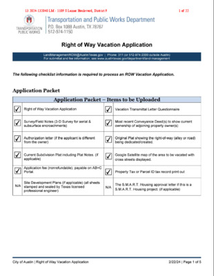
13 2024-132040 LM - 1109 S Lamar Boulevard; District 91 of 22 f '1 �_,.,.,.,,. "" . y TRANSPORTATION PUBLIC WORKS Transportation P.O. Box 1088 Austin, 512-974-1150 and Pub I ic Works Department TX 78767 Right of Way Vacation Application LandManagementROW@AustinTexas For submitta l and fee 1nformat1on , see www austIntexas gov/departmenU gov I Phone 311 (or 512-974-2000 outside Austin) land-management File No. --------- Department use only Section 1: TYPE OF VACATION DATE: -------- Department use only Encroachment Type: StreetO Alleyl✓I RowD Hundred Block: Name of Street/Alley/ROW: Alley Property Address: 1 109 S Lamar B oulevard ___________ _ Is it constructed? YesONol✓I Purpose of Vacation: For use of the property as one l ot with n o division. Section 2: PROPERTY DESCRIPTION ADJACENT TO AREA TO BE VACATED A . I D. t . t p I # 0 100030201 ppra1sa 1s nc arce : _______ urvey 19-22 Block 18 Lot(s) Name: S outh Heights Subdivision S Outlot & Ab t t N rac o. __________ _ s ----------------------------- PI at Book: ______ Document No: ______ or Volume_1 ____ , Page_1_1_2 __ Neighborhood Address including Association Name: _Z_il_ke_r_N_e_i_gh_b_o_r_h_o_od_A_s_s o_c_ia_t_io_n _____ _____ _ _ TX 78704 zip code: 2 109 De Verne St., Austin, Section 3: RELATED CASES & PROJECT NAME {if applicable) Existing Subdivision Site Plan: YesO No� File Number: _________________ Case: Yesl✓I No D File Number: _c_a_-_ Permit: Yes D No �File Number: _________________ _ 18_9_4_-_1 1_1_1 ____________ _ _ Building Name of Development Project: _ N�/_A ________ ________ _____ _ Is this a S.M.A.R.T. Housing Project? signed certification letter from NHCD) YesO No !✓I (If yes, attach Yes D No l✓I Is this within the Downtown Austin Plan Boundaries? City of Austin I Right of Way Vacation Application 2/22/24 I Page 2 of 5 19 and 2013 2024-132040 LM - 1109 S Lamar Boulevard; District 92 of 22 512-567-260013 2024-132040 LM - 1109 S Lamar Boulevard; District 93 of 22 Darin DavisPrincipal13 2024-132040 LM - 1109 S Lamar Boulevard; District 94 of 22 13 2024-132040 LM - 1109 S Lamar Boulevard; District 95 of 22 July 12, 2024 To Whom It May Concern: City of Austin Re: Letter of Authorization relating to the owner’s agent for the submittal of that certain Right-of-Way Vacation application, along with easements and other related materials and documents on behalf of the property located at 1109 S Lamar Boulevard, Austin, Texas 78704, (the “Property”), also known as Lot Nos. 19, 20, 21, and 22, Block 18 in South Heights, an addition in the City of Austin, Travis County, Texas, according to the map or plat recorded in Volume 1, Page 112, of the Plat Records of Travis County, Texas. As the record owner of the above referenced Property, I hereby authorize Leah M. Bojo at Drenner Group PC, or her designee, to act as agent to submit the Right-of-Way Vacation application and related materials and documents associated with the same to the City of Austin, Texas and I attest to all submittal regulations. Sincerely, GSGP, LP Signature: ____________________________ Name (print): _________________________ Title: ________________________________ Darin DavisPrincipal13 2024-132040 LM - 1109 S Lamar Boulevard; District 96 of 22 Leah M. Bojo direct dial: (512) 807-2918 lbojo@drennergroup.com Director Richard Mendoza Transportation and Public Works City of Austin 6310 Wilhelmina Drive Austin, TX 78752 July 11, 2025 Via Electronic Delivery Re: 1109 S Lamar Boulevard – Alley vacation application for the 0.0115-acre property located at 1109 S Lamar Boulevard in Austin, Travis County, Texas (the “Property”). Dear Mr. Mendoza: As representatives of the Owners of the Property, we respectfully submit the enclosed Alley Vacation application package for vacation of the alleyway located between 1109 S Lamar Boulevard and 1200 W Gibson Street. This vacation is being submitted in conjunction with the adjacent property across the alley, located at 1200 W Gibson Street, for their portion of the alley. The portion of the alley requested to be vacated adjacent to 1109 S Lamar Boulevard is approximately 502 square feet, surveys of the respective vacation request accompany this letter. The Property consists of 0.0115-acres in Austin, Texas and is located in the full purpose jurisdiction of the City of Austin. The land requested to be vacated was originally dedicated via the plat recorded in Volume 1, Page 112, of the Plat Records of Travis County via City of Austin Case No. C8-1894-1111. As described in the Policies and Procedures for Requesting Street or Alley Vacations, the reason for the vacation can be described in the answers to the following questions: 1. Is this a residential or commercial project? • Commercial. 2. How was the area to be vacated dedicated? • The plat recorded in Volume 1, Page 112. 3. Did the City purchase the area to be vacated? • No. 4. Are both the area to be vacated and your property in the same subdivision? • Yes, the property is located in the South Heights subdivision. 5. Is the area to be vacated functional right-of-way or is it only dedicated on paper: • It is only dedicated on paper, no surface improvements currently exist. 6. Are there any utility lines within the area to be vacated? If yes, what are your plans for the utilities? • Per review of the City of Austin’s Water Records, an 8” wastewater line only serving the Property is located within the requested vacation and will be relocated as needed. 7. How do you plan to develop the area to be vacated? • The area proposed to be vacated will be incorporated into the existing development on the adjacent property at 1109 S Lamar Boulevard. 13 2024-132040 LM - 1109 S Lamar Boulevard; District 97 of 22 July 11, 2025 Page 2 8. Has a site plan been submitted on your project? • No, a site plan has not been submitted for redevelopment of the Property. 9. Is your project a Unified Development? • No. 10. Is your project a S.M.A.R.T. Housing Project? • No. 11. When do you anticipate starting construction of the development? • Undetermined. 12. What is the current zoning on the adjacent properties: • The Property is zoned CS-1-V-CO-DB90 (Commercial-liquor Sales – Vertical Mixed Use Building – Conditional Overlay – Density Bonus 90) via Ordinance No. 20250410-060. The adjacent properties are zoned CS (General Commercial Services). 13. What is the current status of the adjacent properties? • The Property is developed and used in a way consistent with the commercial base zoning. 14. What type of parking facilities currently exist? • Surface parking. 15. Will your parking requirements increase with expansion? • No. 16. How will the increase be handled? • Not applicable. 17. Have any agreements or easements been executed with adjacent landowner(s) or in draft form? If yes, please include this in your letter and provide us a copy. • No easements have been executed at this time. 18. Does the area to be vacated lie within the Austin Downtown Plan (DAP)? • No. 19. Does the area to be vacated lie within the UT Boundaries: East of Lamar Boulevard, west of IH-35, North of Martin Luther King Boulevard, and south of 45th Street? • No. 20. Does the proposed vacation support the Priority Programs and policy directives set forth in the Imagine Austin Comprehensive Plan? If so, how? • Yes, the proposed development is consistent with the Imagine Austin Plan’s Land Use and Transportation policy No. 3, to “[p]romote development in compact centers, communities, or along corridors that are connected by roads and transit,” and Policy No. 7, to “[e]ncourage infill and redevelopment opportunities that place residential, work, and retail land uses in proximity to each other to maximize walking, bicycling, and transit opportunities.” Best Regards, Leah M. Bojo 13 2024-132040 LM - 1109 S Lamar Boulevard; District 98 of 22 Right of Way Vacation Transmittal Letter LandManagementROW@AustinTexas.gov | Phone: 311 (or 512-974-2000 outside Austin) For submittal and fee information, see www.austintexas.gov/department/land-management Provide a reason for the vaca�on by answering the following ques�ons: 1. Property Type: Residen�al Commercial 2. How was the area to be vacated dedicated? Plat Separate Instrument 3. Did the City purchase the area to be vacated? (i.e., by Street Deed) Yes No 4. Are both the area to be vacated and your property in the same “subdivision”? (They must both be in the same subdivision to be eligible.) Yes No 5. Is the area to be vacated a: Func�onal right-of-way Only dedicated on paper 6. Are there any u�lity lines within the area to be vacated? Yes No If yes, what are your plans for the u�li�es? ________________________________________________ ___________________________________________________________________________________ Applicants should be advised that easements will be retained to protect exis�ng u�li�es, even if u�lity reloca�on is proposed. Also be advised that no structures may be built on, over or under the easements without a license agreement, insurance, and annual fee. 7. How do you plan to develop the area to be vacated? ____________________________________ ___________________________________________________________________________________ 8. Has a site plan been submitted on your project? Yes No 9. Is your project a Unified Development? Yes No 10. Is your project a S.M.A.R.T. Housing Project? Yes No 11. When do you an�cipate star�ng construc�on of the development? ________________________ 12. What is the current zoning on the adjacent proper�es? _________________________________ 13. What is the current status of the adjacent proper�es? __________________________________ 14. What type of parking facili�es currently exist? ________________________________________ 15. Will your parking requirements increase with the expansion? Yes No 16. How will the increase be handled? _________________________________________________ _________________________________________________________________________________ 13 2024-132040 LM - 1109 S Lamar Boulevard; District 99 of 22 Right of Way Vacation Transmittal Letter LandManagementROW@AustinTexas.gov | Phone: 311 (or 512-974-2000 outside Austin) For submittal and fee information, see www.austintexas.gov/department/land-management 17. Have any agreements or easements been executed with adjacent landowner(s) or in dra� form? Yes No If yes, please provide us with a copy. 18. Does the area to be vacated lie within the Aus�n Downtown Plan (DAP)? Yes No If yes, does it meet DAP criteria? Yes No 19. Does the area to be vacated lie within UT boundaries: East of Lamar Boulevard, west of IH35, north of Mar�n Luther King Boulevard, and south of 45th Street? Yes No 20. Does the proposed vaca�on support the Priority Programs and policy direc�ves set forth in the Imagine Aus�n Comprehensive Plan? Yes No If yes, how ________________________________________________________________________ __________________________________________________________________________________ If you have questions; please email Land Management Department: LandManagementROW@AustinTexas.gov 13 2024-132040 LM - 1109 S Lamar Boulevard; District 910 of 22 Alley Vacation Exhibit mar Boulevard S La Gibson Street S 8th Street 13 2024-132040 LM - 1109 S Lamar Boulevard; District 911 of 22 F#__________________ EXHIBIT “______” (Right-of-way Vacation) Portion of Block 18 Alley, South Heights Legal Description BEING A DESCRIPTION OF A TRACT OF LAND CONTAINING 0.0115 ACRE (502 SQUARE FEET) SITUATED IN THE CITY OF AUSTIN, TRAVIS COUNTY, TEXAS, BEING A PORTION OF A 20’ ALLEY IN BLOCK 18, SOUTH HEIGHTS, A SUBDIVISION IN TRAVIS COUNTY, TEXAS, ACCORDING TO THE MAP OR PLAT RECORDED IN VOLUME 1, PAGE 112 OF THE PLAT RECORDS OF TRAVIS COUNTY, TEXAS (P.R.T.C.T.), SAID 0.0115 ACRE BEING MORE PARTICULARLY DESCRIBED BY METES AND BOUNDS AS FOLLOWS: 925 Capital of Texas Hwy B-115, Austin, TX 78746 (512) 327-4006 fperez@capitalsurveying.com COMMENCING, at an iron rod with “Holt Carson” cap found at the intersection of the north right-of-way line of Gibson Street (50’ Right-of-way) with the east right-of-way line of said 20’ Alley crossing Block 18 of said South Heights subdivision, and being the southwest corner of Lot 16, Block 18 of said South Heights subdivision, from which an iron rod with “Holt Carson” cap found at the intersection of the north right-of-way line of said Gibson Street with the west right-of-way line of South 8th Street (50’ Right-of- way), and being the southeast corner of said Lot 16 bears, S62°08’44”E, a distance of 125.00 feet; THENCE, with the north right-of-way line of said Gibson Street and the south terminus line of said 20’ Alley, N62°54’24”W, a distance of 10.00 feet to a 1/2-inch iron rod with “4Ward-Boundary” cap found for the southeast corner and POINT OF BEGINNING hereof; THENCE, continuing with the north right-of-way line of said Gibson Street and the south terminus line of said 20’ Alley, N62°54’24”W, a distance of 10.00 feet to a 1/2-inch iron rod with “4Ward-Boundary” cap found for the southwest corner hereof, said point being at the intersection of the north right-of-way line of said Gibson Street with the west right-of-way line of said 20’ Alley, and being the southeast corner of the remainder of Lot 19, Block 18 of said South Heights subdivision; THENCE, leaving the north right-of-way line of said Gibson Street, with the west right-of-way line of said 20’ Alley and the east line of the remainder of Lots 19 and 20, both of Block 18 of said South Heights subdivision, N27°41’08”E, a distance of 50.27 feet to a 1/2-inch iron rod with “CSC Boundary” cap set for the northwest corner hereof, said point being the common east corner of the remainder of Lots 20 and 21, both of Block 18 of said South Heights subdivision; THENCE, leaving the west right-of-way line of said 20’ Alley, over and across said 20’ Alley, the following two (2) courses and distances: 1) S62°08’44”E, a distance of 10.00 feet to a 1/2-inch iron rod with “CSC Boundary” cap set for the northeast corner hereof, and 2) S27°41’08”W, a distance of 50.13 feet to the POINT OF BEGINNING and containing 0.0115 Acre (502 Square Feet) of land, more or less. NOTE: All bearings are based on the Texas State Plane Coordinate System, Grid North, Central Zone (4203), all distances were adjusted to surface using a combined scale factor of 1.000057798437. See attached sketch (reference drawing: 00045_ROW Vacation-1.dwg). References: TCAD #100020 _____________________________ COA Grid #H-21 Fernando Perez, RPLS #7041 Capital Surveying Company 7/24/2025 P:\00045\Metes & Bounds & Certifications\00045_ROW Vacation-1.docx Page 1 of 1 07/29/2513 2024-132040 LM - 1109 S Lamar Boulevard; District 912 of 22 REMAINDER OF LOT 24 REMAINDER OF LOT 23 REMAINDER OF LOT 22 BLOCK "18" SOUTH HEIGHTS VOL. 1, PG. 112 P.R.T.C.T. REMAINDER OF LOT 21 REMAINDER OF LOT 20 REMAINDER OF LOT 19 P.O.B. [A] Y E L L A ' 0 2 LOT 12 BLOCK "18" SOUTH HEIGHTS VOL. 1, PG. 112 P.R.T.C.T. LOT 13 20' WIDE ALLEY TO BE PARTIALLY VACATED 0.0115 ACRE(S) 502 SQUARE FEET LOT 14 LOT 15 LOT 16 P.O.C. T E E R T S H T 8 H T U O S GIBSON STREET (50' R.O.W.) 0.0115 ACRE 20' WIDE ALLEY TO BE PARTIALLY VACATED City of Austin, Travis County, Texas 925 S CAPITAL OF TEXAS HIGHWAY BLDG. B, SUITE 115, Austin, Texas 78746 info@capitalsurveying.com (512) 327-4006 TBPELS FIRM #1012670 ) . . W O R . ' 0 5 ( 13 2024-132040 LM - 1109 S Lamar Boulevard; District 913 of 22 [A] OWNER: GSGB, LP. DOC. NO. 2007035338 O.P.R.T.C.T. 0.0115 ACRE 20' WIDE ALLEY TO BE PARTIALLY VACATED City of Austin, Travis County, Texas 925 S CAPITAL OF TEXAS HIGHWAY BLDG. B, SUITE 115, Austin, Texas 78746 info@capitalsurveying.com (512) 327-4006 TBPELS FIRM #1012670 13 2024-132040 LM - 1109 S Lamar Boulevard; District 914 of 22 13 2024-132040 LM - 1109 S Lamar Boulevard; District 915 of 22 13 2024-132040 LM - 1109 S Lamar Boulevard; District 916 of 22 13 2024-132040 LM - 1109 S Lamar Boulevard; District 917 of 22 13 2024-132040 LM - 1109 S Lamar Boulevard; District 918 of 22 PID 100020 | 1109 S LAMAR BLVD Property Summary Report | 2024 Online Services | Travis Central Appraisal District GENERAL INFO ACCOUNT Property ID: Geographic ID: Type: Zoning: Agent: Legal Description: 100020 0100030201 R CS COX RYLAND S LOT 19-22 BLK 18 SOUTH HEIGHTS Property Use: 31 LOCATION Address: 1109 S LAMAR BLVD, TX 78704 OWNER Name: Secondary Name: Mailing Address: GSGB L P 3821 JUNIPER TRACE STE 207 AUSTIN TX 78738-5517 Owner ID: % Ownership: Exemptions: 1364623 100.00 Market Area: Market Area CD: Map ID: CEN 010208 PROTEST Protest Status: Informal Date: Formal Date: VALUES CURRENT VALUES Land Homesite: Land Non-Homesite: Special Use Land Market: Total Land: Improvement Homesite: Improvement Non-Homesite: Total Improvement: Market: Special Use Exclusion (-): Appraised: Value Limitation Adjustment (-): Net Appraised: VALUE HISTORY VALUE HISTORY $0 $2,250,000 $0 $2,250,000 $0 $50,000 $50,000 $2,300,000 $0 $2,300,000 $0 $2,300,000 Year 2024 2023 2022 2021 2020 Land Market Improvement Special Use Exclusion Appraised Value Limitation Adj (-) Net Appraised $2,250,000 $2,056,000 $1,332,038 $1,500,000 $1,205,206 $50,000 $0 $0 $82,036 $244,794 $0 $0 $0 $0 $0 $2,300,000 $2,056,000 $1,332,038 $1,582,036 $1,450,000 $0 $0 $0 $0 $0 $2,300,000 $2,056,000 $1,332,038 $1,582,036 $1,450,000 Page 1 of 3 Effective Date of Appraisal: January 1 Date Printed: October 03, 2024 Powered By: <True Prodigy> 13 2024-132040 LM - 1109 S Lamar Boulevard; District 919 of 22 TAXING UNITS Unit Description 01 02 03 0A 2J 68 AUSTIN ISD CITY OF AUSTIN TRAVIS COUNTY TRAVIS CENTRAL APP DIST TRAVIS COUNTY HEALTHCARE DISTRICT AUSTIN COMM COLL DIST Tax Rate 0.950500 0.477600 0.344445 0.000000 0.107969 0.101300 Net Appraised Taxable Value $2,300,000 $2,300,000 $2,300,000 $2,300,000 $2,300,000 $2,300,000 $2,300,000 $2,300,000 $2,300,000 $2,300,000 $2,300,000 $2,300,000 DO NOT PAY FROM THIS ESTIMATE. This is only an estimate provided for informational purposes and may not include any special assessments that may also be collected. Please contact the tax office for actual amounts. IMPROVEMENT Improvement #1: State Code: F1 NIGHT CLUB/BAR Description: Improvement Value: N/A Main Area: Gross Building Area: 1,920 5,059 Type Description Class CD Exterior Wall Number of Units EFF Year Built 1st Floor 1ST UBSMT Unfinished Basement 482 511 611 611 413 413 437 611 511 611 LIGHT POLES DECK TERRACE TERRACE STAIRWAY EXT STAIRWAY EXT FENCE MASON LF TERRACE DECK TERRACE C C C WAC CA CA A A A CAC WA CA 0 0 0 1 1 1 1 1 1 1 1 1 2005 2005 2005 2005 2005 2005 2005 2005 2005 2005 2005 2005 Year 1947 1947 1947 1947 1947 1947 1947 1947 1947 1947 1947 1947 SQFT 1,920 1,470 3 615 480 360 1 1 27 48 92 42 Improvement Features 1ST Ceiling Factor: 14, Floor Factor: 1ST, Grade Factor: E, Shape Factor: L UBSMT Ceiling Factor: 14, Floor Factor: UBSMT, Grade Factor: E, Shape Factor: L LAND Land LAND LAND Description Land Land DEED HISTORY Acres 0.1435 0.1435 SQFT 6,250 6,250 Cost per SQFT Market Value Special Use Value $180.00 $180.00 N/A N/A N/A N/A Deed Date Type Description Grantor/Seller Grantee/Buyer Book ID Volume Page Instrument 1/18/07 CD 1/18/07 WD 10/25/90 ED CORRECTION DEED WARRANTY DEED EXECUTOR DEED GIBSON AND SOUTH LAMAR LEMMOND BOBBIE JACK LEMMOND JESSE R GSGB L P GIBSON AND SOUTH LAMAR LEMMOND BOBBIE JACK 2007035338 TR 2007012100 TR 11302 00335 Page 2 of 3 Effective Date of Appraisal: January 1 Date Printed: October 03, 2024 Powered By: <True Prodigy> 13 2024-132040 LM - 1109 S Lamar Boulevard; District 920 of 22 Deed Date Type Description Grantor/Seller Grantee/Buyer Book ID Volume Page Instrument 10/13/59 WD WARRANTY DEED LEMMOND JESSE R 02103 00410 Page 3 of 3 Effective Date of Appraisal: January 1 Date Printed: October 03, 2024 Powered By: <True Prodigy> 13 2024-132040 LM - 1109 S Lamar Boulevard; District 921 of 22 13 2024-132040 LM - 1109 S Lamar Boulevard; District 922 of 22