09 C14-2025-0006 - 34th & West (Tract 1); District 9 - Staff Report - Part 1 — original pdf
Backup
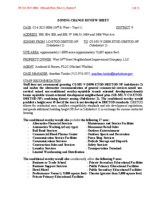
ZONING CHANGE REVIEW SHEET CASE: C14-2025-0006 (34th & West – Tract 1) DISTRICT: 9 ADDRESS: 800, 804, 806, and 808, W 34th St; 3404 and 3406 West Ave ZONING FROM: LO-ETOD-DBETOD-NP TO: CS-MU-V-DB90-ETOD-DBETOD-NP (Subdistrict 2) (Subdistrict 2) SITE AREA: approximately 1.6898 acres (approximately 73,607 square feet) PROPERTY OWNER: West 34th Street Neighborhood Improvement Company, LLC AGENT: Armbrust & Brown, PLLC (Michael Whellan) CASE MANAGER: Jonathan Tomko (512) 974-1057, jonathan.tomko@austintexas.gov STAFF RECOMMEDATION: Staff does not recommend granting CS-MU-V-DB90-ETOD-DBETOD-NP (subdistrict 2) and makes the alternative recommendation of general commercial services-mixed use- vertical mixed use-conditional overlay-equitable transit oriented development-density bonus equitable transit oriented development-neighborhood plan (GR-MU-V-CO-ETOD- DBETOD-NP) combining district zoning (Subdistrict 2). The conditional overlay would prohibit a height over 45 feet if the tract is not developed to DBETOD standards. DBETOD allows for residential uses, modifies compatibility standards and site development regulations, and grants additional building height (90 feet in Subdistrict 2) in exchange for income-restricted housing. The conditional overlay would also prohibit the following 17 uses: - Alternative Financial Services - Automotive Washing (of any type) - Bail Bond Services - Commercial Blood Plasma Center - Communication Service Facilities - Communications Services - Construction Sales and Services - Laundry Services - Limited Warehousing and Distribution - Maintenance and Service Facilities - Monument Retail Sales - Outdoor Entertainment - Outdoor Sports and Recreation - Pawn Shop Services - Pedicab Storage and Dispatch - Safety Services - Transportation Terminal The conditional overlay would also conditionally allow the following 9 uses: - Business or Trade School - Private Secondary Educational Facilities - Business Support Services - Public Primary Educational Facilities - Hotel-Motel - Public Secondary Educational Facilities - Performance Venue (≤ 9,000 square feet) - Theater (greater than 5,000 square feet) - Private Primary Educational Facilities 09 C14-2025-0006 - 34th and West (Tract 1); District 91 of 51 See the basis of recommendation section below for more information. PLANNING COMMISSION ACTION / RECOMMENDATION: July 8, 2025: Neighborhood postponement request to July 22, 2025, granted July 22, 2025: Case is scheduled to be heard by Planning Commission CITY COUNCIL ACTION: TBD ORDINANCE NUMBER: TBD ISSUES: The subject tract is within the flight path of a helipad serving Ascension Seton Medical Center approximately 1,100 feet northwest of the site. Staff reviewed the helipad permit on file and does not have any concerns at this time. When a site plan is filed staff encourage those site plan reviewers to re-review the most current helipad permit and the proposed building heights at that time. On March 9, 2023, City Council approved Resolution No. 20230309-016 accepting the Equitable Transit-Oriented Development Policy Plan and directing the City Manager regarding next steps for implementation of items intended to benefit the Project Connect Phase 1 Austin Light Rail project. This included development of code amendments to support transit in May of 2024 (Ordinance No. 20240516-005), including creation of the ETOD combining district (restrictions on non-transit supportive uses) and the DBETOD combining district (allowing residential use, and relaxing some development standards including increased height in exchange for income- restricted housing). Properties within one half-mile of the Phase 1 Austin Light Rail alignment and Priority Extensions were included within this overlay, and certain properties were rezoned through a City-initiated process to include the ETOD and DBETOD combining districts. Further, properties rezoned with DBETOD combining district were categorized into Subdistrict 1 (maximum allowable height of 120 feet) or Subdistrict 2 (maximum allowable height of 90 feet), generally based on property distance of ¼-mile or ½-mile from the Phase 1 alignment, respectively. However, that rezoning process did not modify any base district zoning or any combining district zoning, which is the subject of this request. CASE MANAGER COMMENTS: A building constructed under ETOD and DBETOD standards allows for a mix of residential uses and transit-supportive commercial uses, and the result is typically retail, restaurants and offices on the ground floor, and residential units on upper levels. Those uses deemed non-transit-supportive have been prohibited or made as conditional within the ETOD combining district. A property rezoned with multiple density program options, such as -DB90, -V, and -ETOD-DBETOD, may choose to utilize the density bonus option. If so, a single program must be selected. 09 C14-2025-0006 - 34th and West (Tract 1); District 92 of 51 A development utilizing the “density bonus ETOD” incentives is permitted with a base GR district, and must include an affordability component for residential use in order to obtain incentives, including height maximum of up to 90 feet in the GR district (60 feet base district plus up to 30 feet height incentive) and relaxation of development and compatibility standards, such as floor to area ratio (FAR), setbacks and building coverage. There are several methods of satisfying DBETOD development affordability requirements, based on whether the proposed units will be offered as rental or for ownership. For rental units, the options are based on a tiered system tied to achievable maximum height or modified development standards. i. To achieve 60 feet in height or to utilize a development standard under DBETOD that is not height-related, a development must provide: · a minimum of 10% of the residential units as affordable for lease and occupancy by households earning 60% or less than the Austin-Round Rock Metropolitan Statistical Area MFI; ii. To achieve 90 feet in height, a development must provide: · a minimum of 12% of the residential units as affordable for lease and occupancy by households earning 60% or less than the Austin-Round Rock Metropolitan Statistical Area MFI; or · a minimum of 10% of the residential units as affordable for lease and occupancy by households earning 50% or less MFI. iii. To achieve120 feet in height, a development must provide: · a minimum of 15% of the residential units as affordable for lease and occupancy by households earning 60% or less than the Austin-Round Rock Metropolitan Statistical Area MFI; or · a minimum of 12% of the residential units as affordable for lease and occupancy by households earning 50% or less MFI. There are two options of satisfying DBETOD development affordability requirements which include ownership units: 1) a minimum of 12% of the units as affordable for ownership and occupancy by households earning 80% or less than the Austin-Round Rock Metropolitan Statistical Area MFI; or 2) an in-lieu-fee payment to the Housing Trust Fund, equivalent to 125% of the required percentage of the total residential units, including the mix of bedrooms required, at the rate set in the fee schedule at the time of site plan submittal. BASIS OF RECOMMENDATION: Zoning should promote clearly-identified community goals, such as creating employment opportunities or providing for affordable housing. This rezoning authorizes a property to participate in a voluntary density bonus or incentive program that provides modifications to development regulations or other regulatory-related benefits in exchange for community benefits. In exchange for increased development potential, the development is required comply with affordable housing requirements as per the DBETOD combining district regulations. This request continues to align with City objectives to increase density and affordability in exchange for relaxed development standards. The rezoning should be consistent with the policies and principles adopted by the City Council. 09 C14-2025-0006 - 34th and West (Tract 1); District 93 of 51 City Council has provided policy and direction for having more residential density and increased affordability and equitable transit-oriented development, as well as incentivizing vertical mixed use buildings throughout the City. The proposed zoning should satisfy a real public need and not provide special privilege to the owner. Part of the ETOD policy implementation included mitigation measures to help reduce require displacement pressures during development utilizing the DBETOD program to comply with residential redevelopment requirements to preserve existing affordable and/or attainable housing opportunities for low- and middle-income households. Further, implementation measures require new development utilizing the DBETOD program to provide the right to return to certain qualifying businesses (certain non- residential uses) in the new development with right to return to affordable, comparably sized spaces. The ETOD policies seek to balance the need for increased density and activity surrounding transit with displacement pressures associated with said redevelopment. implementation measures redevelopment. The EXISTING ZONING AND LAND USES: ZONING LAND USES P-NP and SF-3-CO-NP LO-ETOD-DBETOD-NP A three-story medical office building of approximately 38,000 square feet constructed in approximately 1983 with approximately 56,000 square feet of paved parking lot. A one-story office/retail single family home of approximately 1,500 square feet constructed in approximately 1929. A one-story small office/retail single family home of approximately 1,500 square feet constructed in approximately 1960 with approximately 5,300 square feet of paved parking lot. Approximately 27,000 square feet of paved parking lot for the US Post Office at 3507 North Lamar Boulevard. Parcels included in C14-2025-0007 and C14-2025- 0008. A three-story office building of approximately 8,100 square feet constructed in approximately 1979 with approximately 10,000 square feet of paved parking lot. A two-story medical office building of approximately 32,000 square feet constructed in approximately 1968 with approximately 40,000 square feet of paved parking lot. LO-ETOD-DBETOD-NP A two-story medical office building of approximately 24,000 square feet constructed in approximately 2013 with approximately 45,000 square feet of paved parking lot. Approximately 20,000 square feet of paved parking lot for the US Post Office at 3507 North Lamar Boulevard. LO-ETOD-DBETOD-NP (request for rezoning through related cases C14-2025-0007 and C14- 2025-0008) P-NP Site North South (across West 34th St.) East (across West Ave.) West (across Owen Ave.) 09 C14-2025-0006 - 34th and West (Tract 1); District 94 of 51 NEIGHBORHOOD PLANNING AREA: Central Austin Combined (CANPAC) - West University WATERSHED: Shoal Creek Watershed SCHOOLS: A.I.S.D. Bryker Woods Elementary School O Henry Middle School Austin High School COMMUNITY REGISTRY LIST: Austin Independent School District, Austin Neighborhoods Council, CANPAC (Central Austin Neigh Plan Area Committee), Friends of Austin Neighborhoods, Friends of Heritage, Heritage Neighborhood Association, Homeless Neighborhood Association, Preservation Austin, Shoal Creek Conservancy AREA CASE HISTORIES: Number C14-2015-0030 (34th & King Street) C14-2008-0223 (David Heaps) C14-2008-0067 (Medical Science Center) C14-2007-0262 (Central Austin Combined Neighborhood Planning Area Vertical Mixed Use) Request Commission City Council The applicant is proposing to rezone property from SF-3- CO to GR-MU-CO, SF-4A-CO. The applicant is requesting to rezone the property from LO-NP to LO-MU- NP. The applicant is requesting to rezone property from LO- MU-NP to VMU. The applicant is proposing Vertical Mixed Use Zoning. Withdrawn Withdrawn Withdrawn Withdrawn Withdrawn Withdrawn 01.13.2009: N/A 06.11.2009: Ordinance No. 20090611-056 was approved with amendments and conditions on Council Member Shade’s motion and Council Member Leffingwell’s second on a 6-0 vote. Council Member Cole was absent. 09 C14-2025-0006 - 34th and West (Tract 1); District 95 of 51 RELATED CASES: C14-2025-0007 – 34th & West (Tract 2) C14-2025-0008 – 34th & West (Tract 3) C14-2025-0009 – 34th & West (Tract 4) NPA-2024-0019.02 – 34th & West FLUM Amendment ADDITIONAL STAFF COMMENTS: Environmental 1. The site is not located over the Edwards Aquifer Recharge Zone. The site is located in the Shoal Creek Watershed of the Colorado River Basin, which is classified as an Urban Watershed by Chapter 25-8 of the City's Land Development Code. It is in the Desired Development Zone. 2. Zoning district impervious cover limits apply in the Urban Watershed classification. 3. According to floodplain maps there is no floodplain within or adjacent to the project location. 4. Standard landscaping and tree protection will be required in accordance with LDC 25-2 and 25-8 for all development and/or redevelopment. 5. At this time, site specific information is unavailable regarding vegetation, areas of steep slope, or other environmental features such as bluffs, springs, canyon rimrock, caves, sinkholes, and wetlands. 6. This site is required to provide on-site water quality controls (or payment in lieu of) for all development and/or redevelopment when 8,000 s.f. cumulative is exceeded, and on site control for the two-year storm. 7. At this time, no information has been provided as to whether this property has any preexisting approvals that preempt current water quality or Code requirements. Fire No comments on rezoning. PARD – Planning & Design Review PR1: Parkland dedication will be required at the time of subdivision or site plan application for new residential units, per City Code § 25-1-601, as amended. The proposed development meets the criteria for land dedication in City Code Title 25, Article 14. As such, a partial land dedication will be required, as well as any remaining fees in-lieu. This lot is in a parkland deficient area and, with the intensity of residential entitlements proposed by this zoning case (and the related tracts) the deficiency would grow with the new units. Should there be any remaining fees in-lieu, those fees shall be used toward park investments in the form 09 C14-2025-0006 - 34th and West (Tract 1); District 96 of 51 of land acquisition and/or park amenities within the surrounding area, per the Parkland Dedication Operating Procedures § 14.3.11 and City Code § 25-1-609. Note that residential units that are certified affordable and income-restricted are exempt from the parkland dedication requirements per City Code § 25-1-601(D)(4). Parkland dedication will be required for any new market-rate residential units that may be proposed by this development, at the time of subdivision or site plan, per City Code § 25-1-601. Should the applicant wish to discuss parkland dedication requirements in advance of site plan or subdivision applications, please contact this reviewer: ann.desanctis@austintexas.gov. At the applicant’s request, PARD can provide an early determination letter of the requirements as stated in this review. Site Plan SP1. Site plans will be required for any new development except for residential only projects with up to 4 units. SP2. Any new development is subject to LDC Subchapter E Design Standards and Mixed Use. Additional comments will be made when the site plan is submitted. SP3. This tract is already developed and the proposed zoning change is within the footprint of an existing development. DB90 SP4. This site must meet affordability minimums per LDC 25-2-652 to be eligible for DB90. A signed approval letter from the Housing Department will be required with site plan submittal. SP5. W 34th is the Principal Street for this site. Any buildings fronting this street will be required to have 75% of the ground floor as commercial or civic uses. NOTE: A lobby serving a use other than a pedestrian-oriented commercial or civic space is not counted as a pedestrian-oriented commercial or civic place. SP6. If a building includes a mix of uses, a non-residential use: • may not be located above a residential use; and • may not be located on or above the third story of the building. DBETOD SP7. This site must meet affordability minimums per LDC 25-2-654 to be eligible for DBETOD. A signed approval letter from the Housing Department will be required with site plan submittal. SP8. W 34th is the Principal Street for this site. Any buildings fronting this street will be required to have 75% of the ground floor as commercial or civic uses. SP9. Limitation on Mix of Uses: • The maximum number of floors that can include non-residential uses is two. • A cocktail lounge or performance venue may only be located on the first or second story of the building. 09 C14-2025-0006 - 34th and West (Tract 1); District 97 of 51 • A residential use may not be located below a cocktail lounge or performance venue. SP10. This site must comply with the maximum height requirements pursuant to 25-2-654(G) Transportation and Public Works (TPW) Department – Engineering Review TPW 1. Zoning transportation analysis shall be performed at zoning where anticipated trips are anticipated to exceed 2,000 unadjusted trips to satisfy the LDC requirement for a TIA but does not diminish the authority to require a traffic impact analysis at site plan. Please contact Kaylie Coleman (kaylie.coleman@austintexas.gov) to coordinate the ZTA requirements. This comment can be cleared once the ZTA is finalized, and the fee has been paid. This is a comprehensive ZTA for the following zoning cases: C14-2025-0006; C14-2025-0007; C14-2025-0008; and C14-2025- 0009. LDC 25-6, TCM 10.5.0. The Austin Strategic Mobility Plan (ASMP) calls for 72 feet of right-of-way for W 34th ST. It is recommended that 36 feet of right-of-way from the existing centerline should be dedicated for W 34th ST according to the Transportation Plan with the first subdivision or site plan application. [LDC 25-6-51 and 25-6-55]. TPW 2. EXISTING STREET CHARACTERISTICS: ASMP Classification ASMP Required ROW Existing ROW Existing Pavement Sidewalks Bicycle Route Capital Metro (within ¼ mile) W 34th ST Level 2 West AVE Level 1 Owen AVE Level 1 72’ 58’ 58’ 51’ 63’ 50’ 35’ 30’ 31’ Yes (5’) Yes Yes No No No No Yes Yes TIA: The applicant has elected to conduct an alternative Zoning Transportation Analysis (ZTA) considering the trips generated by all 4 tracts. Please see the Zoning Transportation Analysis (ZTA) included below as exhibit D. Austin Water Utility AW1. No comments on zoning change. FYI: The landowner intends to serve the site with existing City of Austin water utilities. Based on current public infrastructure configurations, it appears that service extension requests (SER) will be required to provide service to this lot. For more information pertaining to the Service Extension Request process and submittal requirements contact the Austin Water SER team at ser@austintexas.gov. INDEX OF EXHIBITS AND ATTACHMENTS TO FOLLOW: 09 C14-2025-0006 - 34th and West (Tract 1); District 98 of 51 A. Zoning Map B. Aerial Map C. Applicant’s Summary Letter D. Zoning Transportation Analysis (ZTA) E. Educational Impact Statement (EIS) F. Correspondence from Interested Parties 09 C14-2025-0006 - 34th and West (Tract 1); District 99 of 51 09 C14-2025-0006 - 34th and West (Tract 1); District 910 of 51 P MF-4-CO C14-00-2224 ( ( SF-3 L R T A W A K N O T ( ( ( ( SF-3 N L Y E L I A B ( ( ( SF-3 ( GR-V-NP L PITA S O N H TIO BILITA A H E R ( 84-192 SF-3 CLINIC C14-2017-0152 W 39T C14-2008-0004 H H A CS-V-ETOD-DBETOD LF S T SH O P PIN G C W 39T H ST ENTE R 76-40 LO LO-V GR-V-ETOD-DBETOD FFIC O E GR-ETOD-DBETOD C14-2008-0004 74-96 LO CS-1-V 87-147 LR-V-ETOD-DBETOD O FFIC E GR-V-ETOD-DBETOD C14-2008-0004 CS-V-ETOD-DBETOD GR-ETOD-DBETOD LR-ETOD-DBETOD SP84-124 O E Q UIP. FFIC E O FFIC E C14-2008-0004 CS-V-ETOD-DBETOD O FFIC ESTR. R E S A P R H O FFIC G PIN P O H S C14-2008-0004 CS-V-ETOD-DBETOD E C M A Y SH R ETAIL O P 87-150 85-302 2008-0004 C14-2008-0004 CS-V-ETOD-DBETOD C14-2008-0003 GO-V-NP P83-002 CP73-38 SF-3-NP P-NP MEDICAL OFFICES/FACILITIES 87-082 C14-2008-0003 GO-V-NP SETON HOSPITAL COMPLEX G KIN R PA A. T S S A G C14-2008-0003 CS-V-ETOD-DBETOD-NP S H O P PIN G C E N TE R SP91-0228C PUD C814-88-0002 SP97-0165C RETAIL STRIP UNZ 68-63 ( LO-CO-ETOD-DBETOD-NP ( MF-3-ETOD-DBETOD-NP ( SF-3-CO-NP ( ( ( ( ( ( ( ( ( ( SF-3-CO-NP 6 61-7 PUD-NP C814-92-0006.02 SP-02-0122D SP07-0057C P80-33 C814-92-0006 CS-ETOD-DBETOD-NP CS-V-ETOD-DBETOD-NP CS-V-CO-ETOD-DBETOD-NP K N A B G KIN R A P W 37T H S T 04 -0 0 21 C14-2007-0262 76-90 O FFIC E SP94-204C CS-V-ETOD-DBETOD-NP CS-ETOD-DBETOD-NP S E R VIC STATIO E N GR-V-ETOD-DBETOD-NP W 37T H S T SP-02-0422C W 38T H S T CS-V-CO-ETOD-DBETOD-NP ( SP-04-1004C GR-NP 61-36 H ELIP O RT O FFIC E S PA R KIN G GO-NP ( 83-36 CS-NP S E FIC F O ( PA R KIN G GO-CO-NP CS-1-NP N Y L E AIL B UNDEV 81-75 MF-4-NP 67-76 81-53 CS-ETOD-DBETOD-NP S P-99-0282 GO-ETOD-DBETOD-NP C SP-97-0490CS W 33R D S T BAILEY PARK 70-224 Y W K L P A DIC E M 9 4 3-1 9 CS-V-ETOD-DBETOD-NP W 35T Y W K CS-ETOD-DBETOD-NP L P A CLINIC DIC CS-V-ETOD-DBETOD-NP E M G KIN R PA C14-2008-0003 H S H S T T W 34T PA R KIN G C14-2008-0003 CS-V-ETOD-DBETOD-NP C14-2007-0262 CS-V-CO-ETOD-DBETOD-NP ( ! ! ( ! ( CS-1-V-ETOD-DBETOD-NP CS-ETOD-DBETOD-NP E VIC R E S ( CS-V-ETOD-DBETOD-NP ! ! PARKING GO-V-ETOD-DBETOD-NP 04 -0 0 21 P-NP P87-026 GR-MU-CO-ETOD-DBETOD-NP S. T P A 87-030R ( S C P-05-1397C SF-3-CO-NP ( PAR KIN G 74-26 SF-3-H-CO-NP 87-178 ! ! ! SF-3-CO-NP ( E V T A S E W SF-3-CO-NP ( 75-106P ( ( 78-55 ( ! ( ! ! ( 81-204 ( ! LO-ETOD-DBETOD-NP ( ( ! ! ! SP92-313C SP92-313C P-NP P RIVAT E S C H O OL SF-3-NP P81-80 ( ( SF-3-NP ( 87-082 GO-MU-V-ETOD-DBETOD-NP C14-2008-0003 CS-V-ETOD-DBETOD-NP C 1 5 4-1 9 P S D S E H AV ( W 32N SP-00-2155C 92-87 S A B A W GR-CO-ETOD-DBETOD-NP T ( GO-ETOD-DBETOD-NP 81-53 83-002 CS-V-CO-ETOD-DBETOD-NP ! ! ! ! ( ! CS-CO-ETOD-DBETOD-NP ! ! ! ! ! LO-ETOD-DBETOD-NP SP85-156 ! ! ! ! ! ! CS-1-CO-ETOD-DBETOD-NP C C14-2007-0262 19 ! 4 ( ! ! ! O FFIC E ! ! ! ! ! ! 63-118 P-06-0 ! LO-ETOD-DBETOD-NP ! ( MF-2-ETOD-DBETOD-NP LO-CO-ETOD-DBETOD-NP 74-172 S ! ! ! ! ! ! ! CS-CO-ETOD-DBETOD-NP ( FU N ER S P-02-0373 04 -0 0 21 AL\H C E M O W S SF-3-CO-NP VIE ( MF-1-CO-ETOD-DBETOD-NP D N A R G T. P ( A ( ( ! T ! ! !! ! LO-CO-ETOD-DBETOD-NP E ! V T A S E W ( ! ! ! ! ! SF-3-CO-NP ( MF-2-CO-ETOD-DBETOD-NP ( 85-012 LO-MU-CO-ETOD-DBETOD-NP C14-2014-0148 SF-3-H-NP C14H-78-016 V E D N U CS-V-ETOD-DBETOD-NP ( SF-3-NP C14-2008-0003 CS-CO-ETOD-DBETOD-NP E V N A E W O C14-2007-0262 77-34 PLA LO-ETOD-DBETOD-NP S H NT P O ( ( ( SF-3-CO-NP ( ( GO-ETOD-DBETOD-NP LO-ETOD-DBETOD-NP NO-MU-ETOD-DBETOD-NP ( SF-3-NP CS-V-ETOD-DBETOD-NP C14-2008-0003 GR-V-ETOD-DBETOD-NP CS-CO-ETOD-DBETOD-NP 84-027 LR-CO-ETOD-DBETOD-NP P-NP C14-2007-0262 SF-3-NP ( C14H-06-0001 NO-MU-ETOD-DBETOD-NP SF-3-H-CO-NP ( ( ( B E L M O N T P K W Y SF-3-CO-NP ( MF-2-CO-ETOD-DBETOD-NP ( ( SF-3-H-CO-NP SF-3-H-CO-NP C14H-2024-0016 N S L G KIN ( 66-193 MF-3-CO-ETOD-DBETOD-NP SF-3-CO-NP 75-115 ( 04 -0 0 21 ( ( SF-3-CO-NP ( ( 04 -0 0 21 ( LO-ETOD-DBETOD-NP ( ! 04 -0 0 21 ! ! ! ! 6 ! 60-7 ! ! ! LO-ETOD-DBETOD-NP ! ! ! 95-0081 APTS. ( 65-89 ( 32 6-0 8 P S ( ! ! LO-ETOD-DBETOD-NP ! ! ! ! ! ! !! ( 84-167 81-112 C14-04-0021 SF-3-CO-NP SF-3-CO-NP ( ( MF-2-CO-ETOD-DBETOD-NP ( SF-3-CO-NP 04-0021 84-019 GR-V-CO-ETOD-DBETOD-NP CSW87-35 C14-2007-0262 04 -0 0 21 P83-79 LO-MU-ETOD-DBETOD-NP C14-2007-0262 GR-CO-ETOD-DBETOD-NP 75-090 04 -0 0 21 ( T N S O S N O R LR-MU-CO-ETOD-DBETOD-NP C AF ET E RIA C14-2007-0262 C14-01-0046.01 GR-CO-ETOD-DBETOD-NP CS-1-V-CO-ETOD-DBETOD-NP C14-2007-0262 ( S E R VIC E 68-189 C. O R G ( W 37T ( SF-3-CO-NP H ST S P-04-0113C CS-CO-ETOD-DBETOD-NP ( SF-4A-CO-NP M AID E CS-CO-ETOD-DBETOD-NP C14-2007-0262 C14-2007-0262 86-72 N LN 80-68 ( CS-1-CO-ETOD-DBETOD-NP ( CS-NCCD-ETOD-DBETOD-NP ( ( H S CS-CO-ETOD-DBETOD-NP ( C14-2007-0262 T 73-252 C14-2007-0262 ( ( ( ( DIO U T S APTS. ( ( ( ( ( ( SF-3-CO-NP ( ( ( W 35T ( ( ( SF-3-CO-NP CS-CO-ETOD-DBETOD-NP R E S T. CS-NCCD-ETOD-DBETOD-NP ( PA ( C14-73-252 SF-3-NCCD-NP R KIN G E BIK T E S P U CS-CO-ETOD-DBETOD-NP L A D A U G 81-P-12 C14-2007-0262 AUT RT PA O S 1 G PIN P O H S O FFIC E SF-3-NCCD-NP SP-04-0165CS C14-2007-0262 SF-3-NCCD-NP CS-MU-CO-ETOD-DBETOD-NP CS-NCCD-ETOD-DBETOD-NP 82-152 ( W 33R D ST C14-2007-0262 C O N D O S A P T S. C14H-03-0018 SF-3-CO-NP CS-CO-ETOD-DBETOD-NP T H S T U R F ( ( H03-0018 3 75-0 ( ( ( ( SF-3-NCCD-NP ( ( ( 0-44 P8 ( APTS. ( ( SF-3-HD-NCCD-NP ( ( ( W 33R D ST ( ( ( C14H-2015-0164 ( C14-04-0022.01 SF-3-H-HD-NCCD-NP SF-3-CO-NP ( SF-3-NP SF-3-H-CO-NP C14H-2007-0035 ( SF-3-CO-NP 85-030 ( ( CS-CO-ETOD-DBETOD-NP SF-3-CO-NP C14-2007-0262 GR-CO-ETOD-DBETOD-NP ( ( W 30T H H ( ALF S T 75-115 ( 81-112 ( SF-3-CO-NP 04 -0 0 21 ( SF-3-CO-NP ( ( ( ( ( ( ( ( ( ( SF-3-CO-NP ( ( ( ( P RIVAT E S C H ( 04 -0 0 21 O OL ( SF-3-CO-NP ( ( ( SF-3-CO-NP ( 04-0021 ( ( ( W 30T P-NP G O L H ST SF-3-CO-NP ( C14-2007-0262 MF-2-ETOD-DBETOD-NP N L A M A R B L V D T L S RIE B A GR-CO-ETOD-DBETOD-NP N G ( A S 85-303 74-77 ( TE N R C E P F H O C14-2007-0262 ( SF-3-CO-NP ( T L S R A E P SF-3-CO-NP ( 02-0032 ( ( P-NP W 2 9 T BIK E S H S T GR-V-CO-ETOD-DBETOD-NP ( C14-2015-0024 ( ( ( MF-2-ETOD-DBETOD-NP MF-2-ETOD-DBETOD-NP MF-2-ETOD-DBETOD-NP ( ( ( ( ( ( SF-3-CO-NP ( ( ( MF-2-CO-ETOD-DBETOD-NP SF-3-CO-NP ( ( ( ( SF-3-CO-NP ( ( ( ( Q N S O SF-3-CO-NP T G HIN S A W SF-3-CO-NP C14H-2008-0012 SF-3-H-CO-NP ( ( ( SF-3-H-CO-NP C14H-06-0033 ( 81-112 A P T S. ( ( MF-2-CO-ETOD-DBETOD-NP W 31ST H ( ( MF-1-CO-ETOD-DBETOD-NP ( SF-3-CO-NP ( ( S CS-CO-ETOD-DBETOD-NP C14-2007-0262 04 -0 0 21 ( ALF ST ( ( ( 4 0 0 3-0 0 H SF-3-HD-NCCD-NP ( ( C14H-2016-0053 ( ( SF-3-HD-NCCD-NP W 3 2 N ( ( C14H-03-0004 ( ( ( P-04-0011C APTS. W 31S ( T S T SF-3-CO-NP ( CS-1-CO-ETOD-DBETOD-NP C14-2022-0076 C14-2007-0262 SF-3-H-HD-NCCD-NP CS-CO-ETOD-DBETOD-NP C14H-01-0003 ( D S T ( MF-1-CO-ETOD-DBETOD-NP MF-3-ETOD-DBETOD-NP C14-2007-0262 CS-MU-CO-ETOD-DBETOD-NP P-HD-NCCD-NP ( 82-293 ( ( ( SF-3-H-HD-NCCD-NP C14H-2009-0037 ( SF-3-HD-NCCD-NP W H E E L E R S T SF-3-HD-NCCD-NP ( C14-2007-0262 CS-NCCD-ETOD-DBETOD-NP ( ( ( ( ( 82-293 P-HD-NCCD-NP ( SF-3-HD-NCCD-NP ( ( ( ( ( ( ( ( H E M P HILL P A R K ( SF-3-CO-NP ( 5 6 0 0 2 7 2 0 1 9 P S 69-3 ( 04-0021 ( SF-3-CO-NP ( SF-3-CO-H-NP ( ( SF-3-CO-NP SF-3-CO-NP MF-1-CO-ETOD-DBETOD-NP ( ( MF-1-CO-ETOD-DBETOD-NP ( SF-3-CO-NP 81-112 SF-5-CO-NP ( ( G S KIN T ( ( SF-5-CO-NP ( ( ( ( ( W 32N 86-041 ( C14H-86-041 SF-3-H-NP ( D S T ( SF-3-CO-NP SF-3-CO-NP ( C A R W A S H SF-3-CO-NP C14-2007-0262 ( CS-CO-ETOD-DBETOD-NP ( P-NP ± SUBJECT TRACT ! ! ! ! ! ! PENDING CASE ZONING BOUNDARY ZONING ZONING CASE#: C14-2025-0006 This product is for informational purposes and may not have been prepared for or be suitable for legal, engineering, or surveying purposes. It does not represent an on-the-ground survey and represents only the approximate relative location of property boundaries. 1 " = 400 ' This product has been produced by the Planning Department for the sole purpose of geographic reference. No warranty is made by the City of Austin regarding specific accuracy or completeness. Created: 1/14/2025 09 C14-2025-0006 - 34th and West (Tract 1); District 911 of 51 ARMBRUST & BROWN, PLLC A T T O R N E Y S A N D C O U N S E L O R S 100 CONGRESS AVENUE, SUITE 1300 AUSTIN, TEXAS 78701-2744 512-435-2300 FACSIMILE 512-435-2360 March 18, 2025 Joi Harden, Zoning Officer Planning Department 6310 Wilhelmina Delco Dr. Austin, Texas 78752 Subject: Rezoning and neighborhood plan amendment applications related to 800, 804, 806, 808 W. 34th St. and 3404, 3406 West Ave. (“Tract 1”), 901, 905, 907 W. 34th St., 3316 Grandview St., and a portion of 3317 N. Lamar Blvd. (“Tract 2”), 801 W. 34th St. (“Tract 3”), and 715, 725 W. 34th St. and 3301 West Ave. (“Tract 4”) (collectively, the “Property”) Dear Ms. Harden, On behalf of West 34th Street Neighborhood Improvement Company, LLC (the “Owner”), I am submitting five applications related to four tracts at the intersection of West 34th Street and West Avenue. Together, these applications will better align the city’s land use regulations to provide for a broader mix of uses at this ‘node.’ This letter replaces the letter dated December 3, 2024. Applicant Request The Property consists of four tracts as shown in Figure 1 below. Figure 1. The Property – Tract Map 1-B 1-A 2-A 2-B 3-B 3-A 3-C 4-A 4-B 09 C14-2025-0006 - 34th and West (Tract 1); District 912 of 51 Today, the Property features a variety of zoning and Future Land Use Map (“FLUM”) designations. We are requesting consolidating these designations into one comprehensive, unified designation for both the FLUM (Mixed-Use) and for zoning (CS-MU-V-DB90-ETOD-DBETOD-NP), as shown in Figure 2 below. This includes removing the existing conditional overlay, which has largely been superseded by the ETOD and DBETOD combining districts. Importantly, the Property already features the DBETOD designation, which allows increased height today. Figure 2. Future Land Use Map and Zoning – Current Designations and Request Tract FLUM Designation Request (FLUM) Zoning Designation Subdistrict Request (Zoning) Mixed-Use 1-A Mixed-Use/Office 1-B Mixed-Use/Office 2-A 2-B Mixed-Use/Office 3-A Mixed-Use/Office 3-B 3-C 4-A Mixed-Use/Office 4-B Mixed-Use/Office Single-Family Single-Family Mixed- Use LO-ETOD-DBETOD-NP LO-ETOD-DBETOD-NP CS-CO-ETOD-DBETOD-NP LO-ETOD-DBETOD-NP LO-ETOD-DBETOD-NP LO-CO-ETOD-DBETOD-NP LO-CO-ETOD-DBETOD-NP LO-ETOD-DBETOD-NP LO-ETOD-DBETOD-NP 2 2 2 2 1 2 1 1 1 CS-MU-V- DB90-ETOD- DBETOD-NP Request (Subdistrict) 2 2 2 2 1 1 1 1 1 This request would also re-designate Tract 3-B from Subdistrict 2 to Subdistrict 1 within the DBETOD combining district, to match Tracts 3-A and 3-C (which are already designated today for Subdistrict 1). Site Context The Property consists of four distinct tracts along West 34th Street, near its intersection with West Avenue. The area is characterized by the following land use context: The Property is within a 10-minute walk of 10 bus routes, including both of the two existing MetroRapid routes (801 and 803), one of only five Night Owl routes (481), an Express route (982), a Crosstown route (335), and five Local routes (1, 3, 5, 30, and 491). The Property is within three City-identified ETOD Station Areas, including the Seton Medical Center Station Area, the Hyde Park (38th) Station Area, and the Rosedale Station Area. The Property is located on West 34th, which connects two major corridors (North Lamar and Guadalupe). The four tracts that constitute the Property span roughly half of the distance between the two corridors, as shown in Figure 3 below. The Property has both north-south and east-west connectivity. The four tracts are generally oriented around West 34th's intersection with West Avenue. While West Avenue ‘jogs’ slightly as its crosses West 34th Street, it is one of only two north-south connections between North Lamar and Guadalupe (the other being King Street), forming a key ‘node’ between the two corridors. The city has designated West 34th generally for mixed-use zoning districts and FLUM categories, including CS and LO base zoning districts (as well as a small amount of P and SF-3 base zoning) and Mixed-Use and Mixed-Use/Office FLUM designations (as well as a small amount of Civic and Single-Family). The city has designated West 34th for mixed-use, equitable transit-oriented development by applying the ETOD and DBETOD combining districts to most properties along West 34th Street between North Lamar and Guadalupe. This designation currently provides between 70 ft. to 120 ft. of height along this street 4933-1197-1883, v. 2 09 C14-2025-0006 - 34th and West (Tract 1); District 913 of 51 Figure 3. Property Context – North Lamar and Guadalupe Corridors Applicant Request As noted, the Owner is applying to designate the Property for “Mixed-Use” on the Future Land Use Map, rezone the Property to CS-MU-V-DB90-ETOD-DBETOD-NP, and designate Tract 3-B for Subdistrict 1 within the DBETOD combining district. This request would: Update the Future Land Use Map to designate the Property for “Mixed-Use,” which better reflects the city’s new equitable transit-oriented development policies. Establish General Commercial Services (CS) as the new base zoning, which would allow for a more diverse mix of walkable uses (with the safeguard that the ETOD combining district restricts less desirable uses). Allow the full range of available density bonus options, including Vertical Mixed-Use and Density Bonus 90, in addition to Density Bonus ETOD, to allow for future optionality while encouraging affordability. Remove the existing conditional overlay, which currently consists primarily of outdated height restrictions that the DBETOD combining district has since superseded and use restrictions that the ETOD combining district now regulates. (See Attachment A for existing conditional overlay provisions.) Provide consistent regulations for Tract 3 by matching Tract 3-B’s subdistrict designation within the DBETOD combining district to the designation already provided for Tracts 3-A and 3-C (Subdistrict 1). Case Rationale We believe that this request is appropriate for the following reasons: This request will support the city’s housing goals by making the Property eligible for a range of different city-run affordable housing bonus programs. Providing this optionality will encourage future projects on the Property to proceed in a manner that requires on-site affordability, whether at 60 ft., 90 ft. or 120 ft. This request is consistent with the city’s land use policies for West 34th Street. The city has already designated this street for a mix of commercial and residential uses as well as for additional ‘transit-oriented’ height. The Owner’s request supports this policy direction by allowing a greater mix of walkable uses – with the additional safeguard that the ETOD combining district restricted auto-oriented and less desirable uses. This request will support the city’s transit and ‘mode-shift’ goals by allowing a broader range of walkable commercial uses within a 10-minute walk of 10 different transit routes and within three ETOD station areas. 4933-1197-1883, v. 2 09 C14-2025-0006 - 34th and West (Tract 1); District 914 of 51 For context, the Austin Strategic Mobility Plan (“ASMP”) sets a ‘50/50 mode split’ goal aiming to have half of residents commuting via an alternative to a single-occupancy vehicle by 2039. To reach this goal, the ASMP specifies that “Allowing for mixed-use and infill development can increase access to safe and convenient transportation options beyond car travel by providing pedestrian, bicycle, and transit access to many types of nearby destinations.” This request helps accomplish that by providing a mix of housing and commercial uses with easy access to both MetroRapid routes (each of which features 10-minute frequency during regular weekday hours), a Night Owl route (with service until 3am), and a Crosstown route (with east-west connectivity to Cherrywood and Mueller), among other routes. Together, these 10 available routes allow direct transit access to downtown, the University of Texas at Austin, the Texas Capitol, Auditorium Shores, Zilker Park, South Congress, Southpark Meadows, the Domain, Burnet Road, North Lamar, South Lamar, Mueller, the Grove at Shoal Creek, East 12th Street, Menchaca Road, and Slaughter Lane, among other areas. Conclusion We believe that our requests for a Mixed-Use FLUM designation, for CS-MU-V-DB90-ETOD-DBETOD-NP zoning, and for designating Tract 3-B for Subdistrict 1 within the DBETOD combining district are appropriate, consistent with the land-use context, and would support the city’s housing and transit goals. I appreciate your consideration and am available if you have questions or if you would like to discuss this case further. Respectfully, Michael J. Whellan 4933-1197-1883, v. 2 09 C14-2025-0006 - 34th and West (Tract 1); District 915 of 51 Attachment A – Existing Conditional Overlay Provisions (Excerpted from Ordinance No. 040826-57) Tract 2-A is subject to the following conditional overlay provisions: o Maximum Height: 50 ft. o Conditional Uses: o Prohibited Uses: Automotive Rentals, Sales, or Repair Services Club or Lodge Commercial Blood Plasma Center Building Maintenance Services Hospital Services (General) Residential Treatment Hotel-Motel Service Station Laundry Services Transitional Housing Research Services Agricultural Sales and Services Automotive Washing (Of Any Type) Campground Maintenance and Service Facilities Convenience Storage Drop-Off Recycling Collection Facilities Outdoor Sports and Recreation Pawn Shop Services Transportation Terminal Indoor Sports and Recreation Kennels Limited Warehousing and Distribution Commercial Off-Street Parking Construction Sales and Services Monument Retail Sales Outdoor Entertainment Electronic Prototype Assembly Equipment Repair Services Equipment Sales Vehicle Storage Tract 3-B is subject to the following conditional overlay provisions: o Maximum Height: 30 ft. Tract 3-C is listed with a conditional overlay combining district, but no such conditional overlay provisions have yet been identified. 4933-1197-1883, v. 2 09 C14-2025-0006 - 34th and West (Tract 1); District 916 of 51 MEMORANDUM Date: To: CC: Reference: April 16, 2025 Aditya Jatar, P.E., BOE Consulting Services Kaylie Coleman, Matiur Rahman, Bryan Golden, Transportation and Public Works Department W 34th St & West Ave Site, Austin Zoning Transportation Analysis (ZTA) Final Memo The Transportation and Public Works Department has reviewed the 3/19/2025 “W 34th St & West Ave Redevelopment ZTA”, prepared by BOE Consulting Services. The proposed site comprises of Mid-Rise Multi- Family (950 dwelling units) and Strip Retail Plaza (17,000 SF). The development location is shown in Figure 1 below. The proposed development is anticipated to be completed in 2028, and phasing is currently unknown. The project proposes access to the surrounding roadway network through seven driveways, one full access and one right-in/right-out (RIRO) on W 34th St, three full access on West Ave, one full access on Owen Ave, and one full access on Grandview St. Figure 1: Site Location 09 C14-2025-0006 - 34th and West (Tract 1); District 917 of 51 Adjacent Roadway Characteristics: The site proposes access to W 34th St, West Ave, Owen Ave, and Grandview St through six full access driveways and one RIRO driveway. The following section provides a brief description of W 34th St, West Ave, Owen Ave, and Grandview St. W 34th St: W 34th St along the site frontage is currently a Level 2 road in the ASMP and 72-84’ ROW is required as per ASMP. It currently has two travel lanes with curb and gutter and sidewalk on both sides of the road. There’s also on street bike lane in both directions on W 34th St west of West Ave. The average daily traffic on W 34th St was about 4,260 vehicles per day based on 2024 traffic count data. West Ave: West Ave segment adjacent to the site is currently a Level 1 road in the ASMP and 58 or 64’ ROW is required as per ASMP. It currently has two travel lanes with curb and gutter and sidewalk on both sides of the road, with some portions on the west side of West Ave missing sidewalk. The average daily traffic on West Ave was about 730 vehicles per day based on 2024 traffic count data. Owen Ave: Owen Ave segment adjacent to the site is currently a Level 1 road in the ASMP and 58 or 64’ ROW is required as per ASMP. It currently has two travel lanes with curb and gutter on both sides of the road and sidewalk on the west side of the road. The average daily traffic on Owen Ave was about 361 vehicles per day based on 2023 traffic count data. Grandview St: Grandview St segment adjacent to the site is currently a Level 1 road in the ASMP and 58 or 64’ ROW is required as per ASMP. It currently has two travel lanes with curb and gutter and sidewalk on both sides of the road, with some portions on the west side of Grandview St missing sidewalk. The average daily traffic on Grandview St was about 150 vehicles per day based on 2023 traffic count data. Trip Generation and Traffic Analysis: Based on the Institute of Transportation Engineers (ITE) Trip Generation Manual (11th Edition), the development will generate 1,203 adjusted daily trips, 91 AM peak hour adjusted trips and 73 PM peak hour adjusted trips, details are shown in Table 1. Table 1: Trip Generation Tract ITE Code Land Use Intensity Daily Trips AM Peak Hour Trips PM Peak Hour Trips Proposed Use (Unadjusted) 1 1 2 3 3 4 Strip Retail Plaza (<40k) 221 Multifamily Housing (Mid Rise) 350 Dwelling Units 1,623 652 822 10,000 Square Feet 431 221 Multifamily Housing (Mid Rise) 100 Dwelling Units 221 Multifamily Housing (Mid Rise) 350 Dwelling Units 1,623 525 822 7,000 Square Feet 669 221 Multifamily Housing (Mid Rise) 150 Dwelling Units 5,522 3,214 1,104 1,203 Total Unadjusted Trips Existing Trip Reduction TDM Reduction (20% Minimum) Total Adjusted Trips Strip Retail Plaza (<40k) 142 24 32 142 17 54 412 237 82 91 137 78 39 137 60 59 510 336 102 73 Average Daily Traffic (ADT) was estimated for the 2024 existing conditions based on collected traffic count data. The growth factor of 2% per year from 2024-2028 was assumed to estimate the projected ADT volumes for 2028 forecasted conditions. Table 2 shows both the existing traffic volumes as well as projected volumes on the road segments in the vicinity of the site. 09 C14-2025-0006 - 34th and West (Tract 1); District 918 of 51 Table 2 Projected Volume Analysis Road Segment ASMP Class Existing Cross Section Future ASMP cross section 2024 ADT W 34th St: Near Lamar W 34th St: E of West Ave West Ave: S of W 34th St West Ave: N of W 34th St Owen Ave: N of W 34th St Kings Ln: S of W 34th St Level 2 2 Lanes, undivided Level 2 2 Lanes, undivided Level 1 2 Lanes, undivided Level 1 2 Lanes, undivided Level 1 2 Lanes, undivided Level 1 2 Lanes, undivided Grandview St: S of W 34th St Level 1 2 Lanes, undivided 2 Lanes, undivided 3,165 2 Lanes, undivided 4,257 726 2 Lanes, undivided 868 2 Lanes, undivided 361 2 Lanes, undivided 61 2 Lanes, undivided 153 2 Lanes, undivided 2026 ADT (Site + Forecasted) 3,786 5,078 946 1,020 471 66 276 Projected volume analysis showed that adjusted site traffic plus forecasted volume at anticipated build out year will remain below the midblock road segment capacity. Moreover, several Transportation Demand Management (TDM) measures per Transportation Criteria Manual (TCM) were also proposed to achieve a minimum of 20% trip reduction. These TDM measures will also minimize the impact on the transportation network. ASMP Right-of-way (ROW) assessment for abutting road segments and turn lane analysis for all driveways for the proposed new driveways were also conducted. Recommendations/conclusions: As a condition for approval for the above referenced zoning review case, the applicant shall adhere to the following recommendations: • This site is required to achieve a minimum of 20% trip reduction utilizing various TDM measures per TCM. This site proposes the following TDM measure categories to achieve the TDM related trip reductions, details will be determined at site plan stage. The applicant has the flexibility to substitute and/or add other relevant TDM measures as per the TCM at the time of the site plan as long as an overall trip reduction of 20% is achieved. o Internal Capture o Reduced Parking Supply o Unbundled Parking o Transportation Management Association Membership o Designated Mobility Coordinator o Marketing and Information o Sustainable Modes Improvements o The proposed development is subject to the City of Austin Street Impact Fee (Ordinance # 20201220-061 & 20201210-062). Street Impact Fee (SIF) calculation shall be performed at the time of the Site Plan submission and will be collected at the time of building permit. No offsets to the proposed development’s SIF will be issued until the completion of identified construction items unless those items are included in the proposed Site Plan application. o ASMP ROW needs have been assessed and this site might require ROW dedications to meet the ASMP requirements. This will be confirmed at the time of Site Plan stage. o Site shall be utilizing seven driveways for general traffic circulation; one full access and one right-in/right-out (RIRO) on W 34th St, three full access on West Ave, one full access on Owen Ave, and one full access on Grandview St. Approval of this ZTA does not grant nor 09 C14-2025-0006 - 34th and West (Tract 1); District 919 of 51 guarantee approval of proposed driveway locations. Driveways will be further reviewed during site plan review by the appropriate City departments. o ZTA does not relieve a development of its Transportation Assessment or Full TIA requirement at time of site plan. Please contact me at manar.hasan@austintexas.gov if you have questions or require additional information. Sincerely, Manar Hasan, P.E. 09 C14-2025-0006 - 34th and West (Tract 1); District 920 of 51 EDUCATIONAL IMPACT STATEMENT Prepared for the City of Austin Austin Independent School District PROJECT NAME: 34th & West Tracts ADDRESS/LOCATION 800, 804, 806, 808 W. 34th St. and 3404, 3406 West Ave. (“Tract 1”), 901, 905, 907 W. 34th St., 3316 Grandview St., and a portion of 3317 N. Lamar Blvd. (“Tract 2”), 801 W. 34th St. (“Tract 3”), and 715, 725 W. 34th St. and 3301 West Ave. (“Tract 4”) CASE #: C14-2025-0006-0009 NEW SINGLE FAMILY NEW MULTIFAMILY DEMOLITION OF MULTIFAMILY TAX CREDIT # SF UNITS: STUDENTS PER UNIT ASSUMPTION Elementary School: Middle School: High School: # MF UNITS: 950 IMPACT ON SCHOOLS STUDENTS PER UNIT ASSUMPTION Elementary School: .059 Middle School: .029 High School: .039 In April 2025 an Educational Impact Statement was submitted to the City of Austin for 950 MF units. The student yield factor of 0.127 (across all grade levels) for apartment homes was used to determine the number of projected students. This was determined by the district’s demographer by looking at the district average for multifamily units. The project will demolish 0 units and propose 950 units of multifamily development. The development is projected to add approximately 121 students across all grade levels to the projected student population. It is estimated that of the 121 students, 56 will be assigned to Bryker Woods Elementary, 28 at O. Henry MS, and 37 at Austin High School. The percentage of permanent capacity by enrollment for School Year 2028-29, including the additional students projected with this development would be under the optimal utilization target range of 85-110% at O. Henry MS (80%) and at optimal utilization at Austin HS (106%), and at Bryker Woods ES (105%). TRANSPORTATION IMPACT All additional students from this development would be considered bus riders. This would require a whole new bus route for all zoned schools, which would have a large financial impact on the district. SAFETY IMPACT No safety impacts were determined at this time. Date Prepared: 05.06.2025 Executive Director: [1] 09 C14-2025-0006 - 34th and West (Tract 1); District 921 of 51 EDUCATIONAL IMPACT STATEMENT Prepared for the City of Austin Austin Independent School District DATA ANALYSIS WORKSHEET ELEMENTARY SCHOOL: Bryker Woods ADDRESS: 3303 Kerby Ln PERMANENT CAPACITY: MOBILITY RATE: 8.1% 264 POPULATION (without mobility rate) ELEMENTARY SCHOOL STUDENTS 2023-24 Population Number % of Permanent Capacity 235 89% ENROLLMENT (with mobility rate) ELEMENTARY SCHOOL STUDENTS 2023-24 Enrollment Number % of Permanent Capacity 254 96% MIDDLE SCHOOL: O. Henry ADDRESS: 2610 W 10th St POPULATION (without mobility rate) MIDDLE SCHOOL STUDENTS 2023-24 Population Number % of Permanent Capacity 801 91% ENROLLMENT (with mobility rate) MIDDLE SCHOOL STUDENTS 2023-24 Enrollment Number % of Permanent Capacity 685 78% 5- Year Projected Population (without proposed development) 5-Year Projected Population (with proposed development) 204 77% 260 98% 5- Year Projected Enrollment (without proposed development) 5-Year Projected Enrollment (with proposed development) 222 84% 278 105% PERMANENT CAPACITY: MOBILITY RATE: -14.5% 878 5- Year Projected Population (without proposed development) 5-Year Projected Population (with proposed development) 792 90% 820 93% 5- Year Projected Enrollment (without proposed development) 5-Year Projected Enrollment (with proposed development) 704 80% 676 77% [2] 09 C14-2025-0006 - 34th and West (Tract 1); District 922 of 51 EDUCATIONAL IMPACT STATEMENT Prepared for the City of Austin Austin Independent School District HIGH SCHOOL: Austin ADDRESS: 1715 W Cesar Chavez St POPULATION (without mobility rate) HIGH SCHOOL STUDENTS 2023-24 Population Number % of Permanent Capacity 2,111 96% ENROLLMENT (with mobility rate) HIGH SCHOOL STUDENTS 2023-24 Enrollment Number % of Permanent Capacity 2,343 107% PERMANENT CAPACITY: MOBILITY RATE: 11% 2,193 5- Year Projected Population (without proposed development) 5-Year Projected Population (with proposed development) 2,062 94% 2099 96% 5- Year Projected Enrollment (without proposed development) 5-Year Projected Enrollment (with proposed development) 2,294 105% 2,331 106% [3] 09 C14-2025-0006 - 34th and West (Tract 1); District 923 of 51 09 C14-2025-0006 - 34th and West (Tract 1); District 924 of 51 • Outlook Proposed Zoning Changes, Case Numbers: C14-2025-0006, C14-2025-0007, C14-2025-0008, C14- 2025-0009 From George Nelson < Date Thu 7/3/2025 2:1 1 PM To Tomko, Jonathan < [You don't often get email from h!tps;//aka.ms/LearnAboutSenderidentification l Learn why this is important at External Email - Exercise Caution City of Austin Planning Commission: LADIES & GENTLEMEN$: I OBJECT to the proposed zoning changes requested by West 34th Street Neighborhood Improvement Company, LLC as described in each and all of the above cases. I only support SINGLE FAMILY zoning and its resulting (limited) density, furthermore, I have been in the neighborhood at 3204 West Ave. for more than 75 years since about 1950. Accordingly, as public servants your instructions are to vote against the proposed changes on 8 July 2025 or any date(s) as a result of postponement. Additionally, I request comment time during the meeting using ZOOM so please provide information such as "link", etc. CAUTION: This is an EXTERNAL email. Please use caution when clicking links or opening attachments. If you believe this to be a malicious or phishing email, please report it using the "Report Message" button in Outlook. For any additional questions or concerns, contact CSIRT at " 09 C14-2025-0006 - 34th and West (Tract 1); District 925 of 51 09 C14-2025-0006 - 34th and West (Tract 1); District 926 of 51 09 C14-2025-0006 - 34th and West (Tract 1); District 927 of 51 09 C14-2025-0006 - 34th and West (Tract 1); District 928 of 51 09 C14-2025-0006 - 34th and West (Tract 1); District 929 of 51 09 C14-2025-0006 - 34th and West (Tract 1); District 930 of 51 09 C14-2025-0006 - 34th and West (Tract 1); District 931 of 51 09 C14-2025-0006 - 34th and West (Tract 1); District 932 of 51 09 C14-2025-0006 - 34th and West (Tract 1); District 933 of 51 09 C14-2025-0006 - 34th and West (Tract 1); District 934 of 51 09 C14-2025-0006 - 34th and West (Tract 1); District 935 of 51 09 C14-2025-0006 - 34th and West (Tract 1); District 936 of 51 09 C14-2025-0006 - 34th and West (Tract 1); District 937 of 51 09 C14-2025-0006 - 34th and West (Tract 1); District 938 of 51 09 C14-2025-0006 - 34th and West (Tract 1); District 939 of 51 09 C14-2025-0006 - 34th and West (Tract 1); District 940 of 51 09 C14-2025-0006 - 34th and West (Tract 1); District 941 of 51 09 C14-2025-0006 - 34th and West (Tract 1); District 942 of 51 09 C14-2025-0006 - 34th and West (Tract 1); District 943 of 51 09 C14-2025-0006 - 34th and West (Tract 1); District 944 of 51 09 C14-2025-0006 - 34th and West (Tract 1); District 945 of 51 09 C14-2025-0006 - 34th and West (Tract 1); District 946 of 51 09 C14-2025-0006 - 34th and West (Tract 1); District 947 of 51