06 C20-2022-025 Colorado River Protections Staff Presentation — original pdf
Backup
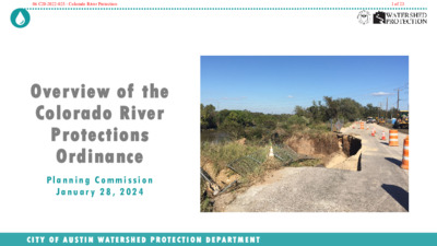
Overview of the Colorado River Protections Ordinance P l a n n i n g C o m m i s s i o n J a n u a r y 2 8 , 2 0 2 4 C I T Y O F A U S T I N W A T E R S H E D P R O T E C T I O N D E P A R T M E N T 06 C20-2022-025 - Colorado River Protection1 of 23 2-Minute Summary Video C I T Y O F A U S T I N W A T E R S H E D P R O T E C T I O N D E P A R T M E N T 2 Youtube video link 06 C20-2022-025 - Colorado River Protection2 of 23 The Colorado River • Crucial Resource • Significant Erosion • Water Quality Better Protected • Needs careful management • Dynamic natural system C I T Y O F A U S T I N W A T E R S H E D P R O T E C T I O N D E P A R T M E N T 3 06 C20-2022-025 - Colorado River Protection3 of 23 Council Resolution Community members asked Council to strengthen Colorado River protections; Council thereafter included in their June 2022 Council resolution: “… evaluate the effectiveness of existing Critical Water Quality Zone and Erosion Hazard Zone buffers on the Colorado River downstream of the Longhorn Dam and to propose protections that will provide adequate protections to the river that will ensure a healthy riparian corridor to stabilize the riverbank and protect property from erosion” C I T Y O F A U S T I N W A T E R S H E D P R O T E C T I O N D E P A R T M E N T 4 06 C20-2022-025 - Colorado River Protection4 of 23 The Proposal One simple change to the Land Development Code: Change Erosion Hazard Zone from 100 to 200 feet, downstream of Longhorn Dam Later (separate process): Improve drainage design rules to reduce extreme erosion C I T Y O F A U S T I N W A T E R S H E D P R O T E C T I O N D E P A R T M E N T 5 06 C20-2022-025 - Colorado River Protection5 of 23 East Austin Longhorn Dam J. Trevino Metro Park Lady Bird Lake Roy Guerrero Park “Dog’s Head” Southeast Austin Parcel Count Juris- diction Type Acres 400ft Buffer Acres CWQZ Buffer Acres Austin’s Full Purpose (City) Limits 1,054 14,896 15,950 391 2,184 2,575 281 1,929 2,211 241 243 484 50% 50% 100% 7% 93% 100% 13% 87% 100% 15% 85% 100% Acres 400ft minus CWQZ 109 255 ABIA 364 30% 70% 100% FULL ETJ Totals FULL ETJ Totals Hornsby Bend Biosolids Plant Tesla SHEC/SAR WWTP Austin’s ETJ Travis County Austin’s Colony 6 06 C20-2022-025 - Colorado River Protection6 of 23 Single-Family Residential Parks & Open Space Industrial Parks & Open Space Agriculture / Undeveloped Parks & Open Space Mining Single-Family Residential Utilities Single-family subdivisions and home construction in ETJ not affected C I T Y O F A U S T I N W A T E R S H E D P R O T E C T I O N D E P A R T M E N T 7 06 C20-2022-025 - Colorado River Protection7 of 23 Current Protections along River/Creeks 1. 100-Year Floodplain 2. Critical Water Quality Zone (CWQZ) buffer 3. Erosion Hazard Zone review buffer 4. Waterfront Overlay District (Red Bluff subdistrict) 5. Wildland-Urban Interface (WUI) L a d y B i r d L a k e • Each zone covers a different purpose, area, and restrictions • Restrictions may differ in COA, ETJ* and Travis County • Both the current and proposed Erosion Hazard Zone are entirely overlapped by the Critical Water Quality Zone • The erosion hazard zone works closely with the Critical Water Quality Zone and can fill in some gaps in regulation * COA = City of Austin; ETJ = Extraterritorial jurisdiction C I T Y O F A U S T I N W A T E R S H E D P R O T E C T I O N D E P A R T M E N T P u r p l e a r e a s s h o w 1 0 0- y e a r f l o o d p l a i n s 8 06 C20-2022-025 - Colorado River Protection8 of 23 Current Protections along River/Creeks 1. 100-Year Floodplain 2. Critical Water Quality Zone (CWQZ) buffer 3. Erosion Hazard Zone review buffer 100-Year Floodplain Width varies L a d y B i r d L a k e C I T Y O F A U S T I N W A T E R S H E D P R O T E C T I O N D E P A R T M E N T P u r p l e a r e a s s h o w 1 0 0- y e a r f l o o d p l a i n s 9 06 C20-2022-025 - Colorado River Protection9 of 23 Current Protections along River/Creeks 1. 100-Year Floodplain 2. Critical Water Quality Zone (CWQZ) buffer 3. Erosion Hazard Zone review buffer Critical Water Quality Zone 200 to 400 ft wide L a d y B i r d L a k e C I T Y O F A U S T I N W A T E R S H E D P R O T E C T I O N D E P A R T M E N T P u r p l e a r e a s s h o w 1 0 0- y e a r f l o o d p l a i n s 10 06 C20-2022-025 - Colorado River Protection10 of 23 Current Protections along River/Creeks 1. 100-Year Floodplain 2. Critical Water Quality Zone (CWQZ) buffer 3. Erosion Hazard Zone review buffer Critical Water Quality Zone Fixed 400 ft wide L a d y B i r d L a k e *** 400ft Fixed CWQZ NOT RECOMMENDED *** Existing buffers provide good protection, best fit the terrain, no additional impacts C I T Y O F A U S T I N W A T E R S H E D P R O T E C T I O N D E P A R T M E N T P u r p l e a r e a s s h o w 1 0 0- y e a r f l o o d p l a i n s 11 06 C20-2022-025 - Colorado River Protection11 of 23 Current Protections along River/Creeks 1. 100-Year Floodplain 2. Critical Water Quality Zone (CWQZ) buffer 3. Erosion Hazard Zone review buffer Erosion Hazard Zone Existing 100 feet wide L a d y B i r d L a k e C I T Y O F A U S T I N W A T E R S H E D P R O T E C T I O N D E P A R T M E N T P u r p l e a r e a s s h o w 1 0 0- y e a r f l o o d p l a i n s 12 06 C20-2022-025 - Colorado River Protection12 of 23 Current Protections along River/Creeks 1. 100-Year Floodplain 2. Critical Water Quality Zone (CWQZ) buffer 3. Erosion Hazard Zone review buffer Erosion Hazard Zone Proposed 200 feet wide L a d y B i r d L a k e *** 200ft EHZ RECOMMENDED *** Much better fit the height of banks and scale of river energy C I T Y O F A U S T I N W A T E R S H E D P R O T E C T I O N D E P A R T M E N T P u r p l e a r e a s s h o w 1 0 0- y e a r f l o o d p l a i n s 13 06 C20-2022-025 - Colorado River Protection13 of 23 Why are we proposing this? S A N D ! • Highly erosive area • Public safety • Public expenditures to stabilize erosion sites • Prevent public and private losses due to erosion • Tens of millions of dollars in damage and counting… • The current erosion hazard zone geometry does not fit the large scale of the river C I T Y O F A U S T I N W A T E R S H E D P R O T E C T I O N D E P A R T M E N T 14 06 C20-2022-025 - Colorado River Protection14 of 23 Erosion from concentrated flow Erosion on channel bends C I T Y O F A U S T I N W A T E R S H E D P R O T E C T I O N D E P A R T M E N T 15 06 C20-2022-025 - Colorado River Protection15 of 23 3 2 0 2 , 5 . n a J m o r f e g a m i p a M r a e N ~90 feet Stranded tree, formerly on edge of bank Knollwood on the Colorado C I T Y O F A U S T I N W A T E R S H E D P R O T E C T I O N D E P A R T M E N T 06 C20-2022-025 - Colorado River Protection16 of 23 Fallwell Lane: 2015 Halloween Flood Access to two critical facilities cut off—for the 2nd time C I T Y O F A U S T I N W A T E R S H E D P R O T E C T I O N D E P A R T M E N T 06 C20-2022-025 - Colorado River Protection17 of 23 Home threatened after 20ft bank failure, May 2015 Hergotz Lane C I T Y O F A U S T I N W A T E R S H E D P R O T E C T I O N D E P A R T M E N T 06 C20-2022-025 - Colorado River Protection18 of 23 Ordinance Proposal • Increases EHZ review buffer from 100ft to 200ft width • Only applies to new buildings with “habitable space” and to infrastructure Change affects EHZs citywide (not just along river) • No change for hard-surfaced trails (100ft EHZ remains the same) • Does not extend beyond parallel public roads • Adds an administrative variance for greater cut and fill to support the provision of EHZ protective works C I T Y O F A U S T I N W A T E R S H E D P R O T E C T I O N D E P A R T M E N T 19 * EHZ = Erosion Hazard Zone 06 C20-2022-025 - Colorado River Protection19 of 23 Ordinance Proposal • Affects foundation design and cost for single-family building permit projects Not applied to existing structures or new driveways, decks, etc. Not applied to new single-family construction in the ETJ* Stakeholder Feedback: Don’t extend to 200ft for single-family lots (i.e., leave at 100ft) • No/low impact on new subdivision or commercial projects (site plans) The proposed 200ft EHZ is entirely within the existing Critical Water Quality Zone (CWQZ) Possible impact on stormwater infrastructure in CWQZ Subdivisions in ETJ also unaffected (EHZ remains 100ft) • Potential impact on redeveloping commercial projects * ETJ = Extraterritorial jurisdiction. In ETJ, single-family building permits regulated by County, not City of Austin C I T Y O F A U S T I N W A T E R S H E D P R O T E C T I O N D E P A R T M E N T 20 06 C20-2022-025 - Colorado River Protection20 of 23 Proposed EHZ Diagram 200ft EHZ Review Buffer Protective works or Engineer Level II required Protective works not required Outside EHZ 200ft EHZ Review Buffer Starting point = lowest surface contour line Water surface Outside of critical slope Place subsurface utilities min. 20ft below channel bottom (if less must demonstrate via Level 2 analysis) C I T Y O F A U S T I N W A T E R S H E D P R O T E C T I O N D E P A R T M E N T 21 06 C20-2022-025 - Colorado River Protection21 of 23 Schedule Develop staff draft ordinance, gather stakeholder input Present ordinance to Commissions and Council Oct. 16 Nov. 6 Jan. 28 Feb. 13 Codes & Ordinances Joint Committee Environmental Commission Planning Commission City Council Develop and solicit stakeholder feedback on Criteria Changes Mar/25 to Jun/25 Interactive map of Erosion Ordinance C I T Y O F A U S T I N W A T E R S H E D P R O T E C T I O N D E P A R T M E N T 22 06 C20-2022-025 - Colorado River Protection22 of 23 C I T Y O F A U S T I N W A T E R S H E D P R O T E C T I O N D E P A R T M E N T 23 06 C20-2022-025 - Colorado River Protection23 of 23