09 C14-2024-0099 - Saxon 2; District 3 Staff Report — original pdf
Backup
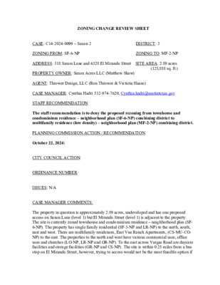
ZONING CHANGE REVIEW SHEET DISTRICT: 3 ZONING TO: MF-2-NP CASE: C14-2024-0099 – Saxon 2 ZONING FROM: SF-6-NP ADDRESS: 318 Saxon Lane and 6328 El Mirando Street SITE AREA: 2.89 acres (125,888 sq. ft.) PROPERTY OWNER: Saxon Acres LLC (Matthew Shaw) AGENT: Thrower Design, LLC (Ron Thrower & Victoria Haase) CASE MANAGER: Cynthia Hadri 512-974-7620, Cynthia.hadri@austintexas.gov STAFF RECOMMENDATION: The staff recommendation is to deny the proposed rezoning from townhouse and condominium residence – neighborhood plan (SF-6-NP) combining district to multifamily residence (low density) – neighborhood plan (MF-2-NP) combining district. PLANNING COMMISSION ACTION / RECOMMENDATION: October 22, 2024: CITY COUNCIL ACTION: ORDINANCE NUMBER: ISSUES: N/A CASE MANAGER COMMENTS: The property in question is approximately 2.89 acres, undeveloped and has one proposed access on Saxon Lane (level 1) but El Mirando Street (level 1) is adjacent to the property. The site is currently zoned townhouse and condominium residence – neighborhood plan (SF- 6-NP). The property has single family residential (SF-3-NP and LR-NP) to the north, south, east and west. There are multifamily residences, East Vue Ranch Apartments, (CS-MU-CO- NP) to the east. The properties to the north and west have various commercial uses, office uses and churches (LO-NP, LR-NP and GR-NP). To the east across Vargas Road are daycare facilities and storage facilities (GR-NP and CS-NP). The site is within 0.25 miles from a bus stop on El Mirando Street, however, trying to access would not be the most feasible option if C14-2024-0099 2 there is not an access proposed to this street.The applicant did not provide trip counts for El Mirando Street when submitting counts for the Neighborhood Traffic Analysis Memo and it will not have vehicular access proposed. Please refer to Exhibits A (Zoning Map) and B (Aerial View). Due to the history on this site and the lack of improved infrastructure, staff is recommending the denial for the rezoning to multifamily residence (low density) – neighborhood plan (MF- 2-NP) combining district. This property previously sought a rezoning in 2020 from SF-3-NP to SF-6-NP. In the four-year time frame since this previously granted rezoning, there have been no updates to the property or the surrounding area. The property continues to be undeveloped and the road unimproved. The Neighborhood Traffic Analysis (NTA) Memo states that traffic on a residential local or collector street less than 30 feet in width is operating at a desirable level if it does not exceed 1200 vehicles per day. This rezoning would surpass that and would mean that Saxon is operating at an undesirable level. There is no indication for changing the recent rezoning of SF-6-NP. The applicant has not proposed a unit count for the proposed rezoning, they are requesting the rezoning “to allow opportunity for a greater number and variety of residential uses housing types.” Please refer to Exhibits C (Summary Letter) and D (Neighborhood Traffic Analysis Memo). BASIS OF RECOMMENDATION: 1. The proposed zoning should be consistent with the purpose statement of the district sought. The townhouse and condominium residence district is intended as an area for moderate density single family, duplex, two family, townhouse, and condominium use, without the spacing and locational requirements for townhouses and condominiums that apply in sf-5. this district is appropriate for areas in which unusually large lots predominate with access to other than minor residential streets, and in selected areas where a transition from single- family to multifamily use is appropriate. The neighborhood plan district denotes a tract located within the boundaries of an adopted neighborhood plan. 2. No change in conditions has occurred within the area indicating that there is a basis for changing the originally established zoning and/ or development restrictions for the property. The current zoning of SF-6-NP is a recent rezoning that the current applicant, Thrower Design LLC, rezoned from SF-3-NP in 2020. There has not been any progress to develop the property since the previous rezoning that staff and Planning Commission recommended for City Council’s approval. As such, there is not a basis for a change in staff’s previous recommendation or rezoning the property. Please refer to Exhibit E (Ordinance from C14- 2020-0044 – Related case). 3. The proposed zoning should promote consistency and orderly planning. C14-2024-0099 3 While the surround zonings do have neighborhood commercial zonings, the neighborhood is primarily single-family residences. There are concerns about granting another rezoning on Saxon Road, a level one, dead end street. Granting a rezoning would mean Saxon Road is operating at an undesirable level, per the neighborhood traffic analysis. Please refer to Exhibit D (Neighborhood Traffic Analysis Memo). EXISTING ZONING AND LAND USES: Site North ZONING SF-6-NP LR-NP, SF-3-NP, GR-NP LAND USES Undeveloped Single Family Residential, Religious Assembly and Commercial uses Single Family Residential, Elementary School, Public Facility Single Family Residential, Multifamily Residential, Storage Facilities, Daycare Services Single Family Residential, Religious Assembly, Auto Repair Services and Commercial uses South LR-NP and SF-3-NP East West LR-NP, SF-3-NP, GR-NP, CS-MU-CO-NP and CS-NP LR-NP, SF-3-NP, GR-NP and LO-NP Martin Middle School SCENIC ROADWAY: No NEIGHBORHOOD PLANNING AREA: Montopolis WATERSHED: Country Club East (Suburban) and Colorado River (Urban) OVERLAYS: Airport Overlay (Controlled Compatible Land Use Area) CAPITOL VIEW CORRIDOR: No SCHOOLS: Austin Independent School District Allison Elementary School COMMUNITY REGISTRY LIST: Austin Independent School District Austin Lost and Found Pets Austin Neighborhoods Council Bonnett Neighborhood Association Carson Ridge Neighborhood Association Crossing Gardenhome Owners Assn. (The) Del Valle Community Coalition East Austin Conservancy El Concilio Mexican-American Neighborhoods Friends of Austin Neighborhoods Homeless Neighborhood Association Montopolis Community Alliance Montopolis Community Development Corporation Montopolis Neighborhood Association Montopolis Neighborhood Plan Contact Team (MNPCT) Montopolis Tributary Trail Association Montopolis-Ponca Neighborhood Association Neighborhood Empowerment Foundation Overton Family Committee Pleasant Valley Preservation Austin Eastside Memorial High School C14-2024-0099 4 Austin Regional Group Vargas Neighborhood Association SELTexas Save Our Springs Alliance Sierra Club AREA CASE HISTORIES: NUMBER C14-2022-0107 – Vargas Mixed Use REQUEST GR-NP for Tract 1 and LR-NP for Tract 2 to CS-DB90-NP for Tract 1; LR-DB90-NP for Tract 2, and to modify the DB90 ordinance ground floor Pedestrian-Oriented Commercial Spaces requirement. CITY COUNCIL Scheduled for City Council (11/21/2024) COMMISSION To Grant CS-CO-DB90-NP on Tract 1 LR- DB90-NP on Tract 2. The CO prohibits; Automotive Rentals, Automotive Repairs & Services, Automotive Sales, Automotive Washing (of any type), Bail Bond Services, Commercial Off-Street Parking, Drop-Off Recycling Collection Facility, Exterminating Services, Pawn Shop Services, Adult Oriented Businesses, Agricultural Sales & Service, Commercial Blood & Plasma Center, Construction Sales & Service, Kennels, Vehicle Storage and limits the Impervious Cover to 80% (06/11/2024) To Grant SF-3-H-NP. Commission also expressed a request to council that the vacation of right-of-way that is related to this site not be granted and to examine any possibilities or methods that the city may be able to use to acquire the entire site for public use and preservation of the site. (09/12/2017) C14H-2017-0055 - 500 Montopolis SF-3-NP to GR-MU- NP for Tract 1 and GR- MU-H-NP for Tract 2 The case was Indefinitely Postponed on 09/28/2017 and then expired. RELATED CASES: NPA-2024-0005.01 – Saxon Acres 2: This is the associated Neighborhood Plan Amendment (NPA). C14-2020-0044 – Saxon Acres Residential Rezoning: The Applicant is proposing to rezone approximately 2.924 acres from SF-3-NP to SF-6-NP. Staff recommendation was to recommend townhouse and condominium residence – neighborhood plan (SF-6-NP) combining district zoning. On July 28, 2020, Planning Commission approved the staff’s recommendation of SF-6-NP. On December 10, 2020, City Council approved the planning commission’s recommendation of SF-6-NP. ADDITIONAL STAFF COMMENTS: Comprehensive Planning: Please refer to the Staff Report submitted for the associated Neighborhood Plan Amendment. C14-2024-0099 5 Drainage: The developer is required to submit a pre- and post-development drainage analysis at the subdivision and site plan stage of the development process. The City’s Land Development Code and Drainage Criteria Manual require that the Applicant demonstrate through engineering analysis that the proposed development will have no identifiable adverse impact on surrounding properties. Environmental: The site is not located over the Edwards Aquifer Recharge Zone. The site is in the Country Club East Watershed classified as a Suburban Watershed and the Colorado River Watershed of the Colorado River Basin classified as an Urban Watershed by Chapter 25-8 of the City's Land Development Code. The site is in the Desired Development Zone. Under the current watershed regulations, development or redevelopment on this site will be subject to the following impervious cover limits: Development Classification One or Two Family Residential Multifamily Residential Commercial % of Net Site Area 30% 40% 40% % NSA with Transfers 40% 55% 55% Zoning district impervious cover limits apply in the Urban Watershed classification. According to floodplain maps there is no floodplain within or adjacent to the project location. Standard landscaping and tree protection will be required in accordance with LDC 25-2 and 25-8 for all development and/or redevelopment. At this time, site specific information is unavailable regarding vegetation, areas of steep slope, or other environmental features such as bluffs, springs, canyon rimrock, caves, sinkholes, and wetlands. Under current watershed regulations, development or redevelopment requires water quality control with increased capture volume and control of the 2-year storm on site. At this time, no information has been provided as to whether this property has any preexisting approvals that preempt current water quality or Code requirements. Fire: There are no comments. PARD – Planning & Design Review: Parkland dedication will be required for the new applicable uses proposed by this development, multifamily with MF-2 zoning, at the time of subdivision or site plan, per City Code § 25-1-601. Should fees in-lieu be required, those fees shall be used toward park C14-2024-0099 6 investments in the form of land acquisition and/or park amenities within the surrounding area, per the Parkland Dedication Operating Procedures § 14.3.11 and City Code § 25-1-609, as amended. If the applicant wishes to discuss parkland dedication requirements in advance of site plan or subdivision applications, please contact this reviewer: thomas.rowlinson@austintexas.gov. Site Plan: Site plans will be required for any new development other than single-family or duplex residential. Any new development is subject to Subchapter E. Design Standards and Mixed Use. Additional comments will be made when the site plan is submitted. Compatibility Standards The site is subject to compatibility standards due to the proximity/adjacency of SF-6 zoning of the triggering property. Reference 25-2-1051, 25-2-1053 Any structure that is located: a. At least 50 feet but less than 75 feet from any part of a triggering property b. Less than 50 feet from any part of a triggering property may not exceed 40 may not exceed 60 feet. feet. Reference 25-2-1061 An on-site amenity, including a swimming pool, tennis court, ball court, or playground, may not be constructed 25 feet or less from the triggering property. Reference 25-2-1062 Airport Overlay The site is located within Austin-Bergstrom Overlay {CCLUA, or AO-1,2,3}. No use will be allowed that creates electrical interference with navigational signals or radio communications between airport and aircraft, make it difficult for pilots to distinguish between the airport lights and others, result in glare in the eyes of pilots using the airport, impair visibility in the vicinity of the airport, create bird strike hazards or otherwise in any way endanger or interfere with the landing, taking off, or maneuvering of aircraft intending to use the Austin-Bergstrom Airport. Height limitations and incompatible uses with each Airport Overlay zone are established in the Airport Overlay Ordinance. Airport Hazard Zoning Committee review may be required prior to Planning Commission Hearing. FYI This site is in the Montopolis Neighborhood Plan C14-2024-0099 7 Austin Transportation Department – Engineering Review: A Neighborhood Traffic Analysis is required and will be performed for this project by TPW staff. Results will be provided in a separate memo. LDC 25-6-114. NTA requires three (3) consecutive 24-hour tube counts, preferably on Tuesday, Wednesday, and Thursday, during a non-holiday week when school is in session. Please contact this reviewer to discuss the location of the tube counts. Results will be provided in a separate memo. LDC 25-6-114. NTA fees will be added in AMANDA. This comment will be cleared once the Memo is approved and the fees are paid. Existing Street Characteristics: Name ASMP Classification Existing ROW Existing Pavement Sidewalks Bicycle Route ASMP Required ROW Capital Metro (within ¼ mile) Level 1 58’ 56’ 26’ No Yes Level 1 58’ 95’ 78’ No Yes No No Saxon Lane El Mirando Street Austin Water Utility: No comments on zoning change. FYI: The landowner intends to serve the site with existing City of Austin water utilities. Based on current public infrastructure configurations, it appears that service extension requests (SER) will be required to provide service to this lot. For more information pertaining to the Service Extension Request process and submittal requirements contact the Austin Water SER team at ser@austintexas.gov. INDEX OF EXHIBITS AND ATTACHMENTS TO FOLLOW: A. Zoning Map B. Aerial Map C. Applicant’s Summary Letter D. Neighborhood Traffic Analysis (NTA) Memo E. Ordinance from C14-2020-0044 – Related case Correspondence from Interested Parties