06 NPA-2024-0030.01 - 1500 W Stassney Lane; District 2 — original pdf
Backup
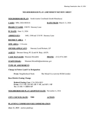
Planning Commission: June 11, 2024 NEIGHBORHOOD PLAN AMENDMENT REVIEW SHEET DATE FILED: March 13, 2024 1408, 1500 and 1510 W. Stassney Lane NEIGHORHOOD PLAN: South Austin Combined (South Menchaca) CASE#: NPA-2024-0030.01 PROJECT NAME: 1500 W. Stassney Lane PC DATE: June 11, 2024 ADDRESS/ES: DISTRICT AREA: 2 SITE AREA: 2.16 acres OWNER/APPLICANT: Stassney Land Partners, LP AGENT: Drenner Group, PC (Leah M. Bojo, AICP) CASE MANAGER: Maureen Meredith STAFF EMAIL: Maureen.Meredith@austintexas.gov TYPE OF AMENDMENT: Change in Future Land Use Designation From: Neighborhood Node Base District Zoning Change Related Zoning Case: C14-2024-0033 From: CS-V-NP, LR-NP, GR-V-NP, and MF-3-NP To: CS-MU-V-DB90-NP NEIGHBORHOOD PLAN ADOPTION DATE: November 6, 2014 CITY COUNCIL DATE: TBD PLANNING COMMISSION RECOMMENDATION: June 11, 2024 – (action pending) ACTION: PHONE: (512) 974-2695 To: Mixed Use Activity HUB/Corridor Planning Commission: June 11, 2024 STAFF RECOMMENDATION: Recommended or the applicant’s request for Mixed Use Activity HUB/Corridor. BASIS FOR STAFF’S RECOMMENDATION: Staff supports the applicant’s request for Mixed Use Activity HUB/Corridor because the applicant proposes a mixed use development with 187 rental units, with 3,400 square feet of ground floor commercial uses. West Stassney Lane is an Activity Corridor as identified on the Imagine Austin Growth Concept Map where mixed use developments are appropriate. The proposed development will provide housing options for the City and the planning area to meet the Austin Strategic Housing Goals. The South Austin combined Neighborhood Plan states that Mixed Use Activity/HUBS are located at major intersections and along arterial roadways. Planning Commission: June 11, 2024 LAND USE DESCRIPTIONS: EXISTING LAND USE: Neighborhood Node - Neighborhood Node districts contain restaurants, shops, offices, and multi- family housing. The form of these areas is similar to Neighborhood Transition districts but with more commercial activity. Neighborhood Nodes have a similar mix of uses as Mixed Use Hubs, but primarily serve residents in the neighborhood. Building heights range from one to two stories (although many locations are zoned for greater height). PROPOSED LAND USE: Mixed Use Activity HUB/Corridor - Located at the intersections of major roadways and along arterial roadways, Mixed-Use Activity Hubs/Corridors are the most urban areas of the neighborhood and serve the surrounding neighborhoods and the broader community. They consist of a mix of services and housing types at a more intensive scale than a Neighborhood Node. Yes Yes Imagine Austin Decision Guidelines Complete Community Measures Imagine Austin Growth Concept Map: Located within or adjacent to an Imagine Austin Activity Center, Imagine Austin Activity Corridor, or Imagine Austin Job Center as identified the Growth Concept Map. Name(s) of Activity Center/Activity Corridor/Job Center: • W. Stassney lane is an Activity Corridor • Approx. 500 feet for South Austin Civic Center Neighborhood Center Yes Mobility and Public Transit: Located within 0.25 miles of public transit stop and/or light rail station. Yes • CapMetro bus routes on West Stassney lane and South Menchaca Rd Yes Mobility and Bike/Ped Access: Adjoins a public sidewalk, shared path, and/or bike lane. Yes Connectivity, Good and Services, Employment: Provides or is located within 0.50 miles to goods and services, and/or employment center. Connectivity and Food Access: Provides or is located within 0.50 miles of a grocery store/farmers market. • • • • 0.4 miles from 7 Days Food Store 0.8 miles from Zapco Meat Market 0.9 miles La Buena Supermercado 1.6 miles from Sprouts Farmers Market Yes Connectivity and Education: Located within 0.50 miles from a public school or university. • • • 0.3 miles from ACC South Campus 0.7 miles from Crockett High School 0.8 miles from Odom Elementary School Connectivity and Healthy Living: Provides or is located within 0.50 miles from a recreation area, park or Planning Commission: June 11, 2024 walking trail. • Near planned Williamson Creek Trail and UPC/ASA Rail Trail • 0.8 miles from Garrison Park Yes Connectivity and Health: Provides or is located within 0.50 miles of health facility (ex: hospital, urgent care, doctor’s office, drugstore clinic, and/or specialized outpatient care.) • • 0.2 miles from Austin Oaks Hospital 0.7 miles from Sigma Mental Health Urgent Care Yes Housing Affordability: Provides a minimum of 10% of units for workforce housing (80% MFI or less) and/or fee in lieu for affordable housing. • The applicant proposes a mixed-use project with 187 rental units, with minimum affordability requirements of 19 units at 50% Medium Family Income (MFI) or 23 units at 60% MFI. Also proposed is 3,400 square feet of ground floor commercial uses. Yes Housing Choice: Expands the number of units and housing choice that suits a variety of household sizes, incomes, and lifestyle needs of a diverse population (ex: apartments, triplex, granny flat, live/work units, cottage homes, and townhomes) in support of Imagine Austin and the Strategic Housing Blueprint. • Applicant proposes 187 rental residential units Yes Mixed use: Provides a mix of residential and non-industrial uses. • Applicant proposes 187 rental residential units and 3,400 s.f. of ground floor commercial uses. No Culture and Creative Economy: Provides or is located within 0.50 miles of a cultural resource (ex: library, theater, museum, cultural center). • 0.7 miles from Menchaca Road Branch No Not Known Not Known No 10 Culture and Historic Preservation: Preserves or enhances a historically and/or culturally significant site. Creative Economy: Expands Austin’s creative economy (ex: live music venue, art studio, film, digital, theater.) Workforce Development, the Economy and Education: Expands the economic base by creating permanent jobs, especially in industries that are currently not represented in particular area or that promotes a new technology, and/or promotes educational opportunities and workforce development training. Industrial Land: Preserves or enhances industrial land. Number of “Yes’s” Proximity to Imagine Austin Activity Centers and Corridors Planning Commission: June 11, 2024 Planning Commission: June 11, 2024 Proximity to Public Parks Planning Commission: June 11, 2024 Proximity to Public Transportation IMAGINE AUSTIN GROWTH CONCEPT MAP Definitions Neighborhood Centers - The smallest and least intense of the three mixed-use centers are neighborhood centers. As with the regional and town centers, neighborhood centers are walkable, bikable, and supported by transit. The greatest density of people and activities in neighborhood centers will likely be concentrated on several blocks or around one or two intersections. However, depending on localized conditions, different neighborhood centers can be very different places. If a neighborhood center is designated on an existing commercial area, such as a shopping center or mall, it could represent redevelopment or the addition of housing. A new neighborhood center may be focused on a dense, mixed-use core surrounded by a mix of housing. In other instances, new or redevelopment may occur incrementally and concentrate people and activities along several blocks or around one or two intersections. Neighborhood centers will be more locally focused than either a regional or a town center. Businesses and services—grocery and department stores, doctors and dentists, shops, branch libraries, dry cleaners, hair salons, schools, restaurants, and other small and local businesses—will generally serve the center and surrounding neighborhoods. Town Centers - Although less intense than regional centers, town centers are also where many people will live and work. Town centers will have large and small employers, although fewer than in regional Planning Commission: June 11, 2024 centers. These employers will have regional customer and employee bases, and provide goods and services for the center as well as the surrounding areas. The buildings found in a town center will range in size from one-to three-story houses, duplexes, townhouses, and rowhouses, to low-to midrise apartments, mixed use buildings, and office buildings. These centers will also be important hubs in the transit system. Regional Centers - Regional centers are the most urban places in the region. These centers are and will become the retail, cultural, recreational, and entertainment destinations for Central Texas. These are the places where the greatest density of people and jobs and the tallest buildings in the region will be located. Housing in regional centers will mostly consist of low to high-rise apartments, mixed use buildings, row houses, and townhouses. However, other housing types, such as single-family units, may be included depending on the location and character of the center. The densities, buildings heights, and overall character of a center will depend on its location. Activity Centers for Redevelopment in Sensitive Environmental Areas - Five centers are located over the recharge or contributing zones of the Barton Springs Zone of the Edwards Aquifer or within water-supply watersheds. These centers are located on already developed areas and, in some instances, provide opportunities to address long-standing water quality issues and provide walkable areas in and near existing neighborhoods. State-of-the-art development practices will be required of any redevelopment to improve stormwater retention and the water quality flowing into the aquifer or other drinking water sources. These centers should also be carefully evaluated to fit within their infrastructural and environmental context. Job Centers - Job centers accommodate those businesses not well-suited for residential or environmentally- sensitive areas. These centers take advantage of existing transportation infrastructure such as arterial roadways, freeways, or the Austin-Bergstrom International airport. Job centers will mostly contain office parks, manufacturing, warehouses, logistics, and other businesses with similar demands and operating characteristics. They should nevertheless become more pedestrian and bicycle friendly, in part by better accommodating services for the people who work in those centers. While many of these centers are currently best served by car, the growth Concept map offers transportation choices such as light rail and bus rapid transit to increase commuter options. Corridors - Activity corridors have a dual nature. They are the connections that link activity centers and other key destinations to one another and allow people to travel throughout the city and region by bicycle, transit, or automobile. Corridors are also characterized by a variety of activities and types of buildings located along the roadway — shopping, restaurants and cafés, parks, schools, single-family houses, apartments, public buildings, houses of worship, mixed-use buildings, and offices. Along many corridors, there will be both large and small redevelopment sites. These redevelopment opportunities may be continuous along stretches of the corridor. There may also be a series of small neighborhood centers, connected by the roadway. Other corridors may have fewer redevelopment opportunities, but already have a mixture of uses, and could provide critical transportation connections. As a corridor evolves, sites that do not redevelop may transition from one use to another, such as a service station becoming a restaurant or a large retail space being divided into several storefronts. To improve mobility along an activity corridor, new and redevelopment should reduce per capita car use and increase walking, bicycling, and transit use. Intensity of land use should correspond to the availability of quality transit, public space, and walkable destinations. Site design should use building arrangement and open Planning Commission: June 11, 2024 space to reduce walking distance to transit and destinations, achieve safety and comfort, and draw people outdoors. BACKGROUND: The applicant proposes to change the character district map from Neighborhood Node to Mixed Use Activity/HUB Corridor for multifamily uses and ground-floor commercial. The applicant proposes a mixed-use project with 187 rental units, with minimum affordability requirements of 19 units at 50% Medium Family Income (MFI) or 23 units at 60% MFI. Also proposed is 3,400 square feet of ground floor commercial uses. The applicant proposes to change the zoning on the property from LR-NP (Neighborhood Commercial – Neighborhood Plan), MF-3-NP (Multifamily Residence Medium Density district- Neighborhood Plan), GR-V-NP (Community Commercial district – Vertical Mixed Use Building combining district) and CS- V-NP (General Commercial Services district – Vertical Mixed Use Building combining district – Neighborhood Plan) to CS-MU-V-DB90-NP (General Commercial Services district – Mixed Use combining district – Vertical Mixed Use Building combining district – Neighborhood Plan). For more information on the proposed rezoning, see case report C14-2024-0033. PUBLIC MEETINGS: The ordinance-required community meeting was virtually held on May 13, 2024. The recorded meeting can be found here: https://publicinput.com/q4506. Approximately 185 meeting notices were mailed to people who rent or own property within 500 feet of the subject properties, in addition to neighborhood and environmental groups who requested notification for the area. Two staff members from the Planning Department attended, Maureen Meredith and Mark Walters. The applicant’s agents, Leah M. Bojo and Drew Rafaele from Drenner Group, PC, attended in addition to two people from the neighborhood. Below are highlights from Leah Bojo’s presentation: • There are two parcels that are to be developed as one. It’s about 2 acres. The building are vacant. • We are asking for CS-MU-V-DB90-NP zoning and also Mixed Use Activity HUB/Corridor. We are seeking consistent zoning across the site. • The property us near the proposed UPC/ASA Rails to Trail. • There is an old warehouse and an office building on the properties. • The property is on an Imagine Austin Corridor and is an ASMP Transit Priority Network Street • CapMetro had bus routes 311 on W. Stassney Lane • There is the Williamson Creek Trail that is planned and the UPC/ASA Trail that is also planned near the property. • There is an all ages and abilities bicycle priority network buffered lanes that are built and protected bike lanes that are planned. • We have a site plan in review and was almost complete under the VMU-2, until the ordinance was taken down, so we have a detailed description of the plan. o Unit count: 187 rental units: Min. affordability requirements 19 units @ 50% MFI or 23 units at 60% MFI. o Commercial Space: 3,400 SF of ground floor commercial uses o Height: Permitted (CS-DB90) is 90 feet. Proposed is 70 feet. o Parking: 229 provided spaces and 40 bicycle spaces o Site Constraints: There are three heritage tree species to remain, 25 protected trees to remain, 19 new shade trees to be planted and 11 new ornamental trees to be planted. Planning Commission: June 11, 2024 Q: I would like to know if staff intends to take a position on this application (as it often does) and what the role of the Contact Team's position (which we do not have as of yet) might be in staff's decision whether or not to support it. A: Staff: At this time in the process, I usually do not have a formal letter of recommendation from a neighborhood plan contact team. I will report back to my team the questions and concerns from this meeting and we take that into consideration. Q: Are the trees going to be behind the building to the north to screen the single family homes? A: You can see there are large tree in the area, but we will be planting large trees between the parking and the homes. Q: Can you tell us where the storm water management will go? A: We have that information, but I don’t have it with me. I will have to send that information to you. Q: How tall will the buildings be allowed? A: We are proposing six stories. Applicant’s Summary Letter Planning Commission: June 11, 2024 Planning Commission: June 11, 2024 March 12, 2024 Page 2 the residential units as affordable for households earning no more that 60% of the area MFI. The Property is currently developed with two vacant commercial office buildings and a warehouse. The Property is located in the South Austin Combined Neighborhood Planning Area – South Manchaca subdistrict and has a Future Land Use Map (FLUM) designation of Neighborhood Node. A Neighborhood Plan Amendment (NPA) is required with this rezoning request to change the FLUM from Neighborhood Node to Mixed Use Activity Hub/Corridor. The Project supports the neighborhood plan’s Mixed Use Activity Hub/Corridor policy no. 5, that, “[n]ew buildings should be mixed-use, with pedestrian-oriented ground floors”, as well as Housing Affordability action no. 10, by encouraging “affordable housing near schools.” The Project is located within ¼ mile of the Crockett Early College High School and ½ mile from Odom Elementary School. The site development permit that is currently in review for the Project previously relied upon the VMU2 Ordinance that was invalidated. Per Part 5 of the adopted DB90 ordinance, the City Council waives the fees related to this rezoning application and the required NPA application necessitated by this zoning change. Please let me know if you or your team members require additional information or have any questions. Thank you for your time and attention to this project. cc: Joi Harden, Planning Department (via electronic delivery) Maureen Meredith, Planning Department (via electronic delivery) Jim Gobel, Development Services Department (via electronic delivery) Sincerely, Leah M. Bojo Letter of Recommendation from the Neighborhood Plan Contact Team (NPCT) (No letter as of June 5, 2024) From: Meredith, Maureen Sent: Monday, May 27, 2024 3:19 PM Cc: Boudreaux, Marcelle <Marcelle.Boudreaux@austintexas.gov>; Leah Bojo <lbojo@drennergroup.com>; Drew Raffaele <draffaele@drennergroup.com> Subject: S Menchaca NPCT Rec?: NPA-2024-0030.01_1408 W. Stassney Ln Dear South Menchaca NPCT: Cases NPA-2024-0030.01 and C14-2024-0033_1408 W. Stassney Lane are on the June 11, 2024 Planning Commission hearing date. If your team would like to submit a letter of recommendation to be included in the staff case reports, please email it to me and Marcelle Boudreaux no later than Wednesday, June 5, 2024 by 5:00 pm when our staff reports are due. If we receive it after this date and time, we will submit as late material for the hearing. You can view the recorded community meeting held on May 13th here: https://publicinput.com/q4506. Thanks. Maureen Maureen Meredith (she/her) Senior Planner – Long-Range Planning Division City of Austin Planning Department 6310 Wilhelmina Delco Dr. Austin, Texas 78752 (4th Floor) P: (512) 974-2695 E: Maureen.Meredith@austintexas.gov 13 Site 14 15 16 17 18 Leah Bojo’s Presentation at the May 13, 2024 Virtual Community Meeting 19 20 21 22 23 Correspondence Received 24