15 C12M-2023-0157 - Moore's Crossing Consent Agreement Amendment; District 2.pdf — original pdf
Backup
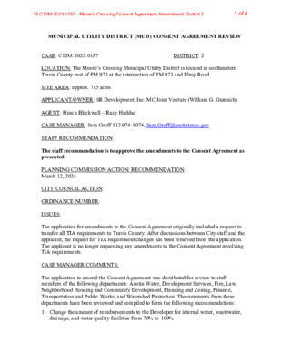
MUNICIPAL UTILITY DISTRICT (MUD) CONSENT AGREEMENT REVIEW DISTRICT: 2 CASE: C12M-2023-0157 LOCATION: The Moore’s Crossing Municipal Utility District is located in southeastern Travis County east of FM 973 at the intersection of FM 973 and Elroy Road. SITE AREA: approx. 785 acres APPLICANT/OWNER: SR Development, Inc. MC Joint Venture (William G. Gurasich) AGENT: Husch Blackwell – Racy Haddad CASE MANAGER: Sara Groff 512-974-8074, Sara.Groff@austintexas.gov STAFF RECOMMENDATION: The staff recommendation is to approve the amendments to the Consent Agreement as presented. PLANNING COMMISSION ACTION/ RECOMMENDATION: March 12, 2024 CITY COUNCIL ACTION: ORDINANCE NUMBER: ISSUES: The application for amendments to the Consent Agreement originally included a request to transfer all TIA requirements to Travis County. After discussions between City staff and the applicant, the request for TIA requirement changes has been removed from the application. The applicant is no longer requesting any amendments to the Consent Agreement involving TIA requirements. CASE MANAGER COMMENTS: The application to amend the Consent Agreement was distributed for review to staff members of the following departments: Austin Water, Development Services, Fire, Law, Neighborhood Housing and Community Development, Planning and Zoning, Finance, Transportation and Public Works, and Watershed Protection. The comments from these departments have been reviewed and compiled to form the following recommendations: 1) Change the amount of reimbursements to the Developer for internal water, wastewater, drainage, and water quality facilities from 70% to 100% 1 of 415 C12M-2023-0157 - Moore's Crossing Consent Agreement Amendment; District 2 C12M-2023-0157 2 2) Remove the requirement for the Developer to dedicate seven (7) acres to Austin Housing and Community Development (AHCD) 3) Add the Developer’s commitment to pay 5% of the net cash proceeds from the Bond Issue to AHCD a) The City will receive approximately $1,430,168.00 over the next 10 years 4) Add the Developer’s commitment to pay the District 2% of the net cash proceeds from each Bond Issue to be invested in District park facilities a) The District would receive approximately $357,542.00 over the next 10 years BACKGROUND: In 1986, the City of Austin consented to the creation of the Moore’s Crossing Municipal Utility District located within the corporate limits of the City in southeastern Travis County east of FM 973 at the intersection of FM 973 and Elroy Road. The Consent Agreement between the City and the MUD contains provisions regarding development requirements for future development within the MUD. In 1994, the first amendment to the Agreement deferred by five years the first possible date for the City to dissolve the MUD due to delays in beginning the development within the MUD. In 1995, special state legislation afforded several municipal utility districts in the Austin area the option to provide tax relief to their residents by petitioning the City to alter the annexation status of land in the municipal utility district from full purpose to limited purpose. The MUD did so in September of 1995. In 1998, the second amendment to the Agreement provided for a reduction in the amount of reimbursement to the Developer to not exceed 70% of the actual cost for design and construction of internal water, wastewater, drainage, and water quality facilities. In 2003, the Agreement and Land Plan were amended again to reflect the amount and location of land to be dedicated to the City for parkland, affordable housing, and for sites for fire stations, emergency medical services, and library facilities and to update the proposed alignment of Elroy Road and Ross Road. In 2016, the Developer brought forth Consent Agreement Amendments that contained asks for (1) increase in bond reimbursements from 70% to 100% for water/wastewater infrastructure and (2) update to the Developer’s obligations for right-of-way dedication and roadway improvements. On March 23, 2017, City Council approved an ordinance that amended the Consent Agreement to allow for the right-of-way dedication and roadway improvements. However, the bond reimbursement was not approved nor was it recommended by staff. At the time, there were concerns about the amount of remaining outstanding bond debt which may have been passed on to the City at the time of full purpose annexation. C12M-2016-0006 2 of 415 C12M-2023-0157 - Moore's Crossing Consent Agreement Amendment; District 2 C12M-2023-0157 3 SCENIC ROADWAY: No Currently, The MUD has approved bonding authority up to $32,000,000 of which $12,420,000 has been issued. EXISTING ZONING AND LAND USES: Zoning designations located throughout the MUD include residential, community commercial, limited industrial service and public districts. NEIGHBORHOOD PLANNING AREA: N/A WATERSHED: Dry Creek East and Onion Creek (Suburban) CAPITOL VIEW CORRIDOR: No SCHOOLS: Del Valle Independent School District COMMUNITY REGISTRY LIST: Austin Lost and Found Pets Del Valle Community Coalition Del Valle Independent School District Elroy Neighborhood Association CONSENT AGREEMENT AMENDMENT PROCESS: Section 25-9-253 of the City Code requires staff and boards and commissions determined to have an interest in this application to review and make a recommendation on the application no later than the 60th day after the date the application is filed. The City Council will act on the application no later than the second regular Thursday City Council meeting following board and commission recommendations. INDEX OF EXHIBITS AND ATTACHMENTS TO FOLLOW: A. Aerial Map B. Fifth Amendment to Consent Agreement Friends of Austin Neighborhoods Onion Creek Homeowners Assoc. Sierra Club, Austin Regional Group 3 of 415 C12M-2023-0157 - Moore's Crossing Consent Agreement Amendment; District 2 !!!!!!!!!!!!!!!!!!!!!!!!!!!!!!!!!!!!!!!!!!!!!!!!!!!!!!!!!!!!!!!!!!!!!!!!!!!!!!!!!!!!!!!!!!!!!!!!!!!!!!!!!!!!!!!!!!!!!!!!!!!!!!!!!!!!!!!!!!!!!!!!!!!!!!!!!!!!!!!!!!!!!!!!!!!!!!!!!!!!!!!!!!!!!!!!!!!!!!!!!!!!!!!!!!!!!!!!!!!!!!!!!!!!!!!!!!!!!!!!!!!!!!!!!!!!!!!!!!!!!!!!!!!!!!!!!!!!!!!!!!!!!!!!!!!!!!!!!!!!!!!!!!!!!!!!!!!!!!!!!!!!!!!!!!!!!!!!!!!!!!!!!!!!!!!!!!!!!!!!!!!!!!!!!!!!!!!!!!!!!!!!!!!!!!!!!!!!!!!!!!!!!!!!!!!!!!!!!!!!!!!!!!!!!!!!!!!!!!!!!!!!!!!!!!!!!!!!!!!!!!!!!!!!!!!!!!!!!!!!!!!!!!!!!!!!!!!!!!!!!!!!!!!!!!!!!!!!!!!!!!!!!!!!!!!!!!!!!!!!!!!!!!!!!!!!!!!!!!!!!!!!!!!!!!!!!!!!!!!!!!!!!!!!!!!!!!!!!!!!!!!!!!!!!!!!!!!!!!!!!!!!!!!!!!!!!!!!!!!!!!!!!!!!!!!!!!!!!!!!!!!!!!!!!!!!!!!!!!!!!!!!!!!!!!!!!!!!!!!!!!!!!!!!!!!!!!!!!!!!!!!!!!!!!!!!!!!!!!!!!!!!!!!!!!!!!!!!!!!!!!!!!!!!!!!!!!!!!!!!!!!!!!!!!!!!!!!!!!!!!!!!!!!!!!!!!!!!!!!!!!!!!!!!!!!!!!!!!!!!!!!!!!!!!!!!!!!!!!!!!!!!!!!!!!!!!!!!!!!!!!!!!!!!!!!!!!!!!!!!!!!!!!!!!!!!!!!!!!!!!!!!!!!!!(!(!(!(!(!(!(!(!(!(!(!(!(!(!(!(!(!(!(!(!(!(!(!(!(!(!(!(!(!(!(!(!(!(!(!(!(!(!(!(!(!(!(!(!(!(!(!(!(!(!(!(!(!(!(!(!(!(!(!(!(!(!(!(!(!(!(!(!(!(!(!(!(!(!(!(!(!(!(!(!(!(!(!(!(!(!(!(!(!(!(!(!(!(!(!(!(!(!(!(!(!(!(!(!(!(!(!(!(!(!(!(!(!(!(!(!(!(!(!(!(!(!(!(!(!(!(!(!(!(!(!(!(!(!(!(!(!(!(!(!(!(!(!(!(!(!(!(!(!(!(!(!(!(!(!(!(!(!(!(!(!(!(!(!(!(!(!(!(!(!(!(!(!(!(!(!(!(!(!(!(!(!(!(!(!(!(!(!(!(!(!(!(!(!(!(!(!(!(!(!(!(!(!(!(!(!(!(!(!(!(!(!(!(!(!(!(!(!(!(!(!(!(!(!(!(!(!(!(!(!(!(!(!(!(!(!(!(!(!(!(!(!(!(!(!(!(!(!(!(!(!(!(!(!(!(!(!(!(!(!(!(!(!(!(!(!(!(!(!(!(!(!(!(!(!(!(!(!(!(!(!(!(!(!(!(!(!(!(!(!(!(!(!(!(!(!(!(!(!(!(!(!(!(!(!(!(!(!(!(!(!(!(!(!(!(!(!(!(!(!(!(!(!(!(!(!(!(!(!(!(!(!(!(!(!(!(!(!(!(!(!(!(!(!(!(!(!(!(!(!(!(!(!(!(!(!(!(!(!(!(!(!(!(!(!(!(!(!(!(!(!(!(!(!(!(!(!(!(!(!(!(!(!(!(!(!(!(!(!(!(!(!(!(!(!(!(!(!(!(!(!(!(!(!(!(!(!(!(!(!(!(!(!(!(!(!(!(!(!(!(!(!(!(!(!(!(!(!(!(!(!(!(!(!(!(!(!(!(!(!(!(!(!(!(!(!(!(!(!(!(!(!(!(!(!(!(!(!(!(!(!(!(!(!(!(!(!(!(!(!(!(!(!(!(!(!(!(!(!(!(!(!(!(!(!(!(!(!(!(!(!(!(!(!(!(!(!(!(!(!(!(!(!(!(!(!(P12P13P14N12N13P11N14N11Q13Q12Q14Q11C12M-2023-0157C12M-2016-0006C814-2018-0122C14-02-0053C14-2007-0016C14-03-0135.SHC14-2007-0271C14-2015-0127C814-2018-0122C14-04-0009C14-2022-0147C14-2014-0184C14-2021-0047C14-97-0005C14-2008-0183.SHC14-2010-0047C14-02-0074C14-2012-0108C14-2019-0057C14-2019-0056C14-2010-0001C14-2019-0165C14-2016-0057C14-2021-0046C14-2014-0182C14-2021-0045C14-2021-0049C14-2015-0154C14-05-0141C14-2014-0181C14-2020-0152C14-2009-0010C14-2018-0146C14-2021-0048C14-2019-0168C14-2022-0135C14-2014-0187C14-2014-0187S SH 130 NBS SH 130 SBELROY RDROSS RDS SH 130 SVRD NBS SH 130 SVRD SBPEARCE LNS FM 973 RDMC ANGUS RDFM 812 RDBAIN RDKELLAM RDCIRCUIT OF THE AMERICAS BLVDHEINE FARM RDFOLEY DRAPPERSON STLINDA VISTA DRTOWERY LNSKY HARBOR DRBURLESON RDIGLESIAS DRLA PAZ LNCASA REAL DRMOORES CROSSING BLVDGEMMER STCAMPANA DRPALOMA BLANCA WAYMARIO DRREVA RDTICKFORD DRELROY RD TO S SH 130 SB RAMPLAS ALAS TRLSCHEBLER STRAILTON DRMOORES BRIDGE RDSILVER FOX DRS SH 130 NB TO ELROY RD RAMPMAYBACH DRSTONEY MEADOW DRPLAINS CREST DRPROUD PANDA DRBUENOS AIRES PKWYSPIERS WAYALBANY SLEIGH DRWARDMAN DRNOCHE CLARA DRFM 812 TO S SH 130 NB RAMPSKY PARK STPLAINS VALLEY DRFERRYSTONE PASSCAMPINA XINGDAIN PATHMALARKEY RDLOS CIELOS BLVDIWANNA DRDARRIN LNALOMAR CVARROWMOUND PASSSAVANNA CANYON DRCONSTELLATION CIRRAMON BNDS SH 130 SB TO FM 812 RAMPHEWERS DRRUXPIN RDLAGUARDIA LNARCADIA CIRFERRYSTONE GLEN DRPASEO NUEVO CIRMORNING VIEW DRPLOW HANDLE DRPANDA ROYLE DRCARRIAGE PINES DRNIGHT SKY WAYYANEZ DRTIERRAALTA CIRANGEL DRCLAREMONT CIRCHARRO DRDESCANSO CIRRUEDAS RDLOS DIOS PLWAGON SPRING STROWOOD DRMACEDO DRCONESTOGA WAGON WAYSTONEY RIDGE BNDHORSESHOE POND DRESTEBAN DRWESTERN MAIL WAYMOORES FERRY DRVIDA NUEVAAVEMISSION CIRRUBIX RDCOZETTE DRPIMLICO DRBACANORA STABRAMS DRLA LOMA LNTESSA CVS SH 130 SB TO ELROY RD RAMPMONTECITO LNELROY RD TO S SH 130 NB RAMPDANCING WIND LNS SH 130 NB TO PEARCE LN RAMPPERCONTE DRLOMA VISTA CIRGREAT PANDA CVCIELO GRANDE STPEARCE LN TO S SH 130 SB RAMPACE IN THE HOLEJULIO DRDOVE FLIGHT DRIRVINE LNBLACK PANDATRLMARENGO PLPONG PATHKELLNER CVWHITE PANDA RUNEL MOLINO CIRFORT LEXINGTON DRCORZO PASSLANETTE LNCABRERA PATHCHIOTILLA STLOS ARBOLES CIRENGLER PARK STSCARLET SLEEVE WAYCHAMBERS PEAK CVLOS ROBLES CIRMEXICANA CVNOEL BAIN CVCORUM RIDGE CVSAVANNA CANYON CTUNIVERSE CIRS SH 130 SB AT MC ANGUS RD TRNLICKETY SPLIT WAYFERRYSTONE CVHAYSEED CTERNESTINA PASSRISING MOON LNSHORT LEAF PATHCOZETTE CTMORNING VIEW CTHUMBER CVARROWMOUND CVROSS RDELROY RDRAMON BNDPUDAVLIPSF-4ALII-RRPI-RRPUDMH-COMH-COI-SF-4APIPLIPLIIP-COGRIPI-RRMF-4-COPSF-2RRSF-4AMHMF-3I-SF-4AI-RRDRGR-COMF-4PSF-2SF-2GRMF-4MF-4SF-2SF-2MF-4I-SF-4ASF-4ASF-2SF-2SF-2MF-2RRSF-2RRSF-2SF-2SF-2SF-2SF-2SF-4ASF-4AI-RRGRSF-2SF-4AI-SF-4AI-SF-4ASF-4ADRMH-COI-RRLR-MU-COSF-4ASF-2SF-2GR-COSF-4AMHI-SF-2I-SF-4AMF-2SF-4ASF-4ASF-4ALR-COI-SF-4ASF-4AI-SF-4ASF-4AI-SF-4ASF-2GR-COPUDMF-2MHI-SF-4AMHI-SF-2SF-4AGR-MU-COMHMH-COSF-4ASF-2MHSF-4AI-SF-2PSF-6MH-COSF-4ASF-2SF-2SF-4AI-RRI-SF-4ASF-4ASF-2I-SF-2PSF-4AMF-2MH-COSF-4AMH-COSF-4ASF-4AMH-COMH-COSF-2LR-MUSF-4ALR-MU-COI-SF-2I-SF-4AMHGR-MU-COI-SF-2MH-COI-SF-4AMH-COI-SF-4AI-SF-2SF-4AI-SF-4AMHI-SF-2MH-COSF-4AI-SF-4AI-SF-2MH-COSF-4AI-SF-2I-RRMH-COGR-MU-COSF-4AI-SF-2SF-4AMHMH-COMoore's Crossing Municipal Utility District±This product has been produced by the Planning Department for the sole purpose of geographic reference. No warrantyis made by the City of Austin regarding specific accuracy or completeness.CASE#:LOCATION:SUBJECT AREA:GRID:MANAGER:C12M-2023-01577110 Heine Farm Rd784.313 AcresP13Sara GroffCreated: 1/31/2024SUBJECT TRACTZONING BOUNDARY!!!!!!PENDING CASECREEK BUFFER02004006008001,0001,2001,4001,6001,8002,0002,2002,4002,6002,8003,0003,2003,4003,6003,8004,000100Feet4 of 415 C12M-2023-0157 - Moore's Crossing Consent Agreement Amendment; District 2