08 NPA-2022-0021.02 - Burleson & Ben White; District 3.pdf — original pdf
Backup
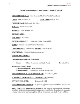
Planning Commission: November 15, 2022 NEIGHBORHOOD PLAN AMENDMENT REVIEW SHEET DATE FILED: July 28, 2022 NEIGHORHOOD PLAN: East Riverside/Oltorf Combined (Parker Lane) CASE#: NPA-2022-0021.02 PROJECT NAME: Burleson & Ben White PC DATE: November 15, 2022 ADDRESS: 3507 Burleson Rd. DISTRICT AREA: SITE AREA: 10.87 acres OWNER/APPLICANT: Stoneridge Capital Partners LTD AGENT: Vanessa Mendez, Dunaway Associates CASE MANAGER: Kathleen Fox PHONE: (512) 974-7877 STAFF EMAIL: Kathleen.Fox@austintexas.gov TYPE OF AMENDMENT: Change in Future Land Use Designation 3 From: Base District Zoning Change Office, Commercial and Single Family To: Mixed Use Related Zoning Case: None submitted Existing Zoning: LO-CO-NP, SF-3-NP and SF-2-NP NEIGHBORHOOD PLAN ADOPTION DATE: November 16, 2006 PLANNING COMMISSION RECOMMENDATION: Pending CITY COUNCIL DATE: STAFF RECOMMENDATION: To grant the applicant’s request for Mixed Use land use. BASIS FOR STAFF’S RECOMMENDATION: The applicant is proposing an unspecified mixed-use development on an undeveloped property. Specifically, the applicant is requesting a change in the future land use map from Office, Commercial and Single Family to Mixed- December 8, 2022 1 of 178 November 15, 2022 Planning Commission Meeting Use. (The submission of a zoning application will happen after the review of the Future Land Use Map for this property by the Planning Commission and City Council.) Approximately 4 acres of the 10.8-acre site will be used for the mixed use development, while the remainder of the property will remain wooded and used as dedicated parkland. The long range planning staff recommends the applicant’s request for Mixed Use land use because the property/project: is located in an area with multifamily uses to the west, and single-family housing to the north; • would add additional multifamily units in support of the Strategic Housing Blueprint; including possible workforce housing in support of the adjacent McKinney Job Center, which is located to the south; is located along the Burleson Road Activity Corridor, which supports dense mixed use and multifamily projects; and is located along a Austin Strategic Mobility Plan Transit Priority Network Roadway. Staff noted that air pollution from the SH71 could possibly negatively impact residents living in the project area, which is adjacent to this major highway. There were no specifics given on the project. East Riverside/Oltorf Combined Neighborhood Plan Policies Related to this case. 2 • • • 2 of 178 November 15, 2022 Planning Commission Meeting 3 Affordable Housing: Goal 8 Provide affordable rental housing opportunities through the redevelopment of existing multifamily developments. 3 of 178 November 15, 2022 Planning Commission Meeting Goal 12 Promote multifamily structures that relate well to the surrounding environment, utilize a variety of building forms, have a thoughtful parking scheme, provide public open space and include a variety of appropriate landscape options Burleson Road Recommendations: LAND USE DESCRIPTIONS EXISTING LAND USES ON THE PROPERTY Single family - Detached or two-family residential uses at typical urban and/or suburban densities. Office - An area that provides for office uses as a transition from residential to commercial uses, or for large planned office areas. Permitted uses included business, professional, and financial offices as well as offices for individuals and non-profit organizations. Commercial - Lots or parcels containing retail sales, services, hotel/motels and all recreational services that are predominantly privately owned and operated for profit (for example, theaters and bowling alleys). Included are private institutional uses (convalescent homes and rest homes in which medical or surgical services are not a main function of the institution), but not hospitals. PROPOSED LAND USE ON THE PROPERTY Mixed Use - An area that is appropriate for a mix of residential and non‐residential uses. Purpose 1. Encourage more retail and commercial services within walking distance of residents; 2. Allow live‐work/flex space on existing commercially zoned land in the neighborhood; 4 4 of 178 November 15, 2022 Planning Commission Meeting 3. Allow a mixture of complementary land use types, which may include housing, retail, offices, commercial services, and civic uses (with the exception of government offices) to encourage linking of trips; 4. Create viable development opportunities for underused center city sites; 5. Encourage the transition from non‐residential to residential uses; 6. Provide flexibility in land use standards to anticipate changes in the marketplace; 7. Create additional opportunities for the development of residential uses and affordable housing; and businesses. 8. Provide on‐street activity in commercial areas after 5 p.m. and built‐in customers for local Application 1. Allow mixed use development along major corridors and intersections; 2. Establish compatible mixed‐use corridors along the neighborhood’s edge 3. The neighborhood plan may further specify either the desired intensity of commercial uses (i.e. LR, GR, CS) or specific types of mixed use (i.e. Neighborhood Mixed Use Building, Neighborhood Urban Center, Mixed Use Combining District); 4. Mixed Use is generally not compatible with industrial development; however it may be combined with these uses to encourage an area to transition to a more complementary mix of development types; 5. The Mixed Use (MU) Combining District should be applied to existing residential uses to avoid creating or maintaining a non‐conforming use; and 6. Apply to areas where vertical mixed-use development is encouraged such as Core 7. Transit Corridors (CTC) and Future Core Transit Corridors. EROC Future Land Use Map in Subject Area 5 5 of 178 IMAGINE AUSTIN CENTERS and CORRIDORS November 15, 2022 Planning Commission Meeting Located along the Burleson Road Activity Corridor and adjacent to the McKinney Job Center PUBLIC TRANSPORTATION and PARK MAP The nearest public bus stop is located 0.63 miles away. The property is located next to Country Club Creek Greenbelt and close to the Mabel Davis District Park 6 6 of 178 November 15, 2022 Planning Commission Meeting • Google Map of surrounding area 7 7 of 178 November 15, 2022 Planning Commission Meeting • Zoning on and around subject property 8 8 of 178 November 15, 2022 Planning Commission Meeting Imagine Austin Decision Guideline Checklist Project Name and Proposed Use: 3507 Burleson Road Yes Imagine Austin Decision Guidelines Y Complete Community Measures Imagine Austin Growth Concept Map: Located within or adjacent to an Imagine Austin Activity Center, Imagine Austin Activity Corridor, or Imagine Austin Job Center as identified the Growth Concept Map. Name(s) of Activity Center/Activity Corridor/Job Center: Along the Burleson Road Activity Corridor and adjacent to the McKinney Job Center Mobility and Public Transit: Located within 0.25 miles of public transit stop and/or light rail station. Y Mobility and Bike/Ped Access: Adjoins a public sidewalk, shared path, and/or bike lane. Y Connectivity, Good and Services, Employment: Provides or is located within 0.50 miles to goods and services, and/or employment center. Connectivity and Food Access: Provides or is located within 0.50 miles of a grocery store/farmers market. Connectivity and Education: Located within 0.50 miles from a public school or university. Connectivity and Healthy Living: Provides or is located within 0.50 miles from a recreation area, park or walking trail. Connectivity and Health: Provides or is located within 0.50 miles of health facility (ex: hospital, urgent care, doctor’s office, drugstore clinic, and/or specialized outpatient care.) Housing Affordability: Provides a minimum of 10% of units for workforce housing (80% MFI or less) and/or fee in lieu for affordable housing. Housing Choice: Expands the number of units and housing choice that suits a variety of household sizes, incomes, and lifestyle needs of a diverse population (ex: apartments, triplex, granny flat, live/work units, cottage homes, and townhomes) in support of Imagine Austin and the Strategic Housing Blueprint. Mixed use: Provides a mix of residential and non-industrial uses. Culture and Creative Economy: Provides or is located within 0.50 miles of a cultural resource (ex: library, theater, museum, cultural center). Culture and Historic Preservation: Preserves or enhances a historically and/or culturally significant site. Creative Economy: Expands Austin’s creative economy (ex: live music venue, art studio, film, digital, theater.) Y Y Workforce Development, the Economy and Education: Expands the economic base by creating permanent jobs, especially in industries that are currently not represented in particular area or that promotes a new technology, and/or promotes educational opportunities and workforce development training. Industrial Land: Preserves or enhances industrial land. Total Number of “Yes’s” 5 9 9 of 178 November 15, 2022 Planning Commission Meeting IMAGINE AUSTIN GROWTH CONCEPT MAP DEFINITIONS Neighborhood Centers - The smallest and least intense of the three mixed-use centers are neighborhood centers. As with the regional and town centers, neighborhood centers are walkable, bikable, and supported by transit. The greatest density of people and activities in neighborhood centers will likely be concentrated on several blocks or around one or two intersections. However, depending on localized conditions, different neighborhood centers can be very different places. If a neighborhood center is designated on an existing commercial area, such as a shopping center or mall, it could represent redevelopment or the addition of housing. A new neighborhood center may be focused on a dense, mixed-use core surrounded by a mix of housing. In other instances, new or redevelopment may occur incrementally and concentrate people and activities along several blocks or around one or two intersections. Neighborhood centers will be more locally focused than either a regional or a town center. Businesses and services—grocery and department stores, doctors and dentists, shops, branch libraries, dry cleaners, hair salons, schools, restaurants, and other small and local businesses—will generally serve the center and surrounding neighborhoods. Job Centers - Job centers accommodate those businesses not well-suited for residential or environmentally- sensitive areas. These centers take advantage of existing transportation infrastructure such as arterial roadways, freeways, or the Austin-Bergstrom International airport. Job centers will mostly contain office parks, manufacturing, warehouses, logistics, and other businesses with similar demands and operating characteristics. They should nevertheless become more pedestrian and bicycle friendly, in part by better accommodating services for the people who work in those centers. While many of these centers are currently best served by car, the growth Concept map offers transportation choices such as light rail and bus rapid transit to increase commuter options. Corridors - Activity corridors have a dual nature. They are the connections that link activity centers and other key destinations to one another and allow people to travel throughout the city and region by bicycle, transit, or automobile. Corridors are also characterized by a variety of activities and types of buildings located along the roadway — shopping, restaurants and cafés, parks, schools, single-family houses, apartments, public buildings, houses of worship, mixed-use buildings, and offices. Along many corridors, there will be both large and small redevelopment sites. These redevelopment opportunities may be continuous along stretches of the corridor. There may also be a series of small neighborhood centers, connected by the roadway. Other corridors may have fewer redevelopment opportunities, but already have a mixture of uses, and could provide critical transportation connections. As a corridor evolves, sites that do not redevelop may transition from one use to another, such as a service station becoming a restaurant or a large retail space being divided into several storefronts. To improve mobility along an activity corridor, new and redevelopment should reduce per capita car use and increase walking, bicycling, and transit use. Intensity of land use should correspond to the availability of quality transit, public space, and walkable destinations. Site design should use building arrangement and open space to reduce walking distance to transit and destinations, achieve safety and comfort, and draw people outdoors. 10 10 of 178 November 15, 2022 Planning Commission Meeting BACKGROUND: The plan amendment application was filed on July 28, 2022, which is in cycle for neighborhood planning areas located on the east side of I.H.-35. The applicant proposes to change the future land use map from Office, Commercial and Single Family to Mixed-Use. No zoning application was submitted concurrently with the NPA application. The Zoning Application will be submitted later. VIRTUAL COMMUNITY MEETING: October 18, 2022, NPA Virtual Community Meeting, conducted from 6 PM to 6:34 PM. 207 community meeting notices were mailed out within 500 feet of the subject property. The EROC contact team received an email notice of this community meeting. Total attendees: 13. City Staff: Kathleen Fox, and Mark Walters. Agent Representatives: Michael Whellan (MW) with Armbrust & Brown PLLC, Vanessa Mendez - Dunaway Associates, Isabelle Parcell - Dunaway Associates, April Brown – Dunaway Associates, and John Noell (JN) an engineer representing the applicant from Dunaway Associates, Staff gave a summary on the case, the NPA process, and explained this project did not have an associated zoning application with it. Michael Whellan, (MW) the agent gave a summary on his client’s proposal. He stated that the request was to amend the Future Land Use Map from Office, Single Family and Commercial to Mixed Use. MW highlighted how the property was located along an Activity Corridor, and along a Austin Strategic Mobility Plan Transit Priority Network Roadway (Burleson). A Metro Rapid Route was planned near the site and how his client was working to have access to that station. MW highlighted that the ASMP’s first land use policy is to “promote transit-supportive densities along the Transit Priority Network”, which this project would accomplish. MW discussed how the existing conditions of the site (large trees and adjoining single family development to the north) constrained the 10.8 acre lot to approximately just four developable acres. The majority of the parcel would remain heavily wooded and include a parkland dedication. MW showed a preliminary thumbnail sketch of the site (see below). Q: Will the city require that South Pleasant Valley Road be extended through to Burleson? Ms. Fox explained that review of the unopened right-of-way would not be reviewed as part of the Neighborhood Plan Amendment process, and that a Traffic Impact Analysis would be required to be submitted when the zoning application filed, which the Austin Transportation Department (ATD) would review. When the site plan application was submitted for this property, ATD would further determine if any traffic and road improvements were needed in the area. JN, an engineer of the applicant, said there no plans to extend South Pleasant Valley Road through to Burleson Rd. Q: The Applicant owns a vacant single-family lot at the south end of South Pleasant Valley Road. What is the plan for this property? JN: It will be part of the parkland dedication. He added that it would be hard to put a road through the property with all the trees, parkland dedication, and land constraints. The meeting adjourned at 6:34 PM. 11 11 of 178 November 15, 2022 Planning Commission Meeting Preliminary thumbnail sketch of project, shown during the October 18, 2022 Virtual Community Meeting 12 12 of 178 November 15, 2022 Planning Commission Meeting Applicant Summary Letter from NPA Application 13 13 of 178 November 15, 2022 Planning Commission Meeting 14 14 of 178 November 15, 2022 Planning Commission Meeting Site 15 15 of 178 November 15, 2022 Planning Commission Meeting Letter of Recommendation from the EROC Neighborhood Plan Contact Team There was no EROC Contact Team letter of recommendation submitted when this staff report was posted on November 8, 2022. Staff notified the EROC Contact Team Chair and he said would try to submit an email recommendation on November 14, 2022 16 16 of 178 November 15, 2022 Planning Commission Meeting Communication Received None received 17 17 of 178