B-06 and B-07 Current Zoning Ordinance.pdf — original pdf
Backup
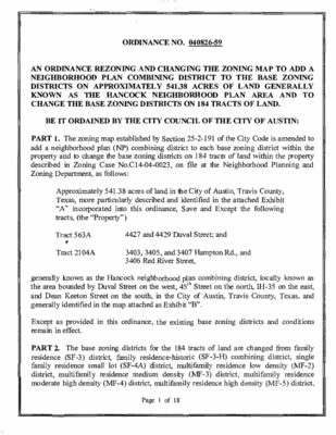
ORDINANCE NO. 040826-59 AN ORDINANCE REZONING AND CHANGING THE ZONING MAP TO ADD A NEIGHBORHOOD DISTRICTS KNOWN AS THE HANCOCK NEIGHBORHOOD PLAN AREA AND TO CHANGE THE BASE ZONING DISTRICTS PLAN COMBINING DISTRICT TO THE BASE ZONING 541.38 ACRES OF LAND GENERALLY ON APPROXIMATELY ON 184 TRACTS OF LAND. BE IT ORDAINED BY THE CITY COUNCIL OF THE CITY OF AUSTIN: map established ood plan (NP) combining and to change the base zoning PART 1. The zoning add a neighborh property described Zoning Department, as follows: by Section district districts 25-2-191 of the City Code is amended to the within to each base zoning district property of land within the on 184 tracts in Zoning Case No.Cl4-04-0023, on file at the Neighborho od Planning and 541.38 more particularly Approximately Texas, "A'' incorporated (the "Propert tracts, described into this ordinance, y") acres of land in the City of Austin, and identified Travis County, Exhibit in the attached Save and Except the following Tract 563A 4427 and 4429 Duval Street; and ·'r Tract 2104A 3403, 3405, and 3407 Hampton 3406 Red River Street, Rd., and known as the Hancock by Duval Street generally the area bounded and Dean Keeton Street generally identified on the south, in the map attached neighborhood plan combining on the west, 45th Street district, locally known as on the north, IH-35 on the east, County, Travis and Texas, in the City of Austin, as Exhi bit "B''. Except as provided in effect. remain in this ordinance, the existing base zoning districts and conditions ce (SF-3) district, PART 2. The base zoning districts residen family residen district, moderate residence (MF-4) district, multifamily high density ce small lot (SF-4A) district, medium density multifamily multifamily residence (MF-3) district, residence low density multifamily high density (MF-2) (MP-5) district, residence for the 184 tracts family residence-histori of land are changed c (SF-3-H) combining from family single district, Page I of 18 overlay-neighborhood plan residence-historic-conditional overlay-neighborhood plan limited office (LO) district, neighborhood commercial (LR) district, neighborhood commercial-conditional overlay (LR-CO) combining district, community commercial (GR) district, community commercial-conditional overlay (GR-CO) combining district, general commercial services (CS) district, general commercial sendees-conditional overlay (CS- CO) combining district, and commercial-liquor sales (CS-1) district, to single family residence-conditional overlay-neighborhood plan (SF-2-CO-NP) combining district, family residence-conditional overlay-neighborhood plan (SF-3-CO-NP) combining district, family (SF-3-H-CO-NP) combining district, single family residence small lot-conditional overlay-neighborhood plan (SF-4A-CO-NP) combining district, multifarnily residence low density-neighborhood plan (MF-2-NP) combining district, multifamily residence low density-conditional overlay- neighborhood plan (MF-2-CO-NP) combining district, multifamily residence medium density-neighborhood plan (MF-3-NP) combining district, multifamily residence medium combining district, density-conditional multifamily residence moderate high density-conditional overlay-neighborhood plan (MF- 4-CO-NP) combining district, neighborhood office-mixed use-neighborhood plan (NO- MU-NP) combining district, limited office-mixed use-neighborhood plan (LOMU-NP) combining district, limited office-mixed use-conditional overlay-neighborhood plan (LO- MU-CO-NP) combining district, general office-mixed use-neighborhood plan (GO-MU- NP) combining district, general office-mixed use-conditional overlay-neighborhood plan (GO-MU-CO-NP) combining district, neighborhood commercial-conditional overlay- neighborhood plan (LR-CO-NP) combining district, neighborhood commercial-mixed use- neighborhood plan (LR-MU-NP) combining district, neighborhood commercial-mixed use- conditional overlay-neighborhood plan (LR-MU-CO-NP) combining district, community commercial-mixed use-neighborhood plan (GR-MU-NP) combining district, community (GR-MU-CO-NP) commercial-mixed combining district, general commercial services-conditional overlay-neighborhood plan (CS-CO-NP) combining district, general commercial services-mixed use-neighborhood plan (CS-MU-NP) combining district, general commercial services-mixed use-conditional overlay-neighborhood plan (CS-MU-CONP) combining district, commercial-liquor sales- conditional overlay-neighborhood plan (CS-1-CO-NP) combining district, and public- neighborhood plan (P-NP) combining district, as more particularly described and identified in the chart below: overlay-neighborhood use-conditional (MF-3-CO-NP) plan TRACT 501 ADDRESS 2803, 2819, 2821. 2827 SAN JACINTO BLVD " . . - . : . .. _.. . . 503 503A 503B 505, 507, 509 RATHERVUE PL 601 , 605 RATHERVUE PL 607, 609 RATHERVUE PL 504 501 BELLEVUE PL FROM LR-CO SF-3 SF-3 SF-3 LO TO LR-MU-CO- NP MF-4-CO-NP MF-4-CO-NP GO-MU-CO- NP LO-MU-NP Page 2 of 18 TRACT 505 506 507 ADDRESS 716 E DEAN KEETON ST; 3013 HARRIS PARK AVE 706 E DEAN KEETON ST 2900, 2902 MEDICAL ARTS ST 507A 291 2 MEDICAL ARTS ST 508 508A 509 291 5 HAMPTON RD WEST 11 51 OF 2910 MEDICAL ARTS ST 3000, 3004 MEDICAL ARTS 814 E 31ST ST; 3100 RED RIVER ST 31 10 MEDICAL ARTS ST 805,811 E32NDST 2901, 2911, 2915, 3001 MEDICAL ARTS ST 51 4A 515 920 E DEAN KEETON ST 926 E DEAN KEETON ST 516 924 E DEAN KEETON ST 0 RED RIVER ST (COMMON AREA LESS 1 1 SO FT MEDICAL ARTS SQUARE PLUS 1/2 VAC STREET) MF-3, MF-5, LO, CS MF-5 2900 SWISHER ST 0 COMANCHE ST (N .255 ACR OF TRT 1 OLT 23 DIVISION C) 2703, 2901 SWISHER ST 2706, 2800, 2900, 2908 COLE ST 2804, 2900, 2908 N I-35 SV RD SB; 0 DEAN KEETON ST E (LOT 10 * LESS SE TRI PLUS PT OF ADJ VAC ALLEY & NW TRI OF LOT 1 1 BLK 1 OLT 23 DIV C FELLMAN HEIGHTS) LO GO SF-3, MF-5, GO SF-3, GO CS 918, 924, 926, 1000, 1004 E 32ND ST 3203, 3205, 3211 RED RIVER ST 812E32NDST 3200 RED RIVER ST 3208 RED RIVER ST 321 2 RED RIVER ST 3304 RED RIVER ST 3310 RED RIVER ST 3308 HAMPTON RD; 0 HARRIS AVE (LOT 17 * & 1.06ACR OF LOT 1 8 OLT 6-9 DIV C BEAU SITE) 906 KEITH LN 3501 RED RIVER ST 1000, 1002, 1004CONCORDIAAVE Page 3 of 18 FROM SF-3 SF-3 LR LR LO MF-3 LO LO GO LO GO GO GO GO CS LO GR-CO GO GO MF-2 LO SF-3 GO MF-4 LO 510 511 512 513 514 517 518 519 520 520A 521 522 523 524 525 526 526A 527 527A 528 529 530 TO P-NP MF-3-NP LR-MU-CO- NP LR-MU-CO- NP SF-3-CO-NP MF-3-CO-NP LO-MU-CO- NP LO-MU-CO- NP GO-MU-CO- NP LO-MU-CO- NP GR-MU-CO- NP GR-MU-CO- NP GR-MU-NP GR-MU-CO- NP/MF-6-CO- NP GR-MU-CO- NP/MF-6-CO- NP GR-MU-NP GR-MU-NP GR-MU-NP GR-MU-NP CS-MU-NP GO-MU-NP CS-MU-CO- NP LO-MU-CO- NP GR-MU-CO- NP GO-MU-CO- NP GO-MU-CO- NP MF-3-NP LO-MU-CO- NP P-NP GO-MU-NP MF-4-CO-NP LO-MU-NP 532A 533 534 535 535A 536 536A 536B 537 537A 538 539 540 540A 541 542 543 543A 546 547 548 549 549A 550 551 557 559 560 561 562 562A TRACT 531 ADDRESS 1009, 1011 E 38TH ST; 3503, 3505, 3507, 3701, 3703 HARMON AVE; 3500, 3502, 3506, 3700, 3702, 3704 N I-35 SVC RD SB " " ." FROM CS 532 1014 E 38TH ST; 1015 E 38TH 1/2 ST 1016 E 38TH ST; 1017 E 38TH 1/2 ST; 3800, 3808, 3810 N IH-35 SVC RD SB 1013E38TH 1/2 ST 1012 E38TH 1/2 ST 1016 E38TH 1/2 ST 3828 N IH-35 SVC RD SB 1006E39THST 1008 E 39TH ST (N 100.28 FT OF S 207.2 FT OF E 52.89 FT OF LOT 1 BLK 9 OLT 20-21 DIV C PLAINVIEW HEIGHTS E 39TH ST) 1008 (S 100.29 FT OF E 52.89 FT OF LOT 1 BLK 9 OLT 20-21 DIV C PLAINVIEW HEIGHTS E 39TH ST) 1019 E 39TH ST; 1009 E 40TH ST 1015, 1017 E 40TH ST; 3900. 3906 N IH-35 SVC RD SB 1005, 1007 E40THST 930, 1000, 1002, 1004, 1006, 1008, 1010 E 40TH ST 1033 E 41 ST ST; 4000 N IH-35 SVC RD SB 1025E43RDST 905,907.909,913,915,923,925,927,931. 1007, 1013, 1017, 1021 E41STST GR 541A 4007-4011 RED RIVER ST 4003, 4005 RED RIVER ST; 902, 910, 912, 918. 920, 924. 928 E 40TH ST 1000 E 41ST ST (EXCEPT 2,500 SQ FT OF OUTLOT 19. ORIGINAL CITY OF AUSTIN, TWIN LIQUORS SITE) 1 000 E 41 ST ST--2.500 SQ FT OF OUTLOT 1 9. ORIGINAL CITY OF AUSTIN, TWIN LIQUORS SITE AS SHOWN ON EXHIBIT C) GR-CO SF-3, MF-3, LO GR, CS CS-CO-NP TO CS-MU-NP CS-MU-CO- NP CS-MU-NP LO-MU-NP LO-MU-NP CS-MU-CO- NP CS-MU-NP LO-MU-CO- NP LO-MU-CO- NP LO-MU-CO- NP GO-MU-NP CS-MU-NP LO-MU-NP LO-MU-NP CS-MU-NP CS-MU-CO- NP GR-MU-CO- NP GR-MU-CO- NP MF-3-NP CS-1-CO-NP LR-MU-NP LO-MU-NP LO-MU-NP P-NP P-NP LR-MU-CO- NP MF-2-CO-NP LR-MU-CO- NP CS-CO-NP MF-2-NP CS-CO-NP MF-4-CO-NP CS-MU-CO- NP CS-MU-CO- NP SF-3-CO-NP CS CS LO LO CS CS SF-3 SF-3 SF-3 GO CS LO LO CS CS-CO CS-1 LR LO LO SF-3 SF-3 MF-4 MF-4 LR CS CS CS MF-4 CS CS SF-3 906 ELLINGSON; 4425 RED RIVER 4400 RED RIVER ST 4210, 4306 RED RIVER ST 811 E41STST 811 E41STST 4003 DUVAL 506 E 40TH ST 500 PARK BLVD 421 5 DUVAL ST 503 E 43RD ST 4301 DUVAL ST 4305 DUVAL 4303, 4305 DUVAL ST 563 4409 DUVAL ST 2001 507, 509, 511 BELLEVUE PL Page 4 of 18 TO SF-3-CO-NP SF-3-CO-NP SF-3-CO-NP SF-3-H-CO- NP SF-3-CO-NP SF-3-CO-NP SF-3-H-CO- NP SF-3-CO-NP SF-3-H-CO- NP SF-3-CO-NP SF-3-CO-NP SF-3-CO-NP SF-3-CO-NP SF-3-CO-NP SF-3-CO-NP SF-3-CO-NP SF-3-CO-NP SF-4A-CO-NP SF-3-CO-NP SF-3-CO-NP SF-3-CO-NP SF-3 SF-3-CO-NP SF-3, MF-3 SF-3-CO-NP FROM SF-3 SF-3 SF-3 SF-3-H SF-3 SF-3 SF-3-H SF-3 SF-3-H SF-3 SF-3 SF-3 SF-3 SF-3 SF-3 SF-3 SF-3 ADDRESS 601, 603, 605 BELLEVUE PL 607, 609 BELLEVUE PL 504 BELLEVUE PL 506 BELLEVUE PL TRACT 2002 2003 2004 2004A 2004B 2005 508 BELLEVUE PL 604. 606. 608. 610 BELLEVUE PL; 3006 HARRIS PARK AVE; 61 1 RATHERVUE PL 2005A 600 BELLEVUE PL 3102, 3104, 3106 HARRIS PARK AVE; 610 RATHERVUE PL 31 10 HARRIS PARK AVE 806, 808, 810, 812, 814, 816 E 31 ST ST; 703, 705, 707, 709, 711, 713, 715, 717, 719. 725, 801, 803 E 32ND ST; 3103, 3103, 3111 HARRIS PARK AVE; 702, 706, 708, 712, 716, 718, 720, 722, 724 SPARKS AVE 701, 705, 707, 709 SPARKS AVE 714 E DEAN KEETON ST 802, 804, 806 E DEAN KEETON ST; 805, 807, 809 LEONARD ST 807, 809 E 30TH ST; 2908, 2914 BEANNA ST; 800, 802, 804, 808 LEONARD ST 817 E 30TH ST; 2903, 2905, 2907, 2909, 2911, 2913 2915 BEANNA ST; 810 E DEAN KEETON ST; 2900, 2902, 2904, 2910, 2914 HAMPTON RD 806, 808, 810, 812, 814, 818, 820, 822, 824 E 30TH ST; 807, 809, . 811, 813, 815, 817. 819 E 31ST ST; 721, 723 SPARKS AVE 900, 904, 905. 906, 907, 908, 909, 910, 911, 912, 913, 914. 915. 916, 917. 918. 919, 920. 921, 923 E 37TH ST; 901, 903, 905, 907, 909, 913, 915, 1001, 1003, 1005, 1007 E 38TH ST; 3504, 3506, 3700, 3702, 3704, 3706, 3708, 3710 HARMON AVE; 351 1 RED RIVER ST 904, 906, 908, 910, 912, 1000. 1002, 1004, 1006, 1008, 1010, 1012 E38THST;909,913,915,917, 1001,1005, 1007, 1009 E38TH 1/2 ST; 3801 , 3803, 3805 RED RIVER ST 1011 E38TH 1/2 ST 906, 908, 910, 912, 914, 916, 1000, 1002, 1004, 1006, 1008, 1010 E 38TH 1/2 ST; 907, 911, 913, 915, 917, 919, 921, 923, 925, 1001, 1003, 1005, 1007 E 39TH ST; 3809, 3813, 3817 RED RIVER ST SF-4A SF-3 907 E 40TH ST; 3900. 3902, 3904. 3906, 3908, 3912, 3914 BECKER AVE; 3901, 3903, 3905, 3907, 3909 RED RIVER ST 912. 914, 916 E 39TH ST; 917, 919, 921 E 40TH ST; 3901, 3903, 3905, 3907, 3909, 391 1 , 391 3, 391 5 BECKER AVE; 3902, 3906, 3908, 3910, 3912, 3914 WILLBERT RD 1004 E 39TH ST; 3901, 3905, 3907, 3909, 3911, 3913, 3915 WILLBERT RD SF-3 SF-3 2006 2007 2008 2009 2010 2011 2012 2013 2014 2015 2016 2017 2018 2019 2020 2021 2022 2023 Page 5 of 18 903, 905, 907, 909, 911. 1001, 1003, 1005, 1007, 1009 E 43RD ST; 4211, 4213 RED RIVER ST SF-3, GR SF-3-CO-NP 1011, 1013, 1015, 1017, 1019, 1021, 1023, 1025, 1027, 1029, 1031, 1 033, 1 035, 1 037, 1 039 E 43RD ST SF-3 SF-3-CO-NP SF-3. LO SF-3-CO-NP SF-3 SF-3-CO-NP SF-3, LO SF-3-CO-NP TO SF-3-CO-NP SF-3-CO-NP SF-3-CO-NP SF-3-CO-NP SF-3-CO-NP SF-3-CO-NP SF-3-CO-NP SF-3-CO-NP SF-3-CO-NP SF-3-CO-NP SF-3-CO-NP SF-3-CO-NP SF-3-CO-NP SF-3-CO-NP SF-3-CO-NP SF-3-H-CO- NP SF-3-CO-NP SF-3-CO-NP SF-3-CO-NP SF-3-CO-NP SF-3-H-CO- NP SF-3-CO-NP TRACT 2024 ADDRESS 902, 904, 906, 908, 1000, 1002, 1004. 1006, 1008 E 43RD ST; 905, 907, 909. 91 1 , 1 001 , 1 003, 1 005, 1 007, 1 009, 1 01 1 E 44TH ST; 4301, 4305 RED RIVER ST ' '.: :" FROM SF-3 1010, 1012, 1014, 1016, 1018, 1020E43RDST; 1013, 1015, 1017, 1019,1 021 , 1 023, 1 025 E 44TH ST; 4302 HARMON AVE SF-3 1 026, 1 028, 1 030, 1 032, 1 036, 1 038 E 43RD ST; 1 029, 1 031 , 1 033, 1035E44THST SF-3 904,906,908, 1002, 1004. 1006, 1008, 1010 E44TH ST; 905, 911, 1001.1005, 1011 ELLINGSONLN; 4401, 4403, 4405 RED RIVER ST 1012, 1014, 1016, 1018, 1020, 1022, 1024, 1026, 1028, 1030, 1032, 1034E44THST; 1013, 1015, 1017, 1019, 1021, 1023, 1025, 1027, 1029, 1031 ELLINGSON LN 1001, 1003, 1005, 1007, 1009, 1011 E 45TH ST; 4406 BENNETT AVE; 1000, 1002, 1004, 1006, 1008, 1010 ELLINGSON LN 1013,1 01 5, 1017,1 01 9, 1 021 , 1 023, 1 025, 1 027 E 45TH ST; 4407 BENNETT AVE; 1014, 1016, 1018, 1020, 1022, 1024, 1026, 1028 ELLINGSON LN 4414, 4418, 4420, 4426 RED RIVER ST 801, 807, 809, 811 E 45 m ST; 4413 CASWELL AVE 4409 CASWELL AVE; 806, 808, 810, 812 KEASBEY ST 815 KEASBEY ST; 4406, 4408, 4410, 4412 RED RIVER ST 4405 CASWELL AVE; 801 , 805. 807, 809. 811,813 KEASBEY ST 800, 802, 804, 806, 812 E 44TH ST 801, 803, 805, 807. 809 E 44TH ST; 4308, 4310, 4312 RED RIVER ST 0 CASWELL AVE (BLK 22 * 59.72AV X 139.78AV DIVISION C OLT 1 5 RIDGETOP ANNEX), 0 CASWELL AVE (88.4 X 68.58FT BLK 22 OLT 14 DIVISION C); 4205, 4211, 4301, 4305 CASWELL AVE; 800, 802, 804, 806, 808, 810, 812 PARK BLVD 701 , 703, 705, 709, 71 1 E 45TH ST; 4412 CASWELL AVE 4408 CASWELL AVE; 700, 702, 704, 706. 708, 712 KEASBEY ST 4404, 4406 CASWELL AVE; 701 , 703, 705, 709 KEASBEY ST 706 E 44TH ST SF-3 SF-3 SF-3 SF-3-H 708, 712E44THST 705, 707, 709 E 44TH ST; 4308 CASWELL AVE; 4307 EILERS AVE 702, 706 E 43RD ST; 4300, 4304, 4306 CASWELL AVE; 4307 EILERS AVE 602, 606, 610, 612 E 43RD ST; 4308, 4310, 4400, 4402, 4404, 4406, 4408 EILERS AVE 2047 602, 606 E 43RD ST SF-3 SF-3 SF-3 SF-3 SF-3 SF-3 SF-3 SF-3 SF-3 SF-3 SF-3 SF-3 SF-3 SF-3-H SF-3 2025 2026 2027 2028 2029 2030 2031 2032 2033 2034 2035 2036 2037 2038 2039 2040 2041 2042 2043 2044 2045 2046 2048 2049 2050 2051 2052 Page 6 of 18 605 E 45TH ST; 4315, 4401, 4413, 4415, 4417, 4419 BARROW AVE 4410, 4412, 4414, 4416, 4418 BARROW AVE 4314, 4316, 4400, 4403, 4403, 4404, 4313, 4317 BARROW AVE; 4401 , 4403, 4405, 4407 DUVAL ST 505,509,511 E43RDST 502, 504, 506, 508. 510 PARK BLVD SF-3, MF-2 SF-3, MF-2, LR SF-3-CO-NP SF-3-CO-NP SF-3 SF-3, MF-4 SF-3-CO-NP SF-3-CO-NP TRACT 2053 ADDRESS 601 , 603, 605, 607, 609, 61 1 , 615, 617, 701 , 705, 707, 71 1 , 713, 71 5 E 43RD ST; 600, 602, 604. 606, 610, 700, 704, 706, 716, 720, 722 PARK BLVD •-••• :•: . : -:;.: FROM SF-3 4205 DUVAL ST; 501, 503, 505, 507 PARK BLVD 500, 502, 504, 506, 508, 512 E 42ND ST; 4203 DUVAL ST 505, 507, 509, 511 E 42MU ST; 4105 DUVAL ST 500, 502, 506, 510, 512 E 41 ST ST 700, 702, 710 E 41ST ST; 0 E 42ND ST (135.22 X 151 .7FT AV & 8 X 14' OLT 14 DIVISION C); 600, 602, 604, 606, 608, 610 E42ND ST; 4203 BARROW ST; 601, 603, 605, 607, 609, 611, 703, 709, 711, 713, 719, 721, 723, 801, 803, 805, 807, 809, 811 PARK BLVD; 4107,4109,4111 PECKAVE 2059 801 PARK BLVD SF-3, MF-4 SF-3, MF-4 SF-3, MF-4 SF-3, MF-4 SF-3 SF-3-H SF-3 SF-3 SF-3, MF-4 601 , 603, 605, 607 E 42™ ST; 4104 PECK AVE 600, 602, 604, 606, 608 E 41ST ST; 4102 PECK AVE 501 , 503, 507, 509, 51 1 E 41 ST ST; 4007 DUVAL ST; 4000 PECK AVE 510. 512, 514, 516, 518 E 40TH ST 505, 509. 511, 513, 515, 517 E 40TH ST; 3911, 3913 DUVAL ST 506, 508, 510, 512, 514 E 39TH ST; 3901, 3903, 3905 DUVAL ST; 3902 PECK AVE 505, 507, 511 , 515 E 39m ST; 3817, 3819, 3823 DUVAL ST 506, 508, 512, 514 E 38m 1/2 ST; 3811. 3813, 3815 DUVAL ST 507, 509, 511, 515, 517 E 38TH 1/2 ST; 3807 DUVAL ST; 3806 PECK AVE 506, 508, 510, 512, 514 E 38TH ST; 3801, 3803, 3805 DUVAL ST 503, 505, 509 E 38TH ST; 3701 , 3703, 3705, 3709 DUVAL ST; 502, 506, 508 TEXAS AVE 501 , 505, 507, 509, 51 1 TEXAS AVE 500, 506, 508 CAROLYN AVE; 3407 DUVAL ST 503, 505, 509 CAROLYN AVE; 3409 DUVAL ST 3405 DUVAL ST; 504, 506, 508 HARRIS AVE 601 , 603, 605, 607, 609 E 38TH ST 3705 LIBERTY ST; 602, 604, 606, 608 TEXAS AVE 601 , 603, 605, 607, 609 TEXAS AVE 600, 602, 604,608 CAROLYN AVE; 3502 MONTROSE 601. 603 CAROLYN AVE; 3408 MONTROSE 600, 602, 604, 606 HARRIS AVE; 3400 MONTROSE ST 3707 MONTROSE ST; 701 , 703, 705 E 38TH ST 700, 702, 704, 706, 708 TEXAS AVE 701, 703, 705, 707, 709 TEXAS AVE; 3506 WOODROW ST 700, 702, 704, 706 CAROLYN AVE; 701, 703, 705, 709 CAROLYN AVE 700, 702, 704, 706, 708 HARRIS AVE 3507, 3509 WOODROW ST 3501 WOODROW ST 713, 715, 719 CAROLYN AVE 712, 714, 716, 718 HARRIS AVE 3219, 3221, 3301 3305 DUVAL ST; 507, 509, 51 1 HARRIS AVE; 3302, 3304, 3306, 3308 LIBERTY ST SF-3 SF-3 SF-3 SF-3 SF-3 SF-3 SF-3 SF-3 SF-3 SF-3 SF-3 SF-3 SF-3 SF-3 SF-3 SF-3 SF-3 SF-3 SF-3 SF-3 SF-3 SF-3 SF-3 SF-3 SF-3 SF-3 SF-3 SF-3 SF-3 Page 7 of 18 2054 2055 2056 2057 2058 2060 2061 2062 2063 2064 2065 2066 2067 2068 2069 2070 2071 2072 2073 2074 2075 2076 2077 2078 2079 2080 2081 2082 2083 2084 2085 2086 2087 2087A 2088 2088A 2089 TO SF-3-CO-NP SF-3-CO-NP SF-3-CO-NP SF-3-CO-NP SF-3-CO-NP SF-3-CO-NP SF-3-H-CQ- NP SF-3-CO-NP SF-3-CO-NP SF-3-CO-NP SF-3-CO-NP SF-3-CO-NP SF-3-CO-NP SF-3-CO-NP SF-3-CO-NP SF-3-CO-NP SF-3-CO-NP SF-3-CO-NP SF-3-CO-NP SF-3-CO-NP SF-3-CO-NP SF-3-CO-NP SF-3-CO-NP SF-3-CO-NP SF-3-CO-NP SF-3-CO-NP SF-3-CO-NP SF-3-CO-NP SF-3-CO-NP SF-3-CO-NP SF-3-CO-NP SF-3-CO-NP SF-3-CO-NP SF-3-CO-NP SF-3-CO-NP SF-3-CO-NP SF-3-CO-NP SF-3-CO-NP SF-3-CO-NP TRACT 2090 ADDRESS 3215DUVALST ...:. . ' 500, 502 E 32ND ST; 3209, 3215 DUVAL ST 500 E 32ND ST 600 E 32ND ST, 601, 603 HARRIS AVE; 3209. 3211, 3213, 3215, 3217, 3219, 3301, 3303, 3305, 3307, 3309 LIBERTY ST 3200, 3202, 3204, 3206, 3208, 3210, 3212, 3214, 3216, 3218, 3300, 3302, 3304, 3306, 3308, 3310, 3312 HARRIS PARK AVE 3308 HAMPTON RD; 701, 703, 705, 707, 709, 711, 713, 715, 717, 719 HARRIS AVE; 3303, 3305, 3309 HARRIS PARK AVE; 700, 702. 704, 706, 708, 710, 712, 714, 716, 720 LANDON LN 701, 703, 705, 707, 709, 711, 713, 715, 717, 719 LANDON LN; 3201, 3203, 3205, 3207, 3209, 3211, 3213 HARRIS PARK AVE;708 E 32ND ST; 3200, 3202, 3203, 3204, 3206, 3207, 3208, 3210, 3212 FAIRFAX WALK; 714, 720, 722, 800 E 32ND ST; 804 E 32ND 1/2 ST; 3202, 3204, 3206, 3208 BEANNA ST; 3208, 3210 HAMPTON RD 321 5 FAIRFAX WALK 806. 808 E 32ND ST; 803, 805, 807 E 32ND 1/2 ST; 3201 BEANNA ST 816 E 32ND ST; 3207, 3209, 3211, 3213, 3215, 3217, 3303, 3305, 3307, 3309, 331 1 HAMPTON RD 3410, 3500, 3508, 3510, 3512, 3700, 3704, 3710, 3712 GREENWAY; 805 E 35TH ST; 3408 HAMPTON RD 3400, 3404 HAMPTON RD 802, 804, 808 HARRIS AVE 817 E 37TH ST; 3501, 3505. 3509 GREENWAY; 3500, 3504, 3700 HAMPTON RD 3711 GREENWAY; 818, 822, 828, 832, 834, 836, 838, 840 E 37TH ST; 3701 HAMPTON RD; 809, 811, 817, 819, 823, 825, 831, 833, 837. 841.843E38THST 829, 841 E 37TH ST; 3501, 3509 HAMPTON RD; 3408, 3412, 3504, 3500, 3506, 3508, 3510. 3512 RED RIVER ST 818, 820, 822, 824, 826, 828, 830 HARRIS AVE 3313 HAMPTON RD; 819, 821, 823, 825, 827 HARRIS AVE 2091 2092 2093 2094 2095 2095A 2095B 2097 2098 2099 2100 2100A 2101 2102 2103 2104 2105 FROM SF-3-H SF-3 SF-3-H SF-3 SF-3 SF-3 SF-3-H SF-3 SF-3 SF-3 SF-3 SF-3 SF-3 SF-3 SF-3 SF-3 SF-3 TO SF-3-H-CO- NP SF-3-CO-NP SF-3-H-CO- NP SF-3-CO-NP SF-3-CO-NP SF-3-CO-NP SF-3-H-CO- NP SF-3-CO-NP SF-3-CO-NP SF-2-CO-NP SF-2-CO-NP SF-3-CO-NP SF-2-CO-NP SF-2-CO-NP SF-2-CO-NP SF-2-CO-NP SF-2-CO-NP SF-3 SF-3-CO-NP PART 3. The following applies to an existing legal lot with single-family residential use or secondary apartment special use within the boundaries of the NP combining district: 1. The minimum lot area is 2,500 square feet. The minimum lot width is 25 feet. 3. For a lot with an area of 4,000 square feet or less, the impervious coverage may not exceed 65 percent. Page 8 of 18 PART 4. The following applies to a single-family residential use, a duplex residential use, or a two-family residential use within the boundaries of the NP: 1. Impervious cover and parking placement restrictions apply as set forth in Section 25- 2-1603 of the Code, 2. Garage placement restrictions apply as set forth in Section 25-2-1604 of the Code. 3. Front or side yard parking restrictions apply as set forth in Section 25-2-1406 of the Code. PART 5. The following tracts may be developed as a neighborhood mixed use building special use as set forth in Sections 25-2-1502 through 25-2-1504 of the Code: 501, 504, 507, 507A, 509, 510, 512, 513, 514, 514A, 515, 516, 517, 518, 519, 520, 522, 523, 524, 525, 526, 527, 536, 536A, 536B, 541, 541A, 543, 543A, 546-548, 550? 557, 559, 56K 562A, and 563. PART 6. Tracts 543 and 543A may be developed as a neighborhood urban center special use as set forth in Section 25-2-1422 through 1424. PART 7. The Property within the boundaries of the conditional overlay combining district established by this ordinance is subject to the following conditions: 1. The following conditions apply to Tracts 536, 536B, 551, 2001 through 2098, 2100, 2100A, 2104, and 2105. A. The maximum height of a building or structure is 30 feet from ground level. B. A building or structure may not exceed a height of two stories. 2. The following conditions apply to Tracts 2099, 2101, 2102 and 2103. A. B. Except as provided in Subsection C, the maximum height of a building or structure is 30 feet from ground level. A building or structure subject to Subsection A may not exceed a height of two stories. Page 9 of 18 C. If the principal structure or building is constructed 15 or more feet from all property lines, then the maximum height of a building structure is 35 feet from ground level. 3. The maximum height of a building or structure on Tracts 508A and 512 is 35 feet from ground level. 4. The following conditions apply to Tracts 503, 503A and 503B. A. The maximum height of a building or structure is 35 feet from ground level. B. The maximum building coverage is 50 percent. C. The maximum impervious cover is 60 percent. D. The maximum number of residential units permitted is 17 units per acre. 5. The maximum height of a building or structure is 40 feet from ground level on Tracts 511, 526, 529, 559, 560, 561, 562, 562A, and 563. 6. The maximum height of a building or structure is 50 feet from ground level on Tracts 513,514, 541,and 541A. is 30 feet. 7. For Tracts 532 and 535, the maximum width of a driveway accessing Harmon Avenue 8. The following conditions apply to Tract 536. A. The maximum impervious cover is 50 percent. B. The maximum floor area ratio is 0.33 to 1.0. 9. The maximum floor area ratio is 0.57 to 1.0 for Tract 536A and 536B. 10. A site plan or building permit for Tract 540A or Tract 541A may not be approved, released, or issued, if the completed development or uses of Tract 540A or Tract 541A, considered cumulatively with all existing or previously authorized development and uses, generate traffic that exceeds 2,000 trips per day. Page 10 of 18 11. The maximum building coverage for Tract 551 is 40 percent. 12. This section applies to the front yard setback of a single family residential structure in Tracts 2099, 2101, 2102, and 2103. A. B. Except as otherwise provided in Subsection B, for an interior lot, if the front yard setbacks of existing adjacent principal single family structures exceed 25 feet, then the front yard setback on the subject property may not be more than five feet different from the average of the front yard setbacks of the principal single family structures on the same side of the street on a block. If the principal single family structure has been removed from the subject property within the preceding 12 months, the minimum front yard setback for new construction on the subject property is the setback of the single family structure previously located on the site. C. For a corner lot, the following applies: 1. If the lot on the side of the corner lot is legally developed, the minimum front yard setback of the corner lot is equal to the setback of the principal structure on the side lot. 2. If the lot on the side of the corner lot is vacant, the minimum front yard setback of the corner lot is equal to the average setbacks of the principal structures on the other lots in the block on the same side of the street. 13. The width of a driveway may not exceed 18 feet for Tracts 2099, 2101, 2102 and 2103. 14. The following conditions apply to Tracts 2100, 2100A, 2104 and 2105. A. The maximum width of a front yard driveway is 12 feet. B. The maximum width of a street side yard driveway is 18 feet. C. The front yard setback for a parking structure is 60 feet. D. A circular driveway is not permitted on a lot that has less than 100 feet of front street yard width Page 11 of 18 15. Financial services use is a conditional use of Tracts 501, 507, 507A and 546. 16. The following uses are prohibited uses of Tracts 501, 507, 507A, 546, 550 and 557: Residential treatment Medical offices (exceeding 5000 sq.ft. gross floor area) Service station 17. Drive-in service is prohibited as an accessory use to commercial uses of Tracts 501, 507, 507A, 513, 514, 541, 541A, 546, 550, 557, 559, 561, 562A, and 563. 18. Drive-in service is a conditional use as an accessory use to commercial uses of Tracts 522, 532, 535, 540A, 543, and 543A. 19. The following uses are conditional uses of Tract 513 and 514: Commercial off-street parking Hotel-motel Indoor entertainment 20. The following uses are prohibited uses of Tract 513 and 514: Automotive rentals Automotive repair services Automotive sales Automotive washing (of any type) Bed & breakfast residential (Group 1) Bed & breakfast residential (Group 2) Drop-off recycling collection facility Research services Exterminating services Funeral services Indoor sports and recreation Outdoor entertainment Outdoor sports and recreation Pawn shop services Service station Residential treatment 21. The following uses are conditional uses of Tract 522: Commercial blood plasma center Commercial off-street parking Hotel-motel Indoor entertainment Plant nursery Laundry services Monument retail sales Off-site accessory parking Research services Page 12 of 18 The following uses are prohibited uses of Tract 522: Agricultural sales and services Automotive rentals Automotive repair services Automotive washing (of any type) Bed & breakfast residential (Group 1) Bed & breakfast residential (Group 2) Building maintenance services Campground Construction sales and services Convenience storage Drop-of recycling collection facilities Electronic prototype assemble Equipment repair services Vehicle storage Equipment sales Exterminating services Funeral services Indoor sports and recreation Kennels Limited warehousing and distribution Maintenance and service facilities Outdoor entertainment Outdoor sports and recreation Pawn shop services Residential treatment Service station Transportation terminal 23. Off-site accessory parking use and research services use arc conditional uses of Tract 524. 24. The following uses are prohibited uses of Tract 524: Automotive rentals Automotive repair services Automotive sales Automotive washing (of any type) Bed & breakfast residential (Group 1) Bed & breakfast residential (Group 2) Commercial off-street parking Consumer convenience services Drop-off recycling collection facility Exterminating services Financial services Food sales Funeral services Theater Consumer repair services General retail sales (convenience) General retail sales (general) Hotel-motel Outdoor entertainment Outdoor sports and recreation Pawn shop services Indoor entertainment Indoor sports and recreation Pet services Personal improvement services Residential treatment Restaurant (general) Restaurant (limited) Service station Page 13 of IS 25. The following uses are conditional uses of Tracts 532 and 535: Automotive repair services Building maintenance services Commercial blood plasma center Commercial off-street parking Custom manufacturing Residential treatment Automotive washing (of any type) Funeral services Hotel-motel Outdoor sports and recreation Research services 26. The following uses are prohibited uses of Tracts 532 and 535: Agricultural sales and services Automotive rentals Automotive sales Campground Construction sales and services Convenience storage Drop-off recycling collection facilities Equipment repair services Equipment sales Kennels Limited warehousing and distribution Maintenance and service facilities Monument retail sales Outdoor entertainment Pawn shop services Service station Vehicle storage 27. The following uses are conditional uses of Tracts 540A and 543: Automotive rentals Building maintenance services Commercial blood plasma center Commercial off-street parking Custom manufacturing Drop-off-recycling collection facilities Residential treatment Exterminating services Funeral services Hotel-motel Monument retail sales Outdoor sports and recreation Research services 28. The following uses are prohibited uses of Tracts 540A and 543: Agricultural sales and services Automotive sales Automotive washing (of any type) Campground Construction sales and services Convenience storage Kennels Limited warehousing and distribution Maintenance and services facilities Outdoor entertainment Pawn shop services Vehicle storage Page 14 of 18 Electronic prototype assembly Equipment sales Equipment repair services 29. The following uses are conditional uses of Tracts 541 and 541 A: Automotive rentals Automotive repair services Commercial off-street parking Exterminating services Hotel-motel Outdoor sports and recreation Research services Residential treatment Funeral services 30. The following uses are prohibited uses of Tracts 541 and 541 A: Automotive sales Automotive washing (of any type) Outdoor entertainment Pawn shop services 31. The following uses are conditional uses of Tract 543 A: Automotive rentals Building maintenance services Commercial blood plasma center Commercial off-street parking Custom manufacturing Drop-off recycling collection facilities Exterminating services Funeral services Hotel-motel Outdoor sports and recreation Research services Residential treatment 32. The following uses are prohibited uses of Tract 543 A: Adult oriented businesses Agricultural sales and services Automotive sales Automotive washing (of any type) Campground Kennels Limited warehousing and distribution Maintenance and services facilities Construction sales and services Convenience storage Electronic prototype assemble Equipment repair services Equipment sales Outdoor entertainment Pawn shop services Vehicle storage 33. Day care services (general) use is a conditional use of Tracts 503, 503A, and 551 Page 15 of 18 34. The following uses are prohibited uses of Tracts 55 Bed and breakfast residential (Group 2) Condominium residential Congregate living Townhouse residential Multifamily residential Residential treatment Retirement housing (large site) 35. The following uses are conditional uses of Tracts 559, 561, 562A, and 563: Commercial off-street parking Congregate living Hospital services (limited) Laundry services Monument retail sales Plant nursery Services station 36. The following uses are prohibited uses of Tract 559, 561, 562A, and 563 Agricultural sales and services Automotive rentals Automotive repair services Automotive sales Automotive washing (of any type) Building maintenance services Business or trade school Campground College and university facilities Commercial blood plasma center Construction sales and services Convenience storage Drop-of recycling collection facilities Electronic prototype assemble Equipment repair services Equipment sales Business support services Hospital services (general) Exterminating services Funeral sendees Indoor sports and recreation Kennels Limited warehousing and distribution Maintenance and service facilities Outdoor entertainment Hotel-motel Indoor entertainment Outdoor sports and recreation Pawn shop services Residential treatment Research services Vehicle storage Medical offices (exceeding 5000 sq. ft. gross floor area) 37. The following uses are prohibited uses of Tracts 503 and 503A: Congregate living Group residential Multifamily residential Convalescent services Hospital sendees (limited) Residential treatment Page 16 of 18 38. The following uses are conditional uses of Tract 503B: Day care services (commercial) Day care services (general) Local utility services Private primary educational facilities Private secondary educational facilities Safety services 39. A college and university facilities use that exceeds 2,400 square feet gross floor area is a conditional use of Tract 503B. 40. The following uses are prohibited uses of Tract 503B: Business or trade school Business support services Communication services Congregate living Convalescent services Counseling services Group residential Guidance services Hospital services (general) Medical offices (not exceeding 5000 sq. ft. gross floor area) Medical offices (exceeding 5000 sq. ft. gross floor area) Multifamily residential Off-site accessory parking Personal services Professional office Residential treatment Restaurant (limited) Hospital services (limited) Software development 41. Except as otherwise provided in this ordinance, Tracts 515 and 516 may be developed and used according to the regulations under the following zoning districts A. Community commercial-mixed use-conditional overlay-neighborhood plan (GR-MU-CO-NP) combining district for an area measured from ground level to a height of 15 feet. B. Multifamily residence highest density-conditional overlay-neighborhood plan (MF-6-CO-NP) combining district for an area measured from 15 feet above ground level to a height of 60 feet. 42. The following conditions apply to Tracts 515 and 516. A. The maximum height of a building or structure is 60 feet from ground level. B. The maximum building coverage is 70 percent. Page 17 of 18 C. The maximum impervious cover is 80 percent. D. Vehicular access from the tracts to Red River Street and Dean Keeton Street is prohibited. All vehicular access to the Property shall be from other adjacent public streets or through other adjacent property. Except as specifically restricted under this ordinance, the Property may be developed and used in accordance with the regulations established for the respective base districts and other applicable requirements of the City Code. PART 8. This ordinance takes effect on September 6, 2004. PASSED AND APPROVED August 26 2004 Will Wynn Mayor APPROVED: ATTEST: id Allar^ Smith City Attorhey Shirle>( A. Brown City Clerk Page 18 of 18 EXHIBIT A 500 0 500 1000 1500 Feet Hancock Neighborhood Plan Combining District: Rezonings Approved 8-26-04 Case C14-04-0023 -o~ fftSjfa \V •"!// City of Austin NetghbortxxxJ Planning and Zoning Department Legend Properties wflh proposed zoning changes 999 I Tract Number Ir= ioocr SUBJECT TRACT PENDING CASE « ZONING BOUNDARY CASEMGR: G.RHOADES // ZONING SttfiGfT CASE #: C14-04-0023 ADDRESS: HANCOCK NEIGHBORHOOD DATE: 04-03 ^acrftsl: 541.380 NUMBER F? U24-25 K24-2T 5 2,500 SQUARE FEET AUSTIN PERMIT SERVICE ZONING TRACT FN . NO, 98-241 (MJJ) JULY 20, 1998 BPI JOB NO. 765-03.97 DESCRIPTION OF A 2,500 SQUARE TOOT TRACT OF LAND SITUATED IN THE CITY OF AUSTIN, TRAVIS COUNTY, TEXAS, OUT OF OUTLOT 19, DIVISION "C" ORIGINAL CITY OF AUSTIN, BEING A PORTION OF THAT 34.243 ACRE TRACT OF LAND CONVEYED TO PACIFIC RETAIL TRUST BY DEED OF RECORD IN VOLUME 12723, PAGE 2153 OF THE REAL PROPERTY' RECORDS OF TRAVIS COUNTY, TEXAS; SAID 2,500 SQUARE FEET BEING MORE PARTICULARLY DESCRIBED BY METES AND BOUNDS AS FOLLOWS : COMMENCING, at a P.K. nail found at the intersection of the easterly line of Red River Street (80' R.O.W. ) with the northerly line of East 41st Street (80' R.O.W.)/ being the southwesterly corner of said 34.243 acres; THENCE, N23°19'22"E, along the easterly line of Red River Street, being the westerly line of said 34.243 acres a distance of 158.77 feet; THENCE, leaving the easterly line of Red River Street, over and across said 34.243 acres the following five (5) courses and distances: 1) S66°40'38"E, a distance of 182.01 feet to the POINT OP BEGINNING and the southwesterly corner hereof; 2) N30°01'12"E, a distance of 41.76 feet to the northwesterly corner hereof; 3) 4) S59°58'38"Er northeasterly corner hereof; a distance of 59.87 feet to the S30°01'12"E, southeasterly corner hereof; a distance of 41.76 feet to the FN 98-241 (MJJ) JULY 20, 1990 PAGE 2 OF 2 5) N59°58'3B"W, a distance of 59.87 feet to the POINT OF BEGINNING, containing an area of 2,500 square feet of land, more or less, within these metes and bounds. I, PAUL L. EASLEY, A REGISTERED PROFESSIONAL LAND SURVEYOR, DO HEREBY CERTIFY THAT THE PROPERTY DESCRIBED HEREIN WAS DETERMINED BY A SURVEY MADE ON THE GROUND UNDER MY DIRECTION AND SUPERVISION. A SURVEY EXHIBIT WAS PREPARED TO ACCOMPANY THIS DESCRIPTION. BURY & PITTMAN, INC. ENGINEERS-SURVEYORS 3345 BEE CAVE ROAD, SUITE 200 AUSTIN, TEXAS 78746 PAUL L. EASESY R.P.L.S. NO. 4432 STATE OF TEXAS DATE LEGEND 1/2" IRON ROD FOUND PK NAIL FOUND CONCRETE HIGHWAY MONUMENT FOUND (XXX) RECORD INFORMATION P.O.B. POINT OF BEGINNING P.O.C. POINT OF COMMENCEMENT VICINITY MAP N.T.S. 120 1 m 33 b 3J m S59*58'38"E 59.87' N30'01'12HE 41.76' S30'01'12"W 41.76' P.O.B. 2,500 SQUARE FEET 34.243 ACR£5 PACIFIC RETAIL TRUST VOL. 12723, PG. 2 1 53 N60*05'04."W 1470.24' U70.24') P.O.C EAST 41ST STREET (SO1 R.O.W.) Bury+Pittman, Inc. Consulting Enp'neen and Surveyori ?«MJ Td lll/3»HMlt 1 c - •- '- . — ? 3 SKETCH TO ACCOMPANY DESCRIPTION OF A 2.500 SQUARE FOOT TRACT OF LAND OUT OF OUTLOT 19. DIVISION "C" ORIGINAL CltY OF AUSTIN. TRAVIS COUNTY. TEXAS. BEING A PORTION OF THAT 3*.243 ACRE TRACT OF LAND CONVEYED TO PACIFIC RETAIL TRUST BY DEED OF RECORD IN VOLUME 12723. PAGE 2153 OF THE REAL PROPERTY RECORDS OF TRAVIS COUNTY, TEXAS^ . AUSTIN PERMIT SERVICE