B-12 C14-2022-0009 - Fifty First Street Residences; District 1.pdf — original pdf
Backup
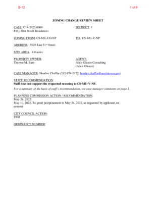
ZONING CHANGE REVIEW SHEET CASE: C14-2022-0009 Fifty First Street Residences DISTRICT: 1 ZONING FROM: CS-MU-CO-NP TO: CS-MU-V-NP ADDRESS: 5525 East 51st Street SITE AREA: 4.0 acres PROPERTY OWNER: Therese M. Baer AGENT: Alice Glasco Consulting (Alice Glasco) CASE MANAGER: Heather Chaffin (512-974-2122, heather.chaffin@austintexas.gov) STAFF RECOMMENDATION: Staff does not support the requested rezoning to CS-MU-V-NP. For a summary of the basis of staff’s recommendation, see case manager comments on page 2. PLANNING COMMISSION ACTION / RECOMMENDATION: May 24, 2022: May 10, 2022: To grant postponement to May 24, 2022, as requested by applicant, on consent. CITY COUNCIL ACTION: TBD ORDINANCE NUMBER: 1 of 8B-12 C14-2022-0009 2 ISSUES: If rezoning is granted, Staff recommends that the existing conditional overlays on the property be retained. The following uses are currently prohibited on the property: Drive-in service as an accessory use to commercial uses, Automotive rentals, Automotive repair services, Automotive sales, Automotive washing (of any type), Service station, and Pawn shop services. CASE MANAGER COMMENTS: The subject property is located on the south side of East 51st Street approximately 400 feet west of Ed Bluestein Boulevard. The 4-acre property is undeveloped and heavily vegetated. The CS-MU-CO-NP property included prohibited land uses, as outlined in the Issues section of this report. Immediately to the west and south of the property is a residential neighborhood zoned SF-4A-NP which triggers compatibility standards on the site. Immediately to the east of the property is property zoned CS-CO-NP is the newly constructed 183/51st Street Trailhead that provides bicycle and pedestrian access across 183/Ed Bluestein Boulevard. The trail connects on the east side of the highway adjacent to the East Communities YMCA and Walnut Creek Greenbelt. Also east and southeast of the rezoning tract are properties that front the southbound Ed Bluestein frontage road. These properties are zoned LI-CO-NP, CS-NP, and CS-CO-NP; these properties include Automotive repair, Undeveloped, and Public high school land uses, respectively. Across East 51st Street to the north is Little Walnut Creek Greenbelt, zoned P-NP, and a Hotel-motel property zoned GR-NP. Please see Exhibits A and B- Zoning Map and Aerial Exhibit. Staff does not support the request to rezone the property to CS-MU-V-NP. The closest bus service is one mile away at 51st and Springdale Road. Sidewalks in the area are fragmented between the property and the closest bus route. Commercial opportunities are very limited in the area, so development on this site will be largely automobile oriented. Under the current zoning the site could get a 20% parking reduction; with VMU the property could get a 40% reduction which is intended for areas where transit and other transportation options are available. Staff supports the existing CS-MU-CO-NP on the site. The existing zoning was developed as part of the neighborhood planning process, downzoning the site from LI and adding residential as an option. The prohibited land uses were also developed as part of that process. The lack of transit opportunities in the area does not support a VMU project at this location. BASIS FOR RECOMMENDATION 1. 2. 3. EXISTING ZONING AND LAND USES: Zoning should be consistent with approved and existing residential densities. The proposed zoning should promote consistency and orderly planning. Rezoning should not contribute to the over zoning of the area. Site North South East ZONING CS-MU-CO-NP P-NP, GR-NP SF-4A-NP CS-CO-NP, LI-CO-NP, CS-NP, CS-CO-NP SF-4A-NP LAND USES Undeveloped Little Walnut Creek Greenbelt, Hotel/motel Small-lot single family residential Public trailhead, Automotive repair, Undeveloped, Public high school Small-lot single family residential West NEIGHBORHOOD PLANNING AREA: Pecan Springs-Springdale Combined NP 2 of 8B-12 C14-2022-0009 3 TIA: Deferred to time of site plan, if required. WATERSHED: Little Walnut Creek (Urban) and Walnut Creek (Suburban) NEIGHBORHOOD ORGANIZATIONS: Austin Heritage Tree Foundation Del Valle Community Coalition Austin Neighborhoods Council Friends of Austin Neighborhoods Bike Austin PSSNA SEL Texas Sierra Club, Austin Regional Group Del Valle ISD Austin ISD Pecan Springs-Springdale NPCT East MLK Combined Neighborhood Contact Team AREA CASE HISTORIES: NUMBER REQUEST CITY COUNCIL ZAP/PLANNING COMMISSION 10/24/2017: To grant P-NP zoning, on consent. 12/7/2017: To grant P-NP zoning, on consent. Little Walnut Creek Greenbelt Rezoning C14-2017-0088 City initiated- To rezone +/- 205 acres of MF-3- CO-NP, GR-NP, SF-6- NP and CS-MU-CO-NP to P-NP EXISTING STREET CHARACTERISTICS: ADDITIONAL STAFF COMMENTS: 3 of 8B-12 C14-2022-0009 4 Environmental This site is located in two watersheds. The front (north) portion of the lot is located in a watershed classified as URBAN, and the rear (south) portion of the lot is located in a watershed classified as SUBURBAN. URBAN WATERSHED PORTION OF THE SITE: 1. The site is not located over the Edwards Aquifer Recharge Zone. The site is located in the Little Walnut Creek Watershed of the Colorado River Basin, which is classified as an Urban Watershed by Chapter 25-8 of the City's Land Development Code. 2. Zoning district impervious cover limits apply in the Urban Watershed classification. 3. According to floodplain maps there is no floodplain within or adjacent to the project location. 4. Standard landscaping and tree protection will be required in accordance with LDC 25-2 and 25-8 for all development and/or redevelopment. 5. At this time, site specific information is unavailable regarding vegetation, areas of steep slope, or other environmental features such as bluffs, springs, canyon rimrock, caves, sinkholes, and wetlands. 6. This site is required to provide on-site water quality controls (or payment in lieu of) for all development and/or redevelopment when 8,000 s.f. cumulative is exceeded, and on site control for the two-year storm. SUBURBAN WATERSHED PORTION OF THE SITE: 1. The site is not located over the Edwards Aquifer Recharge Zone. The site is in the Walnut Creek Watershed of the Colorado River Basin, which is classified as a Suburban Watershed by Chapter 25-8 of the City's Land Development Code. 2. Under current watershed regulations, development or redevelopment on this site will be subject to the following impervious cover limits: Development Classification % of Gross Site Area % of Gross Site Area lot 50% (minimum Single-Family size 5750 sq. ft) Other Single-Family or Duplex Multifamily Commercial 55% 60% 80% with Transfers 60% 60% 70% 90% 3. According to floodplain maps there is no floodplain within or adjacent to the project location. 4. Standard landscaping and tree protection will be required in accordance with LDC 25-2 and 25-8 for all development and/or redevelopment. 5. At this time, site specific information is unavailable regarding vegetation, areas of steep slope, or other environmental features such as bluffs, springs, canyon rimrock, caves, sinkholes, and wetlands. 6. Under current watershed regulations, development or redevelopment requires water quality control with increased capture volume and control of the 2 year storm on site. Site Plan 4 of 8B-12 C14-2022-0009 5 SP 1 Any new development is subject to Subchapter E. Design Standards and Mixed Use. Additional comments will be made when the site plan is submitted. SP 2 If the development standards relief is to be sought under vertical mixed use, affordable housing must be provided as described in Article 4, Subchapter E, and an authorization letter from the Housing and Planning Department will be required. SP 3 The site is subject to compatibility standards. Along the west and south property lines, the following standards apply: a. No structure may be built within 25 feet of the property line. b. No structure in excess of two stories or 30 feet in height may be constructed within 50 feet of the property line. c. No structure in excess of three stories or 40 feet in height may be constructed within 100 feet of the property line. d. No parking or driveways are allowed within 25 feet of the property line. e. A landscape area at least 25 feet wide is required along the property line. In addition, a fence, berm, or dense vegetation must be provided to screen adjoining properties from views of parking, mechanical equipment, storage, and refuse collection. SP 4 Additional design regulations will be enforced at the time a site plan is submitted. Transportation ASMP Assessment Right-of-way dedication has been deferred to subdivision or site plan application. Transportation Assessment Assessment of required transportation mitigation, including the potential dedication of right of way and easements and participation in roadway and other multi-modal improvements, will occur at the time of site plan application. A traffic impact analysis shall be required at the time of site plan if triggered per LDC 25-6-113. The adjacent street characteristics table is provided below: Parks & Recreation PR1: Parkland dedication will be required for the new residential units proposed by this development, multifamily with CS-MU-V-NP zoning, at the time of subdivision or site plan, per City Code § 25-1- 601. The requirement may be met with fees in-lieu using the criteria in City Code Title 25, Article 14, as amended. Any fees in-lieu shall be used toward park investments in the form of land acquisition and/or park amenities within the surrounding area, per the Parkland Dedication Operating Procedures § 14.3.11 and City Code § 25-1-607 (B)(1) & (2). If the applicant wishes to discuss parkland dedication requirements in advance of site plan or subdivision applications, please contact this reviewer: thomas.rowlinson@austintexas.gov. 5 of 8B-12 C14-2022-0009 6 Water Utility AW1. The landowner intends to serve the site with City of Austin water and wastewater utilities. The landowner, at own expense, will be responsible for providing any water and wastewater utility improvements, offsite main extensions, utility relocations and or abandonments required by the land use. The water and wastewater utility plan must be reviewed and approved by Austin Water for compliance with City criteria and suitability for operation and maintenance. Depending on the development plans submitted, water and or wastewater service extension requests may be required. All water and wastewater construction must be inspected by the City of Austin. The landowner must pay the City inspection fee with the utility construction. The landowner must pay the tap and impact fee once the landowner makes an application for a City of Austin water and wastewater utility tap permit. INDEX OF EXHIBITS TO FOLLOW A: Zoning Map B. Aerial Exhibit 6 of 8B-12 ! ! ! ! ! ! ! ! ! ! ! ! ! ! ! ! ! ! ! ! ! ! ! ! ! ! ! ! ! ! ! ! ! ! ! ! ! ! ! ! ! ! ! ! ! ! ! ! ! ! ! ! ! ! ! ! ! ! ! ! ! ! ! ! ! ! ! ! ! ! ! ! ! ! ! ! ! ! ! ! ! ! ! ! ! ! ! ! ! ! ! ! ! ! ! ! ! ! ! ! ! ! ! ! ! ! ! ! ! ! ! ! ! ! ! ! ! ! ! ! ! ! ! ! ! ! ! ! ! ! ! ! ! ! ! ! ! ! ! ! ! ! ! ! ! ! ! ! ! ! ! C14-06-0221 MF-3-CO-NP ! ! ! ! ! ! ! ! ! ! ! ! ! ! ! ! ! ! ! ! ! ! ! ! ! ! ! ! ! ! ! ! ! ! ! ! ! ! ! ! ! ! ! ! ! ! ! ! ! ! ! ! ! ! ! ! ! ! ! ! ! ! ! ! ! ! ! ! ! ! ! ! ! ! ! ! ! ! ! ! ! ! ! ! ! ! ! ! ! ! ! ! ! ! ! ! ! ! ! R84-305 02 -0 1 42 .0 0 1 P-NP C14-2017-0088 85-130RC 02 -0 1 42 .0 0 1 ! ! ! ! ! ! ! ! ! ! ! ! ! ! ! ! ! ! ! ! ! ! ! ! ! GR-MU-NP ! ! ! ! ! ! ! ! ! ! ! ! ! ! ! ! !! B N D V L B N I E T S E U L B D E ! ! ! ! ! ! ! ! ! ! ! D N R O O G N A R ! ! R8 5-1 3 0 RC LI-NP ! ! ! ! ! ! ! ! ! C H A RLIE D R SIG M A N LN N Y L K S E DIM SF-6-NP R N D O S JA ! ! ! ! ! ! ! ! ! ! ! ! !! ! ! ! ! ! ! 02 -0 1 42 .0 0 1 SP-89-0177C ! ! ! ! ! ! ! ! ! ! R E D L L E N E L ! ! ! ! ! ! ! ! 71-48 RAYBURN LN ! ! T C K S U R ! ! ! ! ! SF-4A-NP CS-MU-CO-NP 02-0142.001 SP-02-0379C GR-NP SP-03-0221C MOTEL ! ! ! ! ! ! ! 88-0133 E 51ST ST 2009-0009 CS-CO-NP C14-2009-0009 TRUCK RENTAL ! ! ! ! ! ! ! ! ! ! ! R85-130 RC SP-89-0235C C14-89-0057 LI-CO-NP C14-89-0057 CAP METRO MAINT AND SERVICE FACILITY C14-04-0130 SF-4A-NP 85-130RC C14-04-0132 04-0130 SF-4A-NP L R R T E W O T R N D O S HIN C T U H C O N NALLY LN SF-4A-NP N R L E G E U R K 04-0132 SF-4A-NP 73-157 ( ( ( ( ( ( ( ( R L D K HIL R O Y ( ( ( ( ( ( ( SF-2-NP ( ( ( ( ( ( ( ( ( ( ± C14-04-0131 B E N T S E 85-130RC N L N 04-0131 ( ( ( ( ( ( ( ( ( R E D L A D L HIL ( ( ( ( SF-2-NP ( ( N O R ( T H D AL ( ( ( ( ( SF-2-NP ( ( ( ( ( E D R ( ( ( R E D L A D T S A E ( ( ( ( ( ( ( ( ( N L L HIL E N N TA ( SF-2-NP ( ( ( ( SUBJECT TRACT ! ! ! ! ! ! PENDING CASE ZONING BOUNDARY 95-130RC SP94-0400C R85-130 RC 73-157 SP-94-0400C CS-NP 80-115 CS-CO-NP SF-2-NP B S D V L B N I E T S E U L B D E B D S R V D S V L EIN B T S E U L B D E B N D R V S D V L B N E T S E U L B D E I CS-CO-NP SP94-0400C CS-CO-NP ZONING ZONING CASE#: C14-2022-0009 GR-CO-NP SP-02-0150CF.3 02-0142.002 YMCA C14-98-0089 98-0089 SP-03-0007C ( ( ( ( ( ( SF-2-NP ( (( ( ( ( ( ( ( SF-2-NP ( ( ( ( ( SF-2-NP ( ( ( ( R S D E RL A H G C KIN ( ( ( ( ( ( ( K I N G H E N R Y D R ( ( ( ( ( V T C N E ( ( M RLIA PA SF-2-NP ( ( ( ( ( ( ( ( ( ( ( SF-2-NP ( ( ( ( M E N T D R ( ( P A R LIA ( ( ( P R O V E N ( ( ( ( CIA L D R ( ( ( SF-2-NP ( ( ( ( ( ( ( SF-2-NP ( ( ( ( ( ( ( ( ( ( ( ( This product is for informational purposes and may not have been prepared for or be suitable for legal, engineering, or surveying purposes. It does not represent an on-the-ground survey and represents only the approximate relative location of property boundaries. 1 " = 400 ' This product has been produced by the Housing and Planning Department for the sole purpose of geographic reference. No warranty is made by the City of Austin regarding specific accuracy or Created: 1/24/2022 7 of 8B-12 Legend Zoning Review Cases- IN REVIEW Capital Metro Rapid Bus Stops Capital Metro Rapid Bus Routes Capital Metro Bus Stops Capital Metro Bus Routes ASMP Transit Priority Network Core Transit Corridors Future Core Transit Corridors Zoning Text 0.3 0 0.15 0.3 Miles NAD_1983_StatePlane_Texas_Central_FIPS_4203_Feet Date Printed: This product is for informational purposes and may not have been prepared for or be suitable for legal, engineering, or surveying purposes. It does not represent an on-the-ground survey. This product has been produced by the City of Austin for the sole purpose of geographic reference. No warranty is made by the City of Austin regarding specific accuracy or completeness. 1: 9,600 Notes 8 of 8B-12