B-09 (Right-of-Way Vacation - F#10356-2011, 10357-2011).pdf — original pdf
Backup
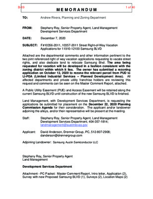
M E M O R A N D U M Andrew Rivera, Planning and Zoning Department TO: FROM: DATE: December 7, 2020 SUBJECT: F#10356-2011, 10357-2011 Street Right-of-Way Vacation Stephany Roy, Senior Property Agent, Land Management Development Services Department Applications for 11910-12100 Samsung BLVD Attached are the departmental comments and other information pertinent to the two joint referenced right of way vacation applications requesting to vacate street rights, and also dedicate land to relocate Samsung Blvd. The area being requested for vacation will be developed in a fashion consistent with the zoning district within which it lies. The owner has submitted a rezoning application on October 12, 2020 to rezone the relevant parcel from PUD to LI-PDA (Limited Industrial Services – Planned Development Area). All affected departments and private utility franchise holders are reviewing this request and comments can be seen on the Master Comment Report, attached. A Public Utility Easement (PUE) and Access Easement will be retained along the current Samsung BLVD until construction of the new Samsung BLVD is finished. Land Management, with Development Services Department, is requesting the applications be submitted for placement on the December 22, 2020 Planning Commission Agenda for their consideration. The applicant and/or landowner adjoining the alleys, and/or their representative will be present at the meeting. Staff: Stephany Roy, Senior Property Agent, Land Management Development Services Department, 404-357-1814; landmanagement@austintexas.gov Applicant: David Anderson, Drenner Group, PC, 512-807-2908; danderson@drennergroup.com Adjoining Landowner: Samsung Austin Semiconductor LLC Stephany Roy, Senior Property Agent Land Management Development Services Department Attachment - PC Packet: Master Comment Report, Intro letter, Application (2), Survey with new Proposed Samsung BLVD (1), Surveys (2), Location Maps (2) B-091 of 40 CITY OF AUSTIN - R.O.W. VACATION MASTER COMMENT REPORT As of: December 07, 2020 PROJECT NUMBER: 2020-172935 LM PROJECT NAME: [10356-2011] 12100 SAMSUNG BLVD LOCATION: 12100 SAMSUNG BLVD, AUSTIN, TX 78754 Reviewer Phone Attempt Date Approved Date Approved With Conditions Lucy Cabading 11/19/2020 11/19/2020 I approve of this ROW vacation as long as we have an easement in place covering our existing facilities until the facilities are moved. Thank you, David A. Williams LEAD OSP PLNG & ENGRG DESIGN 817 W. North Loop Austin, TX 78756 737 255-4856 Review Dept. LM AT&T (SWBT) Comments: LM ATD Review Approved With Conditions Ravi Dhamrat 512-974-1217 11/18/2020 11/18/2020 Comments: Approved with the conditions that a public access agreement be provided for the vacated area until Arterial A is constructed. 12/7/20 73002_f_lm_master_report Page 1 B-092 of 40 As of: December 07, 2020 PROJECT NUMBER: 2020-172935 LM PROJECT NAME: [10356-2011] 12100 SAMSUNG BLVD LOCATION: 12100 SAMSUNG BLVD, AUSTIN, TX 78754 Review Dept. Reviewer Phone Attempt Date Approved Date LM AW Infrastructure Management Approved With Conditions Eric Sermeno 512-972-0497 11/20/2020 11/20/2020 Comments: Per Assistant Director, Kevin Critendon, P.E., Austin Water (AW) has no objections to the requested 4.645 acre (202,323 square feet) Samsung Boulevard Right-of-Way Vacation as long the City of Austin retains a Public Utility Easement (PUE) covering the original 4.645 acre (202,323 square feet). The PUE will protect Austin Water¿s (AW) rights to properly operate and maintain the existing AW infrastructure and appurtenances within the requested ROW area which is more particularly described as being within the Mariquita Castro Survey No. 50, Abstract 160 and the Lucas Munos Survey No. 55, Abstract 513, and being all of Samsung Boulevard as dedicated in Final Plat for Jourdan Crossing Phase C, Section 2, a subdivision recorded in volume 96, page 230 of the plat records of Travis County, Texas and with an address of 12100 Samsung Boulevard, Austin, Texas, 78754. LM Drainage Engineering Review No Comment Sona Singh 512-974-7632 11/16/2020 11/16/2020 Comments: not related to an active site plan.Please defer to WPD. 12/7/20 73002_f_lm_master_report Page 2 B-093 of 40 As of: December 07, 2020 PROJECT NUMBER: 2020-172935 LM PROJECT NAME: [10356-2011] 12100 SAMSUNG BLVD LOCATION: 12100 SAMSUNG BLVD, AUSTIN, TX 78754 Review Dept. LM Electric Review Approved Comments: AE approved. LM EMS Review Approved Reviewer Phone Attempt Date Approved Date Rosario Navarro 512-322-6754 12/02/2020 12/02/2020 Comments: EMS will support staff recommendation on this request. Milissa Warren (512)972-7234 11/16/2020 11/16/2020 12/7/20 73002_f_lm_master_report Page 3 B-094 of 40 As of: December 07, 2020 PROJECT NUMBER: 2020-172935 LM PROJECT NAME: [10356-2011] 12100 SAMSUNG BLVD LOCATION: 12100 SAMSUNG BLVD, AUSTIN, TX 78754 Review Dept. Reviewer Phone Attempt Date Approved Date Tom Migl 512-974-0164 11/23/2020 11/23/2020 LM Fire For Site Plan Review Approved Comments: None LM GAATN Review Approved Comments: None Carlos DeMatos (512) 974-6513 11/19/2020 11/19/2020 12/7/20 73002_f_lm_master_report Page 4 B-095 of 40 As of: December 07, 2020 PROJECT NUMBER: 2020-172935 LM PROJECT NAME: [10356-2011] 12100 SAMSUNG BLVD LOCATION: 12100 SAMSUNG BLVD, AUSTIN, TX 78754 Review Dept. LM Google Fiber Texas Approved Comments: Google Fiber approves this Easement Vacation. Thank you, Lorena Veldañez Engineering Technician (Provided for by Adecco) veldanezgaspar@google.com (512) 230-2385 LM Grande Communications Approved Comments: Grande has no objections Daniel Piña Utility Coordinator- Austin/San Marcos Grande Communications® Cell:737-346-7155 daniel.pina@mygrande.com Reviewer Phone Attempt Date Approved Date Fredric Ritter 11/19/2020 11/19/2020 Daniel Pina 12/02/2020 12/02/2020 12/7/20 73002_f_lm_master_report Page 5 B-096 of 40 As of: December 07, 2020 PROJECT NUMBER: 2020-172935 LM PROJECT NAME: [10356-2011] 12100 SAMSUNG BLVD LOCATION: 12100 SAMSUNG BLVD, AUSTIN, TX 78754 Review Dept. LM PAZ Zoning Review Comments: No comment; Approved Reviewer Phone Attempt Date Approved Date Approved Wendy Rhoades 512-974-7719 11/16/2020 11/16/2020 LM PWD Sidewalks & Special Projects Review Approved Comments: None Eric Dusza 512-974-6504 12/04/2020 12/04/2020 12/7/20 73002_f_lm_master_report Page 6 B-097 of 40 As of: December 07, 2020 PROJECT NUMBER: 2020-172935 LM PROJECT NAME: [10356-2011] 12100 SAMSUNG BLVD LOCATION: 12100 SAMSUNG BLVD, AUSTIN, TX 78754 LM PWD Urban Trails Review Comments: No Comments LM Texas Gas Services Comments: Approved- No conflicts expected. Aaron Diaz Engineer I P: 512-465-1132 C: 512-348-4650 Aaron.Diaz@onegas.com Review Dept. Reviewer Phone Attempt Date Approved Date Approved Katie Wettick 512-974-3529 11/17/2020 11/17/2020 Approved Aaron Diaz 11/23/2020 11/23/2020 12/7/20 73002_f_lm_master_report Page 7 B-098 of 40 As of: December 07, 2020 PROJECT NUMBER: 2020-172935 LM PROJECT NAME: [10356-2011] 12100 SAMSUNG BLVD LOCATION: 12100 SAMSUNG BLVD, AUSTIN, TX 78754 Review Dept. Reviewer Phone Attempt Date Approved Date LM Time Warner Cable / Charter Rejected Comments: Timothy White 11/23/2020 Charter Communications does have a need for an easement on the property as described Thanks, Troy Smith Approved With Conditions Timothy White 11/24/2020 11/24/2020 Comments: Charter Communications Approved with Conditions that a PUE be kept in place for this stretch of Samsung Blvd. Troy Smith LM Urban Design Review No Comment Aaron Jenkins 512-974-1243 12/02/2020 12/02/2020 Comments: no review for Urban Design is required for these applications 12/7/20 73002_f_lm_master_report Page 8 B-099 of 40 As of: December 07, 2020 PROJECT NUMBER: 2020-172935 LM PROJECT NAME: [10356-2011] 12100 SAMSUNG BLVD LOCATION: 12100 SAMSUNG BLVD, AUSTIN, TX 78754 Review Dept. Reviewer Phone Attempt Date Approved Date LM Watershed Engineering Review Approved Comments: WPD has no objection to the ROW vacation due to the Permanent Access Easement and Public Utility Easement being in place concurrently with the recordation of this ROW vacation as well as withholding the recordation of the vacation until the easements are completed. Sofia Reyes 512-974-7792 12/03/2020 12/03/2020 Mobility Bond Review No Review Required Gregory Pepper 512-974-7282 11/18/2020 11/18/2020 Comments: This does not fall within the Corridor Construction Program Limits. 12/7/20 73002_f_lm_master_report Page 9 B-0910 of 40 CITY OF AUSTIN - R.O.W. VACATION MASTER COMMENT REPORT As of: December 07, 2020 PROJECT NUMBER: 2020-173128 LM PROJECT NAME: [10357-2011] 11910 1/2 SAMSUNG BLVD. LOCATION: 11910 1/2 SAMSUNG BLVD, AUSTIN, TX 78754 Review Dept. LM AT&T (SWBT) Approved Comments: LM ATD Review I approve of this ROW vacation. Thank you, David A. Williams LEAD OSP PLNG & ENGRG DESIGN 817 W. North Loop Austin, TX 78756 737 255-4856 Reviewer Phone Attempt Date Approved Date Lucy Cabading 11/19/2020 11/19/2020 Approved With Conditions Ravi Dhamrat 512-974-1217 11/18/2020 11/18/2020 Comments: Approved with the conditions that a public access agreement be provided for the vacated area until Arterial A is constructed. 12/7/20 73002_f_lm_master_report Page 1 B-0911 of 40 As of: December 07, 2020 PROJECT NUMBER: 2020-173128 LM PROJECT NAME: [10357-2011] 11910 1/2 SAMSUNG BLVD. LOCATION: 11910 1/2 SAMSUNG BLVD, AUSTIN, TX 78754 Review Dept. Reviewer Phone Attempt Date Approved Date LM AW Infrastructure Management Approved With Conditions Eric Sermeno 512-972-0497 11/20/2020 11/20/2020 Comments: Per Assistant Director, Kevin Critendon, P.E., Austin Water (AW) has no objections to the requested 6.415 acre (279,445 square feet) Samsung Boulevard Right-of-Way (ROW) Vacation as long one of the two conditions below are met for the requested ROW area which is more particularly described as being within the Lucas Munos Survey No. 55, Abstract 513, and being a portion of Pioneer Crossing East Section One, Samsung Boulevard, a subdivision recorded in document number 200200313, Official Public Records of Travis County, Texas and with an address of 11910-1/2 Samsung Boulevard, Austin, Texas, 78754. The City of Austin Development Services Division and or City of Austin Office of Real Estate Services Division must ensure one of the following two (2) conditions will exist and or confirmed prior to vacation of the requested ROW: 1. The entire intersection of Samsung Boulevard and Braker Lane stays as City of Austin Right-of-Way and not vacated in the partial plat vacation request; or, 2. Ensure the applicant revises their request for this ROW vacation to include the additional acreage/square footage for the entire intersection of Samsung Boulevard and Braker Lane. LM Drainage Engineering Review No Comment Sona Singh 512-974-7632 11/16/2020 11/16/2020 Comments: not related to an active site plan. Please defer to WPD. 12/7/20 73002_f_lm_master_report Page 2 B-0912 of 40 As of: December 07, 2020 PROJECT NUMBER: 2020-173128 LM PROJECT NAME: [10357-2011] 11910 1/2 SAMSUNG BLVD. LOCATION: 11910 1/2 SAMSUNG BLVD, AUSTIN, TX 78754 Review Dept. LM Electric Review Approved Comments: AE approved. LM EMS Review Approved Reviewer Phone Attempt Date Approved Date Rosario Navarro 512-322-6754 12/02/2020 12/02/2020 Comments: EMS will support staff recommendation on this request. Milissa Warren (512)972-7234 11/16/2020 11/16/2020 12/7/20 73002_f_lm_master_report Page 3 B-0913 of 40 As of: December 07, 2020 PROJECT NUMBER: 2020-173128 LM PROJECT NAME: [10357-2011] 11910 1/2 SAMSUNG BLVD. LOCATION: 11910 1/2 SAMSUNG BLVD, AUSTIN, TX 78754 Review Dept. Reviewer Phone Attempt Date Approved Date Tom Migl 512-974-0164 11/23/2020 11/23/2020 LM Fire For Site Plan Review Approved Comments: None LM GAATN Review Approved Comments: None Carlos DeMatos (512) 974-6513 11/19/2020 11/19/2020 12/7/20 73002_f_lm_master_report Page 4 B-0914 of 40 As of: December 07, 2020 PROJECT NUMBER: 2020-173128 LM PROJECT NAME: [10357-2011] 11910 1/2 SAMSUNG BLVD. LOCATION: 11910 1/2 SAMSUNG BLVD, AUSTIN, TX 78754 Review Dept. LM Google Fiber Texas Approved Comments: Google Fiber approves this Easement Vacation. Thank you! Lorena Veldañez Engineering Technician (Provided for by Adecco) veldanezgaspar@google.com (512) 230-2385 LM Grande Communications Approved Comments: Grande has no objections Daniel Piña Utility Coordinator- Austin/San Marcos Grande Communications® Cell:737-346-7155 daniel.pina@mygrande.com Reviewer Phone Attempt Date Approved Date Fredric Ritter 11/19/2020 11/19/2020 Daniel Pina 12/02/2020 12/02/2020 12/7/20 73002_f_lm_master_report Page 5 B-0915 of 40 As of: December 07, 2020 PROJECT NUMBER: 2020-173128 LM PROJECT NAME: [10357-2011] 11910 1/2 SAMSUNG BLVD. LOCATION: 11910 1/2 SAMSUNG BLVD, AUSTIN, TX 78754 Review Dept. LM PAZ Zoning Review Comments: No comments; Approved Reviewer Phone Attempt Date Approved Date Approved Wendy Rhoades 512-974-7719 11/16/2020 11/16/2020 LM PWD Sidewalks & Special Projects Review Approved Comments: None Eric Dusza 512-974-6504 12/04/2020 12/04/2020 12/7/20 73002_f_lm_master_report Page 6 B-0916 of 40 As of: December 07, 2020 PROJECT NUMBER: 2020-173128 LM PROJECT NAME: [10357-2011] 11910 1/2 SAMSUNG BLVD. LOCATION: 11910 1/2 SAMSUNG BLVD, AUSTIN, TX 78754 Review Dept. Reviewer Phone Attempt Date Approved Date Approved Katie Wettick 512-974-3529 11/17/2020 11/17/2020 Approved Aaron Diaz 11/23/2020 11/23/2020 LM PWD Urban Trails Review Comments: No comments. LM Texas Gas Services Comments: Approved- No conflicts expected. Aaron Diaz Engineer I P: 512-465-1132 C: 512-348-4650 Aaron.Diaz@onegas.com 12/7/20 73002_f_lm_master_report Page 7 B-0917 of 40 As of: December 07, 2020 PROJECT NUMBER: 2020-173128 LM PROJECT NAME: [10357-2011] 11910 1/2 SAMSUNG BLVD. LOCATION: 11910 1/2 SAMSUNG BLVD, AUSTIN, TX 78754 Review Dept. Reviewer Phone Attempt Date Approved Date LM Time Warner Cable / Charter Approved Timothy White 11/23/2020 11/23/2020 Comments: Charter Communications does not have a need for an easement on the property as described. LM Urban Design Review No Comment Aaron Jenkins 512-974-1243 12/02/2020 12/02/2020 Comments: no review for Urban Design is required for these applications 12/7/20 73002_f_lm_master_report Page 8 B-0918 of 40 As of: December 07, 2020 PROJECT NUMBER: 2020-173128 LM PROJECT NAME: [10357-2011] 11910 1/2 SAMSUNG BLVD. LOCATION: 11910 1/2 SAMSUNG BLVD, AUSTIN, TX 78754 Review Dept. Reviewer Phone Attempt Date Approved Date LM Watershed Engineering Review Approved Comments: WPD has no objection to the ROW vacation due to the Permanent Access Easement and Public Utility Easement being in place concurrently with the recordation of this ROW vacation as well as withholding the recordation of the vacation until the easements are completed. Sofia Reyes 512-974-7792 12/03/2020 12/03/2020 Mobility Bond Review No Review Required Gregory Pepper 512-974-7282 11/18/2020 11/18/2020 Comments: This does not fall within the Corridor Construction Program Limits. 12/7/20 73002_f_lm_master_report Page 9 B-0919 of 40 B-0920 of 40 B-0921 of 40 B-0922 of 40 B-0923 of 40 B-0924 of 40 Legend Street Labels TCAD Parcels 0.3 0 0.15 0.3 Miles NAD_1983_StatePlane_Texas_Central_FIPS_4203_Feet Date Printed: This product is for informational purposes and may not have been prepared for or be suitable for legal, engineering, or surveying purposes. It does not represent an on-the-ground survey. This product has been produced by the City of Austin for the sole purpose of geographic reference. No warranty is made by the City of Austin regarding specific accuracy or completeness. 1: 9,600 Notes B-0925 of 40 Legend Street Labels TCAD Parcels 0.3 0 0.15 0.3 Miles NAD_1983_StatePlane_Texas_Central_FIPS_4203_Feet Date Printed: This product is for informational purposes and may not have been prepared for or be suitable for legal, engineering, or surveying purposes. It does not represent an on-the-ground survey. This product has been produced by the City of Austin for the sole purpose of geographic reference. No warranty is made by the City of Austin regarding specific accuracy or completeness. 1: 9,600 Notes B-0926 of 40 4. Tract Nomenclature Exhibit B-0927 of 40 NOT TO SCALE 5 4 6 . 4 6.415 . D V L B G N U S M A S F O T N E M N G I L A E R D E S O P O R P PROPOSED REALIGNMENT OF SAMSUNG BLVD. PROPOSED PLAT EXHIBIT; TRACTS 5 & 6 106.752 ACRES INCLUDES AREA TO WEST BEING VACATED PROPOSED PLAT FOR TRACT 5 & 6 OUT OF THE LUCAS MUNOS SURVEY NO. 55, ABSTRACT 513, CITY OF AUSTIN, TRAVIS COUNTY, TEXAS TBPLS Firm No. 10193726 B-0928 of 40 EXHIBIT “A” Page 1 of 3 Samsung Boulevard Right-of-Way Vacation DESCRIPTION FOR VACATION OF SAMSUNG BOULEVARD RIGHT-OF-WAY A 4.645 acre (202,323 square feet), tract of land, lying within the Mariquita Castro Survey No. 50, Abstract 160 and the Lucas Munos Survey No. 55, Abstract 513, Travis County, Texas, and being all of Samsung Boulevard as dedicated in Final Plat for Jourdan Crossing Phase C, Section 2, a subdivision recorded in Volume 96, Page 230, Plat Records of Travis County, Texas, described as follows: BEGINNING at the most easterly northwestern corner of a called 56.597 acre tract (Tract 1) as described in a Special Warranty Deed, dated September 10, 2019 to Samsung Austin Semiconductor LLC, recorded in Document No. 2019138661, of the Official Public Records of Travis County, Texas, being the easterly right-of-way line of said Samsung Boulevard (100’ Right-Of-Way), and also being on the southern right-of-way of Parmer Lane (200’ wide Right- Of-Way), from which a 1/2-inch iron rod with cap stamped “SURVCON INC” found, bears, N30°00’31”E a distance of 0.55 feet, (Grid Coordinates: N=10,110,704.47, E=3,148,432.85); THENCE, with the west line of said 56.597 acre tract and the east right of way line of said Samsung Boulevard, the following two (2) courses and distances; 1. Along a curve to the left, an arc distance of 40.29 feet, having a radius of 25.00 feet, a central angle of 92°20’18”, and a chord which bears S73°31’51”W, a distance of 36.07 feet to a iron rod with cap stamped “SURVCON INC” found, having an NAVD 88 elevation of 644.75 feet; 2. S26°51’48”W, a distance of 1991.79 feet to an iron rod found, having an NAVD 88 elevation of 664.41 feet, at the southeast corner of said Samsung Boulevard, being the northeastern corner of Pioneer Crossing East Section One, Samsung Boulevard, a subdivision recorded in Document No. 200200313, Official Public Records of Travis County, Texas; THENCE, with a southern line of said Jourdan Crossing Phase C, Section 2 and the northern line of said Pioneer Crossing East Section One, Samsung Boulevard, N63°07’33”W, a distance of 99.99 feet to a 60d nail found, having an NAVD 88 elevation of 665.28 feet, being the southwestern corner of said Samsung Boulevard, the northwestern corner of said Pioneer Crossing East Section One, Samsung Boulevard, and being on the eastern line of Lot 1, Block A of said Final Plat for Jourdan Crossing Phase C, Section 2; THENCE, with the eastern line of said Lot 1, Block A and the western right-of-way line of Samsung Boulevard, the following two (2) courses and distances; 1. N26°51’48”E, a distance of 2000.00 feet to iron rod with cap stamped “BAKER AIKLEN ASSOC CEDAR PARK TEXAS” found, having an NAVD 88 elevation of 645.09 feet, at a point of curvature to the left; 2. Along said curve to the left, an arc distance of 37.71 feet, having a radius of 25.00 feet, a central angle of 26°25’44”, and a chord which bears N16°48’38”W, a distance of 34.24 feet to a iron rod found, having an NAVD 88 elevation of 645.83 feet, for the northernmost northeastern corner of said Lot 1, also being in the southern right-of-way line of Parmer Lane (200’ wide Right- Of-Way); B-0929 of 40 EXHIBIT “A” Page 2 of 3 Samsung Boulevard Right-of-Way Vacation THENCE, S59°59’29”E, with the northern line of said Samsung Boulevard as dedicated in Final Plat for Jourdan Crossing Phase CS Section 2 and the southern right-of-way line of said Parmer Lane, a distance of 150.10 feet to the POINT OF BEGINNING; Containing 4.645 acre (202,323 square feet), more or less. Bearings are based on the Texas State Plane Coordinate System, Central Zone (4203), North American Datum of 1983 (NAD83), 2011 Adjustment. All distances shown hereon are surface values represented in U.S. Survey Feet and may be converted to grid by dividing by a combined adjustment factor of 1.00010 exactly. I hereby certify that this boundary description represents the results of a survey made on the ground October 20 of 2020. This description is accompanied by a separate plat of even date. Robert J. Gertson, RPLS Texas Registration No. 6367 Atwell, LLC 3815 Capital of Texas Highway, Suite 300 Austin, Texas 78704 Ph. 512-904-0505 TBPLS Firm No. 10193726 11/12/20 B-0930 of 40 Δ Δ 11/12/20 DATE: DRAWN: CHECKED: JOB NO.: 11/12/20 AY RG 20003531 SHT. 03 OF 03 B-0931 of 40 Mapcheck 1: SamVac01 Closure Summary Precision, 1 part in: 654098.43' Error distance: 0.01' Error direction: N50.2356E (dms) Area: 4.6447acres Square area: 202322.87 Perimeter: 4319.88' Point of Beginning Easting: 3148747.6921' Northing: 10111715.5416' Side 1: Curve Curve direction: Counter-clockwise Radius: [25.00'] Arc length: 40.29' Delta angle: 92.2018 (dms) Tangent: [26.04'] Chord direction: S73.3151W (dms) Chord angle: [73.3151 (dms)] Deflection angle: [-106.2809 (dms)] Chord distance: 36.07' Easting: 3148713.1020' Northing: 10111705.3158' Side 2: Line Direction: S26.5148W (dms) Angle: [179.3006 (dms)] Deflection angle: [-0.2954 (dms)] Distance: 1991.79' Easting: 3147813.0840' Northing: 10109928.4661' Side 3: Line Direction: N63.0733W (dms) Angle: [-89.5921 (dms)] Deflection angle: [90.0039 (dms)] Distance: 99.99' Easting: 3147723.8928' Northing: 10109973.6648' Side 4: Line Direction: N26.5148E (dms) Angle: [-90.0039 (dms)] Deflection angle: [89.5921 (dms)] Distance: 2000.00' Easting: 3148627.6206' Northing: 10111757.8386' Side 5: Curve Curve direction: Counter-clockwise Radius: [25.00'] Arc length: 37.71' Delta angle: 86.2544 (dms) Tangent: [23.49'] Chord direction: N16.4838W (dms) Chord angle: [136.1934 (dms)] Deflection angle: [-43.4026 (dms)] file:///K/20003531%20-%20Star%20Survey%20Plats%20and%20Topo/DWG/Survey/JACOBS/4.645AcSamsungVac%20Mck.txt[11/12/2020 12:36:40 PM] B-0932 of 40 Chord distance: 34.24' Easting: 3148617.7181' Northing: 10111790.6154' Side 6: Line Direction: S59.5929E (dms) Angle: [0.0201 (dms)] Deflection angle: [-179.5759 (dms)] Distance: 150.10' Easting: 3148747.6972' Northing: 10111715.5458' file:///K/20003531%20-%20Star%20Survey%20Plats%20and%20Topo/DWG/Survey/JACOBS/4.645AcSamsungVac%20Mck.txt[11/12/2020 12:36:40 PM] B-0933 of 40 EXHIBIT “A” Page 1 of 4 Samsung Boulevard Right-of-Way Vacation DESCRIPTION FOR VACATION OF SAMSUNG BOULEVARD RIGHT-OF-WAY A 6.415 acre (279,445 square feet), tract of land, lying within the Lucas Munos Survey No. 55, Abstract No. 513, Travis County, Texas, and being a portion of Pioneer Crossing East Section One, Samsung Boulevard, a subdivision recorded in Document No. 200200313, Official Public Records of Travis County, Texas, described as follows: BEGINNING at an iron rod with cap stamped “SURVCON INC” found, having an NAVD 88 elevation of 646.46 feet, for the southwest corner of a called 56.597 acre tract conveyed to Samsung Austin Semiconductor LLC in Document No. 2019138661, Official Public Records of Travis County, Texas, the northwest corner of a called 39.285 acre tract (Tract 3-1) as described in a Special Warranty Deed, dated July 02, 2013 to Dynamic Finance Corporation, recorded in Document No. 2013122753, of the Official Public Records of Travis County, Texas, and also being in the arc of a curve to the left on the eastern right-of-way line of Samsung Boulevard (100’ wide right-of-way), as dedicated by said Pioneer Crossing East Section One “Samsung Boulevard”, for the POINT OF BEGINNING of the herein described tract (Grid Coordinates: N=10,108,347.64, E=3,147,372.14); THENCE, with the common boundary line of said 39.285 acre tract and said Pioneer Crossing East Samsung Boulevard, the following five (5) courses and distances; 1. Along said curve to the left, an arc distance of 117.54 feet, having a radius of 950.00 feet, a central angle of 07°05’20”, and a chord which bears S08°41’54”E, a distance of 117.46 feet to an iron rod with cap stamped “SURVCON INC” found, having an NAVD 88 elevation of 642.20 feet; 2. S12°19’49”E a distance of 364.29 feet to an iron rod with cap stamped “SURVCON INC” found, having an NAVD 88 elevation of 631.76 feet, at a point of curvature to the right; 3. Along said curve to the right, an arc distance of 1441.66 feet, having a radius of 1550.00 feet, a central angle of 53°17’27”, and a chord which bears S14°22’15”W, a distance of 1390.25 feet to an iron rod with cap stamped “SURVCON INC” found, having an NAVD 88 elevation of 650.25 feet; 4. S40°52’33”W a distance of 265.40 feet to an iron rod with cap stamped “SURVCON INC” found, having an NAVD 88 elevation of 653.28 feet, at a point of curvature to the left; 5. Along said curve to the left, an arc distance of 39.89 feet, having a radius of 25.00 feet, a central angle of 91°25’48”, and a chord which bears S03°55’18”E, a distance of 35.79 feet to an iron rod with cap stamped “SURVCON INC” found, having an NAVD 88 elevation of 653.56 feet; THENCE, crossing said Pioneer Crossing East Section One, Samsung Boulevard, N49°00’35”W a distance of 150.20 feet to a capped iron rod with “SURVCON INC” found, having an NAVD 88 elevation of 655.75 feet, at a point of curvature to the left; for the westerly southeasterly corner of a called 27.802 acre tract (Tract 2) as described in a Special Warranty Deed, dated September 10, 2019 to Samsung Austin Semiconductor LLC., recorded in Document No. 2019138661, of the Official Public Records of Travis County, Texas and being on the proposed northerly right- of-way line of Braker Lane, same being the remainder of a called 479.683 acre tract (Tract 10) as described in a Correction General Warranty Deed, dated September 17, 1998 to Art Collection, Inc., recorded in Volume 13270, Page 1369, of the Real Property Records of Travis County, Texas; THENCE, with the easterly line of said 27.802 acre tract and the westerly right-of-way line of Samsung Boulevard, the following five (5) courses and distances; 1. Along said curve to the left, an arc distance of 39.52 feet, having a radius of 25.00 feet, a central angle of 90°34’38”, and a chord which bears N86°09’17”E, a distance of 35.53 feet to a iron rod with cap stamped “SURVCON INC found, having an NAVD 88 elevation of 654.67 feet” 2. N40°55’28”E a distance of 265.82 feet to a 1/2-inch iron rod found, having an NAVD 88 elevation of 650.56 feet, at the point of curvature of a curve to the left; B-0934 of 40 EXHIBIT “A” Page 2 of 4 Samsung Boulevard Right-of-Way Vacation 3. Along said curve to the left, an arc distance of 1348.41 feet, having a radius of 1450.00 feet, a central angle of 53°16’53”, and a chord which bears N14°21’06”E, a distance of 1300.34 feet to a iron rod with cap stamped “SURVCON INC” found, having an NAVD 88 elevation of 631.00 feet; 4. N12°18’59”W a distance of 364.31 feet to a iron rod with cap stamped “SURVCON INC” found, having an NAVD 88 elevation of 641.48 feet, at the point of curvature of a curve to the right; 5. Along said curve to the right, an arc distance of 717.79 feet, having a radius of 1050.00 feet, a central angle of 39°10’04”, and a chord which bears N07°17’42”E, a distance of 703.89 feet to a iron rod with cap stamped “JACOBS” found for the north corner of said 27.802 acre tract and being on the eastern line of Lot 1, Block A of the Final Plat for Jourdan Crossing Phase C, Section 2, a subdivision recorded in Volume 96, Page 230, Plat Records of Travis County, Texas; THENCE, with the easterly line of said Lot 1, Block A and said western right-of-way line of Samsung Boulevard, N26°51’48”E, a distance of 61.33 feet to a 60d nail found, having an NAVD 88 elevation of 665.28 feet, for the northwestern corner of said Pioneer Crossing East Section One, Samsung Boulevard, also being the southwestern corner of said Samsung Boulevard as dedicated in Final Plat for Jourdan Crossing Phase C, Section 2; THENCE, with the northly line of said Pioneer Crossing East Section One, Samsung Boulevard and a southerly line of said Jourdan Crossing Phase C, Section 2, S63°07’33”E, a distance of 99.99 feet to an iron rod found, having an NAVD 88 elevation of 664.41 feet, for the northeastern corner of said Pioneer Crossing East Section One, Samsung Boulevard, being the southeastern corner of said Samsung Boulevard as dedicated in Final Plat for Jourdan Crossing Phase C, Section 2 and being on the western line of said 56.597 acre tract; THENCE, with the westerly line of said 56.597 acre tract and the easterly right-of-way line of Samsung Boulevard, the following two (2) courses and distances; 1. S26°51’48”W a distance of 61.31 feet to a 1/2-inch iron rod found, having an NAVD 88 elevation of 663.70 feet, at the point of curvature of a curve to the left; 2. Along said curve to the left, an arc distance of 531.59 feet, having a radius of 950.00 feet, a central angle of 32°03’38”, and a chord which bears S10°50’20”W, a distance of 524.68 feet to the POINT OF BEGINNING; Containing 6.415 acre (279,445 square feet), more or less. Bearings are based on the Texas State Plane Coordinate System, Central Zone (4203), North American Datum of 1983 (NAD83), 2011 Adjustment. All distances shown hereon are surface values represented in U.S. Survey Feet and may be converted to grid by dividing by a combined adjustment factor of 1.00010 exactly. I hereby certify that this boundary description represents the results of a survey made on the ground October 20 of 2020. This description is accompanied by a separate plat of even date. Robert J. Gertson, RPLS Texas Registration No. 6367 Atwell, LLC 3815 Capital of Texas Highway, Suite 300 Austin, Texas 78704 Ph. 512-904-0505 TBPLS Firm No. 10193726 11/12/20 B-0935 of 40 11/12/20 DATE: DRAWN: CHECKED: JOB NO.: 11/12/20 AY RG 20003531 SHT. 03 OF 04 B-0936 of 40 11/12/20 DATE: DRAWN: CHECKED: JOB NO.: 11/12/20 AY RG 20003531 SHT. 04 OF 04 B-0937 of 40 Mapcheck 1: SamVac#02 Closure Summary Precision, 1 part in: 713724.78' Error distance: 0.01' Error direction: S88.0244W (dms) Area: 6.4152acres Square area: 279444.71 Perimeter: 5869.05' Point of Beginning Easting: 3147686.7176' Northing: 10109358.4528' Side 1: Curve Curve direction: Counter-clockwise Radius: [949.97'] Arc length: 117.54' Delta angle: 7.0520 (dms) Tangent: [58.84'] Chord direction: S8.4154E (dms) Chord angle: [-8.4154 (dms)] Deflection angle: [171.1806 (dms)] Chord distance: 117.46' Easting: 3147704.4813' Northing: 10109242.3438' Side 2: Line Direction: S12.1949E (dms) Angle: [179.5445 (dms)] Deflection angle: [-0.0515 (dms)] Distance: 364.29' Easting: 3147782.2742' Northing: 10108886.4569' Side 3: Curve Curve direction: Clockwise Radius: [1550.00'] Arc length: 1441.66' Delta angle: 53.1727 (dms) Tangent: [777.72'] Chord direction: S14.2215W (dms) Chord angle: [-153.1756 (dms)] Deflection angle: [26.4204 (dms)] Chord distance: 1390.25' Easting: 3147437.2187' Northing: 10107539.7083' Side 4: Line Direction: S40.5233W (dms) Angle: [179.5134 (dms)] Deflection angle: [-0.0826 (dms)] Distance: 265.40' Easting: 3147263.5351' Northing: 10107339.0315' Side 5: Curve Curve direction: Counter-clockwise Radius: [25.00'] Arc length: 39.89' file:///K/20003531%20-%20Star%20Survey%20Plats%20and%20Topo/DWG/Survey/JACOBS/6.415AcSamVac%20Mck.txt[11/12/2020 12:21:46 PM] B-0938 of 40 Delta angle: 91.2548 (dms) Tangent: [25.63'] Chord direction: S3.5518E (dms) Chord angle: [135.1209 (dms)] Deflection angle: [-44.4751 (dms)] Chord distance: 35.79' Easting: 3147265.9828' Northing: 10107303.3253' Side 6: Line Direction: N49.0035W (dms) Angle: [0.3737 (dms)] Deflection angle: [-179.2223 (dms)] Distance: 150.20' Easting: 3147152.6087' Northing: 10107401.8462' Side 7: Curve Curve direction: Counter-clockwise Radius: [25.00'] Arc length: 39.52' Delta angle: 90.3438 (dms) Tangent: [25.25'] Chord direction: N86.0917E (dms) Chord angle: [-44.5008 (dms)] Deflection angle: [135.0952 (dms)] Chord distance: 35.53' Easting: 3147188.0588' Northing: 10107404.2289' Side 8: Line Direction: N40.5528E (dms) Angle: [-179.5630 (dms)] Deflection angle: [0.0330 (dms)] Distance: 265.82' Easting: 3147362.1877' Northing: 10107605.0756' Side 9: Curve Curve direction: Counter-clockwise Radius: [1450.00'] Arc length: 1348.41' Delta angle: 53.1653 (dms) Tangent: [727.39'] Chord direction: N14.2106E (dms) Chord angle: [153.2538 (dms)] Deflection angle: [-26.3422 (dms)] Chord distance: 1300.34' Easting: 3147684.5065' Northing: 10108864.8354' Side 10: Line Direction: N12.1859W (dms) Angle: [179.5822 (dms)] Deflection angle: [-0.0138 (dms)] Distance: 364.31' Easting: 3147606.7956' Northing: 10109220.7606' Side 11: Curve file:///K/20003531%20-%20Star%20Survey%20Plats%20and%20Topo/DWG/Survey/JACOBS/6.415AcSamVac%20Mck.txt[11/12/2020 12:21:46 PM] B-0939 of 40 Curve direction: Clockwise Radius: [1050.00'] Arc length: 717.79' Delta angle: 39.1004 (dms) Tangent: [373.55'] Chord direction: N7.1742E (dms) Chord angle: [-160.2319 (dms)] Deflection angle: [19.3641 (dms)] Chord distance: 703.89' Easting: 3147696.1741' Northing: 10109918.9530' Side 12: Line Direction: N26.5148E (dms) Angle: [179.5904 (dms)] Deflection angle: [-0.0056 (dms)] Distance: 61.33' Easting: 3147723.8870' Northing: 10109973.6647' Side 13: Line Direction: S63.0733E (dms) Angle: [-89.5921 (dms)] Deflection angle: [90.0039 (dms)] Distance: 99.99' Easting: 3147813.0782' Northing: 10109928.4660' Side 14: Line Direction: S26.5148W (dms) Angle: [-90.0039 (dms)] Deflection angle: [89.5921 (dms)] Distance: 61.31' Easting: 3147785.3744' Northing: 10109873.7721' Side 15: Curve Curve direction: Counter-clockwise Radius: [950.01'] Arc length: 531.59' Delta angle: 32.0338 (dms) Tangent: [272.95'] Chord direction: S10.5020W (dms) Chord angle: [163.5832 (dms)] Deflection angle: [-16.0128 (dms)] Chord distance: 524.68' Easting: 3147686.7094' Northing: 10109358.4525' file:///K/20003531%20-%20Star%20Survey%20Plats%20and%20Topo/DWG/Survey/JACOBS/6.415AcSamVac%20Mck.txt[11/12/2020 12:21:46 PM] B-0940 of 40