B-02 (C14-2020-0073 - MSC & CTC Tracts Zoning; District 3).pdf — original pdf
Backup
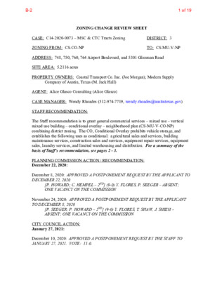
ZONING CHANGE REVIEW SHEET CASE: C14-2020-0073 – MSC & CTC Tracts Zoning ZONING FROM: CS-CO-NP ADDRESS: 748, 750, 760, 764 Airport Boulevard, and 5301 Glissman Road SITE AREA: 5.2116 acres PROPERTY OWNERS: Coastal Transport Co. Inc. (Joe Morgan); Modern Supply DISTRICT: 3 TO: CS-MU-V-NP Company of Austin, Texas (M. Jack Hall) AGENT: Alice Glasco Consulting (Alice Glasco) CASE MANAGER: Wendy Rhoades (512-974-7719, wendy.rhoades@austintexas.gov) STAFF RECOMMENDATION: The Staff recommendation is to grant general commercial services – mixed use – vertical mixed use building – conditional overlay – neighborhood plan (CS-MU-V-CO-NP) combining district zoning. The CO, Conditional Overlay prohibits vehicle storage, and establishes the following uses as conditional: agricultural sales and services, building maintenance services, construction sales and services, equipment repair services, equipment sales, laundry services, and limited warehousing and distribution. For a summary of the basis of Staff’s recommendation, see pages 2 - 3. PLANNING COMMISSION ACTION / RECOMMENDATION: December 22, 2020: December 8, 2020: APPROVED A POSTPONEMENT REQUEST BY THE APPLICANT TO DECEMBER 22, 2020 [P. HOWARD; C. HEMPEL – 2ND] (9-0) Y. FLORES, P. SEEGER – ABSENT; ONE VACANCY ON THE COMMISSION November 24, 2020: APPROVED A POSTPONEMENT REQUEST BY THE APPLICANT TO DECEMBER 8, 2020 [P. SEEGER; P. HOWARD – 2ND] (9-0) Y. FLORES, T. SHAW, J. SHIEH – ABSENT; ONE VACANCY ON THE COMMISSION CITY COUNCIL ACTION: January 27, 2021: December 10, 2020: APPROVED A POSTPONEMENT REQUEST BY THE STAFF TO JANUARY 27, 2021. VOTE: 11-0. 1 of 19B-2 C14-2020-0073 Page 2 ORDINANCE NUMBER: ISSUES: On Tuesday, October 6, 2020, Housing and Planning staff hosted a virtual meeting with the Applicant and invited the Govalle / Johnston Terrace Neighborhood Contact Team to discuss the related Neighborhood Plan Amendment case. East Austin Conservancy and the Govalle / Johnston Terrace Neighborhood Contact Team have provided letters in support of the proposed rezoning and related NPA cases. Please refer to the attached correspondence. The Applicant is in agreement with the Staff recommendation. CASE MANAGER COMMENTS: The subject platted lots and unplatted acreage contains a trucking company, a steel fabrication company, and a storage and parking area located at the southwest corner of Airport Boulevard and Glissman Road. Vehicular access is taken from both Airport Boulevard, an Imagine Austin corridor and Glissman Road, a local street. In March 2003, Council approved rezoning the property from LI-NP to CS-CO-NP as part of the Johnston Terrace neighborhood plan rezonings. The Conditional Overlay prohibits vehicle storage and establishes several other uses as conditional and was applied to several tracts in the planning area along or in close proximity to Airport Boulevard. There is an indoor sports and recreation use across Glissman Road to the north (CS-CO-NP), a local labor union, a pipe supply company, and vacant commercial building across Airport Boulevard to the east (LI- NP; CS-MU-CO-NP), and single family residences on both sides of Glissman Road to the west (SF-3-NP). Please refer to Exhibits A (Zoning Map) and A-1 (Aerial View). The Applicant proposes to rezone the property to the general commercial services – mixed use – vertical mixed use building – neighborhood plan (CS-MU-V-NP) for the opportunity to construct approximately 225 multifamily residences and 2,500 square feet of commercial uses. The addition of –V provides an additional development option to a property and allows it to retain the ability to redevelop under the existing CS base district. A –V does not grant: 1) additional height to the base zoning district which is 60 feet in the CS district or 2) additional impervious cover which is limited to 95 percent in the Boggy Creek and Colorado River watersheds. The addition of –V also does not waive compatibility standards which apply along the west property line abutting single family residences on the south side of Glissman Road. A building constructed under vertical mixed use building (–V) standards is required to contain a mix of residential and commercial uses, and the result is typically retail, restaurants and offices on the ground floor, and residential units on the upper levels. On the subject property there is also the opportunity to waive: 1) the front and street side yard setbacks, 2) the 2:1 floor-to-area ratio established by CS zoning, and 3) the minimum site area requirement which is the number of dwelling units on a site by requiring a certain amount of 2 of 19B-2 C14-2020-0073 Page 3 square footage for a specific type of multi-family unit (efficiency, one bedroom, two bedroom). A –V building is also eligible for 60 percent of the minimum requirement for off- street parking. Finally, a –V building has an established affordability level for rental units which is 10 percent of the residential units set aside for households earning no more than 80 percent of the current MFI ($78,100 is the 2020 Income Limit for a 4-person household), for a period of 40 years. BASIS FOR RECOMMENDATION 1. The proposed zoning should be consistent with the purpose statement of the district sought. The proposed general commercial services (CS) district zoning is intended for commercial or industrial uses that typically have operating characteristics or traffic service requirements generally incompatible with residential environments. The mixed use (MU) district is intended to allow for office, retail, commercial and residential uses to be combined in a single development. The Vertical Mixed Use Building (V) combining district may be applied in combination with any commercial base zoning district and allows for a combination of office, retail, commercial and residential uses within a vertical mixed use building. The Conditional Overlay (CO) combining district may be applied in combination with any base district. The district is intended to provide flexible and adaptable use or site development regulations by requiring standards tailored to individual properties. The neighborhood plan (NP) district denotes a tract located within the boundaries of an adopted Neighborhood Plan. 2. Zoning should promote clearly identified community goals such as creating employment opportunities or providing for affordable housing. The subject property is one that is eligible and appropriate for the addition of –V because of its location within a commercially zoned area, along a major arterial with a bus stop on Airport Boulevard in front of the property, and an 8.4 acre adjacent -V zoned property on Levander Loop (presently under construction for 354 apartments and 7 office spaces). The proposed project includes multifamily residences with affordable housing component and ground floor commercial uses that will serve the residents and the neighborhood. The Staff’s proposed Conditional Overlay carries forward the prohibited and conditional uses approved with the Johnston Terrace neighborhood plan rezonings, as these uses apply to several tracts along Airport Boulevard. EXISTING ZONING AND LAND USES: Site ZONING CS-CO-NP North CS-CO-NP; SF-3-NP South CS-CO-NP; CS-V-CO-NP LAND USES Storage / parking, steel fabrication, trucking business Indoor sports and recreation; Offices; Auto repair; Single family residences Utility; Under construction for apartments and 3 of 19B-2 C14-2020-0073 Page 4 East CS-MU-CO-NP West SF-3-NP offices Commercial building (vacant); Office; Pipe supplier; Fire station Single family residences SCENIC ROADWAY: No NEIGHBORHOOD PLAN AREA: Govalle / Johnston Terrace Combined (Govalle) TIA: Deferred to the site plan application when land uses and intensities will be finalized WATERSHEDS: Boggy Creek; Colorado River – Urban CAPITOL VIEW CORRIDOR: No SCHOOLS: An Educational Impact Statement is required. Please refer to Attachment A. Govalle Elementary School Martin Middle School COMMUNITY REGISTRY LIST: 30 – Guadalupe Neighborhood Development Corporation 477 – El Concilio Mexican – American Neighborhoods 511 – Austin Neighborhoods Council 681 – Govalle / Johnston Terrace Neighborhood Plan Contact Team 742 – Austin Independent School District 1093 – Govalle Neighborhood Association 1228 – Sierra Club, Austin Regional Group 1258 – Del Valle Community Coalition 1363 – SEL Texas 1444 – East Austin Conservancy 1530 – Friends of Austin Neighborhoods 1595 – Neighborhoods United for Progress 1616 – Neighborhood Empowerment Foundation 1774 – Austin Lost and Found Pets AREA CASE HISTORIES: 1424 – Preservation Austin 1528 – Bike Austin 1550 – Homeless Neighborhood Association Eastside Memorial High School NUMBER C14-2017-0140 – 4813 Gonzales St and 4820 E 7th St REQUEST CS-CO-NP to CS- MU-V-CO-NP C14-2007-0259.001 / NPA-2008- 0016.01 – Govalle/Johnston Terrace Vertical Mixed Use Opt- in/Opt-out Tr 9B – CS-CO-NP to CS-V- CO-NP; Related request to change NPA to change the FLUM from Commercial to Mixed Use COMMISSION To Grant CS-MU- V-CO-NP w/CO for list of prohibited and conditional uses To Grant CS-V- CO-NP w/V for dimensional standards and parking reduction, and affordability level of 60% MFI CITY COUNCIL Apvd CS-MU-V-CO- NP as Commission recommended (4-26-2018). Apvd CS-V-CO-NP and Mixed Use land use as Commission recommended (11-20-2008). 4 of 19B-2 C14-2020-0073 Page 5 720 Airport Blvd for 10% rental units To Grant Mixed Use land use RELATED CASES: The subject property is located within the boundaries of the Govalle / Johnston Terrace Combined (Govalle) Neighborhood Planning Area and the property was rezoned from LI to CS-CO-NP in March 2003 (C14-02-0183 – Ordinance No. 03327-11a). The Conditional Overlay for Tract 112 prohibits vehicle storage, and establishes agricultural sales and services, building maintenance services, construction sales and services, equipment repair services, equipment sales, laundry services, and limited warehousing and distribution as conditional uses. There is a corresponding neighborhood plan amendment case to change the land use designation on the Future Land Use Map (FLUM) from Commercial to Mixed Use (NPA-2020-0016.01). The property consists of Lots 2 and 3, Atwell Tract, a subdivision recorded in July 1984 (C8s-84-065), and Lot 1, Atwell Tract No. 2, a subdivision recorded in May 1987 (C8s-87- 008), and unplatted acreage at the southeast corner of the property. Please refer to Exhibit B (Recorded Plat). There are no site plan applications on the property. EXISTING STREET CHARACTERISTICS: Name Classification Sidewalks Pavement Bicycle Route No No No Yes 40 feet 58 feet Level 3 Level 1 (Local) Airport Boulevard Glissman Road OTHER STAFF COMMENTS: Drainage The developer is required to submit a pre- and post-development drainage analysis at the subdivision and site plan stage of the development process. The City’s Land Development Code and Drainage Criteria Manual require that the Applicant demonstrate through engineering analysis that the proposed development will have no identifiable adverse impact on surrounding properties. Existing / ASMP Required ROW 121 feet / 120 feet 56 feet / Existing Capital Metro (within ¼ mile) Yes (Route 350) Yes (Route 350) 5 of 19B-2 C14-2020-0073 Page 6 Impervious Cover Within the Boggy Creek and Colorado River watersheds, the maximum impervious cover allowed by the CS-MU-V-NP zoning district is 95%, which is based on the zoning regulations. Environmental The site is not located over the Edwards Aquifer Recharge Zone. The site is located in the Colorado and Boggy Creek Watersheds of the Colorado River Basin. Both watersheds are classified as Urban Watersheds by Chapter 25-8 of the City's Land Development Code. It is in the Desired Development Zone. Zoning district impervious cover limits apply in the Urban Watershed classification. According to floodplain maps there is no floodplain within or adjacent to the project location. Standard landscaping and tree protection will be required in accordance with LDC 25-2 and 25-8 for all development and/or redevelopment. At this time, site specific information is unavailable regarding vegetation, areas of steep slope, or other environmental features such as bluffs, springs, canyon rimrock, caves, sinkholes, and wetlands. This site is required to provide on-site water quality controls (or payment in lieu of) for all development and/or redevelopment when 8,000 s.f. cumulative is exceeded, and on site control for the two-year storm. Site Plan Any new development is subject to Subchapter E: Design Standards and Mixed Use. Additional comments will be made when the site plan is submitted. If the site design proposes to take relief from development standards as outlined in Section 4.3 of Subchapter E, a letter from the Housing and Planning Department certifying the provided affordable housing will be required. The site is subject to compatibility standards. Along the west property line, the following standards apply: a. No structure may be built within 25 feet of the property line. b. No structure in excess of two stories or 30 feet in height may be constructed c. No structure in excess of three stories or 40 feet in height may be constructed within 50 feet of the property line. within 100 feet of the property line. d. No parking or driveways are allowed within 25 feet of the property line. e. A landscape area at least 25 feet wide is required along the property line. In addition, a fence, berm, or dense vegetation must be provided to screen 6 of 19B-2 C14-2020-0073 Page 7 adjoining properties from views of parking, mechanical equipment, storage, and refuse collection. Additional design regulations will be enforced at the time a site plan is submitted. Airport Overlay FYI – This site is located within the Austin-Bergstrom Airport Controlled Compatible Land Use Area Overlay. No use will be allowed that can create electrical interference with navigational signals or radio communications between airport and aircraft, make it difficult for pilots to distinguish between the airport lights and others, result in glare in the eyes of pilots using the airport, impair visibility in the vicinity of the airport, create bird strike hazards or otherwise in any way endanger or interfere with the landing, taking off, or maneuvering of aircraft intending to use the Austin-Bergstrom Airport. Height limitations and incompatible uses with each Airport Overlay zone are established in the Airport Overlay Ordinance. For the site plan, Airport Hazard Zoning Committee review may be required prior to Planning Commission hearing. Additional comments may be generated during the site plan review process. Transportation The Austin Strategic Mobility Plan (ASMP), adopted April 11, 2019, identifies existing right-of-way as sufficient for Airport Boulevard and Glissman Road. Some additional, limited, right-of-way may need to be dedicated at the time of subdivision or site plan to accommodate planned Corridor Mobility and intersection improvements. A traffic impact analysis should be deferred to the site plan application when land uses and intensities will be finalized. As information, Capitol Metro projects that new MetroRapid bus lines will be operational by 2024. The Pleasant Valley MetroRapid line is planned on Airport Boulevard and could result in a bus station coming online in the vicinity prior to the train service described below. The Springdale Stop on the Green Line of Project Connect is projected to be located in the general vicinity of Springdale Road, Bolm Road, and Shady Lane. Capitol Metro’s projected timeline for operation of the Green Line is 2033. Water / Wastewater The landowner intends to serve the site with City of Austin water and wastewater utilities. The landowner, at own expense, will be responsible for providing any water and wastewater utility improvements, offsite main extensions, utility relocations and or abandonments required by the land use. The water and wastewater utility plan must be reviewed and approved by Austin Water for compliance with City criteria and suitability for operation and maintenance. Based on current public infrastructure configurations, it appears that service extension requests (SER) will be required to provide service to this lot. Public wastewater service is 7 of 19B-2 C14-2020-0073 Page 8 not available to serve this lot. For more information pertaining to the Service Extension Request process and submittal requirements contact Alberto Ramirez with Austin Water, Utility Development Services at 625 E. 10th St., 7th Floor. Ph: 512-972-0211. The landowner must pay the City inspection fee with the utility construction. The landowner must pay the tap and impact fee once the landowner makes an application for a City of Austin water and wastewater utility tap permit. INDEX OF EXHIBITS AND CORRESPONDENCE TO FOLLOW Exhibit A: Zoning Map Exhibit A-1: Aerial Map Exhibit B: Recorded Plats Attachment A: Educational Impact Statement Correspondence Received 8 of 19B-2 P-NP C14-2011-0083 SF-3-NP ( ( ( ( ( ( ( SF-3-NP ( ( B O L M R D ( ( N N L O LT A W SF-3-NP ( ( UNDEV ( N R L E N R E O K ( ( ( CS-MU-CO-NP ( = = SF-3-NP = = = = TEXAS SCHOOL FOR THE DEAF ( ( E V L A L E S N A M ( N O E LIM ( L L A C ( ( ( SF-3-NP ( ( ( ( ( ( ( ( APPL. GR-NP SF-3-NP ( ( T T S T E L L U G ( ( ( ( ( LY O N ( S R D ( ( GR-MU-NP CONV. STR./ GAS A P P A R E L S H P. GR-NP CELLUAR TOWER CS-CO-NP ! ! ! ! ! ! ! ! ! ! ! ! ! ! !! RESTAURANT ! ! ! ! ( ! ! ! ! 72-318 ! ! ! ! ! ! ! ! ! ! ! ! ! ! GOODWILL IND. MOBILE HOME PARK MH-NP ( ( ( ! ! ! ! ! ! ! ! ! ! ! ! ! ! ! ! ! ! ! ! ( ! ! ! ! ( ! ! ( ! ! ! ! ( ( ( SF-3-NP LO-MU-NP RZ85-50 ( ( FARM EQUIPT. COMP. CS-CO-NP SH O P SP96-0367C 59-134 SF-3-NP C14-01-0101 LO-CO-NP 01-0101 G LIS S M A N R D ! ! ! SF-3-NP ! ! ! A I R P O R T B L V D P-NP LI-NP N Y L D A H S LR-MU-CO-NP CS-MU-CO-NP GR-MU-CO-NP ( ( GR-MU-NP ( ( ! ! ! ! ! ! ! ! ! ! ! ! ! ! ! ! ! ! CS-CO-NP ! ! ! ! ! ! ! ! ! ! ! 02-0093 C14-02-0093 CS-V-CO-NP NPA-2008-0016.01 C14-2007-0259 2008-0259.001 SP97-0139C ( ( ( ( MILB U R N LN ( ( ( SF-3-NP ! ! ! ! ! ! ! ! ( ! ! ! ! ! ! ! ! SF-3-NP ! ! ! ! ! ! ! ! ! ! ! ! ! ! ( ! GLISSMAN RD ( ( ( ! SF-3-NP ( ! ! ! ! C14-2014-0123 ! ! E V L A L E S N A M ! ! ! P-NP 98-0057 ELEMENTARY SCHOOL ( G O N Z ! A L E ! ! SF-3-NP ( ! S S ! T ! ! 98-0057 ! ! ! ! ! ! ! ! CS-MU-V-CO-NP C14-2017-0140 C14-2007-0259 NPA-2008-0016.01 ! ! ! P . O M T C R O P ! ! S N A R T L I N G C O . T B O T LI-CO-NP ! ! ! ! CS-CO-NP ! ! ! S A L V A G E O . C USED SALES CS-MU-CO-NP VACANT LOT SP-05-1426C SP83-345C LI-CO-NP ! ! ! ! P M A R R E D N VA E O L B T RT S O P AIR L E V A N D E R L O O P P-NP CS-CO-NP E 5TH ST E 7 T H S T AUTOMOTIVE W H S E OXYEN CO. C14-2007-0259 NPA-2008-0016.01 EXP IM P O O RT R T CS-V-CO-NP S S A L G R E FIB Y N A P M O C E CESAR CHAVEZ ST RIC T C E L E P. M O C AUTO SUPPLY N T I O O C S U N S C Y U L R P T P E F I C F O LI-CO-NP LEVANDER LOOP LI-CO-NP CS-CO-NP O. E C C N A N E T AIN M P-NP L U M B E R L M I L GR-CO-NP ± SUBJECT TRACT ! ! ! ! ! ! PENDING CASE ZONING BOUNDARY ZONING Exhibit A ZONING CASE#: C14-2020-0073 This product is for informational purposes and may not have been prepared for or be suitable for legal, engineering, or surveying purposes. It does not represent an on-the-ground survey and represents only the approximate relative location of property boundaries. 1 " = 400 ' This product has been produced by CTM for the sole purpose of geographic reference. No warranty is made by the City of Austin regarding specific accuracy or completeness. Created: 7/2/2020 C14-2007-0259.001 NPA-2008-0016.02 02-0170 P-NP TEXAS STATE SCHOOL FOR THE DEAF (EAST CAMPUS) 9 of 19B-2 12 11 14 15 16 1 GR-MU-NP SF-3-NP 1-B CS-CO-NP 1 1 3A MH-NP SF-3-NP N Y L D A H S LO-MU-NP CS-CO-NP P-NP SF-3-NP LO-CO-NP 6 5 4 3 1 2 3 4 GLIS 2 1 S M A N R D SF-3-NP LR-MU-CO-NP CS-MU-CO-NP A I R P O R T B L V D P-NP LI-NP P-NP B O LM R D N R L E N R E O K CS-MU-CO-NP G O N Z ALE 1 S S T CS-CO-NP LI-CO-NP N Y L D A H S GR-MU-CO-NP 1 2 3 GR-MU-NP CS-MU-CO-NP 1 3 1 C14-2020-0073 CS-CO-NP L21 2 1 2 CS-V-CO-NP B R T S E D R N O A V P E AIR O L T P M A R 2 2 1 CS-V-CO-NP CS-CO-NP E CESAR CHAVEZ ST 2 LI-CO-NP 3 ± 1'' = 300' A LEVANDER LO OP E 7TH ST E 5TH ST 2 3 1 4 A I R P O R T B L V D P-NP Copyright nearmap 2015 MSC & CTC Tracts Zoning Exhibit A - 1 SUBJECT TRACT ZONING BOUNDARY ! ! ! ! ! ! PENDING CASE CREEK BUFFER ZONING CASE#: LOCATION: SUBJECT AREA: GRID: MANAGER: C14-2020-0073 748, 750, 760, 764 Airport Blvd; 5301 Glissman Rd 5.211 Acres L21 Wendy Rhoades This map has been produced by the Communications Technology Management Dept. on behalf of the Planning Development Review Dept. for the sole purpose of geographic reference. No warranty is made by the City of Austin regarding specific accuracy or completeness. 10 of 19B-2 11 of 19B-2 12 of 19B-2 13 of 19B-2 14 of 19B-2 15 of 19B-2 16 of 19B-2 17 of 19B-2 18 of 19B-2 GOVALLE/JOHNSTON TERRACE NEIGHBORHOOD PLAN CONTACT TEAM “Strength Through Unity” Dec. 15, 2020 NPA-2020-0016.01_MSC & CTC Tracts COA Planning Commission and City Council To: From: Govalle/Johnston Terrace Neighborhood Plan Contact Team Re: zoning case # Dear Commissioners & Council Members, Contact team Please accept this letter on behalf of the Support with the following conditions for the zoning change as an expression of: Govalle/Johnston Terrace Neighborhood Plan the Contact Team have agreed to. case # NPA-2020-0016.01_MSC & CTC Tracts at 1. AFFORDABLE HOUSING. MSC & CTC Tracts (748 Airport Blvd.) Summary of Community Benefits , which the Applicant and 748 Airport, 1. The proposed redevelopment of the MSC & CTC tracts by Oden Hughes will include approximately 330 multifamily units (“Project”). 2. The Project will provide Affordable Housing of 10% of total units at 80% Median Family Income in accordance with City Code Vertical Mixed Use requirements. i. 33 affordable units (10% of 330 units = 33). 2. EAST AUSTIN CONSERVANCY. a. The Project will contribute $297,000 towards East Austin Conservancy (EAC) Family Support Fund. i. EAC Family Support Fund provides that if at least 10% of housing units are affordable at 80% of MFI or less, then developer agrees to donate $1,000 for each market rate unit. 330 units – 33 affordable units = 297 market rate units. 3. PARKLAND. 1. The Project will require payment of approximately $507,711.60 in parkland dedication fees ($345,061.20 fee in lieu, plus $162,650.40 park development fee) in connection with a site development plan for 330 multifamily units. i. FY 2021 Parkland Dedication Fees: Fee In-Lieu = $1,045.64 per unit, and Park Development Fee = $492.88 per unit. 2. Oden Hughes agrees to the following in connection with the rezoning case: towards parkland improvements in the neighborhood identified by the Govalle/Johnston Terrace Neighborhood Plan Contact Team at time of site plan. i. To support earmarking funds from the Project parkland dedication fees described above ii. Oden Hughes agrees to $50,000 donation to the Austin Parks Foundation, earmarked for the Govalle/Park improvements project. Please feel free to contact me directly with any questions or comments concerning this case. Thank you, Daniel Llanes, Chair G/JTNP Contact Team 512-431-9665 19 of 19B-2