B-04 (C14-2020-0017- MLK & 183 Residential; District 1) — original pdf
Backup
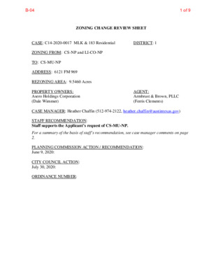
ZONING CHANGE REVIEW SHEET DISTRICT: 1 CASE: C14-2020-0017 MLK & 183 Residential ZONING FROM: CS-NP and LI-CO-NP TO: CS-MU-NP ADDRESS: 6121 FM 969 REZONING AREA: 9.5460 Acres PROPERTY OWNERS: Asero Holdings Corporation (Dale Wimmer) CASE MANAGER: Heather Chaffin (512-974-2122, heather.chaffin@austintexas.gov) STAFF RECOMMENDATION: Staff supports the Applicant’s request of CS-MU-NP. AGENT: Armbrust & Brown, PLLC (Ferris Clements) For a summary of the basis of staff’s recommendation, see case manager comments on page 2. PLANNING COMMISSION ACTION / RECOMMENDATION: June 9, 2020: CITY COUNCIL ACTION: July 30, 2020: ORDINANCE NUMBER: 1 of 9B-04 C14-2020-0017 2 ISSUES: No issues at this time. CASE MANAGER COMMENTS: The proposed rezoning is for a +/- 9.6 acre tract located near the southeast corner of US 183 and FM 969. The property is zoned CS-NP and LI-CO-NP and is mostly undeveloped with a metal fabrication shop on the LI-CO-NP portion. The existing conditional overlay (CO) prohibits some industrial uses and limits vehicular trips to less than 2,000 vehicles per day (vpd). To the west, directly at the corner of US 183 and FM 969, is an undeveloped parcel zoned CS-NP. A site plan for a convenience store is under review for this site. Immediately north of the rezoning site is property zoned CS-CO-NP that is developed with a cocktail lounge. Further north, across FM 969, is property zoned CS-MU-CO-NP that is developed with a fast food restaurant and disused shopping center. The CO limits some commercial and industrial land uses. Further north is a single family neighborhood zoned SF-2-NP. East of the rezoning tract is undeveloped land zoned W/LO-CO-NP; the CO limits some commercial and industrial land uses. Further east is a single family neighborhood zoned SF-2-NP. South is undeveloped land zoned CS-NP; further south is part of the former Motorola campus, zoned LI-NP. Please see Exhibits A and B—Zoning Map and Aerial Exhibit. Staff supports the Applicant’s request of CS-MU-NP. The existing zoning does not allow the possibility of residential or mixed use development of the property. The Applicant has stated that they intend to develop approximately 250-300 multifamily units on the site. Please see Exhibit C- Applicant Letter. BASIS OF RECOMMENDATION: 1. The proposed zoning should be consistent with the purpose statement of the district sought. Adding Mixed Use (MU) allows the property to be developed with the residential land use proposed by the property owner. 2. Zoning changes should promote an orderly relationship among land uses. 3. Zoning should promote a transition between adjacent and nearby zoning districts, land uses, and development intensities. The proposed rezoning will allow an orderly relationship among land uses. The zoning closest to US 183 is CS-NP; changing this tract to CS-MU-NP provides an orderly transition toward the SF-2-NP neighborhood to the east. A similar transition is located on the north side of FM 969. EXISTING ZONING AND LAND USES: Site North CS-CO-NP, CS-MU-CO-NP, ZONING CS-NP, LI-CO-NP LAND USES Undeveloped, Metal fabrication Undeveloped, Cocktail lounge, Fast food restaurant, Single family residential Undeveloped, Mixed commercial and industrial Undeveloped, Single family residential Undeveloped SF-2-NP South CS-NP, LI-NP East W/LO-CO-NP, SF-2-NP West CS-NP 2 of 9B-04 C14-2020-0010 FM 969 Retail C14-2017-0083 Mosaic Sound Collective C14-2020-0017 3 NEIGHBORHOOD PLANNING AREA: East MLK Combined (MLK-183) TIA: N/A- deferred to time of site plan WATERSHED: Walnut Creek NEIGHBORHOOD ORGANIZATIONS: Bike Austin Homeless Neighborhood Association Cavalier Park Neighborhood Association Austin Neighborhoods Council Del Valle Community Coalition Neighborhood Empowerment Foundation East MLK Combined Neighborhood Contact Team AREA CASE HISTORIES: NUMBER REQUEST COMMISSION Friends of Northeast Austin AISD Sierra Club SELTexas Neighbors United for Progress CITY COUNCIL LR-NP to CS-1-NP 5/26/2020: To grant CS-1-CO- NP; Cocktail lounge-prohibited 6/11/2020: GO-NP to CS-MU-CO-NP and CS-1-MU-NP 8/22/2017: CS-MU-CO-NP and CS-1-MU-CO-NP- Comml blood plasma center, Equip sales, Equip repair svs, Vehicle storage. Bail bond svs, Alt Financial svs, Offsite acces parking prohibited 9/28/2017: Ord 20170928-091 approved as rec C14-2016-0031 Kaleidoscope Village SF-6-NP, LR-MU-NP, and LR-NP to MF-2-NP (Tract 1) and LR-MU-NP (Tract 2) 5/24/2016: Recommended MF-2- NP(Tract 1) and LR-MU-NP (Tract 2) 8/11/2016: Ord #20160811-041 Approved MF-2- NP(Tract 1) and LR- MU-NP (Tract 2) EXISTING STREET CHARACTERISTICS: OTHER STAFF COMMENTS: ENVIRONMENTAL 1. The site is not located over the Edwards Aquifer Recharge Zone. The site is in the Walnut Creek Watershed of the Colorado River Basin, which is classified as a Suburban Watershed by Chapter 25-8 of the City's Land Development Code. 2. Under current watershed regulations, development or redevelopment on this site will be 3 of 9B-04 C14-2020-0017 4 subject to the following impervious cover limits: 3. According to floodplain maps there is no floodplain within or adjacent to the project location. 4. Standard landscaping and tree protection will be required in accordance with LDC 25-2 and 25-8 for all development and/or redevelopment. 5. Trees will likely be impacted with a proposed development associated with this rezoning case. Please be aware that an approved rezoning status does not eliminate a proposed development’s requirements to meet the intent of the tree ordinances. If further explanation or specificity is needed, please contact the City Arborist at 974-1876. At this time, site specific information is unavailable regarding other vegetation, areas of steep slope, or other environmental features such as bluffs, springs, canyon rimrock, caves, sinkholes, and wetlands. 6. This site is required to provide on-site water quality controls (or payment in lieu of) for all development and/or redevelopment when 8,000 s.f. cumulative is exceeded, and on site control for the two-year storm. SITE PLAN SP 1. Site plans will be required for any new development other than single-family or duplex residential. SP 2. Any development which occurs in an SF-6 or less restrictive zoning district which is located 540 feet or less from property in an SF-5 or more restrictive zoning district will be subject to compatibility development regulations. SP 3. Any new development is subject to Subchapter E. Design Standards and Mixed Use. Additional comments will be made when the site plan is submitted. Compatibility Standards SP 4. The site is subject to compatibility standards. No structure may be built within 25 feet of the property line. No structure in excess of two stories or 30 feet in height may be constructed within 50 feet of the property line. No structure in excess of three stories or 40 feet in height may be constructed within 100 feet of the property line. No parking or driveways are allowed within 25 feet of the property line. A landscape area at least 25 feet wide is required along the property line. In addition, a fence, berm, or dense vegetation must be provided to screen adjoining properties from views of parking, mechanical equipment, storage, and refuse collection. For a structure more than 100 feet but not more than 300 feet from property zoned SF-5 or more restrictive, height limitation is 40 feet plus one foot for each 10 feet of distance in excess of 100 feet from the property line. An intensive recreational use, including a swimming pool, tennis court, ball court, or playground, may not be constructed 50 feet or less from adjoining SF-3 property. 4 of 9B-04 C14-2020-0017 5 A landscape area at least 25 feet in width is required along the property line if the tract is zoned LR, GO, GR, L, CS, CS-1, or CH. TRANSPORTATION WATER UTILITY 1. The landowner intends to serve the site with City of Austin water and wastewater utilities. The landowner, at own expense, will be responsible for providing any water and wastewater utility improvements, offsite main extensions, utility relocations and or abandonments required by the land use. Water and wastewater utility plans must be reviewed and approved by the Austin Water Utility for compliance with City criteria. All water and wastewater construction must be inspected by the City of Austin. The landowner must pay the City inspection fee with the utility construction. The landowner must pay the tap and impact fee once the landowner makes an application for a City of Austin water and wastewater utility tap permit. INDEX OF EXHIBITS TO FOLLOW A: Zoning Map B. Aerial Exhibit C. Applicant Letter 5 of 9B-04 ( SF-2-NP ( ( SF-2-NP SP94-0400C CS-NP 02-0 142.001 78-64 CS-CO-NP 73-157 73-157 C 0 0 4 0 - 4 9 P S SP94-0400C 73-26 C14-95 -0179 95-0179 E MARTIN LUTHER KING JR BLVD UNDEV 02-142.002 SP-2007-0486C VACANT CS-CO-NP CS-CO-NP SF-2-NP ( CS-CO-NP 02-0142.002 ( ( PROVENCIAL CV ( ( ( ( ( ( ( ( ( ( ( ( ( ( ( ( ( ( ( SF-2-NP ( ( ( ( ( ( ( ( ( ( ( ( ( ( ( ( ( SF-2-NP ( ( ( ( ( SF-2-NP ( P A R LIA SF-3-NP M E N T D R ( ( ( ( ( SF-3-NP ( SF-2-NP ( R ( E G E N C ( ( ( ( ( ( ( ( ( R Y D ( SF-2-NP C N ( E G E R ( ( V Y C ( ( EXHIBIT A C14-2016-0031 SF-3-NP MF-2-NP ( C14-2007-0058.SH GO-NP GO-MU-NP ( CS-1-MU-CO-NP C14-2017-0083 CS-MU-CO-NP LR-MU-NP LI-PDA-NP SPC95-0507C LR-NP ! ! ! CONV. LR-NP B S D R V S D V L B N I E T S E U L B D E B S D V L B N I E T S E U L B D E B N D V L B N I E T S E U L B D E B D N R V D S V L EIN B T S E U L D B E CS-1-MU-CO-NP CENTER C14-2007-0049 CS-MU-CO-NP SP95-0401C FM 969 RD ( ! ! ! ! ! ! ! ! ( ! ! ! ! L E T O \M T N A C A V V E D N U ( ( ( ( P R O V E N ( ( ( CIA ( UNDEV L D ( R ( ( ( 2 4 0 1-0 0 C14-03-0171 LR-MU-NP C 3 9 3 0 - 1 0 - P S N O L A Y S T U A E B 4 0 0 2-0 0 ( C14-75-126(B)(RCT) ! ! ! ! UNDEV ! ! ! ! ! ! ! ! ! ! ! ! ! ! C14-2007-0134 LI-CO-NP CS-CO-NP ! ! ! ! ! ! ! ! ! ! NPA-2007-0015.03 MOBILE HOME SALES ! ! ! ! ! ! ! ! ! ! ! ! ! ! ! ! ! ! ! ! ! ! ( ( ( ( ( CRAIGWOOD CIR ( ( ( ( ( ( SF-2-NP ( ( ( ( HUNTLEIGH WAY ( ( ( ( SF-2-NP ( ( ! ! ! ! ( ! ! W/LO-CO ! ! C14-02-0004 ( ( ( 02-142.002 ( ( ! ! ! ! ! ! ! ! ! ! ( ( ( ( ( ( ( ( ( ( ( ( ( ( ( ( ( ( ( ( ( ( ( ( ( ( ( ( ( ( ( ( LITTLE HILL CIR ( ( ( ( ( ( SF-2-NP ( ( ( ( ( ( SHERWYN DR ( ( ( ( ( SF-2-NP ( ( ( ( ( ( ( ( ( ( ( ( ( ( ( ( ( ( ( ( ( ( ( ( ( ( ( ( ( R D D O O W G I A R C ( ( ( ( ( ( ( ( ( ( ( ( ( ( ( ( ( ( ( ( ( ( ( SF-2-NP ( M A R C EL G ( ( R E S D R SF-3-NP ! ! ! ! ! ! ( ( ( LI-NP 02-142.002 R D E E B C M T R A C O R L N VACANT CS-NP ! ! ! ! SUBJECT TRACT ! ! ! ! ! ! PENDING CASE ZONING BOUNDARY ZONING ZONING CASE#: C14-2020-0017 This product is for informational purposes and may not have been prepared for or be suitable for legal, engineering, or surveying purposes. It does not represent an on-the-ground survey and represents only the approximate relative location of property boundaries. 1 " = 400 ' This product has been produced by CTM for the sole purpose of geographic reference. No warranty is made by the City of Austin regarding specific accuracy or completeness. Created: 2/6/2020 TR A C O R LN MF-2-CO-NP C14-99-0047 CS-NP ± 6 of 9B-04 SF-2-NP SF-2-NP CS-NP CS-CO-NP M24 E MARTIN LUTHER KING JR BLVD E E M D L S B K L E B U B R E A S T M T O P E CS-CO-NP CS-CO-NP I N E T S E U L B D E B N D R V S D V L B PROVENCIAL CV N24 SF-2-NP P R O V E N C I A L D R R Y D C N E G E R CS-1-MU-CO-NP CS-MU-CO-NP E E M D L N B K L W B U R E B T A S M T O P E SF-2-NP SF-2-NP SF-2-NP N R E W D D R A VIE G E G A T I R E H R D E G A L L I V R E G E N YC C V SF-2-NP P A R LI A M E N T D R EXHIBIT B MF-2-NP GO-MU-NP GO-NP CS-1-MU-CO-NP LR-MU-NP CS-MU-CO-NP FM 969 RD LI-PDA-NP CS-CO-NP LR-NP LR-NP EIN B D S T S R E V U D S L D B V L E B B S D V L B N I E T S E U L B D E B N D V L B N I E T S E U L B D E R D D O O W G I A R C I N E T S E U L B D E B S D R V S D V L B B EIN D N T S R E V U D S L D B V L E B LI-CO-NP C14-2020-0017 W/LO-CO CRAIGWOOD CIR SF-2-NP HUNTLEIGH WAY SF-2-NP CS-NP N23 LITTLE HILL CIR SF-2-NP SF-3-NP SF-2-NP CS-CO-NP M23 B S D V L B N I E T S E U L B D E B N D V L B N I E T S E U L B D E MF-2-CO-NP CS-NP ± 1'' = 400' LI-NP M A R C EL G R E S D R T R A C O R L N SHERWYN DR SF-2-NP C R A I G W O O D D R R D E E B C M Copyright nearmap 2015 C14-2020-0017 Creek Buffers ZONING BOUNDARY MLK & 183 RESIDENTIAL ZONING CASE#: LOCATION: SUBJECT AREA: GRID: MANAGER: C14-2020-0017 6121 FM969 RD 9.546 Acres N23 Heather Chaffin This map has been produced by the Communications Technology Management Dept. on behalf of the Planning Development Review Dept. for the sole purpose of geographic reference. No warranty is made by the City of Austin regarding specific accuracy or completeness. 7 of 9B-04 EXHIBIT C 8 of 9B-04 9 of 9B-04