B-12 (C14-2020-0032 (C14H-77-015) - Freedmen's; District 9) — original pdf
Backup
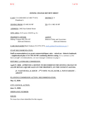
ZONING CHANGE REVIEW SHEET CASE: C14-2020-0032 (C14H-77-015) DISTRICT: 9 Freedman’s C ZONING FROM: CS-MU-H-NP TO: CS-1-MU-H-NP ADDRESS: 2402 San Gabriel Street SITE AREA: 0.23 acres (10,018 sq. ft.) PROPERTY OWNER: Hilltop Venture SH (TX) LP (Edward Johnson) AGENT: Johnson Trube and Associates (Edward Johnson) CASE MANAGER Mark Graham (512-974-3574, mark.graham@austintexas.gov ) STAFF RECOMMENDATION: Staff recommendation is to grant commercial-liquor sales – mixed use - historic landmark – neighborhood plan (CS-1-MU-H-NP) combining district zoning. For a summary of the basis of staff’s recommendation, see case manager comments on page 2. HISTORIC LANDMARK COMMISSION: April 27, 2020: APPROVED A MOTION TO RECOMMEND THE ZONING CHANGE TO ALLOW RETAIL LIQUOR SALES ON THE PROPERTY, ON THE CONSENT AGENDA. [S. VALENZUELA, K. KOCH – 2ND] VOTE: 9-0, M. JACOB, A. PAPAVASILIOU – ABSENT PLANNING COMMISSION ACTION / RECOMMENDATION: May 12, 2020: CITY COUNCIL ACTION: June 11, 2020: ORDINANCE NUMBER: ISSUES No issues have been identified for this request. 1 of 10B-12 C14-2020-0032 2 CASE MANAGER COMMENTS: The subject lot is the second lot north of West 24th Street on the west side of San Gabriel Street, locally known as 2402 San Gabriel Street. The lot is approximately 0.23 acres (10,018 square feet). A two-story limestone building occupies about half the lot width and less than half the length. The building is a designated Austin historic landmark known variously as the Austin Gold Dollar, Franzetti’s grocery store and Freedman’s building. The request is for a building footprint rezoning to permit a cocktail lounge/restaurant in the historic building. Several new, midrise residential buildings have been built north of West 24th Street. Some of the new buildings are mixed use with ground floor retail and personal service uses. There are wide sidewalks and under-building parking. These features make the neighborhood walkable. Much of the demand for goods and services in this mixed-use neighborhood will come from the residents and workers within the neighborhood. The stone structure built in 1869, is the last remaining building from Wheatsville, an African- American neighborhood. The building was the home of Rev. Jacob Fontaine, a Baptist minister and former slave known for his community leadership and newspaper publishing. In 1876, Fontaine founded and published the Austin Gold Dollar, a weekly newspaper from his home, the two-story, limestone building. Austin Gold Dollar was the first black newspaper west of the Mississippi River. Fontaine also established the New Hope Missionary Baptist Church in the building in 1887 and later operated a laundry and grocery in the building. The Franzetti family purchased the building in the 1920s and added a wooden porch to the façade in 1923. Members of the Franzetti family lived in the building until the 1980s. The building was designated an Austin Historic Landmark in 1977. The building interior was refurbished in 2012 in preparation for Freedman’s barbecue restaurant that operated in the building until August of 2018. BASIS OF RECOMMENDATION: 1. The proposed zoning should be consistent with the purpose statement of the district sought. CS-1 – Commercial-Liquor Sales district is intended predominately for commercial and industrial activities of a service nature which typically have operating characteristics or traffic service requirements generally incompatible with residential environments, and specifically includes liquor sales as a permitted use. MU – Mixed Use combining district is intended for combination with selected base districts, in order to permit any combination of office, retail, commercial, and residential uses within a single development. H – Historic landmark combining district is intended to protect, enhance, and preserve structures, sites, or areas that are architectural, historical, archaeological, or cultural significance. NP – Neighborhood Plan district denotes a tract located within the boundaries of an adopted Neighborhood Plan. The proposed building footprint zoning of CS-1 permits operating a cocktail lounge, a business that serves more alcohol than food based on receipts. While the owners intend to offer food as a restaurant, they recognize that their location near the University of Texas may 2 of 10B-12 C14-2020-0032 3 skew sales more towards beverages than food. CS-1 is the only district that permits the proposed use. 2. Zoning should allow for reasonable use of the property. The existing general commercial services (CS) zoning allows for intensity of commercial services and industrial uses. The existing mixed use (MU) zoning allows for combinations of office, retail, commercial and residential uses. The neighborhood, with its six and eight-story residential buildings with retail stores at ground level is urban in density and intensity of uses. A neighborhood cocktail lounge (bar/restaurant) would be an amenity to this neighborhood and is only permitted in the requested CS-1. The building has been used for both residential and commercial purposes for more than a hundred years. Most recently the building was used as a restaurant that also served drinks. The requested zoning would allow the use even if the business sold more drinks than food. There are three other CS-1 zoned sites nearby: on West 24th about a half block west of San Gabriel Street, currently under construction; the northeast and southeast corners of West 24th Street and Rio Grande Street about 1,000 feet east of San Gabriel Street. The southeast corner is operating as a bar, the northeast corner is a student housing building called the Ruckus. The West 24th Street site, a half block south will become student housing. 3. The rezoning should be consistent with the policies and principles adopted by the City Council or Planning Commission. The subject property is located within a Regional Center identified on the Imagine Austin Growth Concept Map. A Regional Center is the most urban of the three activity center categories. Urban areas have a variety of residential, office and commercial uses including bars and restaurants. The West University area is connected: it has public sidewalks and a bus stop within 500 feet of the subject site. Guadalupe Street, at the western edge of the UT campus is less than 2000 feet from the site. Guadalupe is a Core Transit Corridor served by MetroRapid buses. The neighborhood is compact: there are hundreds of residences within a block, a grocery store across the street, small shops and personal services along West 24th Street which is identified as a “main street” for the West Campus Neighborhood in the Central Austin Combined Neighborhood Plan. The owner is maintaining the Historic Overlay for this Austin Historic Landmark. EXISTING ZONING AND LAND USES: Site North Zoning Land Uses CS-MU-H-NP Vacant building (Historic) LR-NP, MF-4-NP Multi-family residential 3 of 10B-12 C14-2020-0032 4 Zoning Land Uses Across W 24th Street: New construction, across West 24th Street: TFWC Mansion (events center) CS-H-CO-NP GR-MU-NP Multi-family residential over ground floor commercial & parking MF-4-NP Multi-family residential NEIGHBORHOOD PLANNING AREA: Central Austin Combined (West University) WATERSHED: Shoal Creek – Urban Maximum impervious coverage 95% OVERLAYS: ADU Approximate Area Reduced Parking; Green Building Mandatory: University Neighborhood Overlay; Residential Design Standards: LDC/25-2-Subchapter F; West Campus Neighborhood Overlay: OUTER WEST CAMPUS SCHOOLS: Bryker Woods Elementary O. Henry Middle Austin High NEIGHBORHOOD ORGANIZATIONS Austin Independent School District Austin Lost and Found Pets Austin Neighborhoods Council Bike Austin, CANPAC (Central Austin Neigh Plan Area Committee) Caswell Heights Neighborhood Association Central Austin Community Development Corporation Friends of Austin Neighborhoods Homeless Neighborhood Association Neighborhood Empowerment Foundation Preservation Austin SEL Texas Shoal Creek Conservancy Sierra Club, Austin Regional Group University Area Partners West Campus Neighborhood Association South East West TIA: N/A 4 of 10B-12 C14-2020-0032 5 AREA CASE HISTORIES: Number Request Commission City Council C14-04-0021 507 W 23rd St Rezone 0.220 ac. from GO-CO-H-NP to GO-NP To Grant Apvd., 12/08/2016 Ord # 20161208-022 Rezone from LR-NP to CS-1 Forward w/out recommendation Withdrawn on 12/07/2011 Rezone 0.1123 ac. From CS-NP to CS-1- NP Rezone from C to C- H, Commercial- Historic To Grant To Grant Apvd., 08/17/2017 Ord # 20170817-068 Apvd., 08/11/1977 Ord. # 77 0811-E C14-2011-0098 2408 San Gabriel San Gabriel Liquor C14-2017-0058 1004 W 24th St C14H-77-015 2402 San Gabriel Street (Franzetti Store Building of Wheatsville) RELATED CASES: Ordinances 20040826-57 – Established zoning for the Central Austin Combined Neighborhood Plan 040902-58 – Added a new University Neighborhood Overlay Zoning District (UNO) OTHER STAFF COMMENTS: Comprehensive Planning This rezoning case is located on the west side of San Gabriel Street north of W. 24th Street. The property is approximately 0.23 acres in size and contains a two-story building that was until 18 months ago used as a restaurant. The property is located within the boundaries of the Downtown Regional Center and within the Central Austin Combined Neighborhood Plan area, in West University area (West Campus UNO). Surrounding land uses include a large multi-story apartment to the north; to the south is an event facility/meeting hall, retail uses and a house museum; to the east is mixed use building with apartments and a grocery store; and to the west is a mixed use building and a condominium building. The proposed use is a bar/restaurant. Owner will retain the Historic overlay. 5 of 10B-12 C14-2020-0032 6 Connectivity There is a CapMetro transit stop located 500 feet from the subject property. A grocery store is located across the street. The area has public sidewalks and transit stop within walking distance to this site. The mobility and connectivity options in the area are good. Central Austin Combined Neighborhood Plan (CACNP) The CACNP Future Land Use Map identifies this property as Mixed Use. Mixed Use is meant to encourage more retail and commercial services within walking distance of residents. Zone CS-1 is permitted in this area. Below are goals, objectives and recommendations relating to commercial and mixed use development in this portion of the CACNP. Goal 3: Allow mixed-used development along the existing commercial corridors that is pedestrian oriented, neighborhood friendly, neighborhood scaled and serves neighborhood needs (p. 74) Objective 4.3: 24th Street should become a more pedestrian-oriented “Main Street” for West Campus (p. 88) Recommendation 7: Limit automobile-oriented uses and allow the neighborhood mixed use building on commercially zoned property along 24th Street. The CACNP appears to support commercial rezoning cases as long as the use is not auto- oriented. Imagine Austin This property is located within the boundaries of a Regional Center, as identified on the Imagine Austin Growth Concept Map. A Regional Center is the most urban of the three activity centers outlined in the growth concept map. These centers are and will be the retail, cultural, recreational, and entertainment destinations for Central Texas, and are the places where the greatest density of people and jobs and the tallest buildings in the region will be located. Based on the comparative scale of this site relative to other nearby commercial and mixed uses and the property being located within a Regional Center, which allows a variety of uses, including bars and restaurants, this project is supported by the Imagine Austin Comprehensive Plan. Environmental 1. The site is not located over the Edwards Aquifer Recharge Zone. The site is located in the Shoal Creek Watershed of the Colorado River Basin, which is classified as an Urban Watershed by Chapter 25-8 of the City's Land Development Code. 2. Zoning district impervious cover limits apply in the Urban Watershed classification. 3. According to floodplain maps there is no floodplain within or adjacent to the project location. 6 of 10B-12 C14-2020-0032 7 4. Standard landscaping and tree protection will be required in accordance with LDC 25-2 and 25-8 for all development and/or redevelopment. 5. At this time, site specific information is unavailable regarding vegetation, areas of steep slope, or other environmental features such as bluffs, springs, canyon rimrock, caves, sinkholes, and wetlands. 6. This site is required to provide on-site water quality controls (or payment in lieu of) for all development and/or redevelopment when 8,000 s.f. cumulative is exceeded, and on site control for the two-year storm. Site Plan SP1. Site plans will be required for any new development other than single-family or duplex residential. SP2. Existing structure appears to be considered a City of Austin Historic Landmark. Please contact the Historic Preservation Officer for more information. SP3. This is within the West Campus Overlay District. If opted into, the development will adhere to Division 9. - University Neighborhood Overlay District Requirements. SP4. If Opted out of West Campus Overlay regulations, any new development is subject to Subchapter E. Design Standards and Mixed Use. Additional comments will be made when the site plan is submitted. SP5. CS-1-NP allows for the following development regulations: • Maximum Height: 60 ft. • Maximum Building Coverage: 95% • Maximum Impervious Cover: 95% • Maximum FAR: 2:1 Transportation The Austin Strategic Mobility Plan (ASMP) adopted 04/11/2019, calls for 70 feet of right-of- way for San Gabriel Street. It is recommended that 35 feet of right-of-way from the existing centerline should be dedicated for San Gabriel St. at the time of subdivision or site plan. A traffic impact analysis is not required at this time as the proposal does not exceed thresholds established in the LDC. Name Pavement ASMP Sidewalks Classification Bicycle Route Existing ROW ASMP Required ROW Capital Metro (within ¼ mile) Yes ~60’ 70’ 27’ 2 Yes Yes San Gabriel St. 7 of 10B-12 C14-2020-0032 8 Austin Water Utility AW1. The landowner intends to serve the site with City of Austin water and wastewater utilities. The landowner, at own expense, will be responsible for providing any water and wastewater utility improvements, offsite main extensions, utility relocations and or abandonments required by the land use. The water and wastewater utility plan must be reviewed and approved by Austin Water for compliance with City criteria and suitability for operation and maintenance. Depending on the development plans submitted, water and or wastewater service extension requests may be required. All water and wastewater construction must be inspected by the City of Austin. The landowner must pay the City inspection fee with the utility construction. The landowner must pay the tap and impact fee once the landowner makes an application for a City of Austin water and wastewater utility tap permit. INDEX OF EXHIBITS TO FOLLOW Exhibit A: Zoning Map Exhibit B: Aerial Map 8 of 10B-12 MF-4-NP MF-4-NP MF-4-NP MF-4-NP W 25TH ST T S N O E L MF-4-NP MF-4-CO-NP MF-4-NP I T S L E R B A G N A S LR-NP C14-2020-0032 CS-MU-H-NP CS-1-NP J24 CS-NP W 24TH ST GO-MU-NP GR-MU-NP T S L R A E P MF-6-CO-NP MF-4-CO-NP CS-H-CO-NP CS-MU-CO-NP LR-H-CO-NP MF-4-CO-NP MF-6-CO-NP W 23RD ST MF-4-CO-NP MF-4-NP ± 1'' = 100' SUBJECT TRACT ZONING BOUNDARY ! ! ! ! ! ! PENDING CASE CREEK BUFFER FREEDMEN'S Exhibit A ZONING CASE#: LOCATION: SUBJECT AREA: GRID: MANAGER: C14-2020-0032 2402 San Gabriel St. 0.23 ACRES J24 MARK GRAHAM This map has been produced by the Communications Technology Management Dept. on behalf of the Planning Development Review Dept. for the sole purpose of geographic reference. No warranty is made by the City of Austin regarding specific accuracy or completeness. 9 of 10B-12 MF-4-NP MF-4-NP MF-4-NP MF-4-NP W 25TH ST T S N O E L MF-4-NP MF-4-CO-NP MF-4-NP I T S L E R B A G N A S LR-NP C14-2020-0032 CS-MU-H-NP CS-1-NP J24 CS-NP W 24TH ST GO-MU-NP GR-MU-NP T S L R A E P MF-6-CO-NP MF-4-CO-NP CS-H-CO-NP CS-MU-CO-NP MF-4-CO-NP MF-6-CO-NP LR-H-CO-NP W 23RD ST MF-4-CO-NP MF-4-NP Copyright nearmap 2015 ± 1'' = 100' FREEDMEN'S EXHIBIT B SUBJECT TRACT ZONING BOUNDARY ! ! ! ! ! ! PENDING CASE CREEK BUFFER ZONING CASE#: LOCATION: SUBJECT AREA: GRID: MANAGER: C14-2020-0032 2402 San Gabriel St. 0.23 ACRES J24 MARK GRAHAM This map has been produced by the Communications Technology Management Dept. on behalf of the Planning Development Review Dept. for the sole purpose of geographic reference. No warranty is made by the City of Austin regarding specific accuracy or completeness. 10 of 10B-12