REGULAR MEETING of the PLANNING COMMISSION TUESDAY, FEBRUARY 25, 2025, 6:00 PM AUSTIN CITY HALL, COUNCIL CHAMBERS, ROOM 1001 301 WEST 2ND STREET AUSTIN, TEXAS Some members of the Planning Commission may be participating by videoconference. The meeting may be viewed online at: http://www.austintexas.gov/page/watch-atxn-live. Public comment will be allowed in-person or remotely via telephone. Speakers may only register to speak on an item once either in-person or remotely. Registration no later than 2 PM the day of the meeting is required for remote participation by telephone. For more information on public comment, please see the agenda section “Speaker Registration.” Please contact Ella Garcia, Staff Liaison, for questions regarding speaker registration at LandUseLiaison@austintexas.gov or by phone at 512-978-0821. CURRENT BOARD MEMBERS/COMMISSIONERS: Claire Hempel, Chair (District 8) Awais Azhar, Vice Chair (Mayor’s Representative) Greg Anderson, Secretary (District 4) Alice Woods, Parliamentarian (District 2) Patrick Howard (District 1) Nadia Barrera-Ramirez (District 3) Felicity Maxwell (District 5) EX-OFFICIO MEMBERS: Casey Haney (District 6) Ryan Johnson (District 7) Danielle Skidmore (District 9) Grayson Cox (District 10) Alberta Phillips (Mayor’s Representative) Adam Haynes (Holdover, Mayor’s Representative) Jessica Cohen, Chair of Board of Adjustment Candace Hunter, AISD Board of Trustees TC Broadnax, City Manager Richard Mendoza – Director of Transportation and Public Works EXECUTIVE SESSION (No public discussion) Executive Liaison: Joi Harden, 512-974-1617 Staff Liaison: Ella Garcia, 512-978-0821 Attorney: AJ Urteaga, 512-974-2386 The Planning Commission will announce it will go into Executive Session, if necessary, according to Chapter 551 of the Texas Government Code, to receive advice from Legal Counsel on matters specifically listed on the agenda. The Commission may not conduct a closed meeting without the approval of the city attorney. Private Consultation with Attorney – Section 551.071. CALL TO ORDER PUBLIC COMMUNICATION: GENERAL AGENDA The first four speakers signed up prior to the meeting being called to order will each be allowed a three-minute allotment to address their concerns regarding items not posted on the agenda. APPROVAL OF MINUTES 1. Approve the minutes of the Planning Commission regular meeting on Tuesday, February 11, 2025. PUBLIC HEARINGS 2. Plan Amendment: NPA-2024-0008.01 - 2600 E Martin Luther King Jr. Boulevard; Location: District 1 2600 East Martin Luther King Jr. Boulevard, Boggy Creek Watershed; Rosewood Neighborhood Planning Area Owner/Applicant: CTMS Holdings LLC Agent: Request: Staff Rec.: Staff: Drenner Group, PC (Leah M. Bojo, AICP) Civic to Mixed Use land use Recommended Maureen Meredith, 512-974-2695, maureen.meredith@austintexas.gov Planning Department 3. …
Planning Commission: February 25, 2025 NEIGHBORHOOD PLAN AMENDMENT REVIEW SHEET NEIGHORHOOD PLAN: Rosewood CASE#: NPA-2024-0008.01 DATE FILED: June 21, 2024 PROJECT NAME: 2600 E Martin Luther King Jr. Blvd PC DATE: February 25, 2025 February 11, 2025 December 17, 2024 ADDRESS/ES: 2600 E Martin Luther King Jr Blvd DISTRICT AREA: 1 SITE AREA: 1.99 acres OWNER/APPLICANT: CTMS Holdings, LLC AGENT: Drenner Group, PC (Leah M. Bojo, AICP) CASE MANAGER: Maureen Meredith PHONE: (512) 974-2695 STAFF EMAIL: Maureen.Meredith@austintexas.gov TYPE OF AMENDMENT: Change in Future Land Use Designation From: Civic To: Mixed Use Base District Zoning Change Related Zoning Case: C14-2024-0111 From: GR-V-CO-NP To: GR-MU-V-DB90-NP NEIGHBORHOOD PLAN ADOPTION DATE: November 29, 2001 CITY COUNCIL DATE: TBD ACTION: 02 NPA-2024-0008.01 - 2600 E Martin Luther King Jr. Boulevard; District 11 of 36 Planning Commission: February 25, 2025 PLANNING COMMISSION RECOMMENDATION: February 25, 2025 – (action pending) February 11, 2025- Postponed to February 25, 2025 on the consent agenda at the request of Staff. [A. Azhar – 1st; F. Maxwell -2nd] Vote: 10 – 0 [P. Howard, A. Phillips and A. Haynes absent]. December 17, 2024 – Postponed to February 11, 2025 on the consent agenda at the request of the Applicant. [C. Haney – 1st; F. Maxwell – 2nd] Vote: 11-0 [N. Barrera-Ramirez and A. Phillips absent]. STAFF RECOMMENDATION: To support the applicant’s request for Mixed Use land use. BASIS FOR STAFF’S RECOMMENDATION: Staff supports the applicant’s request for Mixed Use land use because the property is located on Manor Road, which is an activity corridor where mixed use land use is appropriate. The property is within the MLK Station Neighborhood Center as identified on the Growth Concept Map and is less than ½-mile from the MLK Rail Station. The applicant proposes a 300-unit multifamily development with ground-floor retail. LAND USE DESCRIPTIONS: EXISTING LAND USE: Civic - Any site for public or semi fire facilities, hospitals, and public and private schools. Includes major religious facilities and other religious activities that are of a different type and scale than surrounding uses. Purpose 1. Allow flexibility in development for major, multi the greater community; 2. Manage the expansion of major institutional uses to prevent unnecessary impacts on established neighborhood areas; 3. Preserve the availability of sites for civic facilities to ensure that facilities are adequate for population growth; 4. Promote Civic uses that are accessible and useable for the neighborhood resident and maintain stability of …
ZONING CHANGE REVIEW SHEET CASE: C14-2024-0111 (2600 E. MLK Jr. Blvd.) DISTRICT: 1 ADDRESS: 2600 East Martin Luther King Jr. Boulevard ZONING FROM: GO-V-CO-NP TO: GR-MU-V-CO-DB90-NP (as amended) SITE AREA: approximately 1.99 acres (approximately 86,684 square feet) PROPERTY OWNER: CTMS Holdings, LLC AGENT: Drenner Group, PC (Leah Bojo) CASE MANAGER: Jonathan Tomko (512) 974-1057, jonathan.tomko@austintexas.gov STAFF RECOMMEDATION: Staff recommends granting community commercial-mixed use-vertical mixed use-conditional overlay-density bonus 90-neighborhood plan (GR-MU-V-CO-DB90-NP) combining district zoning. The conditional overlay would prohibit the following 15 uses: - Alternative Financial Services - Automotive Repair Services - Automotive Washing (of any type) - Commercial Off-Street Parking - Drop Off Recycling Facility - Funeral Services - Outdoor Entertainment - Service Station - Automotive Rentals - Automotive Sales - Bail Bond Services - Drive thru as an accessory use (to any use) - Exterminating Services - Hotel-Motel - Pawn Shop Services The conditional overlay would conditionally allow the following 5 uses: - Consumer Convenience Services - Indoor Entertainment - Offsite Accessory Parking - Hospital Services (limited) - Indoor Sports & Recreation For a summary of the basis of Staff’s recommendation, please see the basis of recommendation section below. PLANNING COMMISSION ACTION / RECOMMENDATION: December 17, 2024: Applicant postponement request to February 11, 2025, granted. February 11, 2025: Staff postponement request to February 25, 2025, granted. February 25, 2025: Case is scheduled to be heard by Planning Commission. CITY COUNCIL ACTION: TBD ORDINANCE NUMBER: TBD ISSUES: 03 C14-2024-0111 - 2600 E Martin Luther King Jr. Boulevard; District 11 of 21 C14-2024-0111 2 The applicant is proposing to remove an existing conditional overlay of 2,000 vehicle trips per day, prohibiting business or trade school, business support services, restaurant (limited), off-site accessory parking and personal services. In December 2023, Ordinance No. 20220609-080, Ordinance No. 20221201-056 and Ordinance No. 20221201-055 were invalidated. On March 11, 2024, Ordinance No. 20240229-073, was enacted to create the “DB90” combining district, which amended City Code Title 25 (Land Development) to create a new zoning district for a density bonus program that grants 30 feet in height above the base zoning district, to a maximum of 90 feet, and modifies site development regulations including compatibility standards. CASE MANAGER COMMENTS: The property in question is currently a vacant office/medical use, formerly used as the Capital Area Research and Radiation Center. It is approximately 16,000 square feet constructed in approximately 1972. The site also contains approximately 25,000 square feet …
Wooten Neighborhood Plan Contact Team February 20, 2025 Ms. Sherri Sirwaitis, Planner Principal Current Planning Division Planning Department City of Austin VIA Electronic Mail sherri.sirwaitis@austintexas.gov RE: 2100 Polaris - Rezoning City File Number C14-2024-0158 The Wooten Neighborhood Plan Contact Team(WNPCT) and the Applicant, SB-Polaris Property LLC, and its representatives engaged in a community outreach process to review the proposed rezoning. As of the WNPCT meeting on Monday, February 17th, the WNPCT supports the rezoning of the site located at 2100 Polaris based on the project meeting two goals. First, ensure the Redline Parkway Trail has the ability to pass along this site and is activated by the site. Second, we improve the walking and biking experience by reducing the quantity and impact of car traffic and improve bike and pedestrian infrastructure on nearby streets. To that end, the following will be implemented to meet the WNPCT’s and Applicant’s goals. 1. Ensure the Redline Parkway Trail has ability to pass along this site and is activated by the site. a. Enter into a restrictive covenant(or other legally binding agreement) that ensures the Redline Parkway Initiative, Cap Metro, and/or any other partners of the Reline Parkway Trail project have the easement and any other legal rights they need to build the trail at this location *A Restrictive Covenant will be entered into with Tom Wald with Red Line Trail organization to ensure that a twenty (20) foot easement will be dedicated for the future Red Line Trail. Tom Wald, Executive Director Red Line Parkway Initiative b. Activate the trail by: i. Ensuring trail is easily visible (physically or through way finding signage) from Polaris. *Agree to ensure the trail is easily visible through way finding signage from Polaris Avenue. 04 C14-2024-0158 - 2100 Polaris; District 41 of 5 ii. Not placing back of house functions along future trail and trail access routes. * Agree to hire local artist(s) to paint a mural on the garage side facing the trail at the height of a person on the trail a maximum of 15’. iii. Placing walk up units, preferable live/work, on the trail and trail access route. *Agree to provide units along the south side of the property facing the red line trail in the area on the south portion of the property as shown on the conceptual site plan below. Similar architectural design elements on the West side, facing the neighborhood and …
ZONING CHANGE REVIEW SHEET CASE: C14-2024-0158 (2100 Polaris) DISTRICT: 4 ZONING FROM: CS-CO-MU-NP TO: CS-MU-V-CO-DB90-NP ADDRESS: 2100 Polaris Avenue SITE AREA: 3.373 acres PROPERTY OWNER: SB-Polaris Property LLC (Zachary Greenky) AGENT: Land Use Solutions (Michele Haussmann) CASE MANAGER: Sherri Sirwaitis (512-974-3057, sherri.sirwaitis@austintexas.gov) STAFF RECOMMENDATION: Staff recommends CS-MU-V-CO-DB90-NP, General Commercial Services-Mixed Use- Vertical Mixed Use Building-Conditional Overlay-Density Bonus 90-Neighborhood Plan Combining District, zoning. The conditional overlay will maintain the following prohibited uses from the current zoning ordinance, Ordinance No. 20211021-039, on the property: Automotive repair services Automotive washing (of any type) Automotive rentals Automotive sales Bail bond services Commercial off-street parking Drop-off recycling collection facilities Equipment sales Outdoor entertainment Outdoor Sports and Recreation Commercial blood plasma center Construction sales and services Equipment repair services Exterminating services Maintenance and service facilities Pawn shop services Service station Vehicle storage Veterinary services February 25, 2025 CITY COUNCIL ACTION: ORDINANCE NUMBER: PLANNING COMMISSION ACTION / RECOMMENDATION: December 10, 2024: Postponed to January 28, 2025 at the applicant's request by consent (11-0, C. Haney-absent, G. Anderson-off dais); A. Azhar-1st, A. Woods-2nd. January 28, 2025: Postponed to February 25, 2025 at the applicant's request by consent (9-0, A. Phillips and A. Haynes - off dais, A. Woods and G. Anderson-absent); R. Johnson-1st, F. Maxwell-2nd. 04 C14-2024-0158 - 2100 Polaris; District 41 of 18 C14-2024-0158 ISSUES: 2 In December 2023, Ordinance No. 20220609-080, Ordinance No. 20221201-056 and Ordinance No. 20221201-055 were invalidated. On March 11, 2024, Ordinance No. 20240229-073, was enacted to create the “DB90” combining district, which amended City Code Title 25 (Land Development) to create a new zoning district for a density bonus program that grants 30 feet in height above the base zoning district, to a maximum of 90 feet, and modifies site development regulations including compatibility standards. Subsequently, the applicant submitted this new rezoning application to request the -DB90 combining district. CASE MANAGER COMMENTS: The property in question is a 3+ acre tract of land located at the terminus of Polaris Avenue. This currently vacant site was previously used as demolition company (Heart of Texas Demolition LLC). To the north, there are commercial and light industrial uses. The lot to the south is developed with a public school (Burnet Middle School). There is a rail line to the east. To the west, there are office/warehouse buildings to the north of Polaris Avenue and a multifamily complex, a townhouse residence, a duplex and single family …
PLANNING COMMISSION CONDITIONAL USE SITE PLAN SITE PLAN REVIEW SHEET CASE NUMBER: SPC-2024-0259C PC COMMISSION DATE: February 25, 2025 PROJECT NAME: CIP - Rosewood-Zaragosa Neighborhood Center Walkway ADDRESS: 2800 Webberville Rd DISTRICT: 1 NEIGHBORHOOD PLAN: Rosewood WATERSHED: Boggy Creek (Urban Watershed) AREA: 1.69 acres limits of construction APPLICANT: Sara Sallam, Project Manager City of Austin Building Services 2006 E 4th Street P.O. Box 1088 Austin, TX 78702 Ray Hardaway Lockwood, Andrews & Newnam, Inc. 8911 N. Capital Of Texas Hwy Building 2, Suite 2300 Austin, TX 78759 AGENT: CASE MANAGER: Meg Greenfield, (512) 978-4663 meg.greenfield@austintexas.gov EXISTING ZONING: P-NP PROPOSED USE: The applicant proposes to construct ADA-accessible parking, walkways, and ramp improvements at the existing Rosewood Zaragosa Neighborhood Center. No changes to the building are proposed (flatwork only). No increase to impervious cover is proposed. All site plan reviews are approved or informal status. REQUEST: This site is zoned P (Public) and is greater than one acre in size; therefore, a Conditional Use Permit is required, according to the Land Development Code {Section 25-2- 625}. WAIVER REQUEST: There are no waiver requests with this application. SUMMARY STAFF RECOMMENDATION: Approval. 05 SPC-2024-0259C - CIP - Rosewood-Zaragosa Neighborhood Center Walkway; District 11 of 21 SITE PLAN DETAILS: The site plan proposes the reduction of 7 parking spaces (6 standard, 1 accessible) to accommodate new walkways that will be established in conjunction with existing Accessible Parking Spaces. Additionally, two ramps are designed for construction: one situated at the West Entrance and the other at the Front Entrance. These proposed walkways and ramps are designed to meet the TAS Standards. SURROUNDING CONDITIONS: North: Single-family residential (SF-3-NP) East: Single-family residential (SF-3-NP) West: Park (P-NP) South: Single-family and Multi-family (SF-3-NP and MF-3-NP) NEIGHBORHOOD ORGANIZATION: Austin Independent School District Austin Lost and Found Pets Austin Neighborhoods Council Central Austin Concerned Architects Del Valle Community Coalition East Austin Conservancy El Concilio Mexican-American Neighborhoods Friends of Austin Neighborhoods Govalle/Johnston Terrace Neighborhood Plan Contact Team Homeless Neighborhood Association Neighborhood Empowerment Foundation Neighbors United for Progress, Overton Family Committee Preservation Austin, Red Line Parkway Initiative Rosewood Glen Oaks Neighborhood Association Rosewood Neighborhood Plan Contact Team SELTexas Save Our Springs Alliance Sierra Club Austin Regional Group 05 SPC-2024-0259C - CIP - Rosewood-Zaragosa Neighborhood Center Walkway; District 12 of 21 Property Profile Legend Appraisal Districts TCAD Parcels Review Cases Site Plan Review Cases (All) Zoning 1 Zoning CS GR LI MF NO P SF …
Affordability Impact Statement Colorado River Protection Ordinance Case number: C20-2022-025 Initiated by: Resolution No. 20220609-061 Date: 12/2/2024 Proposed Regulation The current Land Development Code’s Drainage Chapter mandates a 100-foot Erosion Hazard Zone (EHZ) along the Colorado River downstream of Lady Bird Lake. Due to the river’s bank heights and erosive force, this distance is insufficient for protecting buildings and infrastructure. The proposed ordinance seeks to expand the EHZ from 100 feet to 200 feet for new buildings and infrastructure. This expansion excludes hard-surfaced trails, which will retain the 100-foot requirement. Additionally, the proposed Drainage Criteria Manual (DCM) rules introduce standards for non-erosive stormwater outfalls in high-erosion areas, particularly where sandy soils are prevalent. 06 C20-2022-025 - Colorado River Protection1 of 3 Land Use/Zoning Impacts on Housing Costs The proposed EHZ expansion is anticipated to have a neutral impact on housing costs. Watershed Protection Department (WPD) staff have engaged with various stakeholders, including the Lower Colorado River Authority (LCRA), Travis County, Austin Water (AW), Transportation & Public Works (TPW), Parks & Recreation Department (PARD), Austin Energy (AE), community organization PODER, and developers currently undergoing permitting processes. Development stakeholders noted the 200-foot EHZ aligns with the setback under existing Critical Water Quality Zone buffers, thus minimizing development footprint impacts. Additionally, stakeholders PARD and TPW, along with developers, requested that hard-surfaced trails remain under the 100-foot requirement to prevent excessive costs, maintain the trails’ accessibility, and reduce the need for additional easement acquisitions. Impact on Development Cost The proposed changes would have minimal impacts on development cost. Financial impacts will vary by project type and whether a project is new or a redevelopment. Parcels affected by this provision are limited to those along the 25.2 miles of Colorado River downstream of Lady Bird Lake, totaling under 360 parcels. This regulation would not apply to single-family construction in the ETJ, which accounts for 70 of the 360 parcels. For new subdivisions and site plans, the impact is minimal due to the existing minimum 200-foot buffer already restricting most development. Redevelopment site plans and single-family permits, however, could face increased foundation construction costs if building within the EHZ. Structural engineers have estimated potential cost increases of 3-5 times for foundations requiring deeper subsurface anchoring and additional protections against erosion. Developers may opt to relocate structures outside the EHZ to avoid these additional costs. Although developments may increase foundation and erosion protection costs for structures in …
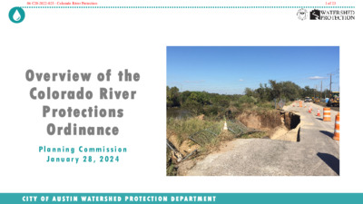
Overview of the Colorado River Protections Ordinance P l a n n i n g C o m m i s s i o n J a n u a r y 2 8 , 2 0 2 4 C I T Y O F A U S T I N W A T E R S H E D P R O T E C T I O N D E P A R T M E N T 06 C20-2022-025 - Colorado River Protection1 of 23 2-Minute Summary Video C I T Y O F A U S T I N W A T E R S H E D P R O T E C T I O N D E P A R T M E N T 2 Youtube video link 06 C20-2022-025 - Colorado River Protection2 of 23 The Colorado River • Crucial Resource • Significant Erosion • Water Quality Better Protected • Needs careful management • Dynamic natural system C I T Y O F A U S T I N W A T E R S H E D P R O T E C T I O N D E P A R T M E N T 3 06 C20-2022-025 - Colorado River Protection3 of 23 Council Resolution Community members asked Council to strengthen Colorado River protections; Council thereafter included in their June 2022 Council resolution: “… evaluate the effectiveness of existing Critical Water Quality Zone and Erosion Hazard Zone buffers on the Colorado River downstream of the Longhorn Dam and to propose protections that will provide adequate protections to the river that will ensure a healthy riparian corridor to stabilize the riverbank and protect property from erosion” C I T Y O F A U S T I N W A T E R S H E D P R O T E C T I O N D E P A R T M E N T 4 06 C20-2022-025 - Colorado River Protection4 of 23 The Proposal One simple change to the Land Development Code: Change Erosion Hazard Zone from 100 to 200 feet, downstream of Longhorn Dam Later (separate process): Improve drainage design rules to reduce extreme erosion C I T Y O F A U S T I N W A T E R S H E D P R O T E C T …
ORDINANCE AMENDMENT REVIEW SHEET Amendment: C20-2022-0025, Land Development Code Amendment to Title 25-7 Drainage Description: Consider an ordinance regarding amendments to Title 25 related to adequate protections to the Colorado River downstream of the Longhorn Dam. Proposed Language: To revise 25-7-32(B)(2) to establish the erosion hazard zone of the Colorado River downstream of the Longhorn Dam as 200 feet from the ordinary high-water mark, with exceptions for trails and bounded by public rights-of-way and only affecting new habitable structures and subsurface infrastructure. See Attachment A. Summary of proposed code changes: The proposed code change would expand the Erosion Hazard Zone (EHZ) associated with the Colorado River downstream of the Longhorn Dam to 200 feet from the ordinary high-water mark (federally defined edge of river bank). The existing EHZ is measured 100 feet from the ordinary high-water mark. The EHZ would only apply to new habitable structures (e.g., residential houses) and infrastructure (e.g., new roadways, water and wastewater pipes) and NOT to existing structures and infrastructure or to new sheds, pools, patios, decks, fences, and the like. Staff are proposing that EHZ requirements for hard-surfaced trails remain at 100 feet. The EHZ would also not extend past existing public rights-of-way. Thus, for example, a property on the far side of a public roadway from river would not be subject to the EHZ. Additionally, single-family residential construction in the Extra Territorial Jurisdiction would not be affected by this ordinance since Travis County, not the City of Austin, regulates such construction. Staff heard from multiple single-family property owners along Red Bluff Rd. concerned about the significant impacts of the ordinance on their properties. Staff are sympathetic to these concerns. Staff’s main focus is on larger infrastructure (roads, water and wastewater lines, etc.) and commercial and multifamily projects that might build too close to the river without sufficient consideration of erosion protections. Staff are less focused on individual single-family projects (which already do have the existing 100-foot erosion hazard requirement)—although it is important for all to understand the risks of building on high, sandy-soil river banks. After presenting the proposed ordinance to the Austin Contractors and Engineers Association, one suggestion that resulted from that discussion is to amend the code to allow for an administrative variance to LDC 25-8-341 to allow for cut and fill greater than four feet as minimally necessary to allow for grading resulting from protective works. Staff are in support …
Austin Core Transportation (ACT) Plan Small Area Mobility Plan of the ASMP: Downtown Austin Planning Commission Briefing – February 25, 2025 Agenda • ACT Plan Purpose and Background • Planning Process • ACT Plan Project Recommendations • Implementation Plan • Next Steps 2 ACT Plan Purpose • The ACT Plan is a Small Area Mobility Plan covering Downtown Austin and will be adopted by Council as an attachment to the ASMP. • It is an update to previous transportation focused efforts Downtown – dating back to 2000 • Why are we updating the transportation plan for Downtown? • changes in transit and bicycle planning, • changes in highway improvements serving Downtown, • changes in national best practices on urban street design, and • disruptions to traditional mobility • The ACT Plan will create a unified vision for transportation Downtown and align the many projects and initiatives under one actionable plan to help accomplish the goals in the Austin Strategic Mobility Plan. 3 Background • Great Streets Master Plan, 2001 • The goal of the Great Streets program is to pursue the vision of streets for people • Downtown Access and Mobility Plan, 2002 • The emphasis of the access and mobility study was on modeling and simulating intersection traffic operations and determining existing and future levels-of- service and operational needs • Downtown Transportation Framework, 2008 • The Downtown Transportation Framework Plan builds on the Great Streets Master Plan, further developing the system of “priority streets by mode”, and developing more detailed streetscape cross sections of all of the different street types and variations • Downtown Austin Plan, 2011 • Established the vision to develop a multimodal transportation system that improves access to and mobility within Downtown 2001 2002 2008 2011 4 Background • New policy • The Austin Strategic Mobility Plan (ASMP) aspires to achieve a 50/50 mode share where 50% of commuters use means other than driving alone to get to work in 2039 • Transit planning • The Project Connect Long Term Vision Plan established a High-Capacity Transit System and was adopted as an element of the ASMP – an initial investment was funded in 2020 • Managing demand • Transportation Demand Management programming, parking policy, and curb management are becoming critical strategies to manage congestion • New street design • The Congress Avenue Urban Design Initiative shows how to reimagine the allocation of space • Many new …
PLANNING COMMISSION REGULAR CALLED MEETING FEBRUARY 11, 2025 The Planning Commission convened in a regular meeting on Tuesday, February 11, 2025, at Austin City Hall, Council Chambers, Room 1001, 301 W. Second Street, in Austin, Texas. Chair Hempel called the Planning Commission Meeting to order at 6:04 p.m. Board Members/Commissioners in Attendance: Claire Hempel Awais Azhar Casey Haney Felicity Maxwell Danielle Skidmore Board Members/Commissioners in Attendance Remotely: Greg Anderson Nadia Barrera-Ramirez Grayson Cox Ryan Johnson Alice Woods Board Members/Commissioners absent: Adam Haynes Patrick Howard Alberta Phillips Ex-Officio Members in Attendance: Jessica Cohen Ex-Officio Members remote: Candace Hunter PUBLIC COMMUNICATION: GENERAL 1 Angela Benavides Garza: Issues about not knowing about the meeting in the community, and the company name Expedia Group is on Lobbyist page Santiago: Historic overlay APPROVAL OF MINUTES 1. Approve the minutes of the Planning Commission REGULAR MEETING on January 14, 2025, and January 28, 2025 The public hearing was closed on Commissioner Maxwell’s motion, Vice Chair Azhar’s second, on a 10-0 vote. Commissioner Anderson was off the dais. Commissioners Haynes, Howard, and Phillips were absent. The minutes from the meeting of January 14, 2025, and January 28, 2025, were approved on the consent agenda on Vice Chair Azhar’s motion, Commissioner Maxwell’s second, on a 10-0 vote. Commissioners Haynes, Howard, and Phillips were absent. PUBLIC HEARINGS 2. Plan Amendment: NPA-2024-0008.01 - 2600 E Martin Luther King Jr. Boulevard; Location: District 1 2600 East Martin Luther King Jr. Boulevard, Boggy Creek Watershed; Rosewood Neighborhood Planning Area Owner/Applicant: CTMS Holdings LLC Agent: Request: Staff Rec.: Staff: Drenner Group, PC (Leah M. Bojo, AICP) Civic to Mixed Use land use Staff postponement request to February 25, 2025 Maureen Meredith, 512-974-2695, maureen.meredith@austintexas.gov Planning Department The motion to approve Staff’s postponement request to February 25, 2025, was approved on the consent agenda on Vice Chair Azhar’s motion, Commissioner Maxwell’s second, on a 10-0 vote. Commissioners Haynes, Howard, and Phillips were absent. 3. Rezoning: Location: C14-2024-0111 - 2600 E Martin Luther King Jr. Boulevard; District 1 2600 East Martin Luther King Jr. Boulevard, Boggy Creek Watershed; Rosewood Neighborhood Planning Area Owner/Applicant: CTMS Holdings LLC Agent: Request: Staff Rec.: Staff: Drenner Group, PC (Leah M. Bojo) GO-V-CO-NP to GR-MU-V-DB90-NP Staff postponement request to February 25, 2025 Jonathan Tomko, 512-974-1057, jonathan.tomko@austintexas.gov Planning Department The motion to approve Staff’s postponement request to February 25, 2025, was approved on the consent agenda on Vice Chair Azhar’s motion, Commissioner …
Planning Commission Amendment Tracking 17 C20-2024-014 - STR Modifications (Hempel, Azhar) Base Motion: Staff recommendation – passes 9-0-1 (Commissioner Cox abstained) (Maxwell 1, Haney) – A requirement that the provisions of the ordinance be reviewed in a report from the Development Services Department in a 12-month timeframe subsequent to enactment - Passes unanimously (Azhar 1, Cox) – Passes unanimously (Commissioner Anderson was off the dais) Language: Revise § 4-23-3X - Eligibility to Operate a Short-Term Rental to include the text below as follows: • On a site with more than four but less than 51 dwelling units, an owner may operate at least one • On a site with more than 50 but less than 101 dwelling units, an owner may operate at least one • On a site with more than 100 but less than 251 dwelling units, an owner may operate at least one • On a site with more than 250 dwelling units, an owner may operate at least one but no more than but no more than 20% of the units but no more than 10% of the units but no more than 5% of the units 3% of the units (Hempel 1, Cox) (substituted so does not pass): If there is a nuisance that involves a criminal activity an owner cannot operate an STR at that location or any other location in perpetuity or a considerable amount of time, subject to legal review, until there is a change of ownership at that property. Substitute Hempel 1: (Cox, failed due to lack of a second): Instead of the owner being banned from operating an STR, the physical property is banned from continuing to be an STR. Substitute to Hempel 1: (Barrera-Ramirez, Johnson) – Passes unanimously If there are three or more nuisance activities that involve a violent criminal activity at a unit, an owner cannot operate an STR in a unit in perpetuity or a considerable amount of time, subject to legal review, until there is a change of ownership of the unit. (Woods 1, Maxwell) – Passes unanimously General recommendation to staff to consider establishing a single city phone number for STR complaints/compliance issues, not to replace 911, and establish a system to first route those calls to the local contact for the STR before routing them to compliance staff. (Cox 1, Azhar) – Passes unanimously (Commissioner Anderson was off the dais) Direct staff to …
AUSTIN FIRE DEPARTMENT 2024 International Wildland Urban Interface Code Adoption Coordinate and Clarify Goals: Clarify previously adopted local amendments with changing technology and published code. Adjust requirements based on challenges and successes of initial implementation of the International Wildland-Urban Interface Code (WUI). Reasons for amendments: 1. To support operating procedures for Wildfire Operations. 2. Formalize WUI Proximity Zones to clarify structure hardening requirements. 3. Align requirements with current wildfire research. 4. Clarification purposes and formalizing 2015 WUIC interpretations. 2 2024 WUI Highlights Clarifications • Formalize allowances and interpretations • Increased use of the Fire Protection Criteria Manual • Added reference alignment to the Fire Code • Extreme Hazard Condition clarified • Fire Hazard Severity Form (amended) required for • Development under City of Austin Homes Options for Mobility and Equity initiatives • Where a single fire apparatus access road serves more than 30 dwelling units • Wildland definition clarified • Compliance with roof fire-rating • No wood or green roof coverings • Raised-deck systems to comply with International Building Code (IBC) • Exterior ceilings, same treatment as soffits • Artificial turf requirements provided 3 2024 WUI Highlights Changes • Unofficial “Proximity Classes” defined and renamed Proximity Zones A, B, and C • Zone A & B modified protection of accessory structures • Zone B enhanced protection of walls • Zone C enhanced eave and ceiling protection • Zone C reduced roofing, underfloor enclosure, and slope requirements • NEW Ember Ignition Zone • Expiration of initial code launch leniency • Reduced full roof replacement requirement • Reduced boat dock requirements • Driveways, 202 Definitions, 403.2, 403.2.3 • Required for Residential* buildings >150’ from fire apparatus access road where a new fire lane is not otherwise provided • Group Residential* buildings >200’ from fire apparatus access road require a new fire lane or may provide a driveway and automatic fire sprinklers • Serve up to three buildings and three dwelling units max, otherwise a Fire Lane is required *Residential buildings defined as R-3 occupancy in the IBC/IFC 4 Post-Engagement Update 2024 WUI Map Proximity Zones: Zone A: Within 50’ of 40 acre+ wildland Zone B: Within 150’ of 40 acre+ wildland Zone C: • Within 1.5 miles of 750 acre+ wildland • Within 0.5 miles of 40 acre+ wildland (new) Legend: Green/Dark Blue = Wildland & Proximity Zones A & B Light Blue = Proximity Zone C New map shows “offsets” or …
PLANNING COMMISSION REGULAR MEETING TUESDAY, FEBRUARY 25, 2025 The Planning Commission convened in a regular meeting on Tuesday, February 25, 2025, at Austin City Hall, Council Chambers, Room 1001, 301 W. Second Street, in Austin, Texas. Vice Chair Azhar called the Planning Commission meeting to order at 6:04 p.m. Commissioners in Attendance: Awais Azhar Greg Anderson Grayson Cox Felicity Maxwell Casey Haney Danielle Skidmore Alice Woods Commissioners in Attendance Remotely: Nadia Barrera-Ramirez Patrick Howard Ryan Johnson Commissioners Absent: Claire Hempel Adam Haynes Alberta Phillips Ex-officio Members in Attendance: Jessica Cohen Ex-officio Members in Attendance Remotely: Candace Hunter Ex-officio Members Absent: 1 TC Broadnax Richard Mendoza PUBLIC COMMUNICATION: GENERAL None. APPROVAL OF MINUTES 1. Approve the minutes of the Planning Commission regular meeting on Tuesday, February 11, 2025. The minutes from the meeting of Tuesday, February 11, 2025, were approved on the consent agenda on Commissioner Haney’s motion, Commissioner Maxwell’s second, on an 8-0 vote. Commissioners Cox and Johnson were off the dais. Chair Hempel and Commissioners Haynes and Phillips were absent. PUBLIC HEARINGS 2. Plan Amendment: NPA-2024-0008.01 - 2600 E Martin Luther King Jr. Boulevard; Location: District 1 2600 East Martin Luther King Jr. Boulevard, Boggy Creek Watershed; Rosewood Neighborhood Planning Area Owner/Applicant: CTMS Holdings LLC Agent: Request: Staff Rec.: Staff: Drenner Group, PC (Leah M. Bojo, AICP) Civic to Mixed Use land use Recommended Maureen Meredith, 512-974-2695, maureen.meredith@austintexas.gov Planning Department The motion to approve Staff’s recommendation of Mixed Use land use for NPA-2024- 0008.01 - 2600 E Martin Luther King Jr. Boulevard, located at 2600 East Martin Luther King Jr. Boulevard, was approved on the consent agenda on Commissioner Haney’s motion, Commissioner Maxwell’s second, on an 8-0 vote. Commissioners Cox and Johnson were off the dais. Chair Hempel and Commissioners Haynes and Phillips were absent. 3. Rezoning: Location: C14-2024-0111 - 2600 E Martin Luther King Jr. Boulevard; District 1 2600 East Martin Luther King Jr. Boulevard, Boggy Creek Watershed; Rosewood Neighborhood Planning Area Owner/Applicant: CTMS Holdings LLC Agent: Request: Staff Rec.: Staff: Drenner Group, PC (Leah M. Bojo) GO-V-CO-NP to GR-MU-V-CO-DB90-NP Recommended Jonathan Tomko, 512-974-1057, jonathan.tomko@austintexas.gov Planning Department The motion to approve Staff’s recommendation of GR-MU-V-CO-DB90-NP for C14- 2024-0111 - 2600 E Martin Luther King Jr. Boulevard, located at 2600 East Martin 2 Luther King Jr. Boulevard, was approved on the consent agenda on Commissioner Haney’s motion, Commissioner Maxwell’s second, on an 8-0 vote. Commissioners Cox and Johnson were …