03-01: IH-35 Capital Express Central Improvements Presentation — original pdf
Backup
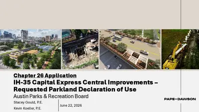
Chapter 26 Application IH-35 Capital Express Central Improvements – Requested Parkland Declaration of Use Austin Parks & Recreation Board Stacey Gould, P.E. Kevin Koeller, P.E. June 22, 2026 AGENDA • Project Objectives • Stakeholder Engagement • 16” Water Line (WL) and 12” Wastewater Line (WWL) Alignment Options o WL & WWL Declaration of Use • 66” Water Transmission Main (WTM) Alignment Options o Shaft Declaration of Use o Subterranean WL Declaration of Use o Temporary Construction Declaration of Use • Summary of Requested Parkland Declaration of Use 2 IH-35 CAPEX CENTRAL Palm Park Palm Park 3D Renderings provided by WSP, Matt Bridgeman 3 PROJECT OBJECTIVES • Provide Austin Water customers with a reliable water and wastewater system that is accessible • Relocate water and wastewater lines impacted by proposed IH-35 CapEx Project • Maintain required fire flows 4 PARKLAND DECLARATION OF USE SUMMARY Declaration of Use Request Area (ft2) WL & WWL Shaft Subterranean WL Temporary Construction 7,903 833 1,116 2,585 TOTAL: 12,437 5 SUMMARY OF STAKEHOLDER ENGAGEMENT • Meetings held to date: o 07/31/2025 – Palm District Interagency Meeting o 09/22/2025 – Present – Biweekly Meeting with Palm Park » Austin Parks & Recreation (APR), Waterloo Greenway Conservancy o 10/2/2025 – Meeting with AW, APR, and Waterloo Greenway Conservancy o 11/13/2025 – Palm District Interagency Meeting o 03/03/2026 – Meeting with Waller Creek Local Government Corporation (LGC) Board* o 04/16/2026 – On-site Meeting with AW, APR, and TxDOT to discuss construction practices near heritage tree *Meeting was open to the public 6 WATER LINE AND WASTEWATER LINE RELOCATION REQUESTED WL & WWL ALIGNMENTS • Palm Park (200 N IH-35 Svrd SB) o Located between E 2nd St and E 3rd St (west of IH-35) o 25’ Water & Wastewater Line Declaration of Use – 7,903 square feet for Permanent Use on Parkland » WL & WWL separation meet TCEQ requirements Placemakr Palm Park Proposed drill shaft wall and buffer requirement Palm Park 8 EXISTING WL Placemakr 9 EXISTING WL TO BE REMOVED Placemakr 10 REQUIRED WL RELOCATION • In order to maintain AW system reliability and fire protection for AW customers, looping is required • Reason selected: o The drill shafts within TxDOT ROW require the removal of the existing WL between 3rd and 4th Streets o The only street available to connect the loop is 3rd St, which requires a WL on the east side of Palm Park Placemakr 11 EXISTING WWL Placemakr 12 EXISTING WWL TO BE RELOCATED Placemakr 13 EVALUATED WWL RELOCATION ALTERNATIVE 1 • Gravity WWL from TxDOT ROW to the west, crossing Waller Creek • Reason not selected: o Gravity WWL is not possible due to elevation requirements Tie-in elev.: 454.82’ Bottom elev. of Waller Creek channel: ~434’ Placemakr Palm Park 14 EVALUATED WWL RELOCATION ALTERNATIVE 2 • Grinder Pump and associated Force Main from Palm Park restrooms to the existing 6” WWL on 3rd St, crossing Waller Creek • Reason not selected: o APR Staff did not approve this alternative due to maintenance concerns 15 REQUIRED WWL RELOCATION • Existing WWL to be relocated to within Palm Park • Reason selected: o Proposed WWL provides service to Placemakr and Palm Park o Gravity WWL installation Placemakr 16 PROFILE VIEW OF PROPOSED WL/WWL ON PARKLAND Not to scale 17 MINIMIZING IMPACTS TO THE PARK • WL & WWL Improvements at Palm Park o WL boring along length of parkland from 6-13 feet deep o WWL boring along 95% length of parkland from 12-17 feet deep o No tree Critical Root Zones (CRZs) are impacted o Low impact to natural resources anticipated o Existing fire hydrant at northeast corner of park to be replaced o WWL will provide service to park and AW customers o Language in declaration of use agreement to allow APR to continue to install AW approved programming within the parkland area • Proposed option meets all the requirements of ECM Section 5.3.0 and would minimize all impacts to the park 18 WATER TRANSMISSION MAIN RELOCATION REQUESTED WTM ALIGNMENT • Palm Park (200 N IH-35 Svrd SB) Placemakr o Shaft Declaration of Use – 833 square feet for Permanent Use on Parkland o Subterranean Water Line Declaration of Use – 1,116 square feet for Permanent Use under Parkland o 2,585 square feet for Temporary Use – duration not to exceed 700 Calendar Days » Proposed Temporary Access Declaration of Use (pink) is not intended for equipment or materials storage and will be used as a shared construction access Palm Park AW construction declaration of use to be returned to APR after construction 20 EXISTING DOWNTOWN WATER CROSSINGS Placemakr Palm Park 21 EVALUATED WTM RELOCATION ALTERNATIVE 1 • 66” Water Transmission Main (WTM) relocation on E 5th St • Reason not selected: o Not adequate space on E 5th St for tunneling shaft o Existing telecom utilities o Proposed location for large diameter gravity WWL Placemakr Palm Park 22 EVALUATED WTM RELOCATION ALTERNATIVE 2 Placemakr Palm Park • 66” WTM Relocation on W Cesar Chavez St • Reason not selected: o Not adequate space on W Cesar Chavez St for tunneling operation o Significant impact to existing utilities o Road closures of W Cesar Chavez St would be required 23 EVALUATED WTM RELOCATION ALTERNATIVE 3 • 66” WTM relocation tunneling underneath Palm Park and Convention Center • Reason not selected: • Scheduling • Large number of unknowns associated with feasibility of construction Geotechnical Declaration of use requirements Utility relocations for E 2nd St tie-in Placemakr 24 EVALUATED WTM ALTERNATIVE SHAFT LOCATION 1 • Evaluation of shaft within 3rd St ROW, would not require a permanent shaft declaration of use • Reason not selected: o The shaft cannot be located within 3rd St without overlapping the existing 66” WTM o The existing 66” WTM must remain in service during construction Placemakr 25 EVALUATED WTM ALTERNATIVE SHAFT LOCATION 2 • Evaluation of shaft partially within 3rd St ROW to move the permanent CAV structure outside of Palm Park, would require a reduced permanent shaft declaration of use • Reason not selected: o Location is not feasible due to the size of the shaft and the existing utilities o 3 utilities would be required to move 5 utility lines. However, the size of the shaft would not allow for the relocation of the utilities to an alternate alignment without a declaration of use from APR Placemakr 26 REQUIRED WTM RELOCATION • Requires Palm Park permanent shaft declaration of use, permanent subterranean declaration of use, and temporary construction declaration of use • Reason selected: o Allows existing 66” WTM to remain in service during construction o Minimizes conflict with existing utilities and infrastructure Palm Park Placemakr 27 PROFILE VIEW OF PROPOSED WTM ON PARKLAND Not to scale 28 ACCESS ROUTES AND CONSTRUCTION STAGING AREAS IN ROW AND FRONTAGE RD 29 ACCESS ROUTES AND CONSTRUCTION STAGING AREAS IN ROW AND FRONTAGE RD Placemakr 30 MINIMIZING IMPACTS TO THE PARK • WTM Improvements at Palm Park o Tunneling under existing trees o No tree CRZs are impacted o WTM depth is approximately 100’ deep o Low impact to natural resources anticipated o WTM will provide AW customers with reliable service and fire protection, including Palm Park • Proposed option meets all the requirements of ECM Section 5.3.0 and would minimize all impacts to the park 31 TUNNEL SHAFT APPEARANCE IN PARK Two 32” manhole covers will be required above ground for the proposed tunnel shaft at Palm Park Palm Park Example of an existing wastewater manhole at Palm Park Example of existing above ground appurtenances at Auditorium Shores for a wastewater tunnel 32 SUMMARY OF REQUESTED PARKLAND DECLARATION OF USE CHAPTER 26 OF THE PARKS AND WILDLIFE CODE (PWC) DUE DILIGENCE FOR UTILITY ASSIGNMENT Section 26.001 A department may not approve any project that requires the use of any public land designated as a park unless the department, acting through its duly authorized governing body or officer, determines that: 1) There is no feasible and prudent alternative to the use or taking of such land – CONFIRMED 2) The program or project includes all reasonable planning to minimize harm to the land, as a park, recreation area, scientific area, wildlife refuge, or historic site, resulting from the use or taking – CONFIRMED 34 SUMMARY OF REQUESTED ACTION Austin Water requests a recommendation to City Council for approval of: • Permanent Use of 9,852 sq. ft. of parkland at Palm Park • Temporary Work Area Use of 2,585 sq. ft. of parkland at Palm Park, not to exceed a total of 700 Calendar Days Total mitigation to be paid by Austin Water is $1,897,883. 35 PROJECT COORDINATION & PARTNER SUPPORT • During construction: o Will coordinate with APR if park events are scheduled in the future o Tree protection and coordination with APR for adjacent heritage tree o Trail access adjacent to Waller Creek will be maintained o Placemakr driveway access and trash service will be maintained o Adequate access to Palm Park from E 3rd St and IH-35 Frontage Rd during redevelopment of the park Palm Park 36 NEXT STEPS • September 2027 o Estimated construction start for water, wastewater, and water transmission main relocation • December 2029 o Installation of final surface amenities (playground, etc.) within easement areas after CapEx project construction o Estimated construction end and park open to the public 37 PROJECT TEAM Managing Engineer Kevin Koeller, P.E. P: 512.972.2055 | E: kevin.koeller@austintexas.gov Project Sponsor Mueen Chowdhury, P.E. P: 512.972.0209 | E: mueen.chowdhury@austintexas.gov Project Design Engineer Stacey Gould, P.E. P: 512.454.8711 | E: sgould@pape-dawson.com 38 IMAGE CITATIONS Our Future 35. (2024, November). Our Future 35 - Austin’s Cap and Stitch Project (Vision Plan November 2024). In publicinput.com. https://publicinput.com/Customer/File/Full/619df3fd-b7c8-4eb2-b085-728ee238647f TxDOT. Cesar Chavez Street with cap. https://www.txdot.gov. https://www.txdot.gov/mymobility35/projects/capex- central.html TxDOT & WSP USA Inc. (2025, July). TxDOT Roadway Design Exhibit - Capital Express - Central Downtown. https://www.txdot.gov. https://www.txdot.gov/content/dam/project-sites/mobility35/documents/capex-central/capex-central- schematic-downtown.pdf Michael Van Valkenburgh Associates Inc. Waller Creek Corridor Framework Plan. https://www.mvvainc.com. https://www.mvvainc.com/projects/waller-creek-corridor-framework-plan City of Austin. (2024, November). Water Forward 2024 Plan Report – Austin’s 100 Year Plan. In austintexas.gov. https://www.austintexas.gov/sites/default/files/files/Water/WaterForward/AW_WaterForward_Report_2024_Appendices.pdf 39