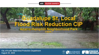
03-1: Guadalupe St. Local Flood Mitigation Presentation — original pdf
Backup

Guadalupe St. Local Flood Risk Reduction CIP Adams-Hemphill Neighborhood Park 5789.075 City of Austin Watershed Protection Department August 25, 2025 Staff • Kristina McLaren, P.E. – Project Sponsor • Stephanie Lott – Public Information Specialist Senior Purpose To communicate the importance of detention basins at Adams Hemphill Neighborhood Park and how they work to mitigate impacts to downstream area. Seeking positive recommendation to Council for use of parkland. Why did we start Guadalupe Street Flood Risk Reduction Project? 3 Existing Drainage System • Main storm system built in 1928 • Generally follows from Avenue A to Hemphill Branch at W. 33rd St • Pipe size varies from 42 inch in diameter to a 9 x 5.5-foot box culvert • Central Park Pond designed in 1993 • Triangle Pond designed in 2004 • 224 structures inundated in 25-year event • 285 structures inundated in 100-year event 4 Triangle Pond Central Park Pond Why do we need the detention basins at Adams Hemphill Neighborhood Park? 5 N Site Constraints • Historic neighborhoods • Historic outfall and downstream crossings • Creek crossings critical to city grid • Built out watershed • Parkland 6 7 Are there alternative locations? • No feasible alternatives have been identified • Numerous variations of detention basins, channel modifications and culvert improvements have been evaluated • Buyouts of several homes between 33rd and 34th Streets was cost prohibitive, within a Local Historic District, and too small • Open space at the Austin Presbyterian Seminary is too small • Parking lot of the Scottish Rite Dormitory is too small 8 Texas Parks and Wildlife Code Chapter 26 Section 26.001. Protected Land; Notice of Taking • State entities cannot approve programs or projects that use or take public land designated for parks, recreation, scientific areas, wildlife refuge, or historic sites unless their authorized governing body or officer determines: 1) There is no feasible and prudent alternative to the use or taking of such land 2) The program or project includes all reasonable planning to minimize harm to the land, as a park, recreation area, scientific area, wildlife refuge, or historic site, resulting from the use or taking 9 Stormwater Pond – Dry Detention Basin N 10 Detention Basins Will Be Mostly Dry • Designed to hold water for up to 24 hours after it rains • Larger basin will be a multi-use, open grassy field • It may include an area with other plants for improved water quality • Smaller basin will be fenced off, with plantings at the bottom 11 Photo credit: The Multi-use Athletic Field and Intermittent Storm Water Detention Pond by TD&H engineering in City of Great Falls, Montana 12 Tillery Fields Quail Creek NP Photo credit: Ignacio Losa Photo credit: Kenneth Perez 13 14 14 15 15 16 16 17 80% or 179 structures removed from 25-year inundation Post-Project 25-yr (4% AC) Flooding 18 City of Austin Drainage Policy Stormwater runoff peak flow rates for the two (2), ten (10), 25 and 100- year frequency storms shall not cause increased inundation of any building or roadway surface or create any additional adverse flooding impacts. 19 Previous Communications and Outreach Public Meetings – 2017 and 2018 Guadalupe St. Flood Risk Reduction Project • • North University Neighborhood Association Meetings – 2021, 2025 • • Updates shared via email distribution list Project Website regularly updated Adams Hemphill Neighborhood Park • Initial Survey and Open House – 2022 • Advisory Committee Meetings – 2023 • Hyde Park Neighborhood Association Meeting – 2024 • • Public Meeting and Survey – 2024 Project Website regularly updated 20 21 21 Park Improvements Added Amenities • Pedestrian Bridge • Nature Play Area • Pavillion • ADA Route to park amenities • Drinking Fountains • Outdoor Fitness Equipment • Rock Climbing Wall • Park Benches & Picnic Tables • Rain/Pollinator Gardens 22 Replaced Amenities (currently exist in park – new version to be constructed as part of improvements) • Basketball Court • Traditional Playground • Backstop • Perimeter Trail • Open green space with less cross slope Park Improvements Wastewater Relocation • Relocates 30" wastewater line from park alignment to Right of Way See MOU Attachment E • Bank Stabilization • Stabilize ~460 linear feet downstream of 30th Street See MOU Attachment F • 23 Mitigation Value, Credits, & Fee Mitigation Value………………….....………………………………….. $6,436,420 Park Amenities Improvements Credit……….………………. ($1,636,226) Wastewater Relocation Credit……………………………………… ($656,748) Bank Stabilization Credit…………………………………………… ($1,162,536) Final Mitigation Fee…………………………………………………….. $2,980,911 24 Requested Action • Watershed Protection requests a recommendation to City Council for approval of 138,136 square feet for permanent use and 11,997 square feet for temporary use for a period not to exceed a total of 120 calendar days on parkland located at Adams-Hemphill Neighborhood Park. Mitigation amount due $2,980,911. 25 Next Steps • Seek City Council approval of Ch. 26 request to use park land for drainage • Project is dependent on Ch. 26 approval and external funding approval; if either are not approved, then there will be no project to reduce flood risk between 45th St. and 33rd St. • Construction anticipated in 2028 pending Ch. 26 and funding 26 Questions? Kristina McLaren Kristina.McLaren@austintexas.gov Office: 512-974-4320