20250820-002: Flood Response Presentation UPDATED — original pdf
Backup
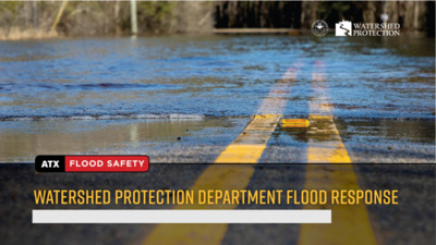
Overview • Austin Flood History • Austin Flood Challenges • Flood Preparedness Strategy • Funding • Rain to River • Questions Austin Flood Challenges • Atlas 14 data shows Austin is experiencing more frequent and heavier rainfall • Austin has shallow soils and world record rainfall rates • 10% of land in Austin is in the floodplain and subject to flash flooding • More than 10,000 buildings and 400 roads are prone to flooding during a 100-year flood National Flood Insurance Program • Participated since 1983 • Must adopt and enforce floodplain regulations • Provides availability of federally-backed flood insurance to residents • Required for federal disaster funding 5 Purpose of Floodplain Regulations • Public safety • Reduce flood risk to residents, buildings, and roads • Minimize flood risk for new development • Make Austin more resilient 6 March 1974 - Waterway Ordinance Establishes 25-year floodplain protection, natural and traditional character Floodplain Regulation Timeline September 1974 • Austin enters FEMA emergency program • First floodplain maps 1983 Floodplain regulations become effective 2019 Floodplain regulations update in response to Atlas 14 1974 1981 1983 2003 2019 May 1981 Memorial Day Flood September 1981 Initial FEMA FIRM date • • Austin enters full NFIP 2003 Floodplain regulations amended to include administrative variance process 7 Floodplain Management Regulations Regulation Regulation Regulation Regulation Regulation Austin Austin Austin Austin Austin FEMA Min. Std. FEMA Min. Std. FEMA Min. Std. FEMA Min. Std. FEMA Min. Std. Increase in flood level No adverse impact Increase in flood level No adverse impact Increase in flood level No adverse impact Increase in flood level No adverse impact Increase in flood level No adverse impact Up to 1 foot Up to 1 foot Up to 1 foot Up to 1 foot Up to 1 foot Freeboard Freeboard Freeboard Freeboard Safe access Safe access Safe access 1 foot overall; 2 1 foot overall; 2 1 foot overall; 2 2 feet feet in some cases feet in some cases feet in some cases 1 foot above 100- 1 foot above 100- 1 foot above 100- year floodplain year floodplain year floodplain 0 feet 0 feet 0 feet 0 feet None None None Substantial Substantial improvement improvement 10-year 10-year cumulative cumulative Permit by permit Permit by permit Watershed conditions Fully developed Existing conditions 8 s g n d i l i u B f o r e b m u N 3,000 2,500 2,000 1,500 1,000 500 0 9 Number of buildings constructed in the 100-year floodplain by decade 1983 Regulations limit encroachment into the 100-year floodplain Pre-1950 1950s 1960s 1970s 1980s 1990s 2000s 2010s 2020s Flood Preparedness Strategy • Flood Mitigation • Flood Preparedness • Flood Response Flood Mitigation • Capital Improvement Projects • Floodplain & Drainage Regulations • Operations & Maintenance • Vegetation & Land Management • In-house Drainage System Upgrades Flood Preparedness • Preventative maintenance of drainage system • Pre-storm checks on critical locations • Monitor the weather for potential flooding • Coordinate with partner departments, Austin-Travis County Homeland Security and Emergency Management (HSEM) and Stakeholders • Communication & Engagement Flood Response • Flood Early Warning System (FEWS) • Watershed Protection Department Emergency Management Team • Department Operations Center • Flood Reconnaissance and Debris Management Flood Impacts & Response May 28, 2025 Department OPCON Level 2 • 8 low water crossing closures • 35 flooded structures • 2 WPD buildings impacted (back-up generation) • 298 Service Requests • 5 reconnaissance teams investigated areas with high intensity rainfall and met with impacted community members • Collaborated with Development Services Department to create resource documents and handouts for affected residents • 1,000 tons of debris removed from drainage system • Coordinated with Austin Resource Recovery and Transportation & Public Works for debris management • Participated in media requests to include in city-wide press conference Watershed Protection Department Operations Center (DOC) First time activated on May 29-30 for OPCON Level 2 Flood Impacts & Response July 5, 2025 Department OPCON Level 3 • 18 low water crossing closures; multiple closures for Spicewood Springs and Old Spicewood Springs • Residents trapped in between crossings on Spicewood Springs and needed rescue • 5 flooded structures • 170 Service Requests • Reconnaissance teams investigated areas with high intensity rainfall • Over 500 tons of debris removed from drainage system Investments to Date Historical Spending • Bond funds used towards 50 stormwater projects since 2001 • Total 114 flood projects have completed phases, costing approximately $567M • Funding sources include GO bonds, cash transfer from drainage charge revenue, and grants • Remaining 2018 Bond funds will be spent down by end of 2026 Challenges • Price escalations for construction after the pandemic • As Austin becomes more compact and connected there is little open space available for drainage detention, escalating project costs • Lower number of grant funding opportunities Current Needs • See proposed budget needs and flood risk reduction projects included in the 2026 bond package • We have over $2B worth of need • Many projects are ready for construction but need funding Questions?