20250507-005: SER 6139 5140 McLemore Tract Staff Memo — original pdf
Backup
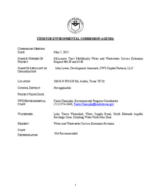
ITEM FOR ENVIRONMENTAL COMMISSION AGENDA COMMISSION MEETING DATE: May 7, 2025 NAME & NUMBER OF PROJECT: McLemore Tract Multifamily Water and Wastewater Service Extension Request #6139 and 6140 NAME OF APPLICANT OR ORGANIZATION: John Lewis, Development Associate, CWS Capital Partners, LLC LOCATION: 10656 N FM 620 Rd, Austin, Texas 78726 COUNCIL DISTRICT: Not applicable PROJECT FILING DATE: WPD/ENVIRONMENTAL STAFF: Kaela Champlin, Environmental Program Coordinator (512) 974-3443, Kaela.Champlin@austintexas.gov WATERSHED: REQUEST: STAFF DETERMINATION: Lake Travis Watershed, Water Supply Rural, North Edwards Aquifer Recharge Zone, Drinking Water Protection Zone Water and Wastewater Service Extension Revision Not Recommended 1 TO: Jennifer Bristol, Chair, and Members of the Environmental Commission MEMORANDUM FROM: Kaela Champlin, Environmental Program Coordinator Watershed Protection Department DATE: May 7, 2025 SUBJECT: McLemore Tract Multifamily Water and Wastewater Service Extension Request #6139 and 6140 Service Extension Requests (SERs) located in the Drinking Water Protection Zone and outside of the City of Austin’s full purpose jurisdiction require City Council approval and review by the Environmental Commission. The Watershed Protection Department (WPD) staff have completed the review for McLemore Tract Multifamily SER #6139 & 6140 and do not recommend approval of the request. Site Overview The site consists of one tract of approximately 10 acres, located at 10656 N FM 620. The site is located outside of the City of Austin’s jurisdiction within Travis County in the Lake Travis Watershed and the Drinking Water Protection Zone. It is also within the North Edwards Aquifer Recharge Zone. This site opted to remove itself from the City of Austin’s ETJ in September 2024. Request Summary The applicant is proposing 300 multifamily units with 150 Living Unit Equivalents (LUEs). The conceptual plan indicates the proposed 10-acre development would propose approximately 59% impervious cover. The proposed development includes parking that covers approximately 34% of the property. If the applicant were required to comply with City of Austin environmental standards, the impervious cover would be limited to 20% of the net site area and would be required to leave 40% of the downstream portion of the site as natural area. Impacts from SER improvements Wastewater: The applicant is proposing to construct 1,300 feet of 8-inch gravity wastewater main from the existing 8-inch gravity wastewater main located in N FM 620 to the subject tract, as shown on the attached map. 2 The applicant is also proposing to construct an appropriately sized upgrade to the existing Volente Lift station, which is also shown on the attached map. Alternative Wastewater Service: Wastewater generated by the development is estimated to be an average daily flow of 36.750 gallons per day (gpd). If service is not extended to the site and wastewater disposal is required, there are three potential alternatives, though only two options are possible under state regulations: • Option 1: Texas Land Application Permit (TLAP) for a Subsurface Area Drip Dispersal System (SADDS) issued by the Texas Commission on Environmental Quality (TCEQ) • Option 2: Onsite Sewage Facility (OSSF) • Option 3: Texas Pollutant Discharge Elimination System (TPDES) permit (also known as direct discharge). Both Option 1 and Option 2 would require the applicant to significantly reduce the amount of proposed impervious cover. Option 1: A TLAP permit for the facility using SADDS would require 9.3 acres with slightly higher area for a spray irrigation system and storage pond (10.1 acres). There are only 3.3 acres in the proposed development that are not being used for parking, stormwater pond, pool, or building footprint. Therefore, if the SER is not approved, a TLAP permit is not an option without drastically scaling back the number of LUEs planned. If the number of LUEs were reduced to a third of that planned (50 LUEs) and the same footprint was used, a treatment plant and SADDS irrigation field with storage would occupy 3.6 acres which is only slightly higher than that avail- able. However, native soils onsite Tarrant soils rolling (TaD) and Tarrant and Speck soils, 0 to 2 percent slopes (TcA) are severely limited due to depth to bedrock and number of coarse frag- ments. Option 2: The Travis County On Site Septic Facility (OSSF) rules would require 0.75 acre lots for development with public water supply and 1 acre lots for development without public water supply. Therefore, the number of LUEs possible using onsite systems would be 10 to 13. It is un- likely that this would be an option chosen. In addition, the Tarrant soils onsite (TcA and TaD) have severe limitations for OSSFs and other soil-based disposal systems (TLAPs). Imported soil would have to be used for either system. This would not eliminate the potential for adverse im- pacts as preferential flowpaths can form more easily in imported soil and the interface with na- tive soils can provide a horizontal plane for effluent to travel offsite. Option 3: A Texas Pollutant Discharge Elimination System (TPDES) permit would not be possi- ble given that the property is too close to Lake Travis. TCEQ is required by 30 TAC 311.1(3) to prohibit wastewater discharges within 10 miles from the pool elevation of Lake Travis at 681 ft mean sea level. The property is approximately 2.9 miles above this location in Cypress Creek. Water: A second water SER option has been proposed if the first option is not feasible due to spacing constraints with other utilities. 3 Option 1: The applicant is proposing to construct approximately 950 feet of 12-inch water main from the existing 12-inch water main located in North FM 620 south of the Foundation Road intersection and extend southwest along North FM 620 to the subject tract, as shown on the attached map. Option 2: The applicant is proposing to construct 1,400 feet of 12-inch water main from the existing 12-inch water main crossing North FM 620 north of the Boulder Lane intersection and extend northeast along North FM 620 to the subject tract, as shown on the attached map. ETJ Regulations Following the passage of Senate Bill 2038, the property owner received a valid petition to be removed from Austin’s ETJ in September 2024 and is no longer located within Austin’s extraterritorial jurisdiction and is therefore no longer required to comply with the City’s environmental regulations. Senate Bill 2038 grants property owners the authority to file a petition or request an election for release from a city’s ETJ. The bill allows properties to be removed on a lot-by-lot basis, significantly hindering regional planning efforts for long-term sustainable growth. Environmental impacts The property lies within the Lake Travis Watershed, which is classified as Water Supply Rural and is within the Drinking Water Protection Zone. The site is also within the North Edwards Aquifer Recharge Zone and is upstream of known Jollyville Plateau salamander habitat. If the property had remained within Austin’s ETJ, it would be subject to the Watershed Protections Ordinance (WPO). In Water Supply Rural watersheds, impervious cover is limited to 20% net site area and 40% of the downstream portion of the site would have been required to be preserved within a natural state. Additionally, the City of Austin’s Land Development Code limits construction on slopes greater than 15%. Based on available information, portions of the site contain slopes greater than 15%. No critical environmental features were identified in the Environmental Resource Inventory (ERI) provided by the applicant, but the City of Austin’s database shows a seep Critical Environmental Feature (CEF) on the western corner of the property. The site is not within the Critical Water Quality Zone (CWQZ) or Water Quality Transition Zone (WQTZ) of Lake Travis. Information related to potential cut or fill is not available at this time. Today, the proposed development application is subject to Travis County Code 482.216(a)(1)(a) which states that there are no impervious cover limits for a commercial subdivision on a tract with primary driveway access on a state road such as FM 620. Recommendation The Watershed Protection Department does not recommend approval of McLemore Tract Multifamily Water and Wastewater Service Extension Request #6139 and 6140 for the following reasons: • The property owner received a valid petition to be removed from the City of Austin’s ETJ and is not subject to the City of Austin’s environmental regulations, which would 4 limit the footprint of the development within this environmentally sensitive area that drains to Austin’s drinking water supply. The project would not be required to meet the following regulations: o 20% net site area impervious cover limit o 40% downstream natural area o Protections for slopes greater than 15% o Cut/fill limited to no greater than four feet o City of Austin Water quality treatment standards, which are more protective than County and State requirements o City of Austin Critical Environmental Feature protections • The site drains to occupied salamander habitat for the Jollyville Plateau salamander and is therefore sensitive to impacts of development. The attached map provides further details regarding the applicant’s request. Please feel free to contact Kaela Champlin at (512) 974-3443 or kaela.champlin@austintexas.gov if you have any questions or comments about the proposed SERs. cc: Katie Frazier, Engineer C, Austin Water Colleen Kirk, P.E., Supervising Engineer, Austin Water Leslie Lilly, Environmental Conservation Program Manager, Watershed Protection Department Liz Johnston, Interim Environmental Officer, Watershed Protection Department 5 !!!!!!!!!!!!!!!!!!!!!!!!!!!!!!!!!!!!!!!!!!!!!!!!!!!!!!!!È(È(·(È(È(È(·(È(È(È(È(È(È(È(È(È(·(È(·(·(·(·(·(·(·(·(·(·(È(È(È(È(N FM 620 RDWINDY RIDGE RDFOUNDATION RDBUCKNER RDHARE TRLBOULDER LNHANGING VALLEY DRROLSTON PLPAINTED BUNTING DRFOUNDATION RDBOULDER LN990980970960950101010009409301020920910900101010201020100010101020960980940990960E37D37E38D388"6"10"24"12"16"8"12"12"8"8"12"8"8"12"24"8"24"8"24"12"16"12"8"W. S.E.R. Name McLemore Tract MultifamilyW. S.E.R. Number: 6139Option 1.Utility Development Services Plotted 4/7/202504008001,200200FeetSubject Tract100-Year FEMA FloodplainCritical Water Quality ZoneFull-Purpose City Limit2-Mile ETJLimited-Purpose City LimitUnincorporated Travis CountyThis product is for informational purposes and may not have been prepared for or be suitable for legal, engineering, or surveying purposes. It does not represent an on-the-ground survey and represents only the approximate relativelocation of the property boundaries. This product has been produced by the City of Austin for the sole purpose of geographic reference. No warranty is made by the City of Austin regarding specific accuracy or completeness.STAFF PROPOSEDAPPROXIMATELY 950 FEETOF 12-INCH WATER MAINPage 1 of 2DRAFT !!!!!!!!!!!!!!!!!!!!!!!!!!!!!!!!!!!!!!!!!!!!!!!!!!!!!!!!È(È(·(È(È(È(·(È(È(È(È(È(È(È(È(È(·(È(·(·(·(·(·(·(·(·(·(·(È(È(È(È(N FM 620 RDWINDY RIDGE RDFOUNDATION RDBUCKNER RDHARE TRLBOULDER LNHANGING VALLEY DRROLSTON PLPAINTED BUNTING DRFOUNDATION RDBOULDER LN990980970960950101010009409301020920910900101010201020100010101020960980940990960E37D37E38D388"6"10"24"12"16"8"12"12"8"8"12"8"8"12"24"8"24"8"24"12"16"12"8"W. S.E.R. Name McLemore Tract MultifamilyW. S.E.R. Number: 6139Option 2.Utility Development Services Plotted 4/7/202504008001,200200FeetSubject Tract100-Year FEMA FloodplainCritical Water Quality ZoneFull-Purpose City Limit2-Mile ETJLimited-Purpose City LimitUnincorporated Travis CountyThis product is for informational purposes and may not have been prepared for or be suitable for legal, engineering, or surveying purposes. It does not represent an on-the-ground survey and represents only the approximate relativelocation of the property boundaries. This product has been produced by the City of Austin for the sole purpose of geographic reference. No warranty is made by the City of Austin regarding specific accuracy or completeness.Page 2 of 2STAFF PROPOSEDAPPROXIMATELY 1,400 FEETOF 12-INCH WATER MAINDRAFT %%%%%%%%%%%%%%%%%%%%%%%%%%%%%%%%%%%%%%%%%%%%%%%%%%%%%%%%%%%%%%%%%%%%%%%%%%%%%%%%%%%%%%%%%%%%%%%%%%%%%%%%%%%%%%%%%%%%%%%%%%%%%%%%%%%%%%%%%%%%%%%%%%%%%%%%%%%%%%%%%%%%%%%%%%%%%%%%%%%%%%%%%%%%%%%%%%%%%%%%%%%%%%%%%%%%%%%%%%%%%%%%%%%%%%%%%\\\%\\\\\\\%\\\\\\%\\\\\\\\%\%\\\\\%\\!!!!!!%!!!!%!!!!!%%%%%%%%%%%%%%%%%\\\\\\!P!P!P!P!P!P!P!P!P!P!P!P!P!P!P!P!P!P!P!P!P!P!P!P!P!P!P!P!P!P!P!P!P!P!P!P!P!P!P!P!P!P!P!P!P!P!P!P!P!P!P!P!P!P!P!P!P!P!P!P!P!P!P!P!P!P!P!P!P!P!P!P!P!P!P!P!P!P!P!P!P!P!P!P!P!P!P!P!P!P!P!P!P!P!P!P!P!P!P!P!P!P!P!P!P!P!P!P!P!P!P!P!P!P!P!P!P!P!P!P!P!P!P!P!P!P!P!P!P!P!P!P!P!P!P!P!P!P!P!P!P!P!P!P!P!P!P!P!P!P!P!P!P!P!P!P!P!P!P!P!P!P!P!P!P!P!P!P!P!P!P!P!P!P!P!P!P!P!P!P$.$.$.[7L[7LN FM 620 RDEL SALIDO PKWYHATCH RDBRISTLE OAK TRLTANGLEBRIAR TRLANTLER LNRANDY RDCENTENNIAL TRLWINDY TERTURTLE LNFOUNDATION RDMIMOSA PASSSTAR VIEW TRLBIRCH DRMONET DRFENCE POST TRLMORNING GLORY TRLBLAZING STAR TRLWINDY RIDGE RDSWEETWATER TRLTEXAS OAK WAYBIRCHBARK TRLCEZANNE STMULBERRY WAYBOBCAT TRLPLUM CREEK LNLAUREL CREEK DRALOE VERA TRLSWEETGUM TRCEANDERSON MILL RDLITTLE ELM TRLMATISSE TRLPINEY CREEK LNBUTTERNUT PLCONCHOS TRLPETUNIA STSIERRA BLANCAHARE TRLSPIDERLILY VWROCKWELL CTQUARTER HORSE TRLPEPPER GRASS TRLYEGUA CREEK RDBRANDON PARKE TRLHICKORY RDJACK RABBIT TRLROCKWELL PLPOWDER MILL TRLBLACK CHERRY DRLARKSPUR WAYPRAIRIE DOG TRLEBONY LNCEZANNE CTLAUREL CREEK CIRSANDSTONE TRLLOCUST CVGREAT VALLEY DRCATSKILL TRLBIRDS NEST CTLANTANA LNHONEYWEED STHAWTHORN CVCOPPERLILLY CVBROAD LEAF CVSHOW BARN CVSWEETWATER CVALOE VERA CVCOTTONWEED TRLSONGBIRD CVALISON PARKE TRLRED BAY DRLAURETTA WOOD DRASTER PASSWIND SONG CVWINDY RIDGE RD990100010109809709601020950940930920103091090089088096010001000102095010101020990980970980950950980970103099098010301000910960960960980103010101000101096096099099099010309409409309909909809509701000920LAKE CREEKE38E37E39D38D37D39VOLENTE LSLAUREL CANYON LS954" DI12" PVC2" PVC8" PVC6" PE8" PVC8" PVC8" PVC8" PVC8" PVC8" PVC8" PVC8" PVC12" PVC8" PVC8" PVC8" PVC8" PVC12" PVC8" PVC8" PVC8" PVC8" PVC6" PE12" PVC8" PVC8" PVC8" PVC8" PVC8" PVC8" PVC8" PVC8" PVC8" PVC8" PVC8" PVC8" PVC8" PVC8" PVC8" PVC8" PVC8" PVC8" PVC8" PVC8" PVC12" PVC8" PVC8" PVC6" PE8" PVC8" PVC8" PVC8" PVC8" PVC8" PVC2" PVC8" PVC8" PVC8" PVC8" PVC8" PVC8" PVC8" PVC8" PVC12" PVC8" PVC8" PVC8" PVC8" PVC8" PVC8" PVCW.W. S.E.R. Name: McLemore Tract MultifamilyW.W. S.E.R. Number: 6140.Utility Development Services Plotted 3/10/202508001,6002,400400FeetSubject TractCritical Water Quality ZoneFull-Purpose City Limit2-Mile ETJLimited-Purpose City LimitCity of Cedar ParkCedar Park ETJUnincorporated Travis CountyThis product is for informational purposes and may not have been prepared for or be suitable for legal, engineering, or surveying purposes. It does not represent an on-the-ground survey and represents only the approximate relativelocation of the property boundaries. This product has been produced by the City of Austin for the sole purpose of geographic reference. No warranty is made by the City of Austin regarding specific accuracy or completeness.STAFF PROPOSEDAPPROXIMATELY 1,300 FEETOF 8-INCH GRAVITYWASTEWATER MAIN270908STAFF PROPOSEDAPPROXIMATELY 1,875 FEETOF 12-INCH GRAVITYWASTEWATER MAINSTAFF PROPOSEDAPPROPRIATELY SIZEDLIFT STATION UPGRADE1139982670DRAFT