20240501-002: Bridle Ridge at Wildhorse Staff Presentation — original pdf
Backup
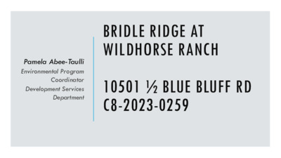
Pamela Abee-Taulli Environmental Program Coordinator Development Services Department BRIDLE RIDGE AT WILDHORSE RANCH 10501 ½ BLUE BLUFF RD C8-2023-0259 PROJECT LOCATION Site Location Austin ETJ Austin City Limits Edwards Aquifer Recharge Zone Edwards Aquifer Contributing Zone 2 This product is for informational purposes and may not have been prepared for or be suitable for legal, engineering, or surveying purposes. It does not represent an on-the- ground survey and represents only the approximate relative location of property boundaries. This product has been produced by the Watershed Protection Department for the sole purpose of geographic reference. No warranty is made by the City of Austin regarding specific accuracy or completeness. 0510Miles[ PROPERTY DATA • Gilleland Creek Watershed • Suburban Classification • Desired Development Zone • Austin Full Purpose Jurisdiction • Council District 1 • Wildhorse Ranch Planned Unit Development (PUD) 3 [ PROJECT DATA • Single family residential development with roadways and storm water ponds. • 21.4 acres [ ENVIRONMENTAL DATA • Wetland Critical Environmental Features (CEF) • Critical Water Quality Zone (CWQZ) CEF CWQZ [ ENVIRONMENTAL DATA • Wetland Critical Environmental Features (CEF) • Critical Water Quality Zone (CWQZ) • Slopes • 86% of the site is 0-15% slopes, but very hilly CEF CWQZ 2-foot contours [ ENVIRONMENTAL DATA CWQZ [ VARIANCE REQUESTS 8 § 25-8-341 - CUT REQUIREMENTS. (A) Cuts on a tract of land may not exceed four feet of depth. • The variance request is to allow cut over 4 feet to15 feet. § 25-8-342 - FILL REQUIREMENTS. (A) fill on a tract of land may not exceed four feet of depth. • The variance request is to allow fill over 4 feet to 15 feet. VARIANCE REQUESTS [ VARIANCE RECOMMENDATION • Variances for grading have been granted for projects with similar site constraints, specifically topographic conditions that constrain the ability to comply with transportation and ADA regulations. • The variance • • • Is necessitated by topographic features, not design choice; Is the minimum deviation from the code; and Is unlikely to result in harmful environmental consequences. • Water quality will be equal to water quality without the variance. 10 VARIANCE CONDITIONS 1. Slope stabilization for areas of existing erosion adjacent to the lots, will be provided with grouted rip-rap or approved equivalent method. [ VARIANCE CONDITIONS 2. Slope stabilization in area of cut over 8 feet will be provided by terracing, 25 feet at 15% grade and 20 feet at 5% grade, and revegetation with native grasses and forbs (per Standard Specifications Manual 609S.5). [ VARIANCE CONDITIONS Staff recommends the variances, with the following conditions. 3. Fill over 8 feet will be contained with engineered walls. 4. The water quality ponds will be biofiltration ponds. 13 THANK YOU Questions?