20221207-002: 200 E Riverside PUD Development Assessment CD-2022-0003 — original pdf
Backup
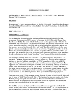
BRIEFING SUMMARY SHEET DEVELOPMENT ASSESSMENT CASE NUMBER: CD-2022-0003 – 200 E. Riverside Planned Unit Development REQUEST: Presentation of a Project Assessment Report for the 200 E. Riverside Planned Unit Development, located at 200 East Riverside Drive, within the Lady Bird Lake Watershed and the East Bouldin Creek Watershed. DISTRICT AREA: 9 DEPARTMENT COMMENTS: The Applicant has submitted a project assessment for a proposed professional office and commercial development on 3.9555 acres to be known as the 200 E. Riverside Planned Unit Development (PUD). The banks of Lady Bird Lake are located approximately 160 feet to the northeast at their closest point. The proposed development area presently contains a circa 1970 51,285 square foot, two-story, 30-35 foot tall (vacant) office building with surface parking and has driveway access to East Riverside Drive and “Little” East Riverside Drive, a 60-foot wide private access easement adjacent to the western property line. The property is within the South River City Citizens Neighborhood Plan Area and designated as Mixed Use on the Future Land Use Map. The property is also within the South Central Waterfront subdistrict of the Waterfront Overlay and within the South Central Waterfront Vision Framework Plan district boundaries. The property is currently zoned lake commercial – neighborhood plan (L-NP) district. The Applicant’s proposed rezoning request to PUD-NP consists of a multi-use project that would include two high-rise buildings intended for 1,377,787 square feet of office uses and 29,318 square feet of ground floor, commercial / retail uses with a maximum height of 410 feet. The Applicant does not currently contemplate residential use of the property, although the proposed project could be modified to include it. The PUD will also provide 0.87 acres of open space (including two pocket parks with a cumulative area of 14,893 square feet and open to the public) located between the two buildings that will connect to surrounding park land through a public access easement. A mix of below grade and above grade structured parking is proposed. Vehicular access to the PUD is proposed to occur from one driveway to East Riverside Drive and one driveway to “Little” East Riverside Drive. The Applicant has had conversation with Capital Metro regarding an at-grade train station for the Project Connect Blue Line on “Little” East Riverside Drive. A transportation impact analysis (TIA) will be required at the time a formal rezoning application for PUD-NP is received by the City. The Staff has reviewed the Applicant’s Development Assessment application for PUD-NP zoning and the stated intent is to comply with all of the Tier One and Tier Two requirements, for the proposed office / commercial development as summarized below. The base zoning district CD-2022-0003 – 200 E. Riverside PUD Page 2 for the PUD is lake commercial (L) which allows for up to 200 feet in height. However, the property’s location within the South Shore Central Subdistrict of the Waterfront Overlay is more restrictive as it pertains to height and establishes a 96 foot maximum height limit, thus superseding the 200 foot height allowed by the L base zoning district (Section 25-2-742(G)(4)). • Open Space – Thirty (30) percent landscaped area in the street yard • Environment / Drainage – Treatment of 100% of on-site water quality controls; treatment of a minimum of 50 percent of the required water quality volume using Green Storm Water Quality infrastructure, including biofiltration ponds, rainwater harvesting, rain gardens, vegetated filter strips, pervious pavers, porous pavement, and non-required vegetation; reduction of impervious cover from 89.8 percent to 80 percent; species rainwater harvesting to irrigate at least 50 percent of the required landscape area; direction of stormwater runoff from impervious surfaces to landscape areas equal to or greater than the 20 percent site area required for landscaping; and provision of an Integrated Pest Management Plan • Trees (part of Environment / Drainage) – Protect 100 percent of protected and Heritage trees unless they are dead, fatally diseased, or an imminent hazard to life or property; all required tree plantings shall utilize native tree species selected from Appendix F of the Environmental Criteria Manual and utilize Central Texas native seed stock • Austin Green Builder Program – Construct all occupied buildings to achieve a three-star rating • Art – Onsite participation or contribution towards the Art in Public Places Program • Community Amenities – Community meeting space on the ground floor at no cost to the neighborhood association and / or community organization • Transportation – Pedestrian and bicycle wayfinding and safety improvements along clearly defined pathways from East Riverside Drive towards Lady Bird Lake, to connect to parkland on adjacent property to the north. Improvements will be coordinated with Project Connect and Austin Transit Partnership. • Building Design – Achieve a minimum of 9 points under the Building Design options of Section 3.3.2 of Chapter 25-2 (Design Standards and Mixed Use) through use of façade articulation, roof design, ground-floor glazing, building materials, and primary entry design • Accessibility – Additional accessibility features such as accessible restrooms and shower • Local Small Business – Affordable rates to an independent retail service provider, stalls restaurant, or small business. At this time, five (5) Code modifications are requested to the Zoning and Transportation sections. The Applicant does not propose any Code modifications to the Environment section. • Modify 25-2-742 (F) (South Shore Central Subdistrict Regulations) to reduce the basewall setback requirement of a 70 degree horizontal angle along East Riverside Drive. The basewall setback complies up to the first 214 feet of the total proposed 410 feet of a building. • Modify 25-2-742 (G)(4) (South Shore Central Subdistrict Regulations) to allow for a maximum building height of 410 feet. CD-2022-0003 – 200 E. Riverside PUD Page 3 • Modify 25-2-1063 (C)(4) (Height Limitations and Setbacks for Large Sites) to allow for a maximum 410 feet building height within the compatibility setback area. (Approximately 1.406 acres is within the 540 foot compatibility setback area; the Applicant estimates 370,772 of building gross square footage would would be within the 540 foot compatibility setback area • Delete the applicability of 25-2-1065 (Scale and Clustering Requirements) to the PUD. • Modify Section 25-6-532 (Off-Street Loading Standards) to allow a shared loading and unloading area for the various uses within the PUD regardless of where the use or loading and unloading is located within the PUD. On July 7, 2022, the Applicant submitted a Development Assessment application that outlines the desire to redevelop the site with a development that includes ground floor pedestrian-oriented uses, with office and commercial uses on the upper floors. During the PUD zoning review process, Staff and the Applicant will work on issues further enumerated in the finalized comment report pertaining to South Central Waterfront compliance, environmental / trees benefits, parkland / open space, transportation, water quality, and Austin Water requirements, and other Tier Two amenities. The City’s completed Project Assessment Report was completed on November 7, 2022 and is attached. Additional information is necessary to demonstrate how the PUD would meet the objectives of the City Code, or provide for development standards that achieve equal or greater consistency with the Code. The following exhibits are attached to this report: • Zoning Map and Aerial View • Finalized Staff comment report • Applicant’s Summary letter • Applicant’s Tier One / Tier Two chart • Applicant’s Code Comparison Table • Applicant’s List of Code Modifications • Applicant’s Existing Zoning, Existing Conditions, Proposed Land Use Plan, Notes & Summary Sheet OWNER / APPLICANT: Garwald Company, Inc. (Rogan Giles) AGENT: Armbrust & Brown, PLLC (Richard T. Suttle, Jr.) SOUTH CENTRAL WATERFRONT ADVISORY BOARD: To be determined ENVIRONMENTAL COMMISSION DATE: December 7, 2022 – CITY COUNCIL DATE: To be determined CD-2022-0003 – 200 E. Riverside PUD Page 4 ASSIGNED STAFF: Wendy Rhoades e-mail: wendy.rhoades@austintexas.gov PUD-NP CS-1-V-NP PUD-NP LI-PDA-NP LI-NP CS-1-V-NP CS-1-V-NP CS-1-V-NP PUD-NP B A R T O N S P R I N G S R D CS-1-V-NP H AY W O O D AVE W R I V E R S I D CS-1-V-NP E D R P-NP CS-1-NP PUD-NP LI-NP CS-NP CS-1-V-NP CS-1-V-NP CS-V-NP CS-V-CO-NP L-NP CS-1-V-NP CS-V-CO-NP UNZ CS-MU-V-NP CS-CO-NP CBD CBD CBD P RIVER ST CBD T Y S E N AI R DMU-CO CBD CUMMINGS ST E V A T S A E CBD E V A S S E R G N O C S N L C I S U M L-NP L-V-NP L-NP SF-3-NCCD-NP B O N NIE VIE W SF-3-NCCD-NP N L A S S I L E M MF-1-NCCD-NP G AVE NIN NEW LE GRANDE AVE SF-3-NCCD-NP MF-4-NP E RIV E R SID E D R E V G A SF-3-NCCD-NP NIN W E N SF-3-H-NCCD-NP SF-3-NCCD-NP SF-3-H-NCCD-NP S U N N Y L N SF-3-NCCD-NP N E W SF-3-H-NCCD-NP L-V-NP CS-1-V-NP CS-1-NCCD-NP CS-NCCD-NP CS-1-NCCD-NP MF-4-NCCD-NP SF-3-H-NCCD-NP CS-V-CO-NP CS-1-H-NCCD-NP GR-H-NCCD-NP ACADEMY DR CS-1-MU-V-NCCD-NP CS-MU-V-NCCD-NP CS-V-NCCD-NP MF-4-NCCD-NP MF-4-NCCD-NP SF-3-NCCD-NP MF-3-NCCD-NP E MF-4-NCCD-NP SF-3-H-NCCD-NP SF-3-NCCD-NP CS-1-V-CO-NCCD-NP MF-2-NCCD-NP MF-3-NCCD-NP SF-3-NCCD-NP R D E N V A R I E AVE HILLSID N I N G A V GO-NCCD-NP MF-4-NCCD-NP SF-3-NCCD-NP SF-3-NCCD-NP P-NP SF-3-H-NP E D G E C SF-3-NP LIF F T E R SF-3-CO-NCCD-NP SF-3-NP SF-3-NCCD-NP GO-NCCD-NP SF-3-NP SF-3-NP ± SUBJECT TRACT ZONING BOUNDARY DEVELOPMENT ASSESSMENT CASE#: CD-2022-0003 This product is for informational purposes and may not have been prepared for or be suitable for legal, engineering, or surveying purposes. It does not represent an on-the-ground survey and represents only the approximate relative location of property boundaries. 1 " = 400 ' This product has been produced by the Housing and Planning Department for the sole purpose of geographic reference. No warranty is made by the City of Austin regarding specific accuracy or ! ! ! ! ! ! ! ! ! ! ! ! ! ! ! ! ! ! ! ! ! ! ! ! ! ! ! ! ! ! ! ! ! ! ! ! ! ! ! ! ! ! ! ! ! ! ! ! ! ! ! ! ! ! ! ! ! ! ! ! ! ! ! ! ! ! ! ! ! ! ! ! ! ! ! ! ! ! ! ! ! ! ! ! ! ! ! ! ! ! ! ! ! ! ! ! ! ! ! ! ! ! BLDG. SP90-0717C C14-2007-0224 05-0139.001 ! ! ! ! ! ! ! !! !! ! ! ! ! ! ! ! ! ! ! ! CS-NP ! ! ! ! ! ! ! ! ! ! ! ! LI-NP STATE OFFICE ! ! ! ! ! ! ! ! ! ! ! ! ! ! ! ! ! ! ! ! ! ! ! ! ! ! ! ! ! ! ! ! ! ! ! ! ! ! ! ! ! ! ! ! ! ! ! ! ! ! ! ! ! ! ! ! ! ! ! ! ! ! ! ! ! ! ! ! ! ! ! ! ! ! ! ! ! ! ! ! ! ! ! ! ! ! ! ! ! ! ! ! ! ! ! ! ! ! CS-1-V-NP 7 9 - 6 2 CS-1-V-NP FI C E F O U I P Q E O . T. C 05-0139 R Z 8 7 - 0 3 8 C14-05-0077 CS-V-CO-NP E R I V 05-0139 CS-1-V-NP C14-2007-0224 APARTMENTS 05-0139 CS-MU-V-NP SP-99-0140C ! ! ! ! ! ! ! ! ! ! C14-2020-0147 MF-4-NCCD-NP N L A S S I L E M ! ! ! ! ! ! ! ! ! ! ! ! ! ! ! ! ± ! ! ! ! ! ! ! ! ! 1 " = 200 ' ! ! ! ! ! ! ! ! ! ! ! ! ! ! ! ! ! ! ! ! ! ! ! ! ! C14-2007-0224 CS-V-NP STATE OFFICES 73-41 PUD-NP SP-06-0378C SP-06-0715C E R S I D R E S T. E D R L-NP J21 C14-05-0139 72-161 OFFICE BLDG. E D A R T AIR P E R CS-V-CO-NP O T U A 05-0139.001 CS-CO-NP SP-98-0134C SF-3-NCCD-NP B O N NIE 81-219 VIE W MF-1-NCCD-NP E G AV 39 05-01 U N D E V NIN W NE SF-3-NCCD-NP MF-3-NCCD-NP C814-2008-0165 SP-06-0347C.SH SP-06-0716C.SH L-NP L-V-NP L-NP C O L O R A D O R I V E R ! ! ! ! ! ! ! ! ! ! ! ! ! ! ! ! ! ! ! ! ! ! ! ! ! ! ! ! ! ! ! ! ! ! ! CS-NCCD-NP ! ! ! ! ! ! ! ! ! ! ! ! ! ! ! ! ! ! ! ! ! ! ! ! ! ! SUBJECT TRACT ZONING BOUNDARY ! ! ! ! ! ! ! ! PENDING CASE CREEK BUFFER 84-235 MF-4-NP ( C14-02-0067 200 E. Riverside ZONING CASE#: LOCATION: SUBJECT AREA: GRID: MANAGER: CD-2022-0003 200 E Riverside Dr 3.9555 Acres J21 Wendy Rhoades SF-3-NCCD-NP APARTMENTS C14-2007-0224 L-V-NP This product has been produced by the Housing and Planning Department for the sole purpose of geographic reference. No warranty is made by the City of Austin regarding specific accuracy or completeness. Created: 8/3/2022 by: MeeksS COMMENT REPORT PHONE #: 512-974-7719 CASE NUMBER: CD-2022-0003 CASE MANAGER: Wendy Rhoades PROJECT NAME: 200 E. Riverside SUBMITTAL DATE: July 7, 2022 REPORT DUE DATE: August 5, 2022 FINAL REPORT DATE: November 7, 2022 REPORT LATE: 61 BUSINESS DAYS LOCATION: 200 East Riverside Drive STAFF REVIEW: This report includes all comments received to date concerning your proposed Planned Unit Development. PLEASE NOTE: IF YOU HAVE ANY QUESTIONS, PROBLEMS, CONCERNS OR IF YOU REQUIRE ADDITIONAL INFORMATION ABOUT THIS REPORT, PLEASE DO NOT HESITATE TO CONTACT YOUR CASE MANAGER (referenced above) at the CITY OF AUSTIN, HOUSING AND PLANNING DEPARTMENT, 1000 East 11th Street, 3RD Floor, AUSTIN, TX 78704. REPORT: The attached comment report identifies those requirements that must be addressed by the PUD application in order to obtain approval. This report may also contain recommendations for you to consider, which are not requirements. ADDITIONAL REQUIREMENTS AND RECOMMENDATIONS MAY BE GENERATED AS A RESULT OF INFORMATION OR DESIGN CHANGES PROVIDED IN YOUR PUD SUBMITTAL. South Central Waterfront Compliance Review – Greg Dutton 512-974-3509 South Central Waterfront (SCW) Vision Framework Plan The 3.95 acre property is located within the South Central Waterfront (SCW) Vision Framework Plan district boundaries. The property is not envisioned in the SCW Vision Framework Plan to be eligible for additional entitlements through the regulating plan (cannot opt-in), but is bounded on the west and north by properties with envisioned heights of 90 – 200 feet. The applicant is requesting to rezone this property from L-NP to PUD-NP to allow for: • 29,000 square feet of ground floor retail use; 1,377,000 square feet of office use • Building heights up to 410 feet CD-2022-0003 – 200 E. Riverside Page 2 • Additional open space, reduced impervious cover, enhanced water quality treatment Ground floor pedestrian uses support the overall goals of the SCW Vision Framework Plan to create a vibrant, mixed-use environment that is more pedestrian-friendly. In addition, the project proposals to provide 0.87 acres of new open space, plus a reduction in impervious cover (compared to what’s on the site today) and enhanced water quality controls fit the aims of the SCW Vision Framework Plan. Although the additional entitlement request for height exceeds the scenario height imagined in the SCW Vision Framework Plan for adjacent properties, the proposed increase fits with the district having more dense, transit-supportive development. Other considerations: the applicant hasn’t yet provided details of proposed floor area ratios (FARs) for the buildings, and any contribution towards affordable housing hasn’t been determined. The PUD currently doesn’t include a residential component, but fee in lieu (FIL) or other contribution for affordable housing is something that should be considered, as achieving 20% affordable housing units in the SCW district is a central goal of the framework plan. Based on the information above, staff believes that the proposed zoning change request is generally supported by the SCW Vision Framework Plan, but staff would like additional details of the PUD proposal as related to other considerations noted above. Drainage Engineering Review - Joydeep Goswami - 512-974-3568 Release of this application does not constitute a verification of all data, information, and calculations supplied by the applicant. The engineer of record is solely responsible for the completeness, accuracy, and adequacy of his/her submittal, whether or not the application is reviewed for code compliance by city engineers. DE1. Demonstration of compliance with all drainage requirements will be required with subsequent development applications. This includes demonstration of no adverse flooding impacts to other property. [LDC 25-7-61; DCM 1.2.2] It is understood that no deviations to current code and criteria, as related to drainage requirements, are proposed with this application. DE2. Dev Assessment – Electric – Andrea Katz – 512-322-6957 EL 1. The following note needs to be added below the Land Use Map and Data Table: “Electrical easements shall be required for all developments. Their location and size onsite will be determined at the subdivision plat/site plan submittal and may require more space than minimum building setback.” CD-2022-0003 – 200 E. Riverside Page 3 EL 2. A civic use must be provided on site for future electrical infrastructure Environmental Office – Leslie Lilly EO1 U0 An exhibit will be required showing additional detail related to the environmental superiority items described in the Land Use Notes. EO2 U0 The location of the property is in an important wildlife corridor, provide note on building design that will reduce the potential for bird/building collisions by using glass with a reflectivity of 15% or less on all or part of the structure to achieve an additional environmental superior element. EO3 U0 Enhance City of Austin Dark Sky regulations by adding the following requirements for 1. 2. the tract: Require warm light: Low Kelvin rated lights (3000 Kelvin or less) are warm and emit less harmful blue-violet light than high Kelvin rated. Shielding: outdoor lighting shall be shielded so that the luminous elements of the fixture are not visible from any other property. Outdoor lighting fixtures are not allowed to have light escape above a horizontal plane running through the lowest point of the luminous elements. Prevent light trespass: Focus light on activity and use activity appropriate lighting. 3. EO4 U0 Incorporate green roof elements, pollinator gardens and/or other innovative measures to provide environmental superiority. EO5 U0 Provide additional opportunities for non-potable on-site water collection and beneficial re-use. EO6 U0 Consider compliance with the proposed Functional Green standards. Environmental - Pamela Abee-Taulli - 512-974-1879 Pamela.abee-taulli@austintexas.gov CODE MODIFICATIONS EV 1 The Land Use Notes (p. 4 of the exhibits) appear to be code modification proposals. Provide them in the form of a code modification proposal, which includes a statement of the current code so that the difference between the requirement and the proposal is easily understood. EV 2 Land Use Notes 6, 7, & 13 relate to or could relate to landscape: 6. The PUD will provide at least 30% landscaping within the street yard area. CD-2022-0003 – 200 E. Riverside Page 4 7. The PUD shall utilize green water quality controls as described in the ECM to treat a minimum of 50% of the water quality volume required by code. 13. The PUD will include rainwater harvesting which will be used to irrigate at least 50% or more of the pedestrian areas. If the applicant is interested in using the Functional Green proposed landscape code as an element of superiority, all of these items would count toward the Functional Green score. Functional Green can also be used to satisfy some requirements of the AEGB. Please contact me if interested and I will be happy to discuss this option. EV 3 Land Use note #25 proposes that Section 25-8-63(C)(1), pertaining to impervious cover calculations, be modified so that a a parking structure can be excluded from impervious cover calculations if it is below the finished grade of the land after it is constructed. Provide detailed information about how connections to and along the waterfront will be TIER ONE REQUIREMENTS EV 4 enhanced. EV 5 2.3.1.B Provide information about how this plan implements “the goals of preserving the natural environment, encouraging high quality development and innovative design, and ensuring adequate public facilities and services.” The only site drawing provided does not demonstrate this. EV 6 2.3.1.H Provide at least a conceptual landscape plan. Be concrete and detailed about exactly how the proposal is superior to current code. I encourage you to explore using the proposed Functional Green landscape code in place of the existing code. TIER TWO REQUIREMENTS EV 7 FYI: some green stormwater facilities can receive Functional Green credit, thereby allowing one feature to get credit for two requirements. EV 8 Rainwater harvesting for landscape. Rainwater harvesting alone may not be able to provide irrigation all year for 50% of the landscape. Use Austin Water Department’s Water Balance Calculator (https://www.austintexas.gov/sites/default/files/files/Water/AW_Water_Balance_Calculator_v1. xls) to determine how much of the site’s irrigation needs can be provided by alternative water sources. EV 9 Reduces impervious cover by five percent below the maximum otherwise allowed by code. State the IC allowance in current code. CODE COMPARISON (Is this in place of a code modifications table?) EV 0 The PUD will provide approximately 5,800 square foot private pocket park with a public access easement to connect to surrounding parkland. Provide more information. Where is it? How exactly (trail? Crosswalk?) is it connected to surrounding parkland? What will it look like? What kinds of plants will it have? If turf, real or artificial? Etc. CD-2022-0003 – 200 E. Riverside Page 5 EV 10 The PUD will provide a total of 0.87 acres of open space. Where? Private? Public? GENERAL COMMENTS EV 11 This plan does not provide environmental superiority proportionate to the code modifications and privileges requested. Some suggestions: • Disconnect downspouts. That is, collect rooftop rain and let it out onto the landscape rather than connecting it directly to the storm drain. • Use porous pavement in areas for pedestrian use. • If street trees are not required, provide them. If they are required, provide a suspended pavement system to allow less-inhibited root growth and increase tree health. For even more credit, make the suspended pavement porous. (If you use Functional Green for landscape, this would give you credit for three elements: newly planted trees, suspended pavement, porous pavement.) Fire Review - Tom Migl - 512-974-0164 AFD1. Proposed plan does not exhibit enough detail or final drawing characteristics to provide a review. Please provide a legend that identifies building footprint, underground parking structure, building overhang and drive lanes that shall be fire lanes. The fire apparatus shall be within 200 feet of all exterior building walls measured, as the hose is deployed from the apparatus. Dev Assessment - Flood Plain Review - Kena Pierce - 512-978-1832 Reviewer’s Notes: The property in located in the Lady Bird Watershed. The regulatory floodplain for this watershed is the FEMA 100-yr per LDC 25-7-6(C). This site is not located in a COA regulatory or a FEMA regulatory floodplain. No comments. City Arborist Review - Jim Dymkowski - 512-974-2772 FYI—ADDITIONAL COMMENTS MAY BE GENERATED WHEN THE REQUESTED INFORMATION HAS BEEN PROVIDED. CA 1. Please confirm that the development assessment and future PUD is proposing no code modifications to LDC SUBCHAPTER B. - TREE AND NATURAL AREA PROTECTION section of the code. CA 2. To achieve compliance with Tier 1 requirement 2.3.1 H, the PUD amendment would need to exceed the minimum landscape requirement. The PUD proposes to exceed the landscape requirement. Please clarify specifically how the PUD will exceed the landscape requirement for tree plantings. CD-2022-0003 – 200 E. Riverside Page 6 CA 3. The PUD proposes a code modification to Subchapter E to allow development in accordance with the PUD. Please clarify how this affects street tree planting options? If not complying with Subchapter E, how is the PUD proposing to be superior for street tree planting? The PUD exhibit for the street section of the new Barton Springs Extension currently proposes a smaller tree planting area than the ones envisioned by the South Central Waterfront (SCW) Plan. CA 4. In the PUD’s Tier 2 requirements, it is only proposed to preserve all of the Heritage trees and not the 75% of the protected size and 75% of all other inches. Please clarify the reasoning behind not committing to meet the other two categories. If this is due to tree condition, please provide a tree survey and assessment from a third party qualified arborist to for review or clarify why these additional tier 2 options are not being met. Additional comments on preservation or transplanting of these smaller trees may be generated. Hydro Geologist Review - Eric Brown - 512-978-1539 No known hydrogeologic CEFs are proposed to be impacted. No additional comments at this time. Dev Assessment - Industrial Waste – Adrian Pap The DA comments provided by IW below are not intended to be exhaustive. These comments are intentionally general as they pertain to typical requirements of commercial/retail/restaurant use cases. Comments below may or may not be applicable. No IW approvals are granted as part of this Development Assessment. Applicant must formally submit civil and/or MEP engineering plans for Industrial Waste review and approval through DSD. IWDA 1. If there are any restaurant, commercial, industrial, or retail components, this project must comply with chapter §15-10 (wastewater regulations) of the Austin City Code. IWDA 2. Per §15-10-71 of the Austin City Code, wastewater from all food service enterprises and food production enterprises with the potential to contain grease or food solids requires pretreatment by a grease interceptor (GI). On the civil (site) plans, show the grease interceptor location and all associated private plumbing. Do not propose a specific model or size of grease interceptor for installation under the site development permit. • If a GI size is shown on a utility plan, this may conflict with the size that will be determined during the building plan Industrial Waste review per §15-10-54 of the Austin City Code. If there is a conflict, the utility plan will need to be corrected and this will create delays. CD-2022-0003 – 200 E. Riverside Page 7 IWDA 3. Civil Engineer - Per chapter § 15-10-226 of the Austin City Code and Utilities Criteria Manual (UCM) 2.9.4.G.6, a sample port will be required at “end-of-pipe” in a non-traffic, non- parking area for safety and accessibility reasons. IWDA 4. Civil Engineer - Accurately show and represent all existing water and wastewater utility services, both public and private plumbing lines, and all infrastructure (e.g. existing sample ports, manholes, cleanouts, etc.) on the existing conditions sheets, demolition plan, site plan, and site utility sheets. Industrial Waste review cannot be performed without this information. IWDA 5. Building (MEP) Engineer - Be aware that an Industrial Waste Approval Letter and commercial building plan review will be required in order to determine the appropriate size/capacity (gallons) for the proposed grease interceptor (GI). Please coordinate with Development Services Division (DSD) to ensure the building plan review process is initiated and completed properly. IWDA 6. Our website has recently been updated to contain helpful information regarding Site and Building plan review processes and requirements. Please use the following link: https://www.austintexas.gov/department/industrial-waste-plan-review-pretreatment-plan-review PR1: PARD does not currently support modifications to the Waterfront Overlay regulations. PR2: Demonstrate how the PUD would advance the South Central Waterfront Vision Plan’s parks and open space components. PARD recommends that parks and open space meet the standards of parkland dedication to meet superiority, including, at minimum, public access via dedication or easement. PR3: Demonstrate how the PUD would meet parkland dedication superiority for commercial developments currently being contemplated by City Council. Site Plan – Zack Lofton - 512-978-1735 SP1. Site plans will be required for any new development other than single-family or duplex residential. SP2. Any new development is subject to Subchapter E. Design Standards and Mixed Use. Additional comments will be made when the site plan is submitted. PARD / Planning & Design Review- Thomas Rowlinson-512-974-9372 CD-2022-0003 – 200 E. Riverside Page 8 Compatibility Standards SP3. Any development which occurs in an SF-6 or less restrictive zoning district which is located 540 feet or less from property in an SF-5 or more restrictive zoning district will be subject to compatibility development regulations. SP4. The site is subject to compatibility standards due to the SF-3-NCCD-NP lots being roughly 350 feet from the southeast property line. Planned Unit Development SP5. Phasing of the PUD development is recommended to ensure adequacy of existing or proposed off-site roadways, utility systems, or other public facilities. SP6. Describe the type of existing and proposed residential uses per tract and/or phase, including: maximum density (if multi-family development is proposed, maximum FAR, maximum height, minimum lot size and width, and any other site development requirements deemed appropriate. If structures are proposed in excess of sixty feet in height, schematic drawings shall be provided which illustrate the height, bulk and location of such buildings and line of sight analyses from adjoining properties and/or rights-of-way. See submittal requirements. SP7. SP8. For all residential development, provide a table indicating the site development regulations for each existing and proposed use by tract and/or phase. Uses shall be listed at a level of detail sufficient for Traffic Impact Analysis review as required in Section 25- 6. Include the following information: a) the type and location of each use; b) the maximum density; c) for multifamily development, the maximum floor to area ratio; d) the maximum building height; e) the minimum lot size and width; and f) other site development regulations that may be required by the council. SP9. For all non-residential development provide a summary table indicating the site development regulations for each existing and proposed use by tract and/or phase. Uses shall be listed at a level of detail sufficient for Traffic Impact Analysis review as required in Section 25-6. Include the following information: a) the type and location of each use; b) the maximum floor area ratio, which may not be greater than the maximum floor to area ratio permitted in the most restrictive base zoning district in which proposed use is permitted; c) the maximum building height; d) the minimum front yard and street side yard setbacks, which must be not less than the greater of:1.25 feet for a front yard, and 15 feet for a street side yard; or2.those required by Subchapter C, Article 10 (Compatibility Standards) e) the number of curb cuts or driveways, which must be the minimum necessary for adequate access to the site; and CD-2022-0003 – 200 E. Riverside Page 9 f) other site development regulations that may be required by the council. SP10. This site is located in the Greater South River City Neighborhood Plan. Please show how this PUD will complement the goals and objectives of this plan. SP11. This site is located in the Waterfront Overlay District and South Shore Central Subdistrict. Please show how this PUD will complement the goals and objectives of the district. SP12. Identify any waivers to be requested from the City Ordinances or development standards. Scenic Roadways SP13. This site is within the Scenic Roadway Sign District. All signs must comply with Scenic Roadway Sign District regulations. Contact Viktor Auzenne at 512-974-2941 for more information. Subdivision - Steve Hopkins - 512-974-3175 No comment. No proposed changes to 25-4 “Subdivision”. ATD Engineering Review - Bryan Golden - 512-974-2426 ATD 1. ATD 2. ATD 3. ATD 4. PUD must comply with City's Great Streets Program. Applicable to commercial, retail, or mixed-use development that is not subject to the requirements of Chapter 25-2, Subchapter E. A TIA is required and must be submitted with the formal PUD zoning application. The Austin Strategic Mobility Plan (ASMP) calls for 116 feet of right-of-way for the Barton Springs Road extension. It is recommended that 58 feet of right-of-way from the future centerline should be dedicated according to the Transportation Plan with the first subdivision or site plan application. [LDC 25-6-51 and 25-6-55]. The Austin Strategic Mobility Plan (ASMP) calls for 116 feet of right-of-way for E. Riverside Drive. It is recommended that 58 feet of right-of-way from the existing centerline should be dedicated according to the Transportation Plan with the first subdivision or site plan application. [LDC 25-6-51 and 25- 6-55]. CD-2022-0003 – 200 E. Riverside Page 10 ATD 5. ATD 6. Driveways along Level 3 roadways are only permitted to be 200’ apart or greater. This also applies to intersection. Only 1 driveway will be permitted along E. Riverside (TCM Table 7-5). If additional emergency access is required by AFD, the second driveway will be a mountable apron only. Primary driveway onto E. Riverside will be right-in, right-out only due to Project Connect Blue Line center running rail line. Full access for driveway at Barton Springs Rd. extension/”Little Riverside” subject to coordination with Project Connect and feasibility of at grade rail crossing. Water Quality - Joydeep Goswami - 512-974-3568 Release of this application does not constitute a verification of all data, information, and calculations supplied by the applicant. The engineer of record is solely responsible for the completeness, accuracy, and adequacy of his/her submittal, whether or not the application is reviewed for code compliance by city engineers. WQ1. Demonstration of compliance with water quality requirements will be required with subsequent development applications. This includes providing water quality controls for all development if the new and/or redeveloped impervious cover exceeds 8,000 sf. [LDC 25-8-211; ECM 1.9.2] WQ2. Per the Code Comparison Chart provided with this submittal, it is stated that the PUD will exceed water quality requirements of current code by providing at least 50% of required water quality using Green Stormwater Infrastructure as described in ECM 1.6.7. Please note that the use of water quality controls as described in the ECM should not be considered to be exceeding current code/criteria requirements. The use of criteria described in the ECM demonstrates compliance with current code only. WQ3. If demonstration of exceeding water quality control requirements of current code is desired, please contact this reviewer to discuss further. This reviewer can coordinate this discussion with the Watershed Protection Department. Wetlands Biologist Review – Leslie Lilly WB1 U0 Provide additional detail about the type, location, function of the green water quality controls. Maximize the multiple benefits provided by green stormwater infrastructure (eg. rain gardens, vegetative filter strips) in the design of the landscaped areas. WB2 U0 For green water quality controls, provide standards on plant diversity and species composition (eg. minimum of 3 native herbaceous species, all plant native to eco region, etc.) CD-2022-0003 – 200 E. Riverside Page 11 AW Utility Development Services - Virginia Collier - 512-972-0117 AW1. The landowner intends to serve the site with City of Austin water and wastewater utilities. The landowner, at own expense, will be responsible for providing the water and wastewater utility improvements, offsite main extensions, system upgrades, utility relocations and or abandonments required. Each lot in the P.U.D. shall have separate wastewater taps, separate water meters, and their respective private water and wastewater service lines shall be positioned or located in a manner that will not cross lot lines. No lot shall be occupied until the structure is connected to the City of Austin water and wastewater utility system. The water and wastewater plan must be in accordance with the City of Austin utility design criteria. The water and wastewater utility plan must be reviewed and approved by Austin Water. All water and wastewater construction must be inspected by the City of Austin. The landowner must pay the City inspection fee with the utility construction. The landowner must pay the tap and impact fee once the landowner makes an application for a City of Austin water and wastewater utility tap permit. AW2. Based on current public infrastructure configurations, it appears that service extension requests will be required to provide service to this lot. For more information pertaining to the Service Extension Request process and submittal requirements contact the Austin Water SER team at ser@austintexas.gov. AW3. The PUD shall submit a completed version of Austin Water’s Water Balance Calculator tool to assess non-potable demands and determine available alternative water supplies for the development. And, AW4. The PUD shall construct, operate and maintain an onsite water reuse system. Irrigation, cooling, toilet/urinal flushing, and clothes washing are required non-potable uses. The collection and reuse of either graywater, or rainwater and condensate water (required alternative water sources) shall be used for required non-potable uses to the extent required by application of the Water Balance Calculator. AW5. All new development within the proposed project will be subject to City ORDINANCE NO. 20210930-117 and any future amendments relating to reclaimed water connections, water benchmarking, and mandatory onsite water reuse. FYI: Dedication of private streets and public utility easements does not obligate the City to approve the placement of City water and wastewater mains within same. Water and wastewater service shall be provided to each lot at their Right of Way frontage. CD-2022-0003 – 200 E. Riverside Page 12 Zoning Review – Wendy Rhoades - 512-974-7719 ZN 1. Label the proposed land uses on Sheet 3 of the submittal. Identify the existing land uses and ownership of the surrounding properties. ZN 2. Label the Site Development Regulations Chart on Sheet 4 of the submittal. Clarify that the Base district is L, Lake Commercial. ZN 3. Staff has received advice that guidance services, residential treatment, and transitional housing should not be prohibited uses of the Property because it could be viewed as discriminating against those suffering from a medical condition. For similar reasons, please move Congregate Living from a Conditional Use to a Permitted Use in the PUD application. Please move Local utility services from the Prohibited Use list to the Permitted Use list. ZN 4. Staff is still considering the proposal for a maximum of 410 foot building and a FAR of 8 : 1. ZN 5. Tier II (Art) – If a public art plan is proposed, please identify the potential location(s) on an exhibit to be included in the PUD application. Review by the Art in Public Places staff at the Economic Development Department will be necessary with the PUD submittal. ZN 6. Tier II (Community Amenities) – More specific about the proposed size and location of the community amenity space and corresponding parking area will be necessary with the PUD submittal. ZN 7. Tier II (Local Small Business) – More specific information is needed with the PUD application about the proposed location of the commercial space for a local business or non- profit with the PUD submittal. Please clarify that this is different from the community amenity space referenced above. ZN 8. Contact Zoning Case Manager for a staff review distribution list prior to submittal of PUD. June 21, 2022 200 E. Riverside PUD (the "Property") Tier 1 and Tier 2 Superiority Table Superior The PUD meets the objectives of City Code. Section Tier One Requirements 2.3.1.A Meet the objectives of the City Code 2.3.1.B Provide for development standards that achieve equal or greater consistency with the goals in Section 1.1 (General Intent) than development under the regulations in the Land Development Code. Section 1.1 states that "[t]his division provides the procedures and minimum requirements for a planned unit development zoning district to implement the goals of preserving the natural environment, encouraging high quality development and innovative design, and ensuring adequate public facilities and services. Provide a total amount of open space that equals or exceeds 10 percent of the residential tracts, 15 percent of the industrial tracts, and 20 percent of the nonresidential tracts within the PUD, except that: 1.a detention or filtration area is excluded from the calculation unless it is designed and maintained as an amenity; and 2. the required percentage of open space may be reduced for urban property with characteristics that make open space infeasible if other community benefits are provided. Open Space 2.3.1.C The PUD will include 0.87 acres of open space which consist of a private pocket park that will be located between the two towers. The PUD will expand the existing open space. Adopting the 200 E. Riverside PUD will allow the City to deliver on it's goals of the South Central Waterfront Plan (SCWP) and the proposed adjacent Capital Metro Rail Station by creating an attractive pedestrian environment, expanding open spaces, and enhancing connection to the waterfront. Green Building 2.3.1.D Comply with the City's Planned Unit Development Green Building Program The PUD will achieve a 3-Star Austin Energy Green Building rating for development. Neighborhood Plans, Historic Areas, Compatibility 2.3.1.E Be consistent with applicable neighborhood plans, neighborhood combining district regulations, historic area and landmark regulations, and compatible with adjacent property and land uses The Property is located in the Greater South River City Neighborhood Plan which designates this site as "Mixed Use" on the FLUM. Since the adoption of the neighborhood plan, City Council has enacted the SCWP which encourages mixed use development on the Property. The PUD is designed to comply with the neighborhood plan and the intent of the SCWP. There are no historic areas or landmarks on the Property. Environmental Preservation 2.3.1.F Provide for environmental preservation and protection relating to air quality, water quality, trees, buffer zones and greenbelt areas, critical environmental features, soils, waterways, topography, and the natural and traditional character of the land The current development on the Property consists of approximately 89.8% impervious cover. The proposed PUD will remove the existing building and surface parking areas and construct two new towers which will reduce the overall impervious cover by 9.8%. The PUD proposes to create a lively, attractive pedestrian environment by expanding open space, a location for a future Capital Metro rail station, and enhancing connections to and along the waterfront. The proposed PUD will preserve trees, incorporate green infrastructure, and keep the natural and traditional character of the land. Public Facilities 2.3.1.G Provide for public facilities and services that are adequate to support the proposed development including school, fire protection, emergency service, and police facilities. The PUD proposes to include the following public facilities: • The enhancement of the public realm space and connectivity to the future Capital Metro Rail Station. • The PUD will achieve access and connectivity to the surrounding area by establishing a lively, attractive pedestrian environment, expanding open space, enhancing connections to the waterfront and implementing a new mixed-use development adjacent to the future Capital Metro Rail Station. Landscaping 2.3.1.H Exceed the minimum landscaping requirements of the City Code. The PUD will exceed the minimum landscape requirements of the City Code and will require the utilization of native and adapted species. The new development will provide an environmentally superior project as opposed to what is currently on the Property or allowed under current Code. Transportation, Connectivity 2.3.1.I Provide for appropriate transportation and mass transit connections to areas adjacent to the PUD district and mitigation of adverse cumulative transportation impacts with sidewalks, trails, and roadways. The PUD will provide for the enhancement of the pedestrian realm space adjacent to the future Capital Metro train station adjoining the Property. Prohibit Gated Roadways 2.3.1.J Prohibit gated roadways The PUD will not include any gated public right-of-ways. Historical Preservation 2.3.1.K Protect, enhance, and preserve areas that include structures or sites that are of architectural, historical, archaeological, or cultural significance There are no identified historic structures or landmarks on the Property. PUD Size 2.3.1.L Include at least 10 acres of land, unless the property is characterized by special circumstances, including unique topographic constraints The proposed PUD consists of approximately 3.955 acres. There are several zoning overlays on the Property which further restrict the development of the Property including the Greater South River City Neighborhood Plan, the South Shore Central Subdistrict located in the Town Lake Waterfront Overlay, and the Riverside Drive Scenic Roadway Overlay. Furthermore, the Property is located adjacent to the proposed Capital Metro Rail Station where density is necessary to facilitate ridership and create a mass transit program. Commercial Design Standards 2.3.2.A Comply with Chapter 25-2, Subchapter E (Design Standards and Mixed Use) The PUD will comply with Subchapter E of the City's Land Development Code, except as modified by the PUD. 2.3.2.B Inside the urban roadway boundary depicted in Figure 2, Subchapter E, Chapter 25-2 (Design Standards and Mixed Use), comply with the sidewalk standards in Section 2.2.2., (Core Transit Corridors: Sidewalks And Building Placement) Street sections have been enhanced and modified to meet the objectives of the SCWP, City Code, and future connection to the Capital Metro Rail Station. 2.3.2.C Contain pedestrian-oriented uses as defined in Section 25-2-691(C) (Waterfront Overlay District Uses) on the first floor of a multi-story commercial or mixed use building. The PUD will comply with pedestrian-oriented uses on the first floor of a multi-story commercial or mixed use building. Open Space Tier Two Requirements Provides open space at least 10% above the requirements of Section 2.3.1.A. (Minimum Requirements). Alternatively, within the urban roadway boundary established in Figure 2 of Subchapter E of Chapter 25-2 (Design Standards and Mixed Use), provide for proportional enhancements to existing or planned trails, parks, or other recreational common open space in consultation with the Director of the Parks and Recreation Department. Superior ECM 2.3.1.A is N/A ECM 2.4.1.A requires 20% of the street yard to be landscaped. The PUD will provide at least 10% above the requirement for a total of 30% landscaped area in the street yard. Environment/Drainage Complies with current code instead of asserting entitlement to follow older code provisions by application of law or agreement. Provides water quality controls superior to those otherwise required by code. The PUD will comply with current code except as modified by the PUD. The PUD will meet and exceed the required water quality control standards as described in Section 25-8 by providing at least 100% of the required water quality volume onsite, and treatment for at least 50% of the required water quality volume of the site using Green Storm Water Quality Infrastructure as described in Section 1.6.7 of the ECM. The PUD will include green water quality controls such as, but not limited to, biofiltration pond(s), rainwater harvesting, rain gardens, vegetated filter strips, pervious pavers, porous pavement, and non required vegetation. Uses green water quality controls as described in the Environmental Criteria Manual to treat at least 50 percent of the water quality volume required by code. The project will strive to treat as much of the required water quality volume with green water quality controls as possible (see examples in previous response). At a minimum, at least 50% of water quality volume will be treated using green methods among those listed. Provides water quality treatment for currently untreated, developed off-site areas of at least 10 acres in size. N/A Reduces impervious cover by five percent below the maximum otherwise allowed by code or includes off-site measures that lower overall impervious cover within the same watershed by five percent below that allowed by code. The current development on the Property consists of approximately 89.8% impervious cover. The PUD proposes to remove the existing building and surface parking areas and construct two new towers which will reduce the overall impervious cover by 9.8%. The proposed project is not making any modifications to the existing 100-year floodplain. Provides minimum 50-foot setback for at least 50 percent of all unclassified waterways with a drainage area of 32 acres. N/A Provides volumetric flood detention as described in the Drainage Criteria Manual. Provides drainage upgrades to off-site drainage infrastructure that does not meet current criteria in the Drainage or Environmental Criteria Manuals, such as storm drains and culverts that provide a public benefit. Proposes no modifications to the existing 100-year floodplain. Uses natural channel design techniques as described in the Drainage Criteria Manual. Restores riparian vegetation in existing, degraded Critical Water Quality Zone areas. Removes existing impervious cover from the Critical Water Quality Zone. Tree plantings use Central Texas seed stock native and with adequate soil volume. Provides at least a 50 percent increase in the minimum waterway and/or critical environmental feature setbacks required by code. Clusters impervious cover and disturbed areas in a manner that preserves the most environmentally sensitive areas of the site that are not otherwise protected. Provides porous pavement for at least 20 percent or more of all paved areas for non-pedestrian in non-aquifer recharge areas. N/A N/A N/A N/A N/A N/A Yes N/A N/A Preserves all heritage trees; preserves 75% of the caliper inches associated with native protected size trees; and preserves 75% of all of the native caliper inches. The PUD will preserve 100% of protected and heritage trees unless they are dead, fatally diseased, or an imminent hazard to life or property which cannot reasonably be mitigated without removing the tree. Provides porous pavement for at least 50 percent or more of all paved areas limited to pedestrian use. The PUD will provide porous pavement for at least 25 percent or more of the pedestrian areas. Provides rainwater harvesting for landscape irrigation to serve not less than 50% of the landscaped areas. The PUD will include rainwater harvesting, which will be used to irrigate at least 50% of the required landscape area. Directs stormwater runoff from impervious surfaces to a landscaped area at least equal to the total required landscape area. Whenever permitted by site topography & circulation routes, stormwater runoff from impervious surfaces will be directed to landscaped areas equal to or greater than the required landscape area (min 20% site area). Employs other creative or innovative measures to provide environmental protection. The PUD will use Integrated Pest Management controls as well as reclaimed double plumbing lines. Austin Energy Green Building Art Provides an Austin Energy Green Building Rating of three stars or above. The PUD has registered with Austin Energy to comply with the 3-Star Austin Energy Green Building Rating. Provides art approved by the Art in Public Places Program in open spaces, either by providing the art directly or by making a contribution to the City's Art in Public Places Program or a successor program. The PUD will participate in the Art in Public Places Program onsite. Great Streets Complies with City's Great Streets Program, or a successor program. Applicable only to commercial, retail, or mixed-use development that is not subject to the requirements of Chapter 25-2, Subchapter E (Design Standards and Mixed Use). N/A Community Amenities Provides community or public amenities, which may include spaces for community meetings, community gardens or urban farms, day care facilities, non-profit organizations, or other uses that fulfill an identified community need. The PUD proposes to provide a community meeting space on the ground floor at no cost to the neighborhood association and/or community. Provides publicly accessible multi-use trail and greenway along creek or waterway. N/A Transportation Provides bicycle facilities that connect to existing or planned bicycle routes or provides other multi-modal transportation features not required by code. Building Design Exceeds the minimum points required by the Building Design Options of Section 3.3.2. of Chapter 25-2, Subchapter E (Design Standards and Mixed Use). Parking Structure Frontage In a commercial or mixed-use development, at least 75 percent of the building frontage of all parking structures is designed for pedestrian-oriented uses as defined in Section 25-2-691(C) ( Waterfront Overlay District Uses ) in ground floor spaces. The PUD will be focusing on significant improvements for pedestrian and bicycle activity from East Riverside Drive toward Lady Bird Lake in coordination with Project Connect and Austin Transit Partnership. Those improvements will be on the west side of the Property with connectivity to the parkland dedication area on the adjacent property to the north. The improvements will provide clarity in both wayfinding and greater pedestrian and bicycle traffic safety with clearly delineated pathways. As the project’s design is further developed, the project proposes to include additional building design options to exceed the minimum points required by the Building Design Options of Section 3.3.2. of Chapter 25-2, Subchapter E (Design Standards and Mixed Use), including, but not limited to, features such as 3- Star Austin Energy Green Building Rating, façade articulation, roof design, ground floor glazing, building materials and primary entry design. 75 percent of the building frontage of all parking structures along Riverside Drive and the future Metro Rail will be designed for pedestrian-oriented uses. June 21, 2022 Affordable Housing Provides for affordable housing or participation in programs to achieve affordable housing. N/A Historic Preservation Preserves historic structures, landmarks, or other features to a degree exceeding applicable legal requirements. N/A Accessibility Provides for accessibility for persons with disabilities to a degree exceeding applicable legal requirements. As the project’s design is further developed, the project proposes to include additional accessibility features to exceed local legal requirements including, but not limited to, additional accessible restrooms and shower stalls. Local Small Business Provides space at affordable rates to one or more independent retail or restaurant small businesses whose principal place of business is within the Austin metropolitan statistical area. The project proposes to provide affordable rates to an independent retail service provider, restaurant, or small business. November 22, 2022 Existing Conditions Acreage 3.9555 200 E. Riverside Code Comparison Chart Current Code 3.9555 Proposed PUD 3.9555 Section 25-2-491: Lake Commercial "L" Zoning - Multifamily and Professional Office are conditional uses. General Retail Sales is a permitted use. The nature of the proposed PUD is Mixed-Use with Professional Office and General Retail Sales. Use The existing development consists of a 92,892 square foot building that is used as an office building and surface parking lot. Greater South River City Neighborhood Planning Area FLUM - Mixed-Use Section 25-2-691(B): Waterfront Overlay District - A residential use is permitted in "L" zoning. Section 25-2-691(D): Pedestrian oriented uses in an MF-1 or less restrictive base district: 1. are permitted on the ground floor of a structure; and 2. may be permitted by the Land Use Commission above the ground floor of a structure. Height The existing office building is 2- stories. Section 25-2-492: Lake Commercial "L" Zoning - 200 feet Section 25-2-742(G)(4): South Shore Central Subdistrict - The lower of 96 feet or the maximum height allowed in the base zoning district. Setbacks Existing office building: Front Yard - 76 feet Streetside - 58 feet Interior Side Yard - 70 feet Rear Yard - 103 feet Section 25-2-492: Lake Commercial "L" Zoning - Minimum Streetside Setback - 10 feet Section 25-2-742(F): South Shore Central Subdistrict - Basewall Setback - 70 degree horizontal angle Pedestrian oriented uses are permitted above the ground floor of a structure. Maximum Height of Towers - 410 feet Minimum Streetside Setback - 10 feet Minimum Front Yard Setback - 10 feet Minimum Side Yard Setback - N/A Miniumum Rear Yard Setback - N/A Basewall Setback complies up to 214 feet Compatibility The existing office building complies with compatibility requirements. The proposed buildings will be located within the compatibility setback area. Section 25-2-1063(C)(4) - for a structure more than 300 feet but not more than 540 feet from property zoned SF-5 or more restrictive, 60 feet plus one foot for each four feet of distance in excess of 300 feet from property zoned SF-5 or more restrictive. Section 25-2-1065 (A) The massing of buildings and the appropriate scale relationship of a building to another building may be accomplished by: (1) avoiding the use of a continuous or unbroken wall plane; (2) using an architectural feature or element that: (a) creates a variety of scale relationships; (b) creates the appearance or feeling of a residential scale; or (c) is sympathetic to a structure on an adjoining property; or (3) using material consistently throughout a project and that is human in scale; or (4) using a design technique or element that: (a) creates a human scale appropriate for a residential use; or (b) prevents the construction of a structure in close proximity to a single-family residence zoning district that is: (i) significantly more massive than a structure in a single-family residence zoning district; or (ii) antithetical to an appropriate human scale; and (c) allows the construction of a structure, including a multi-family structure, that exhibits a human scale and massing that is appropriate for a residential use. (B) Except for good cause, the first tier of buildings in a multi-family or mixed use project must be clustered in a group that is not more than 50 feet wide, as measured along the side of the buildings that are most parallel to the property line of the site. (C) The depth of the first tier of buildings described under Subsection (B) may not exceed: (1) two units; or (2) 60 feet. (D) A building must be at least 10 feet apart from another building, as measured from wall face to wall face. (E) Subsections (B), (C), and (D) do not apply to a: (1) private or public primary educational facility; (2) private or public secondary educational facility; or (3) a college or university. Open Space Acreage N/A The PUD will provide a total of 0.87 acres of open space. Water Quality Water quality controls are required for development if the total of new and redeveloped impervious cover exceeds 8,000 square feet. The existing development does not provide any water quality control standards. Section 25-2-492: Lake Commercial "L" zoning district allows for a maximum of 50% impervious cover. The PUD proposes a maximum impervious cover of 80%. November 22, 2022 Park Acreage N/A Drainage N/A Impervious Cover The current development on the property consists of approximately 89.8% impervious cover. Limits of Disturbance Creek Buffers N/A N/A The PUD will provide approximately 5,800 square foot private pocket park with a public access easement to connect to surrounding parkland. The PUD will meet and exceed the required water quality control standards by providing at least 100% of the required water quality volume onsite and treatment for at least 50% of the required water quality volume of the site using Green Storm Water Quality Infrastructure as described in 1.6.7 of the ECM. The PUD will include green water quality controls such as, but not limited to, biofiltration pond(s), rainwater harvesting, rain gardens, vegetated filter strips, pervious pavers, porous pavement, and non required vegetation. N/A N/A N/A N/A N/A N/A N/A N/A November 22, 2022 CWQZ Crossings Erosion Hazard Zone Critical Environmental Features (CEFs) Floodplain Modification Cut Fill Construction on Slopes N/A N/A N/A N/A N/A N/A N/A N/A N/A N/A N/A N/A N/A N/A N/A N/A N/A N/A N/A N/A N/A Tree Protection N/A Section 25-8-602 - Protected Trees = 19 inches or greater Heritage Tree Ord. N/A Section 25-8-602 - Heritage Trees = 24 inches or greater and is one of the following species: Texas Ash, Bald Cypress, American Elm, Cedar Elm, Texas Madrone, Bigtooth Maple, Oaks, Pecan, Arizona Walnut, and Eastern Black Walnut The PUD will preserve 100% of the Protected Trees unless it is dead, fatally diseased, or poses an imminent hazard to life or property which cannot reasonably be mitigated without removing the tree. The PUD will preserve 100% of Heritage Trees unless it is dead, fatally diseased, or poses an imminent hazard to life or property which cannot reasonably be mitigated without removing the tree. 200 E. Riverside Code Modifications 1. 2. 3. 4. 5. Section 25-6-532 (Off-Street Loading Standards) is modified to allow shared loading and unloading spaces for the various uses within the PUD regardless of where the use or loading and unloading is located within the PUD. Section 25-2-742(F) (South Shore Central Subdistrict Regulations) is modified to reduce the basewall setback requirements along Riverside Drive. Section 25-2-742(G)(4) (South Shore Central Subdistrict Regulations) is modified to allow for a maximum building height of 410 feet. Section 25-2-1063(C)(4) (Height Limitations and Setbacks for Large Sites) is modified to allow for a maximum 410 feet building height within the compatibility setback area. Section 25-2-1065 (Scale and Clustering Requirements) shall not apply to development within the PUD. {W1120975.2} 2 9 5 2 - 8 9 2 ) 2 1 5 ( x a F 4 8 2 3 - 8 9 2 ) 2 1 5 ( . l e T 2 2 0 2 t h g i r y p o C © C L L , C M E a z r a G 9 2 6 4 1 - F # E P B T 5 2 1 e t i u S , . l d v B o t l i a R 8 0 7 7 5 3 7 8 7 s a x e T , n i t s u A I G N N O Z G N T S X E I I I I D U P E V R D E D S R E V R T S A E 0 0 2 I I I E V R D E D S R E V R T S A E 0 0 2 I 1 0 0 0 0 - 5 4 6 3 1 1 : . O N T C E J O R P D S P : Y B N W A R D H M : Y B D E N G S E D I : C Q / A Q SHEET EXH OF EXH l I M A 5 5 : 0 1 2 2 , 2 n u J n o w e h e a y b d e i f i d o m g w d . G N N O Z - 1 0 0 0 0 - 5 4 6 3 1 1 \ S T B H X E D U P S T B H X E D A C - 0 0 \ l i I I I I \ \ i \ v C 1 0 0 0 0 - 5 4 6 3 1 1 \ : V 5 4 0' S E T B A C K - 1 2 0' M A X H E I G H T P.O.B. 3 0 0' S E T B A C K - 6 0' M 2 0 0' S E T B A C K - 5 0' M A X H E I G H T A X H E I G H T LEGEND RIVERSIDE SCENIC ROADWAY OVERLAY WATERFRONT SETBACK COMPATIBILITY SETBACK EASEMENT PROPERTY LINE SUBJECT PROPERTY LINE FLOODPLAIN CRITICAL WATER QUALITY ZONE 2 9 5 2 - 8 9 2 ) 2 1 5 ( x a F 4 8 2 3 - 8 9 2 ) 2 1 5 ( . l e T 2 2 0 2 t h g i r y p o C © C L L , C M E a z r a G 9 2 6 4 1 - F # E P B T 5 2 1 e t i u S , . l d v B o t l i a R 8 0 7 7 5 3 7 8 7 s a x e T , n i t s u A I I S N O T D N O C G N T S X E I I I I D U P E V R D E D S R E V R T S A E 0 0 2 I I I E V R D E D S R E V R T S A E 0 0 2 I 1 0 0 0 0 - 5 4 6 3 1 1 : . O N T C E J O R P D S P : Y B N W A R D H M : Y B D E N G S E D I : C Q / A Q SHEET EXH OF EXH l - M P 2 0 : 2 2 2 , 2 n u J n o w e h e a y b d e i f i d o m g w d . D N O C X E - 1 0 0 0 0 - 5 4 6 3 1 1 \ S T B H X E D U P S T B H X E D A C - 0 0 \ l i I \ I I I \ i \ v C 1 0 0 0 0 - 5 4 6 3 1 1 \ : V 5 4 0' C O M P A T I B I L I T Y S E T B A C K NOTES: 1. 2. THE LOCATION AND SIZE OF ALL IMPROVEMENTS SHOWN ON THIS EXHIBIT ARE APPROXIMATE AND SUBJECT TO CHANGE BASED UPON FINAL DESIGN. A MINIMUM OF XX OF PRIVATE OPEN SPACE WILL BE PROVIDED AS AMENITY DECKS. 2 9 5 2 - 8 9 2 ) 2 1 5 ( x a F 4 8 2 3 - 8 9 2 ) 2 1 5 ( . l e T 2 2 0 2 t h g i r y p o C © C L L , C M E a z r a G 9 2 6 4 1 - F # E P B T 5 2 1 e t i u S , . l d v B o t l i a R 8 0 7 7 5 3 7 8 7 s a x e T , n i t s u A E S U D N A L I I D U P E V R D E D S R E V R T S A E 0 0 2 I I I E V R D E D S R E V R T S A E 0 0 2 I 1 0 0 0 0 - 5 4 6 3 1 1 : . O N T C E J O R P D S P : Y B N W A R D H M : Y B D E N G S E D I : C Q / A Q SHEET EXH OF EXH M A 4 3 : 0 1 2 2 , 7 1 v o N l n o w e h e a y b d e i f i d o m g w d . E S U D N A L - 1 0 0 0 0 - 5 4 6 3 1 1 \ S T B H X E D U P S T B H X E D A C - 0 0 \ l i I I I I \ \ i v C \ 1 0 0 0 0 - 5 4 6 3 1 1 \ 4 0 . 0 0 . 8 1 - 7 1 1 1 2 2 0 2 - T M G @ . . \ : V 2 9 5 2 - 8 9 2 ) 2 1 5 ( x a F 4 8 2 3 - 8 9 2 ) 2 1 5 ( . l e T 2 2 0 2 t h g i r y p o C © C L L , C M E a z r a G 9 2 6 4 1 - F # E P B T 5 2 1 e t i u S l , . d v B o t l a R 8 0 7 7 i 5 3 7 8 7 s a x e T , n i t s u A Y R A M M U S & S E T O N I I D U P E V R D E D S R E V R T S A E 0 0 2 I I I E V R D E D S R E V R T S A E 0 0 2 I 1 0 0 0 0 - 5 4 6 3 1 1 : . O N T C E J O R P D S P : Y B N W A R D H M : Y B D E N G S E D I : C Q / A Q SHEET EXH OF EXH M A 8 5 : 0 1 2 2 , 2 2 v o N n o g n a o h m y b d e i f i d o m g w d . S E T O N - 1 0 0 0 0 - 5 4 6 3 1 1 \ S T B H X E D U P S T B H X E D A C - 0 0 \ l i I \ I I \ I i v C \ 1 0 0 0 0 - 5 4 6 3 1 1 \ : V “ ”