20201104-003a: Albert H. Ullrich Water Treatment Plant, Revision 2, SPC-03-0005C(R2) variance packet Part 2 of 2 — original pdf
Backup
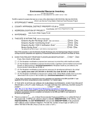
Case No.: (City use only) Environmental Resource Inventory For the City of Austin Related to LDC 25-8-121, City Code 30-5-121, ECM 1.3.0 & 1.10.0 The ERI is required for projects that meet one or more of the criteria listed in LDC 25-8-121(A), City Code 30-5-121(A). 1. SITE/PROJECT NAME: 2. COUNTY APPRAISAL DISTRICT PROPERTY ID (#’s): 3. ADDRESS/LOCATION OF PROJECT: 4. WATERSHED: 5. THIS SITE IS WITHIN THE (Check all that apply) Edwards Aquifer Recharge Zone* (See note below) .................. YES No Edwards Aquifer Contributing Zone*.................................. YES No Edwards Aquifer 1500 ft Verification Zone* ....................... YES No Barton Spring Zone* .......................................................... YES No *(as defined by the City of Austin – LDC 25-8-2 or City Code 30-5-2) Note: If the property is over the Edwards Aquifer Recharge zone, the Hydrogeologic Report and karst surveys must be completed and signed by a Professional Geoscientist Licensed in the State of Texas. 6. DOES THIS PROJECT PROPOSE FLOODPLAIN MODIFICATION?.......YES** NO If yes, then check all that apply: (1) The floodplain modifications proposed are necessary to protect the public health and safety; (2) The floodplain modifications proposed would provide a significant, demonstrable environmental benefit, as determined by a functional assessment of floodplain health as prescribed by the Environmental Criteria Manual (ECM), or (3) The floodplain modifications proposed are necessary for development allowed in the critical water quality zone under LDC 25-8-261 or 25-8-262, City Code 30-5-261 or 30-5-262. (4) The floodplain modifications proposed are outside of the Critical Water Quality Zone in an area determined to be in poor or fair condition by a functional assessment of floodplain health. ** If yes, then a functional assessment must be completed and attached to the ERI (see ECM 1.7 and Appendix X for forms and guidance) unless conditions 1 or 3 above apply. 7. IF THE SITE IS WITHIN AN URBAN OR SUBURBAN WATERSHED, DOES THIS PROJECT PROPOSE A UTILITY LINE PARALLEL TO AND WITHIN THE CRITICAL WATER QUALITY ZONE? ......................................................... YES*** NO ***If yes, then riparian restoration is required by LDC 25-8-261(E) or City Code 30-5-261(E) and a functional assessment must be completed and attached to the ERI (see ECM1.5 and Appendix X for forms and guidance). 8. There is a total of (#’s) Critical Environmental Feature(s)(CEFs) on or within150 feet of the project site. If CEF(s) are present, attach a detailed DESCRIPTION of the CEF(s), color PHOTOGRAPHS, the CEF WORKSHEET and provide DESCRIPTIONS of the proposed CEF buffer(s) and/or wetland mitigation. Provide the number of each type of CEFs on or within 150 feet of the site (Please provide the number of CEFs ): N/A - We are in the Water Supply Rural Watershed, not Urban or Suburban. (#’s) Spring(s)/Seep(s) (#’s) Point Recharge Feature(s) (#’s) Bluff(s) (#’s) Canyon Rimrock(s) (#’s) Wetland(s) Note: Standard buffers for CEFs are 150 feet, with a maximum of 300 feet for point recharge features. Except for wetlands, if the standard buffer is not provided, you must provide a written request for an administrative variance from LDC 25-8-281(C)(1) and provide written findings of fact to support your request. Request forms for administrative variances from requirements stated in LDC 25-8-281 are available from Watershed Protection Department. 9. The following site maps are attached at the end of this report (Check all that apply and provide): All ERI reports must include: Site Specific Geologic Map with 2-ft Topography Historic Aerial Photo of the Site Site Soil Map Critical Environmental Features and Well Location Map on current Aerial Photo with 2-ft Topography Only if present on site (Maps can be combined): Edwards Aquifer Recharge Zone with the 1500-ft Verification Zone (Only if site is over or within 1500 feet the recharge zone) Edwards Aquifer Contributing Zone Water Quality Transition Zone (WQTZ) Critical Water Quality Zone (CWQZ) City of Austin Fully Developed Floodplains for all water courses with up to 64-acres of drainage 10. HYDROGEOLOGIC REPORT – Provide a description of site soils, topography, and site specific geology below (Attach additional sheets if needed): Surface Soils on the project site is summarized in the table below and uses the SCS Hydrologic Soil Groups*. If there is more than one soil unit on the project site, show each soil unit on the site soils map. Soil Series Unit Names, Infiltration Characteristics & Thickness *Soil Hydrologic Groups Definitions (Abbreviated) Soil Series Unit Name & Subgroup** Group* Thickness (feet) A. Soils having a high infiltration rate when thoroughly wetted. B. Soils having a moderate infiltration rate when thoroughly wetted. C. Soils having a slow infiltration rate when thoroughly wetted. D. Soils having a very slow infiltration rate when thoroughly wetted. **Subgroup Classification – See Classification of Soil Series Table in County Soil Survey. WPD ERM ERI-2014-01 Page 2 of 6 (Attachment 9.1)(Attachment 9.2)(Attachment 9.3)(Attachment 9.4)(Attachment 9.5){{(Attachment 9.6)(Attachment 9.7)Please see Attachment 9.4 for CEF descriptions.Please see Attachment 9.4 for CEF descriptions. Description of Site Topography and Drainage (Attach additional sheets if needed): List surface geologic units below: Group Formation Member Geologic Units Exposed at Surface Brief description of site geology (Attach additional sheets if needed): Wells – Identify all recorded and unrecorded wells on site (test holes, monitoring, water, oil, unplugged, capped and/or abandoned wells, etc.): There are (#) wells present on the project site and the locations are shown and labeled (#’s)The wells are not in use and have been properly abandoned. (#’s)The wells are not in use and will be properly abandoned. (#’s)The wells are in use and comply with 16 TAC Chapter 76. There are (#’s) wells that are off-site and within 150 feet of this site. WPD ERM ERI-2014-01 Page 3 of 6 There are no wells within 150 feet of the project limits. See attachment 9.4 for location of wells onthe project property but farther than 150 feet from the project site. 11. THE VEGETATION REPORT – Provide the information requested below: Brief description of site plant communities (Attach additional sheets if needed): There is woodland community on site …………………….YES NO (Check one). If yes, list the dominant species below: Woodland species Common Name Scientific Name There is grassland/prairie/savanna on site……………..YES NO (Check one). If yes, list the dominant species below: Grassland/prairie/savanna species Common Name Scientific Name There is hydrophytic vegetation on site ………………..YES NO (Check one). If yes, list the dominant species in table below (next page): WPD ERM ERI-2014-01 Page 4 of 6 Hydrophytic plant species Common Name Scientific Name Wetland Indicator Status A tree survey of all trees with a diameter of at least eight inches measured four and one- half feet above natural grade level has been completed on the site. YES NO (Check one). 12. WASTEWATER REPORT – Provide the information requested below. On-site system(s) Wastewater for the site will be treated by (Check of that Apply): City of Austin Centralized sewage collection system Other Centralized collection system Note: All sites that receive water or wastewater service from the Austin Water Utility must comply with City Code Chapter 15-12 and wells must be registered with the City of Austin The site sewage collection system is designed and will be constructed to in accordance to all State, County and City standard specifications. YES NO (Check one). Calculations of the size of the drainfield or wastewater irrigation area(s) are attached at the end of this report or shown on the site plan. YES NO Not Applicable (Check one). Wastewater lines are proposed within the Critical Water Quality Zone? YES NO (Check one). If yes, then provide justification below: WPD ERM ERI-2014-01 Page 5 of 6 Not applicable. Is the project site is over the Edwards Aquifer? YES NO (Check one). If yes, then describe the wastewater disposal systems proposed for the site, its treatment level and effects on receiving watercourses or the Edwards Aquifer. 13. One (1) hard copy and one (1) electronic copy of the completed assessment have been provided. Date(s) ERI Field Assessment was performed: Date(s) My signature certifies that to the best of my knowledge, the responses on this form accurately reflect all information requested. Print Name Signature Telephone Email Address Name of Company Date For project sites within the Edwards Aquifer Recharge Zone, my signature and seal also certifies that I am a licensed Professional Geoscientist in the State of Texas as defined by ECM 1.12.3(A). P.G. Seal WPD ERM ERI-2014-01 Page 6 of 6 January 28, 2020 City of Austin Environmental Resource Inventory - Critical Environmental Feature Worksheet Project Name: Project Address: Site Visit Date: Environmental Resource Inventory Date: 1 2 3 4 9 5 6 7 8 Primary Contact Name: Phone Number: Prepared By: Email Address: FEATURE TYPE FEATURE ID {Wetland,Rimrock, Bluffs,Recharge FEATURE LONGITUDE (WGS 1984 in Meters) (WGS 1984 in Meters) FEATURE LATITUDE WETLAND DIMENSIONS (ft) RIMROCK/BLUFF DIMENSIONS (ft) Feature,Spring} coordinate notation coordinate notation X Y Length Avg Height X (eg S-1) RECHARGE FEATURE DIMENSIONS Y Z Trend Springs Est. Discharge cfs City of Austin Use Only CASE NUMBER: For rimrock, locate the midpoint of the segment that describes the feature. For wetlands, locate the approximate centroid of the feature and the estimated area. For a spring or seep, locate the source of groundwater that feeds a pool or stream. DMS DD YES NO Wetland Rimrock Recharge Feature Spring Seep Please state the method of coordinate data collection and the approximate precision and accuracy of the points and the unit of measurement. Method Accuracy GPS Surveyed Other sub-meter □ □ □ Professional Geologists apply seal below □ □ □ > 1 meter meter WPD ERM ERI-CEF-01 Page 7 of 8 January 28, 2020**City of Austin does not consider the depression identified during the site visit to be a recharge feature per the January 30, 2020 email from Minda Sarmiento.**See note below. ATTACHMENT 9.1 - SITE SPECIFIC GEOLOGIC MAP ÿÿÿÿÿÿÿÿÿÿÿÿÿÿ Dr LAKE A U S TIN ÿÿÿÿÿ ÿ ÿ ÿ ÿ Wa ÿ ÿ ÿ Kgru E L ÿ N S E T K A L L T T H A U A I I T K S N B E K I U E E R C E A E L u ll ÿ ÿ C i r ÿ ÿ H id d e n C v Lake s h ore ÿ ÿ ÿ ÿ ÿ ÿ ÿ ÿ ÿ ÿ ÿ ÿ ÿ ÿ ÿ ÿ ÿÿÿÿÿÿÿÿ ÿÿÿÿÿÿÿÿÿÿÿÿÿÿ ÿ ÿ ÿ ÿ ÿ ÿ ÿ ÿ ÿ ÿ ÿ ÿ ÿ ÿ ÿ ÿ ÿ ÿ ÿ ÿ ÿ ÿ ÿ ÿ ÿ ÿ ÿ ÿ ÿ ÿ ÿ ÿ ÿ ÿ ÿ ÿÿÿÿÿ TCEQ Edwards Aquifer Contributing Zone Depressed Area at Base of Rimrock Geologic Formation Boundary Baer-identified Rimrock Kfr 0 Geologic Formations Kfr: Fredericksburg Group Kgru: Upper Glen Rose Formation Qal: Quaternary alluvium Qt: Quaternary fluviatile terrace deposits Redbud Trl Wa: Water ÿÿ Geologic Fault Line TCEQ Edwards Aquifer Recharge Zone TBPE Firm No. F-3181 TBPG Firm No. 50030 Base Map: NAIP Aerial Imagery, 2016 TIN S U E A K A L Kfr Qal E K A D L Y BIR D A L Redbud Trl Qal L a k e A u s t i n B l v d Qt Kfr Kfr L A D Y B I R D L A K E FEMA 100-year Floodplain Project Area µ Feet 200 400 Baer Project No. 172081.01 Date: October 1, 2019 Site Geologic Map Ullrich Water Treatment Plant Low Service Pump Station Improvements 1000 Forest View Drive Austin, Texas 78746 January 28, 2020 December 16, 2019 Page 1 of 1Attachment 9.1 - USGS Texas Geology Area DescriptionUSGS Texas Geology describes this area as "Fredericksburg Group undivided, rock unit code Kfr.Edwards limestone, limestone, dolomite, and chert; limestone aphanitic to fine grained, massive tothin bedded, hard, brittle, in part rudistid blostromes, much miliolid biospraite; dolomite fine to veryfine grained, porous, medium gray to grayish brown; chert nodules and plates common, varies inamount from bed to bed, some intervals free of chert, mostly white to light gray; in zone ofweathering considerable recrystallized, "honeycombed," and cavernous forming an aquifer; formsflat areas and plateaus bordered by scarps; thickness 60-350 feet, things northward. Comanchepeak limestone, fine to very fined grained, fairly hard, nodular, light gray, weathers white,extensively burrowed, burrow fillings slightly coarser and darker, typically crops out in scarp facebeneath Edwards Limestone; thickness up to 80 feet, feathers out southward near WilliamsonTravis County line. Keys Valley Marl, soft, white; marine megafossils include Exogyra texana,Gryphaea mucronata, and other pelecypods, ammonites, gastropods, and echinoids; thickness upto 50 feet, feathers out southward near Williamson Travis County line. Cedar PArk Limestone, Kcp,lithologicvally and faunally similar to Comanche Peak Limestone; thickness 40 feet, south ofWilliamson Travis County line upper part interfingers with Edwards Limestone and lower part ismapped with Bee Cave Marl, Kbc, lithologically and faunally similar to Keys Valley Marl, exceptExogyra texana are more abundant and ammonites are scare; thickness 25-40 feet."Ullrich Pump Station – ERI Attachment ATTACHMENT 9.2 - HISTORIC AERIAL PHOTO OFTHE SITE Ullrich LSPS 2008 - Historical Aerial Legend Image CAPCOG Image CAPCOG Image CAPCOG ➤➤ N N 800 ft LEGENDPROJECTVICINITY ATTACHMENT 9.3 - SITE SOIL MAP W ' ' 9 2 ' 7 4 ° 7 9 30° 17' 51'' N Soil Map—Travis County, Texas (Ullrich LSPS - Soil Map) 616230 616300 616370 616440 616510 616580 616650 W ' ' 2 1 ' 7 4 ° 7 9 30° 17' 51'' N 0 7 3 2 5 3 3 0 0 3 2 5 3 3 0 3 2 2 5 3 3 0 6 1 2 5 3 3 0 9 0 2 5 3 3 0 2 0 2 5 3 3 0 5 9 1 5 3 3 0 8 8 1 5 3 3 0 1 8 1 5 3 3 0 7 3 2 5 3 3 0 0 3 2 5 3 3 0 3 2 2 5 3 3 0 6 1 2 5 3 3 0 9 0 2 5 3 3 0 2 0 2 5 3 3 0 5 9 1 5 3 3 0 8 8 1 5 3 3 0 1 8 1 5 3 3 616230 616300 616370 616440 616510 616580 616650 Soil Map may not be valid at this scale. 30° 17' 32'' N W ' ' 9 2 ' 7 4 ° 7 9 Map Scale: 1:2,850 if printed on A portrait (8.5" x 11") sheet. N 0 40 80 160 Feet Meters 240 0 Map projection: Web Mercator Corner coordinates: WGS84 Edge tics: UTM Zone 14N WGS84 200 400 600 100 30° 17' 32'' N W ' ' 2 1 ' 7 4 ° 7 9 Natural Resources Conservation Service Web Soil Survey National Cooperative Soil Survey 12/16/2019 Page 1 of 3 ATTACHMENT 9.4 - CEF AND WELL LOCATIONMAP Ullrich LSPS CEF and Well Location Map Legend © 2018 Google © 2018 Google © 2018 Google ➤➤ N N 700 ft January 28, 2020LEGENDWETLANDWETLAND CRITICALENVIRONMENTALFEATURE (W-1)APPROX. 3,500 SF OFDISTURBANCEWETLANDCRITICALENVIRONMENTALFEATURE (W-2)RIM ROCKCRITICALENVIRONMENTALFEATURETHIS RECHARGEFEATURE/DEPRESSIONIDENTIFIED IN THE FIELD ISNOT A CEF AS DEFINED BYCITY OF AUSTINWATERSHED PROTECTIONGEOLOGISTS. Ullrich Pump Station – ERI Attachment December 13, 2019 Page 1 of 3 CEF DESCRIPTIONS Baer Engineering conducted a field survey of the assessment area on August 28, 2019. The assessment area is defined as the project area plus a 150-ft buffer. Approximately five-tenths of an inch of rain were recorded near the project area in the week before commencement of the field surveys. No rain was recorded during field surveys. For wetland identification, Baer Engineering used the recommended routine method, outlined in the COA ECM Section 1.10.3. This method assumes adequate hydrology and hydric soils if the area under examination is dominated (over 50% vegetative cover) by Facultative-wet and/or Obligate plant species (as listed in the National List of Plant Species That Occur in Wetlands, South Plains, Region 6, U.S. Department of the Interior, Washington D.C.) and an abrupt boundary is evident between these Facultative-wet and/or Obligate plant community and the Upland plant communities. The wetlands described in this report met the criteria in the wetland delineation method described above. No official delineation was conducted and the dimensions provided in this report are estimates. Four (4) CEFs (two wetlands, one rimrock, & one recharge feature) were observed within the assessment area. The CEFs are described below. Wetland, W-1: This wetland was observed along the eastern edge of the assessment area, at the shore of the Colorado River. The river bank was dominated by bald cypress (Taxodium distichum, OBL), with some glossy privet (Ligustrum lucidum, UPL), green ash (Fraxinus pennsylvanica, FAC), and American sycamore (Platanus occidentalis, FAC). Jamaican sawgrass (Cladium mariscus, OBL) and taro (Colocasia esculenta, OBL) were observed beyond the fence line at the shore, but inaccessible. The wetland was approximately 5 to 60 feet wide, observed from the edge of the water, and approximately 250 feet long. Please see Photographs 1-2. Wetland, W-2: This wetland was observed northwest of the facility at the bank of the Colorado River, at the north end of the assessment area. Bald cypress, smallspike false nettle (Boehmeria cylindrica, FACW), and Emory sedge (Carex emoryii, FACW) dominated the area, along with some glossy privet and American sycamore. The wetland was approximately 15 feet wide from the edge of the water and 140 feet long following the shoreline. Please see Photographs 3-4. Rimrock, Ullrich Rimrock: Rimrock was observed at the center of the assessment area, northwest of the proposed roadway and southeast of the proposed work adjacent to the existing roadway. The rim rock extends northeast to southwest for approximately 430 feet. The estimated height of the rimrock is 30 feet from the base to the upper edge. Please see Photograph 5. Recharge Feature, Solution Recharge Feature: A recharge feature was observed within a depression that is approximately five to six feet below the nearby footpath surface and approximately three to four feet below the level of the nearby Colorado River. The depression contained several inches of leaf litter and detritus. The initial site visit was conducted after a rain event the evening before and little to no water was observed in the depression. Comparing the depression and rimrock discussed above to geologic maps of the area, these features appear to Ullrich Pump Station – ERI Attachment December 13, 2019 Page 2 of 3 correlate with a mapped fault depicted on the site. The feature was approximately 350 long, 20 feet wide, and 4 feet below the surrounding grade. Please see Photographs 5-6. VEGETATION REPORT BRIEF DESCRIPTION OF SITE PLANT COMMUNITIES: The Site is located in the U.S. EPA-defined Balcones Canyonlands ecoregion, described below: The Balcones Canyonlands are highly dissected through the erosion and solution of springs, streams, and rivers working both above and below ground; percolation through the porous limestone contributes to the recharge of the Edwards Aquifer. High gradient streams originating from springs in steep-sided canyons supply water for development on the Texas Blackland Prairies at the eastern base of the escarpment. This ecoregion supports a number of endemic plants and has a higher representation of deciduous woodland than elsewhere on the Edwards Plateau, with escarpment black cherry, Texas mountain-laurel, madrone, Lacey oak, bigtooth maple, and Carolina basswood. Some relicts of eastern swamp communities, such as baldcypress, American sycamore, and black willow, occur along major streamcourses. It is likely that these trees have persisted as relicts of moister, cooler climates following the Pleistocene glacial epoch. Toward the west, the vegetation changes gradually as the climate becomes more arid. Plateau live oak woodland is eventually restricted to north and east facing slopes and floodplains, and dry slopes are covered with open shrublands of juniper, sumac, sotol, acacia, honey mesquite, and ceniza. Vegetation within the project area was characterized by three habitat types: Juniper Woodland, Deciduous Floodplain Forest, and Mowed Grasses. The Juniper Woodland occupied the upland portions of the project area adjacent to the driveway. Canopy cover was mostly dense, with some open grassy areas on the eastern side. Trees were predominantly ashe juniper (Juniperus ashei) with some cedar elm (Ulmus crassifolia) and live oak (Quercus fusiformis). The moderately dense midstory included Texas persimmon (Diospyrus texana), Texas mountain laurel (Sephora secundaflora), agarita (Mahonia trifoliolata), yaupon (Ilex vomitoria), and elbowbush (Forestiera pubescens). Shrubby boneset (Ageratina havanensis) and cedar sedge (Carex planostachys) dominated the wooded understory. The grassy opening vegetation predominantly consisted of silver bluestem (Bothriochloa laguroides), doveweed (Croton monanthaginus), prairie coneflower (Ratibida columnifera), and other grasses and forbs as groundcover. Additionally, evergreen and flameleaf sumac (Rhus virens, Rhus lanceolata) and Texas kidneywood (Eysenhardtia texana) grew as a midstory with some prickly pear species (Opuntia sp.). Please see Photographs 7-9. The Deciduous Floodplain Forest was observed below the bluff, east of the paved driveway. Canopy cover was dense, with cottonwood (Populus deltoides), bald cypress, American sycamore, and glossy privet as overstory. Smaller woody vegetation included ash species (Fraxinus sp.) and chinaberry (Melia azedarach), with some groundcover from poison ivy (Toxicodendron radicans), frostweed (Verbesina virginica), and Virginia wild rye (Elymus virginicus). The understory vegetation had relatively low density. The previously- Ullrich Pump Station – ERI Attachment December 13, 2019 Page 3 of 3 described wetlands occurred along the river bank on the edges of this habitat. Please see Photograph 10. Mowed Grasses were observed along the paved driveway within the project area. Identifiable grasses included silver bluestem and perennial rye (Lolium perenne), and forbs included lemon beebalm (Monarda citriodora), tie vine (Ipomoea cordatotriloba), western ragweed (Ambrosia psilostachya), Indian Blanket (Gaillardia pulchella), marestail weed (Erigeron canadensis), as well as plants as found in the wooded openings in the Juniper Woodland, described above. Please see Photograph 11. Photograph 1: Wetland W-1 – A view of the wetland, dominated by bald cypress along the bank of the Colorado River. Photograph 2: Wetland W-1 – Photo through perimeter fence of taro at river bank. ERI Photolog Page 1 of 6 Photograph 3: Wetland W-2 – Wetland observed on northern side of assessment area along bank of the Colorado River, outside of perimeter fence. Bald cypress and American sycamore can be seen. Photograph 4: Wetland W-2 – View of wetland vegetation at the river bank outside of perimeter fence, including sedges and shortspike false nettle. ERI Photolog Page 2 of 6 Photograph 5: Ullrich Rimrock, Solution Recharge Feature – This depression was observed east of the paved driveway and at the foot of the rimrock. Rimrock Depressed area recharge feature adjacent to the rimrock Photograph 6: Ullrich Rimrock, Solution Recharge Feature – The figure below depicts the location of the feature in blue. ERI Photolog Page 3 of 6 Photograph 7: Example of Juniper Woodland, west of paved driveway. Photograph 8: Example of Juniper Woodland, east of paved driveway and above floodplain bluff. ERI Photolog Page 4 of 6 Photograph 9: Grassy opening in Juniper Woodland, east of paved driveway. Photograph 10: Example of Deciduous Floodplain Forest between the river bank and Ullrich Rimrock. ERI Photolog Page 5 of 6 Photograph 11: Example of Mowed Grasses along paved driveway. ERI Photolog Page 6 of 6 ATTACHMENT 9.5 - EDWARDS AQUIFERRECHARGE AND CONTRIBUTING ZONES MAP Legend Jurisdiction FULL PURPOSE LIMITED PURPOSE EXTRATERRITORIAL JURISDICTION 2 MILE ETJ AGRICULTURAL AGREEMENT OTHER CITY LIMITS OTHER CITIES ETJ Edwards Aquifer Recharge Zone Edwards Aquifer Recharge Verification Zone Edwards Aquifer Contributing Zone 0.2 10/23/2018 NAD_1983_StatePlane_Texas_Central_FIPS_4203_Feet 0 0.08 0.2 Miles This product is for informational purposes and may not have been prepared for or be suitable for legal, engineering, or surveying purposes. It does not represent an on-the-ground survey. This product has been produced by the City of Austin for the sole purpose of geographic reference. No warranty is made by the City of Austin regarding specific accuracy or completeness. 1: 4,800 Notes Edwards Aquifer Recharge Zone, Contributing Zone, and Verification Zone Edwards Aquifer RechargeZoneEdwards Aquifer Recharge Verification ZoneEdwards Aquifer ContributingZone Edwards AquiferRecharge ZoneThis project is entirely in the EdwardsAquifer Recharge Zone. The Contributingand Verification Zones are outside of projectlimits.Ullrich LSPSProject VicinityEdwards Aquifer RechargeVerification Zone (Colorado River) ATTACHMENT 9.6 - WQTZ AND CWQZ MAP Legend Jurisdiction FULL PURPOSE LIMITED PURPOSE EXTRATERRITORIAL JURISDICTION 2 MILE ETJ AGRICULTURAL AGREEMENT OTHER CITY LIMITS OTHER CITIES ETJ Creek Buffers/Waterway Setbacks Critical Water Quality Zone Water Quality Transition Zone 0.2 11/6/2018 NAD_1983_StatePlane_Texas_Central_FIPS_4203_Feet 0 0.08 0.2 Miles This product is for informational purposes and may not have been prepared for or be suitable for legal, engineering, or surveying purposes. It does not represent an on-the-ground survey. This product has been produced by the City of Austin for the sole purpose of geographic reference. No warranty is made by the City of Austin regarding specific accuracy or completeness. 1: 4,800 Notes CWQZ and WQTZ Critical Water Quality ZoneCritical Water QualityTransition ZoneThis project is in the CWQZ and CWTZ.Ullrich LSPSProject Vicinity ATTACHMENT 9.7 - CITY OF AUSTIN FULLYDEVELOPED FLOODPLAINS MAP City of Austin FloodPro Map FEMA Floodplain 100 Year (Detailed-AE) 100 year (Shallow-AO) 100 Year (Approx-A) X Protected by Levee 500 Year This custom map was created with FloodPro and is for informational purposes only. It is not intended for or suitable for legal, engineering, or surveying purposes. It does not represent on-the-ground survey and represents only the approximate relative locations of property boundaries. No warranty is made by the City of Austin regarding the specific accuracy or completeness of the map. Final determination of floodplain status for a property must be based on topographic survey by a Texas registered professional. For regulatory purposes, floodplain elevations must be determined from an engineering model created in accordance with the Drainage Criteria Manual and approved by the City of Austin. 0 793 1,586 Feet Prepared: 12/18/2019 100-Year (Flood Zone AE)100-Year(FloodZone A)City of AustinFully Developed100-YearFloodplain500-year FloodplainProject Vicinity Case No.: ______________________ (City use only) Environmental Resource Inventory For the City of Austin Related to LDC 25-8-121, City Code 30-5-121, ECM 1.3.0 & 1.10.0 The ERI is required for projects that meet one or more of the criteria listed in LDC 25-8-121(A), City Code 30-5-121(A). 1. SITE/PROJECT NAME: Ullrich Water Treatment Plant - Process Drain and Support Systems Improvements Project 2. COUNTY APPRAISAL DISTRICT PROPERTY ID (#’S): 114928 3. ADDRESS/LOCATION OF PROJECT: 1000 Forest View Drive, Austin Texas, 78746. 4. WATERSHED: Little Bee Creek and Lady Bird Lake watersheds. 5. THIS SITE IS WITHIN THE (Check all that apply) Edwards Aquifer Recharge Zone* (See note below) ..................... ☒ Yes ☐ No Edwards Aquifer Contributing Zone* ........................................ ☐ Yes ☒ No Edwards Aquifer 1500 ft Verification Zone* .............................. ☒ Yes ☐ No Barton Spring Zone* ................................................................ ☐ Yes ☒ No *(as defined by the City of Austin – LDC 25-8-2 or City Code 30-5-2) Note: If the property is over the Edwards Aquifer Recharge zone, the Hydrogeologic Report and karst surveys must be completed and signed by a Professional Geoscientist Licensed in the State of Texas. 6. DOES THIS PROJECT PROPOSE FLOODPLAIN MODIFICATION?...... ☐ YES** ☒ NO If yes, then check all that apply: ☐ (1) The floodplain modifications proposed are necessary to protect the public health and safety; ☐ (2) The floodplain modifications proposed would provide a significant, demonstrable environmental benefit, as determined by a functional assessment of floodplain health as prescribed by the Environmental Criteria Manual (ECM), or ☐ (3) The floodplain modifications proposed are necessary for development allowed in the critical water quality zone under LDC 25-8-261 or 25-8-262, City Code 30-5-261 or 30-5-262. ☐ (4) The floodplain modifications proposed are outside of the Critical Water Quality zone in an area determined to be in poor or fair condition by a functional assessment of floodplain health. ** If yes, then a functional assessment must be completed and attached to the ERI (see ECM 1.7 and Appendix X for forms and guidance) unless conditions 1 or 3 above apply. 7. IF THE SITE IS WITHIN AN URBAN OR SUBURBAN WATERSHED, DOES THIS PROJECT PROPOSE A UTILITY LINE PARALLEL TO AND WITHIN THE CRITICAL WATER QUALITY ZONE? ....................................................... ☐ YES*** ☒ NO ***If yes, then riparian restoration is required by LDC 25-8-261€ or City Code 30-5-261€ and a functional assessment must be completed and attached to the ERI (see ECM1.5 and Appendix X for forms and guidance). 8. There is a total of 1 (#’s) Critical Environmental Feature(s)(CEFs) on or within 150 feet of the project site. If CEF(s) are present, attach a detailed DESCRIPTION of the CEF(s), color PHOTOGRAPHS, the CEF WORKSHEET and provide DESCRIPTIONS of the proposed CEF buffer(s) and/or wetland mitigation. Provide the number of each type of CEFs on or within 150 feet of the site (Please provide the number of CEFs): ___ (#’s) Spring(s)/Seep(s) (#’s) Point Recharge Feature(s) ____ (#’s) Bluff(s) ___ (#’s) Canyon Rimrock(s) (#’s) Wetland(s) _1 Note: Standard buffers for CEFs are 150 feet, with a maximum of 300 feet for point recharge features. Except for wetlands, if the standard buffer is not provided, you must provide a written request for an administrative variance from LDC 25-8-281(C)(1) and provide written findings of fact to support your request. Request forms for administrative variances from requirements stated in LDC 25-8-281 are available from Watershed Protection Department. CEF Descriptions and Buffer Mitigation: Baer Engineering conducted a CEF field survey of the assessment area on March 30, 2017, and a karst survey of the site on October 26, 2018. No CEFs were identified during the 2017 survey. One karst recharge feature (sinkhole) CEF was identified during the karst survey on October 19, 2018. Please refer to Figure 4 for the location of the sinkhole. Karst Recharge Feature SH-1, Sinkhole -- SH-1 is a sinkhole located between the facility’s western perimeter drive and western fence. It is roughly nine feet by 10 feet and two feet deep. There are a large number of small trees, shrubs and saplings growing out of the soil floor. Hand excavation encountered soft, aerated clayey soil, but no openings or airflow. A berm has been constructed on the south and topographically up-gradient side of the feature to divert surface water runoff. The east side, along the road, has also been engineered to prevent inflow of surface runoff, with rectangular blocks set in concrete bolstering the east side. Beneath the berm and blocks, Edwards Limestone is visible in the sinkhole walls. The interpreted karst origin of this feature suggests a high probability of rapid infiltration. The soil fill and the reinforced berm around the sinkhole creates a very small catchment area, to Photographs 1 through 3. Recommendation: Impacts to this CEF should be avoided. The project design does not include ground disturbance within 150 feet of SH-1. Existing controls are in place to prevent overland flow from entering the recharge feature. During construction, surface runoff should be watched to check that the existing controls are adequate to protect this CEF. infiltration. Please refer limiting the 9. The following site maps are attached at the end of this report (Check all that apply and provide): All ERI reports must include: ☒ Site Specific Geologic Map with 2-ft Topography – Figure 1 ☒ Historic Aerial Photograph of the Site – Figure 2 ☒ Site Soil Map – Figure 3 ☒ Critical Environmental Features and Well Location Map on current Aerial Photograph with 2-ft Topography – Figure 4 Only if present on site (Maps can be combined): ☒ Edwards Aquifer Recharge Zone with the 1500-ft Verification Zone – Figure 5 WPD ERM ERI-2014-01 Page 2 of 9 (Only if site is over or within 1500 feet the recharge zone) ☐ Edwards Aquifer Contributing Zone ☒ Water Quality Transition Zone (WQTZ) – Figure 5 ☒ Critical Water Quality Zone (CWQZ) – Figure 5 ☒ City of Austin Fully Developed Floodplains for all water courses with up to 64-acres of drainage – Figure 5 10. HYDROGEOLOGIC REPORT – Provide a description of site soils, topography, and site- specific geology below (Attach additional sheets if needed): Surface Soils on the project site are summarized in the table below, using the Soil Conservation Service (SCS) Hydrologic Soil Groups*. If there is more than one soil unit on the project site, show each soil unit on the site soils map. Soil Series Unit Names, Infiltration Characteristics & Thickness Soil Series Unit Name & Subgroup** Group* Thickness (feet) Approximate Percentage of Tarrant soils and Urban land, 0-2% slopes (TeA) Tarrant soils and Urban land, 5-18% slopes (TeE) D D <1 <1 Site 63.5 36.5 *Soil Hydrologic Groups Definitions (Abbreviated) thoroughly wetted. A. Soils having a high infiltration rate when According to the Natural Resources Conservation Service (NRCS) Web Soil Survey, the native soils mapped in the project area consist of four soil groups, listed above. The soil series descriptions for these soils, as defined in the SCS Travis County Soil Survey, are provided below (USDA 1974). Tarrant soils and Urban land, 0 to 2 percent slopes (TeA): This undifferentiated group occupies long, broad ridges. It consists of about 75 percent Tarrant soils, about 20 percent Urban land, and about 5 percent other soils. Undisturbed areas of Tarrant soils have an 8-inch thick surface layer of dark grayish-brown clay or clay loam. The underlying material is limestone. Stones are on the surface and in the soil. Citations for this Section: NRCS (Natural Resources Conservation Service), 2017, Web Soil Survey. Available online at the C. Soils having a slow infiltration rate when thoroughly wetted. thoroughly wetted. thoroughly wetted. D. Soils having a very slow infiltration rate when B. Soils having a moderate infiltration rate when **Subgroup Classification – See Classification of Soil Series Table in County Soil Survey. following url: https://websoilsurvey.sc.egov.usda.gov/ . Accessed 11/8/2018. USDA (United States Department of Agriculture) Soil Conservation Service, 1974, Soil Survey of Travis County. U.S. Government Printing Office. Washington D.C. Description of Site Topography and Drainage (Attach additional sheets if needed): The following sub-sections provide site-specific summaries of existing geologic and hydrologic conditions, including topography, bedrock type, structural geology, surface water, and floodplains. Information was gathered from desktop research, site assessment, and various maps. Photographs 3 through 9 illustrate the topography of the project area. WPD ERM ERI-2014-01 Page 3 of 9 According to the COA Property Profile GIS Viewer 2017 Contour Layer, the elevation within the project area ranges from approximately 720 feet above mean sea level (AMSL) at the southern property boundary adjacent to Rocky River Road, to 610 feet AMSL at the northwest end of the property at Little Bee Creek, and at the northeast end of the property at the corner of Redbud Trail and Forest View Drive. The project area occupies a ridge trending approximately 45 degrees east of north, sloping to the northwest toward Little Bee Creek and Southeast toward an unnamed tributary to Lady Bird Lake. Drainage from the western portion of the facility enters the stormwater collection system through a series of curb and grate inlets, and is discharged on the northwest side of the property through a concrete outfall which drains to Little Bee Creek. Drainage from the eastern portion of the facility passes through a sedimentation pond in the northeast quadrant of the facility, and is discharged to the east beneath Forest View Drive to the unnamed tributary to Lady Bird Lake. The northwest portion of the project area is located in the Little Bee Creek watershed, which is classified by the COA as a Water Supply Rural regulation area. The southeast portion of the project area is in the Lady Bird Lake watershed, which is classified by the COA as Water Supply Suburban. The north western corner of the property intersects the COA-defined Critical Water Quality Zone (CWQZ) and Water Quality Transition Zone of Little Bee Creek. The entire project area is with the COA-defined Edwards Aquifer Recharge Zone (EARZ) and Edwards Aquifer Verification Zone (EAVZ), and the Texas Commission on Environmental Quality (TCEQ) EARZ. The extents of these zones are shown in Figure 5, attached. Citation for this Section: City of Austin. 2019. Property Profile GIS Viewer, 2017 Contours. Site Accessed on 7/29/2019. http://www.austintexas.gov/gis/propertyprofile/ Brief description of site geology (Attach additional sheets if needed): According to the University of Texas at Austin, Bureau of Economic Geology (BEG), Geologic Atlas of Texas (GAT), Austin Sheet, the entire property is within the EARZ and EAVZ, and lies above rocks of the Upper Cretaceous age Edwards Limestone (Ked), bounded by normal faults associated with the Balcones Fault zone to the northwest and southeast. To the northwest of the property beyond the fault is limestone of the Glen Rose Formation (Kgr), which is part of the Edwards Aquifer Contributing Zone. Down-dropped blocks to the southeast of the property include outcrops of the Georgetown Formation (Kgt). The GAT description of the surface geologic unit is below: Edwards Limestone (Ked): A limestone, dolomite, and chert; limestone aphanitic to fine grained, massive to thin bedded, hard, brittle, in part rudistid biostromes, much miliolid biosparite; dolomite fine to very fine grained, porous, medium gray to grayish brown; chert, nodules and plates common, varies in amount from bed to bed, some intervals free of chert, mostly white to light gray; in zone of weathering considerably recrystallized, “honeycombed,” and cavernous forming an aquifer; forms flat areas and plateaus bordered by scarps; thickness 60-350 feet, thins northward. Citation for this Section: Bureau of Economic Geology. 1974. Geologic Atlas of Texas, Austin Sheet; Bureau of Economic Geology. The University of Texas at Austin. Wells – Identify all recorded and unrecorded wells on site (test holes, monitoring, water, oil, unplugged, capped and/or abandoned wells, etc.): WPD ERM ERI-2014-01 Page 4 of 9 There are __0_ (#) wells present on the project site and the locations are shown and labeled ____ (#’s) The wells are not in use and have been properly abandoned. ____ (#’s) The wells are not in use and will be properly abandoned. ____ (#’s) The wells are in use and comply with 16 TAC Chapter 76. There are __0 (#’s) wells that are off-site and within 150 feet of this site. 11. THE VEGETATION REPORT – Provide the information requested below: Brief description of site plant communities (Attach additional sheets if needed): The project area is within the U.S. EPA defined Edwards Plateau Region. This region comprises an area of central Texas commonly known as the Texas Hill Country. Soils of the Edwards Plateau are usually shallow with a variety of surface textures. They are underlain by limestone. Several river systems dissect the surface, creating a rough and well- drained landscape. The limestone of the Edward's Plateau is honeycombed with many caves. Beneath the eastern edge of the Plateau lies the Edwards Aquifer. The Edwards Plateau is characterized by grasslands, juniper/oak woodlands, and plateau live oak or mesquite savannah. Average annual rainfall ranges from 15 to 34 inches. Rainfall is highest in May or June and September. Elevations range from slightly less than 100 feet to over 3,000 feet above sea level. The project site and surrounding study area are characterized by two distinct habitat types: Mowed Grassland/Landscaping and Juniper Oak Woodland. The Mowed Grassland/Landscaping consisted of landscaped grasslands dominated by bermudagrass, manicured, with stand-alone trees. Some landscaped areas included such species as eastern gamagrass (Tripsacum dactyloides), bluebonnets (Lupinus texensis), horseherb (Calyptocarpus vialis), King Ranch Bluestem (Bothriochloa ischaemum), other herbaceous groundcover, and clusters of live oak (Quercus fusiformis), hackberry (Celtis laevigata), Chinaberry (Melia azedarach), and other trees. Some areas between the mowed landscape and the Juniper Oak Woodland are filled with grasses and other herbaceous plants not consistently mowed and left to grow more wildly. Please refer to Photographs 4-6. The Juniper Oak Woodland is dominated by ash juniper (Juniperus ashei), live oak, hackberry, Texas red oak (Quercus buckleyi), and Yaupon (Ilex vomitoria). The woodland also contains an understory that presents bare rock and soil, filled with Ligustrum (Ligustrum japonicum), mountain laurel (Sephora secundaflora), Virginia creeper (Parthenocissus quinquefolia), as well as some bunchgrasses. Please refer to Photograph 6-8. There is woodland community on site ....................................... ☒ Yes ☐ No (Check one). If yes, list the dominant species below: Woodland species Common Name Scientific Name Ashe Juniper Black Willow Bradford pear Chinaberry Juniperus ashei Salix nigra Pyrus calleryana Melia azedarach WPD ERM ERI-2014-01 Page 5 of 9 There is grassland/prairie/savanna on site ............................... ☒ Yes ☐ No (Check one). If yes, list the dominant species below: Grassland/prairie/savanna species Common Name Woodland species Common Name Scientific Name Chinese tallow Hackberry Ligustrum Live oak Mountain Laurel Pecan Pencil cactus Post oak Redbud Sycamore Texas Red Oak Yaupon Bedstraw Beeblossom Bermudagrass Bluebonnet Brown-eyed Susan Coreopsis Crossvine Dandelion Dewberry Eastern gamagrass Hedge parsley Horseherb Johnson Grass King Ranch Bluestem Lemon Mint Peppervine Prairie verbena Prickly pear Primrose Silver bluestem Silver-leaf nightshade Switchgrass Virginia Creeper Winecup Triadica sebifera Celtis laevigata Ligustrum japonicum Quercus fusiformis Sephora secundaflora Carya illinoinensis Euphorbia tirucalli Quercus stellata Cercis canadensis Platanus occidentalis Quercus buckleyi Ilex vomitoria Scientific Name Galium sp. Guara sp. Cynodon dactylon Lupinus texensis Rudbeckia hirta Coreopsis spp. Bignonia capreolata Pyrrhopappus multicaulis Rubus trivialis Tripsacum dactyloides Torillis arvensis Calyptocarpus vialis Sorghum halepense Bothriochloa ischaemum Monarda citriodora Nekemias arborea Glandularia bipinnatifida Opuntia sp. Calylophus spp. Bothriochloa laguroides Solanum elaeagnifolium Panicum virgatum Parthenocissus quinquefolia Callirhoe involucrata There is hydrophytic vegetation on site..................................... ☐ Yes ☒ No (Check one). If yes, list the dominant species below: Hydrophytic plant species WPD ERM ERI-2014-01 Page 6 of 9 Common Name Scientific Name Wetland Indicator Status No wetland vegetation was observed during field reconnaissance. A tree survey of all trees with a diameter of at least eight inches measured four and one- half feet above natural grade level has been completed on the site. ☒ YES ☐ NO (Check one). 12. WASTEWATER REPORT – Provide the information requested below. Wastewater for the site will be treated by (Check all that apply): ☐ On-site system(s) ☒ City of Austin Centralized sewage collection system ☐ Other Centralized collection system Note: All sites that receive water or wastewater service from the Austin Water Utility must comply with City Code Chapter 15-12 and wells must be registered with the City of Austin The site sewage collection system is designed and will be constructed to in accordance to all State, County and City standard specifications. ☒ YES ☐ NO (Check one). Calculations of the size of the drain field or wastewater irrigations area(s) are attached at the end of this report or shown on the site plan. ☐ YES ☐ NO ☒ Not Applicable (Check one). Wastewater lines are proposed within the Critical Water Quality Zone? ☐ YES ☒ NO (Check one). If yes, then provide justification below: Is the project site over the Edwards Aquifer? ☒ YES ☐ NO (Check one). If yes, then describe the wastewater disposal systems proposed for the site, its treatment level and effects on receiving watercourses or the Edwards Aquifer. Wastewater from this facility is transported through the COA sanitary sewer system and treated at a COA wastewater treatment plant. 13. One (1) hard copy and one (1) electronic copy of the completed assessment have been provided. Date(s) ERI Field Assessment was performed: June 30, 2017; Karst survey performed on October 26, 2018 WPD ERM ERI-2014-01 Page 7 of 9 My signature certifies that to the best of my knowledge, the responses on this form accurately reflect all information requested. Michael Macicak, PG (TX4181) Print Name Signature Baer Engineering and Environmental Consulting, Inc. 8/6/2019 Name of Company For project sites within the Edwards Aquifer Recharge Zone, my signature and seal also certifies that I am licensed Professional Geoscientist in the State of Texas as defined by ECM 1.12.4(A). mmacicak@baereng.com Email address 512-453-3733 Telephone Date P.G. Seal WPD ERM ERI-2014-01 Page 8 of 9 1 2 3 4 9 Albert H. Ullrich Water Treatment Plant – Process Efficiency and Rehabilitation 1000 Forest View Drive, Austin Texas, 78741 March 30, 2017; October 19, 2018 August 6, 2019 Critical Environmental Feature Worksheet 5 6 7 8 Primary Contact Name: Phone Number: Prepared By: Email Address: WETLAND DIMENSIONS Michael Macicak, PG 512-453-3733 Michael Macicak, PG mmacicak@baereng.com FEATURE ID (eg S-1) in Meters) in Meters) (ft) FEATURE LONGITUDE (WGS 1984 FEATURE LATITUDE (WGS 1984 RIMROCK/BLUFF DIMENSIONS (ft) RECHARGE FEATURE DIMENSIONS Springs Est. Discharge Coordinate notation Coordinate notation X Y Length Avg Height x y z Trend cfs Project Name: Project Address: Site Visit Date: Environmental Resource Inventory Date: FEATURE TYPE {Wetland, Rimrock, Bluffs, Recharge Feature, Spring} Recharge Feature SH-1 (Photograph log Photographs 1, 2 and 3) -97.7944 DD 30.28977 DD 9 10 2 Please state the method of coordinate data collection and the approximate precision and accuracy of the points and the unit of measurement. Method Accuracy GPS ☒ sub-meter ☐ Surveyed ☐ meter Other ☐ >meter ☒ ☐ Professional Geologists apply seal below City of Austin Use Only CASE NUMBER: Black and Veatch, Inc: 162071-8i.020 Ullrich Water Treatment Plant – Process Drain and Support Systems Improvements August 6, 2019 Photograph Log Page 1 Photograph #1 A view of Sinkhole, SH-1. This karst recharge feature lies between the paved perimeter road and the perimeter fence on the southwest edge of the facility. A berm has been constructed on the topographical up-gradient side of the sinkhole to prevent overland flow from entering the feature. The photographer is facing northwest. Photograph #2 Additional view of SH-1. This view shows the topographical up-gradient berm on the left, the curb along the roadway, and blocks set in concrete between the curb and the sinkhole, to prevent overland flow from entering the feature. The photographer is facing southwest. Baer Engineering and Environmental Consulting, Inc. Black and Veatch, Inc: 162071-8i.020 Ullrich Water Treatment Plant – Process Drain and Support Systems Improvements August 6, 2019 Photograph Log Page 2 Photograph #3 The northeast wall of Sinkhole SH-1 is shown with concrete reinforcement above Edwards Limestone bedrock. The photographer is facing east. Photograph #4 A view of Mowed Landscape on project site. This shows manicured grasses and stand-alone trees. Baer Engineering and Environmental Consulting, Inc. Black and Veatch, Inc: 162071-8i.020 Ullrich Water Treatment Plant – Process Drain and Support Systems Improvements August 6, 2019 Photograph Log Page 3 Photograph #5 Another view of Mowed Landscape with clusters of stand-alone trees. Photograph #6 This is a view of the edge between the Juniper Oak Woodland and the wild grown landscape. Baer Engineering and Environmental Consulting, Inc. Black and Veatch, Inc: 162071-8i.020 Ullrich Water Treatment Plant – Process Drain and Support Systems Improvements August 6, 2019 Photograph Log Page 4 Photograph #7 A view of the Juniper Oak Woodland on the edges of the project site. Photograph #8 A view of the understory of the Juniper Oak Woodland. This shows the bare ground, as well as some of the plant growth underneath the canopy. Baer Engineering and Environmental Consulting, Inc. Geologic Formations Key: Kbu: Buda Limestone Ked: Edwards Limestone Kdr: Del Rio Clay Kgr: Glen Rose Formation Kgt: Georgetown Formation Kgr Laurel Valley R d e D r k s tl a e W K E E R C E E B E L T T L I Ked Redbud Trl Forest View Dr C e d a r P a r k D r r D k e e r C k c o R Kgt d y River R ock R ST1 ¨§¦35 Austin Project Location £¤290 ST1 ¨§¦35 £¤183 ST71 O a k R id g e D r COA Elevation Contour (2-ft) Geologic Formation Boundary Project Boundary Assessment Area (150-ft) µ Feet 0 150 300 Baer Project No. 162071.02 Date: July 29, 2019 TBPE Firm No. F-3181 TBPG Firm No. 50030 Base Map: NAIP Aerial Imagery, 2016 Kgt Kdr Kbu Figure 1 Site Specific Geology with 2-ft Topography Ullrich Water Treatment Plant Process Efficiency and Rehabilitation Laurel Valle y R d e D r k s tl a e W K E E R C E E B L ITT L E Redbud Trl Forest View Dr d y River R ock R O a k Rid g e Dr C e d a r P a r k D r r D k e e r C k c o R Project Boundary Assessment Area (150-ft) µ Feet 0 150 300 Baer Project No. 162071.02 Date: July 30, 2019 TBPE Firm No. F-3181 TBPG Firm No. 50030 Base Map: 1996 Austin West SE Figure 2 Historic Aerial Photograph Ullrich Water Treatment Plant Process Efficiency and Rehabilitation UuE BrF e D r k s tl a e W Laurel Valley R d UuE TeE TeA Travis County Soils: BrF: Brackett soils and Urban land, 12 to 30% slopes GP: Pits, gravel, 1 to 90% slopes TeA: Tarrant soils and Urban land, 0 to 2% slopes TeE: Tarrant soils and Urban land, 5 to 18% slopes TeF: Tarrant soils and Urban land, 18 to 40% slopes UuE: Urban land and Brackett soils, 1 to 12% slopes TeF K E E R C E E B E L T T L I TeA GP Redbud Trl UuE Forest View Dr TeE TeE d y River R ock R TeA C e d a r P a r k D r r D k e e r C k c o R O a k Rid g e Dr BrF Travis County Soils Project Boundary Assessment Area (150-ft) µ Feet 0 150 300 Baer Project No. 162071.02 Date: July 29, 2019 TBPE Firm No. F-3181 TBPG Firm No. 50030 Base Map: NAIP Aerial Imagery, 2016 Figure 3 Travis County Soils Ullrich Water Treatment Plant Process Efficiency and Rehabilitation Laurel Valle y R d e D r k s tl a e W %L SH-1 &( K E E R C E E B E L T T L I d y River R ock R O a k Rid g e Dr C e d a r P a r k D r r D k e e r C k c o R Redbud Trl Forest View Dr &( Texas Water Development Board Well %L Baer-identified Sinkhole CEF (SH-#) COA Elevation Contour (2-ft) Project Boundary Assessment Area (150-ft) µ Feet 0 150 300 Baer Project No. 162071.02 Date: July 29, 2019 TBPE Firm No. F-3181 TBPG Firm No. 50030 Base Map: NAIP Aerial Imagery, 2016 Figure 4 Critical Environmental Features and Well Locations with 2-ft Topography Ullrich Water Treatment Plant Process Efficiency and Rehabilitation Laurel Valle y R d e D r k s tl a e W K E E R C E E B L ITT L E Redbud Trl Forest View Dr d y River R ock R O a k Rid g e Dr C e d a r P a r k D r r D k e e r C k c o R The entire project area/map is located within the Edwards Aquifer Verification Zone. COA Edwards Aquifer Recharge Zone Critical Water Quality Zone Water Quality Transition Zone FEMA 100-year Floodplain FEMA 500-year Floodplain (Interim Atlas 14) µ Feet 0 150 300 Baer Project No. 162071.02 Date: August 2, 2019 Project Boundary Assessment Area (150-ft) TBPE Firm No. F-3181 TBPG Firm No. 50030 Base Map: NAIP Aerial Imagery, 2016 Figure 5 Water Quality Zones, Floodplain, and Edwards Aquifer Ullrich Water Treatment Plant Process Efficiency and Rehabilitation