20200902-002a: Common Variance Requests Conditions Table — original pdf
Backup
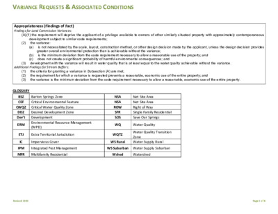
VARIANCE REQUESTS & ASSOCIATED CONDITIONS Appropriateness (Findings of Fact) Findings for Land Commission Variances: (2) development subject to similar code requirements; the variance: (a) (A)(1) the requirement will deprive the applicant of a privilege available to owners of other similarly situated property with approximately contemporaneous is not necessitated by the scale, layout, construction method, or other design decision made by the applicant, unless the design decision provides greater overall environmental protection than is achievable without the variance; is the minimum deviation from the code requirement necessary to allow a reasonable use of the property; and (b) (c) does not create a significant probability of harmful environmental consequences; and (3) development with the variance will result in water quality that is at least equal to the water quality achievable without the variance. Additional Findings for Stream Buffers: (1) (2) (3) the criteria for granting a variance in Subsection (A) are met; the requirement for which a variance is requested prevents a reasonable, economic use of the entire property; and the variance is the minimum deviation from the code requirement necessary to allow a reasonable, economic use of the entire property. GLOSSARY BSZ CEF CWQZ DDZ Dev’t ERM Barton Springs Zone Critical Environmental Feature Critical Water Quality Zone Desired Development Zone Development Environmental Resource Management (WPD) ETJ Extra Territorial Jurisdiction IC Impervious Cover NSA NSA ROW SFR SOS WQ Net Site Area Net Site Area Right of Way Single Family Residential Save Our Springs Water Quality WQTZ WS Rural Water Quality Transition Zone Water Supply Rural IPM Integrated Pest Management WS Suburban Water Supply Suburban MFR Multifamily Residential Wshed Watershed Revised 2020 Page 1 of 4 VARIANCE REQUESTS & ASSOCIATED CONDITIONS Structural containment (retaining walls) – REQUIRED Similar to Cut & Fill Code Requirements Intent of Code Suggested Conditions Examples Max 4 feet cut & fill allowed (except Encourage design within unlimited under buildings, when constructing a WQ pond, or within a ROW) the land constraints Maintain slope stability Prevent loss of site Structural containment (retaining walls) Restoration and revegetation Terracing (expands footprint, disturbance, and tree removal) Variance Request Cut & Fill 25‐8‐341 25‐8‐342 Construction on Slopes 25‐8‐301 25‐8‐302 (CWQZ & WQTZ) 25‐8‐261 25‐8‐322 25‐8‐452 25‐8‐483 Must restore & stabilize cut & fill areas Up to 8 ft. administrative variance allowed in DDZ if not located on a slope gradient >15% or <100 feet of classified waterway No roadway or driveway on slope >15% unless necessary for primary access to >2 acres with gradient of <15% or building sites for at least 5 residential units No buildings/parking structures on slope >25% or parking areas on slope >15% Building/parking structure OK on slope 15‐25% if terraced, vegetation restored, <10% footprint on slopes >15% parks, trails, docks, etc.). Utility lines may cross CWQZ with direct crossing, DDZ allows utility to run parallel if in outer half of CWQZ. Street crossings in CWQZ limited, limits vary with wshed. No variances to CWQZ in BSZ (SOS). WQTZ: Does not apply to DDZ, 18% in WS Sub. Wsheds. In BSZ & WS Rural wsheds, WQTZ same as CWQZ (except SFR OK if min. lot size 2 ac. & max. density 1 unit/3 ac.); WQTZ variances possible in BSZ (is not SOS). character Minimize site disturbance Protect surface & groundwater quality by eliminating sediment discharges Maintain slope stability Protect fragile environments Prevent concentration of runoff Reduce erosion & sedimentation Increased setback from significant features Preserve trees and/or natural areas not already required to preserve (ETJ) Apply Landscaping Ordinance for projects in the ETJ Increase tree mitigation inches condition if slope exceeds 33% (3:1 slope) Restoration & revegetation Terracing (expands footprint, disturbance, and tree removal) Preserve trees and/or natural areas not already required to preserve Apply Landscaping Ordinance for projects in the ETJ Increased tree mitigation inches Preserve function & character of riparian zones Filter pollutants (esp. Additional public open space area designation Provide an ERM‐approved restoration or enhancement plan for native vegetation/invasive plant management (IPM) plan with limited irrigation effective in undisturbed land in riparian soils) Pervious pavers for sidewalks within the CWQZ Ensure infiltration volume is maintained (compensate on other areas of site for lost buffers) Preserve trees and/or natural areas not already required to preserve through conservation easement Increase the CWQZ / WQTZ buffer to compensate or exceed for CWQZ / WQTZ encroachment Creek Buffers CWQZ: dev't prohibited (except fences, Roadways Driveways Parking Level Building Slab, check to see if terrace slab would work Floodplain & Drainage Modifications (buildings and parking) More common in western watersheds with steep slopes CWQZ variances occasional for driveway crossings or encroachments to allow "reasonable use", utility lines, reduction of floodplain area, redirect drainage ways. Revised 2020 Page 2 of 4 VARIANCE REQUESTS & ASSOCIATED CONDITIONS Code Requirements Intent of Code Suggested Conditions Examples Preserve biologic and Increased CEF buffer area from standard Variance Request Critical Environmental Features (CEFs) and CEF Buffers 25‐8‐281 25‐8‐282 Impervious Cover (IC) 25‐8‐63 25‐8‐64 25‐8‐65 Net Site Area (NSA) 25‐8‐62 CEFs include: bluffs, canyon rimrocks, caves, sinkholes, springs, & wetlands Caves and sinkholes protected by 150‐ 300 ft. buffer Wetland buffer 150’, may be administratively mitigated depending on quality of wetland and extent of disturbance without a variance No development allowed within buffer SFR lots may not include or be within 50 ft. of CEF Administrative variances are allowed if all characteristics of the CEF and related water quality/quantity functions are preserved. Preservation/setbacks/mitigation is described in ECM 1.10 Administrative variance allowed to reduce buffer under certain circumstances Spring and karst feature buffers reductions of less than 50‐ft require a formal land commission variance. Based on gross site area within DDZ Based on net site area within WS and Urban wsheds use Zoning IC limits only IC allowed in WQTZ WS Suburban Variances not allowed for SOS IC limits WS Rural and BSZ also have density BSZ (18%) limits hydrogeologic integrity and the water quality/quantity for sensitive environmental resources Subdivisions Site Plans Trams Boat Docks Driveways Utility Lines Drainage Modifications requirement, and apply to unprotected areas that provide additional benefits to water quality/quantity Exceed water quality requirements by providing enhanced stormwater treatment such as green infrastructure (e.g., raingardens, rain harvesting, constructed wetlands, enhanced infiltration/recharge) Provide an ERM‐approved restoration or enhancement plan for native vegetation/invasive plant management (IPM) plan with limited irrigation Preserve trees and/or natural areas not already required to preserve (e.g., meet tree protection ordinance standards, including projects in the ETJ) For caves, install an ERM‐approved cave gate For non‐point recharge features, require a perimeter fence and gate For wetlands, mitigation may include enhancement of existing wetland through plantings, soil amendments, removal of existing land use (i.e. ranching, mowing, etc), invasive species removal, protection of upstream drainages, or similar improvements of other wetland features on site. Minimize runoff & Increase capacity/size and/or upgrade type of maximize infiltration to protect quality & quantity of surface & groundwater Limits established based on sensitivity of watershed and impact on drinking water Conserve open space structural controls, GSI ECM 1.6.7 Treat previously untreated off‐site areas Prohibit harmful land uses (e.g., service stations, auto repair, etc.) Increase creek setbacks Pervious pavement for sidewalks within CWQZ Clustered development to limit disturbance Preserve trees and/or natural areas not already required to be preserve Apply Landscaping Ordinance for projects in the ETJ Increased amount of impervious cover or density Sites with little or no NSA Revised 2020 Page 3 of 4 VARIANCE REQUESTS & ASSOCIATED CONDITIONS Variance Request Placement of Fill in a Lake 25‐8‐368(B), (C), and (D) Placement of fill in a lake is prohibited, unless necessary to restore an eroding shoreline as it existed 10 years prior to the date of the application Code Requirements Intent of Code Suggested Conditions Examples Prevent land capture, Ensure no net loss of lake surface area through Add fill to an existing cut‐ which converts CoA resources to private land Preserve water volume of shoreline modifications elsewhere on the property where existing land becomes lake Increase shoreline/riparian plantings by 25% over the reservoir what is ordinarily required Bring existing non‐compliant bulkheads to current code, with wave abatement and aquatic plantings in slip Previously unpermitted land capture under environmental enforcement action Preserve wetlands Prevent ability of land owners to increase their land development rights through capture of land Prevent sediment plumes in water Prevent contamination of water from sediments Dredging in Excess of 25 Cubic Yards 25‐8‐368(B) and (E) Staff cannot administratively approve Prevent sediment dredging in excess of 25 cubic yards discharge Requires Section 404 of the Clean Preserve shallow aquatic Ensure that spoils disposal is effectively dealt with and that there is adequate construction access off site Water Act (CWA) Permit reviewed by U.S. Army Corps of Engineers vegetation Mitigate potential damage to aquatic plants through Prevent destabilization of additional wetland restoration Prevent excess Ensure run‐off from development is adequately lakebed Preserve benthic macroinvertebrate community near shoreline development in CWQZ buffer and floodplain Prevent erosion from destabilized banks Preserve existing vegetation and ecosystem function of the riparian corridor Limit amount of dredging for what is necessary for a Enhanced inspection of silt curtains to prevent standard size boat sediment plumes controlled and that the proposed access won't cause additional erosion Remove existing development from the lake CWQZ Restore bank to excellent condition, as determined by functional assessment Demonstrate how stormwater will be controlled to prevent bank erosion Shoreline Access For single family residences, necessary access is limited to the minimum area of disturbance necessary to construct a single means of access Dock cannot extend more than 30' from the shoreline, but existing shallow conditions prevent ability of a boat to enter a slip, or a boat lift to be installed within a slip Applicant has existing stairs and wants to add a tram, ramp, etc. Revised 2020 Page 4 of 4