20200819-002b: CD-2020-0001 Springdale Green Environmental Commission Staff Report — original pdf
Backup
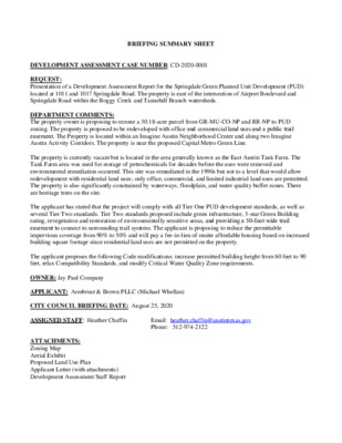
BRIEFING SUMMARY SHEET DEVELOPMENT ASSESSMENT CASE NUMBER: CD-2020-0001 REQUEST: Presentation of a Development Assessment Report for the Springdale Green Planned Unit Development (PUD) located at 1011 and 1017 Springdale Road. The property is east of the intersection of Airport Boulevard and Springdale Road within the Boggy Creek and Tannehill Branch watersheds. DEPARTMENT COMMENTS: The property owner is proposing to rezone a 30.18-acre parcel from GR-MU-CO-NP and RR-NP to PUD zoning. The property is proposed to be redeveloped with office and commercial land uses and a public trail easement. The Property is located within an Imagine Austin Neighborhood Center and along two Imagine Austin Activity Corridors. The property is near the proposed Capital Metro Green Line. The property is currently vacant but is located in the area generally known as the East Austin Tank Farm. The Tank Farm area was used for storage of petrochemicals for decades before the uses were removed and environmental remediation occurred. This site was remediated in the 1990s but not to a level that would allow redevelopment with residential land uses; only office, commercial, and limited industrial land uses are permitted. The property is also significantly constrained by waterways, floodplain, and water quality buffer zones. There are heritage trees on the site. The applicant has stated that the project will comply with all Tier One PUD development standards, as well as several Tier Two standards. Tier Two standards proposed include green infrastructure, 3-star Green Building rating, revegetation and restoration of environmentally sensitive areas, and providing a 50-foot wide trail easement to connect to surrounding trail systems. The applicant is proposing to reduce the permittable impervious coverage from 90% to 50% and will pay a fee-in-lieu of onsite affordable housing based on increased building square footage since residential land uses are not permitted on the property. The applicant proposes the following Code modifications: increase permitted building height from 60 feet to 90 feet, relax Compatibility Standards, and modify Critical Water Quality Zone requirements. OWNER: Jay Paul Company APPLICANT: Armbrust & Brown PLLC (Michael Whellan) CITY COUNCIL BRIEFING DATE: August 25, 2020 ASSIGNED STAFF: Heather Chaffin Email: heather.chaffin@austintexas.gov Phone: 512-974-2122 ATTACHMENTS: Zoning Map Aerial Exhibit Proposed Land Use Plan Applicant Letter (with attachments) Development Assessment Staff Report CS-CO-NP KAY ST SF-3-NP CS-1-CO-NP CS-CO-NP T SF-3-NP R S E T N U G SF-3-NP SF-3-NP SF-3-NP GOVALLE AVE SF-3-NP PUD-NP P-NP SF-3-NP D E R L A D G RIN P S CS-MU-CO-NP SF-3-NP GR-MU-NP MF-2-NP SF-3-NP ± SF-3-NP SF-3-NP SF-6-NP CS-MU-NP M U N S O SF-3-NP N S T SF-3-NP T N S N N A O D SF-3-NP S A R A D R SF-3-NP SF-3-NP CS-MU-V-NP GOODWIN AVE CS-CO-NP CS-MU-NP CS-CO-NP SF-3-NP ALF AV E CS-CO-NP E V K A KIR SF-3-NP GR-MU-CO-NP RR-CO-NP SF-3-NP SF-3-NP T O S D E C U A S SF-3-NP SF-3-NP P-NP E V D A O O W S K O O R B PUD-NP JAIN LN SF-3-NP PUD-NP PUD-NP A I R P O R T B L V D P-NP B OLM R D GR-MU-CO-NP N Y L D A H S GR-MU-NP MF-4-NP P-NP SF-3-NP SF-3-NP SF-3-NP GR-MU-NP SF-3-NP GR-NP CS-MU-CO-NP SUBJECT TRACT ZONING BOUNDARY DEVELOPMENT ASSESSMENT CASE#: CD-2020-0001 This product is for informational purposes and may not have been prepared for or be suitable for legal, engineering, or surveying purposes. It does not represent an on-the-ground survey and represents only the approximate relative location of property boundaries. 1 " = 400 ' This product has been produced by CTM for the sole purpose of geographic reference. No warranty is made by the City of Austin regarding specific accuracy or completeness. SF-3-NP 0 80' 160' GRAPHIC SCALE 80' LEGEND PARCEL BOUNDARY 100-YEAR FLOODPLAIN 25-YEAR FLOODPLAIN EXISTING CONTOUR NOTES: 0.8:1. 3. 1. BUILDING SQUARE FOOTAGE IS APPROXIMATE AND CAN BE TRANSFERRED AMONG BUILDINGS SO LONG AS THE TOTAL LEASABLE SQUARE FOOTAGE DOES NOT EXCEED 850,000 SQUARE FEET. 2. OVERALL IMPERVIOUS COVER WILL NOT EXCEED 50% AND FAR WILL NOT EXCEED 1 0 0 Y R THE BUILDINGS, STRUCTURES, PARKING, SIDEWALKS, TRAILS AND OTHER IMPROVEMENTS SHOWN ON THIS EXHIBIT ARE GRAPHIC REPRESENTATIONS AND ARE NOT EXACT. THE EXACT LOCATIONS AND SPECIFICATIONS FOR THE BUILDINGS, STRUCTURES, PARKING AND OTHER IMPROVEMENTS SHALL BE DETERMINED AS SITE DEVELOPMENT PERMITS ARE ISSUED AS IS CONSISTENT WITH THE PROVISIONS AND INTENT OF THIS ORDINANCE. UTILITY NOTES: 1. WATER SERVICE TO CONNECT TO CITY OF AUSTIN EXISTING 8" CI PUBLIC WATER LINE IN SPRINGDALE ROAD. 2. WASTEWATER SERVICE TO EXTEND AND CONNECT TO CITY OF AUSTIN EXISTING 8" CONC. WASTEWATER LINE IN SAUCEDO STREET. 3. WATER QUALITY AND DETENTION TO BE PROVIDED BY A MIXTURE OF RAIN GARDENS AND BIORETENTION PONDS. S61°55'24"E 983.73' S61°57'24"E 239.39' S61°58'09"E 338.40' ' . 3 3 6 6 2 ' E " 5 3 0 0 ° 8 2 N ' 7 5 . 1 2 2 E ' " 4 5 5 5 ° 4 2 N ' 0 1 . 9 7 ' E " 6 5 8 4 ° 7 2 N 100YR 100YR D S PARKING GARAGE BUILDING C S62°02'52"E 974.23' BUILDING A 100YR 1 0 0 Y R R Y 0 0 1 100YR 1 0 0 Y R 1 0 0 Y R 2 5 Y R R Y 5 2 R Y 0 0 1 R Y 0 0 1 25YR Y R 5 2 R Y 5 2 R Y 0 0 1 D S D S D S 25YR R Y 0 0 1 R Y 0 0 1 R Y 5 2 R Y 5 2 R Y 0 0 1 100YR R Y 1 0 0 1 0 0 Y R R 2 5 Y 2 5 Y R 2 5 Y R 25YR 1 0 0YR 25YR R Y 5 2 1 0 0 Y R 25YR N62°06'46"W 626.12' N61°59'47"W 336.36' 100Y R 100YR 100YR 1 0 0 Y R 100YR 100YR 2 5 Y R 100YR 100YR 2 5 Y R 1 0 0 Y R 0 Y R 0 1 25YR 0 Y R 0 1 25YR R Y 0 0 1 5 Y R 2 25YR 100YR 25YR R Y 0 0 1 1 0 0 Y R 25YR 25YR 1 0 0 Y R 25YR 2 5 Y R 25YR 2 5 Y R R Y 0 0 1 25YR 100YR 2 5YR 100YR R Y 0 0 1 R Y 5 2 R Y 0 0 1 R Y 5 2 R Y 0 0 1 R Y 5 2 ' . 0 1 2 3 5 ' E " 0 5 7 5 ° 7 2 N R Y 0 0 1 R Y 5 2 1 0 0 Y R 2 5 Y R 1 0 0 Y R 2 5 Y R 1 0 0 Y R 2 5 Y R R Y 0 0 1 R 25Y 2 5 Y R 1 0 0 Y R 2 5 Y R 25YR 1 0 0 Y R 2 5 Y R 1 0 0 Y R 25YR 1 0 0 Y R 25YR 2 5 Y R 2 5 Y R 1 0 0 Y R R 25Y S62°13'40"E 253.47' 25YR 25YR 25YR 100YR 1 0 0 Y R 100YR N62°14'06"W 776.03' R Y 5 2 R Y 0 0 1 N 2 0 ° 2 5'3 R Y 7 25 " W 6 100YR 5 . 8 0' N20°09'28"W 30.06' R Y 0 0 1 S 2 0 ° 1 2'5 2 " E 1 0 0YR 1 0 4.6 9' BUILDING B 100YR 100YR R Y 0 0 1 25YR 25YR 25YR R Y 0 0 1 R 25Y R Y 0 0 1 ' . 5 9 5 9 2 9 2 ' W " 3 5 5 5 ° 7 2 S Y R ' 1 8 . 0 5 5 ' W " 3 5 5 5 ° 7 2 S 1 0 0 Y R R Y 0 0 1 2 5 Y R R Y 5 2 25YR R Y 0 0 1 R Y 5 2 1 0 0 Y R R Y 0 0 1 1 0 0 Y R 100YR 25YR 1 0 0 Y R R Y 0 0 1 1 0 0 Y R 1 0 0 Y R R Y 0 0 1 1 R 0 Y 0 0 Y 0 R 1 R Y 0 0 1 R Y 0 0 1 1 0 0 Y R R Y 0 0 1 1 0 0 1 Y 0 R 0 Y R R Y 0 0 1 100YR 1 0 0 Y R 100YR ' 6 8 . 2 3 4 ' W " 1 2 2 3 ° 7 2 S R Y 0 0 1 R Y 0 0 1 ' . 7 2 1 8 R Y 0 0 1 W " 9 4 6 5 ° 5 2 S ' ' 9 2 . 0 9 1 ' W " 1 5 4 2 ° 6 2 S 2 5 Y R 1 0 0 Y R R Y 5 2 2 5 Y R 1 0 0 Y R 25YR Y R 5 2 2 5 Y R R Y 5 2 2 5 Y R 1 0 0 Y R 100 Y R R Y 0 0 1 1 0 0 Y R R Y 0 0 1 1 0 0 Y R 2 5 Y R R Y 0 0 1 1 0 0 Y R 2 5 Y R 1 0 0 Y R1 0 1 0 0 R Y 0 Y R 0 Y R 0 1 2 5 1 Y 0 R 0 Y R R Y 0 R 0 Y 1 2 5 R Y 0 0 1 2 5 Y R 1 0 0 Y R 2 5 Y R 1 0 0 Y R 2 5 R Y 2 R Y 5 1 0 0 Y R R Y 5 2 100YR R Y 0 0 1 R R Y Y 0 5 0 2 1 1 0 0 Y R 25YR R Y 0 0 1 2 5 Y R 2 5 Y R 2 5 Y R R Y 0 0 1 100YR 1 0 0 Y R 2 5 Y R R Y 1 0 0 Y 5 R1 0 2 0 Y R R Y 5 2 2 5 Y R 100YR 2 1 5 0 Y R 0 Y R 100Y R 100YR S70°59'43" W 559.83' SPRINGDALE COMMERCIAL Austin, Texas May 2020 LAND USE PLAN DRAFT DWG NAME LAST SAVED K:\SAU_CIVIL\069268300 SPRINGDALE COMMERCIAL\CAD\EXHIBITS\PLANSHEETS\LAND PLAN EXHIBIT - 20200515.DWG 5/18/2020 4:30 PM 2600 Via Fortuna, Terrace I, Suite 300 Austin, Texas 78746 512-418-1771 State of Texas Registration No. F-928 NOTE: THIS PLAN IS CONCEPTUAL IN NATURE AND HAS BEEN PRODUCED WITHOUT THE BENEFIT OF A SURVEY, TOPOGRAPHY, UTILITIES, CONTACT WITH THE CITY, ETC. ARMBRUST & BROWN, PLLC A T T O R N E Y S A N D C O U N S E L O R S 100 CONGRESS AVENUE, SUITE 1300 AUSTIN, TEXAS 78701-2744 512-435-2300 FACSIMILE 512-435-2360 May 20, 2020 MICHAEL J. WHELLAN (512) 435-2320 mwhellan@abaustin.com Via Email Jerry Rusthoven Planning and Zoning Department City of Austin 505 Barton Springs Rd., 5th Floor Austin, TX 78704 Re: Applications related to Planned Unit Development (“PUD”) zoning for 1011 and 1017 Springdale Rd. (“the Property”) Dear Jerry: I am submitting the attached development assessment application for the “Springdale Green” project on behalf of Jay Paul Company as the first step in applying for Planned Unit Development zoning. Through PUD zoning, Springdale Green will be able to address mistakes from Austin’s “tank farm” past and deliver on the vision of sustainability and managed growth contained in Imagine Austin and many of the City’s policies and plans – and it will do so in a way that is superior to what could be achieved under existing Code. It will provide two office buildings with integrated green infrastructure and three-star Austin Energy Green Building program ratings clustered on the Springdale Road side of the Property, and will revegetate and restore much of the rest of the site – including providing a 50 ft.-wide publicly accessible hike-and-bike trail and limiting overall impervious cover to less than 50 percent. The Property is located on a site that the City’s plans identify as an appropriate location for directing growth. It is a roughly 30-acre site within an Imagine Austin center (Springdale Station) and along two Imagine Austin corridors (Springdale Road and Airport Boulevard) with access to four transit lines within a quarter-mile walk, including two high-frequency routes. The East MLK Combined Neighborhood Plan identifies these former “tank farm” sites at the intersection of Airport Boulevard and Springdale Road as “underused” and a “prime spot” for directing future improvements. Historically, the Property was zoned for industrial uses and operated for decades as a piece of the larger “tank farm” site where oil companies stored fuel and other environmentally compromising chemicals. In the 1990s, community groups successfully campaigned for the oil companies to relocate and the City of Austin rezoned the Property from an industrial zoning district to the current commercial/mixed-use designation. The attached aerial from 1987 shows the above-grade storage tanks on the site prior to closure. As a result of this “tank farm” use, no residential or agricultural uses are currently allowed on the property and no groundwater wells may be drilled. The site can only be used for commercial or industrial uses. {W0973770.6} Springdale Green offers a vision for the Property that addresses its past by implementing a forward- looking sustainability plan and creating quality open space. Key benefits Springdale Green will provide include: Environmental restoration. Springdale Green will, provide native revegetation, restore creek and woodland areas, preserve and add trees, shrubs, and other plants, and utilize biofiltration devices and rain gardens, among other strategies. Sustainable landscaping strategies. Springdale Green will use key sustainability measures to capture stormwater and condensate and reuse it on-site for landscaping and irrigation. Through these efforts, we project we will ultimately achieve at least a 50 percent reduction of irrigation water. Sustainable building practices. Springdale Green will meaningfully reduce impervious cover to below 50 percent overall, build to at least a three-star rating from the Austin Energy Green Building program, provide stormwater management strategies where none exist today, and integrate key green infrastructure strategies. These include implementing stormwater capture and reuse and using more silva cells for tree planting in developed areas than almost any other project in the City. Additionally, there will be no surface parking; all spaces will be provided in a structured parking facility that features green infrastructure and visual screening. Quality open space. Springdale Green will provide a 50 ft.-wide, publicly accessible hike- and-bike trail with the potential to connect the neighborhood to a proposed Tier II urban trail that the City’s Urban Trails Master Plan envisions implementing south of the Property in the future. Affordable housing contribution. Springdale Green is a commercial project. While residential uses are currently prohibited on the site due to its environmentally challenged past, we recognize that housing is a City priority – and are prepared to contribute to the Housing Trust Fund for each square foot of bonus area above the baseline in order to help Austin meet its housing goals. In order to accomplish this vision, we will be requesting a number of Code modifications, including: 90 ft. of height and compatibility modifications (in order to consolidate the building area, minimize impervious cover, and maximize green spaces) as well as modifications to Critical Water Quality Zone requirements (in order to allow for trail and open space improvements). I believe that Springdale Green offers a compelling proposal for the Property that will help address its environmentally challenged past and implement the City’s planning vision. I look forward to discussing this project further and am available to answer questions. Very truly yours, {W0973770.6} Figure 1. Site Aerial (1987) {W0975427.1} SECTION REQUIREMENT MET DISCUSSION Tier One Requirements Matrix 2.3.1.A. Meet the objectives of City Code. Yes Springdale Green is a office project that addresses and corrects for Austin’s “tank farm” past by providing an environmentally superior proposal with less than 50 percent impervious cover on a site that is in an Imagine Austin center and along two Imagine Austin corridors. 2.3.1.B. Provide for development standards that achieve equal or greater consistency with the goals for PUDs outlined in City Code than development under the regulations in the Land Development Code generally. Adopting the Springdale Green PUD will allow the City to deliver on its goals for correcting past environmental Yes mistakes and directing growth in Imagine Austin centers and corridors in a way that would not be possible on this site under the existing Land Development Code. 2.3.1.C. Provide open space that equals or exceeds 10 percent of the residential tracts, 15 percent of the industrial tracts, Yes and 20 percent of the nonresidential tracts within the PUD.1 Springdale Green envisions extensive open space across the entire eastern portion of the site that meaningfully exceeds these baseline requirements and integrates environmental efforts. 2.3.1.D. Provide a two-star Austin Energy Green Building Rating. Yes Springdale Green would provide a three-star Austin Energy Green Building rating for development. 2.3.1.E. Be consistent with applicable neighborhood plans, neighborhood conservation combining district regulations, historic area and landmark regulations, and compatible with adjacent property and land uses. The East MLK Combined Plan identified the sites at Airport and Springdale as “underused” and a “prime Yes spot” for future growth. The plan also values environmental sensitivity and open space. Springdale Green would implement this vision. 1 Except that (1) a detention or filtration area is excluded unless designed and maintained as an amenity, and (2) open space may be reduced for urban property with characteristics that make open space infeasible if other community benefits are provided. {W0974910.6} SECTION REQUIREMENT MET DISCUSSION Provide for environmental preservation and protection relating to air quality, water quality, trees, buffer zones and Springdale Green addresses Austin’s “tank farm” past by providing an environmentally superior project that tests 2.3.1.F. greenbelt areas, critical environmental features, soils, waterways, topography, and the natural and traditional character of the land. Yes for and replaces contaminated soil, provides native revegetation, restores creeks and woodlands, preserves and adds trees, and incorporates green infrastructure. 2.3.1.G. Provide for public facilities and services that are adequate to support the proposed development including school, fire Yes As an infill project, the improvements Springdale Green makes will provide increased tax revenue to the City on an ongoing basis without adding any new land into its protection, emergency service, and police facilities. service area, helping fund public services in this area and 2.3.1.H. Exceed the minimum landscaping requirements of the City Code. across the City. Springdale Green will provide an environmentally superior project that, among other things, exceeds Yes minimum requirements, plants trees, shrubs, and other plants, and harvests rainwater and condensate for irrigation. 2.3.1.I. Provide for appropriate transportation and mass transit connections to areas adjacent to the PUD district and mitigation of adverse cumulative transportation impacts Yes with sidewalks, trails, and roadways. Springdale Green will support a robust public transit system by providing an office project that is served by four CapMetro bus lines, including two high-frequency routes and an existing bus stop at the site itself. 2.3.1.J. Prohibit gated roadways. Yes Springdale Green will prohibit gated roadways. 2.3.1.K. Protect, enhance and preserve areas that include structures or sites that are of architectural, historical, archaeological, N/A or cultural significance. There are no identified historic structures or landmarks on this site. {W0974910.6} SECTION REQUIREMENT MET DISCUSSION 2.3.1.L. Include at least 10 acres of land, unless the property is characterized by special circumstances, including unique topographic constraints. Yes Springdale Green will include over 30 acres of land. 2.3.2.A. Comply with Chapter 25-2, Subchapter E. Yes Springdale Green will substantially comply with Subchapter E or will provide superior Alternative Equivalent Compliance. 2.3.2.B. Inside the urban roadway boundary, comply with the sidewalk standards in Section 2.2.2. of Subchapter E. Yes Springdale Green will substantially comply with Subchapter E or will provide superior Alternative Equivalent Compliance. 2.3.2.C. Pay the tenant relocation fee if approval of the PUD would allow multi-family redevelopment that may result in tenant Springdale Green does not contain existing multi-family N/A and thus redevelopment would not result in displacement. displacement. 2.3.2.D. Contain pedestrian-oriented uses (as defined in the Waterfront Overlay) on the first floor of a multi-story Yes commercial or mixed-use building. Springdale Green will include ground-floor pedestrian- oriented uses. {W0974910.6} Tier Two Requirements Matrix SECTION REQUIREMENT MET DISCUSSION Provides open space at least 10 percent above the minimum requirements. Alternatively, within the urban Open Space roadway boundary, provide for proportional enhancements Yes to existing or planned trails, parks, or other recreational common open space. Springdale Green envisions a comprehensive and extensive open space plan featuring more than 10 percent above minimum requirements and seamlessly integrating key revegetation and environmental efforts. Environment/ Drainage Complies with current code instead of asserting entitlement to follow older code provisions by application of law or Yes agreement. Springdale Green is using the current Land Development Code as the baseline for its PUD proposal. Environment/ Provides water quality controls superior to those otherwise Drainage required by code. Springdale Green will provide an environmentally Yes superior project, with green infrastructure, cisterns, and low impact design with rain gardens, wet meadows, silva cells, and creek and woodland restoration. Environment/ Drainage Uses green water quality controls as described in the Environmental Criteria Manual to treat at least 50 percent Yes of the water quality volume required by code. Springdale Green’s use of water quality controls (such as rain gardens, biofiltration devices, stormwater capture and reuse, and more) will treat a meaningful portion of water quality volume. Environment/ Provides water quality treatment for currently untreated, Drainage developed off-site areas of at least 10 acres in size. {W0974910.6} Springdale Green addresses the site’s “tank farm” history by putting forward a vision of sustainability and environmental stewardship. A key part of this vision is addressing these issues on site rather than requesting off-site alternatives. No SECTION REQUIREMENT Environment/ Drainage Reduces impervious cover by five percent below the maximum otherwise allowed by code or includes off-site measures that lower overall impervious cover within the same watershed by five percent below that allowed by code. MET Yes DISCUSSION Springdale Green envisions a forward-looking development distinguished by its commitment to sustainability. Along with stormwater reuse and other efforts, Springdale Green will also significantly reduce impervious cover below current entitlements, at less than 50 percent impervious cover overall. Environment/ Drainage Provides minimum 50-foot setback for at least 50 percent of all unclassified waterways with a drainage area of 32 acres. N/A There are no known unclassified waterways on the site. Environment/ Provides volumetric flood detention as described in the today, including significantly limiting impervious cover as Drainage Drainage Criteria Manual. Provides drainage upgrades to off-site drainage Environment/ infrastructure that does not meet current criteria in the Drainage Drainage or Environmental Criteria Manuals, such as storm No drains and culverts that provide a public benefit. Springdale Green will provide extensive on-site stormwater management strategies where none exist Yes well as detaining stormwater across the site (for later irrigation use) through cisterns, meadows, rain gardens, and more. Springdale Green envisions a project in which all parts of the site – from the buildings to the open space – work together to provide superior stormwater management and water quality. This will be done on-site, without any applicant requests for alternative off-site measures. Environment/ Proposes no modifications to the existing 100-year Springdale Green is not proposing to amend the 100- Drainage floodplain. year floodplain through the PUD. Yes Environment/ Uses natural channel design techniques as described in the Drainage Drainage Criteria Manual. Springdale Green will provide creek restoration, Yes including removing invasive species, providing native revegetation, and enhancing the soil and habitat. {W0974910.6} MET Yes Yes SECTION REQUIREMENT DISCUSSION Environment/ Restores riparian vegetation in existing, degraded Critical Springdale Green will provide native revegetation within Drainage Water Quality Zone areas. on-site existing Critical Water Quality Zone areas. Environment/ Removes existing impervious cover from the Critical Water Springdale Green will remove existing impervious cover Drainage Quality Zone. from the Critical Water Quality Zone. Environment/ Drainage Preserves all heritage trees; preserves 75% of the caliper inches associated with native protected size trees; and Yes preserves 75% of all of the native caliper inches. Environment/ Tree plantings use Central Texas seed stock native and with Drainage adequate soil volume. Environment/ Drainage Provides at least a 50 percent increase in the minimum waterway and/or critical environmental feature setbacks No required by code. Environment/ Drainage Clusters impervious cover and disturbed areas in a manner that preserves the most environmentally sensitive areas of Yes the site that are not otherwise protected. {W0974910.6} Springdale Green will provide superior tree preservation and will restore and manage its existing woodlands, including removing invasive species. It will also meet the listed heritage and native protected tree standards with the exception of a single heritage tree in poor condition, which will be mitigated at a superior rate. Springdale Green will preserve on-site trees as well plant native trees as part of its broader vision for the project’s native wildflower meadows, woodland restoration, Yes creek restoration, lawns, and more. Springdale Green will extensively restore the meadows, woodlands, and creek within the 100-year floodplain. The only improvements proposed for this space are elevated trails and open space, and will be designed in a way that is environmentally sensitive and minimizes disturbance. Springdale Green will live up to its name by both restoring the natural beauty of the site’s green spaces (to the east) and clustering the impervious cover – featuring integrated green infrastructure – along Springdale Boulevard (to the west). SECTION REQUIREMENT MET DISCUSSION Environment/ Drainage Provides porous pavement for at least 20 percent or more of all paved areas for non-pedestrian in non-aquifer No recharge areas. Springdale Green plans to use porous pavement strategies where feasible, such as using an approved grass-reinforced paving system in fire-lane construction. No surface parking is provided on the property. Environment/ Provides porous pavement for at least 50 percent or more Drainage of all paved areas limited to pedestrian use. Environment/ Provides rainwater harvesting for landscape irrigation to Drainage serve not less than 50% of the landscaped areas. Yes and condensate recovery for irrigation, ultimately achieving at least 50 percent reduction of irrigation water. Springdale Green plans to use porous pavement strategies where feasible, and will use silva cells (with porous paving or gravel) more extensively than almost any other project in the City to date. It will also dedicate No a large amount of site area to landscape planters featuring native shrubs, trees, and grasses. Springdale Green will primarily use rainwater harvesting Springdale Green will be designed to capture stormwater and reuse it on site for landscape irrigation. As noted above, we project this will help achieve a 50 percent reduction of irrigation water. Springdale Green will address this site’s “tank farm” past by not only restoring its natural spaces, but also through integrating green infrastructure (including silva cells, rain gardens, and more) into the commercial parts of the project. Yes Yes Environment/ Drainage Directs stormwater runoff from impervious surfaces to a landscaped area at least equal to the total required Yes landscape area. Environment/ Employs other creative or innovative measures to provide Drainage environmental protection. Austin Energy Green Building Provides an Austin Energy Green Building Rating of three Springdale Green will provide a three-star Austin Energy stars or above. Green Building rating for development. {W0974910.6} SECTION REQUIREMENT MET DISCUSSION Art Provides art approved by the Art in Public Places Program in open spaces, either by providing the art directly or by making a contribution to the City's Art in Public Places Program or a successor program. While Springdale Green envisions incorporating art into its overall plan, the exact form that this effort will take No has not yet been determined. Great Streets Complies with City's Great Streets Program, or a successor program. Applicable only to commercial, retail, or mixed- use development that is not subject to the requirements of Subchapter E. N/A Springdale Green is subject to Subchapter E. Provides community or public amenities, which may include Community Amenities spaces for community meetings, community gardens or urban farms, day care facilities, non-profit organizations, or Yes other uses that fulfill an identified community need. Springdale Green will provide a new 50 ft.-wide public access easement and develop a quality hike-and-bike trail along the eastern boundary of the site for the community – with the potential to connect into a proposed Tier II urban trail that the City envisions implementing south of the Property in the future. Springdale Green will provide a quality, publicly Community Amenities Provides publicly accessible multi-use trail and greenway accessible, 50 ft.-wide hike-and-bike trail along the along creek or waterway. eastern side of the property, with a portion of the trail Yes crossing the existing creek. Transportation Provides bicycle facilities that connect to existing or planned bicycle routes or provides other multi-modal Yes transportation features not required by code. Springdale Green would provide a quality hike-and-bike trail that connects to a Bicycle Priority Network Roadway (Bolm Road) and a future Tier II Urban Trail (along the rail right-of-way). Building Design Exceeds the minimum points required by the Building Design Options of Section 3.3.2. of Subchapter E. Yes Springdale Green will provide a building design that is superior to that required in Section 3.3.2. of Subchapter E, featuring a three-star AEGB rating and quality building materials, among other things. {W0974910.6} REQUIREMENT MET DISCUSSION SECTION Parking Structure Frontage In a commercial or mixed-use development, at least 75 percent of the building frontage of all parking structures is designed for pedestrian-oriented uses (as defined in the No Waterfront Overlay) in ground floor spaces. Parking will be built to meet the current and future needs of the project, with vine screens to visually buffer vehicles. Parking will be provided in a structure separate from the commercial buildings in order to allow that space to be reutilized in the future if parking needs change. In the interim, a portion of the parking structure will include pedestrian-oriented uses. Springdale Green is a commercial project. While residential uses are currently prohibited on the property due to its environmentally challenged past, the applicant will make a contribution to the City of Austin’s Housing Trust Fund in order to help produce affordable units. Affordable Housing Provides for affordable housing or participation in programs to achieve affordable housing. Historic Preserves historic structures, landmarks, or other features There are no identified historic structures or landmarks Preservation to a degree exceeding applicable legal requirements. on this site. Accessibility Provides for accessibility for persons with disabilities to a Springdale Green will provide a high level of accessibility degree exceeding applicable legal requirements. to individuals living with disabilities. Provides space at affordable rates to one or more Local Small Business independent retail or restaurant small businesses whose principal place of business is within the Austin metropolitan statistical area. Springdale Green will strive to provide space to an Yes Austin-area restaurant or small business in the pedestrian-oriented space. Yes N/A Yes {W0974910.6} CD-2020-0001 1 DEVELOPMENT ASSESSMENT MASTER REVIEW REPORT CASE NUMBER: CD-2020-0001 CASE MANAGER: Heather Chaffin PHONE #: 512-974-2122 REVISION #: 0 PROJECT NAME: Springdale Green UPDATE: 0 SUBMITTAL DATE: May 21, 2020 REPORT DUE DATE: June 18, 2020 FINAL REPORT DATE: July 30, 2020 REPORT LATE: 28 days LOCATION: 1011 and 1017 Springdale Rd This report includes all comments received to date concerning your development PLEASE NOTE: IF YOU HAVE ANY QUESTIONS, PROBLEMS, CONCERNS OR IF YOU REQUIRE ADDITIONAL INFORMATION ABOUT THIS REPORT, PLEASE DO NOT HESITATE TO CONTACT YOUR CASE MANAGER (referenced above) at the CITY OF AUSTIN, PLANNING AND ZONING DEPARTMENT, P.O. BOX 1088, AUSTIN, TX. STAFF REVIEW: assessment. REPORT: The attached report identifies those requirements that must be addressed by an update to your application in order to obtain a staff recommendation. This report may also contain recommendations for you to consider, which are not requirements. ADDITIONAL REQUIREMENTS AND RECOMMENDATIONS MAY BE GENERATED AS A RESULT OF INFORMATION OR DESIGN CHANGES PROVIDED IN YOUR UPDATE. CD-2020-0001 2 CASE MANAGER NOTE: THIS COMMENT IS APPLICABLE TO ALL REVIEW DISCIPLINES: ADDITONAL COMMENTS MAY BE GENERATED AS ADDITIONAL INFORMATION IS PROVIDED. ADDITIONAL REVIEWERS MAY BE ADDED AS NEEDED. Environmental Officer - Atha Phillips 512-974-2132 Applicant proposed superiorities: · 3-Star Green Building · Remove impervious cover from critical water quality zone (CWQZ) · Restore the floodplain and CWQZ with native vegetation · Limit impervious cover to 50% or less · 100% Green Stormwater Infrastructure through bio-filtration and rain gardens · Capture stormwater and condensate for landscape irrigation · Utilize silva cells for trees planted within hardscape to provide additional soil volume · No surface parking proposed, will provide parking garage to minimize footprint Additional suggested superiorities: EO 1 Reduce width of proposed bike path from 50’ to 25’ to decrease the area of disturbance within the CWQZ and floodplain. EO 2 Use span bridges for all creek crossings proposed, locate the bridge abutments outside of the erosion hazard zone. EO 3 Consider placing solar panels on the roof. EO 4 Consider dual pipe plumbing within the buildings. EO 5 Utilize glass that has reflectivity of less than 15% to prevent bird strikes. EO 6 Include all restoration and proposed work within the creek and floodplain in the first site plan to ensure work is completed in a timely manner. EO 7 Provide elevations sections to show relationship of 90’ building to neighboring houses. Plant large caliper trees to obscure the neighbor’s views if necessary. DSD Environmental - Jonathan Garner - 512-974-1665 CODE MODIFICATIONS AND EXEMPTIONS EV 1 With the proposed PUD submittal, list and provide the information to review any proposed code modifications or exemptions. TIER 1 REQUIREMENTS Section 2.3.1.H. EV 2 As it pertains to exceeding landscape requirements of the City Code, clarify in the PUD proposal what measures and to what quantifiable extent the PUD will exceed minimum the requirements. TIER 2 SUPERIORITY Environment/Drainage EV 3 Show and locate the proposed environmentally superior water quality controls on the Land Use Plan, and demonstrate how their location meets or exceeds the minimum requirements of current code. If code modifications or exemptions are being sought for the location of water quality controls, indicate how the proposed modifications or exemptions meet Tier II Superiority requirements. CD-2020-0001 3 EV 4 Provide detailed explanation, as well as proposed plant lists, sizes, and quantity take-offs, for the proposed revegetation of the Critical Water Quality Zone and the creek. Additionally, demonstrate how this work meets the requirements of allowed floodplain modifications within a Critical Water Quality Zone. EV 5 Provide detailed explanation for how the removal of existing impervious cover within the Critical Water Quality Zone plans to also decompact the soils and restore the historic grades. EV 6 Staff is not convinced that “restoring meadows, woodlands, and creeks within the 100-year floodplain, as well as providing elevated trails and open space,” meets Tier I requirements of providing at least a 50 percent increase in the minimum waterway setback required by code. Provide an exhibit showing the existing waterway setback delineation and the proposed minimum 50 percent increase setback delineation and demonstrate that no development within this area exceeds or seeks to modify that allowed by code unless adequate Tier II Superiority is proposed. EV 7 For the proposed fire lane construction, show the proposed locations on the Land Use Plan and demonstrate that this delineation does not exceed or seek to modify that which is allowed by code unless adequate Tier II Superiority is proposed. Per ECM 1.8.1., unpaved driveways compacted by vehicular use shall be considered impervious cover. Demonstrate with the PUD proposal how the proposed fire lanes meet or exceed Tier II Superiority requirements. Dev Assessment - Water Quality - Jay Baker - 512-974-2636 Release of this application does not constitute a verification of all data, information, and calculations supplied by the applicant. The engineer of record is solely responsible for the completeness, accuracy, and adequacy of his/her submittal, whether or not the application is reviewed for code compliance by city engineers. WQ 1. The summary letter makes reference to various water quality measures proposed for this project. However, the water quality measures described are not considered to be superior than the current code requirements. Provide water quality analysis demonstrating superiority for what additional measures will be taken to provide superior water quality benefits. WQ 2. In addition to the controls provided for stormwater management, provisions will need to be made to control the 2 year storm runoff discharging from the site in order to minimize downstream erosion. See ECM 1.6.8 for criteria. If on-site detention is provided, the 2 year control can be provided in the detention ponds. If not, the 2 year control can be provided for in the water quality ponds. WQ 3. A Landfill Investigation and Certification will be required for this project. I understand that this site was part of a brownfields restoration so the proposed development should be consistent with those plans. WQ 4. An IPM will be required for this project if alternative stormwater control measures are utilized. WQ 5. Ensure that measures for floatable controls are included in the water quality system. This is particularly important since the site discharge is to a tributary that is traversing the site. DAC Drainage Engineering - Jay Baker - 512-974-2636 Release of this application does not constitute a verification of all data, information, and calculations supplied by the applicant. The engineer of record is solely responsible for the completeness, accuracy, and adequacy of his/her submittal, whether or not the application is reviewed for code compliance by city engineers. GENERAL COMMENTS DE 1. A detailed review cannot be made at this time because the information provided on the land plan does not meet the application requirements. See the application packet for future submittals. The following information was not provided on the land use plan: CD-2020-0001 4 Environmental characteristics of the site, such as, but not limited to, 100 year and 25 year floodplains, slopes, environmentally sensitive areas and protected areas as defined in applicable watershed ordinances. The phasing of the development and the manner in which each phase can exist as a stable independent unit consistent with the provision of adequate public facilities and services. Preliminary stormwater management analysis. FISCAL AND FEES DE 2. This development will be subject to the fiscal and fees requirements as specified in LDC 25-4-37, 25-4-101 and specific ordinances pertaining to this area. FLOODPLAIN DE 3. This development contains the floodplain. Delineate the 25 and 100 year floodplain for upstream fully developed conditions as specified in LDC 25-7-6. If floodplain modifications are proposed, delineate the floodplain for both existing and proposed conditions. Provide a floodplain study to substantiate the floodplain delineation with sufficient detail for review. STORM WATER CONVEYANCE DE 4.This development must convey storm water from adjacent upstream properties without adverse impact to downstream properties as specified in LDC 25-7-151. Provide a drainage report with sufficient detail to demonstrate that conveyance is provided. DE 5. The drainage for this development is linked historically to the development to the north known as 1023 Springdale Commercial (SP-2015-0385C), now known as Springdale General. It appears that the restoration for the tank farms altered the drainage patterns in this area, preventing runoff from being directed to the tributary to the south and causing drainage conveyance issues to that site plan and also impact to the properties to the east along Saucedo St. Contact me to go over in more detail. EASEMENTS AND ROW DE 6 Drainage facilities containing the floodplain and enclosed or open drainage facilities will need to be contained within the ROW or easements as specified in LDC 25-7-152. Delineate all proposed easements and ROW on the land use plan and provide schematic drainage plan substantiating the layout of the subdivision. INCREASED RUNOFF DE 7. This development is proposing additional impervious cover that will result in an increase of storm water runoff. Peak flows shall not be increased at any location for the 2,10,25 and 100 year storm frequency which causes increased inundation of any building or roadway surface, as specified in DCM 1.2.2.C. This effect is typically mitigated by providing on-site detention facilities or through participation in the Regional Stormwater Management Program (RSMP). See DCM Section 8 for additional information about storm water management. Flood Plain Review - Katina Bohrer - 512-974-3558 Reviewer Notes: Site is for Springdale Commercial. Because of postponement of land development code rewrite, applicant has opted to pursue a PUD to develop the site as opposed to continuing with the original site plan (SP-2019-0512C). Applicant is aware of the fact that this Site will need to adhere to Atlas 14 regulations. Site currently is pursing LOMR to change floodplain delineation at site. Site is located at the top of Boggy Trib 1. FP1. Be aware that the FEMA 100-yr floodplain and the COA Atlas 14 floodplains must be contained to a drainage easement. FP2. Be aware that floodplain staff may be unable to administratively approve site plan applications if proposed buildings are located in either the pre project or post project Atlas 14 floodplain. CD-2020-0001 5 FP3. Site will need to maintain No Adverse Impact from a floodplain standpoint. Unmitigated fill in the floodplain may be considered an adverse impact. Additionally, any unmitigated rise in water surface elevation located off-site is also considered an adverse impact. Engineer will have to prove project is no adverse impact. If there is proposed work within the COA 25-year floodplain, Engineer will have to supply a signed and sealed certification letter indicating that the project is no adverse impact. Be aware that any work which adds blockage to the floodplain (e.g. dirt, bridges, etc.) counts as fill in the floodplain. a. Be aware that any pedestrian bridges which cross the creek may result in the necessity of a LOMR to update the floodplain modeling after development of the site. FP4. Any site work located within the pre or post project Atlas 14 floodplain will need to be certified as being compliant with ASCE 24 regulations (i.e. the items are built with materials and methods which reduce the impact of flooding and are able to withstand the flood forces acted upon them). FP5. Does the applicant propose to provide any superiority to floodplain regulations? At a minimum, the development must meet current floodplain regulations. FP6. There should be a signed and sealed floodplain report with digital copy of the study included with development applications. There should be a copy of the LOMR floodplain model and associated backup data supplied with the PUD application. FP7. FFEs of buildings on site are strongly encouraged to be at least 2’ above the Atlas 14 or 500-year floodplain. FP8. If a site plan application is turned in for COA review and approval prior to the predevelopment FEMA LOMR being accepted, be aware that certificate of occupancy for the buildings will be withheld until FEMA has provided a letter of acknowledgement of a complete LOMR application (in the event the current FEMA floodplain is not contained to a drainage easement) or until the LOMR is approved (in the event that the current FEMA floodplain touches a proposed building). FP9. Recommend evaluating if it would make more sense to have the parking garage closer to the floodplain as opposed to one of the habitable buildings from a flood safety/insurance standpoint. FP10. Water quality ponds and detention ponds are not shown on the plan. These ponds will likely be required by other review entities. Be aware that in the event a pond is proposed within the floodplain and is subsequently approved by other reviews, any dirt removed to create that pond does not necessarily constitute as a cut from a floodplain standpoint as the pond will be filled with water by the time the flood occurs and therefore it does not provide compensatory floodplain storage volume. Hydro Geologist Review - Radmon Rice - 512-974-3429 No comments at this time. Additional comments may be generated as information is updated. Wetlands Biologist Review - Andrew Clamann 512-974-2694 WB1. Update0. The summary letter indicates “no modifications to the existing 100-year floodplain” (see row 9 of Environment/Drainage section), however, all plans and discussions as of the time of this comment have indicated substantial modifications (both vertical and horizontal) to the COA 100yr fully developed floodplain. This language would appear to be in error. Please either resolve this language or provide verification that no floodplain modifications will be authorized. WB2. Update0. The summary letter indicates environmental considerations are equal to or superior to code (see rows 2.3.1A/B/F and Environment/Drainage), however, it would appear that the proposed development as it relates to Floodplain Modification (25-8-364) is neither equal to, nor superior to Floodplain Modification rules. CD-2020-0001 6 WB3. Update0. The summary letter indicates that landscape requirements will be exceeded (see 2.3.1.H), however it is unclear if applicant intends to interpret compliance with the requirements of Floodplain Modification as exceeding the landscape requirements. Please verify/clarify in 2.3.1.H that measures that are applied to exceed landscape requirements will not include any planting/seeding that is otherwise required by other sections of code. WB4. Update0. The summary letter indicates using “…natural channel design…” as per DCM (see row 10 of Environment/Drainage section), however these design criteria are not compliant with requirements for Floodplain Modification and supporting ECM 1.7 and Appendix X. Please resolve this conflict by revising this language to ensure compliance with Floodplain Modification rules and subsequent “Significant Demonstrable Environmental Benefit” in accordance with ECM 1.7 and Appendix X. WB5. Update0. The summary letter indicates using “…restoring riparian vegetation…” (see row 11 of Environment/Drainage section). Please revise this language to ensure compliance with Floodplain Modification rules and subsequent “Significant Demonstrable Environmental Benefit” in accordance with ECM 1.7 and Appendix X. WB6. Update0. The floodplain depicted in the Land Plan does not appear to be consistent with the floodplain know to this reviewer per COA GIS. Please resolve. WB7. Update0. Plans and discussions as of the time of this comment have indicated substantial modifications (both vertical and horizontal) to the COA 100yr fully developed floodplain, however, these aspects of the applicant’s plan do not appear on the Land Plan. Please resolve. WB8. Update0. Additional comments may be necessary to address new/changing information in the application. Please be advised that details/criteria proposed to comply with Floodplain Modification rules should be provided in this PUD in order to enable review for compliance and/or superiority. PAZ - Comprehensive Planning - Kathleen Fox 512-974 The subject property for this development assessment is located on the east side of Springdale Road on a parcel that is 30.18 acres in size that contains a building and is the site of a former tank former that closed in the 1990s. The property is located within the boundaries of Springdale Station Neighborhood Center and along the Springdale Road Activity Corridor, (and less than 500 feet from the Airport Road Activity Corridor) as identified on the Imagine Austin’s Growth Concept Map. The subject property is also located within the boundaries of the East MLK Combined Neighborhood Planning Area, within the MLK-183 Planning Area. Surrounding land uses include a creative mixed use incubator development and single family housing to the north; to the south is a church, vacant land and a used car lot; to the east are single family houses and a solar energy farm; and to west are various commercial uses. The proposal calls for two six story office buildings (up to 90 feet tall); a multi-level parking garage; open space; environmental restoration of natural areas; a 50 foot wide hike and bike trail that is assessable to the public; and limiting overall impervious cover to less than 50 percent. Residential uses are currently prohibited on the site due to its environmentally challenged past. The developer also stated in their preliminary submittal that they are willing to contribute to the Housing Trust Fund for each square foot of bonus area above the baseline in order to help Austin meet its housing goals. Connectivity - There are two Cap Metro Transit stops located less than 500 feet from the subject property, including one directly in front of the property. Four transit lines are located within a quarter- mile walk, including two high-frequency routes. Public sidewalks and bike lanes are located on both sides of Springdale Road. Mobility and connectivity options (goods, services, civic uses) in the area are good. The East MLK Neighborhood Plan (EMLKNP) - The EMLKNP Future Land Use Map (FLUM) designates this portion of the planning area (which begins at this parcel and extends past Airport CD-2020-0001 7 Boulevard to the south) as ‘Mixed Use.’ A PUD is permitted under the Mixed Use FLUM category. The following EMNP policies are applicable to this request: Urban Design Guidelines (see pages 17 – 36 for more specific voluntary design guidelines) Guideline Goals These goals provide the foundation for neighborhood design guidelines within City of Austin neighborhoods. (An excerpt – there are more voluntary design guidelines for the development of commercial properties, Nodes and Paths in the Plan.) • Respect the prevailing neighborhood character. The Guidelines aim to reinforce those positive elements, patterns, and characteristics that exist within the neighborhood, that help create a unique sense of place within the city. The Guidelines serve as a framework for new development and provide suggestions as to how it may fit into the existing neighborhood character in terms of scale, mass, building patterns, and details. Following the Guidelines helps ensure the existing neighborhood character is preserved, maintained, complimented, or even enhanced. • Ensure compatibility and encourage adjacent land uses to complement each other. The Guidelines may indicate a neighborhood’s preference for increasing or decreasing the occurrence of certain types of land uses. Examples of this are as “encouraging more owner-occupied residential units” or “encouraging more nearby small-scale retail or grocery stores.” Creating easily accessible areas of mixed-use and neighborhood-oriented services can also minimize the need for residents to travel by car to get goods and services needed on a day-to-day basis. • Enhance and enliven the streetscape. The Guidelines also promote the design of safe, comfortable, and interesting streetscapes that help encourage walking, biking, and transit use. Key to achieving this goal is creating a sense of human scale in the buildings defining the streetscape. This is also achieved by providing accessible, adequately sized and protected pathways. Additionally, safety is enhanced by increasing visibility from buildings to the sidewalk and street (“the eyes on the street” concept). Goal Two - Promote a mix of land uses that respect and enhance the existing neighborhood and address compatibility between residential, commercial, and industrial uses. (p 44) Objective 2.1: Where appropriate, address mis-matches between desired land use and zoning. Objective 2.2: Reduce the impact of commercial and industrial uses on residential areas. Goal Four - Promote the development and enhancement of the neighborhood’s major corridors. (p 45) Objective 4.1: Allow mixed use development along major corridors and intersections Lower Tannehill Branch Text (p 71) Existing Conditions- Lower Tannehill Branch is an established residential area that is bisected by the Tannehill Branch Creek. Residential and commercial development has been hindered by a shallow but extremely broad flood plain caused by blockage of the creek at the railroad tracks on the south side of the neighborhood. Some recent drainage improvements completed by WPDR have significantly reduced flood hazards, but the southeastern portion of the neighborhood is still within the 100- year flood plain. A former petroleum tank farm site, locally referred to as “the Tank Farm” is also located at the intersection of Springdale and Airport. A few new businesses have moved into existing buildings on the property; however most of the 40-acre site remains vacant. Recommendations for Lower Tannehill Branch: (An excerpt) “A top priority of the neighborhood is to remove the barriers that prevent single family infill development in Lower Tannehill Branch. Expanding flood control projects and redevelopment of the Tank Farm site are potential catalysts. Few neighborhood-serving businesses exist in the neighborhood, but there are opportunities to encourage new businesses at the existing commercial nodes on Springdale Road. The large City-owned property along the railroad tracks could also be developed with new single- family homes, provided drainage is improved to reduce the flood plain and there are adequate setbacks CD-2020-0001 8 from the Equillon petroleum pipeline that runs through the property. Any undevelopable land can be left as open space.” Action 51 - Develop neighborhood commercial on Springdale between Tannehill Branch Creek and Ledesma. Action 55 - Develop recommendations for the former Tank Farm site in conjunction with the Govalle/Johnston Terrace Neighborhood Plan. The policies, text and design guidelines taken from the EMLKNP and the FLUM supports Mixed Use and commercial uses in this portion of the planning area, especially if they transition into neighborhood serving uses and enhance the planning area. Imagine Austin- The property is located within the boundaries of Springdale Station Neighborhood Center’ and abuts or is near two Activity Corridors. Like many Imagine Austin Centers, they are represented by a circle that reflects the general location where the center should be located in the future. The center’s actual boundaries would need to be clarified through a small area planning process. Regional, town, and neighborhood centers are supposed to be walkable, bikable, and supported by transit. A Neighborhood Center is the smallest and least intense of the three types of activity centers outlined in the Growth Concept Map, with a focus on creating local businesses and services—including doctors and dentists, shops, branch libraries, dry cleaners, hair salons, coffee shops, restaurants, and other small and local businesses that generally serve the center and surrounding neighborhoods. Activity corridors are characterized by a variety of activities and types of buildings located along the roadway, and are intended to allow people to reside, work, shop, access services, people watch, recreate, and hang out without traveling far distances. The following Imagine Austin policies are also applicable to this case. LUT P1. Align land use and transportation planning and decision-making to achieve a compact and connected city in line with the growth concept map. LUT P3. Promote development in compact centers, communities, or along corridors that are connected by roads and transit that are designed to encourage walking and bicycling, and reduce health care, housing and transportation costs. LUT P4. Protect neighborhood character by directing growth to areas of change that includes designated redevelopment areas, corridors and infill sites. Recognize that different neighborhoods have different characteristics and new and infill development should be sensitive to the predominant character of these communities. A complete compliance review of this application will be made during the formal PUD process. DAC Zoning - Site Plan - Robert Anderson - 512-974-3026 TIER ONE REQUIREMENT [2.3] Minimum Requirements [2.3.1] SP1. Provide a table that clearly depicts the baseline development standards using the GR and RR zoning district standards in Section 25-2-492. In the table, show any proposed modifications. Please clarify whether the PUD will retain separate development standards recognizing separate zoning districts and the disparate development standards, or whether unified baseline standards are proposed. SP2. Provide a table that clearly depicts the baseline development standards according to the Compatibility Standards of 25-2, Subchapter C, Article 10. In the table, show any proposed modifications. Because of the adjacency and proximity of RR and SF-3-NP zoning, the site is constrained according to the Compatibility Regulations. Consider, in particular, the height limitations and setbacks Additional Requirements [2.3.2] CD-2020-0001 9 SP3. Please clarify the level of compliance proposed for Subchapter E requirements. The submitted Tier 1 Matrix is unclear regarding the Subchapter E requirements: “Springdale Green will substantially comply with Subchapter E or will provide Alternative Equivalent Compliance.” Please also be mindful of the mixed-use standards of Article 4. Please provide a table of any baseline and proposed standards if other than what is contained within Subchapter E. DEVELOPMENT BONUSES (2.5) Limitation on Development [2.5.1] SP4. If the PUD will exceed baseline development standards, please work with Neighborhood Housing and Community Development to resolve the amount required for the Affordable Housing Trust Fund. PLANNED UNIT DEVELOPMENT REGULATIONS [3.2] 3.2.3. Nonresidential Uses SP5. Please include the following on the land use plan: Maximum FAR Minimum front yard and street side yard setbacks, which must be not less than the greater of: 1. 25 feet for a front yard, and 15 feet for a street side yard; or 2. those required by Subchapter C, Article 10 (Compatibility Standards) Note: Subchapter E supersedes the base zoning front, side and rear yard setbacks. CONCURRENT CONSIDERATION OF DEVELOPMENT APPLICATIONS [4.1] SP6. The council may consider a preliminary plan or final plat processed concurrently with an application requesting a PUD zoning district classification for a property. However, there is an active site plan application (Springdale Commercial SP-2019-0512C). [4.1] CC City Arborist Review - Jim Dymkowski - 512-974-2772 FYI—ADDITIONAL COMMENTS MAY BE GENERATED WHEN THE REQUESTED INFORMATION HAS BEEN PROVIDED. CA 0 The current PUD development assessment does not indicate that the PUD will be requesting any code modifications for Heritage or any other tree category tree review and will follow current code. CA 1 With the proposed PUD submittal, please list and provide the information to review any proposed code modifications or exceptions. Tier 1 and Tier 2 Superiority CA 2 Staff appreciates the PUDs numerous indications of habitat restoration that would most certainly include more trees planted than what current code would require without the PUD. Please provide additional explanation on how the PUD will accomplish these restorations as mentioned meet the Tier 1 2.3.1.F water quality/environmental section for superiority as it pertains to tree planting and tree preservation. CA 3 As it pertains to mitigation and landscape tree planting, please clarify how the PUD will meet the Tier 1 2.3.1.H Grow green/Landscaping section by explaining by how much the PUD will exceed the current code minimum requirements. CA 4 Staff understands the historical industrial nature of the proposed PUD area. Please provide additional information and clarification on the PUD’s proposal of superior tree preservation? To claim Tier 2 superiority the PUD would need to meet the following for existing trees; Preservation of all heritage trees, preservation of 75% of the caliper inches associated with native protected size trees, and preservation of 75% of all of the native caliper inches. The PUD could also choose to modify this element, for example if the PUD knew the location and poor condition of a heritage tree and have its removal approved with the PUD modifications. Alternatively, the PUD may choose to meet current code for all tree review and would not be able to claim superiority for this particular element. Please clarify how the PUD will proceed on this particular element. CD-2020-0001 10 CA 5 Please provide additional information and clarification on the PUD’s Tier 2 proposal of superior soil volume. What will be the minimum volume proposed? How will this be accomplished and what types and areas of trees to be planted? PARD Planning & Design Review - Scott Grantham - 512-974-9457 Update 0: PR1. The following are big picture elements to consider as the site seeks superiority with regard to Parkland: a. No residential or hotel uses are currently proposed. However, around this site area are many residential uses with more planned and proposed. b. As referred to in the cover letter, the site has historically been a brownfield with many negative impacts on the surrounding community. c. The site has a large creek, floodplain, and Critical Water Quality Zone. d. There is a significant trail system to the east – the Walnut Creek Trail system. PR2. An essential element for superiority will be setting aside land in the form of Parkland Easements, and the construction of public trails through these easements: a. Trail on the eastern side of the property starting at Saucedo and connecting to the property to the south. Is this the 50’ trail identified in the cover letter? b. Creek, surrounding floodplain (25 year and 100 year), and Critical Water Quality Zone c. Trail and greenway along the creek, also referred to in TR 3 d. Other open space areas, if they are contiguous, possibly less developable, and would be reasonable to include within the park easement (these can also overlap open space requirements for subchapter E) PR3. Show detail for the trail crossing of the creek on the eastern side of the property. PR4. Identify level of accessibility (e.g. ADA) for all proposed trails. PR5. Describe levels of remediation taken for open space areas including future trails. Are these the same for the entire site? PR6. When PUD is formally submitted, please set up a meeting with this reviewer. Urban Trails will also be included. DAC Transportation - Adam Fiss - 512-974-1684 TR1. Please clarify the level of compliance proposed for Subchapter E requirements. Application indicates that “Springdale Green will substantially comply with Subchapter E or will provide Alternative Equivalent Compliance”. Will Springdale Green comply with Great Streets standards? TR2. Application indicates that Springdale Green will support a robust public transit system by providing an office project that is served by four CapMetro bus lines, including two high-frequency routes and an existing bus stop at the site itself. Please identify bus stops on site plan. TR3. PUD must provide publicly accessible multi-use trail and greenway along creek or waterway. Please indicate how the trail proposed will connect to the ROW or adjoining Type II Trail along rail – specifically how it will cross the railroad. TR4. For non-residential uses, a land use plan must include, the number of curb cuts or driveways, which must be the minimum necessary for adequate access to the site. Please explain why the second fire access is necessary. Is this request coming from fire? If not gated, how will public access be prohibited? TR5. In a commercial or mixed-use development, at least 75 percent of the building frontage of all CD-2020-0001 11 parking structures is designed for pedestrian-oriented uses as defined in Section 25-2-691(C) (Waterfront Overlay District Uses) in ground floor spaces. Applicant has indicated that a portion of the structure will include pedestrian-oriented uses. Please identify these uses. Per 2.3.2.D, Springdale Green will include ground-floor pedestrian oriented uses. TR6. Application indicates that Springdale Green will provide a high level of accessibility to individuals living with disabilities. Please indicated the level of accessible parking that will be provided. Will the trails be fully accessible? ATD Engineering Review - Amber Mitchell - 512-974-5646 ATD1. Proposed urban trail connection has been send to Public Works for their review, input and acceptance as an improvement. Further comment will be provided as it becomes available. ATD2. Please identify all transportation-related code and criteria the PUD will be requesting relief/modification to. ATD3. A TIA was submitted with the commercial site plan application for this site. Please confirm the land uses and intensities do not vary from what was submitted with the TIA. ATD4. As previously discussed, the second drive is not supported or approved at this time; please remove it from the PUD land use plan. ATD5. RE: 2.3.1.I: The TIA under review will now be required to address this component of the Tier 1 PUD requirements. Dev Assessment - Electric - Andrea Katz - 512-322-6957 EL 1. Fifteen-foot electric distribution, electric telecommunications, and electric fiber easement is required adjacent to all street R.O.W. Show the easement(s) on the face of the plat. LDC § 25-4-132 Easements and Alleys: A) Easements for public utilities and drainage ways shall be retained in all subdivisions in the widths and locations determined necessary by the director. All easements shall be dedicated to public use for the named purpose and shall be aligned to minimize construction and future maintenance costs. Dev Assessment - Fire Review - Tom Migl - 512-974-0164 Information regarding hazardous materials on the site/in the area will be required at time of formal PUD submittal. AW Utility Development Services - Virginia Collier - 512-972-0117 AW1. Springdale Green PUD shall submit a completed version of Austin Water’s Water Balance Calculator tool to assess non-potable demands and determine available alternative water supplies for the development. AW2. Springdale Green PUD shall use alternative water sources, either onsite sources or municipal reclaimed water, within the development for all non-potable uses such as irrigation, cooling and toilet/urinal flushing applications. AE – Green Building Program – Sarah Talkington – 512-482-5393 CD-2020-0001 12 Staff strongly encourages the developer to schedule a meeting with Sarah Talkington, Austin • Energy Green Building (AEGB) Commercial Team Manager, to ensure they understand AEGB 2- and 3-Star requirements prior to agreeing to uphold them. • If this is a Core and Shell project and the Offices are to be finished out by tenants, and/or speculative, Staff strongly discourages the pursuit of an AEGB 3-Star Rating. We commonly see speculative 2-Star projects struggle to achieve COA ratings. If the building is Owner-Occupied, and that Owner/Tenant has a strong understanding of sustainability and what they are agreeing to uphold, Staff may be able to agree to a 3-Star/Superiority in Green Building agreement. Please schedule a meeting to discuss all of this and to establish clear understanding first. NHCD Neighborhood Housing – Alex Radtke – 512-974-3173 NHCD accepts the proposal of paying a fee-in-lieu of affordable housing given the project’s commercial nature. If a residential component does come into the picture then the affordability contribution would need to be reevaluated. PAZ Case Manager / Zoning Review - Heather Chaffin 974-2122 GENERAL: 1. Provide a list of all proposed code/criterial manual modifications with code references. 2. Provide Tier 1/Tier tables with detailed, specific information how all Tier 1 items are met/exceeded and which Tier 2 items are met/exceeded. 3. Provide information about the proposed trail easement. Timing of dedication, parties involved, etc. Does the applicant propose to construct the trail at time of site development, subject to Staff approval of design? 4. Provide documentation of all approved environmental remediation on the property. 5. LAND USE PLAN: 6. Identify baseline zoning category on land use plan (LUP). List existing zoning categories and label the location of each on the drawing. 7. List gross square feet/acreage. 8. Label surrounding zoning and existing land uses. 9. Provide a site location map. 10. Are you proposing to modify the list of permitted land uses? For example, automotive land uses may not be appropriate on this brownfield site. If so, list on LUP near baseline zoning category. 11. Label the trail easement as “public trail easement”. 12. Show and label all existing and proposed easements, as well as easements to be vacated with 13. Show/label existing driveways. 14. Note #1- All information regarding building square footage must be in terms of gross building square footage (s.f.). Leasable s.f. is not a COA zoning enforceable term. 15. Note #2- Spell out floor-to-area ratio. Specify that it’s a maximum 50% impervious cover (IC) for recording info. the gross site area. 16. Note #3- Further discussion will be necessary regarding how much deviation from a PUD LUP is permitted. PUDs typically do not show the level of detail shown on this LUP, particularly in regards to sidewalk locations. It is understood that all buildings, parking, etc. must be reviewed in detail and comply with COA code at time of site plan. 17. Table: Add “commercial” to the Land Use classification. It is Staff understanding that ground floor commercial is proposed. 18. Table: Remove “building height” column; keep max building height column. CD-2020-0001 13 19. Table: Label “maximum” number of floors. 20. Table: In addition to clarifying in the notes section, clarify in the table or nearby the maximum gross building s.f. It may be necessary to remove detailed information about “approximate” s.f. PUDs establish minimum and maximum levels; details could lead to future PUD amendments. 21. Parking Garage (PG) Table: Label building height/levels as maximum. 22. A Carbon Impact Statement will be required. The form is attached. Contact Caitlin Admire in the Office of Sustainability with any questions; submit the Carbon Impact Statement to the Zoning Case Manager at time of formal PUD submittal. ____________________________________________________________________________________ For the formal PUD submittal, please address outstanding reviewer comments outlined in this report with comment-by-comment written response, in addition to other requested documents. Contact the Zoning Case Manager for information about the materials and reviewer distribution required for submittal of a formal PUD application. Carbon Impact Statement Project: Scoring Guide: 1-4: Business as usual 5-8: Some positive actions 9-12: Demonstrated leadership 1 2 3 4 5 6 7 8 9 10 11 12 Response: Y=1, N=0 Documentation: Y/N Transportation T1: Public Transit Connectivity T2: Bicycle Infrastructure T3: Walkability T4: Utilize TDM Strategies T5: Electric Vehicle Charging T6: Maximize Parking Reductions Water + Energy WE1: Onsite Renewable Energy WE2: Reclaimed Water Land Use LU1: Imagine Austin Activity Center or Corridor LU2: Floor-to-Area Ratio Food F1: Access to Food Materials M1: Adaptive Reuse Total Score: The Carbon Impact Statement calculation is a good indicator of how your individual buildings will perform in the Site Category of your Austin Energy Green Building rating. Notes: Brief description of project, further explanation of score and what it means T1. Is any functional entry of the project within 1/4 mile walking distance of existing or planned bus stop(s) serving at least two bus routes, or within 1/2 mile walking distance of existing or planned bus rapid transit stop(s), or rail station(s)? T2. Is there safe connectivity from the project site to an “all ages and abilities bicycle facility” as listed in the Austin Bicycle Master Plan? T3. Is the property location “very walkable” with a minimum Walk Score of 70 (found at walkscore.com), or will the project include at least five new distinct basic services (such as a bank, restaurant, fitness center, retail store, daycare, or supermarket)? T4. Does the project utilize two or more of the following Transportation Demand Management strategies: unbundling parking costs from cost of housing/office space, providing shower facilities, providing secured and covered bicycle storage, and/or providing 2+ car sharing parking spaces for City-approved car share programs? T5. Will the project include at least one DC Fast Charging electric vehicle charging station? T6. Does the project utilize existing parking reductions in code to provide 20% less than the minimum number of parking spaces required under the current land development code (or 60% less than the code’s base ratios if there is no minimum parking capacity requirement)? WE1. Will the project include on-site renewable energy generation to offset at least 1% of building electricity consumption? WE2. Will the project include one or more of the following reclaimed water systems: large scale cisterns, onsite grey or blackwater treatment, and reuse or utilization of Austin Water Utility's auxiliary water system to eliminate the use of potable water on landscape/irrigation? LU1. Is the proposed project site located within one of the centers or corridors as defined in the Imagine Austin Comprehensive Plan Growth Concept Map? LU2. If located in an Imagine Austin activity center or corridor, will the proposed project use at least 90% of its entitled amount of floor-to-area ratio? F1. Will the project include a full service grocery store onsite, or is one located within 1 mile of the project, or will the project integrate opportunities for agriculture to the scale as defined by Austin Energy Green Building? M1. Will the project reuse or deconstruct existing buildings on the project site?