20200304-006b: HEB 10 SP-2019-0034C variance packet 3 of 3 — original pdf
Backup
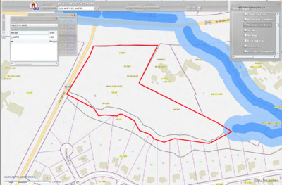
HEB Variance Backup Two, p. 1 H-E-B STORE #10 Exhibit 5 Topographic Map January 10, 2020 EXHIBIT 5 TOPOGRAPHIC MAP C:\Users\tpho\AppData\Local\Microsoft\Windows\INetCache\Content.Outlook\405YLYUD\20200110_env_comm_variance.docx/sg 5 HEB Variance Backup Two, p. 2 1 2 3 4 5 N n o i t c u d o p e R r . c e t n a t S f r r o y t r e p o p e h t e a s g n w a d d n a s n g i s e d r i l l a o t s t h g i r y p o C e h T e h t e a c s T l O N O D . s n o i s n e m d i l l a r o f l e b i s n o p s e r e b d n a y f i r e v l l a h s r o t c a r t n o C e h T . y a e d l t u o h t i w c e t n a t S o t d e t r o p e r e b l l a h s s n o i s s i m o r o s r o r r e y n a - i g n w a d r . n e d d b o r i f s i c e t n a t S y b d e z i r o h t u a t a h t n a h t r e h t o e s o p u p y n a r r o f e s u r o 4 2 3 6 - F # E P B T 0 3 2 4 9 1 0 1 # S L P B T . c n i I s e c v r e S g n i t l u s n o C c e t n a t S 0 0 3 e t i u S t e e r t S h c i r l d A 5 0 9 1 4 4 5 3 - 3 2 7 8 7 X T n i t s u A . m o c c e t n a t s . w w w 1 1 0 0 - 8 2 3 ) 2 1 5 ( : l e T . D D M M Y Y Y Y . d p p A y B n o i s i v e R . D D M M Y Y Y Y . d p p A y B 1 1 . . 1 0 9 1 0 2 I T E S W E V E R % 5 7 d e u s s I Permit/Seal 4 0 2 8 7 X T , I O N O T N A N A S , T E E R T S S E R O L F S 6 4 6 j t c e o r P / t n e C i l P L , B - E - H I 0 9 2 Y A W H G H T S E W 1 0 9 7 0 1 # E R O T S B - E - H 3 0 7 8 7 S A X E T , N I T S U A 222010831 Project No.: File Name: 10831C01_101_SDM Scale: AJM Dwn. Dsgn. TP JF 2020.01.02 Chkd. YYYY.MM.DD Title EXISTING GROUND SLOPE MAP Sheet: 09 of 63 0 Revision: Drawing No. 09 SP-2019-0034C D C B A m d s _ 1 0 1 _ 1 0 c 1 3 8 0 1 \ g n w a d \ r i l i i v c \ 1 3 8 0 1 0 2 2 2 \ e v i t c a \ 0 2 2 2 \ v : M A 7 4 : 7 3 : 8 2 0 . 1 0 . 0 2 0 2 ORIGINAL SHEET - ARCH D HEB Variance Backup Two, p. 3 H-E-B STORE #10 Exhibit 6 For Cut/Fill Variances January 10, 2020 EXHIBIT 6 FOR CUT/FILL VARIANCES C:\Users\tpho\AppData\Local\Microsoft\Windows\INetCache\Content.Outlook\405YLYUD\20200110_env_comm_variance.docx/sg 6 HEB Variance Backup Two, p. 4 1 2 3 4 5 N BUILDING 88,556 SF FFE=964.00 N n o i t c u d o p e R r . c e t n a t S f r r o y t r e p o p e h t e a s g n w a d d n a s n g i s e d r i l l a o t s t h g i r y p o C e h T e h t e a c s T l O N O D . s n o i s n e m d i l l a r o f l e b i s n o p s e r e b d n a y f i r e v l l a h s r o t c a r t n o C e h T . y a e d l t u o h t i w c e t n a t S o t d e t r o p e r e b l l a h s s n o i s s i m o r o s r o r r e y n a - i g n w a d r . n e d d b o r i f s i c e t n a t S y b d e z i r o h t u a t a h t n a h t r e h t o e s o p u p y n a r r o f e s u r o 4 2 3 6 - F # E P B T 0 3 2 4 9 1 0 1 # S L P B T . c n i I s e c v r e S g n i t l u s n o C c e t n a t S 0 0 3 e t i u S t e e r t S h c i r l d A 5 0 9 1 4 4 5 3 - 3 2 7 8 7 X T n i t s u A . m o c c e t n a t s . w w w 1 1 0 0 - 8 2 3 ) 2 1 5 ( : l e T . D D M M Y Y Y Y . d p p A y B n o i s i v e R . D D M M Y Y Y Y . d p p A y B 1 1 . . 1 0 9 1 0 2 I T E S W E V E R % 5 7 d e u s s I Permit/Seal 4 0 2 8 7 X T , I O N O T N A N A S , T E E R T S S E R O L F S 6 4 6 j t c e o r P / t n e C i l P L , B - E - H I 0 9 2 Y A W H G H T S E W 1 0 9 7 0 1 # E R O T S B - E - H 3 0 7 8 7 S A X E T , N I T S U A 222010831 Project No.: File Name: 2019-06-13_CUT FILL EXH Scale: DWN AJM Dwn. DSGN CHKD TP SCALE Dsgn. JF 2020.01.03 Chkd. YYYY.MM.DD Title CUT/FILL EXHIBIT Sheet: 1 of 63 1 Revision: Drawing No. EXH ORIGINAL SHEET - ARCH D SP-2019-0034C D C B A h x e l l i f t u c _ 3 1 - 6 0 - 9 1 0 2 \ h x e l l i f t u c _ 9 1 - 4 0 - 9 1 0 2 \ s t i i b h x e \ g n w a d \ r i l i i v c \ 1 3 8 0 1 0 2 2 2 \ e v i t c a \ 0 2 2 2 \ p u o g k r o w \ 1 0 f - 5 6 5 1 s u \ \ r M P 7 2 : 1 2 : 2 1 3 0 . 1 0 . 0 2 0 2 HEB Variance Backup Two, p. 5 H-E-B STORE #10 Exhibit 7 Site Plan January 10, 2020 EXHIBIT 7 SITE PLAN C:\Users\tpho\AppData\Local\Microsoft\Windows\INetCache\Content.Outlook\405YLYUD\20200110_env_comm_variance.docx/sg 7 HEB Variance Backup Two, p. 6 1 2 3 4 5 N N Permit/Seal n o i t c u d o p e R r . c e t n a t S f r r o y t r e p o p e h t e a s g n w a d d n a s n g i s e d r i l l a o t s t h g i r y p o C e h T e h t e a c s T l O N O D . s n o i s n e m d i l l a r o f l e b i s n o p s e r e b d n a y f i r e v l l a h s r o t c a r t n o C e h T . y a e d l t u o h t i w c e t n a t S o t d e t r o p e r e b l l a h s s n o i s s i m o r o s r o r r e y n a - i g n w a d r . n e d d b o r i f s i c e t n a t S y b d e z i r o h t u a t a h t n a h t r e h t o e s o p u p y n a r r o f e s u r o 4 2 3 6 - F # E P B T 0 3 2 4 9 1 0 1 # S L P B T . c n i I s e c v r e S g n i t l u s n o C c e t n a t S 0 0 3 e t i u S t e e r t S h c i r l d A 5 0 9 1 4 4 5 3 - 3 2 7 8 7 X T n i t s u A . m o c c e t n a t s . w w w 1 1 0 0 - 8 2 3 ) 2 1 5 ( : l e T . D D M M Y Y Y Y . d p p A y B n o i s i v e R . D D M M Y Y Y Y . d p p A y B 1 1 . . 1 0 9 1 0 2 I T E S W E V E R % 5 7 d e u s s I 4 0 2 8 7 X T , I O N O T N A N A S , T E E R T S S E R O L F S 6 4 6 j t c e o r P / t n e C i l P L , B - E - H I 0 9 2 Y A W H G H T S E W 1 0 9 7 0 1 # E R O T S B - E - H 3 0 7 8 7 S A X E T , N I T S U A 222010831 Project No.: File Name: 10831C01_101_TTP Scale: AJM Dwn. Dsgn. TP JF 2020.01.02 Chkd. YYYY.MM.DD Title EXISTING CONDITIONS, TRE PLAN, DEMOLITION PLAN Sheet: 07 of 63 0 Revision: Drawing No. 07 SP-2019-0034C D C B A p t t _ 1 0 1 _ 1 0 c 1 3 8 0 1 \ g n w a d \ r i l i i v c \ 1 3 8 0 1 0 2 2 2 \ e v i t c a \ 0 2 2 2 \ v : M A 5 2 : 7 3 : 8 2 0 . 1 0 . 0 2 0 2 ORIGINAL SHEET - ARCH D HEB Variance Backup Two, p. 7 H-E-B STORE #10 Exhibit 8 Proposed Site Plan January 10, 2020 EXHIBIT 8 PROPOSED SITE PLAN C:\Users\tpho\AppData\Local\Microsoft\Windows\INetCache\Content.Outlook\405YLYUD\20200110_env_comm_variance.docx/sg 8 HEB Variance Backup Two, p. 8 1 2 3 4 5 N BUILDING 88,556 SF FFE=964.00 D C B A p s m _ 1 0 1 _ 1 0 c 1 3 8 0 1 \ g n w a d \ r i l i i v c \ 1 3 8 0 1 0 2 2 2 \ e v i t c a \ 0 2 2 2 \ v : M A 0 5 : 0 4 : 8 2 0 . 1 0 . 0 2 0 2 ORIGINAL SHEET - ARCH D PHASE II ROAD n o i t c u d o p e R r . c e t n a t S f r r o y t r e p o p e h t e a s g n w a d d n a s n g i s e d r i l l a o t s t h g i r y p o C e h T e h t e a c s T l O N O D . s n o i s n e m d i l l a r o f l e b i s n o p s e r e b d n a y f i r e v l l a h s r o t c a r t n o C e h T . y a e d l t u o h t i w c e t n a t S o t d e t r o p e r e b l l a h s s n o i s s i m o r o s r o r r e y n a - i g n w a d r . n e d d b o r i f s i c e t n a t S y b d e z i r o h t u a t a h t n a h t r e h t o e s o p u p y n a r r o f e s u r o 4 2 3 6 - F # E P B T 0 3 2 4 9 1 0 1 # S L P B T . c n i I s e c v r e S g n i t l u s n o C c e t n a t S 0 0 3 e t i u S t e e r t S h c i r l d A 5 0 9 1 4 4 5 3 - 3 2 7 8 7 X T n i t s u A . m o c c e t n a t s . w w w 1 1 0 0 - 8 2 3 ) 2 1 5 ( : l e T . D D M M Y Y Y Y . d p p A y B n o i s i v e R . D D M M Y Y Y Y . d p p A y B 1 1 . . 1 0 9 1 0 2 I T E S W E V E R % 5 7 d e u s s I Permit/Seal 4 0 2 8 7 X T , I O N O T N A N A S , T E E R T S S E R O L F S 6 4 6 j t c e o r P / t n e C i l P L , B - E - H I 0 9 2 Y A W H G H T S E W 1 0 9 7 0 1 # E R O T S B - E - H 3 0 7 8 7 S A X E T , N I T S U A 222010831 Project No.: File Name: 10831C01_101_MSP Scale: AJM Dwn. Dsgn. TP JF 2020.01.02 Chkd. YYYY.MM.DD Title OVERALL SITE PLAN Sheet: 17 of 63 0 Revision: Drawing No. 17 SP-2019-0034C HEB Variance Backup Two, p. 9 H-E-B STORE #10 Exhibit 9 Environmental Map January 10, 2020 EXHIBIT 9 ENVIRONMENTAL MAP C:\Users\tpho\AppData\Local\Microsoft\Windows\INetCache\Content.Outlook\405YLYUD\20200110_env_comm_variance.docx/sg 9 HEB Variance Backup Two, p. 10 HEB Variance Backup Two, p. 11 H-E-B STORE #10 Exhibit 10 Environmental Resource Inventory January 10, 2020 EXHIBIT 10 ENVIRONMENTAL RESOURCE INVENTORY C:\Users\tpho\AppData\Local\Microsoft\Windows\INetCache\Content.Outlook\405YLYUD\20200110_env_comm_variance.docx/sg 10 HEB Variance Backup Two, p. 12 Case No.: (City use only) Environmental Resource Inventory For the City of Austin Related to LDC 25-8-121, City Code 30-5-121, ECM 1.3.0 & 1.10.0 The ERI is required for projects that meet one or more of the criteria listed in LDC 25-8-121(A), City Code 30-5-121(A). 1. SITE/PROJECT NAME: HEB Austin # 10 2. COUNTY APPRAISAL DISTRICT PROPERTY ID (#’s): 315313 & 511018 3. ADDRESS/LOCATION OF PROJECT: 7909 FM 1826 4. WATERSHED: Williamson Creek 5. THIS SITE IS WITHIN THE (Check all that apply) Edwards Aquifer Recharge Zone* (See note below) .................. (cid:133)YES (cid:133)No Edwards Aquifer Contributing Zone*.................................. (cid:133)YES (cid:133)No Edwards Aquifer 1500 ft Verification Zone* ....................... (cid:133)YES (cid:133)No Barton Spring Zone* .......................................................... (cid:133)YES (cid:133)No *(as defined by the City of Austin – LDC 25-8-2 or City Code 30-5-2) ✔ ✔ ✔ ✔ Note: If the property is over the Edwards Aquifer Recharge zone, the Hydrogeologic Report and karst surveys must be completed and signed by a Professional Geoscientist Licensed in the State of Texas. 6. DOES THIS PROJECT PROPOSE FLOODPLAIN MODIFICATION?.......(cid:133)YES** (cid:133)NO ✔ If yes, then check all that apply: (cid:13) (1) The floodplain modifications proposed are necessary to protect the public health and safety; (cid:13) (2) The floodplain modifications proposed would provide a significant, demonstrable environmental benefit, as determined by a functional assessment of floodplain health as prescribed by the Environmental Criteria Manual (ECM), or (cid:13) (3) The floodplain modifications proposed are necessary for development allowed in the critical water quality zone under LDC 25-8-261 or 25-8-262, City Code 30-5-261 or 30-5-262. (cid:13) (4) The floodplain modifications proposed are outside of the Critical Water Quality Zone in an area determined to be in poor or fair condition by a functional assessment of floodplain health. ** If yes, then a functional assessment must be completed and attached to the ERI (see ECM 1.7 and Appendix X for forms and guidance) unless conditions 1 or 3 above apply. 7. IF THE SITE IS WITHIN AN URBAN OR SUBURBAN WATERSHED, DOES THIS PROJECT PROPOSE A UTILITY LINE PARALLEL TO AND WITHIN THE CRITICAL WATER QUALITY ZONE? ......................................................... (cid:133)YES*** (cid:133)NO ✔ ***If yes, then riparian restoration is required by LDC 25-8-261(E) or City Code 30-5-261(E) and a functional assessment must be completed and attached to the ERI (see ECM1.5 and Appendix X for forms and guidance). 0 8. There is a total of (#’s) Critical Environmental Feature(s)(CEFs) on or within150 feet of the project site. If CEF(s) are present, attach a detailed DESCRIPTION of the CEF(s), color PHOTOGRAPHS, the CEF WORKSHEET and provide DESCRIPTIONS of the proposed CEF buffer(s) and/or wetland mitigation. Provide the number of each type of CEFs on or within 150 feet of the site (Please provide the number of CEFs ): HEB Variance Backup Two, p. 13 (#’s) Spring(s)/Seep(s) (#’s) Point Recharge Feature(s) 0 (#’s) Bluff(s) 0 0 0 0 (#’s) Canyon Rimrock(s) (#’s) Wetland(s) Note: Standard buffers for CEFs are 150 feet, with a maximum of 300 feet for point recharge features. Except for wetlands, if the standard buffer is not provided, you must provide a written request for an administrative variance from LDC 25-8-281(C)(1) and provide written findings of fact to support your request. Request forms for administrative variances from requirements stated in LDC 25-8-281 are available from Watershed Protection Department. 9. The following site maps are attached at the end of this report (Check all that apply and provide): All ERI reports must include: ✔ ✔ (cid:13) Site Specific Geologic Map with 2-ft Topography (cid:13) Historic Aerial Photo of the Site (cid:13) Site Soil Map (cid:13) Critical Environmental Features and Well Location Map on current ✔ Aerial Photo with 2-ft Topography Only if present on site (Maps can be combined): (cid:13) Edwards Aquifer Recharge Zone with the 1500-ft Verification Zone(cid:3) (cid:3) (cid:3) (Only if site is over or within 1500 feet the recharge zone) ✔ (cid:13) Edwards Aquifer Contributing Zone(cid:3) (cid:13) Water Quality Transition Zone (WQTZ) (cid:13) Critical Water Quality Zone (CWQZ)(cid:3) (cid:13) City of Austin Fully Developed Floodplains for all water courses with (cid:3) (cid:3) (cid:3) (cid:3) (cid:3) (cid:3) (cid:3) (cid:3) (cid:3) (cid:3) up to 64-acres of drainage 10. HYDROGEOLOGIC REPORT – Provide a description of site soils, topography, and site specific geology below (Attach additional sheets if needed): Surface Soils on the project site is summarized in the table below and uses the SCS Hydrologic Soil Groups*. If there is more than one soil unit on the project site, show each soil unit on the site soils map. Soil Series Unit Names, Infiltration Characteristics & Thickness *Soil Hydrologic Groups Definitions (Abbreviated) Soil Series Unit Name & Subgroup** Group* Thickness Brackett-Rock outcrop complex, 1-12% slopes (BlD) Volente silty clay loam, 1-8% slopes (VoD) D C (feet) 2.5 4.5 A. Soils having a high infiltration rate when thoroughly wetted. B. Soils having a moderate infiltration rate when thoroughly wetted. C. Soils having a slow infiltration rate when thoroughly wetted. D. Soils having a very slow infiltration rate when thoroughly wetted. **Subgroup Classification – See Classification of Soil Series Table in County Soil Survey. WPD ERM ERI-2014-01 Page 2 of 6 HEB Variance Backup Two, p. 14 Description of Site Topography and Drainage (Attach additional sheets if needed): The subject site is located within the Edwards Plateau ecoregion (Gould, 1975) and the Live Oak-Ashe Juniper Parks vegetational area of Texas (McMahan et al., 1984). Elevation on the site ranges from 994 feet above mean sea level (AMSL) to 904 feet AMSL, with surface water flowing west to east towards the Wheeler Branch of Williamson Creek. List surface geologic units below: Group Trinity Geologic Units Exposed at Surface Formation Member Upper Glen Rose Limestone Brief description of site geology (Attach additional sheets if needed): The upper member of the Glen Rose Limestone is relatively impermeable and described as the lower confining unit of the Edwards Aquifer. It has a maximum thickness of about 350 to 500 feet. Stair-step topography is characteristic of the upper member of the Glen Rose Limestone. The Upper Glen Rose Limestone is described as yellowish-tan, thinly bedded limestone and marl (Garner and Young, 1976). The upper member of the Glen Rose Limestone is relatively more thinly bedded, more dolomitic, and less fossiliferous than the lower member of the Glen Rose Limestone. The top of the upper member of the Glen Rose Limestone is red-stained, lumpy, irregular, and bored, with oysters cemented onto the surface (Rose, 1972). Wells – Identify all recorded and unrecorded wells on site (test holes, monitoring, water, oil, unplugged, capped and/or abandoned wells, etc.): There are 0 (#) wells present on the project site and the locations are shown and labeled (#’s)The wells are not in use and have been properly abandoned. (#’s)The wells are not in use and will be properly abandoned. (#’s)The wells are in use and comply with 16 TAC Chapter 76. 0 There are (#’s) wells that are off-site and within 150 feet of this site. WPD ERM ERI-2014-01 Page 3 of 6 HEB Variance Backup Two, p. 15 11. THE VEGETATION REPORT – Provide the information requested below: Brief description of site plant communities (Attach additional sheets if needed): Vegetation observed on the Property includes Ashe juniper (Juniperus ashei), plateau live oak (Quercus fusiformis), cedar elm (Ulmus crassifolia), elbow bush (Forestiera angustifolia), (agarita (Berberis trifoliolata), Texas prickly pear (Opuntia engelmannii var. lindheimeri), hackberry (Celtis laevigata), chinaberry (Melia azedarach), evergreen sumac (Rhus virens), various forbs and grasses There is woodland community on site …………………….(cid:133)YES (cid:133) NO (Check one). If yes, list the dominant species below: ✔ Woodland species Common Name Ashe juniper Plateau live oak Cedar elm Scientific Name Juniperus ashei Quercus fusiformis Ulmus crassifolia There is grassland/prairie/savanna on site……………..(cid:133)YES (cid:133) NO (Check one). If yes, list the dominant species below: ✔ Grassland/prairie/savanna species Common Name Scientific Name There is hydrophytic vegetation on site ………………..(cid:133)YES (cid:133) NO (Check one). If yes, list the dominant species in table below (next page): ✔ WPD ERM ERI-2014-01 Page 4 of 6 HEB Variance Backup Two, p. 16 Hydrophytic plant species Common Name Scientific Name Wetland Indicator Status A tree survey of all trees with a diameter of at least eight inches measured four and one- half feet above natural grade level has been completed on the site. ✔ (cid:3) (cid:133)YES (cid:133) NO (Check one). 12. WASTEWATER REPORT – Provide the information requested below. Wastewater for the site will be treated by (Check of that Apply): (cid:13) On-site system(s) (cid:13) City of Austin Centralized sewage collection system ✔ (cid:13) Other Centralized collection system Note: All sites that receive water or wastewater service from the Austin Water Utility must comply with City Code Chapter 15-12 and wells must be registered with the City of Austin The site sewage collection system is designed and will be constructed to in accordance to all State, County and City standard specifications. ✔ (cid:3) (cid:133)YES (cid:133) NO (Check one). Calculations of the size of the drainfield or wastewater irrigation area(s) are attached at the end of this report or shown on the site plan. (cid:133)YES (cid:133) NO (cid:133) Not Applicable (Check one). Wastewater lines are proposed within the Critical Water Quality Zone? (cid:3) (cid:133)YES (cid:133) NO (Check one). If yes, then provide justification below: ✔ WPD ERM ERI-2014-01 Page 5 of 6 HEB Variance Backup Two, p. 17 Is the project site is over the Edwards Aquifer? (cid:133)YES (cid:133) NO (Check one). ✔ If yes, then describe the wastewater disposal systems proposed for the site, its treatment level and effects on receiving watercourses or the Edwards Aquifer. 13. One (1) hard copy and one (1) electronic copy of the completed assessment have been provided. Date(s) ERI Field Assessment was performed: 27 July 2017 Date(s) My signature certifies that to the best of my knowledge, the responses on this form accurately reflect all information requested. Jeremy Mantooth Print Name Signature Horizon Environmental Services, Inc. Name of Company 512-328-2430 Telephone jeremy_mantooth@hroizon-esi.com Email Address 23 August 2017 Date For project sites within the Edwards Aquifer Recharge Zone, my signature and seal also certifies that I am a licensed Professional Geoscientist in the State of Texas as defined by ECM 1.12.3(A). P.G. Seal WPD ERM ERI-2014-01 Page 6 of 6 HEB Variance Backup Two, p. 18 170141 ERI Attachments ENVIRONMENTAL RESOURCE INVENTORY ATTACHMENTS HEB AUSTIN # 10 7909 FM 1826 HJN 170141 HEB Variance Backup Two, p. 19 DATA RESOURCES USED IN COMPLETING THIS ERI (COA) City of Austin. GIS Data Sets, Year 2003 2-foot contours of the City of Austin and ETJ only, <ftp://ftp.ci.austin.tx.us/GIS-Data/Regional/coa_gis.html>. Updated by City of Austin 2012. ______. GIS Data Sets, Recharge Zone, Contributing Zone, and Edwards Contributing Zone 1500' Buffer, <ftp://ftp.ci.austin.tx.us/GIS-Data/Regional/ coa_gis.html>. Updated by City of Austin 2007. ______. Development Web Map, <http://www.austintexas.gov/GIS/developmentwebmap/ Viewer.aspx>. Accessed 26 July 2017. Gould, F.W. Texas Plants – A Checklist and Ecological Summary. College Station: Texas A&M University. 1975. McMahan, Craig A., Roy G. Frye, and Kirby L. Brown. The Vegetation Types of Texas – Including Cropland. Austin: Texas Parks and Wildlife Department. 1984. (NRCS) Natural Resources Conservation Service (formerly Soil Conservation Service), US Department of Agriculture. Web Soil Survey, <http://websoilsurvey.nrcs.usda.gov /app/WebSoilSurvey.aspx>. Accessed 26 July 2017. Rose, P.R. Edwards Group, Surface and Subsurface, Central Texas. Report of Investigations 86. The University of Texas at Austin, Bureau of Economic Geology. 1972. (TWDB) Texas Water Development Board. Water Information Integration and Dissemination System. TWDB Groundwater Database (ArcIMS), <http://wiid.twdb.state.tx.us/ ims/wwm_drl/viewer.htm?>. Accessed 26 July 2017. (USDA) US Department of Agriculture. National Agriculture Imagery Program, Farm Service Agency, Aerial Photography Field Office. Travis County, Texas. 2016. (USGS) US Geological Survey. Digital Orthophoto Quarter-Quadrangle, Signal Hill NE, Texas. 1995. (UT-BEG) University of Texas Bureau of Economic Geology, C.V. Proctor, Jr., T.E. Brown, J.H. McGowen, N.B. Waechter, and V.E. Barnes. Geologic Atlas of Texas, Austin Sheet, Francis Luther Whitney Memorial Edition. 1974; reprinted 1995. 170141 ERI Attachments HEB Variance Backup Two, p. 20 170141 ERI Attachments ERI WORKSHEET SECTION 9: SITE MAPS Figure 1. Site-Specific Geologic Map Figure 2. Historical Aerial Photo Figure 3. Site Soil Map Figure 4. Edwards Aquifer Map HEB Variance Backup Two, p. 21 9 6 4 9 6 8 9 6 2 95 6 962 9 5 4 950 954 974 9 8 2 976 9 7 8 8 7 9 2 97 8 97 974 9 7 6 970 9 7 6 974 9 7 2 944 942 954 8 6 9 9 7 2 9 6 6 966 9 6 6 976 968 9 4 6 934 4 3 9 930 9 3 6 9 3 0 934 9 3 2 932 936 938 9 2 8 9 2 8 942 9 8 8 9 9 2 9 9 2 990 0 8 9 4 8 9 980 988 9 7 8 9 8 4 9 9 4 6 9 9 8 9 9 0 9 9 0 7 9 966 4 6 9 968 966 968 8 96 9 7 6 9 6 4 2 9 9 9 8 2 986 9 6 0 9 5 6 9 5 8 950 9 4 0 2-Foot Contours 9 3 6 Subject Site Legend Upper Glen Rose (Kgru) 9 5 2 948 Kgru 940 4 3 9 0 3 9 6 6 9 0 5 9 9 5 2 8 9 5 6 5 9 938 9 2 8 924 Date: Drawn: HJN NO: Source: 07/26/2017 JM 170141 COA, 2012; UT-BEG, 1981; USDA, 2016 Figure 1 Site Specific Geologic Map HEB Austin # 10 7909 FM 1826 Austin, Travis County, Texas 170141 - HEB Austin 10 ERI HA\Graphics\170141ERI_01A_Geo 9 3 0 2 2 9 2 2 9 6 2 9 926 932 9 3 0 9 2 8 9 2 0 0 2 9 4 2 9 9 1 6 9 1 4 914 916 914 2 1 9 91 0 908 9 1 6 9 1 4 2 1 9 9 1 8 9 1 6 9 1 6 0 2 9 9 2 6 930 932 9 3 4 9 2 2 9 2 8 9 1 0 912 9 1 8 9 2 4 936 942 6 4 9 8 4 9 8 3 9 0 4 9 I 200 Feet 0 400 HEB Variance Backup Two, p. 22 Legend Subject Site 170141 - HEB Austin 10 ERI HA\Graphics\170141ERI_02A_1995 Date: Drawn: HJN NO: Source: 07/28/2017 JM 170141 USGS, 1995 Figure 2 1995 Historical Aerial Photo HEB Austin # 10 7909 FM 1826 Austin, Travis County, Texas I 200 Feet 0 400 HEB Variance Backup Two, p. 23 VoD BlD Legend Brackett-Rock outcrop complex (BlD) Volente silty clay loam (VoD) Subject Site Date: Drawn: HJN NO: Source: 07/28/2017 JM 170141 NRCS, 2017; USDA, 2016 Figure 3 Site Soil Map HEB Austin # 10 7909 FM 1826 Austin, Travis County, Texas I 200 Feet 0 400 170141 - HEB Austin 10 ERI HA\Graphics\170141ERI_03A_soil HEB Variance Backup Two, p. 24 Edwards Aquifer Contributing Zone Legend Edwards Aquifer Contributing Zone Subject Site Date: Drawn: HJN NO: Source: 07/28/2017 JM 170141 COA, 2007; USDA, 2016 Figure 4 Edwards Aquifer Contributing Zone Map HEB Austin # 10 7909 FM 1826 Austin, Travis County, Texas I 200 Feet 0 400 170141 - HEB Austin 10 ERI HA\Graphics\170141ERI_04A_Edwards HEB Variance Backup Two, p. 25 H-E-B STORE #10 Exhibit 11 Variance Request Letter January 10, 2020 EXHIBIT 11 VARIANCE REQUEST LETTER C:\Users\tpho\AppData\Local\Microsoft\Windows\INetCache\Content.Outlook\405YLYUD\20200110_env_comm_variance.docx/sg 11 HEB Variance Backup Two, p. 26