20200115-007a: 614 S 1st Street PUD (CD-2019-0006) Development Assessment Briefing — original pdf
Backup
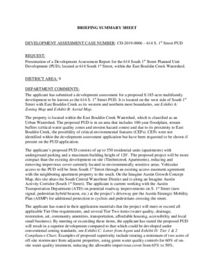
BRIEFING SUMMARY SHEET DEVELOPMENT ASSESSMENT CASE NUMBER: CD-2019-0006 – 614 S. 1st Street PUD REQUEST: Presentation of a Development Assessment Report for the 614 South 1st Street Planned Unit Development (PUD), located at 614 South 1st Street, within the East Bouldin Creek Watershed. DISTRICT AREA: 9 DEPARTMENT COMMENTS: The applicant has submitted a development assessment for a proposed 8.185-acre multifamily development to be known as the 614 S. 1st Street PUD. It is located on the west side of South 1st Street with East Bouldin Creek as its western and northern most boundaries, see Exhibit A: Zoning Map and Exhibit B: Aerial Map. The property is located within the East Bouldin Creek Watershed, which is classified as an Urban Watershed. The proposed PUD is in an area that includes 100-year floodplain, stream buffers (critical water quality zones and erosion hazard zones) and due to its proximity to East Bouldin Creek, the possibility of critical environmental features (CEFs). CEFs were not identified within the development assessment application but have been requested to be shown if present on the PUD application. The applicant’s proposed PUD consists of up to 550 residential units (apartments) with underground parking and a maximum building height of 120’. The proposed project will be more compact than the existing development on site (Timbercreek Apartments), reducing and removing impervious cover currently located in environmentally sensitive areas. Vehicular access to the PUD will be from South 1st Street through an existing access easement agreement with the neighboring apartment property to the south. On the Imagine Austin Growth Concept Map, this site abuts the South Central Waterfront District and is along an Imagine Austin Activity Corridor (South 1st Street). The applicant is current working with the Austin Transportation Department (ATD) on potential roadway improvements on S. 1st Street (new signal, pedestrian hybrid beacon, etc.) at the project’s driveway per the Austin Strategic Mobility Plan (ASMP) for additional protection to cyclists and pedestrians crossing the street. The applicant has stated in their application materials that the project will meet or exceed all applicable Tier One requirements, and several Tier Two items (water quality, drainage, restoration, art, community amenities, transportation, affordable housing, accessibility and local small business). By meeting or exceeding these items, the applicant has stated the proposed PUD will result in a superior development compared to that which could be developed under conventional zoning standards, see Exhibit C: Letter from Agent and Exhibit D: Tier 1 & 2 Compliance Chart. Examples of proposed superiority include treating a minimum of two acres of off-site stormwater from adjacent properties, using green water quality controls for 60% of on- site water quality treatment, reducing the allowable impervious cover from 65% to 50%, integrating public art along the South 1st Street frontage, providing public access to East Bouldin Creek for increased bicycle and pedestrian connectivity, and providing at least 15% of the total units as accessible and “universal design” Type B Units (equivalent to Fair Housing Act guidelines for accessible units). At this time, code modifications are requested to the Zoning, Transportation and Environmental chapters of the Land Development Code (LDC). Examples of requested code modifications include reduced parking, floodplain modifications, increased maximum building height, decreased compatibility setbacks and alternative equivalent compliance to Subchapter E, see Exhibit E: PUD Code Modification Table for the applicant’s list of requested code modifications. The applicant intends to redevelop the property as a new high density multifamily project which will increase the amount of open space on the property by clustering the buildings towards S. 1st Street and providing all parking underground. Staff and the applicant will continue to discuss and work together on compatibility between new and existing housing, and access and redevelopment to and around East Bouldin Creek. The staff’s comments on the applicant’s development assessment submittal for this proposed PUD project were completed on November 6, 2019 and is compiled in the Master Report, see Exhibit H: Master Report. Additional information is necessary to demonstrate how the PUD would meet the objectives of the City Code or provide for development standards that achieve equal or greater consistency with the Code. OWNER/APPLICANT: University Financial of Texas, Inc. (R. Lee Huntington) AGENT: Drenner Group, PC (Leah Bojo) ENVIRONMENTAL COMMISSION DATE: January 15, 2020 – Briefing scheduled. CITY COUNCIL BRIEFING DATE: January 23, 2020 – Briefing scheduled. ASSIGNED STAFF: Kate Clark e-mail: kate.clark@austintexas.gov H22 P-NP J22 W RIVERSIDE DR P-NP CS-1-NP P-NP SF-3-NP CS-1-V-NP MF-3-NP CS-1-V P CS-1-V CS-V BARTON SPRINGS RD CS A 1 4 DAWSON RD 5 7 2 9 6 3 8 10 34 CS-V-NP 33 36 35 SF-3-NP 37 30 31 28 32 DANIEL DR 29 27 39 38 41 3 43 45 4052 42 44 54 5A SF-3-NP 46 53 6A 51 48 49 7 50 55 8 47 POST OAK ST 56 10 9 57 63 59 58 62 61 SF-3-NP 60 17 RETAMA ST 19 18 21 16 SF-3-NP 22 8 4 24 6 4 29 3 5 EBONY ST 14 3 15 17 16 13 20 19 8 18 7 5 RAMONA ST 1A 4 2 10 11 13 1 9 10 16 18 14 8 8 17 21A 19 9 6 7 5 3 7 25A 21 6 4 24 2 22 1 26 5 27 28 20 30 25 28 4 19 1 SF-3-NP 2 18 15 11 6 4 5 13 8 7 10 8 7 5 9 6 3 8 4 2 6 7 5 1 SF-3-NP 7 2 1 6 4 5 3 1-A 14 2-A 15 17 16 18 10 3 11 2 1 SF-3-NP SF-3-NP SF-3-NP 1B SF-3-NP CHRISTOPHER ST 4 3 2 4 5 6 16 SF-3-NP 13 11 12 COLUMBUS ST 2 1 4 3 5 1 SF-3-NP 9 8 7 SF-3-NP S 3RD ST W JAMES ST 5 4 2 3 9 1 6 7 8 5 4 SF-3-NP 12 1 15 14 13 17 16 18 SF-3-NP SF-3-NP 4 7 6 5 4 32 1 1 5 7 8 10 9 1 11 12 11 2 1 5 1 1 8 7 2 7 4 2 3 3 4 1 3 2 5 SF-3-NP 10 SUBJECT TRACT ZONING BOUNDARY PENDING CASE CREEK BUFFER BOULDIN AVE ± 1'' = 400' ! ! ! ! ! ! 26 BOULDIN AVE SF-3-NP S 3RD ST 4 3 18 A 1 PUD-NP 2 6 7 9 2 8 1 11 2 12 10 SF-3-NP 1 14 15 17 SF-3-H-NP 16 H21 BARTON SPRINGS RD P-NP CS-1-V-NP CS-MU-V-CO-NP 2 MF-3-NP 2 1 3 1C MF-2-NP 1 4 NO-NP S 1ST ST LO-MU-V-NP 5 6 7 8 9 UNNAMEDST 248 SF-6-CO-NP 1B S 2ND ST 14 13 1 212 11 3 4 9 10 5 COPELANDST 6 6 3 5 2 4 3 S 1ST ST 1 P-NP GR-MU-V-CO-NP 13 4 1 2 1 3 ZONING CASE#: LOCATION: SUBJECT AREA: GRID: MANAGER: 614 1st. Street CD-2019-0006 614 S. 1st Street 8.19 ACRES H21KATE CLARK 14 UNZ P-NP 3F S 1ST ST PUD-NP 1 5A 5B CS-1-V-NP 1 LI-NP 2F 6 3 2 3F PUD-NP 3F PUD-NP 2F 1 CS-1-V-NP 3 2 CS-1-V-NP CS-1-V-NP HAYWOOD AVE J21 CS-1-NP CS-1-V-NP 2A P-NP 1 3A CS-1-V-NP CS-1-NP A S CONGRESS AVE CS-MU-V-NP MUSIC LN 1 NEWTON ST 16 15 EVA DR 14 NELLIEST This map has been produced by the Communications Technology Management Dept. on behalf of the Planning Development Review Dept. for the sole purpose of geographic reference. No warranty is made by the City of Austin regarding specific accuracy or completeness. H22 P-NP J22 W RIVERSIDE DR P-NP CS-1-NP P-NP SF-3-NP CS-1-V-NP MF-3-NP CS-1-V P CS-1-V CS-V BARTON SPRINGS RD CS A 1 4 DAWSON RD 5 7 2 9 6 3 8 10 34 CS-V-NP 33 36 35 SF-3-NP 37 30 31 28 32 DANIEL DR 29 27 39 38 41 3 43 45 4052 42 44 54 5A SF-3-NP 46 53 6A 51 48 49 7 50 55 8 47 POST OAK ST 56 10 9 57 63 59 58 62 61 SF-3-NP 60 17 RETAMA ST 19 18 21 16 SF-3-NP 22 8 4 24 6 4 29 3 5 EBONY ST 14 3 15 17 16 13 20 19 8 18 7 5 RAMONA ST 1A 4 2 10 11 13 1 9 10 16 18 14 8 8 17 21A 19 9 6 7 5 3 7 25A 21 6 4 24 2 22 1 26 5 27 28 20 30 25 28 4 19 1 SF-3-NP 2 18 15 11 6 4 5 13 8 7 10 8 7 5 9 6 3 8 4 2 6 7 5 1 SF-3-NP 7 2 1 6 4 5 3 1-A 14 2-A 15 17 16 18 10 3 11 2 1 SF-3-NP SF-3-NP SF-3-NP 1B SF-3-NP CHRISTOPHER ST 4 3 2 4 5 6 16 SF-3-NP 13 11 12 COLUMBUS ST 2 1 4 3 5 1 SF-3-NP 9 8 7 SF-3-NP S 3RD ST W JAMES ST 5 4 2 3 9 1 6 7 8 5 4 SF-3-NP 12 1 15 14 13 17 16 18 SF-3-NP SF-3-NP 4 7 6 5 4 32 1 1 5 7 8 10 9 12 11 2 1 5 1 1 8 7 2 7 2 4 3 1 11 3 4 1 3 2 5 SF-3-NP 10 SUBJECT TRACT ZONING BOUNDARY PENDING CASE CREEK BUFFER BOULDIN AVE ± 1'' = 400' ! ! ! ! ! ! 26 BOULDIN AVE SF-3-NP S 3RD ST 4 3 18 A 1 PUD-NP 2 6 7 9 2 8 1 11 2 12 10 SF-3-NP 1 14 15 17 SF-3-H-NP 16 H21 BARTON SPRINGS RD P-NP CS-1-V-NP CS-MU-V-CO-NP 2 MF-3-NP 2 1 3 1C MF-2-NP 1 4 NO-NP S 1ST ST LO-MU-V-NP 5 6 7 8 9 UNNAMEDST 248 SF-6-CO-NP 1B S 2ND ST 14 13 1 212 11 3 4 9 10 5 COPELANDST 6 6 3 5 2 4 3 S 1ST ST 1 P-NP GR-MU-V-CO-NP 13 4 1 2 1 3 ZONING CASE#: LOCATION: SUBJECT AREA: GRID: MANAGER: 614 1st. Street CD-2019-0006 614 S. 1st Street 8.19 ACRES H21KATE CLARK 14 UNZ P-NP 3F S 1ST ST PUD-NP 1 5A 5B CS-1-V-NP 1 LI-NP 2F 6 3 2 3F PUD-NP 3F PUD-NP 2F 1 CS-1-V-NP 3 2 CS-1-V-NP CS-1-V-NP HAYWOOD AVE J21 CS-1-NP CS-1-V-NP 2A P-NP 1 3A CS-1-V-NP CS-1-NP A S CONGRESS AVE CS-MU-V-NP MUSIC LN 1 NEWTON ST 16 15 EVA DR 14 NELLIEST Copyright nearmap 2015 This map has been produced by the Communications Technology Management Dept. on behalf of the Planning Development Review Dept. for the sole purpose of geographic reference. No warranty is made by the City of Austin regarding specific accuracy or completeness. Code Section Requirement §25-6-472 Parking Facility Standards 614 S. 1st Street PUD Code Modification Table Except as provided in Section 25-6- 472 ( Modification Of Parking Requirement ), a parking facility for a use must comply with the requirements in Appendix A ( Tables Of Off-Street Parking And Loading Requirements ). In all watersheds, development is prohibited in a critical water quality zone except as provided in this Division. Development allowed in the critical water quality zone under this Division shall be revegetated and restored within the limits of construction as prescribed by the Environmental Criteria Manual. Floodplain modification within a critical water quality zone is prohibited except as allowed under Section 25-8-261 (Critical Water Quality Zone Development). Floodplain modification outside a critical water quality zone is allowed only if the modification proposed: (3) is located within a floodplain area classified as in fair or poor condition, as determined by a functional assessment of floodplain health, prescribed by the Environmental Criteria Manual. (A) Removal of a heritage tree is prohibited unless the Planning and Development Review Department has issued a permit for the removal under this division. PUD Code Modification Minimum off-street parking requirements shall be fifty percent (50%) of that prescribed by Appendix A. and Concrete piers as reasonably necessary to support structures in that area, and cisterns for stormwater irrigation storage are permitted within the current and proposed 100- year floodplain within the PUD boundary. A Code modification to §25-8- 364 is granted to allow for modification in the floodplain to allow removal of existing buildings, re-grading of the floodplain, and to install piers for the elevated portion of the proposed building and cisterns for stormwater and irrigation storage in the floodplain, as will be required. Zone 2 has been categorized as good condition; Zone 3 has been categorized as fair condition. The project has conducted a tree survey and will work with the City Arborist during the Development Assessment process to finalize a tree plan prior to submittal of the PUD application. §25-8-261, Critical Water Quality Zone Development §25-8-364, Floodplain Modification §25-8-641, Removal Prohibited §25-2-1051, Compatibility Standards A Code modification to §25-2- 1051 is granted to allow a 120- foot building to encroach within the 540-foot compatibility standards setback area up to 60 feet from the triggering properties. 614 S. 1st Street PUD Code Modification Table (A) Except as provided in Section 25- 2 1052 ( Exceptions ) or another specific provision of this title, this article applies to the following uses: (1) A use in a townhouse and condominium residence (SF-6) or less restrictive zoning district and to a civic use described in Subsection (B) that is located on property: (a) across the street from or adjoining property: (i) in an urban family residence (SF- 5) or more restrictive zoning district; (ii) on which a use permitted in an SF-5 or more restrictive zoning district is located, other than a dwelling permitted by Section 25-2- 894 ( Accessory Uses For A Principal Commercial Use ); or (iii) in a traditional neighborhood (TN) zoning district; or (b) located 540 feet or less from property in: (i) an SF-5 or more restrictive zoning district; (ii) a TN district; or (iii) a development reserve (DR) zoning district. (B) The minimum site area for each dwelling unit is: (1) 1,200 square feet, for an efficiency dwelling unit; (2) 1,500 square feet, for a one bedroom dwelling unit; and (3) 1,800 square feet, for a dwelling unit with two or more bedrooms. 40 feet §25-2-562, Multifamily Residence Medium Density (MF-3) District Restrictions §25-2-492, Site Development Regulations, Max Height A Code modification to §25-2- 562 is granted to waive minimum net site area requirements for the PUD with a maximum of 550 units. Maximum height of the PUD is 120 feet. 614 S. 1st Street PUD Code Modification Table §25-2-492, Site Development Regulations, Max FAR .75:1 Maximum FAR of the PUD is 2:1. §25-2, Subchapter E, 2.2.2.c, Core Transit Corridors: Sidewalks and Building Placement – Supplemental Zone (optional) §25-2, Subchapter E, 2.2.2.d, Core Transit Corridors: Sidewalks and Building Placement – Building Placement §25-2, Subchapter E, 2.2.5, Internal Circulation Routes: Sidewalks and Building Placement Requirements for Large Sites A supplemental zone may be provided at the option of the applicant between the street-facing facade line and the required clear zone. (See Figures 10 - 11.) The following standards apply to supplemental zones: 1. If a supplemental zone is provided, up to 30 percent of the linear frontage of the supplemental zone may be a maximum of 30 feet wide, and the remainder of the supplemental zone shall be a maximum of 20 feet wide. (See Figures 10 - 11.) General Building Placement Standard. Notwithstanding the minimum setback requirements of the base zoning districts, at least 75 percent of the net frontage length of the property along the Core Transit Corridor must consist of continuous building facade built up to the clear zone, or the supplemental zone if one is provided. Applies if the Principal Street Is: Development of a site five acres or larger with frontage on a Core Transit Corridor or Urban Roadway. Applies to the Following: - All zoning districts - See additional exemptions in Subsection C of this section. Alternative Equivalent Compliance to §25-2, Subchapter E, 2.2, Relationship of Buildings to Streets and Walkways is granted to allow, if provided, up to 30 percent of the linear frontage of the supplemental zone to be a maximum of 90 feet wide, and the remainder of the supplemental zone to be a maximum of 75 feet wide. Alternative Equivalent Compliance to §25-2, Subchapter E, 2.2, Relationship of Buildings to Streets and Walkways is granted to allow that a minimum of 60 percent of the net frontage length of the property along the Core Transit Corridor must consist of continuous building facade built up to the clear zone, or the supplemental zone if one is provided. Alternative Equivalent Compliance to §25-2, Subchapter E, 2.2.5 is granted to remove the requirement for an Internal Circulation Route, related Block Standards, Project Circulation Plan, Sidewalks, Building Placement, Parking, and Joint Access due the site constraint that only approximately 3.36 acres of 614 S. 1st Street PUD Code Modification Table developable area exist outside of the floodplain. B.1. At least one customer entrance must face and connect directly to the roadway or Internal Circulation Route where building frontage is provided consistent with the requirements of this Subchapter. A building entrance is not required under this subsection if the following requirements are met (See Figure 32.): (See Figure 32 set forth in Exhibit A attached to Ord. 20130606-088; Requirements for a principal entrance that does not face the principal street.) Alternative Equivalent Compliance to §25-2, Subchapter E, 2.4 Commercial Design Standards is granted to allow that a minimum of 60 percent of the net frontage length along the principal street must consist of continuous building facade that is built up to the clear zone (or supplemental zone if provided) regardless of the applicable building frontage requirements of Sections 2.2.2 through 2.2.5. a. At least 80 percent of the net frontage length along the principal street must consist of continuous building facade that is built up to the clear zone (or supplemental zone if provided) regardless of the applicable building frontage requirements of Sections 2.2.2 through 2.2.5. §25-2, Subchapter E, 2.4, Building Entryways G F E D C B A 0529.10.002 - LAND USE PLAN.DWG FILE NAME: LAST MODIFIED BY: LAST MODIFIED ON: PLOTTED BY: PLOTTED ON: PLOTTED WITH: PLOT STYLE: FILENAME: FILENAME: ---- NONE RACHEL.ENNS 10/3/2019 9:11:42 AM RACHEL ENNS 10/3/2019 9:22:47 AM 1 P:\Projects\0529 - Drenner Group, PC\10.002 - Timbercreek PUD\01 - Civil\06-Exhbts\Land Use Plan\0529.10.002 - LAND USE PLAN.dwg - LAYOUT LAND USE PLAN P:\Projects\0529 - Drenner Group, PC\10.002 - Timbercreek PUD\01 - Civil\06-Exhbts\Land Use Plan\0529.10.002 - LAND USE PLAN.dwg - LAYOUT LAND USE PLAN 2 3 4 RACHEL.ENNS LASTMODIFIEDBY 10/3/2019 9:11:42 AM LASTMODIFIEDON LAST MODIFIED BY: LAST MODIFIED BY: LAST MODIFIED ON: LAST MODIFIED ON: PLOTTED BY: PLOTTED BY: PLOTTED ON: PLOTTED ON: PLOTTED WITH: PLOTTED WITH: PLOT STYLE: PLOT STYLE: RACHEL ENNS PLOTTEDBY 10/3/2019 9:22:47 AM PLOTTEDON DWG TO PDF.PC3 PLOTTEDWITH V1.0 BRD PRODUCTION STANDARD.CTB PLOTSTLYE 5 5.0' 16.0' 8.9' P R O P O S E D P U D B O U N D A R Y 9.4' P O S T O (50' R.O.W.) A K S T R E E T BOULDIN AVENUE (60' R.O.W.) P U D B O U N D A R Y P R O P O S E D 67.0' 2 6 . 5 ' 4 6 . 9' 9.7' 51.2' E TRACT 2 EASEMENT AGREEMENT VOL. 7869, PG. 291, D.R.T.C.T. 143.5' 12.4' 3 9.9' 116.3' 31.8' 56.2' SOUTH 1ST STREET (R.O.W. VARIES) 5 7.8' 58.0' P R O P O S E D P U D B O U N D A R Y 2 1 . . N O T E S : L A Y O U T F O R I L L U S T R A T I O N . I D M E N S I O N S S H O W N A R E A P P R O X M A T E A N D V A R I E D I . I I I N O T C R E A T E L A B L T Y O N T H E P A R T O F T H E S U R V E Y O R . F L O O D N G I O R F L O O D D A M A G E . T H S I F L O O D S T A T E M E N T A N D O R / T H E S T R U C T U R E S T H E R E O N I W L L B E F R E E S H A L L F R O M T H S I F L O O D S T A T E M E N T D O E S N O T I M P L Y T H A T T H E P R O P E R T Y T H S I P R O P E R T Y I S F L O O D P L A N N O T E I : A R E A S D E T E R M N E D I T O F L O O D P L A N I , P A R T A L L Y I B E W T H N I I L O C A T E D T H E 0 . 2 % A N N U A L I W T H N I Z O N E ' X ' - A R E A S D E T E R M N E D I T O B E I W T H N I T H E 1 % A N N U A L I T R A V S C O U N T Y , T E X A S D A T E D J A N U A R Y 6 , 2 0 1 6 . F L O O D P L A N D E T E R M N E D F L O O D P L A N I I I , , A N D T O B E P A R T A L L Y I O U T S D E I T H E 0 . 2 % A N N U A L I W T H N I Z O N E ' X ' , A S S H O W N O N F . I . . R M . P A N E L N O . 4 8 4 5 3 C 0 4 4 5 J , C H A N C E A R E A S S H A D E D C H A N C E C H A N C E , P A R T A L L Y I L O C A T E D I W T H N I Z O N E " A E " , R E C O R D S O F T R A V S C O U N T Y I , T E X A S . A M E N D E D I N V O L U M E 7 8 1 8 , P A G E 9 3 5 O F T H E R E A L P R O P E R T Y C O U N T Y , T E X A S , A C C O R D N G I T O T H E D E C L A R A T O N I C O N D O M N U M S I I A N D A M E N D M E N T S T H E R E T O , R E C O R D E D V O L U M E 7 2 9 6 , P A G E 8 7 O F T H E C O N D O M N U M I I R E C O R D S ; A N D K N O L L C O N D O M N U M S I I , A C O N D O M N U M I I P R O J E C T I N T R A V S I C O U N T Y V O L U M E , T E X A S , O V E R A N D A C R O S S A P O R T O N I O F T H E O A K 7 8 6 9 , P A G E 2 9 1 O F T H E D E E D R E C O R D S O F T R A V S I E A S E M E N T T R A C T 2 : E A S E M E N T A G R E E M E N T , R E C O R D E D O N S E P T E M B E R 2 9 , 1 9 8 2 I N E S T A T E C R E A T E D B Y T H A T C E R T A N I O F I N L E G A L D E S C R P T O N I I : I O F T R A V S C O U N T Y , T E X A S . R E C O R D E D I N V O L U M E 6 0 , P A G E S ( ) 6 3 O F T H E C O U N T Y T R A C T 1 , : T E X A S , A C C O R D N G I T O T H E M A P O R L O T ( S ) 2 , P A R A G O N A D D T O N I I , A S U B D V S O N I I I P L A T P L A T I R E C O R D S T H E R E O F , N T R A V S I V I C I N I T Y M A P L E G E N D I B U I L D N G F A C E C O N T O U R ( G R A D E ) E L E V A T O N S I I E R O S O N H A Z A R D Z O N E C U R B / E D G E O F P A V E M E N T I I C R T C A L W A T E R Q U A L I T Y Z O N E E A S E M E N T / S E T B A C K F E M A 5 0 0 - Y E A R F L O O D P L A N I F E M A 1 0 0 - Y E A R F L O O D P L A N I B O U N D A R Y / I R G H T O F W A Y PROJECT: 0 1 O F 0 2 0 1 S H E E T SHEET TITLE: TIMBERCREEK PUD 614 S. 1ST STREET AUSTIN, TRAVIS COUNTY, TEXAS, 78704 LAND USE PLAN 512.669.5560 FIRM NO: F-15085 2021 EAST 5TH STREET, SUITE 200 AUSTIN, TEXAS, 78702 NOT AUTHORIZED FOR CONSTRUCTION PRIOR TO FORMAL CITY APPROVAL G F D C B A 0529.10.002 - LAND USE PLAN.DWG FILE NAME: LAST MODIFIED BY: LAST MODIFIED ON: PLOTTED BY: PLOTTED ON: PLOTTED WITH: PLOT STYLE: FILENAME: FILENAME: ---- NONE RACHEL.ENNS 1032019 9:11:42 AM RACHEL ENNS 1032019 9:22:50 AM P:\Projects\0529 - Drenner Group, PC\10.002 - Timbercreek PUD\01 - Civil\06-Exhbts\Land Use Plan\0529.10.002 - LAND USE PLAN.dwg - LAYOUT LAND USE NOTES P:\Projects\0529 - Drenner Group, PC\10.002 - Timbercreek PUD\01 - Civil\06-Exhbts\Land Use Plan\0529.10.002 - LAND USE PLAN.dwg - LAYOUT LAND USE NOTES 1 2 RACHEL.ENNS LASTMODIFIEDBY 1032019 9:11:42 AM LASTMODIFIEDON LAST MODIFIED BY: LAST MODIFIED BY: LAST MODIFIED ON: LAST MODIFIED ON: PLOTTED BY: PLOTTED BY: PLOTTED ON: PLOTTED ON: PLOTTED WITH: PLOTTED WITH: PLOT STYLE: PLOT STYLE: RACHEL ENNS PLOTTEDBY 1032019 9:22:50 AM PLOTTEDON DWG TO PDF.PC3 PLOTTEDWITH V1.0 BRD PRODUCTION STANDARD.CTB PLOTSTLYE 5 1 1 . 1 0 . 7 . 6 . 5 . 4 . 3 . 2 . 1 . A R E A S . I R P P L E P O O L S - . R E D U C E P O L L U T A N T R U N O F F . I L O A D N G A N D W A T E R U S A G E . D E V E L O P M E N T D E P A R T M E N T . H O U S N G I , A S A F F O R D A B L E 4 0 . A F F O R D A B L E H O U S N G I A N D A F E E I N T H E A M O U N T E S T A B L I S H E D U N D E R S E C T O N I 2 . 5 . 6 ( I N T H E P R O J E C T W I L L C O M P L Y I W T H S E C T O N I 2 . 5 . 2 . B . 2 B Y P R O V D N G I I A I C O M B N A T O N I O F - O N S T E I D O N A T O N I ) F O R E A C H S Q U A R E H O U S N G I T R U S T F U N D F O O T T O O F B O N U S S Q U A R E F O O T A G E A B O V E T H E B A S E L N E I T O B E U S E D F O R P R O D U C N G I O R I F N A N C N G I A F F O R D A B L E T H E I L E U D E T E R M N E D I B Y T H E I D R E C T O R O F T H E I N E G H B O R H O O D H O U S N G I A N D C O M M U N T Y I F H A T Y P E B U N T S I . 3 6 . T H E P R O J E C T W I L L U N B U N D L E I I T S P A R K N G F R O M I I T S U N T R E N T S . 3 9 . T H E P R O J E C T S H A L L P R O V D E I A C C E S S B I L I T Y I F O R P E R S O N S W T H I I I D S A B L T E S I I A T A L E V E L T H A T E X C E E D S A P P L I C A B L E L E G A L I R E Q U R E M E N T S B Y P R O V D N G I I I I A M N M U M O F 1 5 O F T H E U N T S I A S O F T H E S T R U C T U R E M A Y B E V S B L E D U E T O T O P O G R A P H Y I I . 3 8 . A L L P A R K N G I F O R T H E P R O J E C T S H A L L B E L O C A T E D I E N T R E L Y S U B S U R F A C E , T H O U G H A P O R T O N I 3 7 . I I O P T O N S O F S E C T O N 3 . 3 . 2 O F C H A P T E R 2 5 - 2 , S U B C H A P T E R E ( I D E S G N S T A N D A R D S A N D M X E D U S E I ) . T H E P R O J E C T S H A L L A C H E V E I A I I M N M U M O F F O U R ( 4 ) I P O N T S U N D E R T H E I B U L D N G I D E S G N I C O N N E C T V T Y I I . C O N N E C T V T Y I I . 3 5 . T H E P R O J E C T W I L L I N C L U D E A P U B L I C , I - O N S T E T R A I L A L O N G T H E C R E E K F O R A D D T O N A L P E D B K E I I I 3 2 . T H E P R O J E C T S H A L L C O M P L Y W T H T H E D A R K S K Y I I I I N T A T V E I . 3 4 . T H E P R O J E C T W I L L P R O V D E I P U B L I C C R E E K A C C E S S F O R I A D D T O N A L I I - B K E P E D E S T R A N I B E S E T B A C K D U E T O T O P O G R A P H Y . 3 3 . I T H S P R O J E C T W I L L I N T E G R A T E A R T A L O N G T H E S . 1 S T S T R E E T F R O N T A G E W H E R E B U L D N G S M U S T I I I D E L I V E R Y O F R E C L A M E D W A T E R T O T H E S T E T O W E R S A M O N G O T H E R A P P R O V E D F X T U R E S I . I 3 1 . T H E P R O J E C T S H A L L B E C O N S T R U C T E D I U S N G A D U A L I I D S T R B U T O N I I P P E S Y S T E M T O S U P P L Y - N O N P O T A B L E I F X T U R E S I W T H N I T H E B U I L D N G S I ( I N C L U D N G I T O I L E T S U R N A L S I A N D C O O L N G I 3 0 . T H E P R O J E C T W I L L S T A B I L I Z E T H E S T R E A M B A N K S W T H N A T U R A L A N D B O D E G R A D A B L E M A T E R A L - I I I . ) ’ I I W T H T H E C T Y S R E C L A M E D W A T E R S E R V C E I I , U P O N 2 9 . T H E P R O J E C T W I L L R E L O C A T E T H E - O N S T E I D O G P A R K O U T O F T H E 1 0 0 - Y E A R F L O O D P L A N I T O 2 8 . I I T H E P R O J E C T S H A L L U S E R A N W A T E R H A R V E S T N G T O R E D U C E S T O R M W A T E R R U N O F F P O L L U T A N T 2 6 . T H E P R O J E C T S H A L L I N S T A L L W E T L A N D F E A T U R E S I N T H E F L O O D P L A N I . 2 7 . T H E P R O J E C T S H A L L R E S T O R E I A N M A L H A B T A T I B Y U S E O F W O O D Y M A T E R A L I A N D I N C H A N N E L 3 I D S T U R B E D A R E A S W I L L B E C L U S T E R E D A T T H E S . 1 S T S T R E E T F R O N T A G E . 2 3 . T H E P R O J E C T S H A L L R E L O C A T E A L L S T R U C T U R E S A W A Y F R O M T H E C H A N N E L A N D I I M N M Z E I I A C T V T Y I I N T H E I I C R T C A L W A T E R Q U A L I T Y Z O N E A N D F L O O D P L A N I . N E W I M P E R V O U S I C O V E R A N D S P E C E S I ) A N D U T I L I Z E C E N T R A L T E X A S N A T V E S E E D S T O C K I . 2 2 . I I A L L R E Q U R E D T R E E P L A N T N G S S H A L L U T I L I Z E N A T V E T R E E S P E C E S S E L E C T E D F R O M A P P E N D X F I I I O F T H E I E N V R O N M E N T A L I C R T E R A I M A N U A L A P P E N D X I ( D E S C R P T V E I I C A T E G O R E S I O F T R E E 2 5 . I I R R G A T O N I S O U R C E T H E P R O J E C T S H A L L F O R L A N D S C A P E U S E I R A N W A T E R I I R R G A T O N I F O R A I I M N M U M O F 6 0 O F T H E H A R V E S T N G I A N D O T H E R W A T E R R E U S E A S L A N D S C A P E D T H E I P R M A R Y E X T E N T O F B E L O W G R A D E P A R K N G I , A S A P P R O V E D B Y T H E C T Y O F A U S T N I I . 2 4 . T H E P R O J E C T S H A L L I M P L E M E N T I P E R V O U S C O N C R E T E O U T S D E O F I I F R E A C C E S S D R V E S I A N D T H E I I C R T C A L W A T E R Q U A L I T Y Z O N E . 2 1 . ( B O T H S U R F A C E I P A R K N G A N D S T R U C T U R E S ) , I W T H I I A M N M U M O F 1 0 , 0 0 0 S Q U A R E F E E T F R O M T H E T H E P R O J E C T W I L L R E M O V E 5 0 , 0 0 0 T O T A L S Q U A R E F E E T O F I M P E R V O U S I C O V E R F R O M T H E I S T E R E M O V E D E N T R E L Y I . 2 0 . I I I I I I M P E R V O U S C O V E R A N D E X S T N G B U I L D N G S W T H N T H E C R T C A L W A T E R Q U A L T Y Z O N E S H A L L B E I I I I I R F F L E S , A N D P O O L S W I L L B E I M P L E M E N T E D A S D E S C R B E D I I I N T H E D R A N A G E C R T E R A M A N U A L I I . 1 9 . T H E P R O J E C T I F U N C T O N A L I T Y A N D W I L L A E S T H E T C S I . N A T U R A L C H A N N E L D E S G N I F E A T U R E S S U C H A S R U N S , S T E P S , I M P L E M E N T I - N C H A N N E L S T R E A M I M P R O V E M E N T S T H R O U G H E N H A N C E D S T A B I L I Z E T H E B A N K S . 1 5 . I M A X M U M I I M P E R V O U S C O V E R S H A L L B E 5 0 O F T H E G R O S S S T E A R E A I . 1 8 . T H E P R O J E C T W I L L R E M O V E I I T H E E X S T N G B U I L D N G S I I I N T H E F L O O D P L A N A N D W L L R E G R A D E I A N D A S D E S C R B E D I I I N T H E D R A N A G E C R T E R A M A N U A L . I I 1 7 . 1 6 . I I W A T E R W A Y S E T B A C K S S H A L L B E A M N M U M O F 5 0 F E E T F R O M T H E B O U L D N C R E E K C E N T E R L N E I I . I I T H E P R O J E C T S H A L L P R O V D E V O L U M E T R C F L O O D D E T E N T O N T O P R E D E V E L O P M E N T C O N D T O N S - I I I I P R E S C R B E D B Y A P P E N D X A I . 1 4 . I I M N M U M O F F - S T R E E T P A R K N G I I R E Q U R E M E N T S S H A L L B E I F F T Y P E R C E N T ( 5 0 ) O F T H A T 4 I O R D N A N C E . 1 3 . T H E P R O J E C T S H A L L C O M P L Y I W T H O R E X C E E D T H E I C T Y O F A U S T N I T E N A N T R E L O C A T O N I 1 2 . T H E P R O J E C T S H A L L U T I L I Z E G R E E N W A T E R Q U A L I T Y C O N T R O L S A S D E S C R B E D I I N T H E I P R O P E R T Y U S N G W A T E R Q U A L I T Y C O N T R O L S T H A T A R E S U P E R O R T O T H O S E R E Q U R E D B Y C O D E I I . T H E P R O J E C T W I L L T R E A T A I I M N M U M O F 2 A C R E S O F O F F - S T E I S T O R M W A T E R F R O M A D J A C E N T I R A N W A T E R H A R V E S T N G I , O R R A N I Q U A L I T Y V O L U M E R E Q U R E D B Y C O D E I . I E N V R O N M E N T A L I C R T E R A I M A N U A L , G A R D E N S , T O T R E A T I S X T Y P E R C E N T ( 6 0 ) O F T H E I N C L U D N G I B U T N O T I L I M T E D T O I I B O F L T R A T O N I W A T E R P O N D S , 9 . N O G A T E D R O A D W A Y S S H A L L B E P E R M T T E D W T H N T H E P U D I I I . I T R A N S P O R T A T O N D E P A R T M E N T , I F U N D N G S H A L L B E P R O V D E D I . I T H E P U D S H A L L C O M P L Y W T H A T L A S 1 4 F L O O D P L A N S T A N D A R D S I . S H A L L B E I D R V E W A Y 8 . T H E P R O J E C T S H A L L F U N D A N D C O N S T R U C T A P E D E S T R A N I H Y B R D I T O P R O V D E I A S A F E P A T H A C R O S S S O U T H I F R S T S T R E E T . F U N D N G I B E A C O N F O R T H E B E A C O N A T T H E P R O J E C T T H A T A P E D E S T R A N I H Y B R D I B E A C O N I S N O T F E A S B L E I O R I D E S R E D B Y T H E A U S T N I M A D E I P R O R T O T H E I S S U A N C E O F I C E R T F C A T E I O F O C C U P A N C Y . I F I T I S D E T E R M N E D I P U D N O T E S : G I I T H E P U D S H A L L E X C E E D C T Y R E Q U R E M E N T S F O R A T R E E M A N T E N A N C E P L A N I . T H E P U D S H A L L M T G A T E I I T R E E S T H A T M U S T B E R E M O V E D A T T W C E I T H E R A T E T H A T I S R E Q U R E D I I I G R E E N N A T V E A N D A D A P T E D P L A N T G U D E O R C T Y O F A U S T N R A N G A R D E N P L A N T L S T I I I I . T H E P R O J E C T S H A L L E X C E E D I I T H E M N M U M L A N D S C A P E I R E Q U R E M E N T S O F T H E I C T Y C O D E . 1 0 0 I I O F A L L L A N D S C A P E P L A N T N G O N S T E S H A L L B E T H O S E D E S G N A T E D B Y T H E C T Y O F A U S T N G R O W I I I W A S T E C O L L E C T O N S Y S T E M S I , A N D R E M O V A L O F T R A S H D E B R S I . D E S G N I , L A N D S C A P E M A N A G E M E N T P R A C T C E S I , S T O R M W A T E R C O N V E Y A N C E D E S G N I , I A N M A L T H E P R O J E C T S H A L L R E D U C E P O L L U T A N T L O A D N G I B Y A I I M N M U M O F 7 0 D U E T O L A N D S C A P N G I T H S I P R O J E C T S H A L L C O M P L Y - T H R E E S T A R L E V E L , I A T A M N M U M I . I W T H T H E I C T Y O F A U S T N I G R E E N I B U L D N G I P R O G R A M A T A S U B C H A P T E R E , I I S E C T O N 2 . 7 P R V A T E C O M M O N O P E N S P A C E A N D P E D E S T R A N A M E N T E S I I I . O P E N S P A C E . O P E N S P A C E S H A L L B E C A L C U L A T E D I N A C C O R D A N C E I W T H C H A P T E R 2 5 - 2 , A T L E A S T 1 0 0 , 0 0 0 S Q U A R E F E E T O F O P E N S P A C E A T G R A D E A N D 4 , 0 0 0 S Q U A R E F E E T O F E L E V A T E D I I I T H E P R O J E C T S H A L L E X C E E D T H E T E R 1 M N M U M R E Q U R E M E N T S F O R O P E N S P A C E B Y P R O V D N G I I I I B Y C T Y C O D E . ( A S M P ) O N S . 1 S T S T R E E T . T H E P U D S H A L L P R O V D E I I R G H T O F W A Y , A S N E E D E D , P E R T H E A U S T N I I S T R A T E G C M O B L T Y I I P L A N P R O P E R T E S I . 9 . 8 . 6 . 5 . 4 . 3 . I I I I A P P L C A B L E B U L D N G F R O N T A G E R E Q U R E M E N T S O F S E C T O N S 2 2 2 T H R O U G H 2 2 5 . . I . . . 1 3 . A L T E R N A T V E I I E Q U V A L E N T C O M P L A N C E I T O S T A N D A R D S I S G R A N T E D T O A L L O W T H A T A I I M N M U M O F 6 0 P E R C E N T O F T H E N E T F R O N T A G E § 2 5 - 2 , S U B C H A P T E R E , 2 4 . C O M M E R C A L I D E S G N I B U L T I U P T O T H E C L E A R Z O N E ( O R S U P P L E M E N T A L Z O N E I F P R O V D E D I ) R E G A R D L E S S O F T H E L E N G T H A L O N G T H E I P R N C P A L I S T R E E T M U S T C O N S S T O F C O N T N U O U S I I I I B U L D N G F A C A D E T H A T I S T H E F L O O D P L A N I . O N E I S P R O V D E D I . 1 2 . C O N S T R A N T I T H A T O N L Y A P P R O X M A T E L Y I . 3 3 6 A C R E S O F D E V E L O P A B L E A R E A E X S T I O U T S D E I O F I C R C U L A T O N P L A N T H E R E Q U R E M E N T I I , I S D E W A L K S , I I B U L D N G P L A C E M E N T , P A R K N G I , I A N D J O N T A C C E S S D U E T H E S T E I F O R A N I I N T E R N A L C R C U L A T O N R O U T E I , R E L A T E D B L O C K S T A N D A R D S , P R O J E C T A L T E R N A T V E I I E Q U V A L E N T C O M P L A N C E I T O § 2 5 - 2 , S U B C H A P T E R E , 2 2 . . 5 I S G R A N T E D T O R E M O V E 1 1 . I C O N T N U O U S I B U L D N G I F A C A D E B U L T I U P T O T H E C L E A R Z O N E , O R T H E S U P P L E M E N T A L Z O N E I F F R O N T A G E L E N G T H O F T H E P R O P E R T Y A L O N G T H E C O R E T R A N S T I C O R R D O R I M U S T C O N S S T I O F T O S T R E E T S A N D W A L K W A Y S I S G R A N T E D T O A L L O W T H A T I I A M N M U M O F 6 0 P E R C E N T O F T H E N E T I I A L T E R N A T V E E Q U V A L E N T C O M P L A N C E T O § 2 5 - 2 I , S U B C H A P T E R E , 2 2 . , I I R E L A T O N S H P O F B U L D N G S I I I R E M A N D E R O F T H E S U P P L E M E N T A L Z O N E T O B E A M A X M U M O F 7 5 F E E T W D E I I . 1 0 . I L N E A R F R O N T A G E O F T H E S U P P L E M E N T A L Z O N E T O B E A I M A X M U M T O S T R E E T S A N D W A L K W A Y S I S G R A N T E D T O A L L O W , I F P R O V D E D I , O F U P 9 0 F E E T W D E I , A N D T O 3 0 P E R C E N T O F T H E T H E I I A L T E R N A T V E E Q U V A L E N T C O M P L A N C E T O § 2 5 - 2 I , S U B C H A P T E R E , 2 2 . , I I R E L A T O N S H P O F B U L D N G S I I P U D A P P L C A T O N I I . T H E D E V E L O P M E N T A S S E S S M E N T P R O C E S S T O F N A L Z E A T R E E P L A N P R O R T O S U B M T T A L O F I I I I T H E T H E P R O J E C T H A S C O N D U C T E D A I T R E E S U R V E Y A N D W L L W O R K W T H T H E C T Y A R B O R S T D U R N G I I I I I M A X M U M F A R O F T H E P U D I S 2 1 : . I I P U D W T H A M A X M U M O F 5 5 0 U N T S I . S I T E D E V E L O P M E N T M O D I F I C A T I O N S : 7 . A I V A R A N C E T O § 2 5 - 2 - 5 6 2 I S G R A N T E D T O W A V E M N M U M N E T I I I I S T E A R E A R E Q U R E M E N T S I F O R T H E A S G O O D C O N D T O N I I ; Z O N E 3 H A S B E E N C A T E G O R Z E D A S F A R C O N D T O N I I I I . I I I R R G A T O N S T O R A G E I N T H E F L O O D P L A N I , A S W L L I B E R E Q U R E D I . Z O N E 2 H A S B E E N C A T E G O R Z E D I T H E E L E V A T E D P O R T O N I O F T H E P R O P O S E D I B U L D N G I A N D I C S T E R N S F O R S T O R M W A T E R R E M O V A L O F I E X S T N G I I B U L D N G S I , - R E G R A D N G I O F T H E F L O O D P L A N I , A N D T O I N S T A L L I P E R S I A V A R A N C E T O § 2 5 - 8 - 3 6 4 I S G R A N T E D T O A L L O W F O R M O D F C A T O N I I I I N T H E F L O O D P L A N T O A L L O W I A N D F O R A N D P R O P O S E D 1 0 0 - Y E A R F L O O D P L A N W T H N T H E P U D B O U N D A R Y I I I . I C S T E R N S F O R S T O R M W A T E R A N D I I R R G A T O N I S T O R A G E A R E P E R M T T E D I I W T H N I T H E C U R R E N T C O N C R E T E I P E R S A S R E A S O N A B L Y N E C E S S A R Y T O S U P P O R T S T R U C T U R E S I N T H A T A R E A , A N D I S U B C H A P T E R E R E Q U R E M E N T S O F C T Y C O D E I . 2 . E X C E P T W H E R E M O D F E D I I H E R E N I , D E V E L O P M E N T I W T H N I T H E P U D S H A L L B E S U B J E C T T O T H E I D S T R C T I , I I E X C E P T A S M O D F E D O N T H E L A N D U S E P L A N A N D A S S O C A T E D N O T E S I . 1 . T H E P U D I S S U B J E C T T O T H E I S T E D E V E L O P M E N T R E G U L A T O N S I I A S S O C A T E D W T H I T H E M F - 3 B A S E I I I M A X M U M H E G H T O F T H E B U L D N G S W T H N T H E P R O J E C T I I I I S 1 2 0 F E E T . 5 4 0 - F O O T C O M P A T B L T Y I I I S T A N D A R D S S E T B A C K A R E A U P T O 6 0 F E E T F R O M T H E I T R G G E R N G I A I V A R A N C E T O § 2 5 - 2 - 1 0 5 1 I S G R A N T E D T O A L L O W A 1 2 0 - F O O T I I B U L D N G T O E N C R O A C H W T H N T H E I I F E D C B A G F E D C B A PROJECT: 2 O F 2 0 2 S H E E T SHEET TITLE: TIMBERCREEK PUD 614 S. 1ST STREET AUSTIN, TRAVIS COUNTY, TEXAS, 78704 LAND USE NOTES 512.669.5560 FIRM NO: F-15085 2021 EAST 5TH STREET, SUITE 200 AUSTIN, TEXAS, 78702 NOT AUTHORIZED FOR CONSTRUCTION PRIOR TO FORMAL CITY APPROVAL MASTER REVIEW REPORT PHONE #: 512-974-1237 CASE NUMBER: CD-2019-0006 CASE MANAGER: Kate Clark PROJECT NAME: 614 S. 1st Street PUD SUBMITTAL DATE: October 3, 2019 REPORT DUE DATE: November 1, 2019 FINAL REPORT DATE: November 6, 2019 REPORT LATE: 4 BUSINESS DAYS LOCATION: 614 S. 1st Street STAFF REVIEW: This report includes all comments received to date concerning your proposed Planned Unit Development. PLEASE NOTE: IF YOU HAVE ANY QUESTIONS, PROBLEMS, CONCERNS OR IF YOU REQUIRE ADDITIONAL INFORMATION ABOUT THIS REPORT, PLEASE DO NOT HESITATE TO CONTACT YOUR CASE MANAGER (referenced above) at the CITY OF AUSTIN, PLANNING AND ZONING DEPARTMENT, 505 Barton Springs Road, 5th Floor, AUSTIN, TX 78704. REPORT: The attached report identifies those requirements that must be addressed by the PUD application in order to obtain approval. This report may also contain recommendations for you to consider, which are not requirements. ADDITIONAL REQUIREMENTS AND RECOMMENDATIONS MAY BE GENERATED AS A RESULT OF INFORMATION OR DESIGN CHANGES PROVIDED IN YOUR PUD SUBMITTAL. Case Number: CD-2019-0006 Development Assessment Master Report Austin Energy Green Building – Heidi Kasper – 512-482-5407 AEGB 1. Austin Energy Green Building is fine with the applicant’s proposal to obtain a 3-Star Austin Energy Green Building rating. No further comments at this time. Austin Fire Department Planning – Laura Everett – 512-974-4134 No comments at this time. Comments may be generated at time of PUD application. Austin Fire for Site Plan Review – Tom Migl – 512-974-0164 No comments at this time. Comments may be generated at time of PUD application. AW Utility Development Review – Bradley Barron – 512-972-0078 WW 1. The landowner intends to serve the site with City of Austin water and wastewater utilities. The landowner, at own expense, will be responsible for providing any water and wastewater utility improvements, offsite main extensions, utility relocations and or abandonments required by the land use. The site shall have separate wastewater taps, separate water meters, and their respective private water and wastewater service lines shall be positioned or located in a manner that will not cross lot lines. Depending on the development plans submitted, water and/or wastewater service extension requests may be required. All water and wastewater construction must be inspected by the City of Austin. The water and wastewater utility plan must be reviewed and approved by Austin Water for compliance with City of Austin criteria. All water and wastewater construction must be inspected by the City of Austin. The landowner must pay the City of Austin inspection fee with the utility construction. The landowner must pay the tap and impact fee once the landowner makes an application for a City of Austin water and wastewater utility tap permit. FYI: Dedication of private streets and public utility easements does not obligate the City of Austin to approve the placement of City of Austin water and wastewater mains within same. Water and wastewater service shall be provided to each lot at their right-of-way frontage. 2 Case Number: CD-2019-0006 Development Assessment Master Report City Arborist – Taylor Horton – 512-974-1218 Tree Protection Requirements can be found in LDC 25-8-604, 624 and ECM 3.3.0, 3.4.0, 3.5.0. CA 1. Provide a tree survey of all trees located within and adjacent to the proposed PUD boundary (including right-of-way trees) eight inches in diameter or more as measured 4-1/2 feet above the natural grade. Include the following information in a Tree Survey Chart: • Species (include type of Oak or Ash etc.); • Tree ID numbers; • Caliper inches (measured at DBH as per ECM); • Multi-trunk trees annotated with an “M” and all stem diameters included; • Heritage trees annotated with an “H”; • Right-of-way trees indicated with “ROW”; • Trees to be removed; • Trees to be preserved; and • Date of survey (must be w/in 5 years of date of project application). CA 2. Trees proposed to be removed must be shown with a dashed circle. CA 3. Trees proposed to be preserved must be shown with a continuous circle. Comprehensive Plan Review – Kathleen Fox – 512-974-7877 This compliance report is to review a development assessment application submitted for the above referenced property. The subject tract for this zoning case is located along an Imagine Austin Activity Corridor, South 1st Street, and abuts the South Central Waterfront District. The property is located on the west side of South 1st Street and is currently the site of the Timbercreek Apartment complex located in the Bouldin Creek Neighborhood Planning area. The applicant is requesting a maximum building height of 120 feet with up to 550 units. The following are some of the code modifications being requested by the developer: • Maximum building height for MF-3 is 40 feet while the maximum height of this proposed PUD is 120 feet; a code modification to allow a 120 foot building to encroach within the 540 foot compatibility area up to 60 feet from triggering properties; A code modification to allow for a floodplain modification to allow removal of existing buildings, regrading of the floodplain, and to install piers for the elevated portion of the proposed building and cisterns for stormwater and irrigation; A code modification to the minimum off-street parking requirements to be 50 percent of that prescribed by Appendix A; An alternative equivalent compliance request to the public sidewalk and building placement requirement; An alternative equivalent compliance request to the 3 Case Number: CD-2019-0006 Development Assessment Master Report internal circulation routes, including sidewalks an building placement; A maximum FAR 2:1; and a code modification to grant waive minimum site area requirements for the PUD with a maximum of 550 units. Below are some of the proposed superior elements of this project: • The project will meet or exceed the open space standards by providing a minimum of 100,000 square feet of open space at grade; The project will collect and treat a minimum of 2 acres of untreated off-site runoff; Over 50,000 total square feet of impervious cover will be removed; and impervious cover and existing buildings within the critical water quality zone will be removed; Though only one point is required, the developer will achieve a minimum of 4 points in the Design Standards; the parking structure will be completely underground; will provide on-site affordable housing and fee in lieu in the amount established in the Land Development Code and comply with or exceed the city of Austin’s Tenant Relocation Ordinance; the project will achieve Austin Green Building 3 star level; provide public creek access for additional bike-pedestrian access; the project will include a public on-site trail and use porous material; include public art along South 1st Street; the project will install wetland features in the floodplain; the project will restore animal habitat by use of wood material and in channel ripple-pools; rainwater harvest will be used to reduce stormwater runoff; the dog park will be relocated out of the 100 year floodplain; the project will stabilize the stream banks with natural and bio-degradable material; new impervious coverage and disturbed area will be clustered at the South 1st Street frontage; the project will implement pervious concrete outside of fire access drives and the below grade parking garage; the project will replant only native trees while increasing species diversity; existing buildings in the floodplain will be removed; and the project will exceed the minimum landscape requirements and will mitigate trees that must be removed at twice the rate that is required. Connectivity The property is located in front of a public transit stop. Public sidewalks are located on both sides of South 1st Street. The property is located approximately 0.60 miles from Downtown Austin (north of the Colorado River) and less than a half of a mile from walking trails. Mobility and connectivity options in this area are above average. Bouldin Creek Neighborhood Plan (BCNP) The Future Land Use Map of the Bouldin Creek Neighborhood Plan identifies this property as ‘Multi- Family.’ The following objectives and actions in the Bouldin Creek Neighborhood Plan support multi- family apartments. GOAL 1: Maintain established neighborhood character and assets (page 14) • Objective 1.1: Maintain Single Family Residential Character (page 14) o Multifamily development should be allowed in the interior of the neighborhood where already permitted by existing zoning. o New multifamily development should: have adequate off-street parking; provide adequate greenspace and buffers between multifamily and other land uses; 4 Case Number: CD-2019-0006 Development Assessment Master Report be designed to mitigate or limit additional traffic impacts along residential streets or interactions; and not exceed 60 ft. in height. Action 17: Provide incentives to developers to include affordable housing units serving households at or below 80% of the Area Median Income by offering neighborhood support for such developments. (page 20) Action Item 30: Encourage commercial or multifamily developments to use semi-porous material for parking areas. (page 24) Bouldin Creek Design Guidelines for Multifamily Housing (pages 52 – 53): • Residential Objective 5: Provide a diversity of housing options through the development of multi- family housing that is in keeping with the character of the neighborhood • Guideline 5.1: Multi-family buildings less than 100 feet in width on any street-facing side are more in keeping with the scale of the neighborhood. Building facades should be divided into approximately 30-foot wide bays and be treated as separate units to avoid a blocky appearance. • Guideline 5.2: Use exterior building materials typical to the neighborhood: stone, brick, wood or stucco. • Guideline 5.3: Multi-family buildings should have the same relationship to the street as single family houses. Landscaped front yards with porches or balconies and a walkway connecting the building to the street sidewalk are neighborhood characteristics. Front doors and windows facing the street encourage neighborliness and enhance security by putting “eyes on the street”. • Guidelines 5.4: Parking lots along the street detract from the pedestrian-oriented character of the neighborhood. Locating parking lots to the side or behind the building or buffering the lot from street view by a fence or hedge, low enough to screen the cars but allowing visibility for security, helps to preserve the quality of the streetscape. • Guideline 5.5: Service areas for trash disposal, air conditioners, and utility meters are best located behind the building or screened from public view. While the Bouldin Creek Neighborhood supports multifamily development in this area, the plan states that new multifamily developments should not exceed 60 feet in height and building design should keep the current character of the neighborhood. Imagine Austin The Imagine Austin Comprehensive Plan identifies this section of South 1st Street as an Activity Corridor. Activity Corridors are characterized by a variety of activities and types of buildings located along the roadway – shopping, restaurants and cafés, parks, schools, single-family houses, apartments, public buildings, houses of worship, mixed-use buildings, and offices. Along many corridors, there will be both large and small redevelopment sites. To improve mobility along an Activity Corridor, new and redevelopment should reduce per capita car use and increase walking, bicycling, and transit use. Intensity of land use should correspond to the availability of quality transit, public space, and walkable 5 Case Number: CD-2019-0006 Development Assessment Master Report destinations. Site design should use building arrangement and open space to reduce walking distance to transit and destinations, achieve safety and comfort, and draw people outdoors. The following Imagine Austin policies are also applicable to this case: • LUT P1. Align land use and transportation planning and decision-making to achieve a compact and connected city in line with the growth concept map. • LUT P3. Promote development in compact centers, communities, or along corridors that are connected by roads and transit that are designed to encourage walking and bicycling, and reduce health care, housing and transportation costs. • LUT P4. Protect neighborhood character by directing growth to areas of change that includes designated redevelopment areas, corridors and infill sites. Recognize that different neighborhoods have different characteristics and new and infill development should be sensitive to the predominant character of these communities. • LUT P7. Encourage infill and redevelopment opportunities that place residential, work, and retail land uses in proximity to each other to maximize walking, bicycling, and transit opportunities. • HN P10. Create complete neighborhoods across Austin that have a mix of housing types and land uses, affordable housing and transportation options, and access to schools, retail, employment, community services, and parks and recreation options. The property is situated within a half of a mile from commercial, civic, and recreational uses with a variety of mobility options (public transit, multi-use trails and car). Of the variances requested, two stand out: a request to construct up to a 120 foot tall building(s) and construct high rise building(s) within 60 feet of an existing single family neighborhood. Based on this proposed PUD multifamily project being located along an Activity Corridor that supports multifamily housing and the Imagine Austin policies referenced that supports dense, walkable and connected development, the proposed PUD project appears to partially support the policies of the Imagine Austin Comprehensive Plan. A full compliance review of this project will be undertaken once a complete PUD application is submitted to staff in the next phase of this project. Drainage Engineering – David Marquez – 512-974-3389 Release of this application does not constitute a verification of all data, information, and calculations supplied by the applicant. The engineer of record is solely responsible for the completeness, accuracy, and adequacy of his/her submittal, whether or not the application is reviewed for code compliance by city engineers. DE 1. For the language added for allowances in 25-8-261 and for 25-8-364, it appears that there is also a restriction for 25-7-92 that will not allow for development of buildings in the floodplain. Without proposed plans, the City cannot have a blanket approved variance for the site. 6 Case Number: CD-2019-0006 Development Assessment Master Report DE 2. For the proposed rain water harvesting tanks/cisterns, these will need to be placed outside of the 100-year floodplain or will take up volume in the floodplain and would be considered an adverse impact. As with the buildings, all proposed structures in the erosion hazard zone and in the floodplain will need to be reviewed for life safety. You may want to also speak to the floodplain reviewer about subsurface parking below the floodplain elevation. DE 3. Submit an erosion hazard zone analysis and show what will be proposed with the creek modifications. As with the items above, all erosion control activity will need to demonstrate compliance with Appendix E of the Drainage Criteria Manual. It also appears that floodplain modification regulations may be triggered from the development. You may request a meeting with myself and Eric Loucks to discuss erosion hazard zone requirements and allowable modifications in the creek. DE 4. There is language about volumetric detention, you may want to make a meeting with me and the floodplain reviewer to discuss the requirements of volumetric detention as it may be difficult for this site to comply with volumetric detention. Electric Review – Karen Palacios – 512-322-6110 EL 1. Within the baseline site development regulations table for minimum setbacks, the following note needs to be added to the Land Use Plan: “Electrical easements shall be required for all developments. Their location and size onsite will be determined at the subdivision plat/site plan submittal and may require more space than minimum building setback.” Environmental Officer – Chris Herrington and Atha Phillips – 512-974-2132 The site is an existing apartment complex that is built within the critical water quality zone and 100-year floodplain. Current superiority items proposed: • Exceed Tier 1 requirements for open space; • Austin Green Building-3-star; • Will comply with Atlas 14; • 60% of water quality will utilize green stormwater infrastructure techniques; • Will treat a minimum of 2 acres of off-site stormwater from neighboring property not currently receiving treatment; 7 Case Number: CD-2019-0006 Development Assessment Master Report Impervious cover will be limited to 50% gross site area; • • Existing impervious cover within the critical water quality zone will be removed; • Restore functionality of East Bouldin creek; • Rainwater harvesting to water minimum 60% landscaped area; • Building to be dual-plumbed to allow use of reclaimed water; • Dark sky initiative light fixtures; and • Publicly accessible trail along creek. EO 1. Please provide a current environmental resource inventory with the PUD application. Show all critical environmental features and provide the required buffer per code. Any modifications needed at the PUD application will start from this baseline. EO 2. Please show the current FEMA 500-year floodplain on the Land Use Plan. EO 3. Per 25-8-92(C), an urban waterway is defined by the floodplain or an offset of 50’ from the centerline of the creek, please use this guideline to define the critical water quality zone. EO 4. Show the potential open space and provide the acreage. If providing parkland and open space, show where each is located and provide the acreage. EO 5. Listed within the code modifications is a request to vary 25-8-364, but this will be unnecessary if improving floodplain and creek health. EO 6. A request to allow concrete within the critical water quality zone is listed within the code modifications. Please show and label the proposed areas for the PUD application. EO 7. Please contact environmental staff to set up a walk of the creek prior to submittal of PUD application. Environmental Review – Pamela Abee-Taulli – 512-974-1879 Variances EV1. 25-8-261 CWQZ Development. Development may not be any closer than 50 feet from the creek centerline. Further comment pending receipt of building design proposal. Tier One EV2. 2.3.1.H (p. 3). Educational signage should be publicly accessible. EV3. 2.3.1.H (p. 3). If rainwater harvesting system is used to irrigate landscape, it could count for this requirement. 8 Case Number: CD-2019-0006 Development Assessment Master Report Tier Two EV4. 2.f (p. 6). Compliance for this should be “NA,” since there are no unclassified waterway setbacks on the site. EV5. 2.t (p. 8). The goal of this requirement is to direct stormwater runoff to required landscape. Water quality controls, such as rain gardens, would be acceptable as long as they are designed as public amenities. Floodplain Review – Katina Bohrer – 512-974-3558 Reviewer notes: Site is located on the southwest side of East Bouldin at South 1st Street. There are currently seven buildings which partially encroach into the floodplain. This review is a development assessment of a proposed PUD which would include demolition of all buildings on site. Proposed buildings would be above floodplain but would have supports in the floodplain. Plan would include regrading of the banks of the creek to accommodate pedestrian access per the approved plan for the south of the river area. Plan also includes riparian restoration and wetlands creation in East Bouldin creek as well as storm water cistern harvesting within the floodplain. FP1. LDC 25-7-92 prohibits encroachments in the floodplain (including building supports, cisterns and non-compensatory grading). As such, variances will be required for any buildings which encroach in the floodplain or development which does not provide a compensatory floodplain volume (see 2 below). A blanket variance cannot be granted as variances must be associated with a specific site plan. FP2. Applicant is strongly encouraged to NOT demolish buildings until a new site plan for building replacement has been approved as removal of the buildings prior to new plan would set the existing conditions for the new plan as being an empty lot whereas if the buildings are demolished AFTER a new building plan has been approved, the seven buildings in the floodplain would be considered the existing condition, thus removal of the buildings and replacement with support piers for a new building would be considered an improvement to the flood encroachment. FP3. Applicant may use draft DCM guidance for Atlas 14 floodplain location as opposed to utilizing the 500-year floodplain. Applicant may find the guidance under the “Drainage Criteria Manual Revisions” heading here: http://austintexas.gov/page/flood-risk-and-atlas-14-details FP4. Any development within the floodplain, including riparian improvements to the creek, cisterns, buildings, and grading must meet floodplain “No Adverse Impact” requirements (i.e. the project will not make flooding worse on any other property). As such, hydrologic and hydraulic modeling proving that the development is compliant with code (LDC 25-7) and criteria (DCM 1.2) must be provided at time of site plan application. a. Because loss of floodplain storage volume is considered an adverse impact, cut/fill calculations will need to be provided at site plan stage to ensure compliance as well. b. If either of the above shows an adverse floodplain impact, staff will be unable to administratively approve the project. 9 Case Number: CD-2019-0006 Development Assessment Master Report FP5. Superiority Tier 1 Table 2.3.1.F indicates that there is an increased Greenbelt area. Be aware that if this greenbelt area is in the floodplain, the n-values in the post project model must account for the level of expected growth and maintenance. FP6. Superiority Tier II Table 2.O indicates that the proposed pier portion of the building setback will be no more than 50’ from Bouldin Creek. Does this mean that the first solid wall of the buildings is 50’ from Bouldin Creek but the piers can range from the centerline of the creek to 50’ from the centerline of the creek, or does this mean that there is a 50’ clear space from the creek to the first pier? Be aware that piers in the flowline of the creek are not recommended from a floodplain standpoint, and it is unlikely that environmental reviewers will be able to approve a pier being in the creek, or within a specified distance from the top of bank. FP7. Superiority Tier II Table 2.u indicates that wetland features and ripple pools will be installed as part of this project. These improvements must be accounted for in the floodplain modeling via cross section ground alteration and/or appropriate n-values being selected for post-project conditions. Modeling must be submitted at site plan stage. FP8. Superiority Tier II Table 5 indicates that public creek access, bike connectivity, and trail along the creek will be constructed (or at least an area will be set aside). If the trail is in the floodplain, signage will be needed to indicate as such and provide guidance to the closest location outside the floodplain for safety purposes. Additionally, it is strongly recommended that access be provided at multiple locations along the trail to an area which is outside the floodplain for safety purposes. FP9. Be aware that any development within the floodplain will require Structural Certification indicating that the development is built with means, methods, and materials meant to withstand and reduce the impact of flooding. Certifications must be signed and sealed by a design professional licensed within the state of Texas. FP10. Be aware that any development within the 25-year floodplain will require a No Adverse Impact certification which must be signed and sealed by a registered engineer within the state of Texas. Hydro Geologist Review – Scott Hiers – 512-974-1916 HG 1. Please be advised that an Environmental Resource Inventory report is required to submitted with your development or PUD application, see Austin Land Development Code, Section 25-8-121. HG 2. Critical Environmental Features such as rimrocks, springs, seeps, and wetland may be present on or within 150-ft of the site. Development restriction and additional setbacks or buffers may apply, see LDC 25-8-281. Attached is an aerial photo with several potential rimrock areas; red area, along the creek. 10 Case Number: CD-2019-0006 Development Assessment Master Report Industrial Waste – John W. McCulloch – 512-972-1069 IW 1. Redevelopment of this property needs to follow general Industrial Waste rules: • Unless Industrial Waste agrees to allow separate water and wastewater zones, all wastewater from this project needs to discharge at only one sewer tap. (Note: Due to complications with reviewing plumbing plans, our office is moving away from allowing zoning in individual buildings. Make every effort to use only one master water meter and one sewer connection, if possible.) • A suitable access structure on the wastewater service must be available at the property line in a non-traffic area. The ideal structure is a City of Austin large diameter cleanout, per standard detail 506-14 for the wastewater demands of a building this size. • Do not put the wastewater service in the middle of a driveway. • Pretreatment needs will vary depending on the plumbing plans submitted and proposed uses within the building. Except for a below grade parking garage mentioned in the engineer’s letter, more information is needed in order to make pretreatment determinations. Below-grade parking garage decks will require a sand/oil interceptor for any drains present. • Discharge the elevator sump to the storm drain. 11 Case Number: CD-2019-0006 Development Assessment Master Report NHCD – Travis Perlman – 512-974-3156 NHCD 1. As a means to meet Tier 2, NHCD recommends the applicant provide not less than 10% of total dwelling units as affordable (60% MFI for Rental and 80% MFI for Ownership). Additionally – NHCD would encourage the applicant to provide income‐restricted units, specifically rental, at deeper levels affordability. In this case the applicant would provide not less than 10% of total rental units as income‐restricted units at an average of 60% MFI (for example – 2% at 30% MFI, 2% at 50% MFI, 2% at 60% MFI, and 4% at 80% MFI). NHCD 2. In addition to the recommendation above, NHCD suggests that the applicant provide multi‐bedroom income restricted units in proportion to the ratio of the total multi‐bedroom units developed within the PUD. NHCD 3. Please clarify for purposes to determining the bonus whether you intend the baseline to be the site development regulations allowed under existing zoning, or whether you intend to set the baseline by modifying the site development regulations allowed under existing zoning as indicated in the Baseline Site Development. Office of Sustainability – Caitlin Admire – 512-974-9394 OOS 1. Please submit a Carbon Impact Statement (CIS) with the formal PUD submittal. PARD/Planning and Design Review – Robynne Heymans – 512- 974-9549 Superiority PR 1. 2.3.1.C Tier I and II Parkland dedication of 15% credited acres of the site will be required to include (but not limited to) land area classified under Atlas 14 as 100- and 25-year floodplains and some high/dry areas for a trail head connection adjacent to the right-of-way. Applicant may request a meeting with PARD to determine or discuss Parkland dedication. PR 2. 2.3.1.I Trail to be constructed by applicant to provide pedestrian and bike connectivity along the greenbelt and align with existing and planned trails along Bouldin Creek. PR 3. Environment i: Piers constructed within the floodplain may not encumber parkland dedication PR 4. Community Amenities b: Construction of trail must align with existing and planned connections to East Bouldin Creek Greenbelt park to the south of the site and the South Central Waterfront plans to the east of the site. 12 Case Number: CD-2019-0006 Development Assessment Master Report Code Modifications PR 5. 25-8-261 CWQZ Development: Piers and cisterns developed in the CWQZ may not encumber parkland dedication. Site Plan Review – Christine Barton-Holmes – 512-974-2788 Is any retail square footage proposed? SP1. SP2. What buffering will be provided between the 120’ tall building and the adjacent SF-3 properties? SP3. Please note, Alternative Equivalent Compliance (AEC) requests incorporated into the PUD zoning ordinance will not require AEC approval at site plan submittal. SP4. Please indicate what will be provided in the requested expanded supplemental zone and reduced frontages, and what is provided in lieu. Subdivision Review – David Wahlgren – 512-974-6455 SR 1. The site is currently platted, and unless public or private streets are proposed with the future development, there are no further comments. If public or private streets are proposed in the future, a preliminary plan will be required at that time. Transportation Engineering – Sangeeta Jain – 512-974-5614 The traffic impact analysis (TIA) for this PUD application is being deferred to the site plan stage, when staff has an accurate count of proposed land use intensities. However, at the time of PUD zoning, ATD staff is requiring the applicant to do a transportation mitigation analysis. The applicant shall be required to construct /pay fee in lieu towards identified mitigation as part of the PUD zoning. Additional right-of-way may be required at the time of subdivision and/or site plan. The adjacent street characteristics table is provided below: Name Classification Sidewalks Pavement ROW Bicycle Route Capital Metro (within ¼ mile) South 1st St Post Oak St 80’ 50’ 28’ 38’ ASMP Level 3 ASMP Level 1 Yes No Shared Lane No Yes Yes 13 Case Number: CD-2019-0006 Development Assessment Master Report DSD Transportation Review – Mark Kere – 512-974-2964 TR 1. Please provide an 8’ wide pedestrian connection from Post Oak Street to South 1st Street. TR 2. Please provide all trail connections to be within an easement. TR 3. Revise notes #34 and #35 in PUD application to specify an 8’ wide accessible trail. FYI Alternative Equivalent Compliance (AEC) requests incorporated into the PUD zoning ordinance will not require AEC approval at site plan submittal. Water Quality Review – David Marquez – 512-974-3389 Release of this application does not constitute a verification of all data, information, and calculations supplied by the applicant. The engineer of record is solely responsible for the completeness, accuracy, and adequacy of his/her submittal, whether or not the application is reviewed for code compliance by city engineers. WQ 1. For the water quality proposals, the internal discussion will need to occur to determine what will be considered superior including the use of filterra and acceptable modifications in the floodplain. Wetlands Biologist Review – Ana Gonzalez – 512-974 -2929 WB 1. Pursuant to LDC 25-8-121 or 30-5-121, please provide an Environmental Resource Inventory Report (ERI) that identifies all Critical Environmental Features (CEF), proposes protection, and is compliant with ECM 1.3.0. WB 2. If CEFs are determined to be on site or within 150 ft of the boundaries of the property, clearly show the boundaries of all Critical Environmental Features and clearly label the feature(s): “CRITICAL ENVIRONMENTAL FEATURE” WB 3. If CEFs are determined to be on site or within 150 ft of the boundaries of the property, please clearly show and label the standard 150 ft CEF setback and/or provide an alternative protection/ mitigation strategy compliant with and pursuant to (ECM 1.10.4(d)) for all wetland CEFs. Alternative strategies must be appropriate and approved by this reviewer. WB 4. If CEFs are determined to be on site or within 150 ft of the boundaries of the property, pursuant to LDC 25-8-281(C)(2)(a) or 30-5-121(C)(2)(a), please add a note stating that: “All activities within the CEF buffer must comply with the City of Austin Code and Criteria. The natural vegetative cover must be retained to the maximum extent practicable; construction is prohibited; and wastewater disposal or irrigation is prohibited.”. 14 Case Number: CD-2019-0006 Development Assessment Master Report Zoning Review – Kate Clark – 512-974-1237 ZN 1. Please provide an updated, Land Use Plan with the PUD application containing the following: • The overall land area divided into tracts with corresponding acreages and land uses (e.g. open space, residential, mixed use, etc.) clearly identified; • Exclude existing features to be removed and associated dimension lines/notes within the proposed PUD boundary for readability; • Exclude or grey back all other existing features and associated dimension lines/notes from the Land Use Plan for readability; • Grey back existing contour elevation lines from Land Use Plan for readability; • Remove Baseline Allowable Use from the Land Use Plan, see Comment ZN 5. ZN 2. Please remove the “Land Use Notes” sheet and make sure “PUD Notes” and “Site Development Modifications” are captured within the “Tier 1 and 2 Compliance” and “PUD Variances” tables. PUD notes may be required further along in the process and shall be determined once the Tier 1 and Tier 2 Compliance and PUD Variances tables are finalized. ZN 3. On the Land Use Plan or as a separate exhibit with the PUD application please provide a summary table showing the proposed development standards (e.g. minimum lot size, minimum lot width, maximum height, minimum setbacks, maximum number of units or maximum building coverage, maximum impervious cover and/or maximum FAR) for all tracts within the PUD boundary. Staff will consider the height request of 120’ when additional information is provided at the time of PUD application. ZN 4. Please ensure that the number of units and areas in the applicant’s summary letter, summary table (described above) and TIA Determination worksheet are consistent (or explain the difference). If current MF-3 permitted, conditional or prohibited uses are not changing with proposed PUD, the Baseline Allowable Uses chart is unnecessary, please remove. If the proposed PUD will modify the existing uses, please provide a Land Use Chart as a separate exhibit to identify all permitted and conditional uses with the PUD boundary. ZN 5. ZN 6. Staff has received guidance from the Law Department to refrain from prohibiting or making conditional the following uses, please add these uses to the Land Use Chart: Group Home (Class II), Local Utility Services and Telecommunication Tower. ZN 7. Please provide an Open Space and Parks Plan and identify the following on the map: • Dedicated Open Space and/or Parkland areas with corresponding acreages; • Proposed hike and bike trail location; and 15 Case Number: CD-2019-0006 Development Assessment Master Report • Proposed access point(s) to trail. ZN 8. Code Modification 25-2-562, Multifamily Residence Medium Density (MF-3) District Restrictions: At the time of PUD application, please provide a proposed minimum site area to be allotted for the 550 units. ZN 9. Code Modification 25-2-492, Site Development Regulations, Building Height and Max FAR: Please see Comment ZN1. ZN 10. Tier 1 (Additional Requirements): Does the applicant intend to pursue any of these at the time of PUD submittal? If so, please add to the Tier 1 & Tier 2 Compliance Chart. ZN 11. Tier 2 (Art): If a public art master plan is proposed, please identify the potential locations on an exhibit to be included in with the PUD application and we will forward to the appropriate staff for review. These areas may be shown on the requested Open Space and Parks Plan. ZN 12. Tier 2 (Affordable Housing): Please clarify with PUD application whether you are complying with or exceeding the City’s Tenant Relocation Ordinance. If planning to exceed, please provide a document or plan on how the PUD’s Tenant Relocation exceeds current code. ZN 13. Tier 2 (Local Small Business): More specific information is needed with the PUD application about proposed uses, size and location(s) of commercial/civic uses, including its affordability level and the length of time it will remain affordable. If adding commercial or civic uses to the PUD application, please make sure they are included in the Permitted Use Chart, Land Use Plan and proposed development standards chart. ZN 14. As the applicant is requesting to develop residential uses within the PUD, an Educational Impact Statement (EIS) will be required. Please submit a completed EIS form with the PUD application and we will forward to the appropriate staff for review. FYI: ZN 15. A Carbon Impact Statement (CIS) form will be required with the PUD application. Please make sure to include this with your application for the Office of Sustainability to review. If the applicant requests uses outside of the baseline zoning district (MF-3), a neighborhood plan amendment (NPA) may be required. Please discuss with Maureen Meredith (Maureen.meredith@austintexas.gov) prior to PUD submittal to determine whether a NPA is required. 16 Case Number: CD-2019-0006 Development Assessment Master Report Case Manager – Kate Clark – 512-974-1237 For your PUD application, please schedule an appointment with Intake and submit one copy of the application to each of the reviewers listed below. PLEASE CLEARLY LABEL ALL PACKETS WITH THE REVIEWER’S NAME. Additional comments may be generated as requested information is provided. Please include a comment response letter indicating how comments have been addressed. If required as part of the PUD approval, please address all fiscal/fee requirements and provide copies of the receipts to the Case Manager prior to final ordinance readings at City Council. Reviewers: 1. Austin Energy Green Building – Heidi Kasper (Intake: Put in the Zoning box) 2. AFD Planning – Laura Everett (Intake: Put in the Zoning box) 3. Austin Fire for Site Plan Review – Tom Migl (Intake: Put in the Zoning box) 4. AW Utility Development Review – Bradley Barron (Intake: Put in the Zoning box) 5. City Arborist – Jim Dymkowski 6. Drainage Engineering – David Marquez 7. Electric Review – Karen Palacios 8. Environmental Officer – Chris Herrington & Atha Phillips (Intake: Put in the Zoning box) 9. Environmental Review – Mike Mcdougal 10. Floodplain Review – Katina Bohrer 11. Hydro Geologist Review – Scott Hiers 12. Industrial Waste – John W. McCulloch 13. Law Department – Cathy Curtis (Intake: Put in the Zoning box) 14. NHCD – Travis Perlman (Intake: Put in the Zoning box) 15. Office of Sustainability – Caitlin Admire (Intake: Put in the Zoning box) 16. PARD/Planning and Design Review – Scott Grantham 17. Site Plan Review – Christine Barton-Holmes 18. ATD Engineering – Sangeeta Jain 19. DSD Transportation Review – Mark Kere 20. Water Quality Review – David Marquez 21. Wetlands Biologist Review – Liz Johnston 22. Zoning/Land Use Review – Kate Clark 17