Item 2: 5811 Southwest Parkway SOS Amendment Staff Report — original pdf
Backup
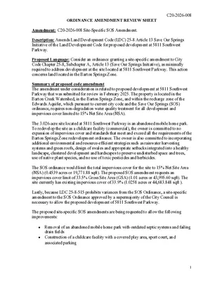
ORDINANCE AMENDMENT REVIEW SHEET C20-2026-008 Amendment: C20-2026-008 Site-Specific SOS Amendment. Description: Amends Land Development Code (LDC) 25-8 Article 13 Save Our Springs Initiative of the Land Development Code for proposed development at 5811 Southwest Parkway. Proposed Language: Consider an ordinance granting a site-specific amendment to City Code Chapter 25-8, Subchapter A, Article 13 (Save Our Springs Initiative), as minimally required to address development at the site located at 5811 Southwest Parkway. This action concerns land located in the Barton Springs Zone. Summary of proposed code amendment The amendment under consideration is related to proposed development at 5811 Southwest Parkway that was submitted for review in February 2025. The property is located in the Barton Creek Watershed, in the Barton Springs Zone, and within the recharge zone of the Edwards Aquifer, which pursuant to current city code and the Save Our Springs (SOS) ordinance, requires non-degradation water quality treatment for all development and impervious cover limited to 15% Net Site Area (NSA). The 3.026-acre site located at 5811 Southwest Parkway is an abandoned mobile home park. To redevelop the site as a childcare facility (commercial), the owner is committed to no expansion of impervious cover and standards that meet and exceed all the requirements of the Barton Springs Zone redevelopment ordinance. The owner is also committed to incorporating additional environmental and resource-efficient strategies such as rainwater harvesting systems and green roofs, design of swales and appropriate setbacks integrated into a healthy landscape, clustered development and hardscapes to preserve undisturbed space and trees, use of native plant species, and no use of toxic pesticides and herbicides. The SOS ordinance would limit the total impervious cover for the site to 15% Net Site Area (NSA) (0.4539 acres or 19,771.88 sqft). The proposed SOS amendment requests an impervious cover limit of 33.5% Gross Site Area (GSA) (1.01 acres or 43,995.60 sqft). The site currently has existing impervious cover of 33.9% (1.0258 acres or 44,683.848 sqft ). Lastly, because LDC 25-8-515 prohibits variances from the SOS Ordinance, a site-specific amendment to the SOS Ordinance approved by a supermajority of the City Council is necessary to allow the proposed development of 5811 Southwest Parkway. The proposed site-specific SOS amendments are being requested to allow the following improvements: • Removal of an abandoned mobile home park with outdated septic systems and failing drain fields • Construction of a childcare facility with a covered play area, sport court, and associated parking 1 Background: C20-2026-008 On January 31, 2019, City Council approved Resolution No. 20190131-040 to initiate variances and amendments to the Land Development Code, including site-specific amendments to Chapter 25-8, Subchapter A, Article 13 (Save Our Springs Initiative) as minimally required to address development related to the proposed development at 5811 Southwest Parkway. The 3.206-acre site is an abandoned mobile home park with outdated septic systems and failing drain fields that were constructed several years before the property was annexed by the City of Austin. The septic fields are to be removed, and the new development will be utilizing public wastewater. The applicant is proposing a site-specific SOS amendment to allow for the proposed development of the site while providing on site water quality treatment, a small reduction in impervious cover, and native plantings. Staff Recommendation: Staff recommends approval of the proposed amendment and associated variances for the following reasons: • Small reduction in impervious cover from 33.9% to 33.5% • SOS non-degradation water quality treatment for entire site • Austin Energy Green Building rating of 2 star • Bird friendly building design • Integrated Pest Management • No artificial turf • • Complies with the Hill Country Roadway regulations • Two electric charging stations • Caliper inches of trees for mitigation has increased by 1 inch (3-inch to 4-inch) • All disturbed areas are shown to be revegetated with 609S • Landscape plants will be Texas native plantings Interpretive signage Board and Commission Actions August 19th, 2026, Considered by Environmental Commission. August 19th, 2026, Considered by Codes and Ordinances Joint Committee. August 25th, 2026, Considered by Planning Commission. Council Action September 24th, 2026: A public hearing will be scheduled. Ordinance Number: C20-2026-008 City Staff: Leslie Lilly Phone: (512) 535-8914 Email: Leslie.lilly@austintexas.gov 2 (cid:55)(cid:75)(cid:82)(cid:80)(cid:83)(cid:86)(cid:82)(cid:81) (cid:47)(cid:68)(cid:81)(cid:71) (cid:40)(cid:81)(cid:74)(cid:76)(cid:81)(cid:72)(cid:72)(cid:85)(cid:76)(cid:81)(cid:74)(cid:15) (cid:47)(cid:47)(cid:38) (cid:11)(cid:41)(cid:16)(cid:20)(cid:19)(cid:21)(cid:21)(cid:19)(cid:12) BLDG # 1 # of STORIES 2 HEIGHT [FT] ~34.5 F.F.E. 796.88 FOUNDATION CONCRETE SLAB IC AREA [SF] 14,200 BLDG AREA [SF] 19,975 BUILDING DATA SUMMARY USE * General Day Care Services ** Office (on second floor) Site Development Calculations Impervious Cover (IC) Summary Total Site Area: 131,472 sf 3.018 ac 40% Natural Area (sf) Private Common Open Space (sf) Zoning Site Area (sf) (ac) Existing * LR-CO-NP 131,472 3.02 -- -- -- -- 44,588 Impervious Cover (sf) * 1.02 (ac) 33.9% (%) 28,088 Total Building Coverage Area (sf) 21.4% (%) 0 Total Building Floor Area (sf) 0:1 Total Floor to Area Ratio (FAR) 0.0 Total Building Height (feet) Total Building Height (stories) 0 * Existing "structures" are vacated mobile homes Allow / Required 6,574 52,589 -- -- sf = 5.0% GSA (min.) sf = 40.0% GSA (min.) -- (see Q-2 tables on Slope Map sheet) IC items: -------------- - Bldgs (primary) - Bldgs (covered canopy) - Drive aisle and parking - Sidewalk Pavement Total Existing IC Area (sf) -------------- 28,088 0 15,000 1,500 44,588 % -------------- 21.4% 0.0% 11.4% 1.1% 33.9% Existing to be Removed -------------- -28,088 0 -15,000 -1,500 -44,588 Proposed to be Added -------------- 14,200 1,110 22,451 6,252 44,013 Total Proposed IC Area (sf) -------------- 14,200 1,110 22,451 6,252 44,013 % -------------- 10.8% 0.8% 17.1% 4.8% 33.5% Total IC = APPENDIX Q-2 IMPERVIOUS COVER WATER SUPPLY SUBURBAN / WATER SUPPLY RURAL / BARTON SPRINGS ZONE WATER QUALITY TRANSITION ZONE 40' allowed WATER QUALITY TRANSITION ZONE OUTSIDE OF 100-YEAR FLOODPLAIN (NON-FP WQTZ) = 0.00 ACRES ALLOWABLE IMPERVIOUS COVER IMPERVIOUS COVER ALLOWED AT IMPERVIOUS COVER ALLOWED AT TOTAL IMPERVIOUS COVER ALLOWED = TOTAL IMPERVIOUS COVER ALLOWED = 0% 15% 0.45 1.02 x NON-FP WQTZ = x NET SITE AREA = 0.00 0.45 ACRES ACRES ACRES ACRES (per Appendix Q in the COA ECM) (per Resolution No. 20190131-040) Proposed LR-CO-NP 131,472 3.02 6,637 5.05% 53,076 40.4% 44,013 1.01 33.5% 19,975 15.2% 19,975 0.15:1 ~34.5' 2 APPENDIX Q-1 NET SITE AREA Enrollment Capacity (per State standards*): 510 * 1:30 sq.ft. usable floor area and 1:80 sq.ft. outdoor fenced area Type Parking Totals - Total - Total (Standard) - Total (Compact) - Total (Parallel) - Total (Accessible) - Total (Bicycle) - Short Term Bicycle Parking Spaces - Long Term Bicycle Parking Spaces Parking Summary Required / Allowed Proposed See below See below (30% allowed per LDC 25-6-475) 10% of vehicle spaces) 54.0 -- 16.8 -- 2.0 6 50% 50% 56 42 9 3 2 8 4 4 Required Parking per USE: * General Day Care Services ** Office (on second floor) SF ------------- 14,200 5,775 Employees ------------- 33 - Required ------------- 33.0 21.0 54.0 Proposed ------------ 35 21 56 Total Spaces = * One space per each employee; General daycare has more than 12 people served per day ** One space per 275 sq. ft. NOTE: NET SITE AREA IS ONLY APPLICABLE TO WATERSHEDS CLASSIFIED AS WATER SUPPLY SUBURBAN / WATER SUPPLY RURAL / BARTON SPRINGS ZONE ALLOWABLE IMPERVIOUS COVER BREAKDOWN BY SLOPE CATEGORY Total acreage 15-25% = 0.00 x 10% = 0.000 Total Gross Site Area = 3.02 Acres Site Deductions Critical water quality zone (CWQZ) = Water quality transition zone (WQTZ) = Wastewater irrigation areas = Deduction subtotal = 0.00 Acres 0.00 Acres 0.00 Acres 0.00 Acres Upland area (gross area minus total deductions) = 3.02 Acres Net Site Area Calculation: Area of Uplands with Slopes 0-15% Area of Uplands with Slopes 15-25% Area of Uplands with Slopes 25-35% Area of Uplands with Slopes > 35% 3.02 0.00 0.00 0.00 X 100% X 40% X 20% X 0% 3.02 Acres 0.00 Acres 0.00 Acres 0.00 Acres Net Site Area (subtotal) = 3.02 Acres THIS PROJECT IS SUBJECT TO THE REDEVELOPMENT EXCEPTION PER COA LDC 25-8-26. PROPOSED TOTAL IMPERVIOUS COVER IMPERVIOUS COVER IN NON-FP WQTZ = IMPERVIOUS COVER IN UPLANDS ZONE = 0.00 1.01 Acres = Acres = 0.0% 33.5% TOTAL PROPOSED IMPERVIOUS COVER = 1.01 Acres PROPOSED IMPERVIOUS COVER ON SLOPES Slope Categories 0-15% 15-25% 25-35% Over 35% Total Site Acres 3.02 0.00 0.00 0.00 3.02 IMPERVIOUS COVER BUILDING / AND OTHER IMPERVIOUS COVER % of Category 11.6% 0.0% 0.0% 0.0% Acres 0.35 0.00 0.00 0.00 Driveways Roadways Acres 0.66 0.00 0.00 0.00 (cid:55)(cid:75)(cid:82)(cid:80)(cid:83)(cid:86)(cid:82)(cid:81) (cid:47)(cid:68)(cid:81)(cid:71) (cid:40)(cid:81)(cid:74)(cid:76)(cid:81)(cid:72)(cid:72)(cid:85)(cid:76)(cid:81)(cid:74)(cid:15) (cid:47)(cid:47)(cid:38) (cid:11)(cid:41)(cid:16)(cid:20)(cid:19)(cid:21)(cid:21)(cid:19)(cid:12)