Item3_C20-2024-024_ColoradoRiverProtections_Presentation — original pdf
Backup
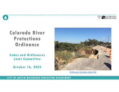
Colorado River Protections Ordinance C o d e s a n d Or d i na n c es J o i nt C o m m i tte e Oct o b er 1 6 , 2 02 4 C I T Y O F A U S T I N W A T E R S H E D P R O T E C T I O N D E P A R T M E N T Ordinance Youtube video link Presentation Outline Background • Council Resolution and Goals • Colorado River Overview • Erosion & Water Quality Threats and Costs to Community Draft Ordinance • Draft Proposal & Analysis • Schedule Discussion C I T Y O F A U S T I N W A T E R S H E D P R O T E C T I O N D E P A R T M E N T 2 Presentation Outline Background • Council Resolution and Goals • Colorado River Overview • Erosion & Water Quality Threats and Costs to Community Draft Ordinance • Draft Proposal & Analysis • Schedule Discussion C I T Y O F A U S T I N W A T E R S H E D P R O T E C T I O N D E P A R T M E N T 3 Council Resolution Community members asked Council to strengthen Colorado River protections; Council thereafter included in their June 2022 Council resolution: “… evaluate the effectiveness of existing Critical Water Quality Zone and Erosion Hazard Zone buffers on the Colorado River downstream of the Longhorn Dam and to propose protections that will provide adequate protections to the river that will ensure a healthy riparian corridor to stabilize the riverbank and protect property from erosion” C I T Y O F A U S T I N W A T E R S H E D P R O T E C T I O N D E P A R T M E N T 4 Longhorn Dam Austin’s Full Purpose (City) Limits CWQZ Buffer Acres 400ft Buffer Acres Acres Parcel Count 241 243 484 50% 50% 100% 1,054 14,896 15,950 7% 93% 100% 281 1,929 2,211 13% 87% 100% 391 2,184 2,575 15% 85% 100% Acres 400ft minus CWQZ 109 255 364 30% 70% 100% Juris- diction Type FULL ETJ Totals FULL ETJ Totals Travis County Austin’s ETJ Colorado River City Limits & ETJ 5 East Austin Longhorn Dam J. Trevino Metro Park Lady Bird Lake Roy Guerrero Park “Dog’s Head” Austin’s Colony Hornsby Bend Biosolids Plant Tesla SHEC/SAR WWTP Southeast Austin Parcel Count Acres Juris- diction Type CWQZ Buffer Acres 400ft Buffer Acres Acres 400ft minus CWQZ FULL ETJ Totals FULL ETJ Totals 241 243 484 50% 50% 100% 1,054 14,896 15,950 7% 93% 100% 281 1,929 2,211 13% 87% 100% 391 2,184 2,575 15% 85% 100% 109 255 ABIA 364 30% 70% 100% Travis County Colorado River City Limits & ETJ 6 Single-Family Residential Parks & Open Space Mining Industrial Agriculture / Undeveloped C I T Y O F A U S T I N W A T E R S H E D P R O T E C T I O N D E P A R T M E N T Colorado River Land Uses 7 Utilities C I T Y O F A U S T I N W A T E R S H E D P R O T E C T I O N D E P A R T M E N T Colorado River Geology 8 Erosion Threats Unique, highly erosive alluvial soils River massively larger than creeks Seeing major erosion problems Erosion Hazard Zone (EHZ) code requirements designed for creeks Tens of millions of dollars in damage and counting… C I T Y O F A U S T I N W A T E R S H E D P R O T E C T I O N D E P A R T M E N T 9 $1.9M Tillery St. Outfall Repair Erosion Threats Unique, highly erosive alluvial soils River massively larger than creeks Seeing major erosion problems Erosion Hazard Zone (EHZ) code requirements designed for creeks Tens of millions of dollars in damage and counting… C I T Y O F A U S T I N W A T E R S H E D P R O T E C T I O N D E P A R T M E N T 10 $1.9M Tillery St. Outfall Repair Erosion Threats Unique, highly erosive alluvial soils River massively larger than creeks Seeing major erosion problems Erosion Hazard Zone (EHZ) code requirements designed for creeks Tens of millions of dollars in damage and counting… Road is sole access to two critical infrastructure facilities C I T Y O F A U S T I N W A T E R S H E D P R O T E C T I O N D E P A R T M E N T 11 Fallwell Lane: $11.4M needed to stabilize bank Erosion Threats Unique, highly erosive alluvial soils River massively larger than creeks Seeing major erosion problems Erosion Hazard Zone (EHZ) code requirements designed for creeks Tens of millions of dollars in damage and counting… C I T Y O F A U S T I N W A T E R S H E D P R O T E C T I O N D E P A R T M E N T 12 Fallwell Lane: $11.4M needed to stabilize bank Erosion Threats Unique, highly erosive alluvial soils River massively larger than creeks Seeing major erosion problems Erosion Hazard Zone (EHZ) code requirements designed for creeks Tens of millions of dollars in damage and counting… C I T Y O F A U S T I N W A T E R S H E D P R O T E C T I O N D E P A R T M E N T 13 Home threatened after bank failure, May 2015 Erosion Threats Unique, highly erosive alluvial soils River massively larger than creeks Seeing major erosion problems Erosion Hazard Zone (EHZ) code requirements designed for creeks Tens of millions of dollars in damage and counting… C I T Y O F A U S T I N W A T E R S H E D P R O T E C T I O N D E P A R T M E N T 14 US 183 bridge and public trail: Erosion threat Erosion Threats Unique, highly erosive alluvial soils River massively larger than creeks Seeing major erosion problems Erosion Hazard Zone (EHZ) code requirements designed for creeks Tens of millions of dollars in damage and counting… C I T Y O F A U S T I N W A T E R S H E D P R O T E C T I O N D E P A R T M E N T 15 US 183 bridge and public trail: Construction Erosion Threats Unique, highly erosive alluvial soils River massively larger than creeks Seeing major erosion problems Erosion Hazard Zone (EHZ) code requirements designed for creeks Tens of millions of dollars in damage and counting… C I T Y O F A U S T I N W A T E R S H E D P R O T E C T I O N D E P A R T M E N T 16 Drilled-pier walls required to protect Erosion Threats Unique, highly erosive alluvial soils River massively larger than creeks Seeing major erosion problems Erosion Hazard Zone (EHZ) code requirements designed for creeks Tens of millions of dollars in damage and counting… C I T Y O F A U S T I N W A T E R S H E D P R O T E C T I O N D E P A R T M E N T 17 US 183 bridge and public trail: Post-construction Erosion Threats Unique, highly erosive alluvial soils River massively larger than creeks Seeing major erosion problems Erosion Hazard Zone (EHZ) code requirements designed for creeks Tens of millions of dollars in damage and counting… C I T Y O F A U S T I N W A T E R S H E D P R O T E C T I O N D E P A R T M E N T 18 Roy Guerrero Park: Original pedestrian bridge Erosion Threats Unique, highly erosive alluvial soils River massively larger than creeks Seeing major erosion problems Erosion Hazard Zone (EHZ) code requirements designed for creeks Tens of millions of dollars in damage and counting… C I T Y O F A U S T I N W A T E R S H E D P R O T E C T I O N D E P A R T M E N T 19 Roy Guerrero Park: Bridge destroyed Erosion Threats Unique, highly erosive alluvial soils River massively larger than creeks Seeing major erosion problems Erosion Hazard Zone (EHZ) code requirements designed for creeks Tens of millions of dollars in damage and counting… C I T Y O F A U S T I N W A T E R S H E D P R O T E C T I O N D E P A R T M E N T 20 Roy Guerrero Park: $23M+ project to repair C I T Y O F A U S T I N W A T E R S H E D P R O T E C T I O N D E P A R T M E N T 21 Austin’s Colony Phase 2: No Stable Channel C I T Y O F A U S T I N W A T E R S H E D P R O T E C T I O N D E P A R T M E N T 22 Austin’s Colony Phase 2: No Stable Channel Original ground level 25ft canyon C I T Y O F A U S T I N W A T E R S H E D P R O T E C T I O N D E P A R T M E N T 23 Failing outf alls, insuf ficient armoring f or outf all creek or along drainage path to creek C I T Y O F A U S T I N W A T E R S H E D P R O T E C T I O N D E P A R T M E N T 24 Water Quality Threats, Historical Context Riparian zone long compromised Initial transformation by agriculture Then by sand and gravel mining And by upstream Highland Lakes dams altering flow and sediment regimes River water quality primarily affected by upstream flows; secondarily by large creek tributaries Direct drainage (buffers) less influential C I T Y O F A U S T I N W A T E R S H E D P R O T E C T I O N D E P A R T M E N T 1940 2021 25 Water Quality Threats & Historical Context Travis County’s existing 400ft buffer 200-400ft Critical Water Quality Zone buffer in 1986* Buffer improved by 2008 ordinance to ensure full expected buffer width Buffer remained unchanged with the 2013 Watershed Protection Ordinance Current buffer narrower than 400ft Travis County river and City of Austin Barton buffers * By the 1986 Comprehensive Watershed Ordinance (CWO) C I T Y O F A U S T I N W A T E R S H E D P R O T E C T I O N D E P A R T M E N T 26 Draft Ordinance Proposal Recommended 200ft Erosion Hazard Zone (EHZ) buffer 1 2 New technical specifications for stormwater discharges to the river Evaluated but Not Recommended 3 400ft Critical Water Quality Zone (CWQZ) buffer C I T Y O F A U S T I N W A T E R S H E D P R O T E C T I O N D E P A R T M E N T 27 1 200ft Erosion Hazard Zone (EHZ) buffer Existing: EHZ review buffer width is 100ft L a d y B i r d L a k e Erosion Hazard Zones: Regulatory protection to ensure that new buildings and infrastructure built near waterways are located at a safe distance and/or designed with protective works to help prevent future damage to these resources from creek and river erosion. C I T Y O F A U S T I N W A T E R S H E D P R O T E C T I O N D E P A R T M E N T 28 1 200ft Erosion Hazard Zone (EHZ) buffer Existing: EHZ review buffer width is 100ft L a d y B i r d L a k e Proposed: Expand review buffer to 200ft C I T Y O F A U S T I N W A T E R S H E D P R O T E C T I O N D E P A R T M E N T 29 Proposal: Erosion Protections 200ft Erosion Hazard Zone (EHZ) review buffer • Expanded from current 100ft review buffer width • EHZ-Level 1 envelope goes from “toe” of river inland at a 4:1 angle 1 Typical bank height of 50ft x 4:1 angle = 200ft recommended review buffer width Toe starts at the Water surface contour (from Property Profile) • Must show “protective works” if build within EHZ-Level 1 envelope • Applies only to “habitable space” and infrastructure (not driveways, decks, etc.) • Does not extend beyond parallel public ROWs • 20ft depth below river bottom for underground utility crossings • More detailed “Level 2” options also available C I T Y O F A U S T I N W A T E R S H E D P R O T E C T I O N D E P A R T M E N T 30 Level 1 EHZ Diagram: Existing 100ft EHZ Review Buffer Protective works or Engineer Level II required Protective works not required Outside EHZ 100ft EHZ Review Buffer Water surface Starting point = lowest surface contour line Outside of critical slope C I T Y O F A U S T I N W A T E R S H E D P R O T E C T I O N D E P A R T M E N T 31 Level 1 EHZ Diagram: Proposed 200ft EHZ Review Buffer Protective works or Engineer Level II required Protective works not required Outside EHZ 200ft EHZ Review Buffer Water surface Starting point = lowest surface contour line Can use topo contour in Property Profile web tool Outside of critical slope C I T Y O F A U S T I N W A T E R S H E D P R O T E C T I O N D E P A R T M E N T 32 Level 1 EHZ Diagram: Proposed 200ft EHZ Review Buffer Protective works or Engineer Level II required Protective works not required Outside EHZ 200ft EHZ Review Buffer Water surface 20ft Place subsurface utilities min. 20ft below channel bottom (if less must demonstrate via Level 2 analysis) C I T Y O F A U S T I N W A T E R S H E D P R O T E C T I O N D E P A R T M E N T 33 2 New technical specifications for stormwater discharges to the river Existing: Storm drainage systems causing severe erosion $$$ Proposed: Build non-erosive structures to curb damage Armored stormwater discharge infrastructure: engineering solutions designed to reduce the erosive energy from stormwater flows from developed areas to reduce erosion and related property damage and loss. 34 C o l o r a d o R i v e r C o l o r a d o R i v e r C I T Y O F A U S T I N W A T E R S H E D P R O T E C T I O N D E P A R T M E N T Proposal: Non-Erosive Stormwater Discharges 2 New technical criteria and specifications for outfalls to river 40ft. 66" pipe C I T Y O F A U S T I N W A T E R S H E D P R O T E C T I O N D E P A R T M E N T 35 Tillery Street Storm Drain Outfall Repair Austin’s Colony Phase 2: No Stable Channel 36 Austin’s Colony Phase 4: Stable Channel 37 Austin’s Colony Phase 4: Stable Channel 38 Example Drop Structure for Outfall Water from surface runoff Non-erosive passage to river Armoring Col. River C I T Y O F A U S T I N W A T E R S H E D P R O T E C T I O N D E P A R T M E N T 39 Water from storm drainage system Energy of flowing and falling water entirely contained within structure Tillery St. Outfall Structure Diagram 3 400ft Critical Water Quality Zone (CWQZ) buffer Existing: CWQZ buffer width varies from 200 to 400ft L a d y B i r d L a k e Critical Water Quality Zones: Regulatory buffers to reduce the intensity of new development directly adjacent to waterways to protect natural riparian soils and vegetation that protect water quality and flows; low-intensity uses are permitted; high-intensity uses are restricted. P u r p l e a r e a s s h o w 1 0 0 - y e a r f l o o d p l a i n s C I T Y O F A U S T I N W A T E R S H E D P R O T E C T I O N D E P A R T M E N T 40 3 400ft Critical Water Quality Zone (CWQZ) buffer Existing: CWQZ buffer width varies from 200 to 400ft L a d y B i r d L a k e C I T Y O F A U S T I N W A T E R S H E D P R O T E C T I O N D E P A R T M E N T 41 Studied: Fixed 400ft buffer width P u r p l e a r e a s s h o w 1 0 0 - y e a r f l o o d p l a i n s Studied: Fixed-Width River Buffers 3 400ft Critical Water Quality Zone (CWQZ) buffer • Expanded from current 200-400ft width • May use “buffer averaging” (min. width 200ft) • May retain developable area via Redevelopment Exception and Gross Site Area • Matches Travis County’s 400ft width (and that of Barton Creek mainstem) *** NOT RECOMMENDED *** Existing buffers provide good protection, best fit the terrain C I T Y O F A U S T I N W A T E R S H E D P R O T E C T I O N D E P A R T M E N T 42 Commercial corridor on high bank L a d y B i r d L a k e Protected parkland Residential area on high bank Residential area on high bank P u r p l e a r e a s s h o w 1 0 0 - y e a r f l o o d p l a i n s C I T Y O F A U S T I N W A T E R S H E D P R O T E C T I O N D E P A R T M E N T 43 Similar patterns (by definition) of extensions of 400ft buffers onto high banks C I T Y O F A U S T I N W A T E R S H E D P R O T E C T I O N D E P A R T M E N T 44 Overview of Staff Ordinance Proposal 1. 200ft Erosion Hazard Zone (EHZ) review buffer RECOMMENDED More accurate recognition of erosion risk Most properties along river not impacted 2. New technical specifications for stormwater discharges to river RECOMMENDED Low-cost solution relative to much higher damage/costs 3. 400ft Critical Water Quality Zone (CWQZ) buffer NOT RECOMMENDED High impact on some properties; high banks not where protection needed; water quality protection more in upstream flows and larger tributaries C I T Y O F A U S T I N W A T E R S H E D P R O T E C T I O N D E P A R T M E N T 45 DRAFT 2024 Code Amendment Schedule Sep. Sep. - Oct. Finalize staff recommendation Stakeholder input • Oct. 28 In-Person WPD outreach meeting at 6:30 (Montopolis Rec. Center) Oct - Dec. Commissions and Council • 10/16 Codes & Ordinances Joint Committee • 11/6 Environmental Commission • 11/12 Planning Commission • 12/12 City Council ABRCP = Austin Bastrop River Corridor Partnership; COJC = Codes & Ordinances Joint Committee (PC + ZAP); EC = Environmental Commission; PC = Planning Commission C I T Y O F A U S T I N W A T E R S H E D P R O T E C T I O N D E P A R T M E N T 46 Discussion C I T Y O F A U S T I N W A T E R S H E D P R O T E C T I O N D E P A R T M E N T