ITEM05 C15-2025-0027 PRESENTATION OPPOSITION — original pdf
Backup
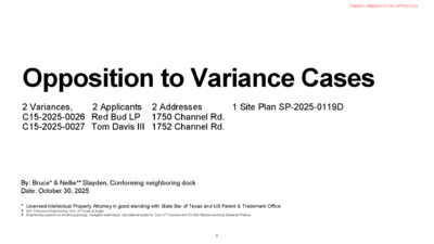
Opposition to Variance Cases 2 Variances, 2 Applicants 2 Addresses C15-2025-0026 Red Bud LP 1750 Channel Rd. C15-2025-0027 Tom Davis III 1752 Channel Rd. 1 Site Plan SP-2025-0119D By: Bruce* & Nellie*+ Slayden, Conforming neighboring dock Date: October 30, 2025 * Licensed Intellectual Property Attorney in good standing with State Bar of Texas and US Patent & Trademark Office + B.S. Petroleum Engineering, Univ. of Texas at Austin + Engineering experience involving geology, navigable waterways, depositional systems. Core UT Courses and On-Site Studies involving Edwards Plateau 1 ITEM05/1-PRESENTATION OPPOSITION Reasonable Use Summary Board Inquiry Reasonable Use: The zoning regulations applicable to the property do not allow for a reasonable use because: Applicants’ Response The maximum length from shoreline allowed for a boat dock is a navigational hazard, due to the naturally existing shallow conditions of Lake Austin in this area. Similar neighboring properties have addressed this unique environmental feature for decades by building their boat docks further into the lake Objections The proposed maximum length from shoreline for a new LDC 25-2-1172 new construction, unreasonably interferes with a preferred travel path in the highest congested area of a public navigable waterway and thus unreasonably impedes Texas’ laws that protect navigation safety. Local zoning regulations do allow for a reasonable use. Numerous watercraft and lift options are readily available and would enable Applicant to comply with 30 foot zoning regulation limits. ITEM05/2-PRESENTATION OPPOSITION Hardship (a) Summary Board Inquiry Hardship: a) The hardship for which the variance is requested is unique to the property in that: Applicants’ Response The bathymetry of Lake Austin in this area is uniquely shallow, due to annual sedimentary deposits caused by neighboring property’s runoff. Objections The bathymetry of Lake Austin in this area is NOT uniquely shallow. Numerous conforming docks in this and many other areas of Lake Austin are similarly situated vis-a-vis same or similar depth contours, as shown on Austin’s ArcGis. The LDC anticipates and alleviates this hardship. LDC allows applicants to repair and modify grandfathered structures in deeper water. The Board should not grant a variance that would provide the applicant with a special privilege not enjoyed by others similarly situated or potentially similarly situated. ITEM05/3-PRESENTATION OPPOSITION Hardship (b) Summary Board Inquiry Hardship: b) The hardship is not general to the area in which the property is located because: Applicants’ Response The homeowners are seeking no special privilege to shoreline use not already given to owners of other similar situated property with approximately contemporaneous development. Due to the nature of the lake's inaccessibility in this area, the extension of a boat dock greater than 30' from shoreline is requested to guarantee the owner's right to access. Objections The bathymetry of Lake Austin in this area is NOT uniquely shallow. Numerous conforming docks in this and many other areas of Lake Austin are similarly situated vis-a-vis same or similar depth contours, as shown on Austin’s ArcGis. Applicant ignores reasonable options under LDC to repair and modify grandfathered structures in deeper water. The proposed length contributes to a blind curve at a critical and congested area of a notoriously hazardous navigable waterway. The request to ensure this navigation hazard continues into perpetuity is unreasonable. ITEM05/4-PRESENTATION OPPOSITION Area Character Summary Applicants’ Response The variance will allow the proposed boat dock to be a functional appurtenence similar to other docks in the area that have been built greater than 30' from shoreline. The proposed dock will adhere to all other Land Development codes pertaining to boat docks. Board Inquiry Area Character: The variance will not alter the character of the area adjacent to the property, will not impair the use of adjacent conforming property, and will not impair the purpose of the regulations of the zoning district in which the property is located because: Objections The Board should not allow nonconforming supersized structures in congested areas on a dangerous Public State waterway. Should the Board approve this variance, hundreds of homeowners along Bull Creek and Lake Austin with grandfathered shoreline lengths will flood this Board with similar demands. This would lead to systematic abuse as owners will unreasonably seek to cherry pick across the LDC for new super-sized docks. Such a grant will open a Pandora’s box that foreseeably results in further narrowing a dangerous state navigable waterway. ITEM05/5-PRESENTATION OPPOSITION Proposed vs. Existing (1750) Nonconforming at 37’ Existing nonconforming: Never Permitted 1 story Uncovered fishing pier NO watercraft slips “Lake Pioneer” Variance Applicant & Owner per TCAD: Red Bud Partners LP, a Limited Partnership Entity Proposed dock non-conforming to LDC 25-2-963, LDC 25-2-964, or LDC 25-2-1176 • 3 stories • 1 watercraft slip • 37’ Shoreline L , 124% of statutory 30’ Limit • 14’ Wide vs. ~10 existing W • 1 flight of stairs over water • Proposed dimensions and location not same as existing 6 ITEM05/6-PRESENTATION OPPOSITION Proposed vs. Existing (1752) Nonconforming at 47’ or 46’ 1” Existing nonconforming structure: Never permitted 1-story with roof 1-watercraft slip 47’ Length Variance Applicant & Owner per TCAD: Tom Davis III Proposed dock non-conforming to LDC 25-2-963, LDC 25-2-964 & LDC 25-2-1176 • 3 stories across entire structure • 2 watercraft slips • 46’1’ shoreline L is 16’1” (154% of) over statutory 30’ • 22’ W vs. 14’W Existing • 2 flights of stairs • Proposed dimensions and location not same as Existing 7 ITEM05/7-PRESENTATION OPPOSITION Proposed vs. Existing 1 Site Plan, 2 Owners Dimensions and locations of both proposed super- sized docks different than existing “Grandfathered” 8 ITEM05/8-PRESENTATION OPPOSITION Public Navigation Safety Watercraft vs. Cars • NO BRAKES • Engine cutoff switch doesn’t stop momentum • SHIFT to REVERSE reduces forward momentum & speed • Could jolt or throw passengers • Beware if towing skiers, surfers, kids on floats • No Numerical Speed Limits (TPWC § 55.303) • No chickens - Swerving at last minute to avoid collision not permitted (TPWC § 31.106) 9 ITEM05/9-PRESENTATION OPPOSITION Public Navigation Safety The Priority on Texas Navigable Waterways Core Principle: • Texas law prioritizes public navigation safety. • Navigable waterways (e.g., Lake Austin) are owned by the State in trust for public benefit. • Lakebed owners or holders of riparian rights, cannot unreasonably impair public navigation on a statutory navigable waterway. Key Legal References: • Adjudication of Upper Guadalupe Segment of Guadalupe River Basin, 625 S.W.2d 353 (Tex. App. 1981), aff’d 642 S.W.2d 438 (1982) • State v. Bradford, 121 Tex. 515, 50 S.W.2d 1065 (1932) 10 ITEM05/10-PRESENTATION OPPOSITION Public Navigation Safety Numerous Layers of State, Federal and Local Laws Apply Texas Water Safety Act (Parks & Wildlife Code, Chapter 31): • Ensures uniform laws for Texas’ navigable waterways • Prioritizes protecting public’s navigation safety Multiple Legal Layers Control Lake Austin: • Texas Administrative Code (Title 31) – Waterway and boating safety regulations • Parks & Wildlife Code (Ch. 12, 31) – State enforcement authority • Federal Law (33 U.S.C. §83) – U.S. Inland Navigation Rules • Texas Penal Code (Ch. 38 & 49) – Criminal penalties for unsafe or unlawful water activity • Local Ordinances – Texas statute authorize local government to incorporate safety regulations into their respective ordinances or other rules. • TPWD legal reviews filed Local Ordinances and codes involving navigable waterways (e.g. LDC) for state law consistency Takeaway: Multiple local, state and federal laws safeguard public navigation safety on Texas’ statutory navigable waterways, e.g. Lake Austin. 11 ITEM05/11-PRESENTATION OPPOSITION Public Navigation Safety Jarring Statistics: Fixed Object Collisions Top Texas Waterway Incidents Recreational Boating Incident Statistics, TPWD 2024 Recreational Boating Incident Statistics, TPWD 2023 12 ITEM05/12-PRESENTATION OPPOSITION Public Navigation Safety Jarring 2024 Statistics: Lake Austin (and Travis County) Had Highest Incidents and Injuries on Texas Waterways Recreational Boating Incident Statistics, TPWD 2024 at 7-8 13 ITEM05/13-PRESENTATION OPPOSITION Public Navigation Safety Jarring 2024 Statistics: Lake Austin (and Travis County) Had Highest Incidents and Injuries on Texas Waterways Recreational Boating Incident Statistics, TPWD 2023 at 7-8 14 Recreational Boating Incident Statistics, TPWD 2023 ITEM05/14-PRESENTATION OPPOSITION Public Navigation Safety Takeaways • Vessel operators' actions, fixed objects, other impediments to navigation, congestion, carelessness, and substance abuse result in boating related fatalities, injuries, accidents, violations, and property damage. See Recreational Boating Incident Statistics, TPWD 2023 & 2024 Takeaway: Lake Austin and Travis County lead in injuries and incidents on Texas Waterways Takeaway: Fixed Object Collisions are a primary • • cause of Texas Waterway Incidents 15 ITEM05/15-PRESENTATION OPPOSITION Navigation Safety Properties are in Highest Traffic Area of A Public Navigable Waterway • Planes taking off and landing • New to Watercraft operators • Kids on floats with distracted multi- tasking drivers • Jet Skis (rental) • New surfers and skiers falling • Multiple watercraft accelerating from Party Cove and Public ramp at control zone buoys near Applicants’ properties 16 ITEM05/16-PRESENTATION OPPOSITION Navigation Safety Properties In High Traffic Area with 360 Bridge Public Ramp, Party Cove, and Navigation Control Zone Directly Upstream • 360 Bridge Public Ramp and Navigation Control Zone represent the lake’s highest congestion area. • Navigation Control Buoys delineate transition from No Wake Zone to acceleration lanes. • Traffic density increases during summer high season, holidays and events at Austin Country Club & Marina further degrading navigation safety Figure 1: Navigation Control Zone – 360 Bridge Ramp, Control Buoys, and No Wake Zone boundaries. (Austin ArcGis) 17 ITEM05/17-PRESENTATION OPPOSITION Navigation Safety: Properties Are In High Traffic, Acceleration Area • Most Watercraft accelerate from idle to high speed beginning around the No Wake buoys. • Operators’ navigation sight-lines are impaired by encroachments extending into this acceleration area. • New non-conforming encroachments would contribute to blind curve in congested acceleration area. • New encroachment significantly beyond codified limits in this critical navigational corridor are unreasonable for navigation safety. Figure 2: Acceleration and Normal Travel Paths – illustrating increased high-speed transition zones. (Austin ArcGis) 18 ITEM05/18-PRESENTATION OPPOSITION Navigation Safety: Properties Contribute to Blind Curve and Impeded Visibility • Obstructed visibility reduce operators’ reaction time • Operators and downstream neighbors may experience impaired sight-lines affecting lawful dock ingress and egress. Figure 3: Artificial blind curve and obstructed sight-lines in highly congested acceleration area impacts navigation safety. (Austin ArcGis) 19 ITEM05/19-PRESENTATION OPPOSITION Reasonable Use Available No Cherry Picking Applicants’ claim hardship due to lack of “Guaranteed Access Rights” to unreasonably cherry pick across LDC Codes for new Super- Sized Dock in New Location. LDC anticipates these alleged hardships and balances landowners' rights with publics' navigation safety. No Hardship: LDC allows preserving existing nonconforming docks, see e.g. remodeled and repaired docks at 1758 Channel Rd. (LDC 25-2-963:) and 1756 Channel Rd. (LDC 25-2- 964) LDC offers Applicants 3 Mutually Exclusive Choices: 1. LDC 25-2-963: see, e.g. 1758 Channel Rd. (Aqua Permits’ site plan) -Major Repair, Remodel or Modify Existing Structure -Keep Existing Nonconforming access: 47’ Length and desired 4’ depth 2. LDC 25-2-964: see, e.g., 1756 Channel Rd. (Aqua Permits’ site plan) -Major Repair, Remodel or Modify Damaged Existing Structure -Keep Existing Nonconforming access: 47’ Length and desired 4’ depth 3. LDC 25-2-1172: see, e.g., 1744 Channel Rd. (Aqua Permits) -Remove Existing Structure -Build New Multi-level dock that is Code Compliant: -Max Width: 20% Shoreline and Multi slip -30’ Shoreline Length +/- for public’s navigation safety Figure 5: Boat Dock Application Permit Process (ABC Connect) 20 ITEM05/20-PRESENTATION OPPOSITION Reasonable Use Available: Applicants Ignore Reasonable Options in “Modern Watercraft” FALSE “‘Modern watercraft’ require water depth of 4 feet” True: “Modern watercraft’ do NOT require 4’ water depth across entire dock • Large 23 - 27’ V-Drive Surf or Ski Boats with Drafts of 2.675’ or less • Largest Super Air Nautique G25 Length 27’ 5”, 19 persons, Draft = 2.675’ • Super Air Nautique G23, Length 25’ 5”, 16 persons, Draft = 2.675’ • Multisport Super Air Nautique GS20,Length 22’7”, 12 persons, Draft = 2.5' True: “Modern watercraft” operate in less than 2.5’ depths: • Inboard/Outboard Watercraft • Pontoon Watercraft • Tritoon Watercraft • Outboard Watercraft • Jet Watercraft 21 ITEM05/21-PRESENTATION OPPOSITION Reasonable Use Available: Applicants Ignore Reasonable Lift Options; Contrive Hardships Misleading: Dredge Chart shows “Modern watercraft’ require 4’ water depth across entire dock True: Modern Lifts (Hydraulic Lifts, Cantilever or Extending Lifts) designed to launch, dock, and store “modern watercraft” in very shallow waters. • See e.g., Lift Specifications for Sunstream Sunlift X SLX5010B4 (7”), SLX6512B4 (7”), SLX8012B4 (8”), SLX9012 (8”) , SLX10014 (8”) SLX12016 (8”) • Extend out and retract 3’ to 6.5’ from dock inlet into deeper waters to drive or float Modern Watercraft onto lift • Temporarily extend out and retract, only during lift operations • Recommended depth is 2’ at bulkhead and 4’ at slip entry to float a large V-drive such as G23 onto the extended lift. • Adaptive to a wide range of V-drive surf and ski boats, in even shallower minimal depths with Shallow Water Configurations or Extension kits. https://sunstreamboatlifts.com/sunlift-x/ 22 ITEM05/22-PRESENTATION OPPOSITION NO HARDSHIP (1750 Channel Rd.): Applicants’ Inflate Dredge Volume With Misleading Assumptions Misleading: Dredge depth of 4’ across entire dock footprint required for Modern Watercraft yields 31.01 Cu Yds No Board precedent cited for 4.0’ required depth Exceeds minimum required depth profile for modern watercraft and/or modern lifts Baseless Assumptions Inflate Dredge Volume to Purposefully exceed 25 Cu Yds to contrive a Hardship TRUE • 4.0’ depth across entire slip footprint and length Not Required • Modern Lifts launch and dock Modern Watercraft in shallow water • Cradles travel 3’ - 6.5’ into deeper water • Modern Lifts Reduce or eliminate Dredging • Realistic Dredge Volume: _____ Cu Yds < 25 Cy Yd * ** *Average End Area Calculation with Applicants’ Data (Chart data ) with Required Minimum Depth Profile for Modern Lift + Modern Watercraft **Under review by second Expert 23 ITEM05/23-PRESENTATION OPPOSITION NO HARDSHIP (1750): Applicants’ Inflate Dredge Volume With Misleading Assumptions Misleading: Dredge depth of 4’ across dock footprint required for Modern Watercraft inflates dredge volume to 31.01 Cu Yds TRUE • No cited variances approved 4.0’ minimum required depth • 4.0’ across entire footprint and length not required No Board precedent cited for 4.0’ required depth • Modern Lifts launch, and dock Modern Watercraft in shallower waters Exceeds minimum required depth profile for modern watercraft and/or modern lifts • 2’ Depth at Bulkhead and 4’ at Dock Entry is Recommended to float Large V-Drive like G23 on or off extended Sunlift Cantilever Lift Baseless Assumptions purposefully Inflate Dredge Volume to exceed 25 Cu Yds • Modern Lifts extend out 3’ - 6.5’ into deeper water • Modern Lifts Significantly Reduce or Eliminate Dredging • Realistic Dredge Volume =12.34 Cu Yds for Recommended 2’ Depth at Bulkhead and 4’ at Dock Entry to float Large V-Drive like G23 on or off extended Sunlift Cantilever Lift * ** *See Calculations Steps Slide for Average End Area Calculation with Applicants’ Data (Chart data ) with Required Minimum Depth Profile for Modern Lift + Modern Watercraft **Under review by second Expert 24 ITEM05/24-PRESENTATION OPPOSITION NO HARDSHIP (1750 Channel): Contrived Hardship Ignores Facts and Alternatives -Hydraulic Cantilever Lifts prevalent on Lake Austin -Hydraulic Cantilever Lifts extend out 3’ to 6.5’ to reach deeper water -Recommended depth profile (2’ sloped to 4’) yields 12.34 Cu Yds Dredge Volume <25 Cu Yds -Generous depth profile (3’ sloped to 4’) yields 20.12 Cu Yds Dredge Volume <25 Cu Yds -Minimizes dredging = No Hardship Cantilever Lift with Minimum dredging (<25 Cu Yds) eliminates the negative impact on public safety by reducing unnecessary non-Code 7-foot further extension into Lake Austin. 25 ITEM05/25-PRESENTATION OPPOSITION Calculation Steps (1750 Channel) Dredge Volume Up to 4’ Depth for 30’ Dock Length I Redline is current Lakebed sediment contour 1. Since the depth profile runs the entire length of 30’ dock, can reverse calculate area under line ABC using Aqua Permits volume calculation 2. Area under line ABC calculated by Aqua Permits is 31.01 Cu Yd x 27 cu ft per cu yd / 14’ W= 59.805 SF 3. Channel width = 14 ft. Dredge Volume is Less than 2’ Depth at Bulkhead and 4’ at Entry for 30’ Dock Length Recommended to float Large V-Drive on or off Hydraulic Cantilever Lift II. Blue line is the minimum dredge depth with 2’ at bulkhead and 4’ at dock entry, assume straight line D-C Dredge Volume: 3’ Depth at Bulkhead and 4’ at Entry for 310 Dock Length Generous to float G23 Large Boat on or off Hydraulic Cantilever Lift III. Green line is more dredge volume with 3’ depth at bulkhead and 4’ at dock entry, assume straight line E-C 1. Assume D is X=0, Y=490.8’ and C is x=30’ at y=489’ 1. Assume E is X=0, Y=489.8’ and C is x=30’ at y=489’ 2. Integration limited to x = 0–30.0 ft (dredge area). 2. Integration limited to x = 0–30.0 ft (dredge area). 3. Calculate the Area under blue line DC using average end area 3. Calculate the area under blue line EC using average end calculation area calculation 4. Area= (1/2 x (2-0) x 30’)+ (.2 x 30’)= 36 SF 4. Area=1/2 x (1-0) x 30 + (.2 x 30’)= 21 SF 4. Apply area 59.805 SF as obtained from Aqua Permits Calculations 5. Subtract Area under line DC from Area under line ABC ( 59.805 SF - 36 SF = 23.805 SF) 5. Subtract Area under line EC from Area under line ABC ( 59.805 SF - 21 SF = 38.805 SF) 6. Calculate volume using Channel width = 14. ft. then divide by 27 6. Calculate volume using Channel width = 14 ft. then divide by for cu yds. 27 for cu yds 7. Dredge Volume = 12.34 Cu Yds for 2’ Depth at Bulkhead and 4’ 7. Dredge Volume = 20.12 Cu Yds for 3’ Depth at Bulkhead at Dock Entry as Recommended to float Large V-Drive like G23 on or off extended Sunlift Cantilever Lift and 4’ at Dock Entry, Generous depth to float Large V-Drive like G23 on or off extended Sunlift Cantilever Lift 26 ITEM05/26-PRESENTATION OPPOSITION NO HARDSHIP (1752): Applicants’ Inflate Dredge Volume With Misleading Assumptions Misleading: Dredge depth of 4’ across dock footprint required for Modern Watercraft inflates dredge volume to 41.12 Cu Yds TRUE • No cited variances approved 4.0’ minimum required depth • 4.0’ across entire footprint and length not required No Board precedent cited for 4.0’ required depth • Modern Lifts launch, and dock Modern Watercraft in shallower waters Exceeds minimum required depth profile for modern watercraft and/or modern lifts • 2’ Depth at Bulkhead and 4’ at Dock Entry is Recommended to float Large V-Drive like G23 on or off extended Sunlift Cantilever Lift Baseless Assumptions purposefully Inflate Dredge Volume to exceed 25 Cu Yds • Modern Lifts extend out 3’ - 6.5’ into deeper water • Modern Lifts Significantly Reduce or Eliminate Dredging • Realistic Dredge Volume = ~ 11 Cu Yds for Recommended 2’ Depth at Bulkhead and 4’ at Dock Entry to float Large V-Drive like G23 on or off extended Sunlift Cantilever Lift * ** *See Calculations Steps Slide for Average End Area Calculation with Applicants’ Data (Chart data ) with Required Minimum Depth Profile for Modern Lift + Modern Watercraft **Under review by second Expert 27 ITEM05/27-PRESENTATION OPPOSITION NO HARDSHIP (1752 Channel): Alleged Hardship Ignores Facts and Alternatives -Hydraulic Cantilever Lifts prevalent on Lake Austin -Hydraulic Cantilever Lifts extend out 3’ to 6.5’ to reach deeper water -Recommended depth profile (2’ sloped to 4’) yields 10.96 Cu Yds Dredge Volume <25 Cu Yds -Generous depth profile (3’ sloped to 4’) yields 23.52 Cu Yds Dredge Volume <25 Cu Yds -Minimizes dredging = No Hardship Cantilever Lift with Minimum dredging (<25 Cu Yds) eliminates the negative impact on public safety by reducing unnecessary non-Code 7-foot further extension into Lake Austin. 28 ITEM05/28-PRESENTATION OPPOSITION Calculation Steps (1752 Channel) Dredge Volume Up to 4’ Depth for 31’ Dock Length I Redline is current Lakebed sediment contour 1. Assume the red line has two different downward slopes with 1 inflection Dredge Volume is Less than 2’ Depth at Bulkhead and 4’ at Entry for 31’ Dock Length Recommended to float Large V-Drive on or off Hydraulic Cantilever Lift II. Blue line is the minimum dredge depth with 2’ at bulkhead and 4’ at dock entry, assume straight line D-C point: “Segment A to B”and “segment B to C” 1. Assume D is X=0, Y=490.8’ and C is x=31’ at Dredge Volume: 3’ Depth at Bulkhead and 4’ at Entry for 31’ Dock Length Generous to float G23 Large Boat on or off Hydraulic Cantilever Lift III. Green line is more dredge volume with 3’ depth at bulkhead and 4’ at dock entry, assume straight line E- C 2. “Segment A to B” runs from point A to Point B 3. Segment B to C runs from point B to point C 4. Point A is X=0’ at y=492.8’; 5. Point B is x=2.286' at y=492.0’ 6. Point C is x=31’ at y=488.9’ 7. Inflection point of the two slopes is x=2.286 at y=492.0 8. Integration limited to x = 0–31.0 ft (1’ longer than needed dredge area) 9. Channel width = 21.9 ft. 10.Calculate area under redline AB to 4’ depth flat baseline (44.5067 SF) 11.Multiply by 21.9.’ then divide by 27 for cu yds. Confirm > than or +/- 10% of 42.18 cu yds for conservative estimate. 12.Calculated Area Under ABC yields 42.59 Cu Yd using 31’ length, is greater +1% of 42.18 Cu Yd by Aqua, so Area is sufficiently accurate y=488.9’ 1. Assume E is X=0, Y=489.8’ and C is x=31’ at 2. Integration limited to x = 0–31.0 ft (1’ longer than y=488.9’ needed dredge area). 2. Integration limited to x = 0–31.0 ft (1’ longer than 3. Calculate the Area under blue line DC using average end area calculation (Area=1/2 x (2-0) x 31= 31 SF) 4. Subtract Area under line DC from Area under line ABC (44.5067 SF - 32 SF = 13.5067 SF) 5. Calculate volume using Channel width = 21.9 ft. then divide by 27 for cu yds. 6. Dredge Volume = 10.96 Cu Yds for 2’ Depth at Bulkhead and 4’ at Dock Entry as Recommended to float Large V-Drive like G23 on or off extended Sunlift Cantilever Lift needed dredge area). 3. Calculate the area under blue line EC using average end area calculation (Area=1/2 x (1-0) x 31= 15.5 SF) 4. Subtract Area under line EC from Area under line ABC (44.5067 SF - 15.5 SF = 29.0067 SF) 5. Calculate volume using Channel width = 21.9 ft. /27 for cu yds 6. Dredge Volume = 23.52 Cu Yds for 3’ Depth at Bulkhead and 4’ at Dock Entry, Generous depth to float Large V-Drive like G23 on or off extended Sunlift Cantilever Lift 29 ITEM05/29-PRESENTATION OPPOSITION Area Character • Should the Board approve this variance and set precedent, hundreds of homeowners along Bull Creek and Lake Austin with grandfathered shoreline lengths will flood this Board with similar demands. Figure AC1: Lake Austin’s contour lines (Austin ArcGis) 30 ITEM05/30-PRESENTATION OPPOSITION Area Character • Approving this variance would lead to systematic abuse as owners will unreasonably seek to cherry pick across LDC for new super-sized docks. Figure AC1: Showing docks on 490’ to 485’ Contour Lines in Bull Creek (Austin ArcGis) 31 ITEM05/31-PRESENTATION OPPOSITION Area Character • Such a grant will open a Pandora’s box that will foreseeably result in further narrowing of a dangerous Texas navigable waterway. Figure AC1: (Austin ArcGis), showing docks on 490’ to 485’ Contour Lines on Lake Austin 32 ITEM05/32-PRESENTATION OPPOSITION Approving These Variances Would Set A Perilous Precedent Granting these variance would: 1.Reward applicants that ignore ordinances that allow repair and modification of existing access to allege Hardship where there is none. 2.Endorse an unsupported 4.0’ depth across the slip footprint falsely inflating dredge volumes for contrived hardships (e.g. no recent core data). 3.Perpetuate a significant navigation hazard negatively impacting the public’s navigation safety and Code-compliant neighbors 4.Allow applicants to bypass reasonable and available Code-compliant options (e.g., lifts) to game the system to build super-sized docks; and 5.Eschew Texas’ laws prioritizing public safety on entrusted waterways in favor of affluent landowners’ desires for cheaply mooring large deep-drafting watercraft. The Board should not approve nonconforming supersized docks in congested areas of dangerous Public waterways. Approval of this variance will lead to many homeowners (e.g., along Bull Creek and Lake Austin with grandfathered lengths) to flood this Board with similar demands leading to systematic abuse as owners will unreasonably seek to cherry-pick across LD Codes for new super-sized docks. Such a grant will open a Pandora’s box that foreseeably results in further narrowing of a dangerous State of Texas navigable waterway. 33 ITEM05/33-PRESENTATION OPPOSITION ITEM05/34-PRESENTATION OPPOSITION