ITEM02 C15-2025-0035 LATE BACKUP OCT13_UPDATED APPLICATION_PERMIT HOLDER — original pdf
Backup
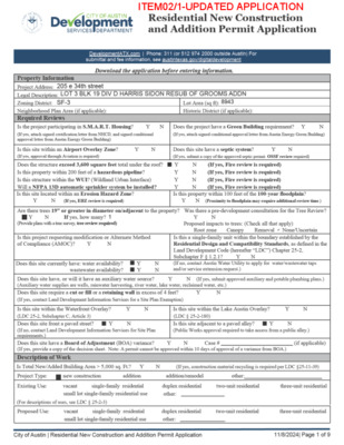
ITEM02/1-UPDATED APPLICATION ITEM02/2-UPDATED APPLICATION ITEM02/3-UPDATED APPLICATION ITEM02/4-UPDATED APPLICATION ITEM02/5-UPDATED APPLICATION ITEM02/6-UPDATED APPLICATION Tree Review All design proposals must abide by the Tree Preservation Criteria set forth in Section 3.5.2 of the City of Austin’s Environmental Criteria Manual. Cut and fill is limited to 4” within ½ Critical Root Zones (foundations cannot adhere to this), canopy removal is limited to 25% or less per tree, and 50% or more of the full Critical Root Zone must be kept at natural grade with natural ground cover. If proposing to remove a tree that is dead, diseased or an imminent hazard, please provide a Tree Risk Assessment from a Certified Arborist and/ or photographic evidence. Austin Energy Review All overhead and underground electrical facilities need to be clearly shown and labeled on the plot plan including: pad mount transformer and pad, pull boxes, all underground electric wires on site including service wire, utility poles, all overhead wires on subject property and adjacent properties including service wires, down guy wires, existing electric meter location. All electric easements and public utility easements need to be shown and labeled on the plot plan. AE will review based on current Austin Energy Design Criteria for required safety clearance per section 1.10. Any construction not listed in this application will NOT be considered part of the review. Please note if your project has existing transmission facilities and or transmission easements this BSPA and plot plan will be reviewed by our AE Transmission group. The Transmission review is separate from the Distribution review. The Transmission review group may require additional documentation than the Distribution review. Documentation Explanations and Definitions Permit Exhibits Plot Plan Plot Plans must be drawn to a standard scale and are to include but are not limited to the following items: property address and legal description, north arrow, drawing scale, trees within the ROW or trees equal to or greater than 19 inches in diameter located on the property and immediately adjacent to the property, property lines, building lines for both existing and proposed improvements, easements, required zoning setbacks and roof overhangs, water meter and wastewater cleanout locations, clearly shown all overhead and underground electrical facilities (see Austin Energy Review Discipline), and water and/or wastewater line size and material. Floorplan(s) Floorplans must be drawn to a standard scale and are to include (but are not limited to) the following items: drawing scale, room labels, new wall measurements, new ceiling heights, new door and window schedule, smoke detector* and carbon monoxide detector** specifications and locations, dimensioned locations of new plumbing fixtures, handrail/guardrail locations and room square footages. Please provide an Existing and Proposed Floor plan if part of the improvements includes removing or adding any wall, window, door, plumbing fixtures, etc. Clearly differentiate between existing, demolished, and new items, as applicable. *provide smoke detector system (hardwired, interconnected, battery back-up) at each sleeping room and vicinity in accordance with IRC R314 **provide carbon monoxide detector in immediate vicinity of sleeping rooms in accordance with IRC R315. Exterior Elevations Elevation plans must be drawn to a standard scale and are to include front, rear, and sides of the structure. For additions, elevations are required of all sides of the new portion of the structure. Height dimensions are required on all elevations. If a building height exceeds 20’ or building is multi-story include dimensions of high, low, and average elevations at grade. Setback Plane Compliance Plan If subject to Subchapter F, separate exhibit must be submitted showing topographic elevations on 1-foot intervals on the property, including the top of foundation spot elevation and intersections of the property boundary with the building line segments per Subchapter F, Section 2.6. All topographic information must be prepared and sealed by a Texas-registered professional land surveyor. Structural Drawing(s) Foundation plan of sufficient detail to show conformance to the provisions of the currently adopted IRC including but not limited to: 1) size, spacing and strength of reinforcing steel 2) foundation requirements for braced wall panels required in braced wall plan. Wall and floor/ceiling/roof sections and details, framing plans and/or framing design information as follows: General – lumber size, grade, species and spacing of all wood elements. Wood framed floors – spans and intermediate girders. Wood framed walls – wall type (e.g. 2x4’s @ 16 in. o.c.), wall height, headers. Wood Framed roofs – roof framing plan to include rafters and girders as a minimum. Brace wall plan showing compliance with the currently adopted IRC. The plan shall clearly indicate the braced wall lines and the braced wall method use for compliance to expedite review. Additional Requirements Non-complying Structures (applicable to all work types) A separate exhibit must be submitted showing the existing building footprint location in relation to the property boundaries and required City of Austin | Residential New Construction and Addition Permit Application 11/8/2024| Page 7 of 9 ITEM02/7-UPDATED APPLICATION setbacks. Exterior walls and supporting structural elements must be clearly labeled and dimensioned showing walls to be removed per Land Development Code Section 25-2-963. Setback Averaging If using setback averaging, one copy of the Contextual Site Plan showing four adjacent properties with location of existing buildings and existing front yard setbacks identified for front yard setback averaging per the provisions of Subchapter F, Residential Design and Compatibility Standards, Section 2.3. Surveys must be provided by a Texas-registered professional land surveyor showing existing buildings and their distance from the front lot line. Design Professionals For any project exceeding 20 feet in height or more than one-story within the Subchapter F boundaries, all permit exhibits must be sealed and signed by a Texas-registered architect or certified building designer (National Council of Building Designers or Texas Institute of Building Design). Localized flooding If there is a storm drain inlet or pipe, drainage ditch, or drainage easement on or near the property or the property is at the low point of a roadway, there may be a chance of flooding from the local drainage system. The proposed development cannot cause additional flooding on other property nor have an adverse impact on the existing local drainage system. Contact Land Development Information Services for more information. Tree Survey Provide a tree survey per ECM 3.3.2 that labels the ¼, ½ and full Critical Root Zones and provides the diameter and species of each protected tree (a Tree Legend is recommended). Depict proposed access routes and material staging. Show all proposed and existing utilities. Show specific locations of tree protection fencing and mulching per requirements of ECM 3.5.2. City of Austin | Residential New Construction and Addition Permit Application 11/8/2024| Page 8 of 9 ITEM02/8-UPDATED APPLICATION ITEM02/9-UPDATED APPLICATION