ITEM02 C15-2024-0013 PRESENTATION MAY13 — original pdf
Backup
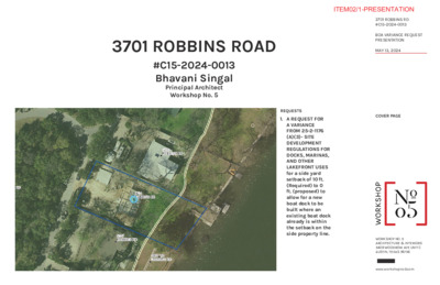
3701 ROBBINS ROAD #C15-2024-0013 Bhavani Singal Principal Architect Workshop No. 5 COVER PAGE REQUESTS 1. A REQUEST FOR A VARIANCE FROM 25-2-1176 (A)(3)- SITE DEVELOPMENT REGULATIONS FOR DOCKS, MARINAS, AND OTHER LAKEFRONT USES for a side yard setback of 10 ft. (Required) to 0 ft. (proposed) to allow for a new boat dock to be built where an existing boat dock already is within the setback on the side property line. WORKSHOP NO. 5ARCHITECTURE & INTERIORS5409 WOODROW AVE UNIT C AUSTIN, TEXAS 78756www.workshopno5.com3701 ROBBINS RD#C15-2024-0013BOA VARIANCE REQUEST PRESENTATIONMAY 13, 2024ITEM02/1-PRESENTATION telephone pedestal wall ' 3 . 3 1 8 3 5 7 3 65 3 5 0" 5 3 5 0 3 5 15.2' ' 5 . 2 1 " 0 - ' 0 1 3279 ' 2 . 1 1 5 2 5 19.1' 3280 0 2 5 3281 ' 4 . 0 1 5 1 5 22" Pecan (S64°14'E 231.96') S64°16'15"E 231.16' wall 19" Pecan old rock wall wall with wrought iron fence in concrete 1/2CRZ 1/4CRZ ground behind wall 493.80' 10' Building Line per site plan 10' SIDE SETBACK 0 0 5 5 9 4 ) . W . O . R ' 5 4 ( D A O R S N I B B O R e n i l t o l e v o b a s n u r e n i l y t i l i t u d a e h r e v o 15.7' 3268 ) ' 0 0 . 0 0 1 E ' 8 2 ° 5 2 N ( ' 0 0 . 0 0 1 E " 0 0 ' 1 3 ° 5 2 N 5 3 5 GARAGE FFE - 526'-3" ' 0 . 4 2 n a l p e t i s r e p e n i L g n i d l i u B ' 5 1 40' - 0" l n a p e t i s r e p e n L g n d i i l i u B ' 0 4 l t n e m p o e v e D n i t s u A e k a L d n a 5 2 5 : k r a m h c n e b n o e l g n a i r t y r a r o p m e t d e l e s i h c ' 4 9 . 6 3 5 t a l l a w g n i v a p f o e g d e 3.4' 2 STORY RESIDENCE FFE - 514'-6" Z Q W C d n a e Lin g uildin B tin s u A e k a L 5' 7 t n e m p elo v e D tin s u A e k a L d n a n pla e sit r e p 5 0 5 "LOT B" Heidi Wang Lew and Veronica Lew Document No. 2022128635 previously Angeline D. Thomas Volume 8840 Page 201 3285 3284 Z Q W C d n a e Lin g uildin B tin s u A e k a L 5' 2 0 0 5 xx " 0 - ' 0 1 0 2 5 10' Building Line per site plan 1 . 1 ' 3269 3270 15 5 xx STONE RETAINING WALL ATLAS-14 100 Year Flooplain and FEMA 500 Year Floodplain (0.2% annual chance) base flood elevation 515.8 ft. xx N64°46'20"W xx 213.03' (N64°43'W 213.28') BEARING BASIS from prior suvery FEMA 100 Year Floodplain (1% annual chance) base flood elevation 496.5 ft. 49.5" Texas Ash (41" and 17" stems) HERITAGE ASH TREE top of wall: 493.64 lake bed: 490.73' xx k c e d k c e d boat dock wall boat slip (deck above) concrete boat slip (deck above) NEIGHBOR'S EXISTING BOAT DOCK upper level boat dock elevation: 500.0' lower level boat dock elevation: 493.6' S64°19'04"E to west gradient boundary of the Colorado River TREE LIST 3268 3269 3270 3279 3280 3281 3284 3285 15" Juniper 8" Hackberry 9" Hackberry 15" Hackberry 18" Hackberry 10" Cedar Elm 40" Magnolia 33" Pecan EXISTING BOAT DOCK COA WETLANDS wood ramp conc. steps 3' 7 9. 9 8') .8 9 9 4'W 1 ° 6 3 S ( W " 7 9'3 5 ° 5 3 S wood deck concrete steps top of wall: 493.08' lake bed: 489.94' ground behind wall 492.60' f o e g d e r e t a w lake bed: 489.42' ground behind wall 492.83' top of wall: 493.24' e t e r c n o c TOP OF WATER ELEVATION JUNE 5, 2023 492.4 FT. lake bed: 489.92' ground behind wall 493.06' ground behind wall 493.11' 5 9 4 4 9 4 3 9 4 xx top of wall: 493.24' lake bed: 490.18' to west gradient boundary of the Colorado River N64°46'20"W EXISTING SITE PLAN SITE CONSTRAINTS 1. The existing boat dock was erected before 1984, and needs to be replaced. The current dock does not have enough clearance above the waterline to accommodate modern boats. Rebuilding the dock with an increase in height will allow a reasonable use enjoyed by other homeowners on the lake. 2. There are established wetlands. Relocating the boat dock would directly impact the wetlands and cause further disruption to the shorefront ecology and the lakebed. 3. There is a large green ash present on the property line adjacent to the boat dock. Rebuilding in the current location will avoid further damage to the CRZ. 4. The neighbor also has a boat dock built on the shared lot line. R E V I R O D A R O L O C ) N I T S U A E K A L ( EXISTING CONDITIONS & DESIGN CONSTRAINTS SITE PHOTOS- Taken March 2021 after site was mowed WORKSHOP NO. 5ARCHITECTURE & INTERIORS5409 WOODROW AVE UNIT C AUSTIN, TEXAS 78756www.workshopno5.com3701 ROBBINS RD#C15-2024-0013BOA VARIANCE REQUEST PRESENTATIONMAY 13, 2024ITEM02/2-PRESENTATION telephone pedestal wall ' 3 . 3 1 8 3 5 7 3 65 3 5 0" 5 3 5 0 3 5 15.2' ' 5 . 2 1 " 0 - ' 0 1 3279 ' 2 . 1 1 5 2 5 19.1' 3280 0 2 5 3281 ' 4 . 0 1 5 1 5 22" Pecan (S64°14'E 231.96') S64°16'15"E 231.16' wall 19" Pecan old rock wall wall with wrought iron fence in concrete 1/2CRZ 1/4CRZ ground behind wall 493.80' 10' Building Line per site plan 10' SIDE SETBACK 0 0 5 5 9 4 ) . W . O . R ' 5 4 ( D A O R S N I B B O R e n i l t o l e v o b a s n u r e n i l y t i l i t u d a e h r e v o 15.7' 3268 ) ' 0 0 . 0 0 1 E ' 8 2 ° 5 2 N ( ' 0 0 . 0 0 1 E " 0 0 ' 1 3 ° 5 2 N 5 3 5 GARAGE FFE - 526'-3" ' 0 . 4 2 n a l p e t i s r e p e n i L g n i d l i u B ' 5 1 40' - 0" l n a p e t i s r e p e n L g n d i i l i u B ' 0 4 l t n e m p o e v e D n i t s u A e k a L d n a 5 2 5 3.4' 2 STORY RESIDENCE FFE - 514'-6" " 0 - ' 0 1 0 2 5 10' Building Line per site plan 1 . 1 ' 3269 3270 15 5 xx STONE RETAINING WALL ATLAS-14 100 Year Flooplain and FEMA 500 Year Floodplain (0.2% annual chance) base flood elevation 515.8 ft. ) . W . O . R ' 5 4 ( D A O R S N I B B O R e n i l t o l e v o b a s n u r e n i l y t i l i t u d a e h r e v o 15.7' 3268 ) ' 0 0 . 0 0 1 E ' 8 2 ° 5 2 N ( ' 0 0 . 0 0 1 E " 0 0 ' 1 3 ° 5 2 N 5 3 5 GARAGE FFE - 526'-3" ' 0 . 4 2 n a l p e t i s r e p e n i L g n i d l i u B ' 5 1 40' - 0" l n a p e t i s r e p e n L g n d i i l i u B ' 0 4 l t n e m p o e v e D n i t s u A e k a L d n a 5 2 5 3.4' 2 STORY RESIDENCE FFE - 514'-6" " 0 - ' 0 1 0 2 5 10' Building Line per site plan 1 . 1 ' 3269 3270 15 5 xx STONE RETAINING WALL ATLAS-14 100 Year Flooplain and FEMA 500 Year Floodplain (0.2% annual chance) base flood elevation 515.8 ft. : k r a m h c n e b n o e l g n a i r t y r a r o p m e t d e l e s i h c ' 4 9 . 6 3 5 t a l l a w g n i v a p f o e g d e : k r a m h c n e b n o e l g n a i r t y r a r o p m e t d e l e s i h c ' 4 9 . 6 3 5 t a l l a w g n i v a p f o e g d e HERITAGE ASH TREE top of wall: 493.64 lake bed: 490.73' NEIGHBOR'S EXISTING BOAT DOCK upper level upper level boat dock boat dock elevation: 500.0' elevation: 506.10' lower level lower level boat dock boat dock elevation: 493.6' elevation: 494.10' 49.5" Texas Ash (41" and 17" stems) xx boat dock wall BOAT SLIP (DECK ABOVE) WOOD DECK BOAT SLIP (DECK ABOVE) WOOD DECK top of wall: 493.08' lake bed: 489.94' ground behind wall 492.60' f o e g d e r e t a w lake bed: 489.42' S64°19'04"E to west gradient boundary of the Colorado River TREE LIST 3268 3269 3270 3279 3280 3281 3284 3285 15" Juniper 8" Hackberry 9" Hackberry 15" Hackberry 18" Hackberry 10" Cedar Elm 40" Magnolia 33" Pecan PROPOSED BOAT DOCK COA WETLANDS- CONSTRUCTION IMPACT ONLY TOP OF WATER ELEVATION JUNE 5, 2023 492.4 FT. STAIRS STEPS 3' 7 9. 9 8') .8 9 9 4'W 1 ° 6 3 S ( W " 7 9'3 5 ° 5 3 S ground behind wall 492.83' top of wall: 493.24' e t e r c n o c lake bed: 489.92' ground behind wall 493.06' ground behind wall 493.11' 5 9 4 4 9 4 3 9 4 xx top of wall: 493.24' lake bed: 490.18' to west gradient boundary of the Colorado River N64°46'20"W HERITAGE ASH TREE top of wall: 493.64 lake bed: 490.73' NEIGHBOR'S EXISTING BOAT DOCK upper level upper level boat dock boat dock elevation: 500.0' elevation: 506.10' lower level lower level boat dock boat dock elevation: 493.6' elevation: 494.10' 49.5" Texas Ash (41" and 17" stems) xx boat dock wall BOAT SLIP (DECK ABOVE) WOOD DECK BOAT SLIP (DECK ABOVE) WOOD DECK 492.60' f o e g d e r e t a w lake bed: 489.42' " 8 / 5 5 - 0' 1 S64°19'04"E to west gradient boundary of the Colorado River TREE LIST 3268 3269 3270 3279 3280 3281 3284 3285 15" Juniper 8" Hackberry 9" Hackberry 15" Hackberry 18" Hackberry 10" Cedar Elm 40" Magnolia 33" Pecan ADDITIONAL LAKEBED IMPACT PROPOSED BOAT DOCK TOP OF WATER ELEVATION JUNE 5, 2023 492.4 FT. 133 SF OF NEW IMPACT TO TREE CRZ 43 SF OF WETLANDS DIRECTLY AFFECTED COA WETLANDS to west gradient boundary of the Colorado River N64°46'20"W 3' 7 9. 9 STAIRS STEPS 8') .8 9 9 4'W 1 ° 6 3 S ( W " 7 9'3 5 ° 5 3 S ground behind wall 492.83' top of wall: 493.24' e t e r c n o c lake bed: 489.92' ground behind wall 493.06' ground behind wall 493.11' 5 9 4 4 9 4 3 9 4 xx top of wall: 493.24' lake bed: 490.18' IMPACT OF SETBACK COMPLIANCE Email from Miranda Reinhard Environmental Scientist Senior – Policy & Environmental Review City of Austin | Watershed Protection Department "1:1 mitigation will be required for both designs. The current proposed designs will be impacts to the wetland CEF setbacks; however, they do not appear to affect the wetland CEFs themselves. Keeping the construction within the existing footprint will have less impact to the existing wetland CEFs on-site. Moving the boat dock will have new impacts to the wetland CEFs themselves and wetland CEF setbacks that would not occur within the existing footprint." Email from Skylar Netherland, PWS, CAPM, Flameleaf Environmental "From an ecological perspective it would be much less disruptive to leave the dock where it is. It is currently surrounded by fringe wetlands that you would be required to complete mitigation for impacts if construction occurred in them." Letter from Ashraf T. Ahsanullah, P.E., Advanced Consulting Engineers "[It] does not create a significant adverse impact to the lake front, avoids unnecessary bulkhead modifications and offers minimal impact to the lake front environment considering that the dock is located in the FEMA 100 year flood plain and in the Critical Water Quality Zone (CWQZ). Moreover it is a minimum impact change necessary to avoid encroaching into the wetlands just west of the existing dock." R E V I R O D A R O L O C ) N I T S U A E K A L ( R E V I R O D A R O L O C ) N I T S U A E K A L ( Z Q W C d n a e Lin g uildin B tin s u A e k a L 5' 7 t n e m p elo v e D tin s u A e k a L d n a n pla e sit r e p 5 0 5 "LOT B" Heidi Wang Lew and Veronica Lew Document No. 2022128635 previously Angeline D. Thomas Volume 8840 Page 201 3285 3284 xx N64°46'20"W xx 213.03' (N64°43'W 213.28') BEARING BASIS from prior suvery Z Q W C d n a e Lin g uildin B tin s u A e k a L 5' 7 t n e m p elo v e D tin s u A e k a L d n a n pla e sit r e p 5 0 5 "LOT B" Heidi Wang Lew and Veronica Lew Document No. 2022128635 previously Angeline D. Thomas Volume 8840 Page 201 3285 3284 xx N64°46'20"W xx 213.03' (N64°43'W 213.28') BEARING BASIS from prior suvery Z Q W C d n a e Lin g uildin B tin s u A e k a L 5' 2 0 0 5 xx Z Q W C d n a e Lin g uildin B tin s u A e k a L 5' 2 0 0 5 xx FEMA 100 Year Floodplain (1% annual chance) base flood elevation 496.5 ft. PROPOSED BOAT DOCK SITE PLAN FEMA 100 Year Floodplain (1% annual chance) base flood elevation 496.5 ft. IMPACT DIAGRAM FOR SETBACK COMPLIANCE telephone pedestal wall ' 3 . 3 1 8 3 5 7 3 65 3 5 0" 5 3 5 0 3 5 15.2' ' 5 . 2 1 " 0 - ' 0 1 3279 ' 2 . 1 1 5 2 5 19.1' 3280 0 2 5 3281 ' 4 . 0 1 5 1 5 22" Pecan (S64°14'E 231.96') S64°16'15"E 231.16' wall 19" Pecan old rock wall wall with wrought iron fence in concrete 1/2CRZ 1/4CRZ ground behind wall 493.80' 10' Building Line per site plan 10' SIDE SETBACK 0 0 5 5 9 4 PROPOSED BOAT DOCK & IMPACT DIAGRAM WORKSHOP NO. 5ARCHITECTURE & INTERIORS5409 WOODROW AVE UNIT C AUSTIN, TEXAS 78756www.workshopno5.com3701 ROBBINS RD#C15-2024-0013BOA VARIANCE REQUEST PRESENTATIONMAY 13, 2024ITEM02/3-PRESENTATION W-2 W-1 WETLAND DOCUMENTATION JUNE 2023 CRITICAL ENVIRONMENTAL FEATURE MAP A small City of Austin wetland was present behind the bulkhead that was dominated by Elephant Ear, Mexican Primerose-willow, and Water Hemlock. Prepared by Skylar Netherland Flameleaf Environmental WORKSHOP NO. 5ARCHITECTURE & INTERIORS5409 WOODROW AVE UNIT C AUSTIN, TEXAS 78756www.workshopno5.com3701 ROBBINS RD#C15-2024-0013BOA VARIANCE REQUEST PRESENTATIONMAY 13, 2024ITEM02/4-PRESENTATION ATTACHEMENT I : SITE PHOTOGRAPHS . Photograph 1 This photograph documents a view facing south along the existing bulkhead on-site. There was a dominance of hydrophytic (wetland) vegetation behind the bulkhead that met the requirements for the a City of Austin defined wetland. Dominant wetland vegetation in this photograph included Elephant Ear (Colocasia esculenta) and Mexican Primerose-willow (Ludwigia octovalvis). Photograph was taken within Wetland W-1. Photograph 2 This photograph documents a view facing north along the existing bulkhead on-site. There was a dominance of hydrophytic (wetland) vegetation behind the bulkhead that met the requirements for the a City of Austin defined wetland. Dominant wetland vegetation in this photograph included Elephant Ear, Mexican Primerose-willow, and Water Hemlock (Cicuta maculata). Dallisgrass was present and dominant behind the City of Austin wetland. Photograph was taken within Wetland W-1. Photograph 1 This photograph documents a view facing south along the existing bulkhead on-site. There was a dominance of hydrophytic (wetland) vegetation behind the bulkhead that met the requirements for the a City of Austin defined wetland. Dominant wetland vegetation in this photograph included Elephant Ear (Colocasia esculenta) and Mexican Primerose-willow (Ludwigia octovalvis). Photograph was taken within Wetland W-1 (see attached Critical Environmental Features Map for wetland locations). Photograph 2 This photograph documents a view facing north along the existing bulkhead on-site. There was a dominance of hydrophytic (wetland) vegetation behind the bulkhead that met the requirements for the a City of Austin defined wetland. Dominant wetland vegetation in this photograph included Elephant Ear Mexican Primerose-willow (Ludwigia octovalvis) and Water Hemlock (Cicuta maculata). Dallisgrass was present and dominant behind the City of Austin wetland. Photograph was taken within Wetland W-1 (see attached Critical Environmental Features Map for wetland locations). PHOTOGRAPH LOCATIONS MAP Prepared by Skylar Netherland Flameleaf Environmental WETLAND DOCUMENTATION JUNE 2023 WORKSHOP NO. 5ARCHITECTURE & INTERIORS5409 WOODROW AVE UNIT C AUSTIN, TEXAS 78756www.workshopno5.com3701 ROBBINS RD#C15-2024-0013BOA VARIANCE REQUEST PRESENTATIONMAY 13, 2024ITEM02/5-PRESENTATION Photograph 3 This photograph documents a small City of Austin Wetland (W- 2) adjacent to the existing boat dock on the northern corner of the Project Area near Lake Austin. Elephant Ear (Colocasia esculenta) was the dominant species in this City wetland. PHOTOGRAPH LOCATIONS MAP Prepared by Skylar Netherland Flameleaf Environmental WETLAND DOCUMENTATION JUNE 2023 Photograph 3 This photograph documents a small City of Austin Wetland (W-2) adjacent to the existing boat dock on the northern corner of the Project Area near Lake Austin. Elephant Ear (Colocasia esculenta) was the dominant species in this City wetland. Photograph 4 This photograph documents a general view of the site condtion near Lake Austin. Ground cover species visible in this photograph include Dallisgrass (Paspalum dilatatum), Bermuda grass (Cynodon dactylon), Virginia wild-rye (Elymus virginicus), and Whitemouth dayflower (Commelina erecta). Photograph 4 This photograph documents a general view of the site condtion near Lake Austin. Ground cover species visible in this photgraph include Dallisgrass (Paspalum dilatatum), Bermuda grass (Cynodon dactylon), Virginia wild-rye (Elymus virginicus), and Whitemouth dayflower (Commelina erecta). WORKSHOP NO. 5ARCHITECTURE & INTERIORS5409 WOODROW AVE UNIT C AUSTIN, TEXAS 78756www.workshopno5.com3701 ROBBINS RD#C15-2024-0013BOA VARIANCE REQUEST PRESENTATIONMAY 13, 2024ITEM02/6-PRESENTATION Photograph 5 This photograph documents the Southern Pecan (Carya illinoinensis) and Southern Magnolia (Magnolia grandiflora) that were present within the Project Area. Photograph 5 This photograph documents the Southern Pecan (Carya illinoinensis) and Southern Magnolia (Magnolia grandiflora) that were present within the Project Area. PHOTOGRAPH LOCATIONS MAP Prepared by Skylar Netherland Flameleaf Environmental WETLAND DOCUMENTATION JUNE 2023 Photograph 6 This photograph documents an additional general view of the Project Area near Lake Austin. The Green Ash (Fraxinus pennsylvanica) that is present on-site near the existing boat dock is visible in this photograph. Photograph 6 This photograph documents an additional general view of the Project Area near Lake Austin. The Green Ash (Fraxinus pennsylvanica) that is present on-site near the existing boat dock is visible in this photograph. WORKSHOP NO. 5ARCHITECTURE & INTERIORS5409 WOODROW AVE UNIT C AUSTIN, TEXAS 78756www.workshopno5.com3701 ROBBINS RD#C15-2024-0013BOA VARIANCE REQUEST PRESENTATIONMAY 13, 2024ITEM02/7-PRESENTATION A FEELING OF OPENNESS Rigid metal screening on metal framing will provide protection from mosquitos without obstructing the view to the lake or restricting air flow. Setbacks are meant to prevent overcrowding and promote a feeling of openness in our neighborhoods. The design of this new deck accomplishes those objectives while remaining in its existing location within the setback. PROVIDING PRIVACY While the dock is built within the setback, it still provides privacy for the homeowner and their neighbor by using metal "fins" turned at an angle. This allows air to flow through the screened area while creating a visual barrier. EXTERIOR FINISHES TO PROMOTE OPENNESS AND PROVIDE PRIVACY WORKSHOP NO. 5ARCHITECTURE & INTERIORS5409 WOODROW AVE UNIT C AUSTIN, TEXAS 78756www.workshopno5.com3701 ROBBINS RD#C15-2024-0013BOA VARIANCE REQUEST PRESENTATIONMAY 13, 2024ITEM02/8-PRESENTATION