ITEM 9 C15-2022-0061 ADV PACKET PART3 — original pdf
Backup
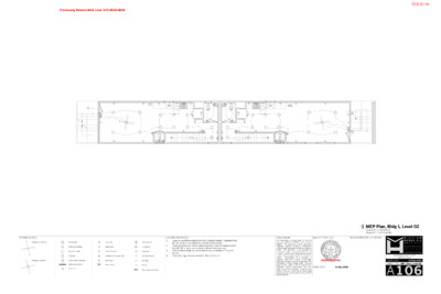
Previously Denied BOA case C15-2020-0020 $ $ $ $ SC $ $ Stack W+D $$ $$ $$ $$ SC $ $ Stack W+D $ $ $ $ $ FIXTURE LEGEND. Ceiling fan w/o light kit Pendant light $ Wall switch Ceiling-mounted light Duplex outlet Recessed can light GFCI duplex outlet Vanity light Waterproof GFCI duplex outlet Hot+cold water tap S C Smoke detector CO2 detector Thermostat Hose bibb Gas tap W/H Gas tankless water heater Ceiling fan w/ light kit Exterior wall-mounted light 220V outlet Undercounter lighting EM Electric meter Exhaust fan GENERAL MEP NOTES. 1. Switches and thermostats on all floors shall be located no greater than 45" (@ junction-box centerline) above finish floor level. Power receptacles and data ports on all floors shall be located no less than 18" (@ junction-box centerline) above finish floor level. Final locations of lighting and outlets to be coordinated in field with Owner. Final switching to be coordinated in field with Owner. 2. 3. 4. 1 MEP Plan, Bldg 1, Level 02 Scale 1/8" = 1'-0" @ 11x17 Scale 1/4" = 1'-0" @ 24x36 SEAL OF ARCHITECT. SEAL OF MUNICIPAL APPROVAL. DISCLAIMERS. issued under the seal of is This document WILLIAM LAWRENCE HODGE, Texas architect #19074. This document is not for permitting, regulatory approval, pricing or construction unless the seal and signature of the Architect are This document is not approved for visible. construction unless a seal of municipal approval is visible. No set of construction documents can contain all information required to construct a is project. required. That which is shown in one sheet, applies to all sheets in this set by reference. The information in G001 through G009 (inclusive) apply to every sheet in this set and to every that may contractor and/or subcontractor perform work on this project. Unless this set contains the cover sheet and all sheets listed thereon, this set is incomplete and INVALID FOR CONSTRUCTION. Interpretation by a contractor ISSUE DATE 21 May 2020 W I L L I A M H O D G E A I A A R C H I T E C T 4 8 0 1 S C O N G R E S S A V E # N 3 A U S T I N , T X 7 8 7 4 5 5 1 2 . 7 8 6 . 9 2 9 8 H O D G E A R C H I T E C T . C O M NEW PROJECT AT 1401 E 3rd ST AUSTIN, TX 78702 21 May 2020 ISSUE DATE SHEET TYPE MEP Plans, Level 02. A 1 06 ITEM 9/110 Previously Denied BOA case C15-2020-0020 ENTRY STAIRS- SOUTH ITEM 9/111 ENTRY DOORWAY #1 - NE Previously Denied BOA case C15-2020-0020 ITEM 9/112 Previously Denied BOA case C15-2020-0020 SIDE VIEW - EAST ITEM 9/113 Previously Denied BOA case C15-2020-0020 SIDE VIEW - WEST ITEM 9/114 Previously Denied BOA case C15-2020-0020 ENTRY STARIS - NORTH ITEM 9/115 Previously Denied BOA case C15-2020-0020 ENTRY DOOR #2 - SE ITEM 9/116 Previously Denied BOA case C15-2020-0020 INTERIOR VIEW - 1ST FLOOR ENTRY DOOR #1 - NE ITEM 9/117 Previously Denied BOA case C15-2020-0020 INTERIOR VIEW - 1ST FLOOR ENTRY DOOR #1 - NE ITEM 9/118 EXTERIOR VIEW ENTRTY DOOR #2 -SE Previously Denied BOA case C15-2020-0020 ITEM 9/119 Previously Denied BOA case C15-2020-0020 INTERIOR VIEW ENTRTY DOOR #2 -SE ITEM 9/120 Previously Denied BOA case C15-2020-0020 EXTERIOR VIEW ENTRTY DOOR #2 -SE ITEM 9/121 5/22/2020 Previously Denied BOA case C15-2020-0020 Mail - Kasey Jaegers - Outlook Re: Neighborhood Meeting david cancialosi <david@permit-partners.com> Fri 5/22/2020 9�08 AM To: Susan Benz <benz@benzresourcegroup.com> Cc: eccsector7rep@gmail.com <eccsector7rep@gmail.com>; Hon. Sabino Pio Renteria <sabino.renteria@austintexas.gov>; Derrick Dixon <derrick@waterloosurveyors.com>; Crisene Casper <ccasper@c3presents.com>; Farah Rivera <farahrivera@yahoo.es>; Julio Perez <Azucar_a1@att.net>; Kristen Heaney <kristen.e.heaney@gmail.com>; Kristen Hotopp <kristen.hotopp@gmail.com>; RENEE LOPEZ <reneelop218@yahoo.com>; Sara Pedrosa <sara.pedrosa@gmail.com>; Eric Pace <ericryanpace@gmail.com>; Kasey Jaegers <kasey@permit-partners.com> Good morning Susan, I have forwarded your email to my client, the property owner and the architect. Unfortunately there is not appear to be any consensus nor any details that specifically address your concerns. I apologize but since I was not involved whatsoever in the permitting nor construction phase of this project, I am unable to provide you with details myself as well. As the board requested, we intend to provide existing elevation exhibits, proposed elevation exhibits, pictures, and fire rating information. The owner intends on installing a sprinkler system throughout the houses, and closing some windows along the upper side of the west facing façade, and relocating the doors to face Navasota. We will be sharing this information with the city today so it could be uploaded in their back up material. I am more than happy to facilitate an ongoing conversation in hopes to get your questions answered to her satisfaction. Please let me know how I can help do that. Sent from a mobile device. There will be typos. Communications sent via this device are CONFIDENTIAL and shall not be shared unless authorized by sender. On May 21, 2020, at 16�14, Susan Benz <benz@benzresourcegroup.com> wrote: Respectfully, David David, My apologies for the delay in responding. I've had a crazy couple of weeks! Our ECC NPCT have not been meeting because the library is closed but we did figure out how to meet and vote via ZOOM and had our May meeting yesterday. We did go over the issue of your project and we would very much like to talk with you further. If necessary, we could schedule a special meeting but we'd prefer not to do that as it's difficult to get everyone's schedules coordinated. Perhaps we can do this via email? I've copied the whole team so that they can read your responses and ask their own questions. Once we've had a few conversations and folks have had a chance to ask their own questions, perhaps we can come to a conclusion to report to the BOA. I understand that you had conflicting surveys. It happens. I'm wondering who the builder was and if the pins were difficult to locate, why the builder didn't get a surveyor out there to establish the https://outlook.office.com/mail/inbox/id/AAQkADc0NWY0NTUzLTMwYTYtNGU0NS04ODg4LTA0NzExMTAzZTFmNQAQAFy2yR4vGqVPqLGqSXdkPN4%3D 1/5 ITEM 9/122 5/22/2020 Previously Denied BOA case C15-2020-0020 Mail - Kasey Jaegers - Outlook pins so that the foundation could be located properly. If the builder couldn't find the pins how did they do the layout? Once the formwork for the foundation was laid out was there an inspection by the architect and owner? What did they plan to do about the fence which is obviously closer than 5 ft to the structure? Were they going to move the fence to what they believed was their property line? If not, how did they think they would be able to open those east facing doors? Did the owner, architect or builder talk to the adjacent neighbors about the confusion and the close proximity of the fence? We've all noticed this project and clearly it's been on hold for quite some time - at least a year. Is this hold entirely to the property line issue? I recognize that this question is unrelated to the BOA request but I'm confused about your statement that this is a single family home with an ADU when both residences have the same layout and size. It's laid out like a duplex. Could you help me understand the intent going forward? Again, sorry for the delay. Thanks, Susan Susan Benz | Benz Resource Group 1101 - B E 6th St - Medina Street Entrance Austin, TX 78702 512-220-9542 benz@BenzResourceGroup.com Keep Calm and Carry On ... and wash your hands! On Fri, May 15, 2020 at 3�11 PM david cancialosi <david@permit-partners.com> wrote: Hi Susan, Apologies for the delayed response. It's been a very hectic week. I have attached the information re: surveys and site information. This information was also provided to the BOA and is available online. It does not encompass the totality of the surveying exercises performed by Waterloo Surveying. I've included Derrick Dixon from Waterloo in this email. As I understand the pins within the immediate area and in the alley behind the lot were incorrectly tagged by a former survey(s). There was also a new survey with the purchase of the house. It was not clear which survey was correct due to the very confusing nature of locating monument pins which were either missing or decades old (if they could be found). The site plan for the house was drawn to these pins assuming they were correct. That is how the house was able to pass city zoning review and this far in the construction process. Once it was understood there was an issue, the survey crews went back to the area and uncovered data which had been previously not found. Since the entire house was constructed this presented an obvious issue - do you cut off 3' of the entire house? demolish it and construct a house 3' to the east? These are not easy to answer because any solution to the encroachment is very complex and costly. https://outlook.office.com/mail/inbox/id/AAQkADc0NWY0NTUzLTMwYTYtNGU0NS04ODg4LTA0NzExMTAzZTFmNQAQAFy2yR4vGqVPqLGqSXdkPN4%3D 2/5 ITEM 9/123 5/22/2020 Previously Denied BOA case C15-2020-0020 Mail - Kasey Jaegers - Outlook What my client is attempting to do is find a fair compromise. This was an honest mistake, if not an easy one to make given the myriad of surveying issues in this area (as described to me). It's not unreasonable to allow an encroachment into a side yard setback. Especially on a corner lot and especially on a lot this small. It's unfortunate the mistake occurred but we are looking for the best worst case scenario. Otherwise the house gets ripped apart - literally. At the online BOA meeting I proposed that we look changing the doors from swinging (out) to sliding. I've asked the architect to look into that as well as the fire rating of that side of the building. I also sympathize with the neighbor who feels this house is too close to his. I reminded the board this house is compliant with 100% of the City regulations with the exception of this side yard setback. The building would still be as tall as it is if it were 3' back and so forth. That said we're looking for some acceptable compromise in lieu of demolishing all or part of the house for the sake of a few feet. As to the city compliance and inspection questions, I honestly do not know. I do know the owner cannot obtain a Certificate of Occupancy from the city due to not being bale to pass final inspection (due to the encroachment). No-one is living there at this time. I am not aware of any further on-site construction schedules nor any city enforcement actions. Again we are trying to find a reasonable solution. This was not a malicious act by the builder. It's only a function of the best decision the builder could make using a combination survey information which the initial City-approved plans were based on. Please feel free to contact my office directly. I would be happy to answer any questions I can. We would also be happy to participate in any online neighborhood meetings prior to the June BOA. Thank you. Kind regards, David Cancialosi Due to the nature of the COVID19 virus, the City of Austin is experiencing longer than normal review and response times. We appreciate your patience while we diligently work to get your project approved. We hope that you and your loved ones are taking recommended precautions. - The Permit Partners Team PERMIT PARTNERS, LLC TEXAS EXCAVATION SOLUTIONS, LLC 105 W Riverside Drive, Suite 225 Austin, TX 78704 (O) 512-593-5361 (F) 512-213-0261 www.permit-partners.com | TRICO FUNDING, LLC CONFIDENTIALITY This email message and any attachments is intended only for use by the addressee(s) named herein and may contain legally privileged and/or confidential information. If you are not the intended recipient of this email you are hereby notified that any dissemination, distribution or copying of this email and any attachments thereto is strictly prohibited. If https://outlook.office.com/mail/inbox/id/AAQkADc0NWY0NTUzLTMwYTYtNGU0NS04ODg4LTA0NzExMTAzZTFmNQAQAFy2yR4vGqVPqLGqSXdkPN4%3D 3/5 ITEM 9/124 5/22/2020 Previously Denied BOA case C15-2020-0020 Mail - Kasey Jaegers - Outlook you have received this email in error please notify the sender and permanently delete the original and any copies of this email and any prints thereof. thereof. Kasey, Best, Susan From: Susan Benz <benz@benzresourcegroup.com> Sent: Tuesday, May 12, 2020 12:05 PM To: Kasey Jaegers <kasey@permit-partners.com> Cc: eccsector7rep@gmail.com <eccsector7rep@gmail.com>; david cancialosi <david@permit-partners.com>; Hon. Sabino Pio Renteria <sabino.renteria@austintexas.gov>; Roig, Jose G <Jose.Roig@austintexas.gov>; Votra, Doug <Doug.Votra@austintexas.gov> Subject: Re: Neighborhood Meeting Thanks for reaching out. Our meetings are required to be held in public places and we meet at the Terrazas Library on E Cesar Chavez. The library is closed and so we don't know when we will be meeting in person again. We have had several virtual votes and if you could send the documentation showing your survey problem and explain how this happened and why it was not corrected early in the process, I can share that information with the Team and see if they would change their minds from the current "strongly oppose a variance" that we have already submitted to the City. I can tell you that one of our neighbors reported the error in the layout of the foundation to the City multiple times and we are asking for an investigation by the City to determine why this problem was not addressed as the project should have been red-flagged in January of 2018. We've noticed that your jobsite has been silent for quite some time. Is this because the owners were notified by Code Compliance of the problem? If so, when was this notice received? We'd really appreciate the full story. Susan Benz | Benz Resource Group 1101 - B E 6th St - Medina Street Entrance Austin, TX 78702 512-220-9542 benz@BenzResourceGroup.com Keep Calm and Carry On ... and wash your hands! On Tue, May 12, 2020 at 11�45 AM Kasey Jaegers <kasey@permit-partners.com> wrote: Mrs. Hotopp and Mrs. Benz, Good afternoon. We are representing a client who is requesting a variance to allow a 2.77’ setback in the required 5’ side setback due to a survey issue. The property address is 1401 E 3rd St. Are we able to discuss this property during your next meeting? I https://outlook.office.com/mail/inbox/id/AAQkADc0NWY0NTUzLTMwYTYtNGU0NS04ODg4LTA0NzExMTAzZTFmNQAQAFy2yR4vGqVPqLGqSXdkPN4%3D 4/5 ITEM 9/125 5/22/2020 Previously Denied BOA case C15-2020-0020 Mail - Kasey Jaegers - Outlook believe it will be held on 5/20? Please let us know what else you need from us or if you have any additional questions. Thank you. Regards, Kasey Jaegers, Office Manager Due to the nature of the COVID19 virus, the City of Austin is experiencing longer than normal review and response times. We appreciate your patience while we diligently work to get your project approved. We hope that you and your loved ones are taking recommended precautions. - The Permit Partners Team. PERMIT PARTNERS, LLC TEXAS EXCAVATION SOLUTIONS, LLC 105 W Riverside Drive, Suite 225 Austin, TX 78704 (O) 512-593-5361 (F) 512-213-0261 www.permit-partners.com | TRICO FUNDING, LLC CONFIDENTIALITY This email message and any attachments is intended only for use by the addressee(s) named herein and may contain legally privileged and/or confidential information. If you are not the intended recipient of this email you are hereby notified that any dissemination, distribution or copying of this email and any attachments thereto is strictly prohibited. If you have received this email in error please notify the sender and permanently delete the original and any copies of this email and any prints thereof. thereof. https://outlook.office.com/mail/inbox/id/AAQkADc0NWY0NTUzLTMwYTYtNGU0NS04ODg4LTA0NzExMTAzZTFmNQAQAFy2yR4vGqVPqLGqSXdkPN4%3D 5/5 ITEM 9/126 Previously Denied BOA case C15-2020-0020 BOA GENERAL REVIEW COVERSHEET CASE: C15-2022-0061 BOA DATE: July 11th, 2022 ADDRESS: 1401 E. 3rd St OWNER: Cortlandt Chalfant COUNCIL DISTRICT: 3 AGENT: Nikelle Meade ZONING: SF-3-NP LEGAL DESCRIPTION: W 35.6FT OF N138FT OF W193.4 OLT 20 DIVISION O VARIANCE REQUEST: reduce interior side setback from 5 ft. to 2.77 ft. SUMMARY: complete construction of a Single-Family residence ISSUES: layout error during construction ZONING LAND USES Site North South East West SF-3-NP SF-3-NP SF-3-H-NP SF-3-NP SF-3-NP Single-Family Single-Family Single-Family Single-Family Single-Family NEIGHBORHOOD ORGANIZATIONS: Austin Independent School District Austin Lost and Found Pets Austin Neighborhoods Council Barrio Unido Neighborhood Assn. Bike Austin Capital Metro Del Valle Community Coalition East Austin Conservancy East Cesar Chavez Neighborhood Association East Cesar Chavez Neighborhood Plan Contact Team El Concilio Mexican-American Neighborhoods Friends of Austin Neighborhoods Greater East Austin Neighborhood Association Guadalupe Neighborhood Development Corporation Homeless Neighborhood Association Neighborhood Empowerment Foundation Neighbors United for Progress Preservation Austin SELTexas Sierra Club, Austin Regional Group Tejano Town ITEM 9/127 Previously Denied BOA case C15-2020-0020 July 1, 2022 Nikelle Meade 111 Congress Ave Suite 1400 Austin, TX 78701 Re: C15-2022-0061 Dear Nikelle, Property Description: W 35.6FT OF N138FT OF W193.4 OLT 20 DIVISION O Austin Energy (AE) has reviewed your application for the above referenced property, requesting that the Board of Adjustment consider a variance request from LDC Section 25-2-492 at 1401 East 3rd Street. Austin Energy does not oppose the request, provided that any proposed or existing improvements follow Austin Energy’s Clearance & Safety Criteria, the National Electric Safety Code, and OSHA requirements. Any removal or relocation of existing facilities will be at the owner’s/applicant’s expense. Please use this link to be advised of our clearance and safety requirements which are additional conditions of the above review action: https://library.municode.com/tx/austin/codes/utilities_criteria_manual?nodeId=S1AUENDECR_1 .10.0CLSARE If you require further information or have any questions regarding the above comments, please contact our office. Thank you for contacting Austin Energy. Cody Shook, Planner II Austin Energy Public Involvement | Real Estate Services 2500 Montopolis Drive Austin, TX 78741 (512) 322-6881 Cody.Shook@austinenergy.com ITEM 9/128 C15-2022-0061 12953473 0204061201 Council District: 3 ITEM 9/129 ITEM 9/130 ____________________________________________________________________________ Allowing the existing structure to remain will not alter the character of the area, impair the use of ____________________________________________________________________________ the adjacent conforming property, or impair the purpose of the regulations because it is ___________________________________________ _____________________ common for structures to be placed in setbacks in this neighborhood because of discrepancies ____________________________________________________________________________ and errors in the original surveying and lot creation. ____________________________________________________________________________ ____________________________________________________________________________ - - 1. 2. 3. 4. ____________________________________________________________________________ ____________________________________________________________________________ ____________________________________________________________________________ ____________________________________________________________________________ ____________________________________________________________________________ ____________________________________________________________________________ ____________________________________________________________________________ ____________________________________________________________________________ ____________________________________________________________________________ ____________________________________________________________________________ ____________________________________________________________________________ ____________________________________________________________________________ ____________________________________________________________________________ ____________________________________________________________________________ ____________________________________________________________________________ ____________________________________________________________________________ | Board of Adjustment General/Parking Variance Application | Page 6 of 8 ITEM 9/131 ITEM 9/132 ITEM 9/133 3 4 L14 T. S Outlot 19 3 1 1 L23 3 1 L 3 1 3 2 0 4 3 2 T. S 2 1 L 3 1 R E L L A W 1 1 L 0 3 3 1 0 L10 9 2 3 6 8 2 3 3 5 EAST T. N S NIO O 7 2 L T. S 4 1 Subject Tract L15 3RD ST. 8 1 L 3 3 0 L24 4 2 C A Y A T T A 2 2 L 3 3 7 A T O S A V A N 6 2 L 3 0 9 L9 L8 2 8 4 2 3 L28 L25 Outlot 20 EAST 2ND ST. Division "O" Formerly: EAST 1ST ST 7 L7 2 4 0 3 5 0 3 2 3 7 1 L T. S 4 2 5 4 0 1 3 0 8 3 9 2 T. A S T O S A V A N INSET MAP No Scale (28.03) 27.97 g k ric Bld B 0+79.94 E " 7 2'4 3 ° 0 2 N r r's e e fo e gin rlin r St. n City E nte alle e C W (28.04) 28.12 5) 9.9 4 9.9 (3 3 5) 9.9 6 9.9 (3 3 3 2.5 6 + 9 3 8 2.5 8 + 9 3 3 0 1 0+00 9 0.5 1 + 0 4 City Engineer's Monument Line N69°36'18"W Survey Completed 09/12/2021 Graphic Scale 0 100 200 400 F e e t Reconstruction of City Engineer's Monument Lines : Sheets 1 and 2 of this map show the reconstruction of the City Engineer's Monument lines in the vicinity of Outlot 20 from which old boundaries and evidence thereof perpetuated by surveys made by the City Engineer and his staff at early dates in the 20th century were also reconstructed as a part of the determination of the boundaries of the Subject Property. Boundary of Subject Property : Sheet 3 shows the boundary of the Subject Property as determined by my resurvey and improvements in place upon it. Legend City Engineer's Monument Line marking Baseline or Established Centerline as noted in KEY TO SURVEY MARKS on Sheet 2 (or common line of Outlots 19 and 20 where symbol appears in Navasota Street) LNo. Refer to LINE DATA TABLE on Sheet 2 (Data) Tie Data in Parentheses from Monument Lines to Building Corners is from City FB 1118 Pg 7 dated 10/30/1936 or City Engineer's District Map No.10 L19 Refer by Number to KEY TO SURVEY MARKS on Sheet 2 for marker descriptions 1 0 1 1 1 L 2 1 0 0 2 L A M O C 6 1 L 3 0 2 h t r o N d i r G Outlot 21 3 0 6 L20 L29 1 2 L Outlot 22 EAST CESAR CHAVEZ L6 2 L 7 0 3 3 3 L T. S 2 0 1 4 3 0 1 L5 N O HIC 4C L 5 0 0 2 1 0 2 MAP FOR SURVEYOR'S REPORT No. 21-1009 Upon the Lot known locally as 1401 East 3rd Street, in Outlot 20 of Division "O" of the City of Austin, Travis County, Texas Map No. 21-1009 Sheet 1 of 3 ITEM 9/134 K E Y T O S U R V E Y M A R K S In the following list "Standard Spike and Washer" denotes a Punchmark on a 3/8 in. Spike with a 2 in. Aluminum Washer stamped "KENT MCMILLAN, SURVEYOR, RPLS 4341" and numbered as noted, set in a Hole Drilled in a Concrete Curb or Pavement No. Description 1-5 Set Standard Spike and Washer (in 2015) 23 Set Standard Spike and Washer SE Cor E 3rd & Comal 24 Set Standard Spike and Washer NE Cor E 2nd & Comal 25 Set Standard Spike and Washer SW Cor E 2nd & Comal 27 Set Standard Spike and Washer in Sidewalk at 1408 E 1st 28 Set Standard Spike and Washer in Curb Laydown NW Cor E 1st & Navasota 29 Set Standard Spike and Washer on E side Driveway at 1208 E 1st 30 Set Standard Spike and Washer NE Cor E 1st & Waller 31 Set Standard Spike and Washer NW Cor E 2nd & Waller (N side of Inlet on Waller) 32 Set Standard Spike and Washer SE Cor E 3rd & Waller 34 Set Standard Spike and Washer NW Cor E 3rd & Attayac 35 Set Standard Spike and Washer SE Cor E 3rd & Navasota 36 Set Standard Spike and Washer NW Cor E 3rd & Navasota 41 Set Standard Spike and Washer in Gutter E side of Navaosta at Alley 42 Set Standard Spike and Washer NW Cor E 2nd & Navasota 100 Found (in 2015) 1/4 in. Copper Pin in Concrete in Iron Casting on Established Centerline of Chicon St 101 Found (in 2015) 1/4 in. Copper Pin in Concrete in Iron Casting on Established Centerline of Chicon St from which Copper Pin: - Spike and Washer No. 1 bears S02-50-25E, 52.25 ft. 102 Found (in 2015) 1/4 in. Copper Pin in Concrete in Iron Casting on Established Centerline of Chicon St from which Copper Pin: - Spike and Washer No.4 bears S14-15-49E, 34.40 ft. 200 Reconstructed Position of Intersection of Established Centerlines of Chicon Street and East 1st St from which Point: - Spike and Washer No.5 bears N11-19-10W, 34.32 ft. 201 Reconstructed Position of Concrete Monument on Established Centerline of Chicon Street at Intersection of Monument Line Offset 10 ft. South of Established Centerline of East 1st Street from which Point: - Spike and Washer No.5 bears N04-18-04W, 43.14 ft. 301 Reconstructed Position of City Engineer's Monument on 10 ft. Offset Baseline in E 1st St 302 Reconstructed Position of City Engineer's Monument on 10 ft. Offset Baseline in E 1st St at Intersection of Established Centerline of Comal St 304 Reconstructed Position of City Engineer's Monument on Established Centerline of Comal St at Intersection of City Engineer's Baseline for E 3rd between Navasota and Comal from which Point: - Spike and Washer No.23 bears S35-17-33E, 26.07 ft. 305 Reconstructed Position of City Engineer's Monument on Established Centerline of Comal St at Intersection of City Engineer's Baseline for E 3rd running East from Comal 306 Reconstructed Position of City Engineer's Monument on City Engineer's baseline for E 3rd between Comal and Chicon 308 Reconstructed Position of City Engineer's Monument on 10 ft. Offset Baseline in E 1st St at intersection of Baseline for Navasota St. running South from which Point: - Spike and Washer No.28 bears N32-30-17W, 55.69 ft. 309 Reconstructed Position of City Engineer's Monument on 10 ft. Offset Baseline in E 1st St at intersection of Basline for Attayac St. from which Point - Spike and Washer No.29 bears N48-15-01W, 88.08 ft. 310 Reconstructed Position of City Engineer's Monument on 10 ft. Offset Baseline in E 1st St at intersection of Established Centerline of Waller St running North from which Point: - Spike and Washer No.30 bears N56-09-06E, 41.78 ft. 311 Reconstructed Position of City Engineer's Monument at Intersection of Established Centerlines of Waller St and E 2nd St running East from which Point: - Spike and Washer No.31 bears N06-05-30W, 45.27 ft. 313 Reconstructed Position of City Engineer's Monument at Intersection of Established Centerlines of Waller St and E 3rd St running East to Navasota 324 Reconstructed Position of Stone Monument set by R.W. Ford in 1870 to mark the South common corner of Outlots 19 and 20, Div "O" from which Point: - Spike and Washer No.28 bears S89-14-26W, 13.61 ft. and - Spike and Washer No.27 bears S68-22-34E, 251.43 ft. 328 Reconstructed Position of Stone Monument set by R.W. Ford in 1870 to mark the North common corner of Outlots 19 and 20, Div "O" from which Point: - Spike and Washer No.35 bears S11-03-23E, 25.60 ft. - Spike and Washer No.36 bears N12-19-44w, 27.53 ft. 329 Point on City Engineer's 10 ft. Offset Baseline in E 1st St at intersection of S'ly prolongation of common line of Outlots 19 and 20 330 Reconstructed Position of intersection of Baseline in Attayac St and Established Centerline of E 2nd St as shown in City FB 2521 Pg 48-49 337 Intersection of Established Centerline of E 2nd St and common line of Outlots 19 and 20, Div "O" from which Point: - Spike and Washer No.42 bears N00-35-31W, 30.31 ft. 401 Found 1/4 in. Copper Pin in Concrete in Iron Casting at intersection of Established Centerlines of Comal St and E 2nd St and from which Copper Pin: - Spike and Washer No.24 bears N60-56-43E, 35.49 ft. - Spike and Washer No.25 bears S59-25-57W, 36.20 ft. 402 Found 1/4 in. Copper Pin in Concrete without Iron Casting (under Street Pavement, 0.55 ft. Down) from which Pin: - Spike and Washer No.32 bears S71-15-13E, 20.45 ft. - Spike and Washer No.34 bears S78-37-53E, 326.83 ft. - Spike and Washer No.31 bears S24-38-42W, 284.21 ft. COORDINATE LIST Coordinates in the following list are in units of US Survey Feet and refer to the Texas Coordinate System of 1983 (Central Zone); NAD83 (2011 Epoch 2010.0 as derived by connection to the local segment of the National CORS network and estimated from analysis of variance to have uncertainies (standard errors) less than +/-0.02 ft.in N and E components. No. N (ft.) E (ft.) 1 10068171.144 3120635.097 2 10067920.384 3120491.174 3 10067569.023 3120362.525 4 10067203.782 3120272.452 5 10066940.541 3120133.846 23 10068028.847 3119123.573 24 10067731.120 3119012.308 25 10067695.477 3118950.118 27 10067557.810 3118471.095 28 10067650.281 3118223.767 29 10067786.835 3117852.139 30 10067871.449 3117629.804 31 10068234.032 3117718.055 32 10068485.770 3117855.934 34 10068427.923 3118156.965 35 10068258.126 3118483.871 36 10068310.147 3118473.083 41 10068107.415 3118426.192 42 10067981.695 3118351.945 46 10068179.684 3118454.243 100 10067897.260 3120510.679 101 10068223.327 3120632.508 102 10067237.115 3120263.978 200 10066906.895 3120140.581 201 10066897.528 3120137.081 301 10067138.702 3119496.046 302 10067379.826 3118854.889 304 10068050.127 3119108.510 305 10068052.920 3119109.564 306 10067815.509 3119750.552 308 10067603.321 3118253.689 309 10067728.189 3117917.847 310 10067848.181 3117595.110 311 10068189.020 3117722.859 313 10068517.589 3117846.136 324 10067650.461 3118237.370 328 10068283.251 3118478.961 329 10067614.494 3118223.638 330 10068066.930 3118046.224 333 10068240.080 3118516.934 334 10068252.538 3118483.291 335 10068122.663 3118433.706 336 10068110.215 3118467.006 337 10067951.384 3118352.258 401 10067713.887 3118981.288 402 10068492.344 3117836.565 423 10068108.686 3118466.418 432 10068239.666 3118516.775 441 10068263.091 3118452.544 455 10068065.951 3118523.717 456 10068101.572 3118429.842 471 10068110.907 3118467.255 LINE DATA TABLE Bearings refer to Grid North of the Texas Coordinate System of 1983 (Central Zone). Distances are Horizontal Surface Distances in units of US Survey Feet, computed using an Average Combined Scale Factor of 0.999947 Surface Dist = Grid Dist/0.999947 No. From-To Bearing Distance dd-mm-ss L1 101-100 S20-29-14W 348.10 L2 100-307 S20-29-29W 340.69 L3 307-102 S20-29-27W 364.09 L4 102-201 S20-29-23W 362.54 L4 102-200 S20-29-23W 352.54 L5 201-301 N69-22-57W 684.94 L6 301-302 N69-23-24W 685.03 L7 302-308 N69-36-27W 641.43 L8 308-309 N69-36-16W 358.32 L9 329-309 N69-36-16W 326.26 L10 309-310 N69-36-18W 344.34 L11 310-311 N20-32-47E 364.01 L12 311-402 N20-32-58E 323.95 L13 402-313 N20-45-41E 27.00 L14 313-328 S69-40-49E 674.86 L15 328-304 S69-40-49E 671.36 L16 302-401 N20-43-31E 357.19 L17 401-304 N20-43-30E 359.52 L18 304-305 N20-40-30E 2.99 L19 305-306 S69-40-34E 683.58 L20 306-307 S69-40-36E 683.45 L21 301-306 N20-36-30E 723.12 L22 309-330 N20-45-21E 362.27 L23 311-330 S69-18-56E 345.66 L24 330-337 S69-18-56E 327.14 L25 337-401 S69-18-56E 672.41 L26 329-337 N20-53-47E 360.63 L27 337-328 N20-53-47E 355.25 L28 308-329 N69-36-16W 32.06 L29 401-102 S69-36-36E 1368.50 The above represents the results of a comprehensive readjustment of data from surveys performed by the City Engineer and his staff from 1931 through 1962, including the data from following City records: City FB 743 Pg 28 __/__/1932 City FB 973 Pg 49-50 02/06/1934 City FB 953 Pg 36 05/22/1931 City FB 984 Pg 18 03/18/1935 City FB 1118 Pg 7&8 10/30/1936 City FB 2521 Pg 48 05/23/1961 City Engineer's Map of District 15 dated 08/20/1940 I, Kent Neal McMillan, a Registered Professional Land Surveyor, hereby certify that this Map No. 21-1009, consisting of Sheets 1, 2, and 3, taken together with my Surveyor's Report No. 21-1009 prepared to accompany them, is a true and correct representation of the results of an actual resurvey performed upon the ground under my direction for the purpose of determining the boundaries of the property known as 1401 East 3rd St. in Outlot 20, Division "O" of the City of Austin, Travis County, Texas. Sheets 1 and 2 of this map show the reconstruction of the City Engineer's Monument lines in the vicinity of said Outlot 20 from which old boundaries and evidence thereof perpetuated by surveys made by the City Engineer and his staff at early dates in the 20th century were also reconstructed as a part of the determination of the boundaries of the Subject Property. Sheet 3 shows the boundary of the Subject Property as determined by my resurvey and improvements in place upon it. Witness my hand and seal of registration, September 22, 2021. Kent Neal McMillan Registered Professional Land Surveyor No. 4341 1200 Cascade Trail, San Marcos TX 78666 Telephone (512) 667-7455 MAP FOR SURVEYOR'S REPORT No. 21-1009 Upon the Lot known locally as 1401 East 3rd Street, in Outlot 20 of Division "O" of the City of Austin, Travis County, Texas Map No. 21-1009 Sheet 2 of 3 ITEM 9/135 ITEM 9/136 ITEM 9/137 ITEM 9/138 ITEM 9/139 ITEM 9/140 ITEM 9/141 ITEM 9/142 ITEM 9/143 ITEM 9/144 ITEM 9/145 June 24, 2022 The Board of Adjustment c/o Elaine Ramirez Planner Senior and Board of Adjustment Liaison City of Austin Development Services Department 6310 Wilhelmina Delco Dr Austin, Texas 78752 Re. Request for Sideyard Setback Variance to Preserve Existing Single-Family Home with Accessory Apartment at 1401 E. 3rd Street, Austin, 78702, District 2 On behalf of the owner of the above referenced Property, please accept the enclosed request for a variance to reduce a side-yard setback from 5 feet to 2.77 feet to preserve the existing single family home and accessory apartment. This site was reviewed by the Board in 2020, but although the existing hardship existed at the time the case was considered, the applicant failed to present proper evidence to explain what the hardship was and the reasons it was not in any way caused by the property owner. The property now has a new owner, and we, on behalf of that new owner, wish to ask for the Board’s review. Sincerely, Nikelle S. Meade NSM/sm Enclosure ITEM 9/146 Location Map ITEM 9/147 ITEM 9/148 ITEM 9/149 ITEM 9/150