E-2 C15-2022-0021 PRESENTATION — original pdf
Backup
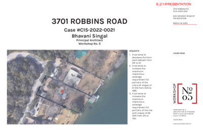
3701 ROBBINS ROAD Case #C15-2022-0021 Bhavani Singal Principal Architect Workshop No. 5 COVER PAGE REQUESTS 1. A variance to decrease the front yard setback from 40’ to 15’. 2. A variance to increase the maximum impervious coverage requirement for portions of the site with slopes of 0-15% from 35% to 48%. 3. A variance to increase the maximum impervious coverage requirement for portions of the site with slopes of 26- 35% from 5% to 14%. WORKSHOP NO. 5ARCHITECTURE & INTERIORS3027 N. Lamar Blvd. #302BAustin, TX 78705512.710.9705www.workshopno5.com3701 ROBBINS RD#C15-2022-0021BOA VARIANCE REQUEST PRESENTATIONMARCH 14, 2022E-2/1-PRESENTATION A100 5 telephone pedestal 5 3 5 0 3 5 wall EXISTING GARAGE OUTSIDE SIDE SETBACK 5 2 5 8 3 5 7 3 65 3 5 EXISTING RESIDENCE PROPOSED RESIDENCE 0 2 5 5 1 5 0 1 5 5 0 5 wall with wrought iron fence 0 0 5 old rock wall xx x x 5 1 5 wall t u o - n a e c l K C A B T E S N I T S U A E K A ' L 5 7 WATER WELL 5 2 5 531'-9" NEW 529'-6" EXISTING 520'-0" NEW 512'-6" EXISTING DN 0 2 5 515 xx xx xx FRONT YARD SETBACK - PROPOSED FRONT YARD SETBACK - LAO 100 YEAR FLOODPLAIN ELEVATION 518'-0" 0 0 5 5 9 4 4 9 4 3 9 4 xx WATER'S EDGE 493'-0" 4 9° xx K C A B T E S ' 5 1 K C A B T E S ' 0 4 SITE CONSTRAINTS 5 9 4 wall boat dock 1. There is a 45’ change in level from the street to the water’s edge. 2. Existing house is in the 100-year floodplain. Proposed house is lifted 7’-6" above existing slab to allow a 2’ freeboard. This pushes the entry level up 2’-3" above the existing garage level. 3. The aging clients require a boat slip (deck above) concrete boat slip (deck above) xx k c e d k c e d wood deck conc. steps wood deck e t e r c n o c f o e g d e r e t a w smooth, no-step access from the garage to the main living areas, necessitating an enclosed "bridge". 4. The existing garage is located at a natural flat spot on the lot. Moving the garage behind the 40’ setback would increase the length, steepness, and impervious cover of the driveway approach. 5. The existing driveway is narrow and dangerously steep. Reconfiguring the driveway and turnaround will increase the safety of the homeowner and their visitors. 6. An existing water well constrains building placement. E N I L Y T R E P O R P E G D E S R E T A W ' I K C A B T E S N T S U A E K A L S U O V E R P I ' 5 2 2 8 9 1 , 2 2 L I R P A E R O F E B D E D R O C E R T A L P F I K C A B T E S 5' 2 K C A B T E S N T S U A E K A L I ' 5 7 EXISTING CONDITIONS & DESIGN CONSTRAINTS e n i l t o l e v o b a s n u r e n i l y t i l i t u d a e h r e v o 5 3 5 : k r a m h c n e b y r a r o p m e t n o e l g n a i r t d e l ' 4 9 . 6 3 5 t a e s i h c l l a w g n i v a p f o e g d e T E E R T S F O E G D E 0 3 5 E N I L Y T R E P O R P STREET LEVEL 538' - 0" ENTRY LEVEL 531' - 9" (E) GARAGE 529' - 6" GROUND LEVEL 520' - 0" 100 YR.FLOODPLAIN 518' - 0" (E) GROUND LEVEL 512' - 6" WATER'S EDGE 493' - 0" WORKSHOP NO. 5ARCHITECTURE & INTERIORS3027 N. Lamar Blvd. #302BAustin, TX 78705512.710.9705www.workshopno5.com3701 ROBBINS RD#C15-2022-0021BOA VARIANCE REQUEST PRESENTATIONMARCH 14, 2022E-2/2-PRESENTATION EXISTING GARAGE IS OUTSIDE THE SIDEYARD SETBACK EXISTING SLAB IS 5’-6" BELOW THE 100-YEAR FLOODPLAIN LEVEL EXISTING CONDITIONS EXISTING ACCESS FROM GARAGE IS STEEPLY SLOPED WITH NO RAILING EXISTING DRIVEWAY IS NARROW AND DANGEROUSLY STEEP WORKSHOP NO. 5ARCHITECTURE & INTERIORS3027 N. Lamar Blvd. #302BAustin, TX 78705512.710.9705www.workshopno5.com3701 ROBBINS RD#C15-2022-0021BOA VARIANCE REQUEST PRESENTATIONMARCH 14, 2022E-2/3-PRESENTATION PROPOSED BUILDING EXISTING BUILDING GARAGE WALL BELOW 15' - CURRENT BUILDING SETBACK FROM PROPERTY LINE 15' - PROPOSED BUILDING SETBACK FROM PROPERTY LINE 15' - 0" NEIGHBORHOOD SETBACK EXHIBIT 15' - 0" 10' - 0" 2 0' - 0" 3605 ROBBINS RD 15' - BUILDING SETBACK FROM PROPERTY LINE 3603 ROBBINS RD 10' - BUILDING SETBACK FROM PROPERTY LINE 3601 ROBBINS RD 20' - BUILDING SETBACK FROM PROPERTY LINE NOTE: APPROX PROPERTY LINE ASSUMED FROM POWER LINES ABOVE WORKSHOP NO. 5ARCHITECTURE & INTERIORS3027 N. Lamar Blvd. #302BAustin, TX 78705512.710.9705www.workshopno5.com3701 ROBBINS RD#C15-2022-0021BOA VARIANCE REQUEST PRESENTATIONMARCH 14, 2022E-2/4-PRESENTATION ALLOWED IMP COVER % EXISTING IMP COVER % 58% 3% 4% 35% 10% 5% EXISTING IMP COVER S.F. PROPOSED IMP COVER % PROPOSED DECKING AT %50 S.F. PROPOSED IMP COVER BLDGS/DRIVE S.F. PROPOSED IMP COVER TOTAL S.F. 5207.39 201 263 5671.39 48% 10% 14% 0 895 250 970 0 1058 3910 494 435 4358 619 920 0 5897 TOTAL SQUARE FOOTAGES PER SLOPE DESIGNATION SLOPE 9017 6349 6589 768 22723 0-15% 16-25% 26-35% 35% + 5671.39 25% 5896.5 26% totals EXISTING IMP TOTAL SF EXISTING IMP TOTAL % PROPOSED IMP TOTAL SF PROPOSED IMP TOTAL % 1. For portions of the site with slopes of 0-15% from 35% to 48%, proposed coverage is 48% while existing coverage is 58%. 2. For portions of the site with slopes of 26- 35% from 5% to 14%, proposed coverage is 14% while existing coverage is 4%. 3. Total impervious coverage will increase by only 225 SF. IMPERVIOUS COVER EXHIBIT SCALE: 1"=20' D) (45') A O BIN R O D (R A O S R BIN B ve lot lin O R ns ab e ru e o 3268 concrete drive 5 53 d utility lin g vin a e of p g d e a e erh v o 0.00' 0') 10 0.0 (N25°28'E 10 N25°31'00"E 0 53 1.1' "LOT C" "OAK SHORES" unrecorded telephone pedestal wall 2.1' 538 7 3 5 536 535 2.6' 1 530 LEGEND 1/2 " Iron Rod Found Calculated Point Wood Fence Wrought Iron Fence xx guy wire Overhead Utililty Line (Record Bearing and Distance) 3279 525 3278 "LOT A" 3280 0 2 5 3277 3276 525 3275 3274 5 2 0 3271 3272 2.5' 1 3273 5 1 5 3286 rock step ell ater w w 3269 3270 JAMES JETT SURVEY NO. 1 ABSTRACT NO. 437 Staci Barton, trustee of The SBSG Trust (0.459 Acres) Document No. 2012192860 Slope Category area of lot percentage of lot within slope category within slope category 0% - 15% 9,017 Square Feet = 28.42% of lot area greater than 15% - 25% 6,349 Square Feet = 20.01% of the lot area greater than 25% - 35% 6,589 Square Feet = 20.77 % of the lot area graeter than 35% 768 Square Feet = 2.42 % of the lot area Total Lot Area: 31,726 Square Feet (9,003 Square Feet below the waters surface = 28.38 % of lot area) SLOPE PERCENTAGE MAP OF THAT CERTAIN TRACT OUT OF THE JAMES JETT SURVEY NO. 1, ABSTRACT NO. 437 IN TRAVIS COUNTY, TEXAS, WHICH IS KNOWN AS "LOT B, OAK SHORES," AN UNRECORDED SUBDIVISION, AND BEING ALL OF THAT CERTAIN TRACT CONVEYED TO ANGELINE D. THOMAS BY DEED RECORDED IN VOLUME 8840 PAGE 201 OF THE REAL PROPERTY RECORDS OF TRAVIS COUNTY, TEXAS. LOCATED AT 3701 ROBBINS ROAD. PAGE 2 OF 2 TREE LIST 3268 3269 3270 3271 3272 3273 3274 3275 3276 3277 15" Juniper 8" Hackberry 9" Hackberry 9" Hackberry 8" Hackberry 8" Hackberry 11" Hackberry 11" Hackberry 11" Hackberry 29.5" Live Oak (11", 14" and 17" stems) 14" Hackberry 15" Hackberry 18" Hackberry 10" Cedar Elm 35" Hackberry 13" Pecan 40" Magnolia 31" Pecan 25" Hackberry 3278 3279 3280 3281 3282 3283 3284 3285 3286 This survey was completed without the benefit of a current title commitment. This lot may be subject to restrictions and easements not shown hereon. Tree "crowns" shown hereon are drawn as a function of trunk diameter. One inch of trunk diameter equals one foot of crown radius. Multi-trunk trees are drawn calculated on the full diameter of the largest stem plus one half of the diameter of each additional stem. Due to natural variations in tree growth, these generalized depictions may not correlate to actual tree crowns or root zones. Elevations shown hereon are based on GPS observations over a Trimble RTK network. NAVD88 datum. 19" Pecan David S. Stein and Jenny Kerwick Document No. 2010142322 wall with wrought iron fence 0 0 5 w o o d d eck 495 conc. steps 99.73' concrete edge of water (S36°14'W 99.88') S35°59'37"W in concrete 49.5" Texas Ash (41" and 17" stems) xx w all deck b o at d o ck at slip v e) b o c o b o (d e n ck a crete at slip v e) b o deck b o (d e ck a w o o d d eck S64°19'04"E to west gradient boundary of the Colorado River (S64°14'E 231.96') S64°16'15"E 231.16' old rock wall 3281 5 1 5 xx xx 5 1 5 3282 wall ut n-o a cle 1.1' 1.7' 3283 0 1 5 5 50 Heidi Wang Lew Document No. 2020193945 previously Angeline D. Thomas Volume 8840 Page 201 xx xx N64°46'20"W (N64°43'W 213.28') 213.03' 3284 500 xx 495 2.5' 494 493 xx to west gradient boundary of the Colorado River N64°46'20"W PREPARED: May 19. 2021 BY: Anne Thayer Registered Professional Land Surveyor No. 5850 HOLT CARSON, INC. 1904 FORTVIEW ROAD AUSTIN, TX 78704 (512) 442-0990 Texas Licensed Surveying Firm No. 10050700 SLOPE MAP- EXISTING IMPERVIOUS COVER SCALE: 1"=20' D) (45') A O 3268 BIN R O D (R A O S R BIN B ve lot lin O R ns ab e ru e o d utility lin g vin a e of p g d e a e erh v o concrete drive 5 53 0.00' 10 N25°31'00"E 112 SF 1.1' "LOT C" "OAK SHORES" unrecorded telephone pedestal 538 7 3 5 536 535 2.6' 1 wall 22.0' frame garage 530 3.2' 2 guy wire 2.1' 3279 525 76 SF LEGEND 1/2 " Iron Rod Found Calculated Point Wood Fence Wrought Iron Fence xx Overhead Utililty Line (Record Bearing and Distance) "LOT A" 3280 0 2 5 SLOPE PERCENTAGE MAP OF THAT CERTAIN TRACT OUT OF THE JAMES JETT SURVEY NO. 1, ABSTRACT NO. 437 IN TRAVIS COUNTY, TEXAS, WHICH IS KNOWN AS "LOT B, OAK SHORES," AN UNRECORDED SUBDIVISION, AND BEING ALL OF THAT CERTAIN TRACT CONVEYED TO ANGELINE D. THOMAS BY DEED RECORDED IN VOLUME 8840 PAGE 201 OF THE REAL PROPERTY RECORDS OF TRAVIS COUNTY, TEXAS. LOCATED AT 3701 ROBBINS ROAD. PAGE 2 OF 2 TREE LIST 3268 3269 3270 3271 3272 3273 3274 3275 3276 3277 15" Juniper 8" Hackberry 9" Hackberry 9" Hackberry 8" Hackberry 8" Hackberry 11" Hackberry 11" Hackberry 11" Hackberry 29.5" Live Oak (11", 14" and 17" stems) 14" Hackberry 15" Hackberry 18" Hackberry 10" Cedar Elm 35" Hackberry 13" Pecan 40" Magnolia 31" Pecan 25" Hackberry 3278 3279 3280 3281 3282 3283 3284 3285 3286 2051 SF ell ater w w 3277 3276 525 250 SF 3275 3274 4 9 4 S F 3281 5 1 5 xx 3 5 9 S F xx 14.1' (S64°14'E 231.96') S64°16'15"E 231.16' old rock wall 3282 3283 0 1 5 wall ut n-o a cle 5 SF 75 SF 19" Pecan 1856 SF 895 SF 3269 3270 5 2 0 3271 2.5' 1 A/C pads 3272 24.4' crete er crete v tile o n o c n o c 3273 5 1 5 3286 rock step 5 50 Heidi Wang Lew Document No. 2020193945 previously Angeline D. Thomas Volume 8840 Page 201 JAMES JETT SURVEY NO. 1 ABSTRACT NO. 437 Staci Barton, trustee of The SBSG Trust (0.459 Acres) Document No. 2012192860 Slope Category area of lot percentage of lot within slope category within slope category 0% - 15% 9,017 Square Feet = 28.42% of lot area greater than 15% - 25% 6,349 Square Feet = 20.01% of the lot area greater than 25% - 35% 6,589 Square Feet = 20.77 % of the lot area graeter than 35% 768 Square Feet = 2.42 % of the lot area Total Lot Area: 31,726 Square Feet (9,003 Square Feet below the waters surface = 28.38 % of lot area) xx xx N64°46'20"W (N64°43'W 213.28') 213.03' 3284 500 xx This survey was completed without the benefit of a current title commitment. This lot may be subject to restrictions and easements not shown hereon. Tree "crowns" shown hereon are drawn as a function of trunk diameter. One inch of trunk diameter equals one foot of crown radius. Multi-trunk trees are drawn calculated on the full diameter of the largest stem plus one half of the diameter of each additional stem. Due to natural variations in tree growth, these generalized depictions may not correlate to actual tree crowns or root zones. Elevations shown hereon are based on GPS observations over a Trimble RTK network. NAVD88 datum. David S. Stein and Jenny Kerwick Document No. 2010142322 in concrete 49.5" Texas Ash (41" and 17" stems) xx w all deck b o at d o ck at slip v e) o b c o b o (d e n ck a crete at slip v e) o b deck b o (d e ck a w o o d d eck S64°19'04"E to west gradient boundary of the Colorado River wall with wrought iron fence 0 0 5 w o o d d eck 495 conc. steps 99.73' concrete edge of water (S36°14'W 99.88') S35°59'37"W PREPARED: May 19. 2021 BY: 495 2.5' 494 493 xx to west gradient boundary of the Colorado River N64°46'20"W Anne Thayer Registered Professional Land Surveyor No. 5850 HOLT CARSON, INC. 1904 FORTVIEW ROAD AUSTIN, TX 78704 (512) 442-0990 Texas Licensed Surveying Firm No. 10050700 SLOPE MAP- PROPOSED IMPERVIOUS COVER xx 3285 xx 3285 WORKSHOP NO. 5ARCHITECTURE & INTERIORS3027 N. Lamar Blvd. #302BAustin, TX 78705512.710.9705www.workshopno5.com3701 ROBBINS RD#C15-2022-0021BOA VARIANCE REQUEST PRESENTATIONMARCH 14, 2022E-2/5-PRESENTATION PROPOSED DEVELOPMENT RENDERINGS STREET VIEW ADJUSTED DRIVEWAY APPROACH REDUCES DANGEROUS SLOPE WORKSHOP NO. 5ARCHITECTURE & INTERIORS3027 N. Lamar Blvd. #302BAustin, TX 78705512.710.9705www.workshopno5.com3701 ROBBINS RD#C15-2022-0021BOA VARIANCE REQUEST PRESENTATIONMARCH 14, 2022E-2/6-PRESENTATION PROPOSED DEVELOPMENT RENDERINGS SIDE VIEW FLOODPLAIN ELEVATION PROPOSED RESIDENCE BALANCES THE REQUIREMENTS OF THE FLOODPLAIN WITH ACCESS TO THE STREET AND THE WATER’S EDGE WORKSHOP NO. 5ARCHITECTURE & INTERIORS3027 N. Lamar Blvd. #302BAustin, TX 78705512.710.9705www.workshopno5.com3701 ROBBINS RD#C15-2022-0021BOA VARIANCE REQUEST PRESENTATIONMARCH 14, 2022E-2/7-PRESENTATION FLOODPLAIN ELEVATION PROPOSED DEVELOPMENT RENDERINGS LAKE VIEW PROPOSED RESIDENCE LOCATED IN THE SAME LOCATION AS THE EXISTING RESIDENCE, BUT RAISED ABOVE FLOODPLAIN LEVEL, ENSURES GREATEST LEVEL OF ACCESSIBILITY AND SAFETY WORKSHOP NO. 5ARCHITECTURE & INTERIORS3027 N. Lamar Blvd. #302BAustin, TX 78705512.710.9705www.workshopno5.com3701 ROBBINS RD#C15-2022-0021BOA VARIANCE REQUEST PRESENTATIONMARCH 14, 2022E-2/8-PRESENTATION